|
May 27, 2006: Dayton Cut Off
|
|
May 27, 2006: Dayton Cut Off
|
|
|
|
Like the Zane's Trace outing on March's
last weekend, this is a drive with a National Road connection. Both could
be considered side trips to the National Road
drive that I hope to get in later this summer. I'm just doing the side
trips first. However, unlike Zane's Trace, the Dayton Cutoff was not a
predecessor of the National Road. It was a substitute. In one sense, it's
too bad that the Dayton Cutoff is only about 60 miles long. Even with a
late variation included, driving it is clearly a day trip. Day trips are
typically covered here in a single page with little room for preamble and
this unofficial branch of the National Road is deserving of preamble. The
short story is that it tapped the National Road at Springfield and carried
more traffic than the real thing all the way to Richmond. A longer version
is here.
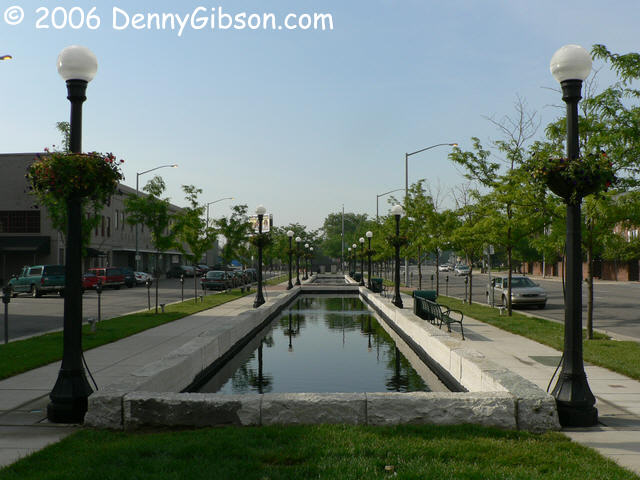
The Cutoff passed through downtown Dayton on Third Street and, west of Main, so did the National Old Trails Road. The original Cutoff followed a pretty straight line between Dayton and Springfield and joined Third Street several blocks to the east. The NOTR route from the 1920s is what I called a "late variation" and it's what I'm starting my day with. |
|
|
|
|
|
|
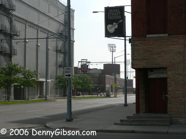
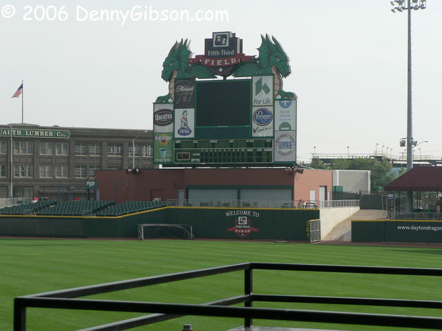
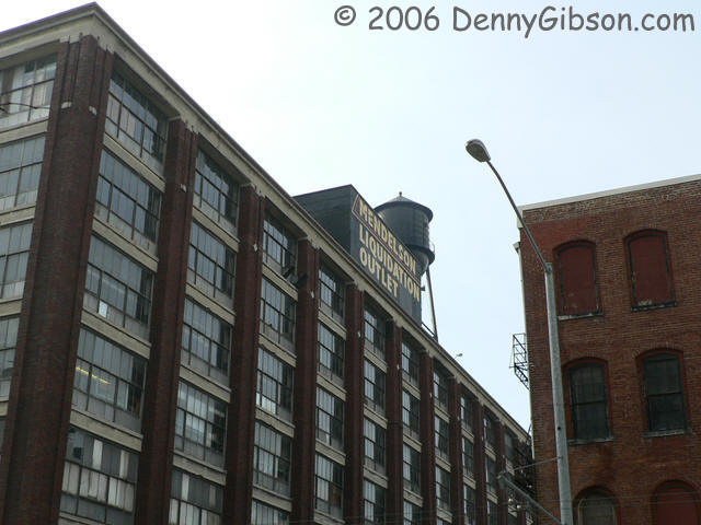 The National Old Trails Road ran north on Main then east on First. Today,
First Street is one way so it's a good thing I'm going that way. It
crosses Canal Street where evidence still remains of why it's called that.
The cleverly named Canal Street Tavern continues to showcase some of the
best musical talent around and continues to accept cash only. The Class A
Dayton
Dragons, a Cincinnati Reds farm club, play just up the street and have
a pretty classy scoreboard. Between the tavern and the ball park is
Mendelson's Liquidation
Outlet and that name really fits. Like Arlo said about a certain
restaurant, "You can get anything you want".
The National Old Trails Road ran north on Main then east on First. Today,
First Street is one way so it's a good thing I'm going that way. It
crosses Canal Street where evidence still remains of why it's called that.
The cleverly named Canal Street Tavern continues to showcase some of the
best musical talent around and continues to accept cash only. The Class A
Dayton
Dragons, a Cincinnati Reds farm club, play just up the street and have
a pretty classy scoreboard. Between the tavern and the ball park is
Mendelson's Liquidation
Outlet and that name really fits. Like Arlo said about a certain
restaurant, "You can get anything you want".
|
|
|
 Left on Keowee, cross the bridge and bear right on Valley, then follow
OH-201 off to the left. It's Brandt Street here and will soon turn into
Brandt Pike but you can't tell that at the intersection; Follow the state
route signs instead.
Left on Keowee, cross the bridge and bear right on Valley, then follow
OH-201 off to the left. It's Brandt Street here and will soon turn into
Brandt Pike but you can't tell that at the intersection; Follow the state
route signs instead.
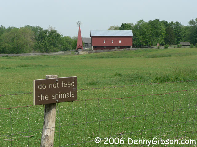
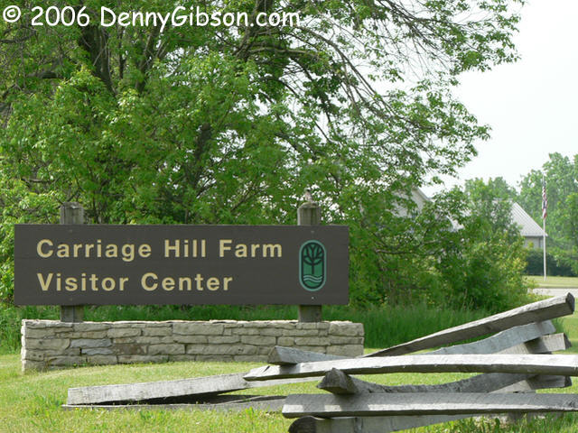
Brandt Pike is not the most picturesque thoroughfare going. It isn't unpleasant to drive but doesn't offer a lot besides the business/residential mix of a typical suburban road. An exception is Carriage Hill Farm just north of I-70. There is a working 1880s farm here but the cows are allowed to sleep in on weekends and I was a few hours early. This place went onto my "To Do" list. |
|
|
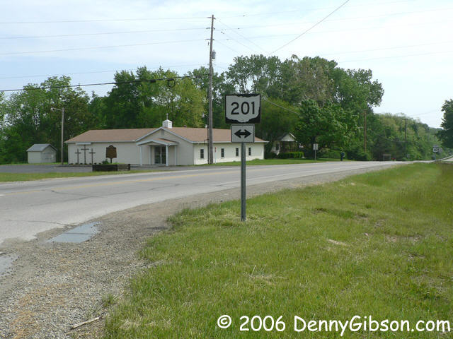
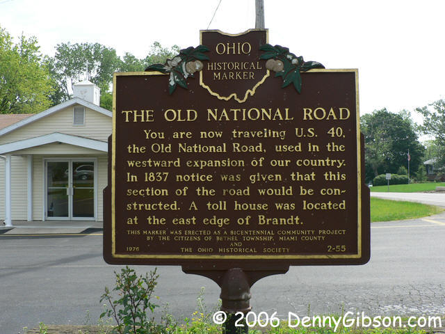 The NOTR joined the National Road at the east edge of Brandt and US-40 has
long ago replaced them both. There is
nothing particularly special about the intersection now and, except for a
nearby tollhouse, probably never was.
The NOTR joined the National Road at the east edge of Brandt and US-40 has
long ago replaced them both. There is
nothing particularly special about the intersection now and, except for a
nearby tollhouse, probably never was.
|
|
|
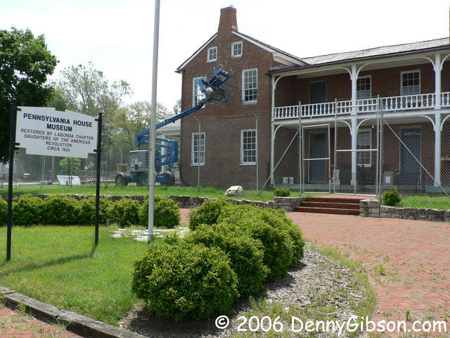 Entering Springfield from the west, it takes a slight turn onto Main
Street to stay on the National Road then it's about three quarters of a
mile to the Pennsylvania House on the south side of the road.
Built in the late 1830s, the inn sat between the branches of the National
Road-Dayton Cutoff fork. Some serious restoration work is going on here
with reopening this year a possibility but not a certainty.
Entering Springfield from the west, it takes a slight turn onto Main
Street to stay on the National Road then it's about three quarters of a
mile to the Pennsylvania House on the south side of the road.
Built in the late 1830s, the inn sat between the branches of the National
Road-Dayton Cutoff fork. Some serious restoration work is going on here
with reopening this year a possibility but not a certainty.
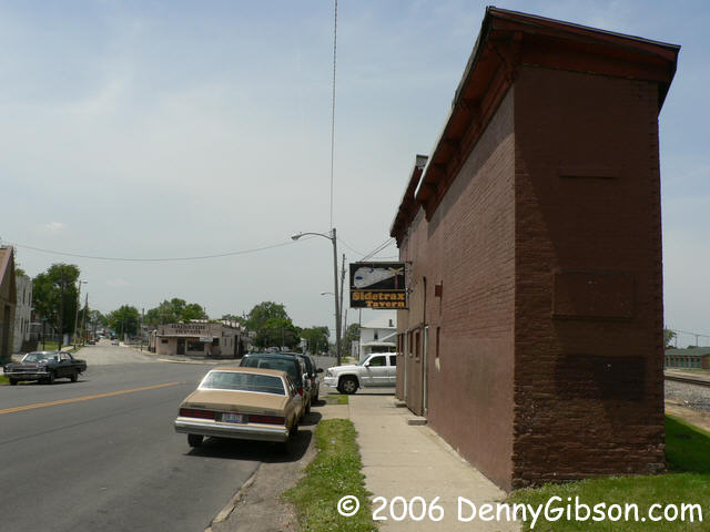
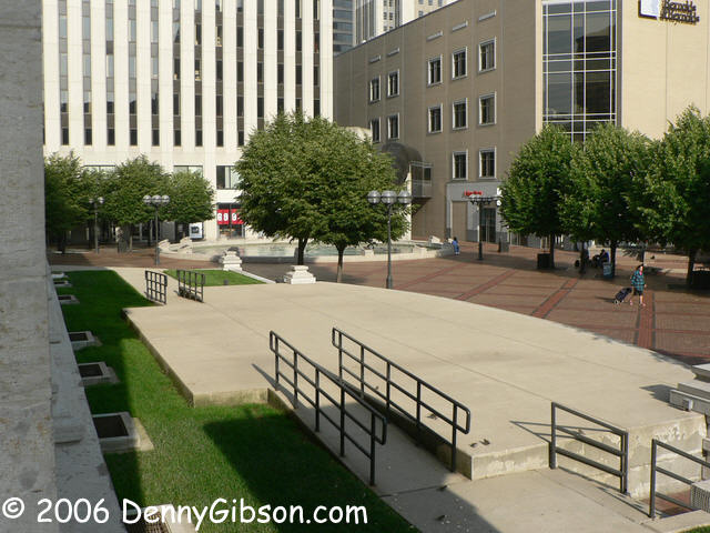
The second picture was taken facing west on Main with Dayton Avenue - the Dayton Cutoff - branching off to the left. It's one way to a jog at High Street and the name morphing begins not far beyond. Dayton Avenue, Dayton Road, Dayton Springfield Road. Where the original route is interrupted by Wright-Patterson AFB, it passes through town as Broad Street. It emerges as Dayton Springfield Pike then enters Dayton as Springfield Street. I find the building on the right of the photo interesting. Current home of Sidetrax Tavern, patrons report it was once a train station and is about a hundred years old. Great folks but not necessarily quotable historians. Observed facts are that it is wedged into the acute angle between Main Street and the Norfolk Southern and it's a pretty popular place with the locals. I've stopped here twice and both times found the dozen or so bar stools just about filled. There are also a few small tables and I have no doubts that those are frequently filled. Its west end encloses about eighteen feet. (I counted six panels that I took to be about three foot each.) The east end encloses just enough. |
|
|
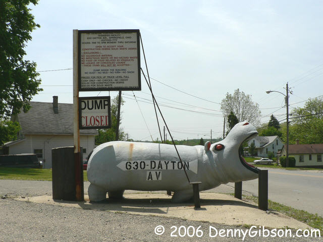


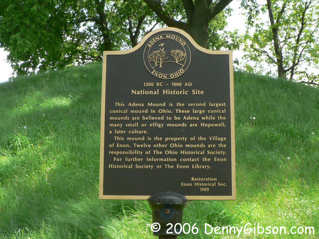 The hippo is in Springfield, the mound is in Enon, and there is some
actual open space in between.
The hippo is in Springfield, the mound is in Enon, and there is some
actual open space in between.
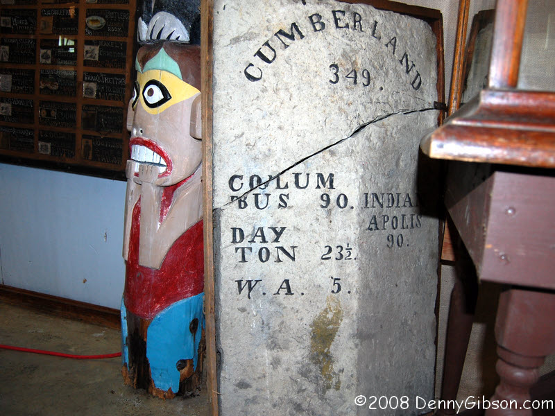
ADDENDUM: Although I somehow missed it on this trip, I later learned that one of the original Dayton and Springfield Turnpike mile markers is in Enon near the mound. Had I been a little more observant, a picture of the stone would almost certainly appeared in this panel so here it is. |
|
|
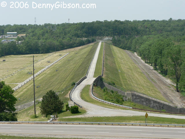
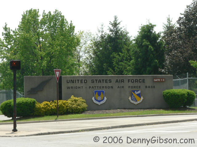 A combination of airport and flood plain put a big dent in the original
path of the Dayton Springfield Turnpike. The airport is the
Wright-Patterson Air Force Base and the flood plain is there because of
one of the dams built after the 1913 flood. (I've visited a couple of
those dams over the last two weekends and the curious can check out those
visits here and
here.) In this instance, the
dam did not exactly end a town's existence but it did cause one to move
and was part of the chain of events that, in 1950, turned the towns of
Osborn and Fairfield into Fairborn.
A combination of airport and flood plain put a big dent in the original
path of the Dayton Springfield Turnpike. The airport is the
Wright-Patterson Air Force Base and the flood plain is there because of
one of the dams built after the 1913 flood. (I've visited a couple of
those dams over the last two weekends and the curious can check out those
visits here and
here.) In this instance, the
dam did not exactly end a town's existence but it did cause one to move
and was part of the chain of events that, in 1950, turned the towns of
Osborn and Fairfield into Fairborn.
|
|
|
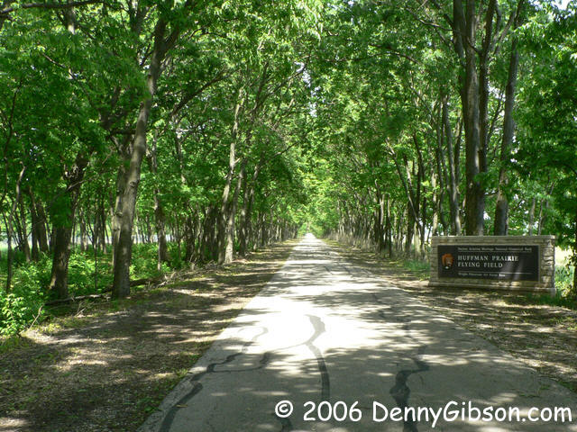
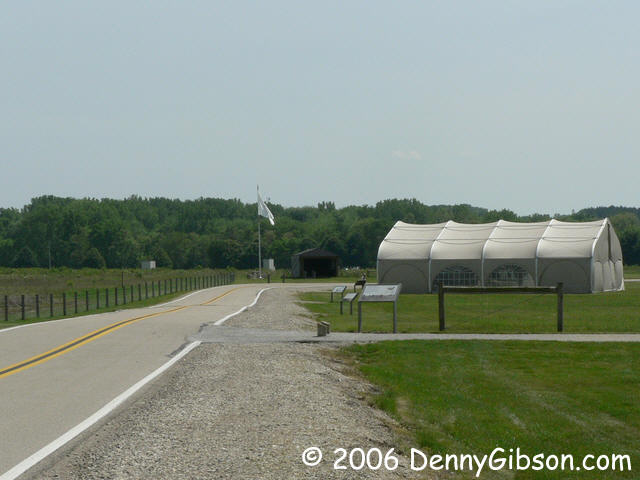

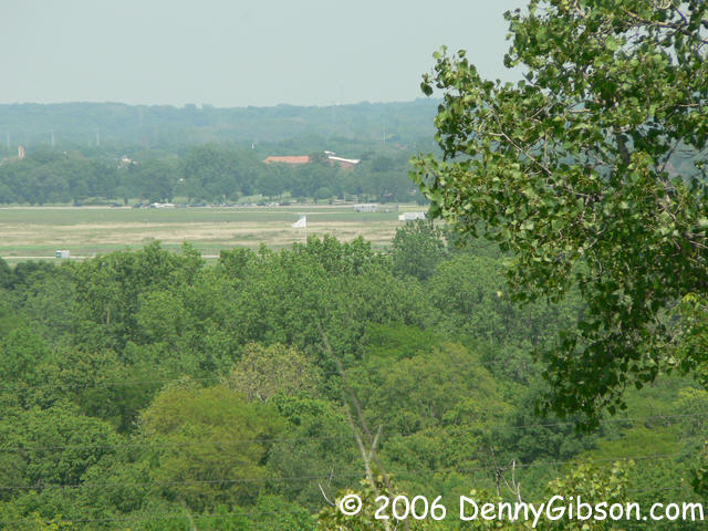
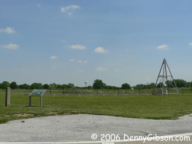 Huffman Prairie Flying Field is just north of where
the road gets back on route and becomes Dayton Springfield Pike. It is
actually on Wright-Patterson AFB but is open to the public. After getting
off the ground at Kitty Hawk, this is where Wilbur & Orville perfected
their invention and, more importantly, their flying skills. The corners of
the odd shaped field are marked with large white flags and there are
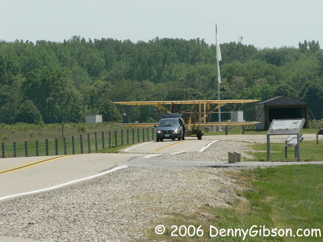
replicas of their first hangar and catapult. Today I lucked out and
arrived as a replica of a 1911 Wright airplane was towed away. I first
guessed that this was the flyable version that I had seen in its hangar near
Springboro. The men towing the plane explained that, although it is owned
by the same group, this plane was not made to fly.
Huffman Prairie Flying Field is just north of where
the road gets back on route and becomes Dayton Springfield Pike. It is
actually on Wright-Patterson AFB but is open to the public. After getting
off the ground at Kitty Hawk, this is where Wilbur & Orville perfected
their invention and, more importantly, their flying skills. The corners of
the odd shaped field are marked with large white flags and there are
replicas of their first hangar and catapult. Today I lucked out and
arrived as a replica of a 1911 Wright airplane was towed away. I first
guessed that this was the flyable version that I had seen in its hangar near
Springboro. The men towing the plane explained that, although it is owned
by the same group, this plane was not made to fly.
|
|
|
|
The last picture has nothing to do with the Cutoff, the Wright Brothers, or anything else in particular. In fact, the subjects are so distant that a description is probably required. By the road in front of the interpretive center, a horseman and a biker chat beneath the trees with their steeds resting a short distance away. The horse cools off in the shade while the motorcycle is stuck out in the sun. Just something you don't see everyday. |
|
|
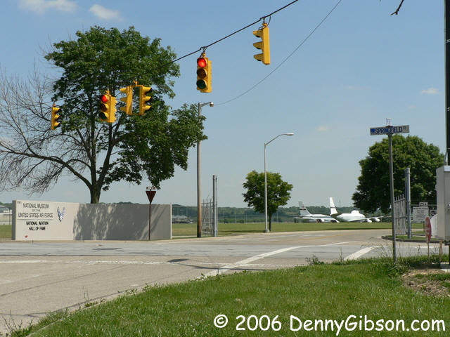 Another museum I skipped today is the National Air Force Museum. It's been
years since I've been inside and I made a note to self to get back here
soon.
Another museum I skipped today is the National Air Force Museum. It's been
years since I've been inside and I made a note to self to get back here
soon.
|
|
|
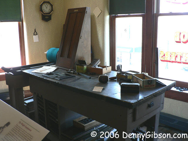
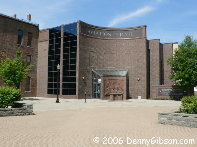
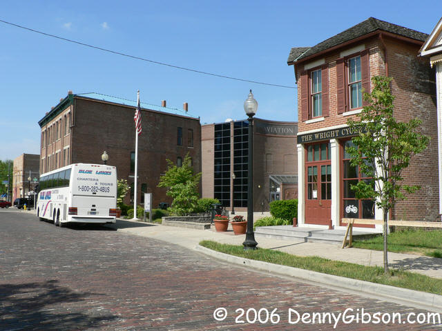 I skipped those previously visited museums partly because I had plans of
stopping at another Aviation Trail site, the Wright-Dunbar Interpretive
Center. Springfield Street merges into Third Street and that, after
passing this morning's starting point at Main, goes right to the center.
I skipped those previously visited museums partly because I had plans of
stopping at another Aviation Trail site, the Wright-Dunbar Interpretive
Center. Springfield Street merges into Third Street and that, after
passing this morning's starting point at Main, goes right to the center.
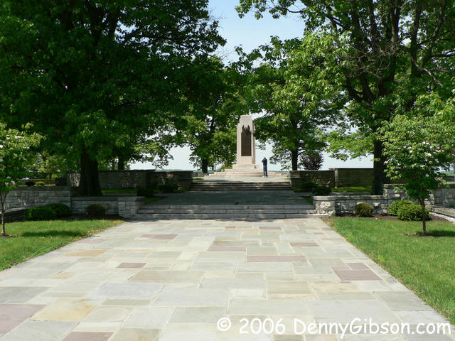
Until recently I thought that Paul Dunbar and the Wrights were often mentioned together simply because they were Dayton celebrities at roughly the same time but there's more to it than that. Orville and Paul were high school classmates and all were friends. There were also business connections when the Wrights were in the printing business and Dunbar had things, including a weekly newspaper, that needed printing. I was able to watch the orientation film, tour the entire center, and check out the Wright Cycle Company Building next door. But I ran out of time before I could get to the nearby Paul Laurence Dunbar Memorial. It closes at 5:00 and that's when I pulled away from the Wright-Dunbar Interpretive Center. Next time. |
|
|
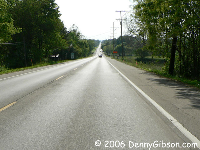
 Third Street continues due west and US-35 eventually joins up. Thirty-five
moved to a multi-lane bypass some years back but returns to the straight
and narrow near the city limits. That lets me get a picture of what may be
the longest straight stretch I've seen all day. From Dayton to Richmond,
US-35 is the modern equivalent of the NOTR/Dayton Cutoff.
Third Street continues due west and US-35 eventually joins up. Thirty-five
moved to a multi-lane bypass some years back but returns to the straight
and narrow near the city limits. That lets me get a picture of what may be
the longest straight stretch I've seen all day. From Dayton to Richmond,
US-35 is the modern equivalent of the NOTR/Dayton Cutoff.
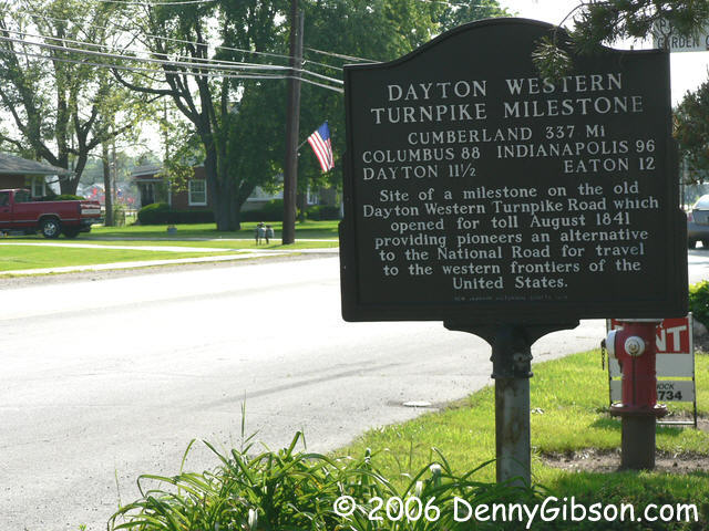
In New Lebanon, this roadside marker is the only sign I'm aware of that even hints at the history of the road. My understanding is that the whereabouts of the milestone referenced by the sign are unknown but that some other turnpike markers are "preserved". When, if at all, those will be publicly displayed is unknown to me. ADDENDUM: Nov 5, 2009 - In the spring of 2008, I found a Dayton-Western Turnpike marker in a museum operated by the Preble County Historical Society. I've linked to it elsewhere but, in rereading this section today, I realized that this was a natural place for a pointer to that picture so here 'tis. The full tale is here. |
|
|


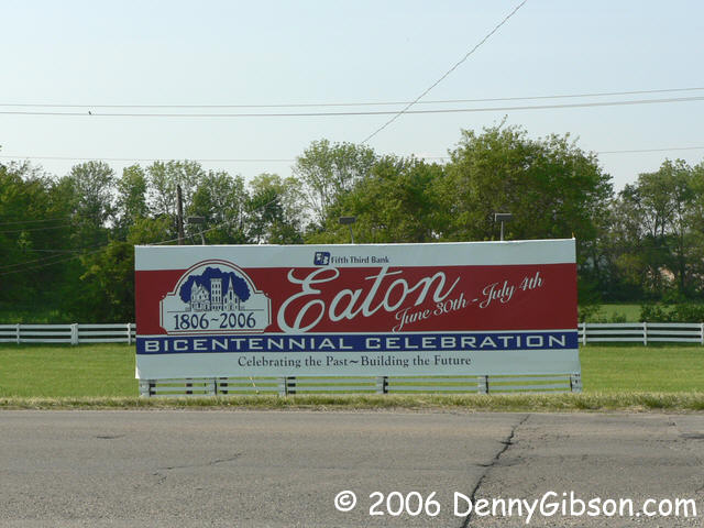 Looks like Eaton, the "other" city responsible for the Dayton
Cutoff, shares a birthday with the original National Road. Two hundred
years of being ever so close. I've always liked the National Guard Armory
in Eaton. You can't tell me that place doesn't look safe. The Preble County
courthouse looks pretty solid, too.
Looks like Eaton, the "other" city responsible for the Dayton
Cutoff, shares a birthday with the original National Road. Two hundred
years of being ever so close. I've always liked the National Guard Armory
in Eaton. You can't tell me that place doesn't look safe. The Preble County
courthouse looks pretty solid, too.
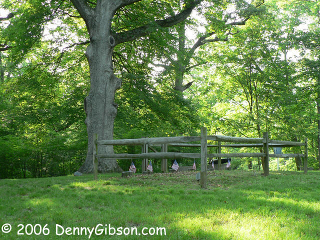
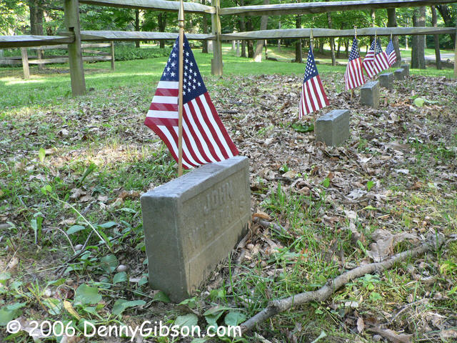
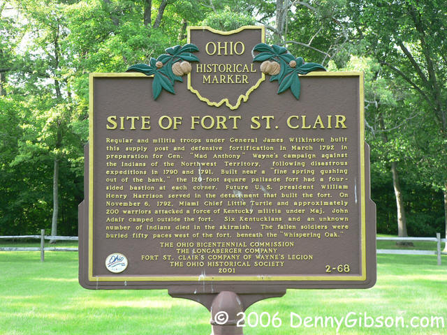
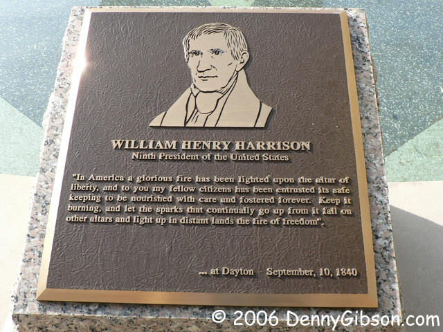
Fort St. Clair State Park is a little west of town and about a half mile off of US-35. In 1791 and '92, a fort was constructed here to support Anthony Wayne's Indian campaigns. Six soldiers, all Kentucky volunteers, were killed in a 1792 attack and are buried here. Remember that William Henry Harrison who was the first U.S. president to speak in Dayton? Helping build the fort here was one of his first assignments after joining the military. |
|
|
 Since the route of the Dayton Cutoff became US-35, a claim could possibly
be made for the Cutoff ending when 35 joins I-70. But surely no sane
person would support that. The Cutoff is best represented by the straight
line that was once US-35 and is now OH-320, Eaton Pike, and a few other
names. The US-35/OH-320 intersection itself is anything but straight but
working through to the state route is the right thing to do and you get a
more relaxed view of the "Ohio Arch" on I-70.
Since the route of the Dayton Cutoff became US-35, a claim could possibly
be made for the Cutoff ending when 35 joins I-70. But surely no sane
person would support that. The Cutoff is best represented by the straight
line that was once US-35 and is now OH-320, Eaton Pike, and a few other
names. The US-35/OH-320 intersection itself is anything but straight but
working through to the state route is the right thing to do and you get a
more relaxed view of the "Ohio Arch" on I-70.
|
|
|
 A much better claim is possible for Eaton Pike's meeting with US-40 but
looking for the straight line rules it out, too. Backtracking just a
little to Roby Lane (tellingly, DeLorme SA9 calls this
"US 35|Roby Ln") leads to a dead end at a nursery. I did
not see any "private" signs but the nursery seems to have
assumed possession. I chose not to walk through the balled trees.
A much better claim is possible for Eaton Pike's meeting with US-40 but
looking for the straight line rules it out, too. Backtracking just a
little to Roby Lane (tellingly, DeLorme SA9 calls this
"US 35|Roby Ln") leads to a dead end at a nursery. I did
not see any "private" signs but the nursery seems to have
assumed possession. I chose not to walk through the balled trees.
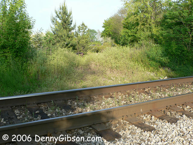
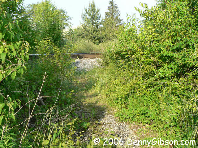
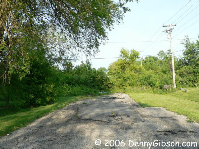
Getting to the other side of the break is straight forward enough. Just drive there on something called Old National Road!! Once there, I could verify (No signs and no nursery stock.) what the map indicated - the break was for a railroad. Did new rails cut through an unused road or did a former crossing get obliterated when it was no longer needed? That's something to be sorted out some day, maybe. |
|
|
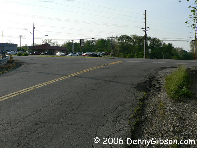
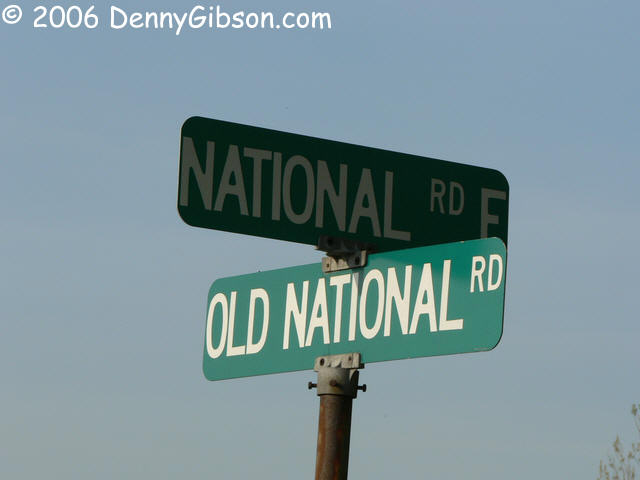
 The best current claim is here where Old National Road meets National Road
but I've got a feeling that it wasn't always so. The third picture
illustrates two things: 1) There is a good reason that you've been told
not to shoot into the sun and 2) There is a straighter line. I'm thinking
that the Dayton Cutoff might have once ended under that man made hill.
The best current claim is here where Old National Road meets National Road
but I've got a feeling that it wasn't always so. The third picture
illustrates two things: 1) There is a good reason that you've been told
not to shoot into the sun and 2) There is a straighter line. I'm thinking
that the Dayton Cutoff might have once ended under that man made hill.
|
|
|
| [Site Home] [Contact] |


