A Fifty Degree Swing
Prev
Next


|
|
Day 1: December 24, 2008 A Fifty Degree Swing |
Prev Next |
|
|
|
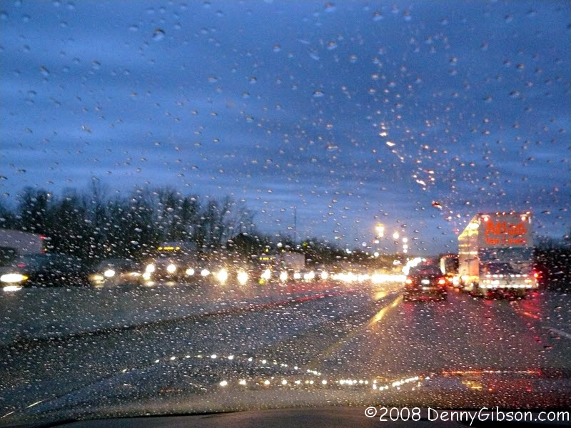
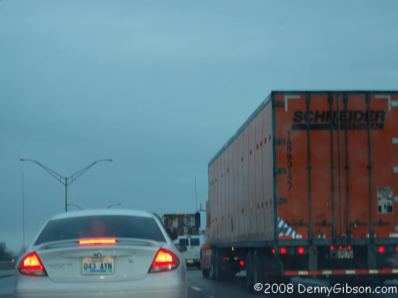
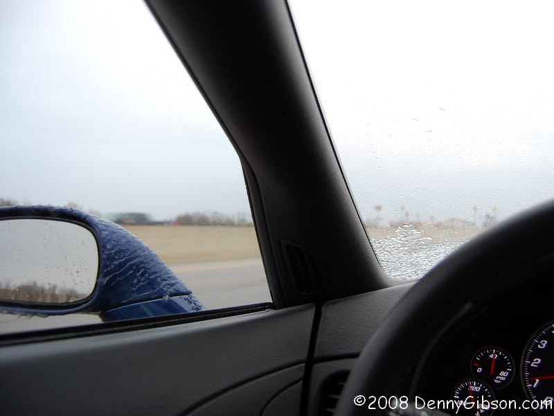 I left work about 2:00 on Tuesday and pulled into Christmas shopping
gridlock on the street where I live. I made it home, finished loading the
car, and headed back into the traffic. It took about twenty minutes to
drive the half mile to the expressway. Traffic was heavy but moving as I
headed south and across the river. The temperature hovered around 32
degrees and the falling rain produced what you see in the first picture.
Yep, that's ice on the mirror and in the corner of the windshield. The
radio told me that accidents were "too numerous to count" behind
me. I saw cars off the road and progress was slowed but I had no real
problems. I spent about an hour covering a ten mile stretch past Lexington
in which the northbound lanes were closed in at least two places. The
entire expressway full of traffic was routed up ramps and somehow
northward. Getting to Cincinnati was even harder than getting away from
it. But I was moving in the right direction and so was the temperature.
As the rain faded away, I was able to return to normal speeds and drove on
to the east edge of Chattanooga before stopping for the night.
I left work about 2:00 on Tuesday and pulled into Christmas shopping
gridlock on the street where I live. I made it home, finished loading the
car, and headed back into the traffic. It took about twenty minutes to
drive the half mile to the expressway. Traffic was heavy but moving as I
headed south and across the river. The temperature hovered around 32
degrees and the falling rain produced what you see in the first picture.
Yep, that's ice on the mirror and in the corner of the windshield. The
radio told me that accidents were "too numerous to count" behind
me. I saw cars off the road and progress was slowed but I had no real
problems. I spent about an hour covering a ten mile stretch past Lexington
in which the northbound lanes were closed in at least two places. The
entire expressway full of traffic was routed up ramps and somehow
northward. Getting to Cincinnati was even harder than getting away from
it. But I was moving in the right direction and so was the temperature.
As the rain faded away, I was able to return to normal speeds and drove on
to the east edge of Chattanooga before stopping for the night.
|
|
|

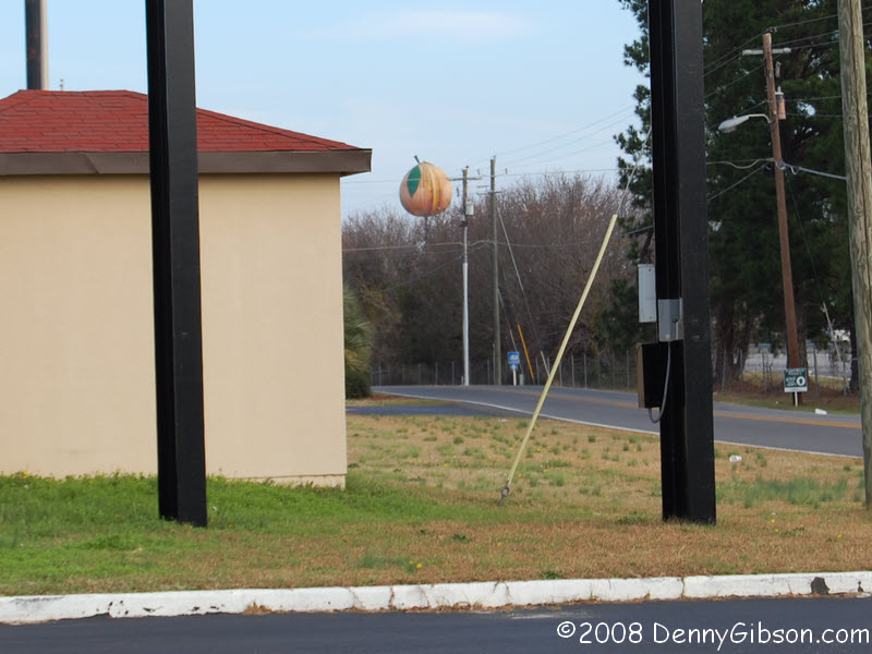
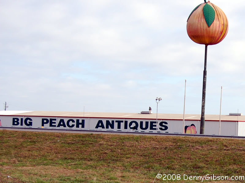 I was on the road at 6:30 and halfway through Georgia before making a
breakfast stop near Macon. A big peach I had passed on the expressway was
visible from the Country Cupboard parking lot but I drove up the road a
bit to get a clearer shot. I had to hold the camera over my head to keep
the bottom of the letters from being blocked by the guardrail and it took
me several tries to get the peach and the sign in the frame without a car
blocking something. If your relatives were driving south on I-75 today,
there's a pretty good chance I have a picture of them.
I was on the road at 6:30 and halfway through Georgia before making a
breakfast stop near Macon. A big peach I had passed on the expressway was
visible from the Country Cupboard parking lot but I drove up the road a
bit to get a clearer shot. I had to hold the camera over my head to keep
the bottom of the letters from being blocked by the guardrail and it took
me several tries to get the peach and the sign in the frame without a car
blocking something. If your relatives were driving south on I-75 today,
there's a pretty good chance I have a picture of them.
|
|
|

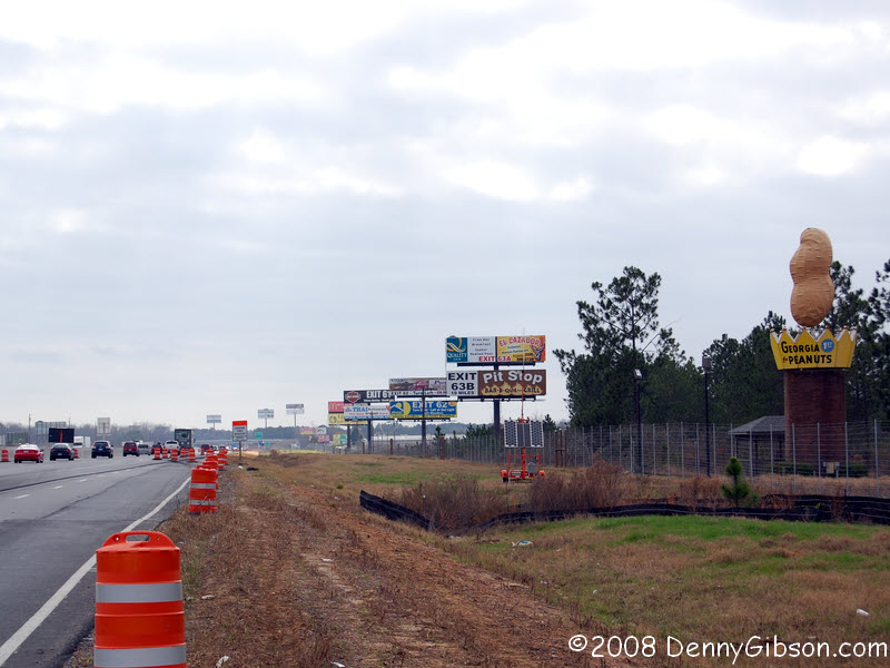 I knew that the road I'll be taking through the Florida keys in a couple
of days is the subject of an article in the current issue of
American Road
Magazine but I didn't realize that I'd be passing a landmark featured
in another article. Robert Klara's article on peanut monuments says this
one near Ashburn, Georgia, is the country' tallest.
I knew that the road I'll be taking through the Florida keys in a couple
of days is the subject of an article in the current issue of
American Road
Magazine but I didn't realize that I'd be passing a landmark featured
in another article. Robert Klara's article on peanut monuments says this
one near Ashburn, Georgia, is the country' tallest.
|
|
|
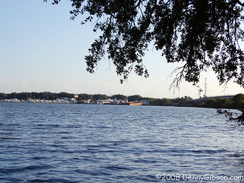
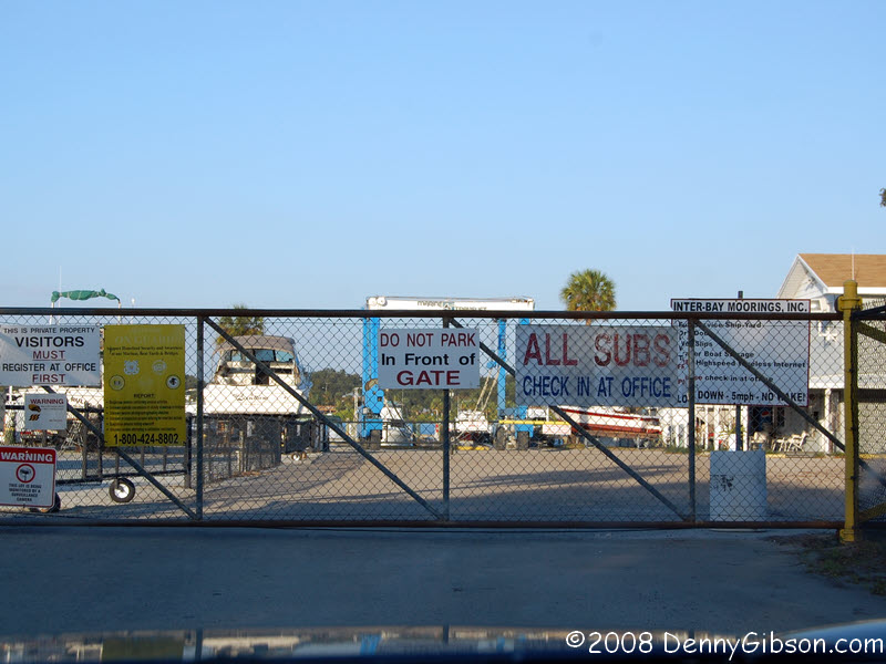 This is the Alafia River where my great-grandparents spent Christmas Eve
of 1920. The first picture is from the park on the north bank where Chris
& I stopped in 2001. The second is from another little park, on the
other side of US-41, that is also on the north bank. There was no bridge
here in 1920 and no ferry is mentioned in Granny's notes for the day so my
guess is that they spent the night on the south side of the river. The
locked gate of the closed marina in the third picture is as close as I got
to the river's south bank.
This is the Alafia River where my great-grandparents spent Christmas Eve
of 1920. The first picture is from the park on the north bank where Chris
& I stopped in 2001. The second is from another little park, on the
other side of US-41, that is also on the north bank. There was no bridge
here in 1920 and no ferry is mentioned in Granny's notes for the day so my
guess is that they spent the night on the south side of the river. The
locked gate of the closed marina in the third picture is as close as I got
to the river's south bank.
|
|
|
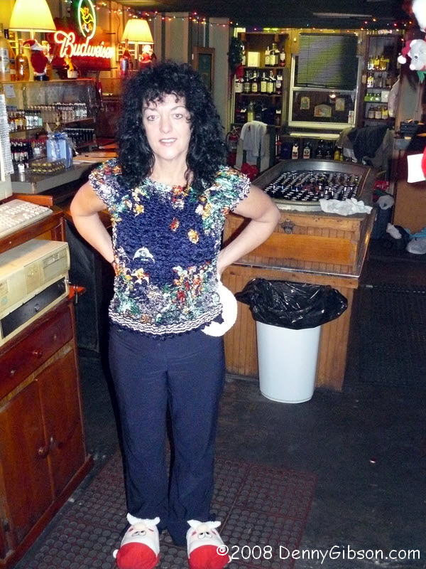
 Instead of spending Christmas eve "listening to fishermen tell sea
tales", I spent it listening to carnival workers talk about the
midway. Mary, the Showtown USA employee with the most seniority, sat
next to me and shared some of the bar's, the town's, and her own history.
I didn't get a picture of Mary. That's Kathy in the picture. I made three
attempts to get a picture of her shoes and still clipped off the toes. The
Showtown was closing at 8:00 for an employee party so I tested a couple of
Gibsonton's other bars. They're OK but the Showtown is the place to be.
It's where I'll be for Christmas morning breakfast.
Instead of spending Christmas eve "listening to fishermen tell sea
tales", I spent it listening to carnival workers talk about the
midway. Mary, the Showtown USA employee with the most seniority, sat
next to me and shared some of the bar's, the town's, and her own history.
I didn't get a picture of Mary. That's Kathy in the picture. I made three
attempts to get a picture of her shoes and still clipped off the toes. The
Showtown was closing at 8:00 for an employee party so I tested a couple of
Gibsonton's other bars. They're OK but the Showtown is the place to be.
It's where I'll be for Christmas morning breakfast.
|
|
|
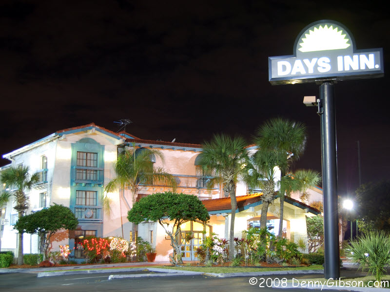 This is my home for the night and I've included the picture mostly to show
that, with 80 degree weather and a few palm trees, even a Day's Inn looks
inviting.
This is my home for the night and I've included the picture mostly to show
that, with 80 degree weather and a few palm trees, even a Day's Inn looks
inviting.
|
|
|
| [Prev] [Site Home] [Trip Home] [Contact] [Next] |