Dirty in Two Countries
Comment via blog
Prev
Next


|
Day 4: April 20, 2018 Dirty in Two Countries Comment via blog |
Prev Next |
|
|
|
 Today it got real. No more preamble, staging, and getting in position.
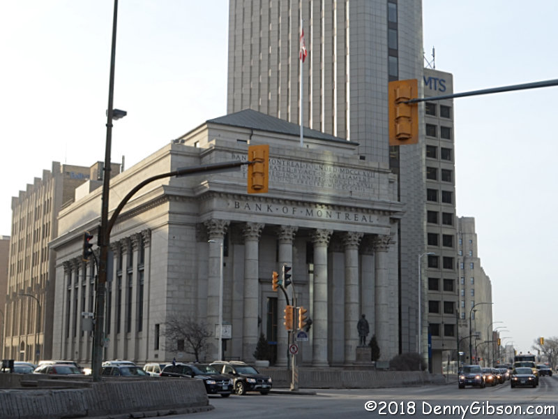
Today I started south on the Jefferson/Pine to Palm Highway. I'd hoped to
get a shot of the car in front of the Bank of Montreal where the highway
originally started but I was quickly convinced me that Friday morning
traffic wasn't going to permit that. So I settled for a drive-by and also
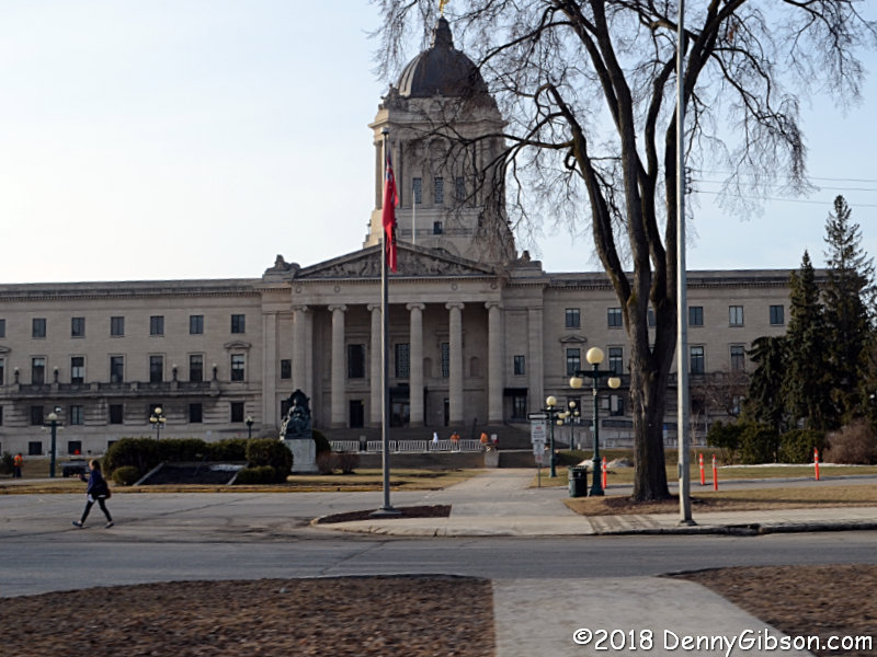
snapped a drive-by of the Manitoba capitol as I passed it on Broadway. I
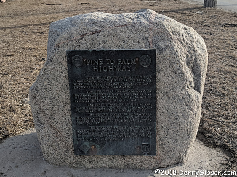
was able to actually stop for a picture of the
Pine to Palm Highway Plaque on Pembina Highway. Thomas
Jefferson didn't have a big following in Canada and there the route named
for him was more commonly referred to as the Pine to Palm Highway and this
location is considered its northern terminus.
Today it got real. No more preamble, staging, and getting in position.
Today I started south on the Jefferson/Pine to Palm Highway. I'd hoped to
get a shot of the car in front of the Bank of Montreal where the highway
originally started but I was quickly convinced me that Friday morning
traffic wasn't going to permit that. So I settled for a drive-by and also
snapped a drive-by of the Manitoba capitol as I passed it on Broadway. I
was able to actually stop for a picture of the
Pine to Palm Highway Plaque on Pembina Highway. Thomas
Jefferson didn't have a big following in Canada and there the route named
for him was more commonly referred to as the Pine to Palm Highway and this
location is considered its northern terminus.
|
|
|
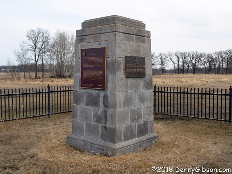
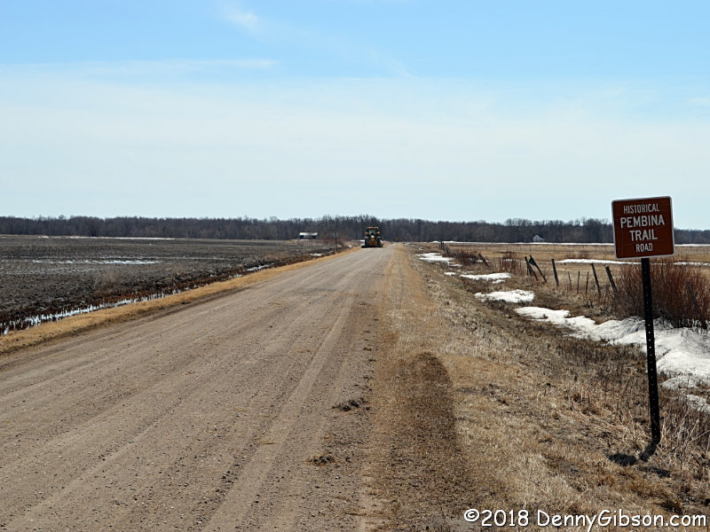
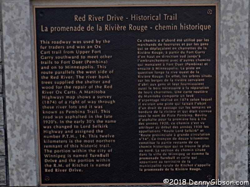
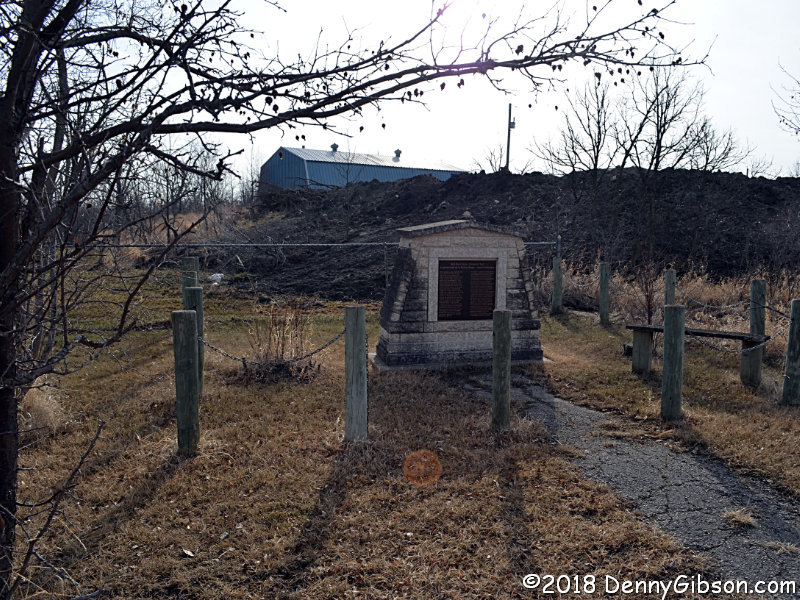 About ten miles further south, this marker commemorates the Pembina Trail
which was used by ox carts traveling between Fort Garry and Fort Daer in
the late nineteenth century. The plaque can be read
here.
About ten miles further south, this marker commemorates the Pembina Trail
which was used by ox carts traveling between Fort Garry and Fort Daer in
the late nineteenth century. The plaque can be read
here.
|
|
|
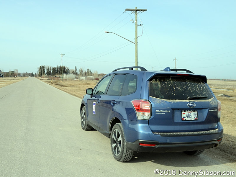
 I paused a short distance later to take one last picture of my clean car
before driving my first unpaved segment of Jefferson Highway. Well, I've
got that behind me.
I paused a short distance later to take one last picture of my clean car
before driving my first unpaved segment of Jefferson Highway. Well, I've
got that behind me.
|
|
|
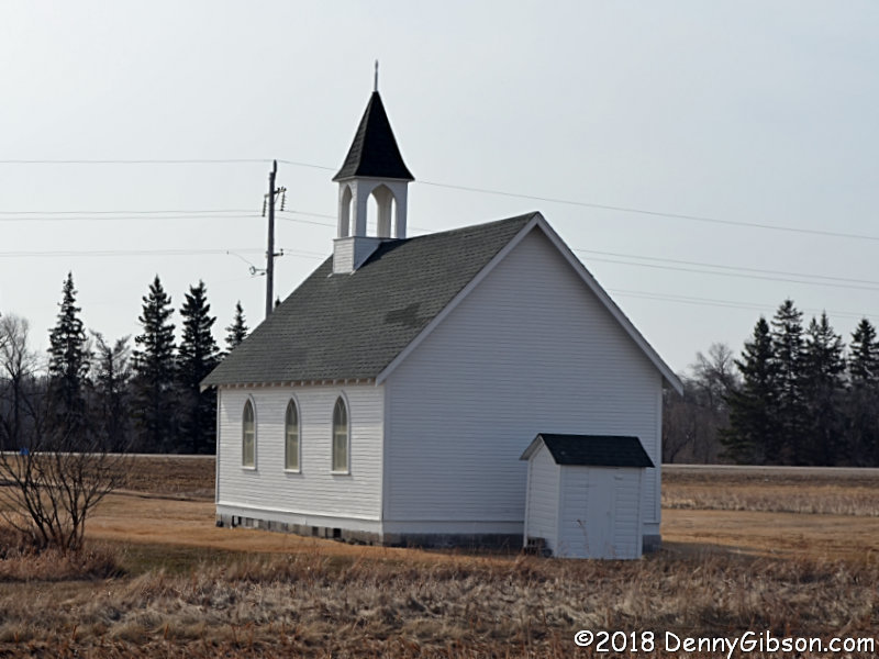
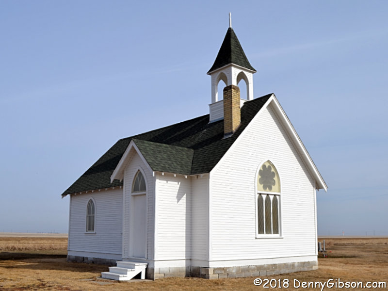 Not surprisingly, some portions of the Jefferson Highway have been
overlaid by newer routes and that includes some of the path I followed
north. I knew about this church and thought of stopping as I drove by
yesterday but decided to wait a do it in the proper sequence. That looked
like a real goof when I realized there was no access to the church from
the southbound lanes of PTH-75 (Provincial Trunk Highway) but crossovers
were available fairly close by. The 1887 church is all that is left of the
small town of Union Point and it would have fallen to the highway had it
not been for its cemetery.
Not surprisingly, some portions of the Jefferson Highway have been
overlaid by newer routes and that includes some of the path I followed
north. I knew about this church and thought of stopping as I drove by
yesterday but decided to wait a do it in the proper sequence. That looked
like a real goof when I realized there was no access to the church from
the southbound lanes of PTH-75 (Provincial Trunk Highway) but crossovers
were available fairly close by. The 1887 church is all that is left of the
small town of Union Point and it would have fallen to the highway had it
not been for its cemetery.
|
|
|
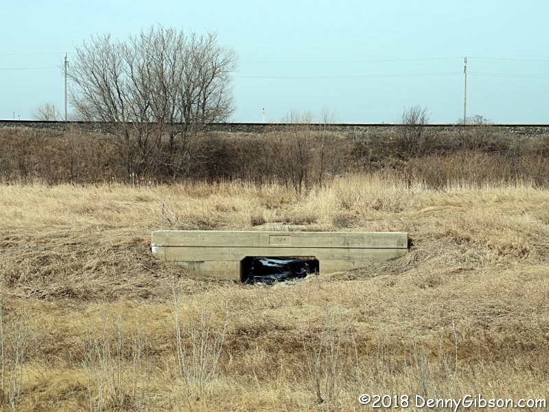
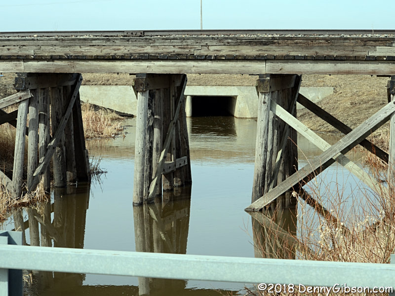
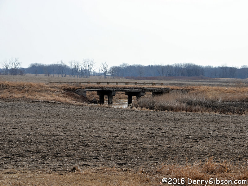
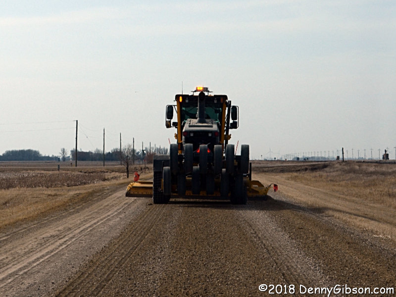
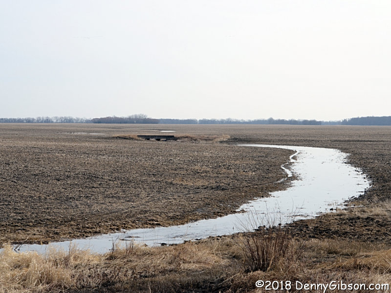
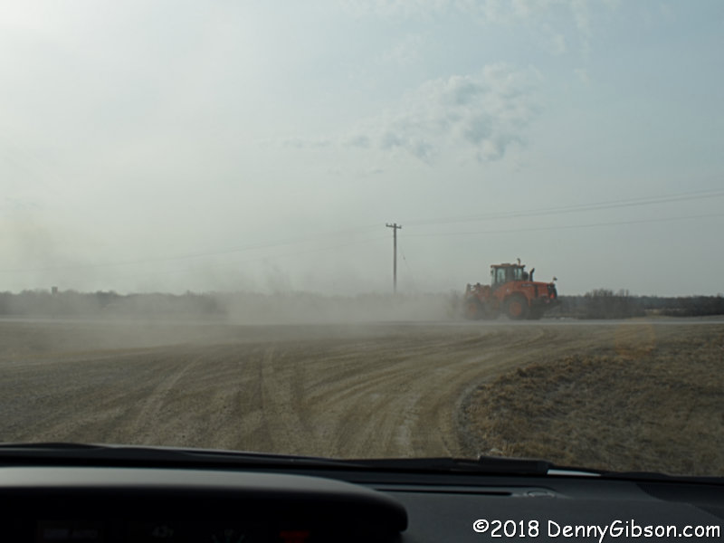
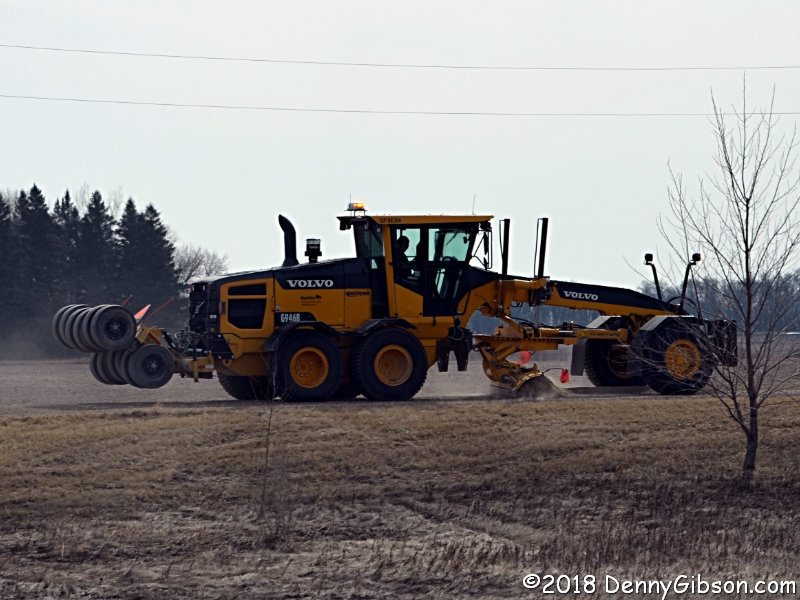
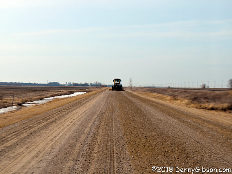 As soon as I reached the next stretch of unpaved road, I could see it was
undergoing maintenance. I didn't stop since three abandoned bridges can be
seen from this road, plus I thought I might be able to get by the grader.
I reached the first bridge with no problem but soon realized that getting
around the big machine wasn't going to be possible. I resigned myself to
a 7 MPH pace. That's not as grim as it might sound. Staying under 20 MPH
on unpaved roads is not uncommon for me and I've covered rougher bits,
like Route 66's heavily washboarded "sidewalk highway", at 10
MPH. Nonetheless, I still found it more comfortable to simply pause from
time to time instead of shadowing the operator. At the second bridge, I
passed some time by photographing the other three bridges at that spot.
The railing of the bridge I'm on can be seen at the bottom of the picture.
The railroad bridge is next and beyond that is PTH-75's concrete bridge.
All three of the abandoned Jefferson Highway bridges are from 1924 but I
could only make out the date clearly on the third one. I got a picture of
the grader on one of the turns so you can see what I
was following.
As soon as I reached the next stretch of unpaved road, I could see it was
undergoing maintenance. I didn't stop since three abandoned bridges can be
seen from this road, plus I thought I might be able to get by the grader.
I reached the first bridge with no problem but soon realized that getting
around the big machine wasn't going to be possible. I resigned myself to
a 7 MPH pace. That's not as grim as it might sound. Staying under 20 MPH
on unpaved roads is not uncommon for me and I've covered rougher bits,
like Route 66's heavily washboarded "sidewalk highway", at 10
MPH. Nonetheless, I still found it more comfortable to simply pause from
time to time instead of shadowing the operator. At the second bridge, I
passed some time by photographing the other three bridges at that spot.
The railing of the bridge I'm on can be seen at the bottom of the picture.
The railroad bridge is next and beyond that is PTH-75's concrete bridge.
All three of the abandoned Jefferson Highway bridges are from 1924 but I
could only make out the date clearly on the third one. I got a picture of
the grader on one of the turns so you can see what I
was following.
|
|
|
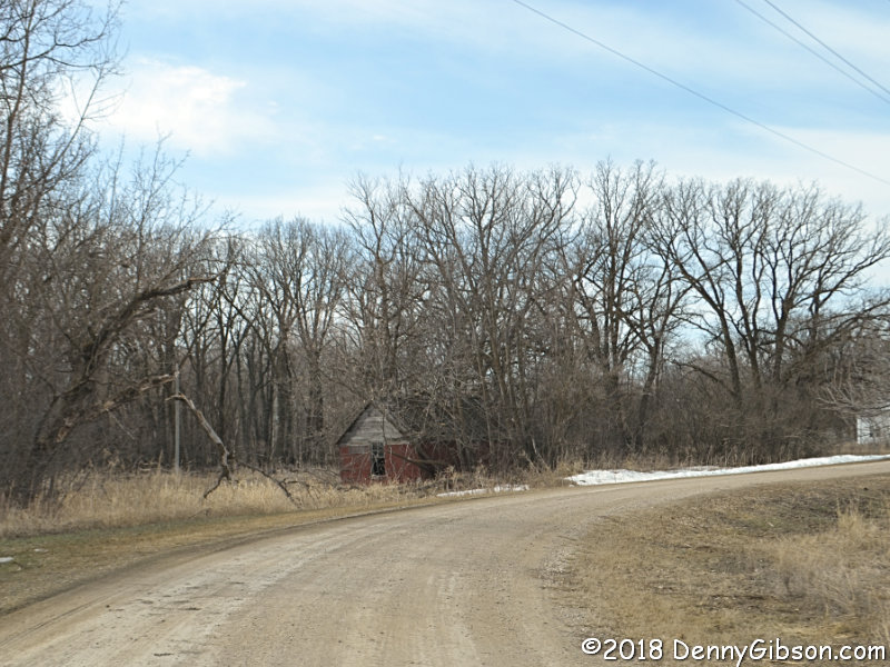
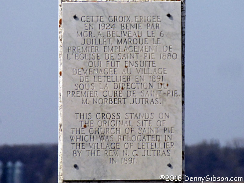
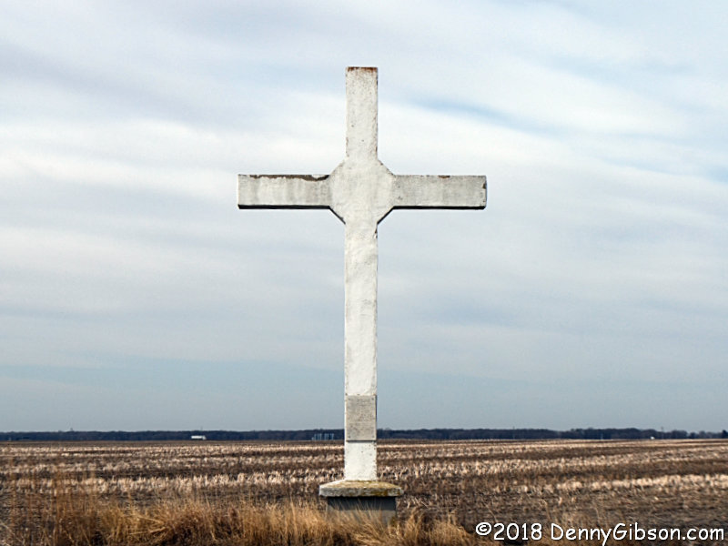 This cross really does seem to be in the middle of nowhere It's in an
empty field and some distance from the passing road which is unpaved. It
marks the spot where the Church of Saint Pie once stood. I know that only
from the plaque on the cross.
This cross really does seem to be in the middle of nowhere It's in an
empty field and some distance from the passing road which is unpaved. It
marks the spot where the Church of Saint Pie once stood. I know that only
from the plaque on the cross.
|
|
|

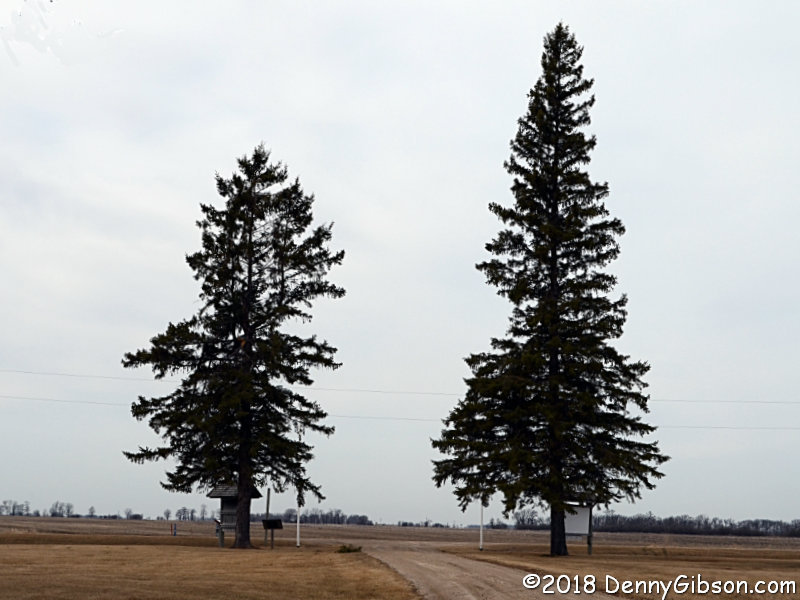
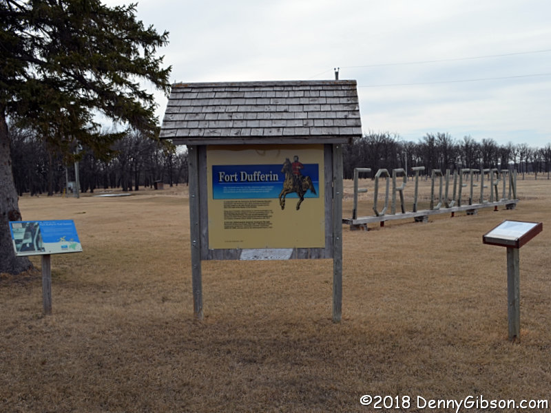 In the late 1800s,
Fort Dufferin was home to the North American Boundary
Commission and the North-West Mounted Police. Its final use was as an
immigration station. I had intended to photograph some pine trees on the
way out of Winnipeg but got distracted. Instead, I designate this fine
pair at the entrance to Fort Dufferin as the official pines I'm going to
palms from.
In the late 1800s,
Fort Dufferin was home to the North American Boundary
Commission and the North-West Mounted Police. Its final use was as an
immigration station. I had intended to photograph some pine trees on the
way out of Winnipeg but got distracted. Instead, I designate this fine
pair at the entrance to Fort Dufferin as the official pines I'm going to
palms from.
|
|
|
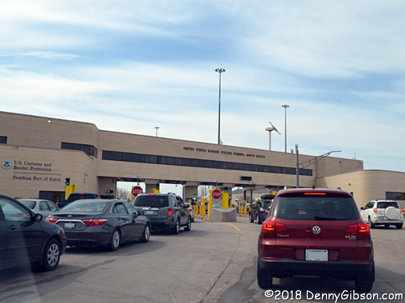 Cars were lined up at the US border but they moved quickly and I was soon
repatriated.
Cars were lined up at the US border but they moved quickly and I was soon
repatriated.
|
|
|
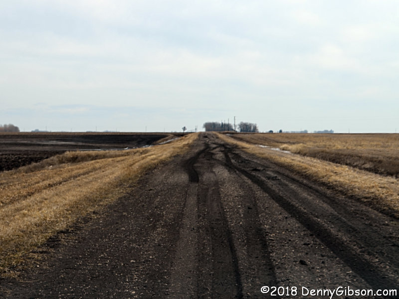
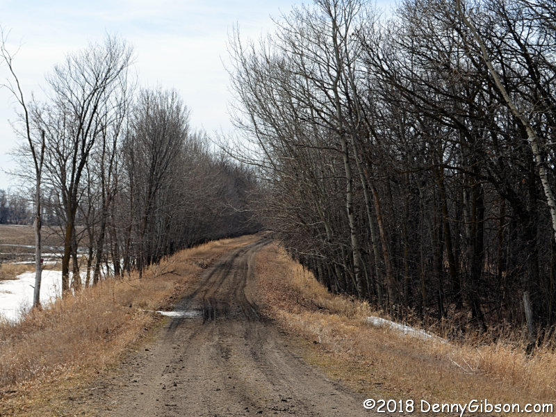
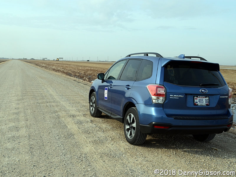
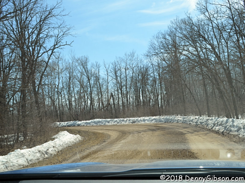
 It wasn't long before I was traveling without pavement in the US. This
stretch south of Saint Vincent, Minnesota, was actually the most worrisome
of the day. There was almost no gravel and the wet conditions turned
things somewhat to the muddy side.
It wasn't long before I was traveling without pavement in the US. This
stretch south of Saint Vincent, Minnesota, was actually the most worrisome
of the day. There was almost no gravel and the wet conditions turned
things somewhat to the muddy side.
|
|
|
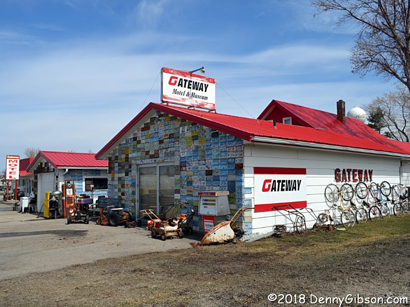
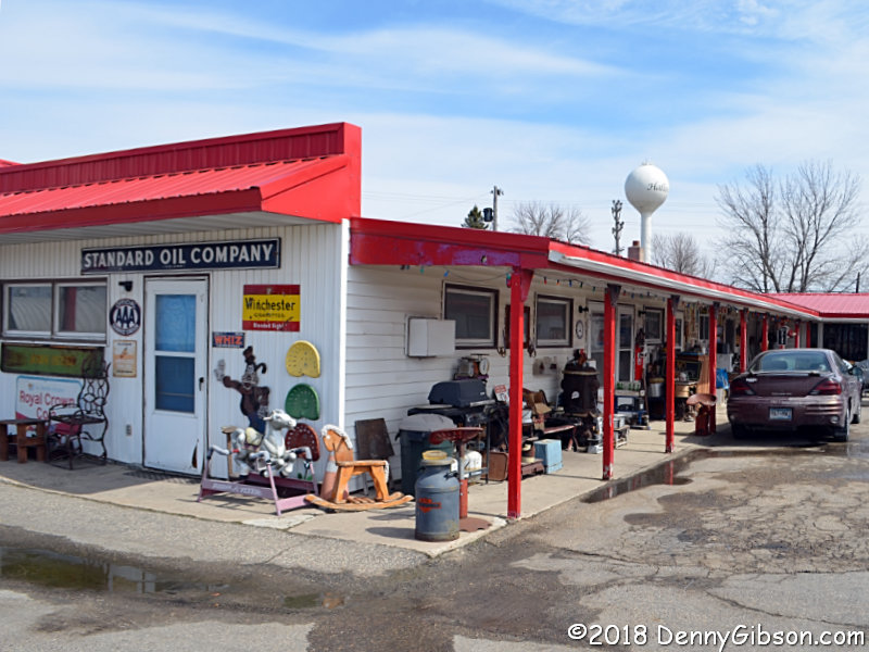
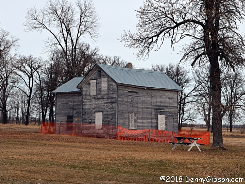
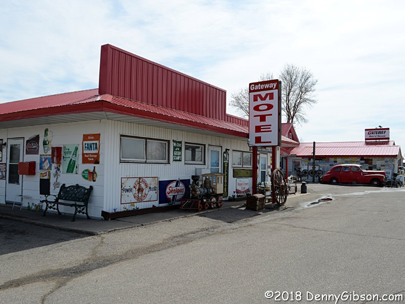 This isn't exactly on the Jefferson Highway but it's close enough (< 0.5
mile) and interesting enough (just look) to be worth the tiny detour. I
learned about the
Gateway Motel and Museum too late to work in a stay on
this trip but I'll sure give it a try next time.
This isn't exactly on the Jefferson Highway but it's close enough (< 0.5
mile) and interesting enough (just look) to be worth the tiny detour. I
learned about the
Gateway Motel and Museum too late to work in a stay on
this trip but I'll sure give it a try next time.
|
|
|
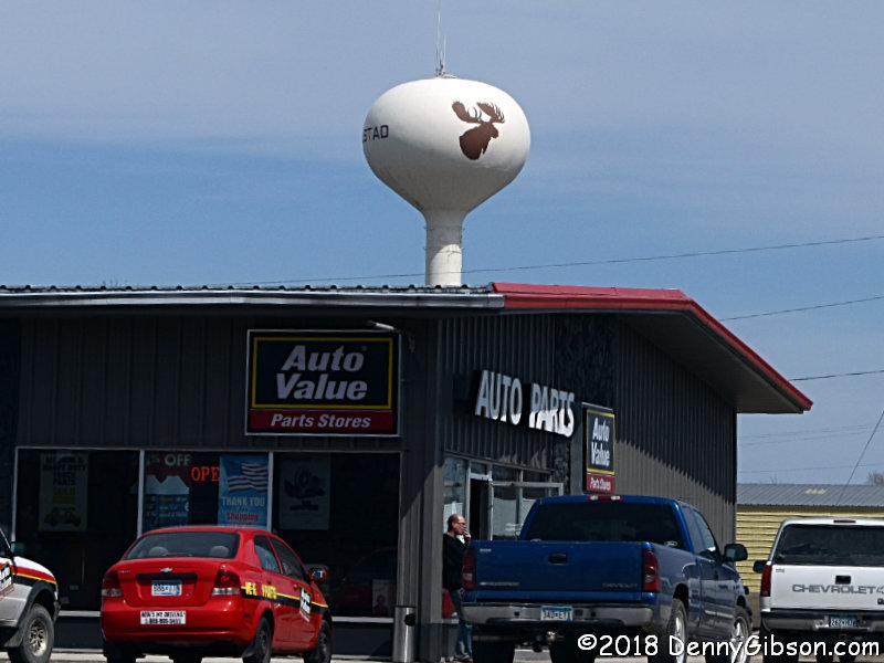
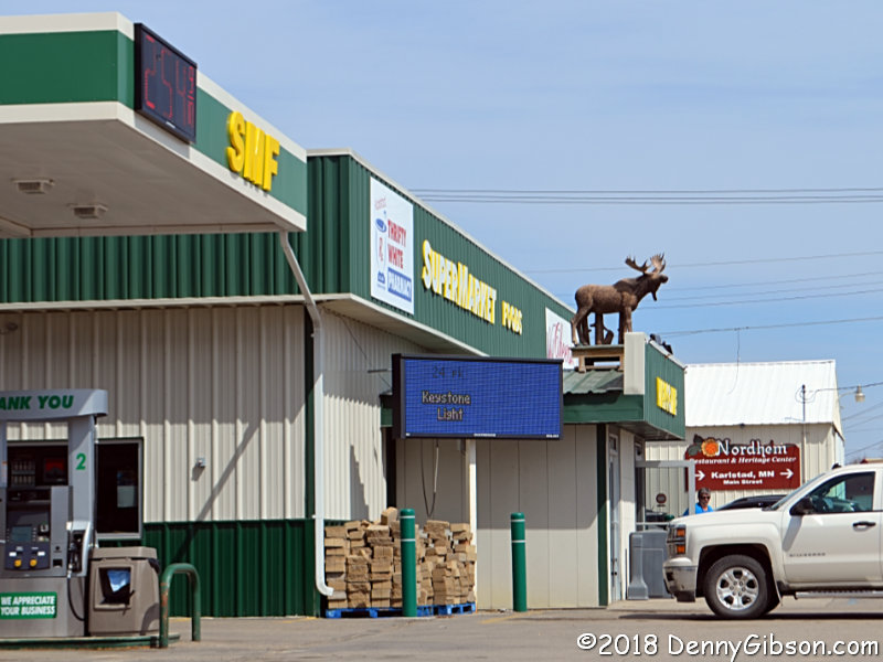
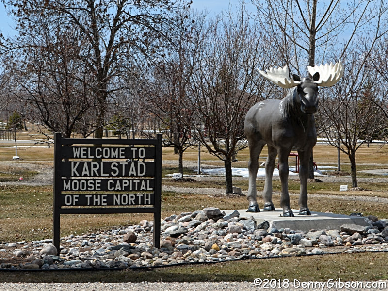 Karlstad, Minnesota, calls itself the "Moose Capital of the
North" and greets visitors with a not-exactly-on-the-JH big moose
statue. There's a smaller one atop the local grocery and the water tower
has its own version of a smiley face.
Karlstad, Minnesota, calls itself the "Moose Capital of the
North" and greets visitors with a not-exactly-on-the-JH big moose
statue. There's a smaller one atop the local grocery and the water tower
has its own version of a smiley face.
|
|
|
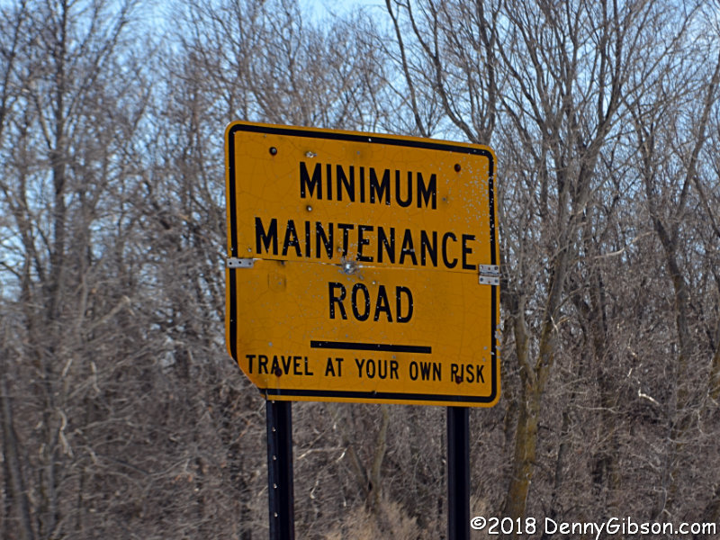
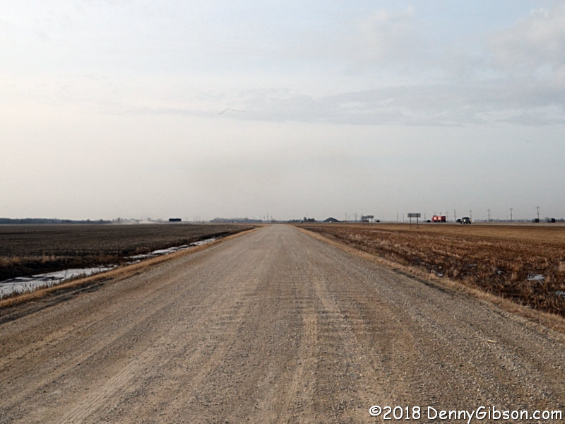
 I encountered more road maintenance in Minnesota but this time I was able
to slip by the grader. Knowing that most roads like this receive minimum
maintenance even when it doesn't advertise the fact, I've encountered
graders on unpaved roads a surprising -- and reassuring -- number of times
over the years.
I encountered more road maintenance in Minnesota but this time I was able
to slip by the grader. Knowing that most roads like this receive minimum
maintenance even when it doesn't advertise the fact, I've encountered
graders on unpaved roads a surprising -- and reassuring -- number of times
over the years.
|
|
|
| [Prev] [Site Home] [Trip Home] [Contact] [Next] |