Sleeping on the Corner
Comment via blog
Prev
Next


|
Day 8: April 24, 2018 Sleeping on the Corner Comment via blog |
Prev Next |
|
|
|
 I had Rancho Deluxe Z Garden in my GPS and tried to find it
yesterday when I came through Mason City. I eventually decided it no
longer existed and headed on to Clear Lake. Iowa resident and JH expert,
Scott Berka,
sent me a list of JH POIs and I've been intending to load some of them
into the GPS. This morning, after I've already driven about twenty-five
miles of Iowa's Jefferson Highway, I finally got around to it. The list
contained coordinates for Rancho Deluxe that were slightly different than
what I had and they got me close enough to see it. It doesn't help that
2nd Street NE, where Rancho Deluxe is situated, is chopped in two with two
dead-ends.
I had Rancho Deluxe Z Garden in my GPS and tried to find it
yesterday when I came through Mason City. I eventually decided it no
longer existed and headed on to Clear Lake. Iowa resident and JH expert,
Scott Berka,
sent me a list of JH POIs and I've been intending to load some of them
into the GPS. This morning, after I've already driven about twenty-five
miles of Iowa's Jefferson Highway, I finally got around to it. The list
contained coordinates for Rancho Deluxe that were slightly different than
what I had and they got me close enough to see it. It doesn't help that
2nd Street NE, where Rancho Deluxe is situated, is chopped in two with two
dead-ends.
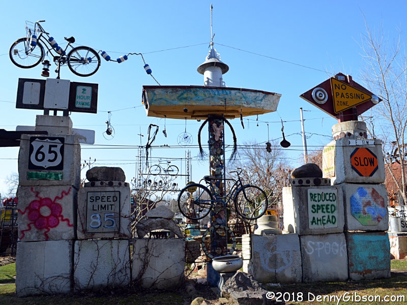
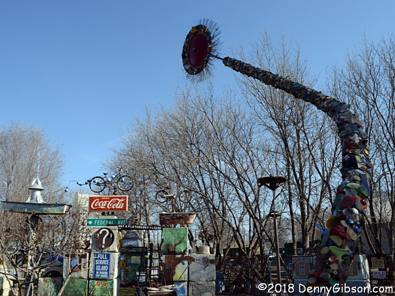
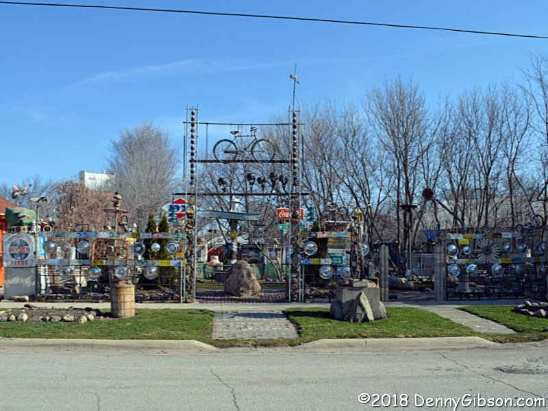
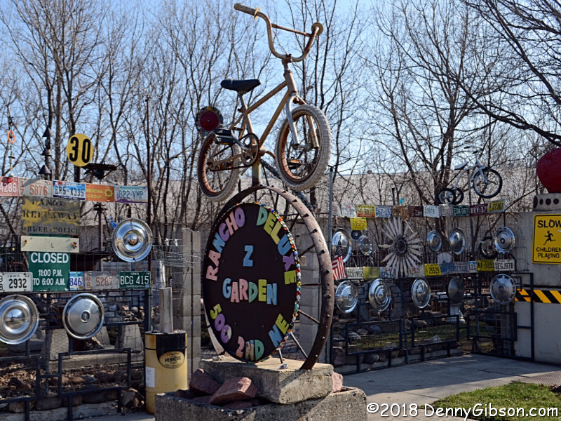
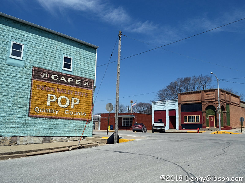
Rancho Deluxe Z Garden is the work of Max Weaver. It's a fun place to which I've seen the words "eclectic" and "unique" applied. I don't think I've ever seen those words better used. |
|
|
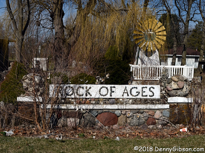
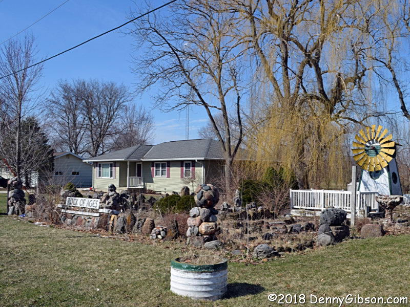 Scott's list also contained an entry for Rock of Ages, but that didn't
mean anything to me and the internet failed to enlighten me. I didn't put
it in the GPS but I recognized it instantly when I saw it.
Scott's list also contained an entry for Rock of Ages, but that didn't
mean anything to me and the internet failed to enlighten me. I didn't put
it in the GPS but I recognized it instantly when I saw it.
|
|
|
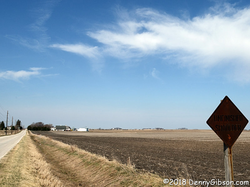
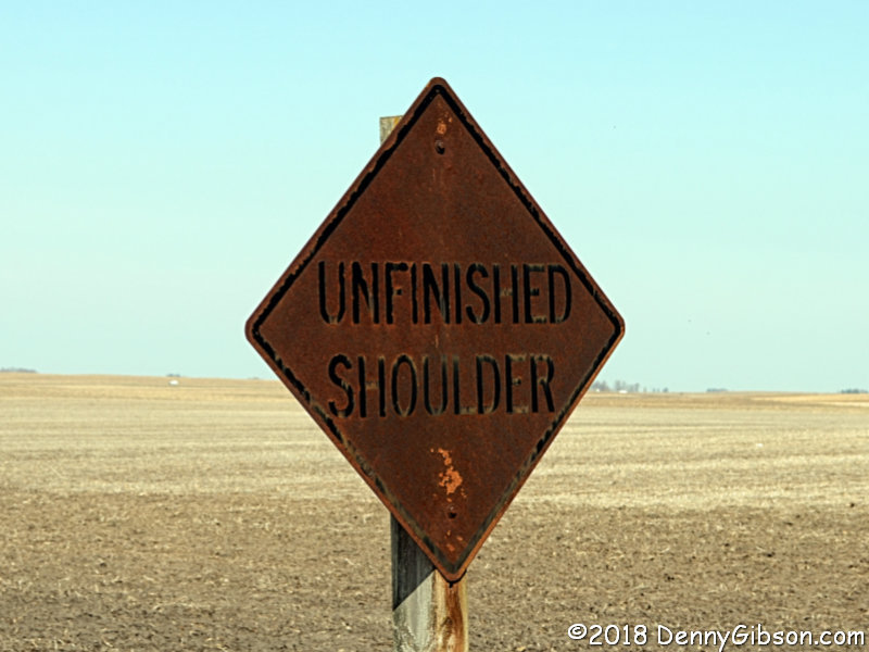 Scott's list did not mention this sign on the road leading to Hubbard,
Iowa. I don't believe I've ever seen an "UNFINISHED SHOULDER"
sign before and now I have a picture of such a sign and (AFAIK) one of an
actual unfinished shoulder.
Scott's list did not mention this sign on the road leading to Hubbard,
Iowa. I don't believe I've ever seen an "UNFINISHED SHOULDER"
sign before and now I have a picture of such a sign and (AFAIK) one of an
actual unfinished shoulder.
|
|
|
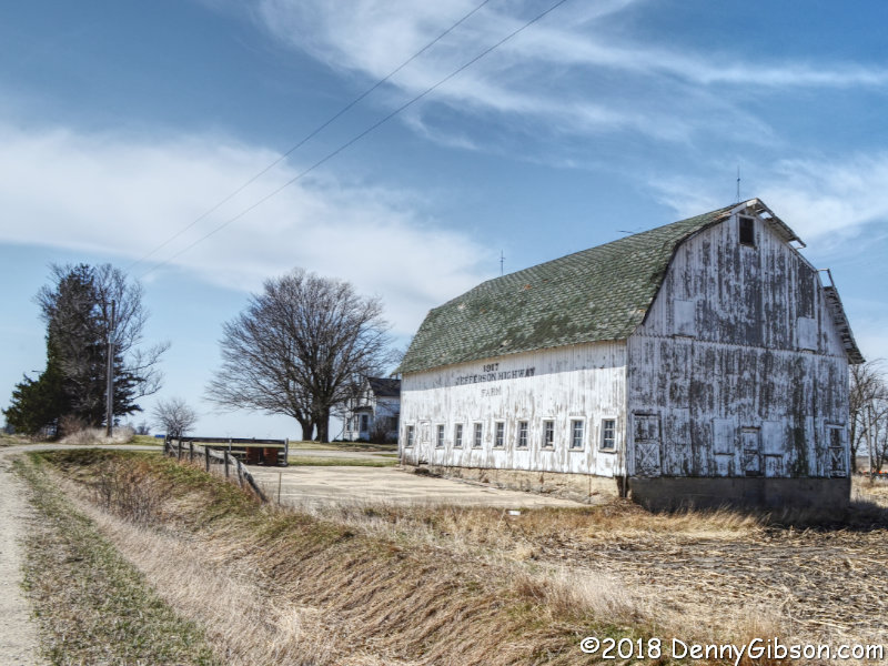
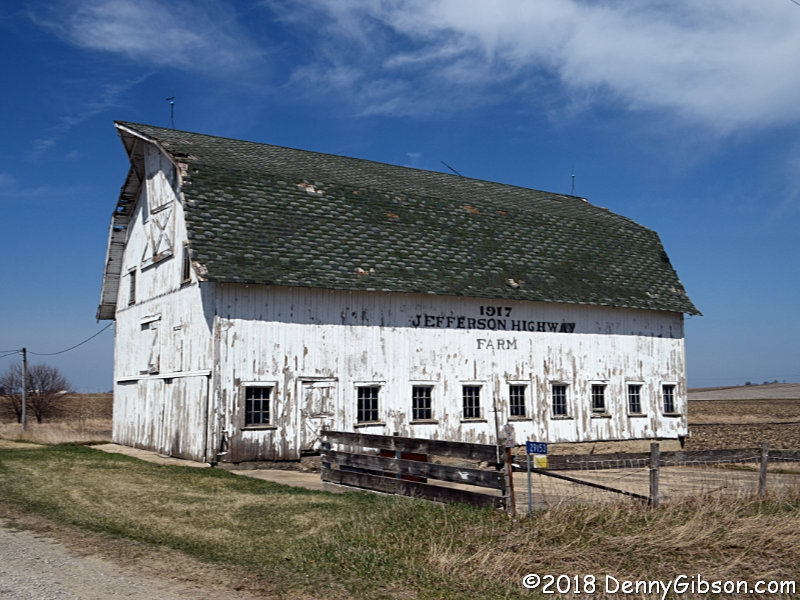
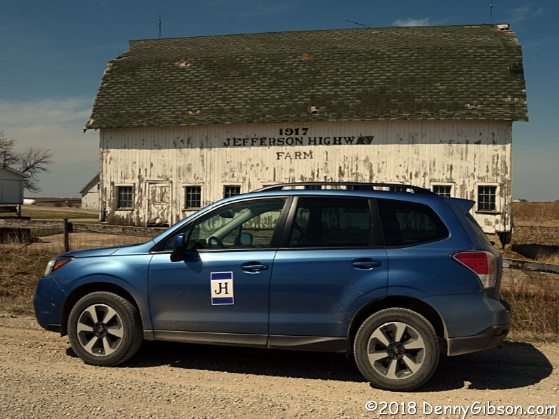
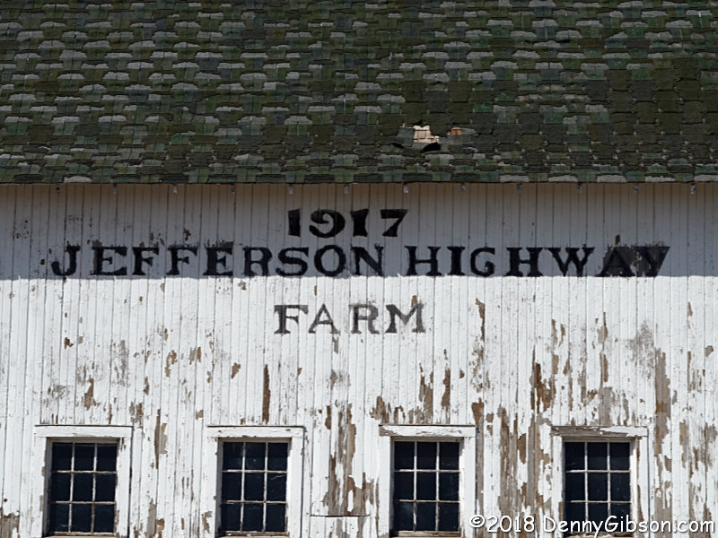 This barn just south of Hubbard is on everybody's JH list. It's one of
very few things surviving from the Highway's lifetime that specifically
identify with it. Sadly, it's showing up on a lot of endangered lists,
too. The barn is still a nice looking road side attraction but holes have
started to develop in the roof and it could be approaching a tipping
point. My photos do include proof I was there.
This barn just south of Hubbard is on everybody's JH list. It's one of
very few things surviving from the Highway's lifetime that specifically
identify with it. Sadly, it's showing up on a lot of endangered lists,
too. The barn is still a nice looking road side attraction but holes have
started to develop in the roof and it could be approaching a tipping
point. My photos do include proof I was there.
|
|
|
 This mural with the JH logo, is in the town of Zearing.
|
|
|
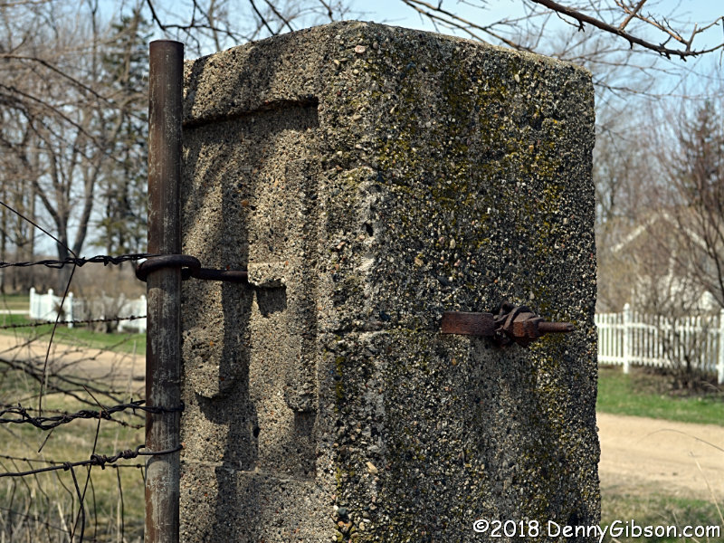 Even though I basically knew the location of this marker, I initially
dismissed this candidate because I first saw it from the other side and
could tell it had wires attached. I figured it was just another fence post
rather than a rare JH era survivor.
Even though I basically knew the location of this marker, I initially
dismissed this candidate because I first saw it from the other side and
could tell it had wires attached. I figured it was just another fence post
rather than a rare JH era survivor.
|
|
|
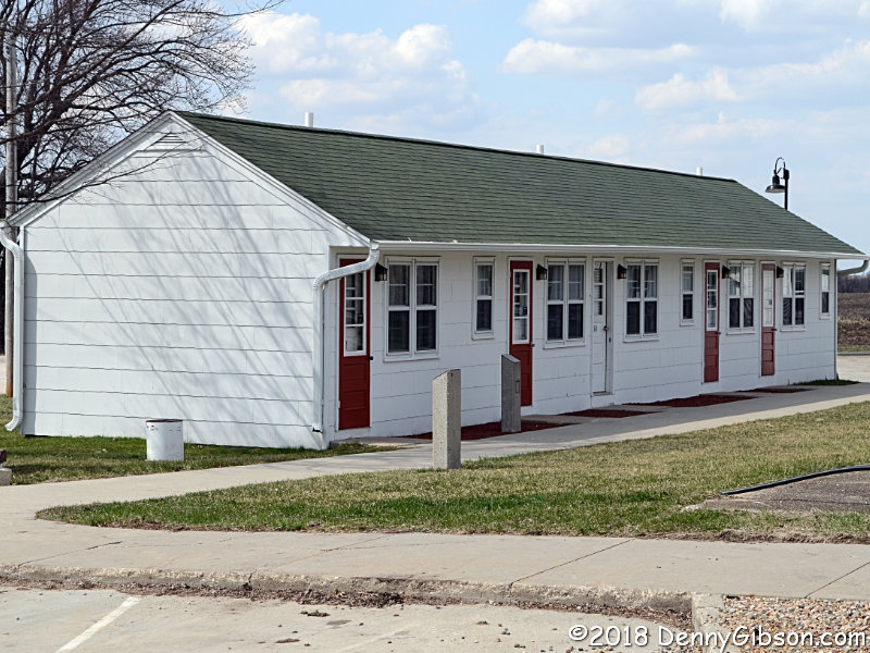
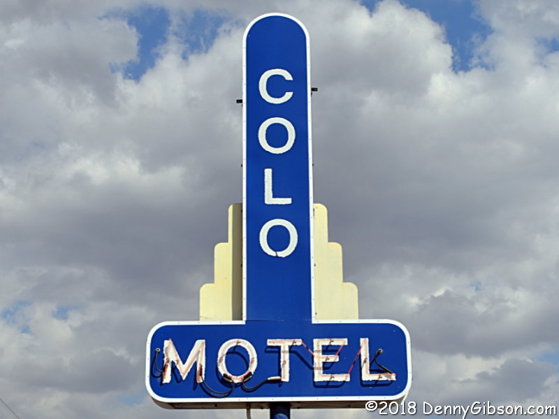
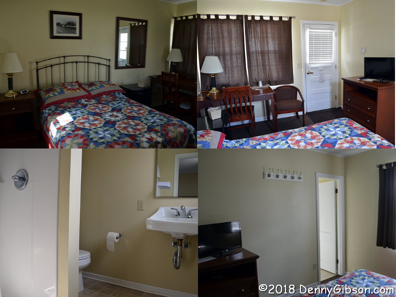
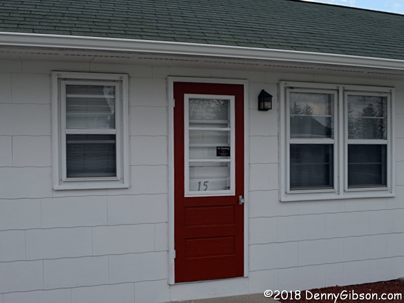
 I finally get to spend the night in Colo. I've passed through several
times but, with a single exception, the timing was never right for an
overnight. On that one occasion when I could have stayed, the motel was
full. That's not at all unusual. There are only six rooms available and
they're all full again tonight. But this time, I'm in one of them.
I finally get to spend the night in Colo. I've passed through several
times but, with a single exception, the timing was never right for an
overnight. On that one occasion when I could have stayed, the motel was
full. That's not at all unusual. There are only six rooms available and
they're all full again tonight. But this time, I'm in one of them.
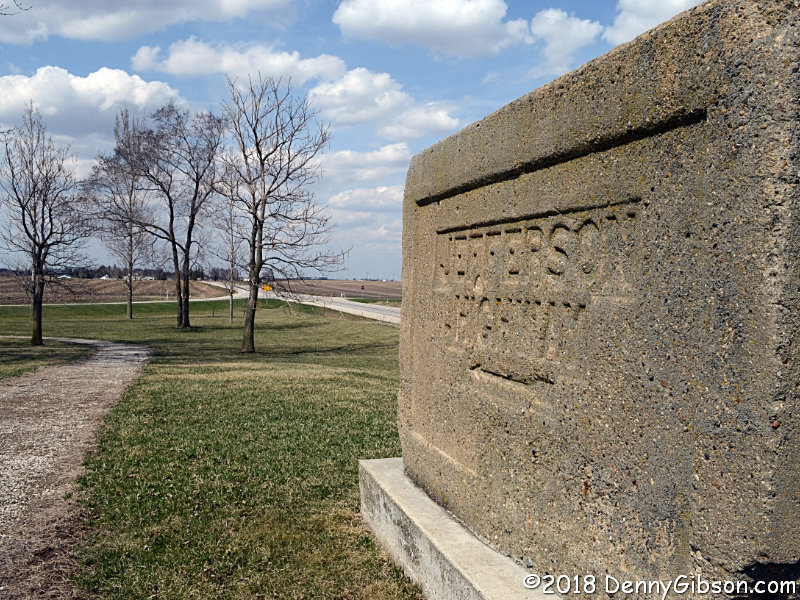
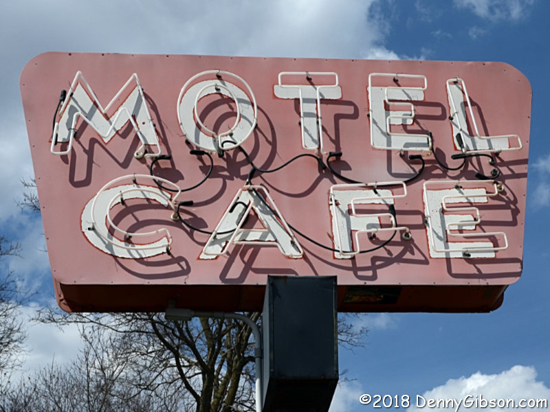
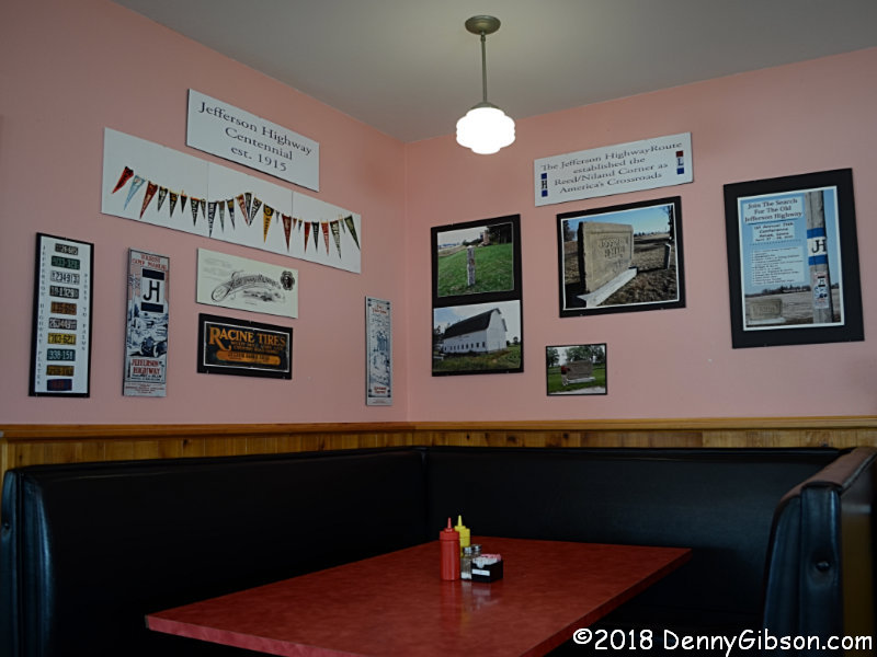
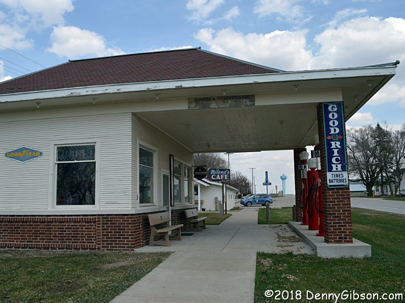
It really is a special place. Everyone has their own favorite "Crossroads of America" intersection. As a south Ohioan, my favorite is the National Road/Dixie Highway intersection near Dayton. But even I must admit that this place where the Lincoln Highway once met the Jefferson Highway could have a really strong claim. Of course, there is the technicality that no actual crossroads resulted from their meeting. They joined up here and traveled west together for about fifteen miles before once again going their separate ways. In addition to being a meeting place for two great highways, Reed-Niland Corner was a true one-stop in its day, offering gas, food, and lodging. All three components survive. Although it doesn't sell gas or service automobiles these days, Reed's Gas Station has been restored to show what it looked like in the 1920s. Niland's Cafe serves food six days a week and, as previously mentioned, the Colo Motel has six restored and modernized room available to travelers. Visit the website here. The interior shot of the cafe show a Jefferson Highway display. Other displays feature the Lincoln Highway and the numbered highways, US-65 and US-30, that replaced them both in the area. The big concrete sign once stood at the corner and pointed north on the Jefferson Highway. That's something it still does. Five of the available rooms are in the standalone building in the last picture. My room is behind door fifteen. |
|
|
| [Prev] [Site Home] [Trip Home] [Contact] [Next] |