The Other End
Comment via blog
Prev
Next


|
Day 20: May 6, 2018 The Other End Comment via blog |
Prev Next |
|
|
|
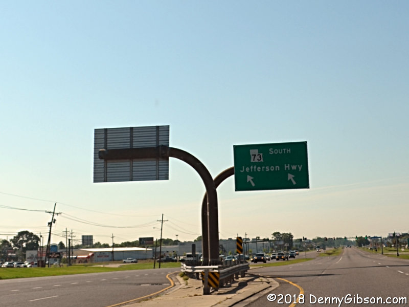
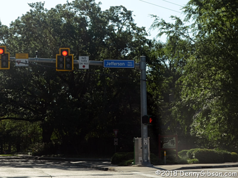 I spent the night in Port Allen on the west side of the Mississippi from
Baton Rouge. I crossed over and soon found myself on Jefferson Highway.
That's REGULAR Jefferson Highway, not OLD Jefferson Highway. The name
disappeared for awhile when the street merged with another but it soon
reappeared in a big way.
I spent the night in Port Allen on the west side of the Mississippi from
Baton Rouge. I crossed over and soon found myself on Jefferson Highway.
That's REGULAR Jefferson Highway, not OLD Jefferson Highway. The name
disappeared for awhile when the street merged with another but it soon
reappeared in a big way.
|
|
|
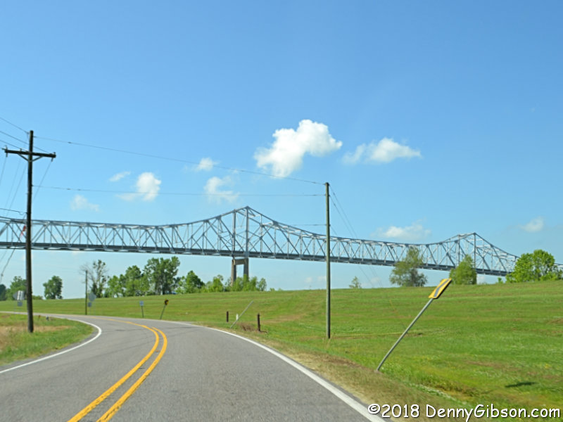
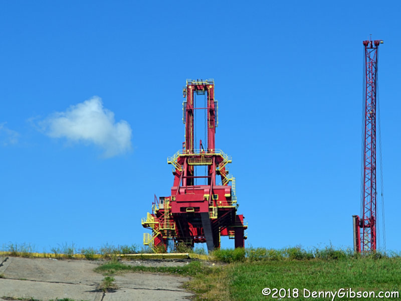
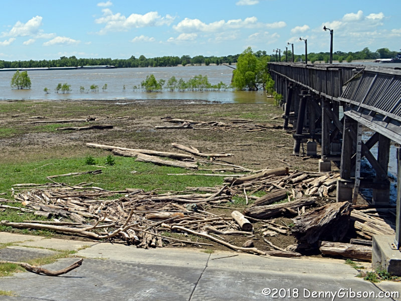
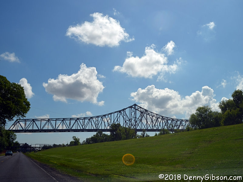 I came back to the river near the town of Geismar and basically hugged it
all the way to New Orleans. The river and road have both moved around a
little over the years and the riverside probably doesn't look like it did
in the 1910s. Today it's lined with nice big grass covered levees and
actually looks rather attractive. The first bridge pictured is the
Sunshine Bridge which carries LA-70. The second is the Veterans Memorial
Bridge which carries LA-3213. The area is basically industrial looking
with refineries and oil and grain handling equipment. Some of the rigs
look pretty good, though.
I came back to the river near the town of Geismar and basically hugged it
all the way to New Orleans. The river and road have both moved around a
little over the years and the riverside probably doesn't look like it did
in the 1910s. Today it's lined with nice big grass covered levees and
actually looks rather attractive. The first bridge pictured is the
Sunshine Bridge which carries LA-70. The second is the Veterans Memorial
Bridge which carries LA-3213. The area is basically industrial looking
with refineries and oil and grain handling equipment. Some of the rigs
look pretty good, though.
|
|
|
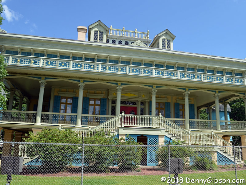
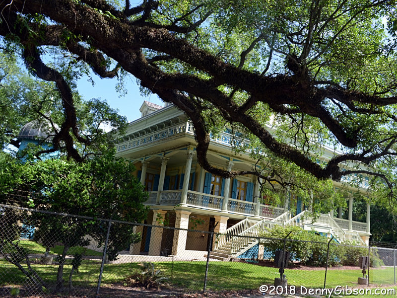
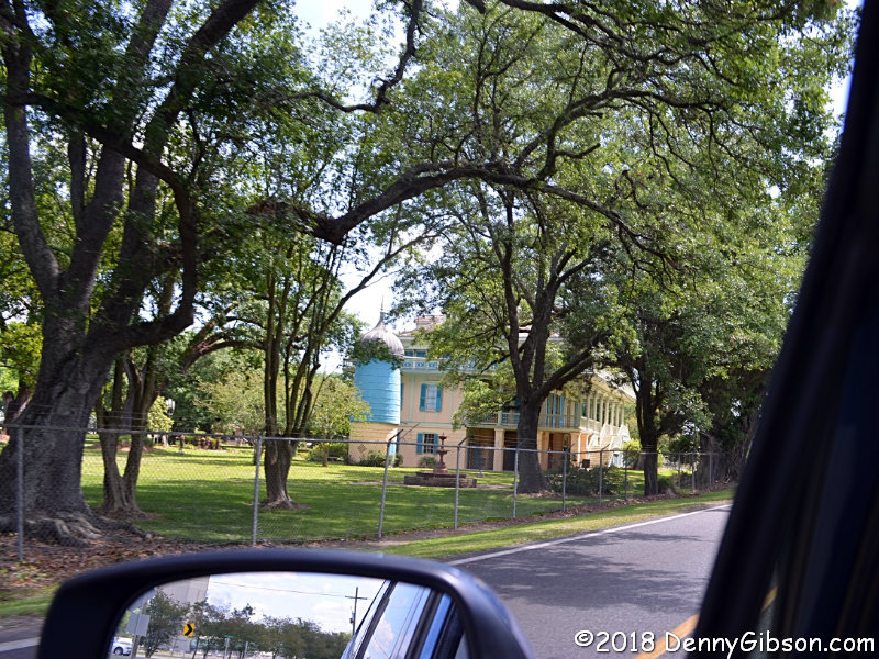 I sure wasn't expecting a plantation big house among those storage tanks
and silos but there it was.
San
Francisco Plantation offers tours but I didn't take one. There are
signs posted in front of the place warning against stopping on the pavement
so all of the blurs in the photos are legally mandated.
I sure wasn't expecting a plantation big house among those storage tanks
and silos but there it was.
San
Francisco Plantation offers tours but I didn't take one. There are
signs posted in front of the place warning against stopping on the pavement
so all of the blurs in the photos are legally mandated.
|
|
|
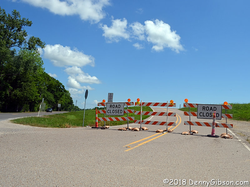 Just beyond Muntz, Spillway Road was closed for "flood control".
Getting around it wasn't too tough but I skipped another two and a half
miles of my planned route.
Just beyond Muntz, Spillway Road was closed for "flood control".
Getting around it wasn't too tough but I skipped another two and a half
miles of my planned route.
|
|
|
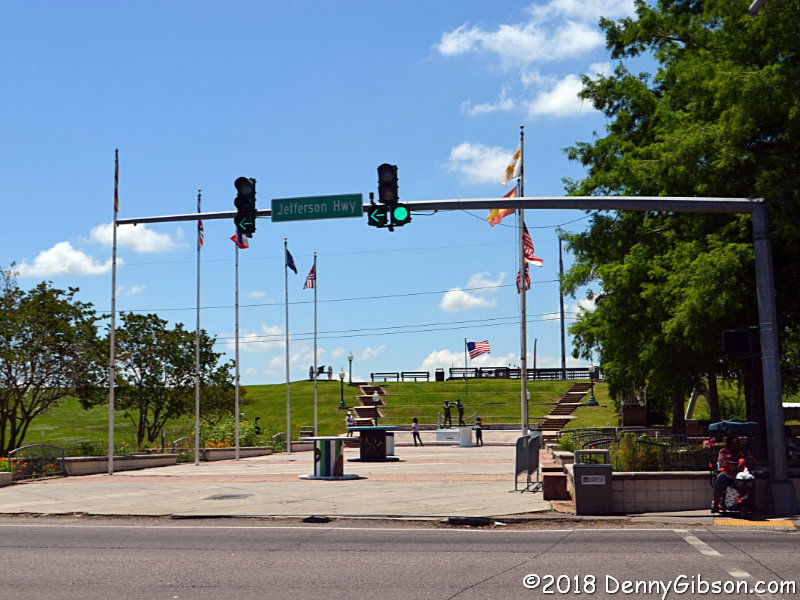
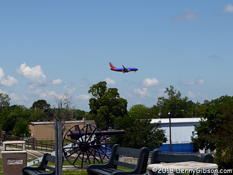
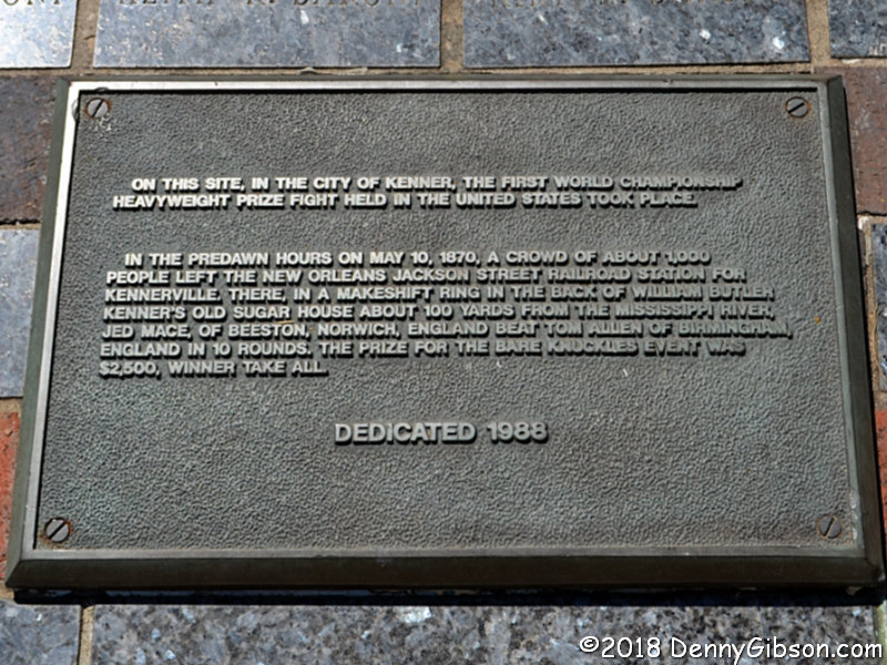
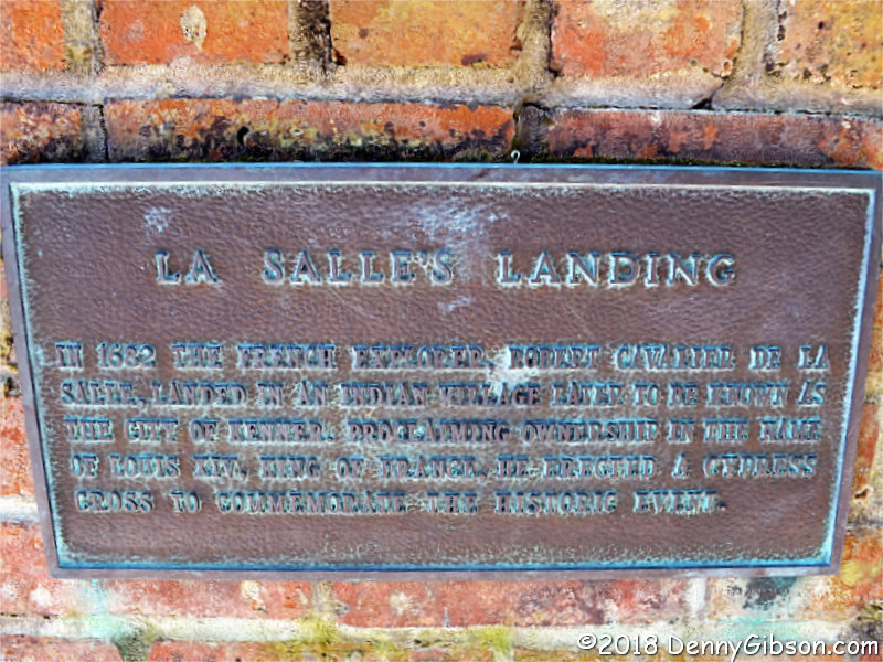
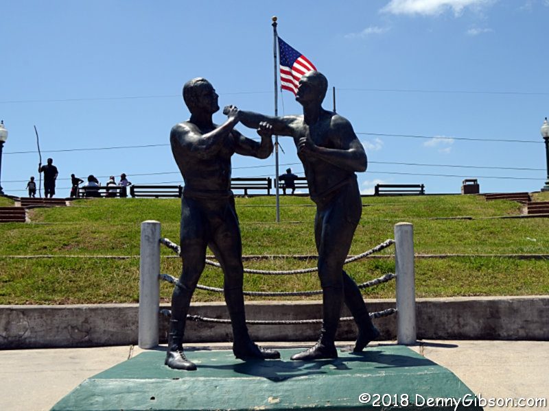 This is Kenner where the "first world
championship heavyweight prize fight held in the United States"
took place. Before that, it was where René-Robert Cavelier, Sieur de La
Salle landed when he was out claiming and naming. Here he claimed a huge
bunch of land for France and he named it
Louisiana for France's king. All of that was quite a surprise to me.
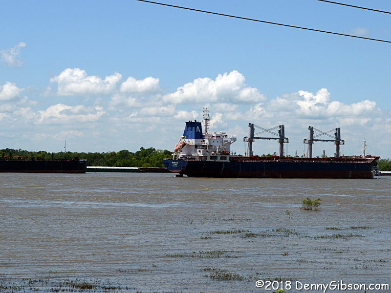
I'd stopped merely to get a look at the river on the other side of those
levees. The submerged trees make me think it must be somewhat bigger than
normal. Kenner is near an airport and very much on the Jefferson Highway.
This is Kenner where the "first world
championship heavyweight prize fight held in the United States"
took place. Before that, it was where René-Robert Cavelier, Sieur de La
Salle landed when he was out claiming and naming. Here he claimed a huge
bunch of land for France and he named it
Louisiana for France's king. All of that was quite a surprise to me.
I'd stopped merely to get a look at the river on the other side of those
levees. The submerged trees make me think it must be somewhat bigger than
normal. Kenner is near an airport and very much on the Jefferson Highway.
|
|
|
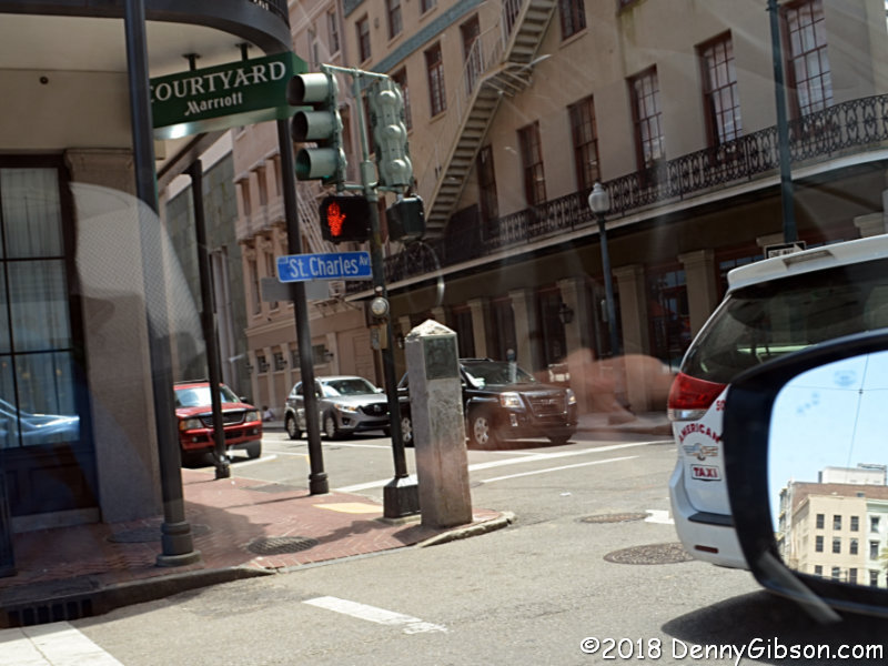
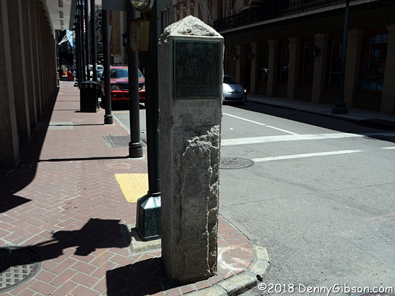
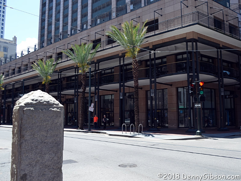
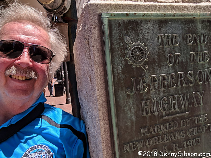 From Kenner, I kept following the GPS instructions until I was driving
down Canal Street and turning onto Saint Charles. You'd think that I'd
have researched what corner the marker is on but I didn't. I knew it was
at the next intersection but nothing more. I was lucky to spot it and get
a shot between cars. First contact. I've driven 3,943 miles to get to this
point so you're going to get three more pictures. The first is just a
picture I was able to take while standing still. I found a parking spot a
few blocks away (free on Sundays:-) and walked back. The next is a photo
from the rear showing the palm trees I've been driving from the pines to
for seventeen days. The last is the selfie I Tweeted and posted to
Facebook to announce my arrival.
From Kenner, I kept following the GPS instructions until I was driving
down Canal Street and turning onto Saint Charles. You'd think that I'd
have researched what corner the marker is on but I didn't. I knew it was
at the next intersection but nothing more. I was lucky to spot it and get
a shot between cars. First contact. I've driven 3,943 miles to get to this
point so you're going to get three more pictures. The first is just a
picture I was able to take while standing still. I found a parking spot a
few blocks away (free on Sundays:-) and walked back. The next is a photo
from the rear showing the palm trees I've been driving from the pines to
for seventeen days. The last is the selfie I Tweeted and posted to
Facebook to announce my arrival.
|
|
|
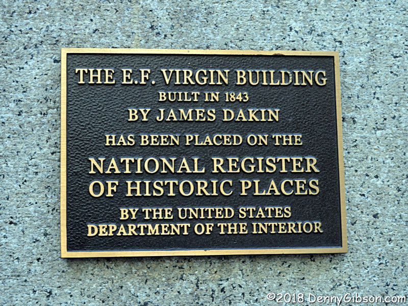
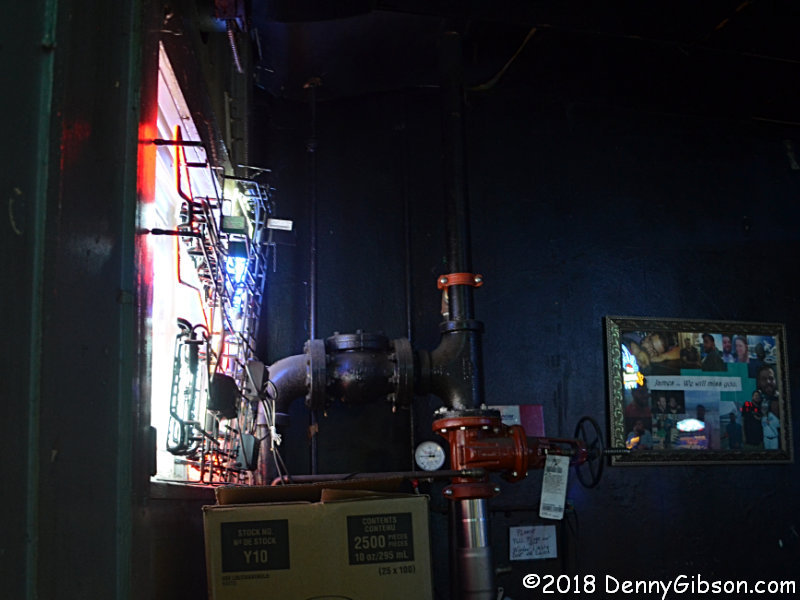
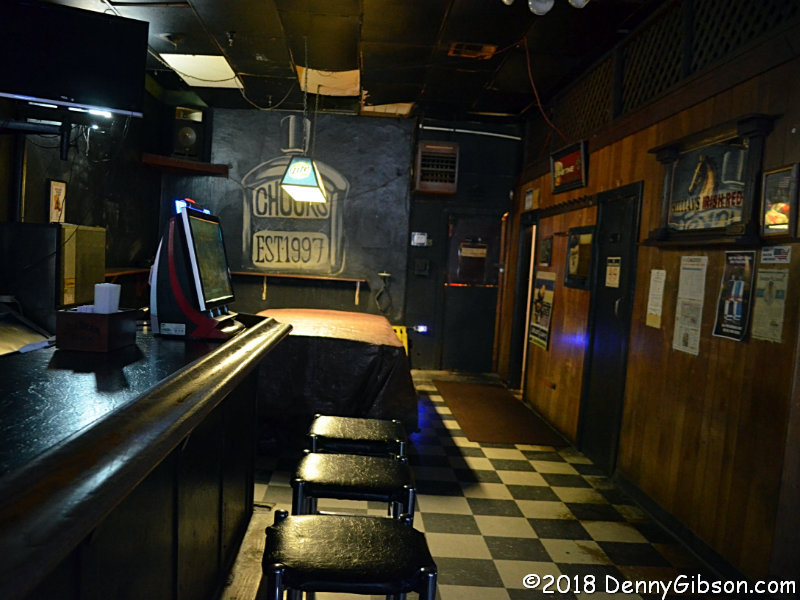
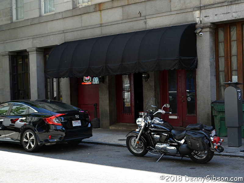 Now to celebrate. An internet search turned up an unpretentious sounding
bar just a couple of blocks away. From the outside,
Chuck's Sports Bar looks even less pretentious than it
sounds and the inside is even less pretentious than that. Among the four
taps was a beer from New Orleans Lager and Ale Brewing Company, so that's
what I had. Before leaving I asked about the big pipes in the front and
the bartender explained that it was their water connection. Plumbing has
to be added to these old buildings by whatever works. He then went outside
with me to point out a couple aspects of the building and its National
Register plaque.
Now to celebrate. An internet search turned up an unpretentious sounding
bar just a couple of blocks away. From the outside,
Chuck's Sports Bar looks even less pretentious than it
sounds and the inside is even less pretentious than that. Among the four
taps was a beer from New Orleans Lager and Ale Brewing Company, so that's
what I had. Before leaving I asked about the big pipes in the front and
the bartender explained that it was their water connection. Plumbing has
to be added to these old buildings by whatever works. He then went outside
with me to point out a couple aspects of the building and its National
Register plaque.
|
|
|
 It was time to check into my motel, then hook up with my son for a poor
boy and a couple of beers. Only now, as I'm writing this and sorting
pictures, did I realize that, over two days, I did not get a single
picture of my son or his family. Now that's embarrassing.
It was time to check into my motel, then hook up with my son for a poor
boy and a couple of beers. Only now, as I'm writing this and sorting
pictures, did I realize that, over two days, I did not get a single
picture of my son or his family. Now that's embarrassing.
|
|
|
| [Prev] [Site Home] [Trip Home] [Contact] [Next] |