Ruts, Rails, & Bricks
Comment via blog
Prev
Next


|
Day 3: June 10, 2014 Ruts, Rails, & Bricks Comment via blog |
Prev Next |
|
|
|
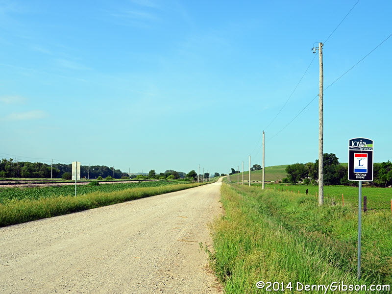
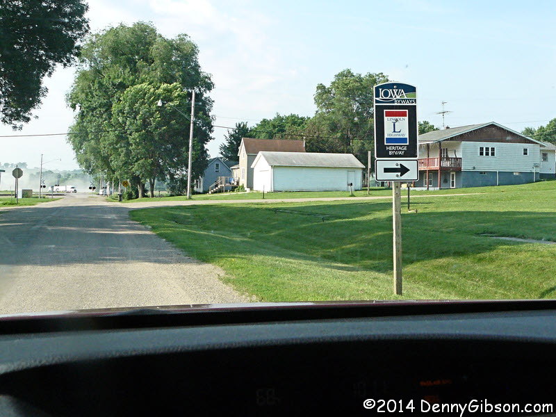
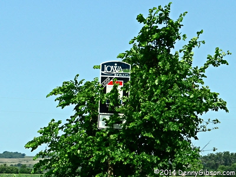
 I was barely out of Denison before I found myself on gravel. Both my solo
2009 drive and last year's Centennial Tour sort of stream lined the route
through here in the interest of time and avoiding an excess of gravel.
This time I was really trying to follow the earliest Lincoln Highway
alignment and I was really impressed at how well the byway signs matched
where I was going.
I was barely out of Denison before I found myself on gravel. Both my solo
2009 drive and last year's Centennial Tour sort of stream lined the route
through here in the interest of time and avoiding an excess of gravel.
This time I was really trying to follow the earliest Lincoln Highway
alignment and I was really impressed at how well the byway signs matched
where I was going.
|
|
|
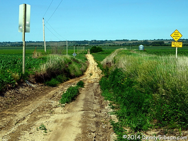
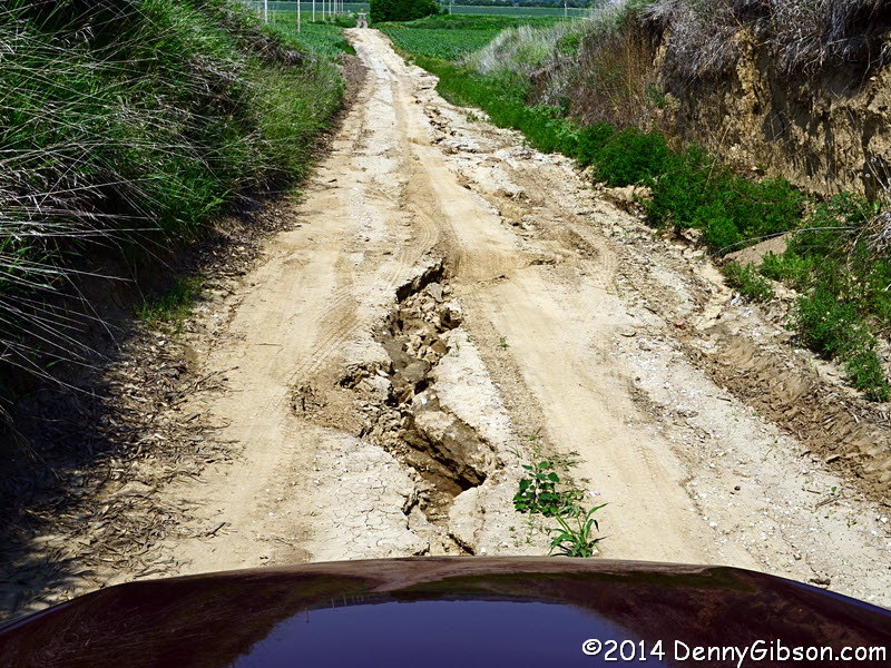
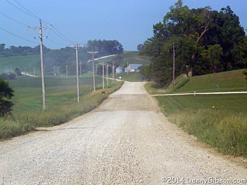
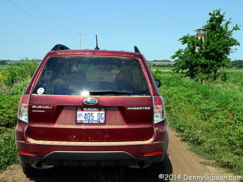 About five miles south of Woodbine, I got onto about a half mile of road
that wasn't even gravel. That yellow sign on
the right of the first picture ends with "ENTER AT YOUR OWN
RISK". In case you think you've made a wrong turn. there's another
sign at the other end of the section. It's in the third photo but may be
hard to see so here's an enlargement.
About five miles south of Woodbine, I got onto about a half mile of road
that wasn't even gravel. That yellow sign on
the right of the first picture ends with "ENTER AT YOUR OWN
RISK". In case you think you've made a wrong turn. there's another
sign at the other end of the section. It's in the third photo but may be
hard to see so here's an enlargement.
In another dozen miles, I got onto some Lincoln Highway that I had never passed even in a streamlined fashion. The original Lincoln Highway ran through Omaha, Nebraska, in 1913 and it was still running that way in 1928 when the Boy Scouts lined it with concrete markers. In July of 1929, a new bridge opened across the Missouri River at Blair, Nebraska. This shortened the route considerably for long distance travelers and was going to be used whether it was on the Lincoln Highway or not. Was it? To the federal government, the Lincoln Highway and other named auto trails ceased to exist with the creation of a nationwide numbering system in 1926. The Lincoln Highway Association had ended active promotion of the road with its 1928 marking of the route with concrete posts but it officially existed until 1935. In the same month that the bridge opened, concrete markers were moved from the Omaha route to the Blair route. LHA secretary, Gael S. Hoag, was no doubt right in his position that the posts were the property of the association and could be placed where ever they chose. However, the fact that the posts were relocated in the middle of the night might indicate that the movers weren't completely confident and it certainly did not sit well with folks in Council Bluffs and Omaha. Say the right words to the right people and you can still stir up an argument over whether the REAL Lincoln Highway ever went through Blair, Nebraska. |
|
|
 I had not researched the city of Omaha very well before my first visit and
ended up relying on the Roadside America GPS app to focus my attention. I
believe it is purely coincidental that the three "Omaha"
attraction I stopped at were in Council Bluffs, Iowa.
I had not researched the city of Omaha very well before my first visit and
ended up relying on the Roadside America GPS app to focus my attention. I
believe it is purely coincidental that the three "Omaha"
attraction I stopped at were in Council Bluffs, Iowa.
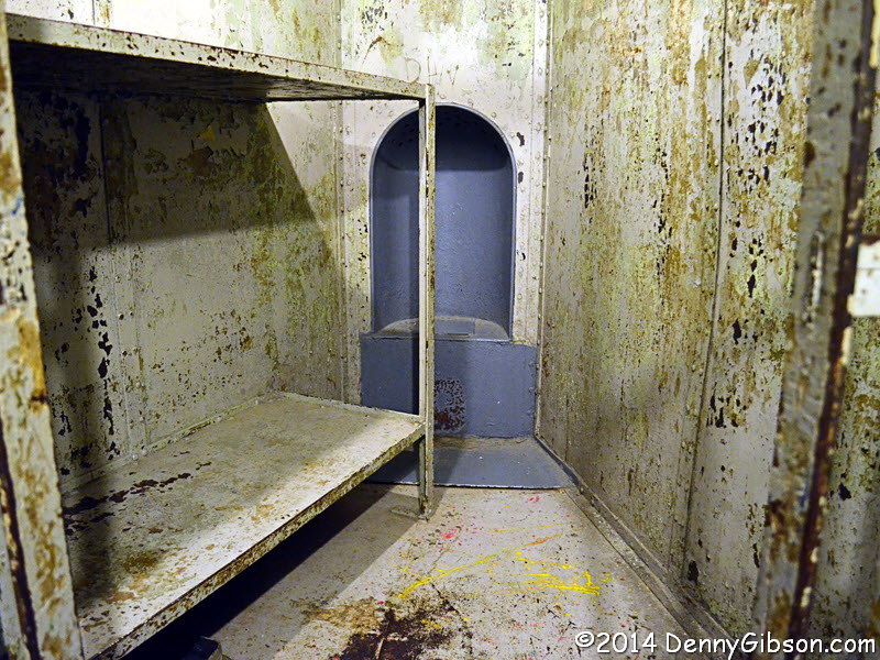
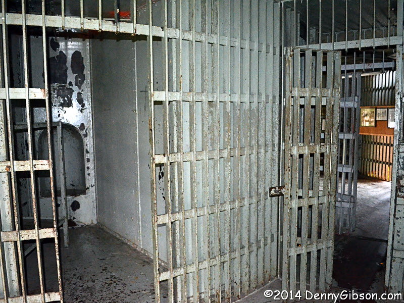
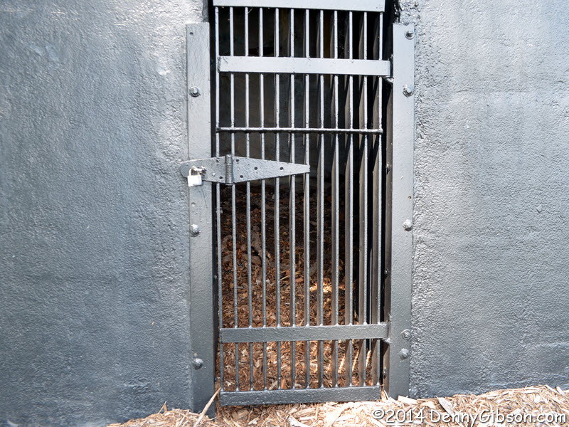
The first thing that caught my eye was nineteenth century high-tech jail like the one I visited in Indiana many years ago. That's where I headed first and, while I enjoyed seeing the jail, it is no where near as well presented as the one in Indiana. The jails had wedge shaped cells rotating to align with a single door. The concept was a secure one but not a safe one. Eventually fire codes and such caught up with them. This one had its turning mechanism disabled and opening cut for each cell in 1960. It was closed as a jail in 1969. |
|
|
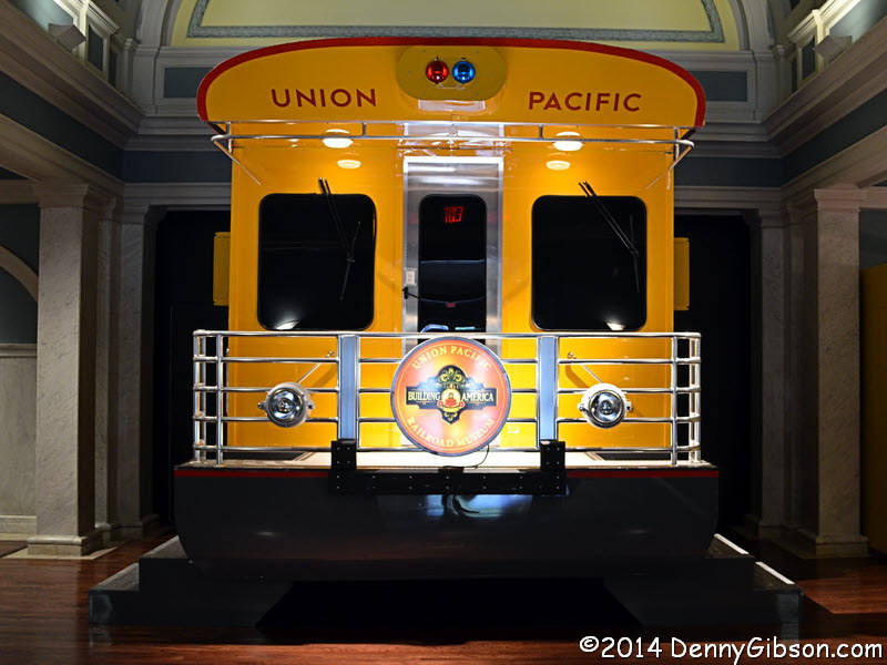
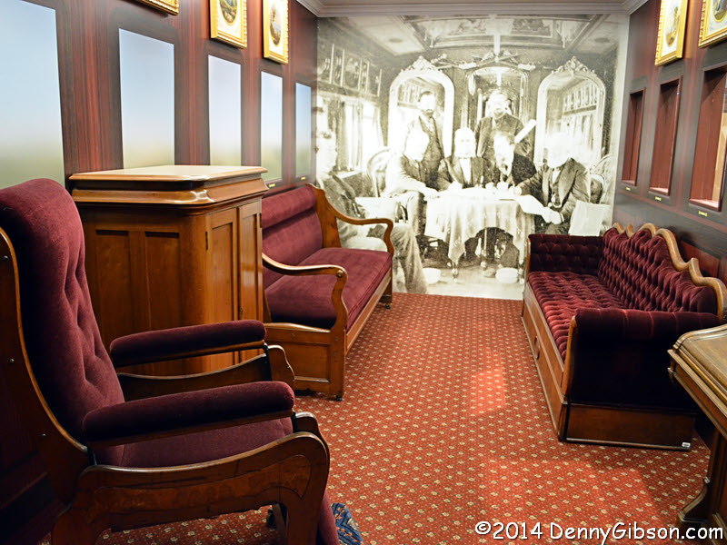

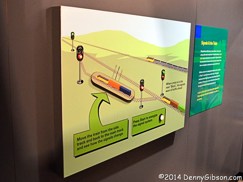 Right next door is the Union Pacific Railroad Museum which had also caught my
eye. A museum tour starts with an area featuring Abraham Lincoln. The
first floor of the museum presents the story of building the
transcontinental railroad and Lincoln was certainly involved in getting
that underway. The pictured furniture and paintings are from Lincoln's
personal rail car but their connection to Lincoln is not overly direct.
The car was completed just a couple of months before the assassination.
The president never rode in it while alive. It was used to transport his
body to Springfield, Illinois, for burial. Union Pacific bought the car in
1866 and it was then used to haul VIPs around. Odds are the president of
the United States never sat in that chair but the president of the Union
Pacific might have.
Right next door is the Union Pacific Railroad Museum which had also caught my
eye. A museum tour starts with an area featuring Abraham Lincoln. The
first floor of the museum presents the story of building the
transcontinental railroad and Lincoln was certainly involved in getting
that underway. The pictured furniture and paintings are from Lincoln's
personal rail car but their connection to Lincoln is not overly direct.
The car was completed just a couple of months before the assassination.
The president never rode in it while alive. It was used to transport his
body to Springfield, Illinois, for burial. Union Pacific bought the car in
1866 and it was then used to haul VIPs around. Odds are the president of
the United States never sat in that chair but the president of the Union
Pacific might have.
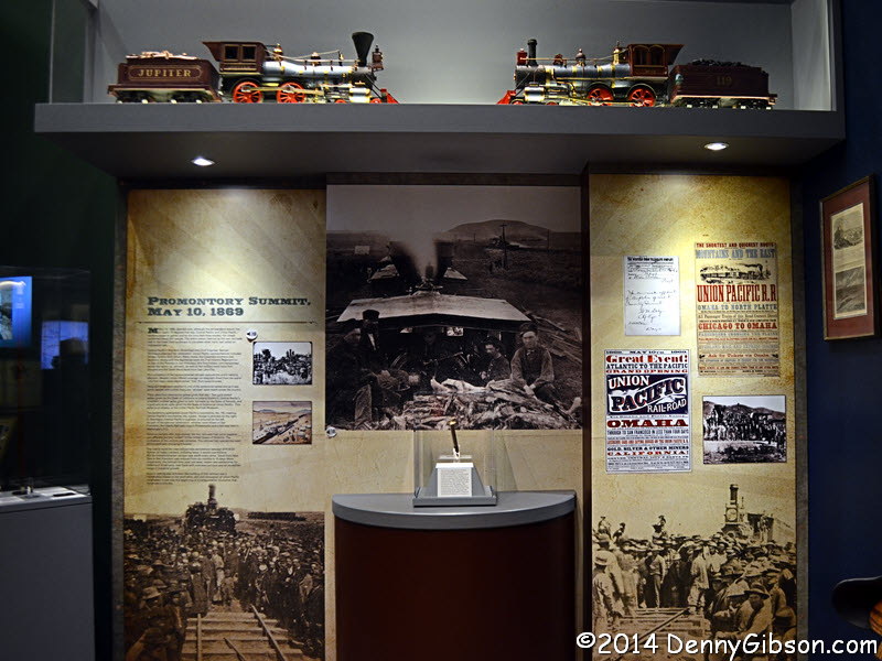
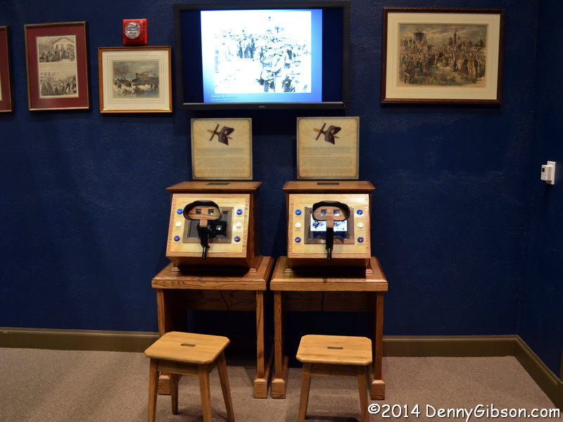
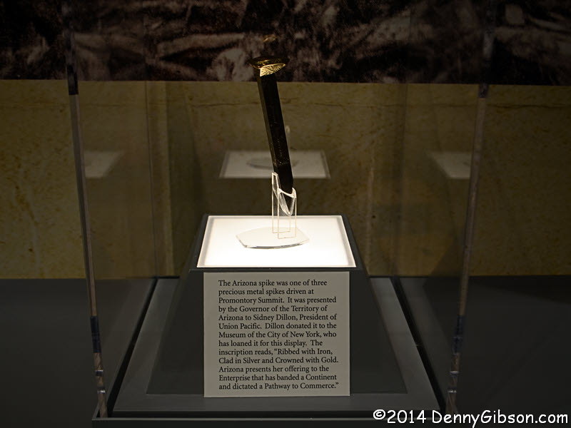
The third picture is of a display on the construction in Donner Pass where the Lincoln Highway eventually appeared. The display on events at the Promontory Summit joining of east and west contains a golden spike associated with those events. Among my favorite displays were two stereoscopes containing nineteenth century 3D photos of railroad scenes. There are even more hands-on interactive exhibits on the second floor in the areas devoted to the modern railroad and to pre-Amtrak passenger service. |
|
|
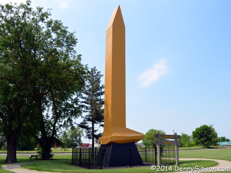 Council Bluffs is a long way from Promontory Summit but it is the eastern
terminus of the Union Pacific Railroad. A film titled Union Pacific
was released in 1939 and this 56 foot Golden Spike Monument was placed
here to promote it. I have no idea why there is a door in the base.
Council Bluffs is a long way from Promontory Summit but it is the eastern
terminus of the Union Pacific Railroad. A film titled Union Pacific
was released in 1939 and this 56 foot Golden Spike Monument was placed
here to promote it. I have no idea why there is a door in the base.
|
|
|
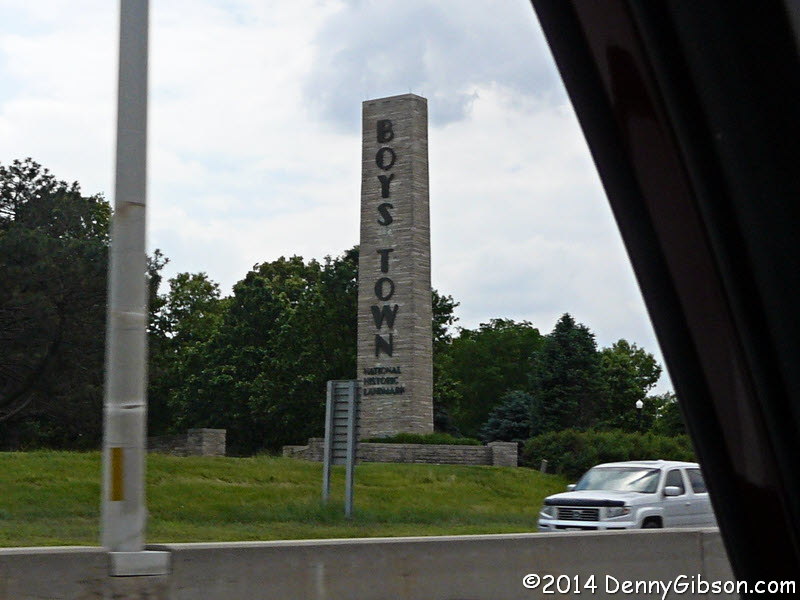
 I snapped a picture of the Boys Town marker as I drove by on the expressway then
exited and got a shot of the more familiar to me "He Ain't Heavy,
He's My Brother" sculpture as I drove around the property a bit.
I snapped a picture of the Boys Town marker as I drove by on the expressway then
exited and got a shot of the more familiar to me "He Ain't Heavy,
He's My Brother" sculpture as I drove around the property a bit.
|
|
|

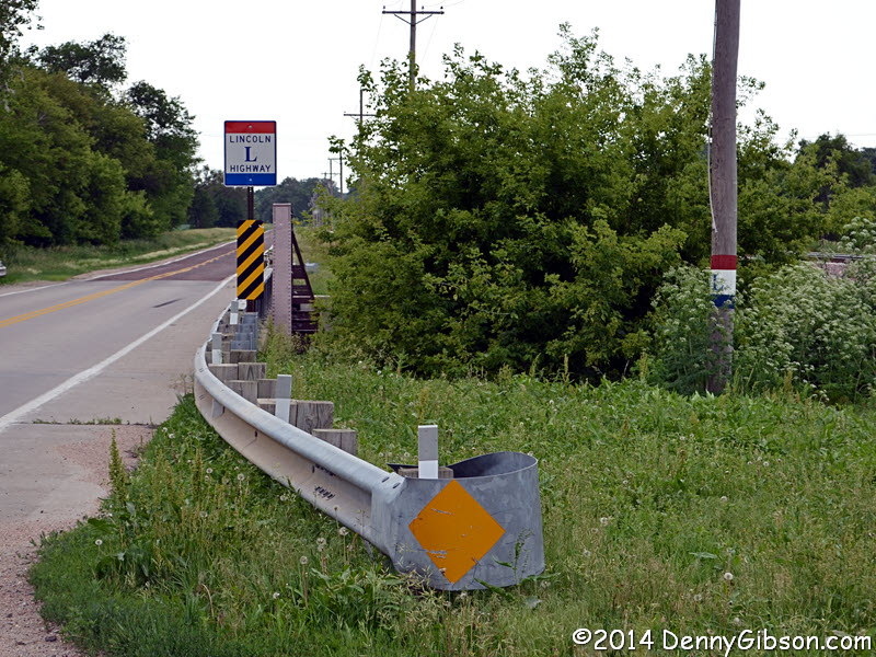

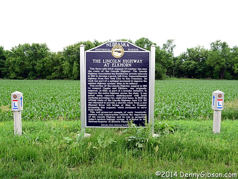
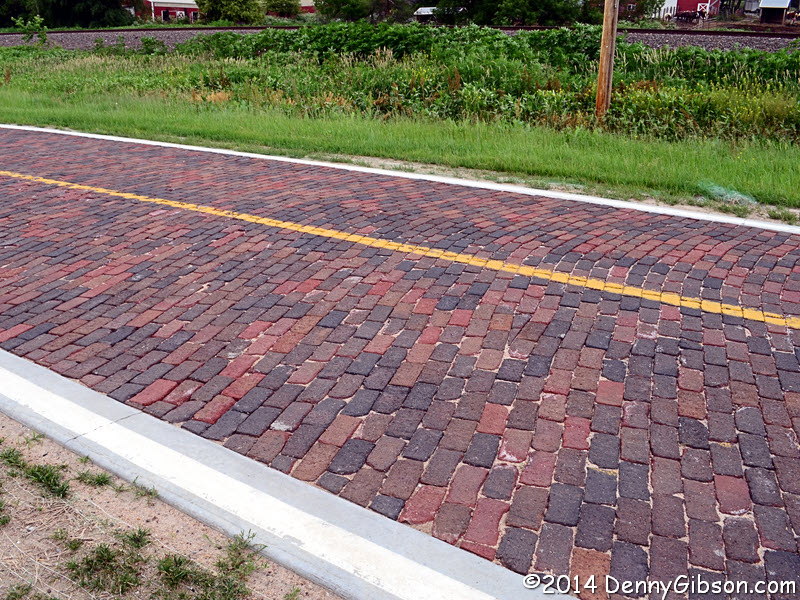
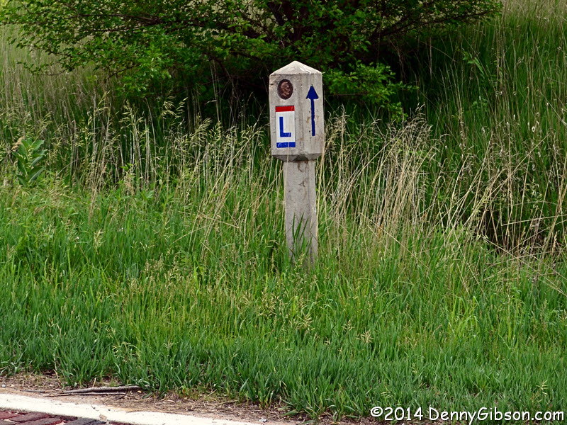
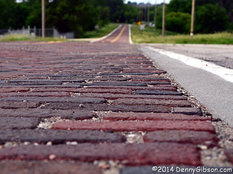 The "rerouting" of the Lincoln Highway may have helped the more
than three miles of 1920 brick pavement to survive near Elkhorn,
Nebraska. It carries modern markings and is in daily use. Besides the
explanatory panel with its replica concrete markers, the roadside contains
a couple of real 1928 markers. There is also
some pole striping that looks as if it could be contemporary with the
bricks along with some fresher striping and other modern signs. I don't
recall ever seeing a sign like the last one that uses the LH color scheme
to ban large trucks and explain why.
The "rerouting" of the Lincoln Highway may have helped the more
than three miles of 1920 brick pavement to survive near Elkhorn,
Nebraska. It carries modern markings and is in daily use. Besides the
explanatory panel with its replica concrete markers, the roadside contains
a couple of real 1928 markers. There is also
some pole striping that looks as if it could be contemporary with the
bricks along with some fresher striping and other modern signs. I don't
recall ever seeing a sign like the last one that uses the LH color scheme
to ban large trucks and explain why.
|
|
|
| [Prev] [Site Home] [Trip Home] [Contact] [Next] |