|
Day 2: November 6, 2004 |
Prev Next |
|
Day 2: November 6, 2004 |
Prev Next |
|
|
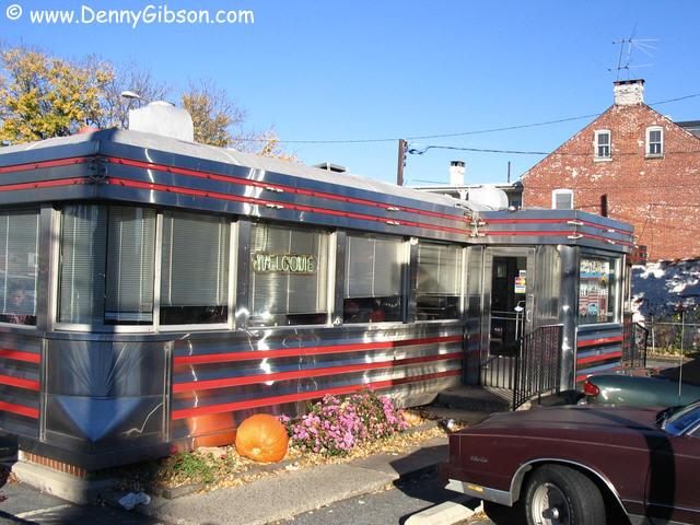
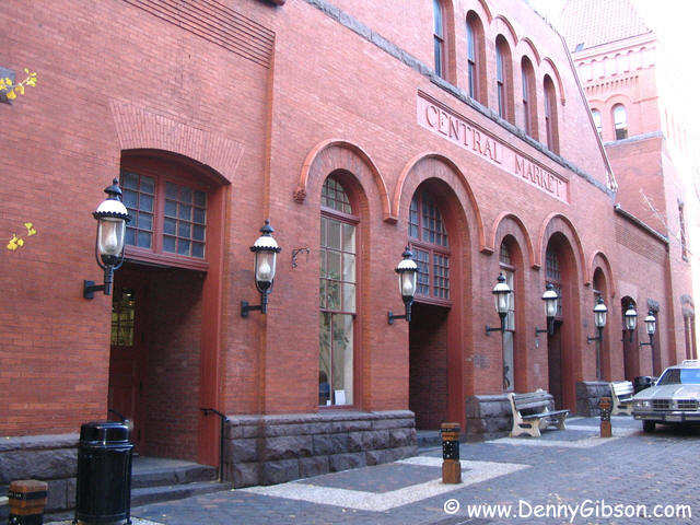
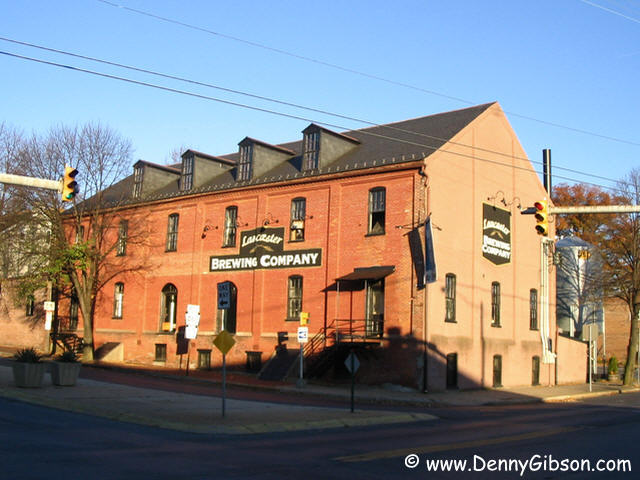 The original route of the Lincoln Highway through Lancaster in now one way
east bound so I got to drive through the town twice. I passed the brewery,
for better or worse not yet open, on the west bound pass on PA-462. That
means it's not actually on the Lincoln Highway. Folks have been selling
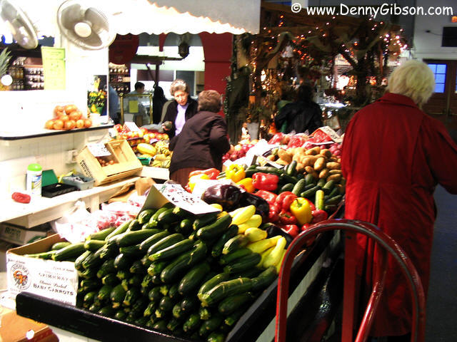
things where the red brick Central Market building stands since 1730. It
is the oldest publicly owned, continuously operated market in the country.
The present building was constructed in 1889, twenty-four years before the
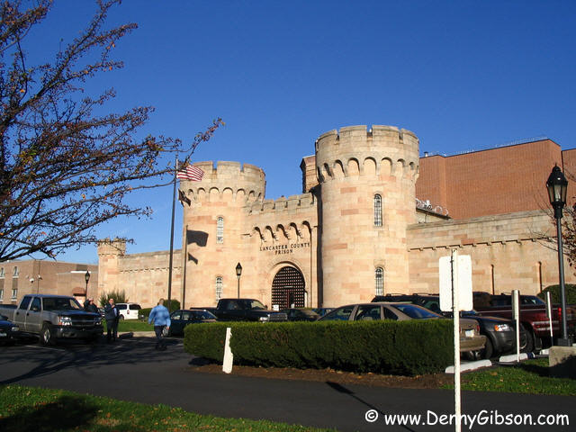
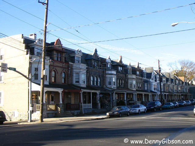
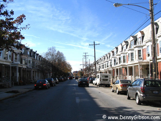
road it was on was called the Lincoln Highway. Row houses seem to be
almost everywhere including both east and west bound PA-462 routes. This
example happens to be right across the street from the Lancaster County
Prison which has a marked resemblance to a medieval castle.
The original route of the Lincoln Highway through Lancaster in now one way
east bound so I got to drive through the town twice. I passed the brewery,
for better or worse not yet open, on the west bound pass on PA-462. That
means it's not actually on the Lincoln Highway. Folks have been selling
things where the red brick Central Market building stands since 1730. It
is the oldest publicly owned, continuously operated market in the country.
The present building was constructed in 1889, twenty-four years before the
road it was on was called the Lincoln Highway. Row houses seem to be
almost everywhere including both east and west bound PA-462 routes. This
example happens to be right across the street from the Lancaster County
Prison which has a marked resemblance to a medieval castle.
Brian Butko's excellent Lincoln Highway Pennsylvania Traveler's Guide tipped me off to the split nature of the LH through Lancaster and to plenty of other facts as well. His mention of the Neptune Diner made me want to eat there but also made me think it was on Lincoln Highway. It's actually several blocks away on the wrong-way one-way Prince Street. But the diner is worth seeking out. It is a 1951 Mountain View refurbished and reopened in 1993. The owner's name is Tony and I ordered Tony's Special for breakfast. A big western omelet and home-fries served in a genuine cast iron skillet. $4.99 with coffee another 90¢. Recommended. |
|
|
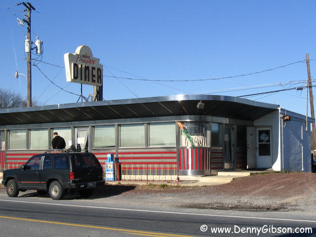
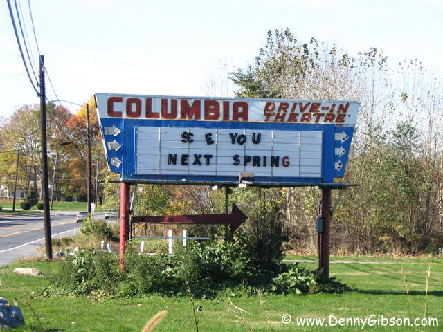
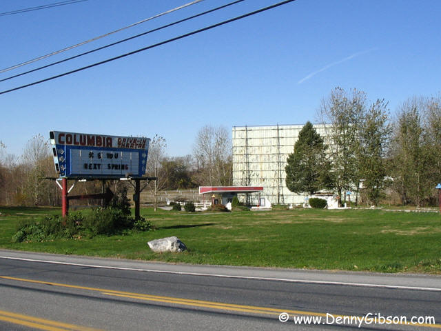
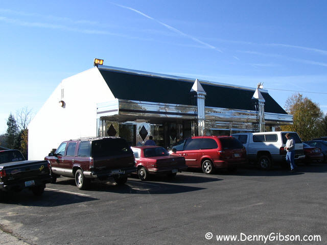 Not far down the road, Keri's Prospect Diner was doing great business but
I was still absorbing Tony's Special so didn't try it. The Columbia
Drive-In is almost next door. The frame building with chrome facade had no
visible name but Lincoln Highway Diner was written on a whiteboard inside.
I drank a cup of coffee at the five stool counter but did not test the
food. The place was quite busy which probably qualifies as a
recommendation.
Not far down the road, Keri's Prospect Diner was doing great business but
I was still absorbing Tony's Special so didn't try it. The Columbia
Drive-In is almost next door. The frame building with chrome facade had no
visible name but Lincoln Highway Diner was written on a whiteboard inside.
I drank a cup of coffee at the five stool counter but did not test the
food. The place was quite busy which probably qualifies as a
recommendation.
|
|
|
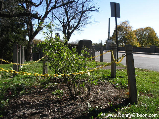
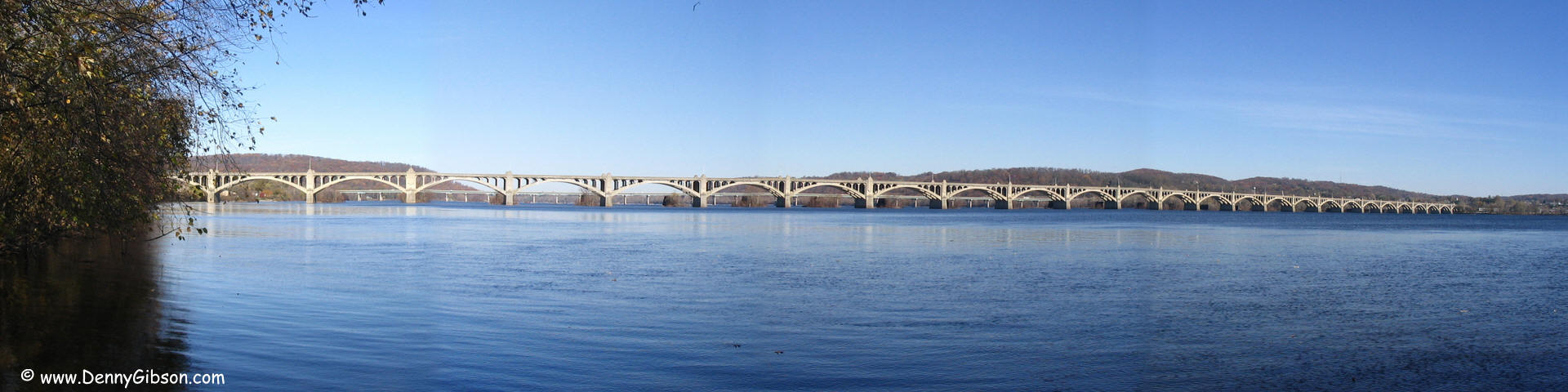
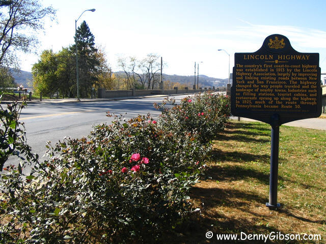 Some 500 years before Michael Douglas & Kathleen Turner did that
movie, there was an even bigger War of the Roses. That one was a
thirty-three year long affair between the Houses of York and Lancaster in
England. In 1931, area residents, using the symbols from the 15th century
conflict, planted red roses along the roadside near Lancaster and white
roses along the York roadside. The Susquehanna river was the dividing
line. The mile long Veteran Memorial Bridge was only a year or two old at
the time and was the longest multiple-arch, reinforced concrete bridge
in the world. It no longer holds that title (I don't know where the
current champ is.) and the roses are pretty much gone. too. There is some
recent interest in restoring the flowers and red rose bushes line both
sides of the eastern approach for several yards. On the York end, each
side of the road sports a single bush with white flowers.
Some 500 years before Michael Douglas & Kathleen Turner did that
movie, there was an even bigger War of the Roses. That one was a
thirty-three year long affair between the Houses of York and Lancaster in
England. In 1931, area residents, using the symbols from the 15th century
conflict, planted red roses along the roadside near Lancaster and white
roses along the York roadside. The Susquehanna river was the dividing
line. The mile long Veteran Memorial Bridge was only a year or two old at
the time and was the longest multiple-arch, reinforced concrete bridge
in the world. It no longer holds that title (I don't know where the
current champ is.) and the roses are pretty much gone. too. There is some
recent interest in restoring the flowers and red rose bushes line both
sides of the eastern approach for several yards. On the York end, each
side of the road sports a single bush with white flowers.
|
|
|
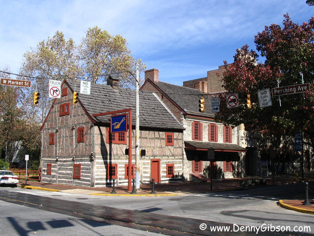
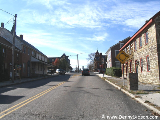
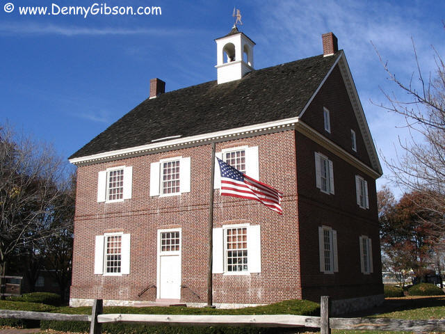 Someone must have been giving away row houses at one time. They're
everywhere including long stretches of York street side. The Golden Plough
Tavern dates from around 1741 and the house next to it is from the same
period. The brick courthouse is not the original but it is an accurate
replica. York was the nation's capital for nearly a year and it was here
that the Articles of Confederation were adopted on November 15, 1777. On
September 27 of the same year, rose rival Lancaster served as the capital
for a single day as the government moved to York from Philadelphia.
Someone must have been giving away row houses at one time. They're
everywhere including long stretches of York street side. The Golden Plough
Tavern dates from around 1741 and the house next to it is from the same
period. The brick courthouse is not the original but it is an accurate
replica. York was the nation's capital for nearly a year and it was here
that the Articles of Confederation were adopted on November 15, 1777. On
September 27 of the same year, rose rival Lancaster served as the capital
for a single day as the government moved to York from Philadelphia.
|
|
|
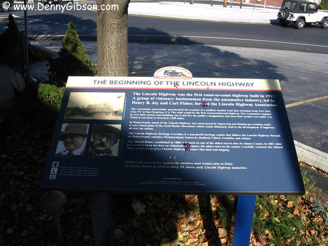

 The Lincoln Highway Heritage Corridor starts in Abbottstown and that
really is a new LH marker on the side of the road. That's the Altland
House hotel & restaurant to the left of the picture and those rockers
are on the Altland's front porch ready for highway watching. The first
corridor exhibit sign stands beside the hotel. Some of te displays have
audio recordings that can be activated by touching two metal contacts with
a coin or key. This one offers some reminisces by Chares Bream, Jr.
The Lincoln Highway Heritage Corridor starts in Abbottstown and that
really is a new LH marker on the side of the road. That's the Altland
House hotel & restaurant to the left of the picture and those rockers
are on the Altland's front porch ready for highway watching. The first
corridor exhibit sign stands beside the hotel. Some of te displays have
audio recordings that can be activated by touching two metal contacts with
a coin or key. This one offers some reminisces by Chares Bream, Jr.
|
|
|
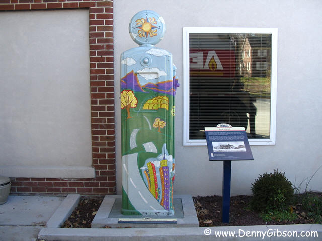

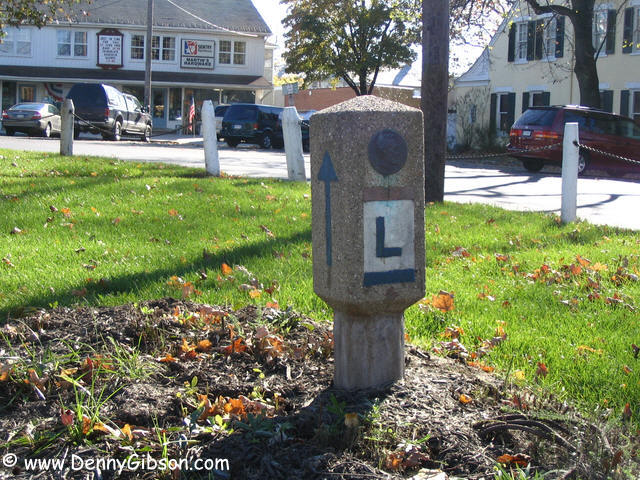 The Heritage Corridor also features over twenty gas pump sculptures
painted by various artists. This one is in New Oxford. The Lincoln Highway
marker, one of the 1928 originals, is in the New Oxford town circle.
The Heritage Corridor also features over twenty gas pump sculptures
painted by various artists. This one is in New Oxford. The Lincoln Highway
marker, one of the 1928 originals, is in the New Oxford town circle.
|
|
|
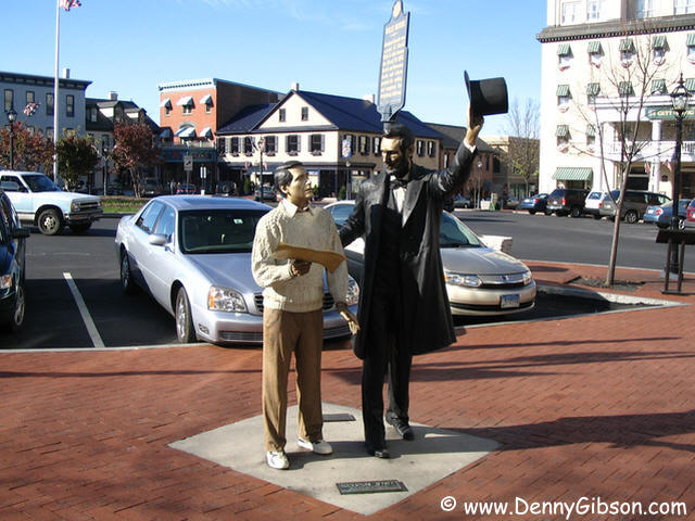

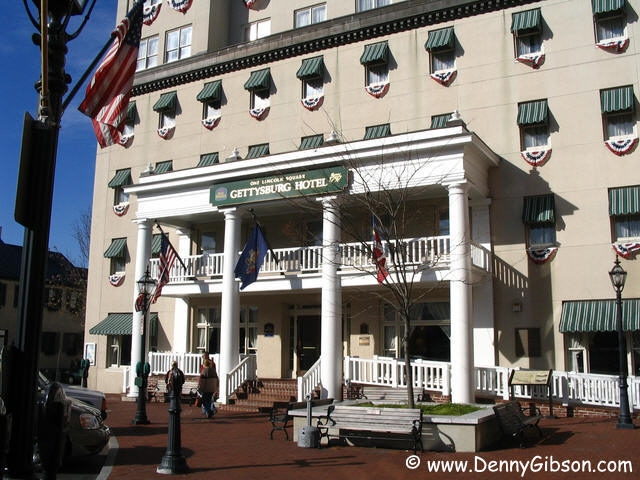 In downtown Gettysburg, the white building in the middle photo is the
Wills House where Lincoln stayed when in town for the Gettysburg Cemetery
dedication and where he completed the speech he would deliver there. The
statue in front of the Wills House is probably the most accurate around.
It is by J. Seward
Johnson, Jr., whose realistic sculptures have recently decorated the
Ohio towns of Troy and Hamilton, with face and hands copied from actual
Lincoln castings.
In downtown Gettysburg, the white building in the middle photo is the
Wills House where Lincoln stayed when in town for the Gettysburg Cemetery
dedication and where he completed the speech he would deliver there. The
statue in front of the Wills House is probably the most accurate around.
It is by J. Seward
Johnson, Jr., whose realistic sculptures have recently decorated the
Ohio towns of Troy and Hamilton, with face and hands copied from actual
Lincoln castings.
|
|
|
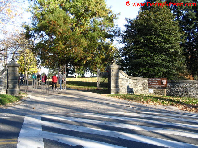
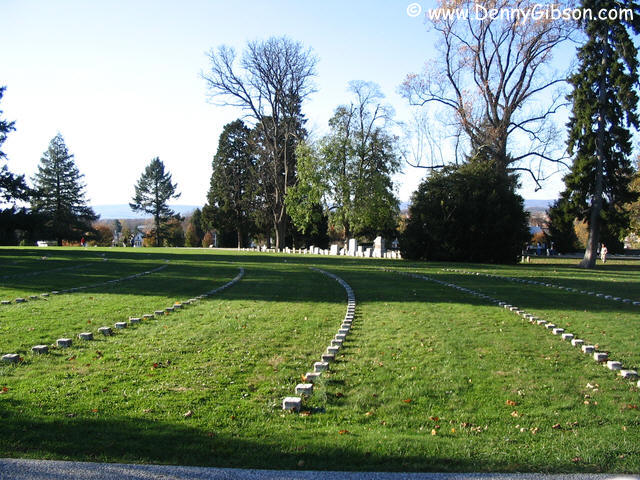
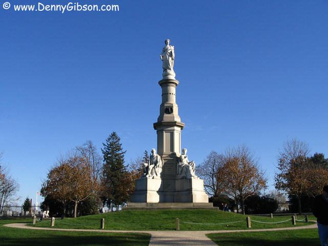 This was my first visit to Gettysburg and, at the cemetery, I was prepared
for the mind numbing size and repetition of Arlington. It is no where near
Arlington in size but the small markers bearing only a number have an
impact similar to Arlington' s rows of identical white crosses. Plus, you
can't ignore its connection to the battlefield it comes from.
This was my first visit to Gettysburg and, at the cemetery, I was prepared
for the mind numbing size and repetition of Arlington. It is no where near
Arlington in size but the small markers bearing only a number have an
impact similar to Arlington' s rows of identical white crosses. Plus, you
can't ignore its connection to the battlefield it comes from.
|
|
|
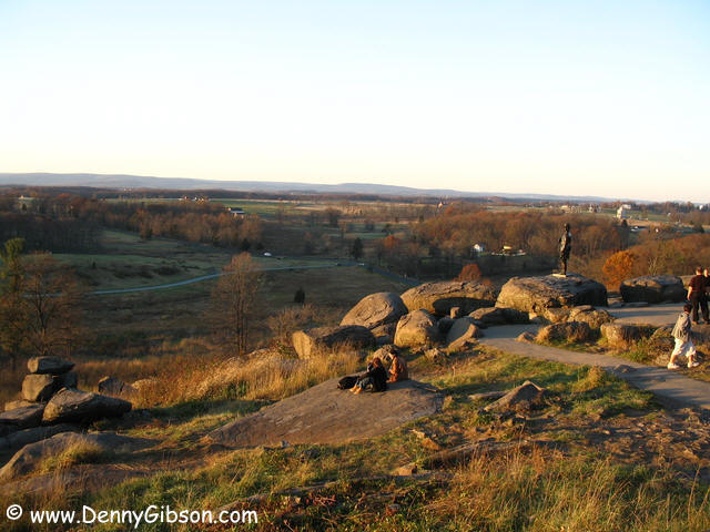
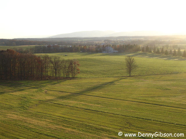


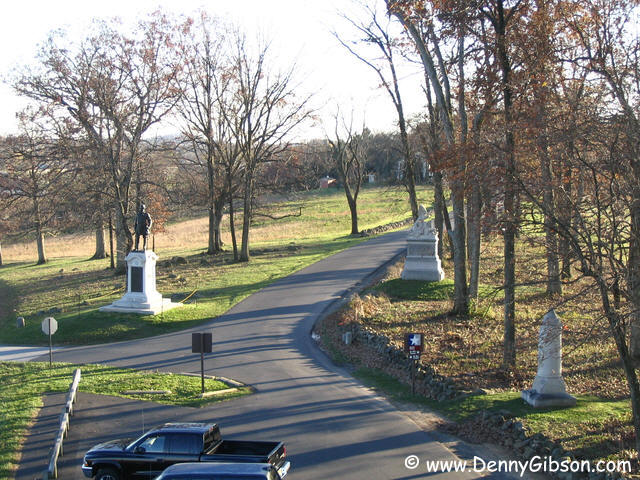
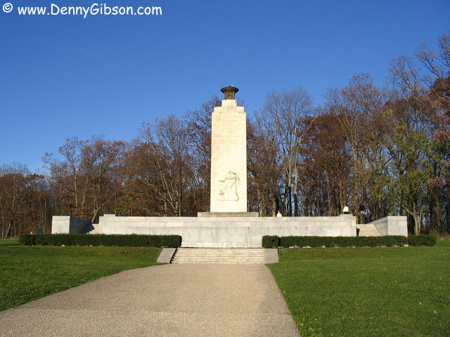 A brochure available at the park visitor's center describes a self guided
auto-tour of the battlefield. The size of the battlefield and the number
and variety of monuments it contains is quickly apparent. Miles of roadway
leads to hundreds of monuments and markers in an incredible range of sizes
and styles. There are a couple of observations with his one being the
tallest. From its top, you can see the former home of Dwight Eisenhower.
It's there in the distance in the fifth picture. The last picture is
Little Round Top.
A brochure available at the park visitor's center describes a self guided
auto-tour of the battlefield. The size of the battlefield and the number
and variety of monuments it contains is quickly apparent. Miles of roadway
leads to hundreds of monuments and markers in an incredible range of sizes
and styles. There are a couple of observations with his one being the
tallest. From its top, you can see the former home of Dwight Eisenhower.
It's there in the distance in the fifth picture. The last picture is
Little Round Top.
|
|
|

 I actually spotted and photographed this LHHC pump sculpture while on the
battle field tour but include it here out of sequence. Next to it is the
one and only "branch" of the Appalachian Brewing Company in
Harrisburg where I ate last night. Tonight I ate at the
"branch".
I actually spotted and photographed this LHHC pump sculpture while on the
battle field tour but include it here out of sequence. Next to it is the
one and only "branch" of the Appalachian Brewing Company in
Harrisburg where I ate last night. Tonight I ate at the
"branch".
|
|
|