|
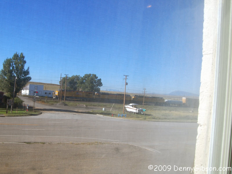
 The first picture is the view from my room at the Virginian when a train
rolling through. That happens rather often and they do blow their
whistles but it didn't really bother me much. Maybe all that carousing in
the bar with the other cowboys helped. The Virginian Hotel is named, of
course, for the book written by Owen Wister with many mentions of Medicine
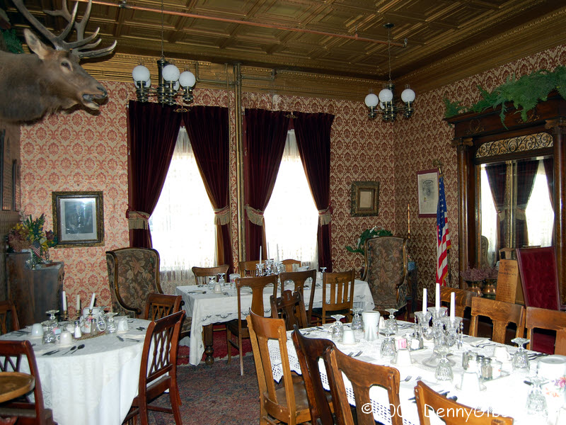
Bow. In return, Medicine Bow mentions Owen a lot. The hotel has an Owen
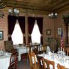
Wister suite and an Owen Wister dining room. That's the dining room in the
second picture. My waitress at breakfast told me that Owen, in a scene he
almost duplicated in the book, slept on the counter in that white build
accross the tracks while waiting for a train. She swore that was true and
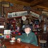
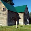
not like some of the other stories. The third picture is a public sitting
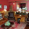
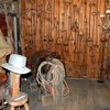
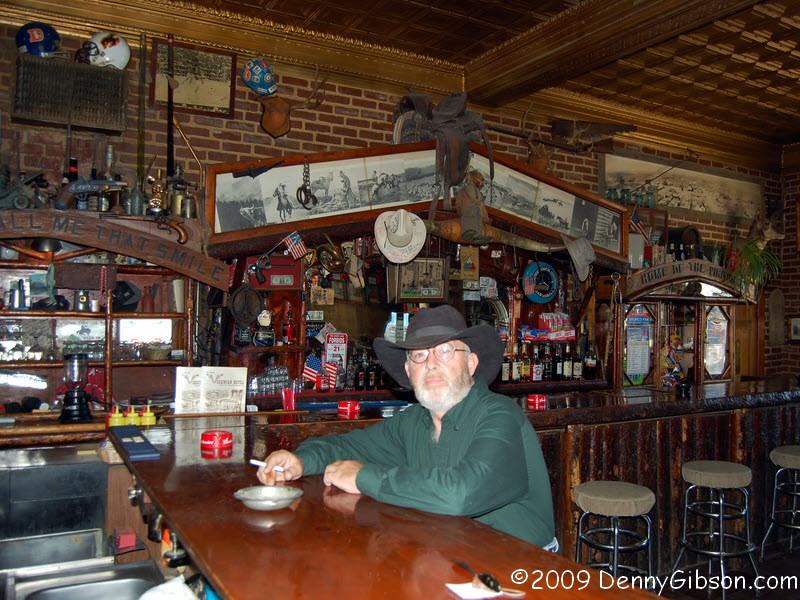
room that backs the restaurant and bar. The last picture is the bar and
one of the local cowboys. In fact, when I asked his name, he said,
"They just call me Cowboy." He's recently arrived from Alabama
to take possession of some land near Medicine Bow. I'm guessing that the
nickname "Cowboy" works better in Alabama than in Wyoming.
He and that bar sure look good together.
The first picture is the view from my room at the Virginian when a train
rolling through. That happens rather often and they do blow their
whistles but it didn't really bother me much. Maybe all that carousing in
the bar with the other cowboys helped. The Virginian Hotel is named, of
course, for the book written by Owen Wister with many mentions of Medicine
Bow. In return, Medicine Bow mentions Owen a lot. The hotel has an Owen
Wister suite and an Owen Wister dining room. That's the dining room in the
second picture. My waitress at breakfast told me that Owen, in a scene he
almost duplicated in the book, slept on the counter in that white build
accross the tracks while waiting for a train. She swore that was true and
not like some of the other stories. The third picture is a public sitting
room that backs the restaurant and bar. The last picture is the bar and
one of the local cowboys. In fact, when I asked his name, he said,
"They just call me Cowboy." He's recently arrived from Alabama
to take possession of some land near Medicine Bow. I'm guessing that the
nickname "Cowboy" works better in Alabama than in Wyoming.
He and that bar sure look good together.
|
 August 21,1999
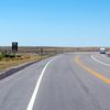
Things got rolling the next day. This was the trip's first eagerly
anticipated Route 66 icon. I remember spending the night at a slightly
questionable motel near Pontiac, Illinois, but I don't believe I posted my
first from-the-road photos while there. My connection was a 10 cent a
minute 888 number which some motels blocked. Others just had really crappy
phone service and I think this was one of those. I had a cell phone but it
barely did voice let alone data.
|
|
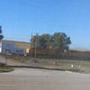
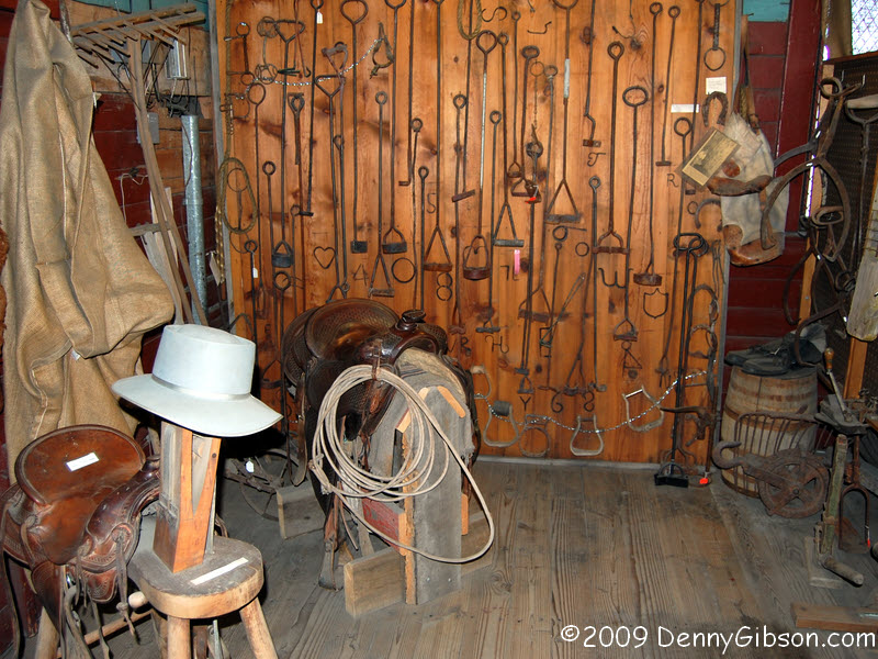
 The museum across the street has the actual cabin that Wister had built
near Jackson, Wyoming, in 1912. Note the Lincoln Highway Marker in front
of the cabin. The museum proper has some really nice displays on local
history.
The museum across the street has the actual cabin that Wister had built
near Jackson, Wyoming, in 1912. Note the Lincoln Highway Marker in front
of the cabin. The museum proper has some really nice displays on local
history.
|
|

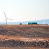
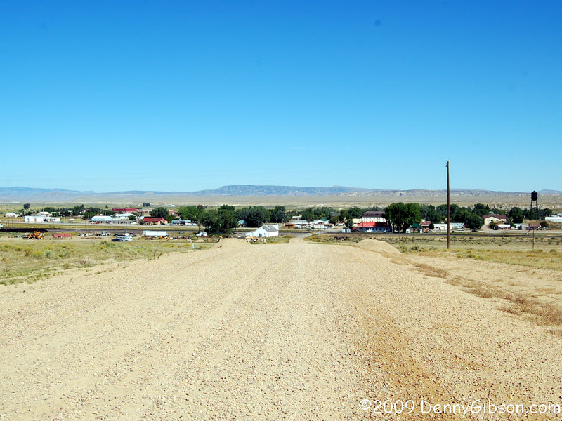
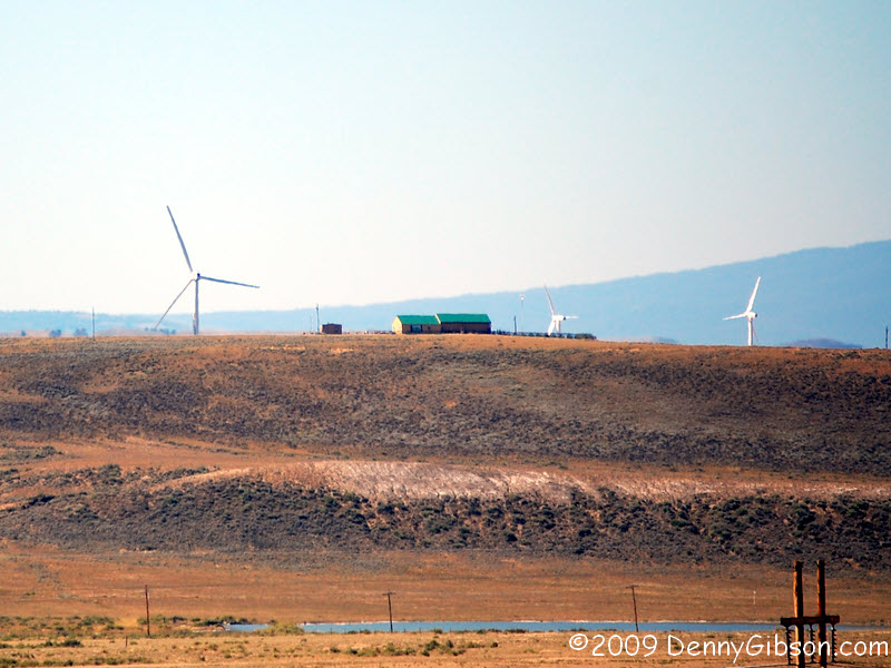
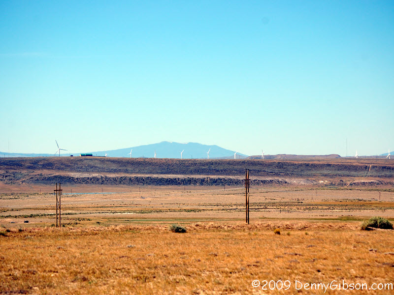
 The Medicine Bow area is one of the windiest in the country and one of the
countries first wind farms was built just south of town. That farm now
includes the largest or one of the largest turbines in the country. It's
possible to drive much closer to the turbines but I took these pictures
from the top of the first rise out of town. That's also a pretty good spot
to get a picture of the entire town of Medicine Bow.
The Medicine Bow area is one of the windiest in the country and one of the
countries first wind farms was built just south of town. That farm now
includes the largest or one of the largest turbines in the country. It's
possible to drive much closer to the turbines but I took these pictures
from the top of the first rise out of town. That's also a pretty good spot
to get a picture of the entire town of Medicine Bow.
|
|
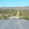
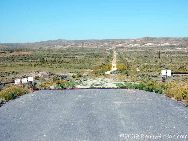
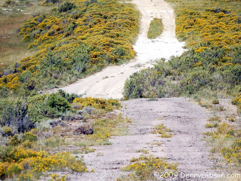
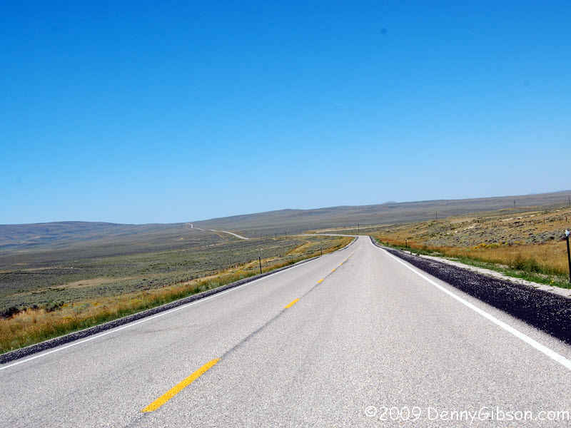
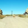
 This two-track west of Medicine Bow was once the Lincoln Highway. I walked
out as far as that big dip then headed back. The pictures don't really do
that dip justice. The truck with trailer came through there while I
was walking back with my back turned so I didn't see it. When he pulled up
beside me I commented that the dip was probably pretty tricky with the
trailer. "Naw", the driver said. "It was a lot trickier
when we had 6000 pounds of rocks on it." The three man crew was
"working for the mine" which didn't explain all that much to me
but I asked no more.
This two-track west of Medicine Bow was once the Lincoln Highway. I walked
out as far as that big dip then headed back. The pictures don't really do
that dip justice. The truck with trailer came through there while I
was walking back with my back turned so I didn't see it. When he pulled up
beside me I commented that the dip was probably pretty tricky with the
trailer. "Naw", the driver said. "It was a lot trickier
when we had 6000 pounds of rocks on it." The three man crew was
"working for the mine" which didn't explain all that much to me
but I asked no more.
|
|
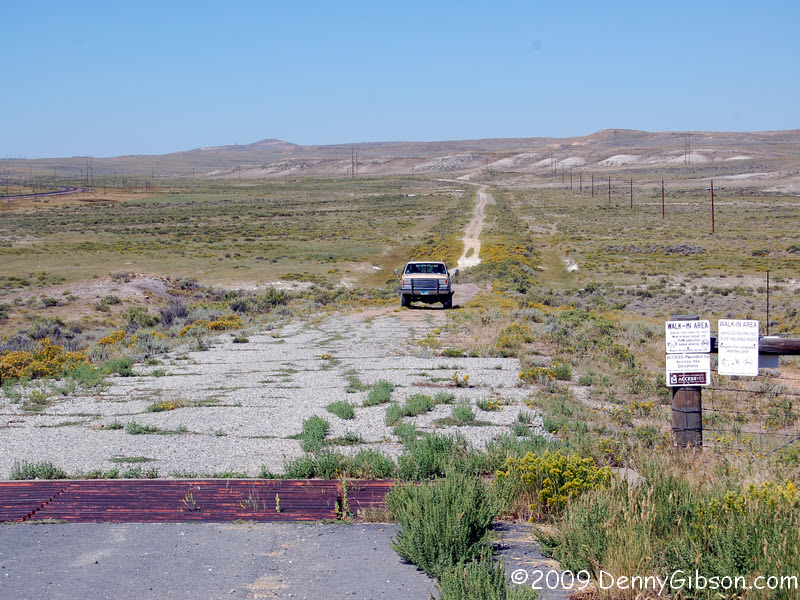
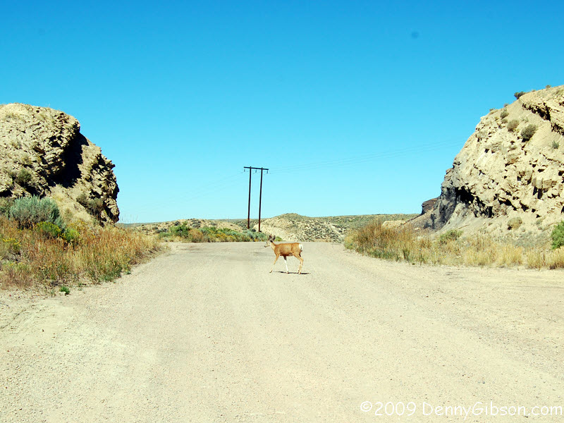
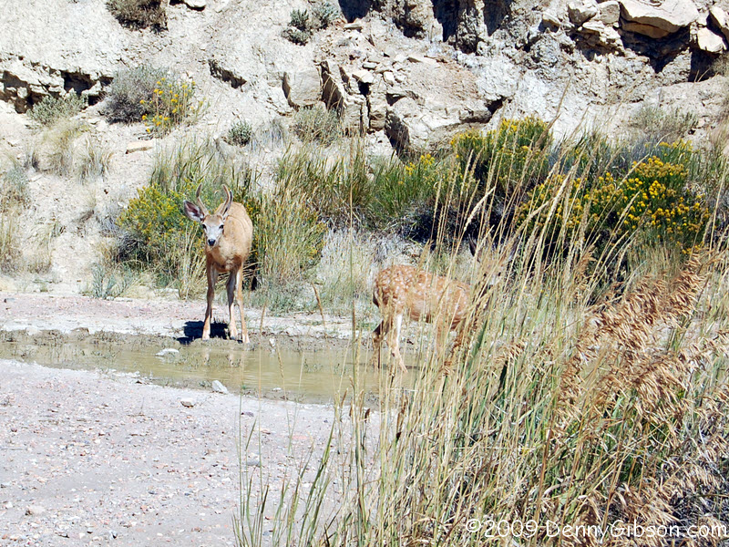
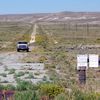
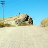 I understandably skipped the two-track but decided to take another look
in the town of Hanna. The old Lincoln ran through there and it is just
over a mile off US-30. The cut through the rock looked interesting and the
gravel road to it looked smooth. At the top of the hill I started toward a
wide spot to turn around but suddenly realized that the wide spot wasn't
empty. Three antelope were moving in to drink from the pool of water there.
What I took to be the mom, kept an eye on me but they all went on about
their business even when I got out of the car to get some better pictures.
I waited while they drank their fill then watched the little family head
west on the old Lincoln Highway.
I understandably skipped the two-track but decided to take another look
in the town of Hanna. The old Lincoln ran through there and it is just
over a mile off US-30. The cut through the rock looked interesting and the
gravel road to it looked smooth. At the top of the hill I started toward a
wide spot to turn around but suddenly realized that the wide spot wasn't
empty. Three antelope were moving in to drink from the pool of water there.
What I took to be the mom, kept an eye on me but they all went on about
their business even when I got out of the car to get some better pictures.
I waited while they drank their fill then watched the little family head
west on the old Lincoln Highway.
|
|
 Words wouldn't add a thing.
|
|
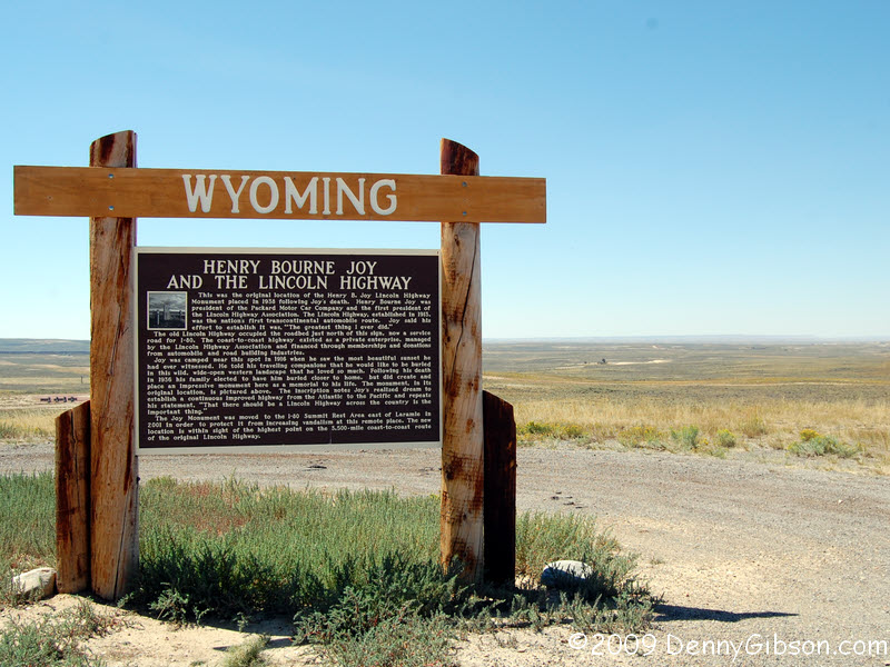
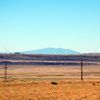
 This is where the Henry Joy monument that is now at the I-80 Summit Rest
Area was originally. Henry actually picked this for his burial spot. Nice
view. Too bad they didn't listen, Henry.
This is where the Henry Joy monument that is now at the I-80 Summit Rest
Area was originally. Henry actually picked this for his burial spot. Nice
view. Too bad they didn't listen, Henry.
|
|
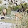
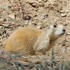 A little past Point of Rocks, the LH moves to the south side of I-80 and
through the middle of a prairie dog town. I would see them standing guard
at the roadside but I could never get a picture. The best I could do was
this fellow who stopped a few feet from the road after he had barked his
warning and dashed away.
A little past Point of Rocks, the LH moves to the south side of I-80 and
through the middle of a prairie dog town. I would see them standing guard
at the roadside but I could never get a picture. The best I could do was
this fellow who stopped a few feet from the road after he had barked his
warning and dashed away.
|
|
 Brian Butko lists Green River Palisades as a "must-see".
I had no clue where they were and no hoped for big sign materialized. A
visitor center did so in I go. Petroglyphs? Nope, Palisades. The attendant
paged through a couple of pamphlets and found the sought for word at the
top of a page. They were just one turn and barely a quarter of a mile
away. Within moments the cover of Greeting from the Lincoln Highway
was in front of me. Ah, the Green River Palisades.
Brian Butko lists Green River Palisades as a "must-see".
I had no clue where they were and no hoped for big sign materialized. A
visitor center did so in I go. Petroglyphs? Nope, Palisades. The attendant
paged through a couple of pamphlets and found the sought for word at the
top of a page. They were just one turn and barely a quarter of a mile
away. Within moments the cover of Greeting from the Lincoln Highway
was in front of me. Ah, the Green River Palisades.
|
|
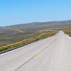
 This is where the Lincoln Highway and US-30 diverge. US-30 takes off for
Oregon and what was the LH is now County Road 2. I stayed with it for awhile
but the pavement gave out and the gravel wasn't in the best of shape. I
turned around and climbed back on I-80. It wasn't forever though. I climbed off
at exit 48 and followed two lane to Fort Bridger.
This is where the Lincoln Highway and US-30 diverge. US-30 takes off for
Oregon and what was the LH is now County Road 2. I stayed with it for awhile
but the pavement gave out and the gravel wasn't in the best of shape. I
turned around and climbed back on I-80. It wasn't forever though. I climbed off
at exit 48 and followed two lane to Fort Bridger.
|
|


 The first picture is the view from my room at the Virginian when a train
rolling through. That happens rather often and they do blow their
whistles but it didn't really bother me much. Maybe all that carousing in
the bar with the other cowboys helped. The Virginian Hotel is named, of
course, for the book written by Owen Wister with many mentions of Medicine
Bow. In return, Medicine Bow mentions Owen a lot. The hotel has an Owen
Wister suite and an Owen Wister dining room. That's the dining room in the
second picture. My waitress at breakfast told me that Owen, in a scene he
almost duplicated in the book, slept on the counter in that white build
accross the tracks while waiting for a train. She swore that was true and
not like some of the other stories. The third picture is a public sitting
room that backs the restaurant and bar. The last picture is the bar and
one of the local cowboys. In fact, when I asked his name, he said,
"They just call me Cowboy." He's recently arrived from Alabama
to take possession of some land near Medicine Bow. I'm guessing that the
nickname "Cowboy" works better in Alabama than in Wyoming.
He and that bar sure look good together.
The first picture is the view from my room at the Virginian when a train
rolling through. That happens rather often and they do blow their
whistles but it didn't really bother me much. Maybe all that carousing in
the bar with the other cowboys helped. The Virginian Hotel is named, of
course, for the book written by Owen Wister with many mentions of Medicine
Bow. In return, Medicine Bow mentions Owen a lot. The hotel has an Owen
Wister suite and an Owen Wister dining room. That's the dining room in the
second picture. My waitress at breakfast told me that Owen, in a scene he
almost duplicated in the book, slept on the counter in that white build
accross the tracks while waiting for a train. She swore that was true and
not like some of the other stories. The third picture is a public sitting
room that backs the restaurant and bar. The last picture is the bar and
one of the local cowboys. In fact, when I asked his name, he said,
"They just call me Cowboy." He's recently arrived from Alabama
to take possession of some land near Medicine Bow. I'm guessing that the
nickname "Cowboy" works better in Alabama than in Wyoming.
He and that bar sure look good together.
 August 21,1999
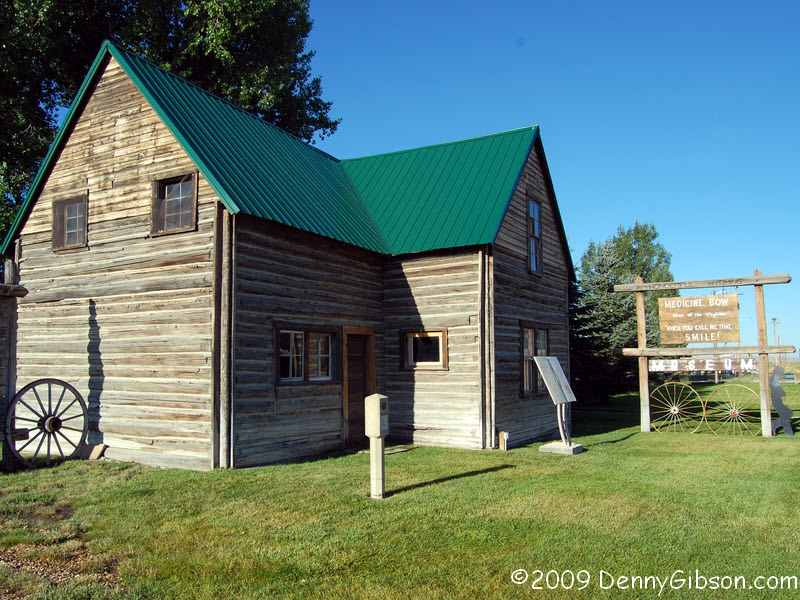
 The museum across the street has the actual cabin that Wister had built
near Jackson, Wyoming, in 1912. Note the Lincoln Highway Marker in front
of the cabin. The museum proper has some really nice displays on local
history.
The museum across the street has the actual cabin that Wister had built
near Jackson, Wyoming, in 1912. Note the Lincoln Highway Marker in front
of the cabin. The museum proper has some really nice displays on local
history.