|
Day 6: January 2, 2006 A Weatherful Day |
Prev Next |
|
Day 6: January 2, 2006 A Weatherful Day |
Prev Next |
|
|
 Yesterday ended in Salem, IL. Before settling on the Super 8 just west of
I-57, I drove to the other side of town on US-50 and to the north and
south edges on Broadway (IL-37) and found nothing besides the few motels
in the cluster of businesses by the expressway. One of those businesses
was a Citco Station selling regular grade gas for $2.299. I just smiled as
I drove by this morning and filled my tank for $2.129 a gallon on the
other side of the expressway. 17¢ difference for stations a few hundred
yards apart seems excessive but I guess there is enough business from
folks stopping at the place nearest the exit to allow it to work. A
similar situation existed in Kingman, AZ, in September with a difference
of 15¢ or so between stations on different sides of I-40.
Yesterday ended in Salem, IL. Before settling on the Super 8 just west of
I-57, I drove to the other side of town on US-50 and to the north and
south edges on Broadway (IL-37) and found nothing besides the few motels
in the cluster of businesses by the expressway. One of those businesses
was a Citco Station selling regular grade gas for $2.299. I just smiled as
I drove by this morning and filled my tank for $2.129 a gallon on the
other side of the expressway. 17¢ difference for stations a few hundred
yards apart seems excessive but I guess there is enough business from
folks stopping at the place nearest the exit to allow it to work. A
similar situation existed in Kingman, AZ, in September with a difference
of 15¢ or so between stations on different sides of I-40.
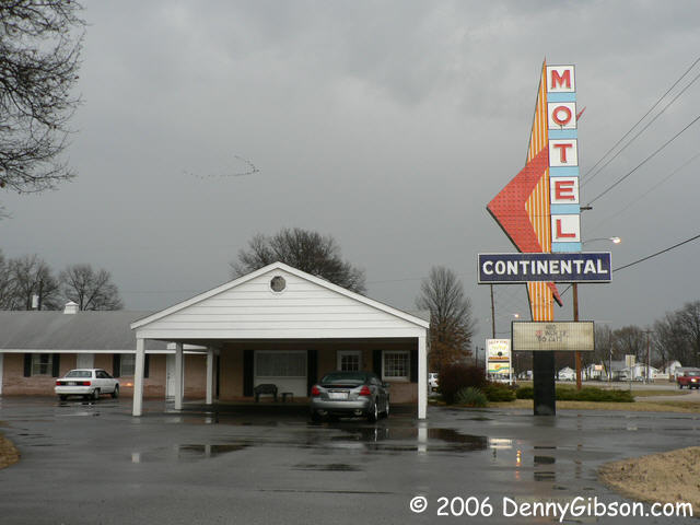
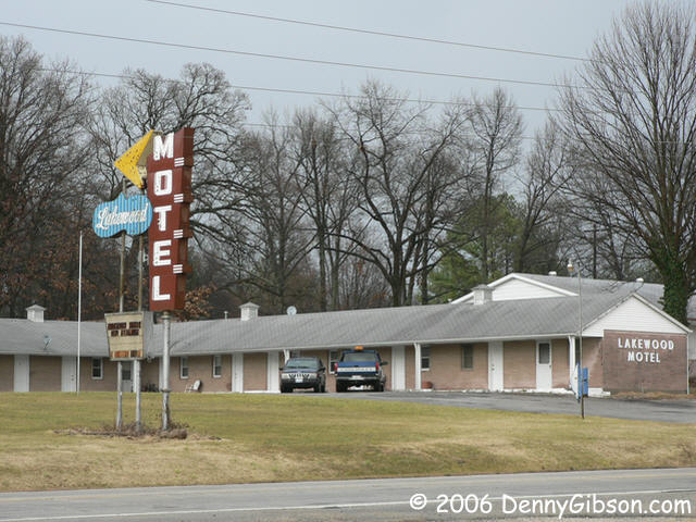
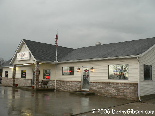
But, even though it saved me a little gas money, my drive through town wasn't quite long enough. These two promising looking establishments were on US-50 just a couple of miles east of Salem. |
|
|
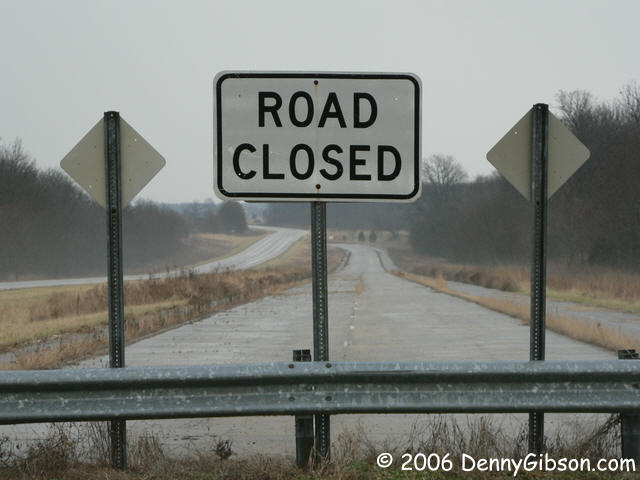
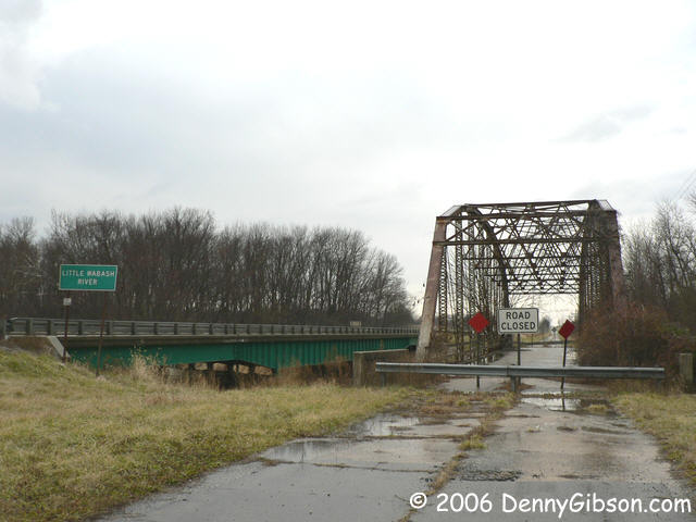
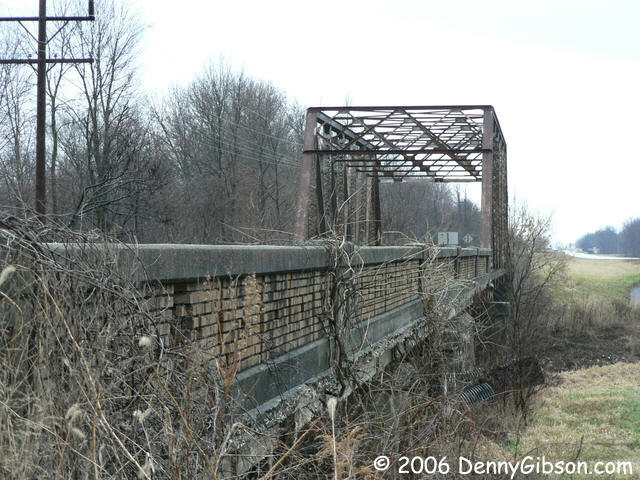
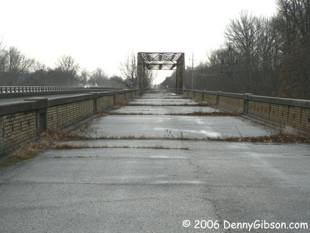 A bit further east, several abandoned sections of what I assume was once
US-50 still exist. Those with bridges are the most interesting. The
bridges shown here are over the Little Wabash, Little Muddy, and Big Muddy
Rivers.
A bit further east, several abandoned sections of what I assume was once
US-50 still exist. Those with bridges are the most interesting. The
bridges shown here are over the Little Wabash, Little Muddy, and Big Muddy
Rivers.
|
|
|
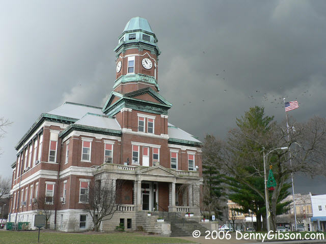

 I heard thunder this morning almost as soon as I woke up. Heavy rain soon
followed but the rain was fairly light by the time I hit the road.
According to weather reports, the storm was traveling at 30-35 miles an
hour so I eventually caught up with its leading edge. There the thunder
and lightening were plentiful and the rain was heavy. I did get ahead of
it and, as I entered the Lawrenceville public square, could actually see
patches of blue ahead and dark clouds behind. I had this wonderful idea
that I would get pictures of the court house from both east and west with
those very different skies behind it but I really blew it. By the time I
parked on the east side and walked to the west, the sky was darkening
above the building. The picture I've included here was taken from the
north with the darker sky moving in from the right. The birds that can be
seen fluttering around the flag pole were perched atop the clock tower
just seconds before the picture was snapped.
I heard thunder this morning almost as soon as I woke up. Heavy rain soon
followed but the rain was fairly light by the time I hit the road.
According to weather reports, the storm was traveling at 30-35 miles an
hour so I eventually caught up with its leading edge. There the thunder
and lightening were plentiful and the rain was heavy. I did get ahead of
it and, as I entered the Lawrenceville public square, could actually see
patches of blue ahead and dark clouds behind. I had this wonderful idea
that I would get pictures of the court house from both east and west with
those very different skies behind it but I really blew it. By the time I
parked on the east side and walked to the west, the sky was darkening
above the building. The picture I've included here was taken from the
north with the darker sky moving in from the right. The birds that can be
seen fluttering around the flag pole were perched atop the clock tower
just seconds before the picture was snapped.
|
|
|
 By my calculations, I was about forty-five minutes ahead of the storm when
I stopped at Uncle Buck's Restaurant & Pub in Loogootee. My
calculations weren't even close. The rain hit about fifteen minutes later
and had nearly an hour head start on me when I returned to the road. It
took me two hours and most of Indiana to regain the lead. Loogootee
happens to be the point where I picked up US-50 in October so I'll just
make it the end of this road trip. I made it home ahead of the rain but
heard that same thunder for the third time today as the storm once again
passed me by.
By my calculations, I was about forty-five minutes ahead of the storm when
I stopped at Uncle Buck's Restaurant & Pub in Loogootee. My
calculations weren't even close. The rain hit about fifteen minutes later
and had nearly an hour head start on me when I returned to the road. It
took me two hours and most of Indiana to regain the lead. Loogootee
happens to be the point where I picked up US-50 in October so I'll just
make it the end of this road trip. I made it home ahead of the rain but
heard that same thunder for the third time today as the storm once again
passed me by.
|
|
|