
Turning West
Prev
Next
|
|
Day 5: July 5, 2006 Turning West |
Prev Next |
|
|
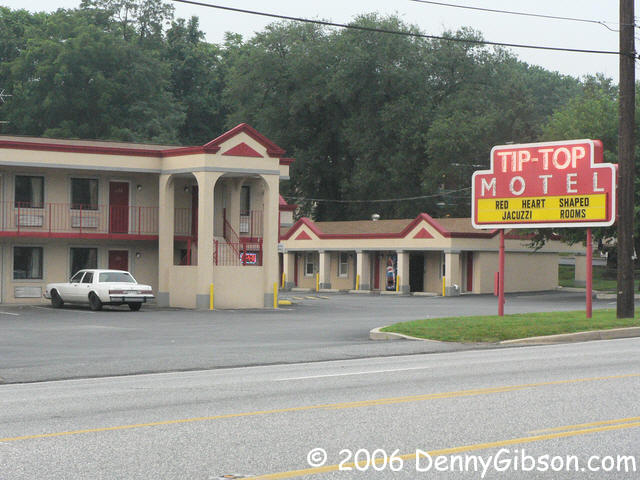
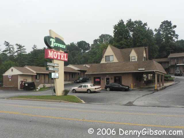
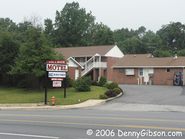

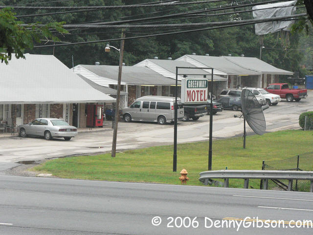
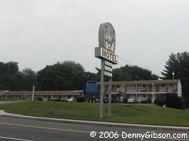 After three nights in one spot I'm moving at last. First it's up US-1 to
Baltimore. This was certainly not part of the National Road and I don't
believe it was ever part of the National Old Trails Road. But the NOTR saw
many variations and politically motivated hints at inclusion so I suppose
it isn't entirely out of the question. Whatever its early history, it's
obvious that the route has been around a long time. I was pleasantly
surprised to at the number of independent motels that still exist and
remain open. This half-dozen is just a sample. There are several motels in
Elkridge which was founded in 1734. I imagine that lodging has been
available here for a long time.
After three nights in one spot I'm moving at last. First it's up US-1 to
Baltimore. This was certainly not part of the National Road and I don't
believe it was ever part of the National Old Trails Road. But the NOTR saw
many variations and politically motivated hints at inclusion so I suppose
it isn't entirely out of the question. Whatever its early history, it's
obvious that the route has been around a long time. I was pleasantly
surprised to at the number of independent motels that still exist and
remain open. This half-dozen is just a sample. There are several motels in
Elkridge which was founded in 1734. I imagine that lodging has been
available here for a long time.
|
|
|
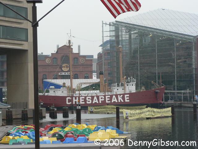
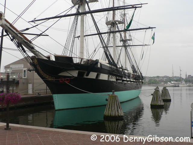
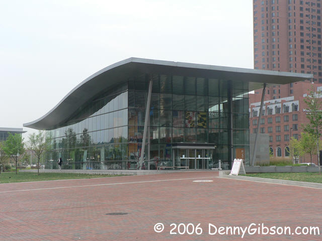 Baltimore was closed when I got there. There was plenty of traffic so not
everything could have been closed but it was too early for the
USS Constellation or the impressive looking
visitor center.
Baltimore was closed when I got there. There was plenty of traffic so not
everything could have been closed but it was too early for the
USS Constellation or the impressive looking
visitor center.
|
|
|

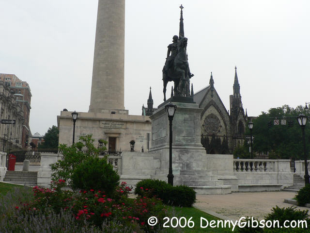
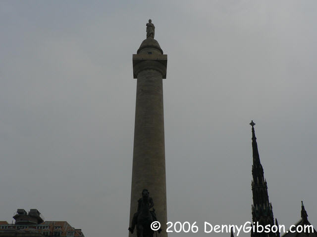 That tall obelisk where I watched fireworks last night was a latecomer as
Washington Monuments go. It wasn't even started until 1848 and wasn't
completed until 1888. The dedication ceremony, a day before George's
birthday in 1885, was just a little early but did start the fireworks
tradition. Seems that DC's
Washington Monument
has always been a party sort of place.
That tall obelisk where I watched fireworks last night was a latecomer as
Washington Monuments go. It wasn't even started until 1848 and wasn't
completed until 1888. The dedication ceremony, a day before George's
birthday in 1885, was just a little early but did start the fireworks
tradition. Seems that DC's
Washington Monument
has always been a party sort of place.
Construction of this one, at Mount Vernon Place in Baltimore, was begun in 1815 and finished in 1829. But even it isn't the oldest. Stay tuned. |
|
|
 This stone in Irvington marked mile three on the Baltimore Frederick
Turnpike. The "To B" is still quite readable. The number "3" much less so.
While not federally funded and not officially part of the National Road,
this turnpike did form part of the link to Cumberland and is justifiably
part of the Historic National Road Byway. If the stone looks a bit tired,
it's because it has been standing here since 1787.
This stone in Irvington marked mile three on the Baltimore Frederick
Turnpike. The "To B" is still quite readable. The number "3" much less so.
While not federally funded and not officially part of the National Road,
this turnpike did form part of the link to Cumberland and is justifiably
part of the Historic National Road Byway. If the stone looks a bit tired,
it's because it has been standing here since 1787.
|
|
|
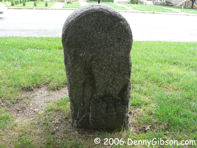
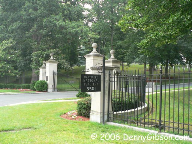
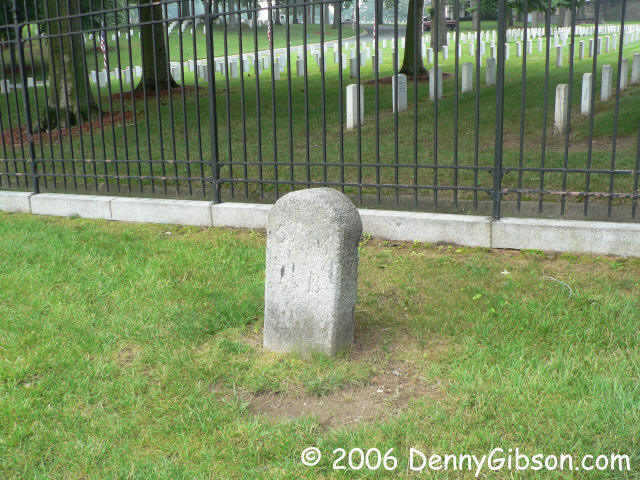 This is Frederick mile marker #5. It is right outside of the Baltimore
National Cemetery looking, as others have noted, as if it could be a grave
stone that has slipped through the fence. Note that, in 1787, it did not
seem necessary to spend time finishing the back of these stones.
This is Frederick mile marker #5. It is right outside of the Baltimore
National Cemetery looking, as others have noted, as if it could be a grave
stone that has slipped through the fence. Note that, in 1787, it did not
seem necessary to spend time finishing the back of these stones.
|
|
|
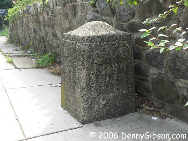
 This boundary stone was set in 1919 and still marks the Baltimore city
limits. I learned about it
here. Look here to learn about a lot of Baltimore stuff -
including those mile markers.
This boundary stone was set in 1919 and still marks the Baltimore city
limits. I learned about it
here. Look here to learn about a lot of Baltimore stuff -
including those mile markers.
|
|
|

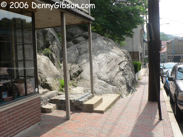
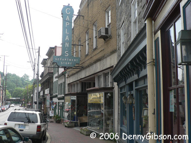
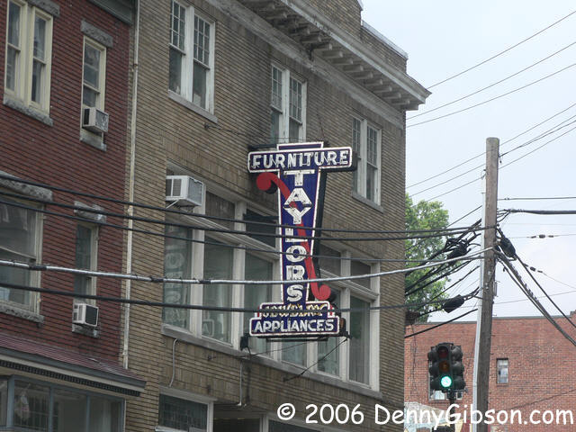
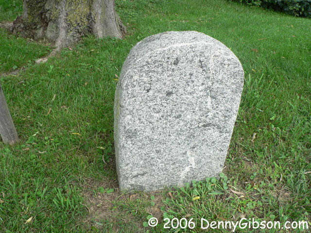
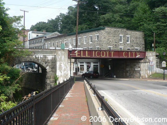 There are some pretty neat signs - and buildings - in Ellicott City. There
is also a pretty big rock that I've not seen mentioned. Today's breakfast
consisted of a muffin and iced tea from Sarah & Desmond's.
There are some pretty neat signs - and buildings - in Ellicott City. There
is also a pretty big rock that I've not seen mentioned. Today's breakfast
consisted of a muffin and iced tea from Sarah & Desmond's.
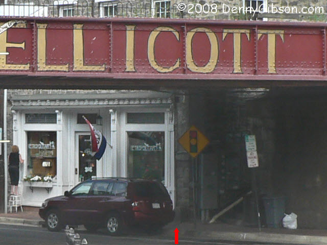
ADDENDUM: Dec 22, 2008 - William Least Heat-Moon is a name recognized among roadies for his 1982 book "Blue Highways" and roadies know Frank X. Brusca as the leading authority on US Route 40. In his latest book, "Roads to Quoz", Heat-Moon devotes three chapters to Brusca and Route 40. The word quoz means "anything strange, incongruous, or peculiar..." and Heat-Moon also uses it to indicate "something that connects". These two writers are connected by a most fitting quoz. As told in the first of those chapters, it was the very same Frederick Turnpike mile marker that, many years ago, first caught the eye of both men. That marker is the "10 M To B" marker in Ellicott City. As I read Heat-Moon's description, I knew I must have been by the marker in 2006 but I had no memory of it. Armed with a good description and some online close-ups, I looked through all of the pictures I took on that visit and surprised myself by discovering that the stone is actually present in one of the pictures I had posted. It's not easily seen but it really is in -- almost dead center -- the picture of the railroad overpass. With some enlarging, a little tweaking, and a nice red arrow, you should be able to see it here. That's the milestone that started both Frank X. Brusca and William Least Heat-Moon on the road to roads and I missed it completely. Makes my embarrassment, mentioned in the next panel, over missing "6 M To B" seem kind of minor. ADDENDUM: Apr 12, 2020 - A look back at this page triggered by a friend's trip through the area, led to the discovery that the link to "online close-ups" in the previous paragraph is dead. A close-up I took on a 2011 revisit can be seen here. |
|
|
 I guess I was so happy to have found that city limits stone that I forgot
all about Frederick #6. Since it is well marked with a real sign, that's
rather embarrassing but I'm telling myself that finding this marker
without help makes up for it. The stone is at the east edge of New Market
but I can't read anything on it.
I guess I was so happy to have found that city limits stone that I forgot
all about Frederick #6. Since it is well marked with a real sign, that's
rather embarrassing but I'm telling myself that finding this marker
without help makes up for it. The stone is at the east edge of New Market
but I can't read anything on it.
|
|
|
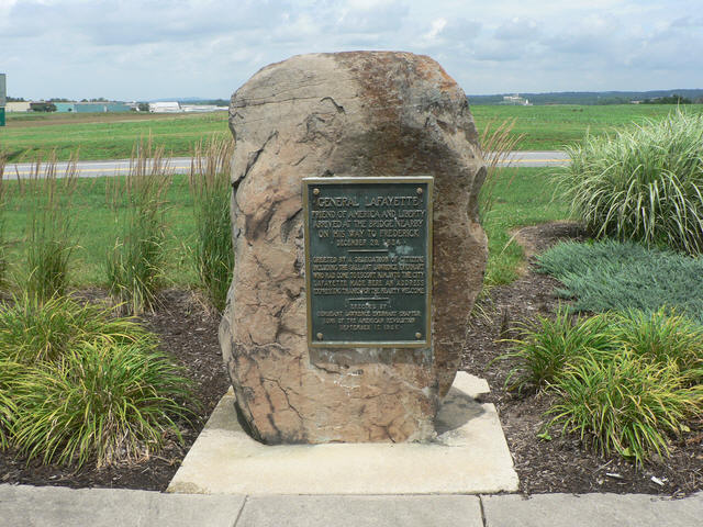
 The stone jug was how Leonard Harbaugh marked the stone bridge he built
over the Monocracy River in 1808. Both it and the plaque were moved about
a mile west of the river following the bridge's collapse after 134 years
of use. They are visible from US-40A but require a turn onto Bowman Farm
Road to access. General Lafayette visited nearby Frederick in 1824 and was
met on the bridge. The plaque commemorating this was erected by the Sons
of the American Revolution. About time the guys did something.
The stone jug was how Leonard Harbaugh marked the stone bridge he built
over the Monocracy River in 1808. Both it and the plaque were moved about
a mile west of the river following the bridge's collapse after 134 years
of use. They are visible from US-40A but require a turn onto Bowman Farm
Road to access. General Lafayette visited nearby Frederick in 1824 and was
met on the bridge. The plaque commemorating this was erected by the Sons
of the American Revolution. About time the guys did something.
|
|
|


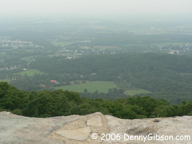
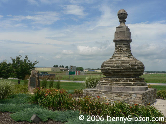
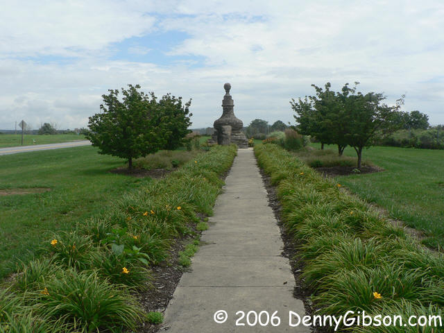
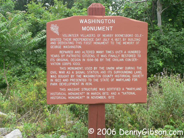 Here it is. The first Washington Monument. Apparently the whole thing was
originally built in one day, July 4, 1827, to beat out the laggards in
Baltimore. The monument itself isn't all that tall but it sits atop a tall
ridge for some great views. For the bizarrely curious, cell phones do work
at the base of the tower and I called from here to make reservations at
the Cassleman Inn which is three years older than the tower.
Here it is. The first Washington Monument. Apparently the whole thing was
originally built in one day, July 4, 1827, to beat out the laggards in
Baltimore. The monument itself isn't all that tall but it sits atop a tall
ridge for some great views. For the bizarrely curious, cell phones do work
at the base of the tower and I called from here to make reservations at
the Cassleman Inn which is three years older than the tower.
ADDENDUM: Sep 26, 2021 - I've know for a long time that the whole thing was NOT originally built in one day but it took opening this page to replace an obsolete link for me to get arround to correcting it. What was built in one day was just fifteen feet tall. It was enlarged to thirty feet in the months that followed. The current tower is the result of several cycles of deterioration and repair. |
|
|
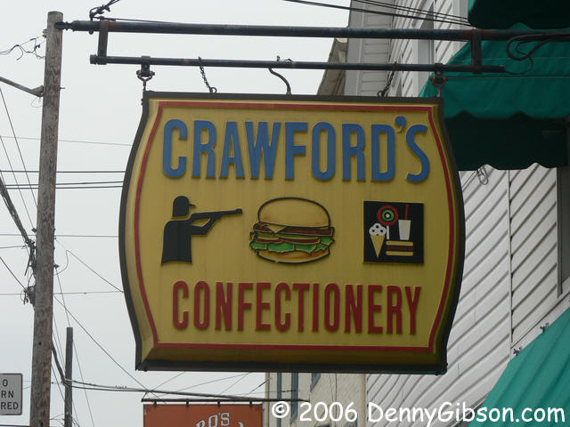
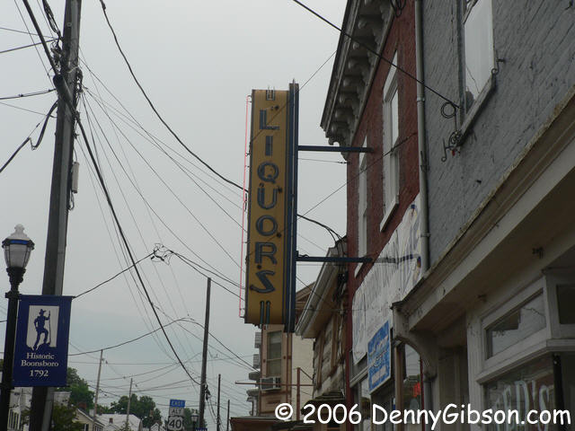
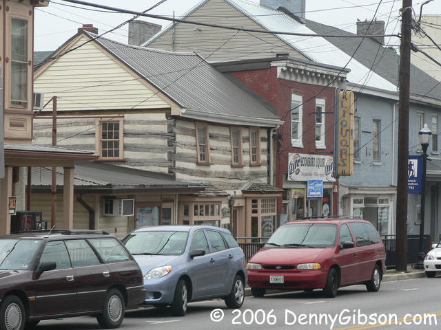 This is Boonsboro, home of the tower builders and site of the highlight of
my day. I liked the appearance of the liquor store and the log cabin
beside it and I also liked the hanging sign at Crawford's. A hunter, a
'burger, and some things that just might be confections. I walked by
before deciding that this was probably a good place to get an iced tea for
the road. Inside, just to the left of the door, were some small hunting
& fishing items; Lures & such. Shelves in the center hold what I'd
call sundries and there are greeting card racks in the back. There is a
counter with eight or so stools and some booths squeezed in between the
counter and the sundries and among the greeting cards. As centrally
located as possible was what I instantly recognized as a "liar's table".
It was occupied and as I entered I heard two great political lines that
had something to do with a shirt.
This is Boonsboro, home of the tower builders and site of the highlight of
my day. I liked the appearance of the liquor store and the log cabin
beside it and I also liked the hanging sign at Crawford's. A hunter, a
'burger, and some things that just might be confections. I walked by
before deciding that this was probably a good place to get an iced tea for
the road. Inside, just to the left of the door, were some small hunting
& fishing items; Lures & such. Shelves in the center hold what I'd
call sundries and there are greeting card racks in the back. There is a
counter with eight or so stools and some booths squeezed in between the
counter and the sundries and among the greeting cards. As centrally
located as possible was what I instantly recognized as a "liar's table".
It was occupied and as I entered I heard two great political lines that
had something to do with a shirt.
The talk continued and topics included snuff, charcoal, raw meat, and big ears. It was a friendly group and, after a little conversation, I asked about the shirt. It seems that one of the group, in his younger days, had made a bet or accepted a dare about climbing a tree. A sycamore, they thought. The tree was so big that you couldn't get a grip on it at the ground so he went up neighboring trees until he could reach the lower limbs of the big tree and then made his way to the top. As proof of this accomplishment, he had left his shirt hanging in the tree's uppermost branches. And that's the point at which I had walked in to hear: "When the Democrats were in office, you could afford to leave a shirt in a tree." |
|
|

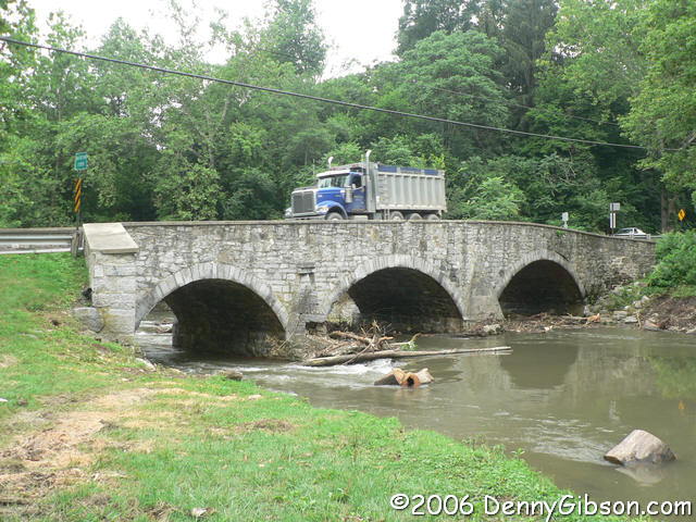
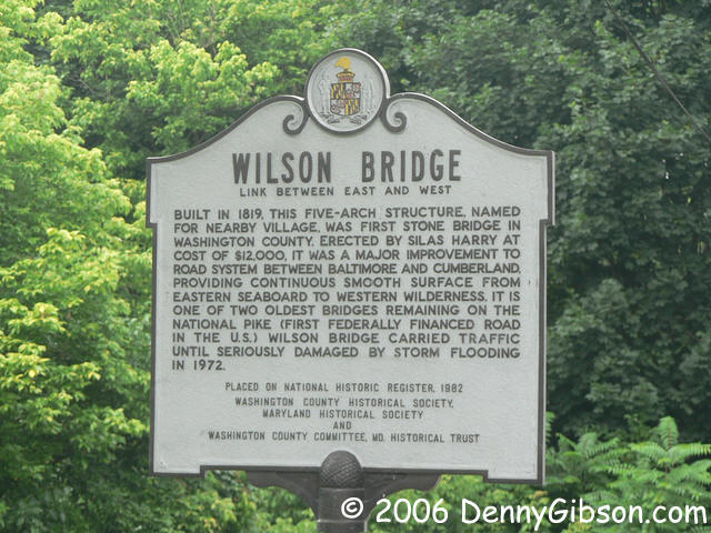
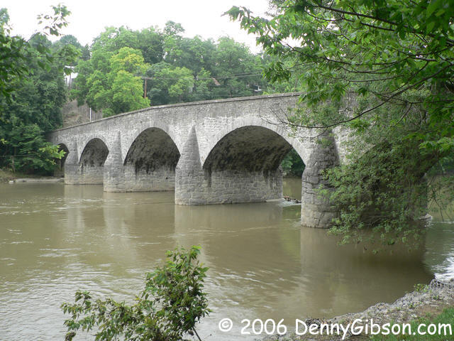
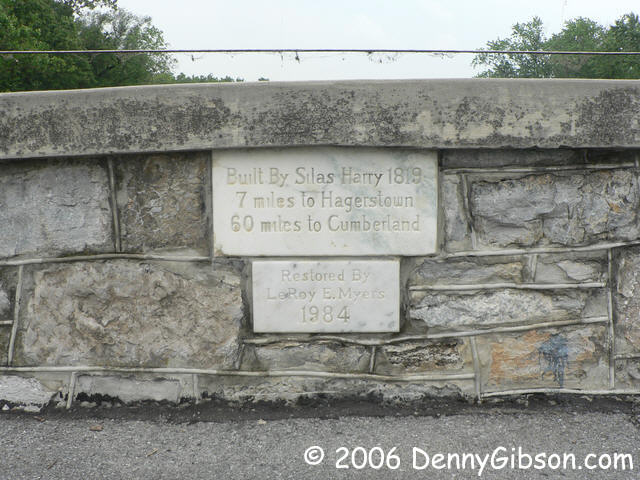 The first bridge here isn't on the signed byway but is straight ahead
where the current US-40A turns right leaving Funkstown. Built in 1833, it
once carried the road over Antietam Creek. As the picture shows, it is
still very much in service. The Wilson Bridge no longer carries anything
but foot traffic. Built in 1819, it is now the focus of a park west of
Hagerstown.
The first bridge here isn't on the signed byway but is straight ahead
where the current US-40A turns right leaving Funkstown. Built in 1833, it
once carried the road over Antietam Creek. As the picture shows, it is
still very much in service. The Wilson Bridge no longer carries anything
but foot traffic. Built in 1819, it is now the focus of a park west of
Hagerstown.
The day started dry but there had been periods of light rain. It started again as I crossed Sidling Hill. Plan B was to dash to the Cassleman on the expressway if it got too late. Encountering rain, I-68, and 6 o'clock all at the same time seemed to be a sign. I hit the expressway with plans to return in the morning. |
|
|
| [Prev] [Site Home] [Home] [Contact] [Next] |