
The Last Bridge
Prev
Next
|
|
Day 10: July 10, 2006 The Last Bridge |
Prev Next |
|
|
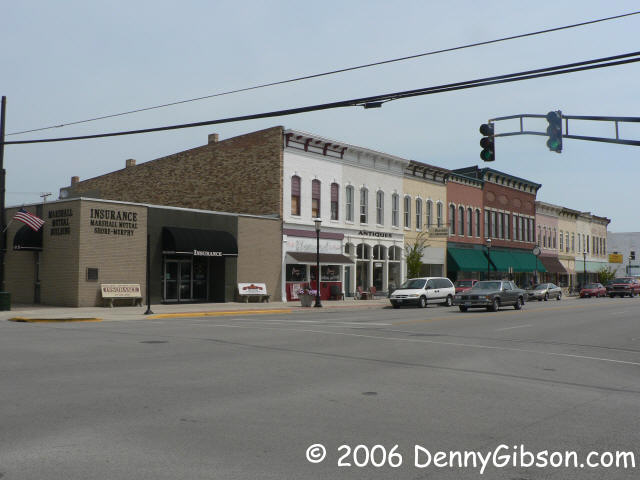
 This is Marshall, one of the towns photographed by George Stewart in his
1953 book. I mimicked Stewart's shot when I passed through and thought in
unnecessary this time. But it's like photographing the Gemini Giant. No matter
how many pictures you have and how little things have changes since you took
the last one, get near there with a camera and you just can't keep from
clicking. So here's my most recent version of Stewart's Marshall, IL, picture
and, as a bonus, the block to the east of it. I bet those buildings hardly
ever get photographed.
This is Marshall, one of the towns photographed by George Stewart in his
1953 book. I mimicked Stewart's shot when I passed through and thought in
unnecessary this time. But it's like photographing the Gemini Giant. No matter
how many pictures you have and how little things have changes since you took
the last one, get near there with a camera and you just can't keep from
clicking. So here's my most recent version of Stewart's Marshall, IL, picture
and, as a bonus, the block to the east of it. I bet those buildings hardly
ever get photographed.
|
|
|
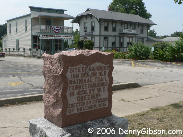
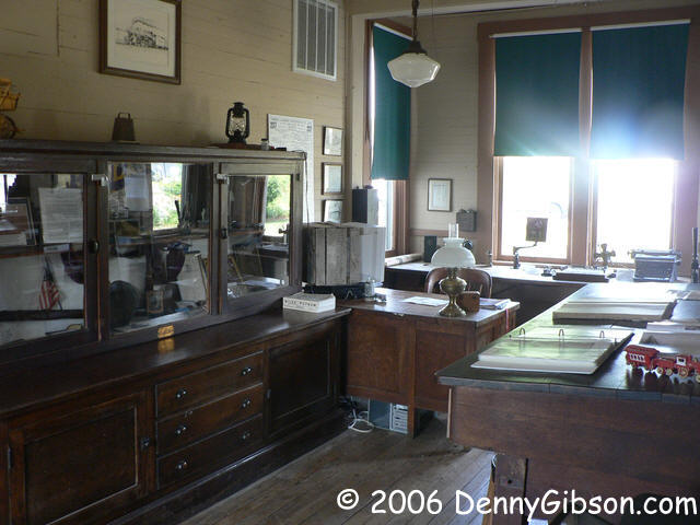
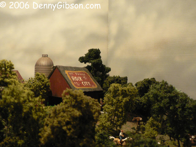
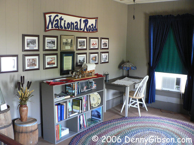 I stopped in Greenup and wandered into the
Historic
Greenup Depot where Bobbie and Thelma were working through a newly
received collection of photographs. As I looked through the displays,
Bobbie offered to unlock the depot so I could have a look. "Men
usually like the train stuff", she said. The "train stuff"
included items from just about every period of the depot's 1870 through
1967 existence. The Historical Society bought it for $25 in 1973 and moved
it to its present downtown location in 1992. The depot also contains an
elaborate model train layout (That's where the Rock City barn is.) and a
National Road room with some vintage photos on the wall.
I stopped in Greenup and wandered into the
Historic
Greenup Depot where Bobbie and Thelma were working through a newly
received collection of photographs. As I looked through the displays,
Bobbie offered to unlock the depot so I could have a look. "Men
usually like the train stuff", she said. The "train stuff"
included items from just about every period of the depot's 1870 through
1967 existence. The Historical Society bought it for $25 in 1973 and moved
it to its present downtown location in 1992. The depot also contains an
elaborate model train layout (That's where the Rock City barn is.) and a
National Road room with some vintage photos on the wall.
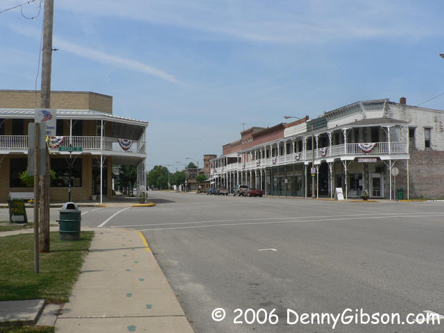
I asked Bobbie about the balconies that identify the town and she explained that they were people's front porches. The first floor of most of those buildings were occupied by businesses. Living quarters were on the second and the balcony was where folks might sit or children play. |
|
|
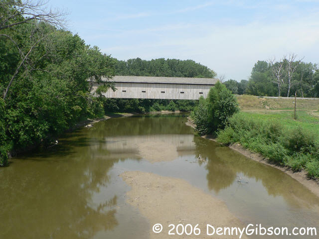
 Cumberland County people are rightfully proud of their "retro" bridge.
Built in 2000, the county opted to build something close to the bridge
that was here in the 1830s and not like the metal bridge they were replacing.
The bridge is on the old National Road so I would have found it without
Bobbie's help but I wouldn't have known of the great view of it from "new 40".
As she described how I should drive through the bridge then swing around
to pick up the newer road, her body went through each turn. With her directions, I had
no trouble getting to the ideal viewing point.
Cumberland County people are rightfully proud of their "retro" bridge.
Built in 2000, the county opted to build something close to the bridge
that was here in the 1830s and not like the metal bridge they were replacing.
The bridge is on the old National Road so I would have found it without
Bobbie's help but I wouldn't have known of the great view of it from "new 40".
As she described how I should drive through the bridge then swing around
to pick up the newer road, her body went through each turn. With her directions, I had
no trouble getting to the ideal viewing point.
|
|
|
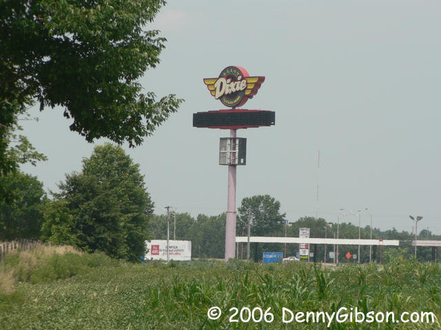
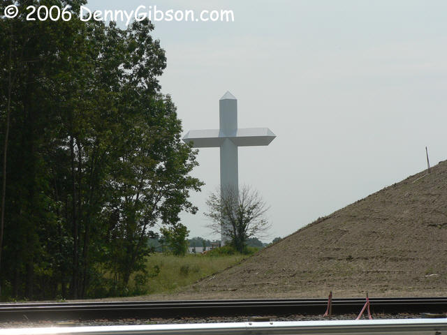 Near Effingham, two major landmarks are visible from where US-40 passes
under I-57/I-70. One is the former Dixie Trucker's Home and the other is a
197 foot cross.
Trees prevent you from viewing them both without moving but you need only
move a few yards. I'm writing this after I've returned home and passed
through here on the interstate. The Trucker's Home appears to be
completely deserted.
Near Effingham, two major landmarks are visible from where US-40 passes
under I-57/I-70. One is the former Dixie Trucker's Home and the other is a
197 foot cross.
Trees prevent you from viewing them both without moving but you need only
move a few yards. I'm writing this after I've returned home and passed
through here on the interstate. The Trucker's Home appears to be
completely deserted.
|
|
|
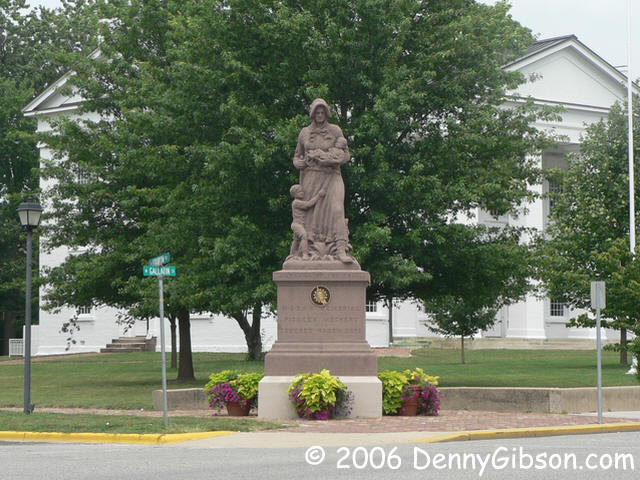 The Illinois Madonna of the Trail is at the end of the "official" National
Road. Under the federal government, the road was surveyed to Vandalia
even though it was not built. This was the Illinois capital when surveyors
first headed west from Wheeling but it was long gone by the time the road
reached here.
The Illinois Madonna of the Trail is at the end of the "official" National
Road. Under the federal government, the road was surveyed to Vandalia
even though it was not built. This was the Illinois capital when surveyors
first headed west from Wheeling but it was long gone by the time the road
reached here.
|
|
|
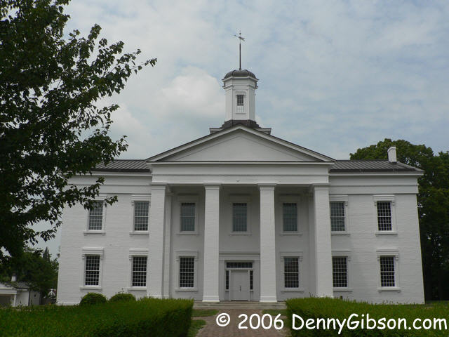


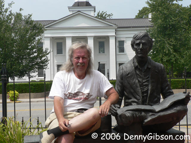 This building was completed in 1836 and used as the capitol for just three
years. Vandalians seem to miss no opportunity to mention that Abraham Lincoln
served as a congressman in all three of those sessions despite the fact
that his primary accomplishment during those years was to get the capital
moved to Springfield.
This building was completed in 1836 and used as the capitol for just three
years. Vandalians seem to miss no opportunity to mention that Abraham Lincoln
served as a congressman in all three of those sessions despite the fact
that his primary accomplishment during those years was to get the capital
moved to Springfield.
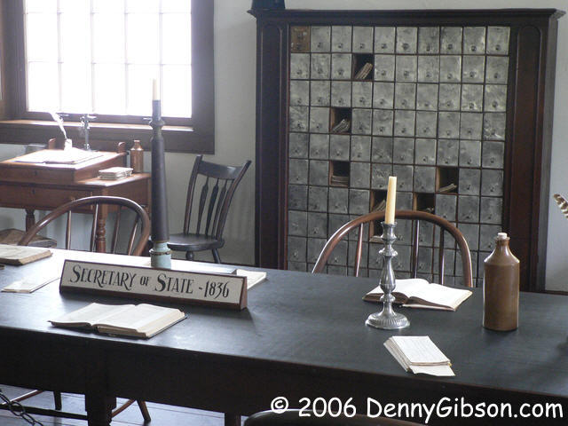
The interior shots are the Supreme Court (containing the building's only carpet), the Secretary of State's office, and the representatives & senate rooms. The last picture is just me and my buddy Abe. |
|
|
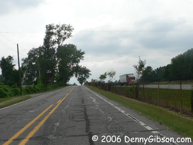
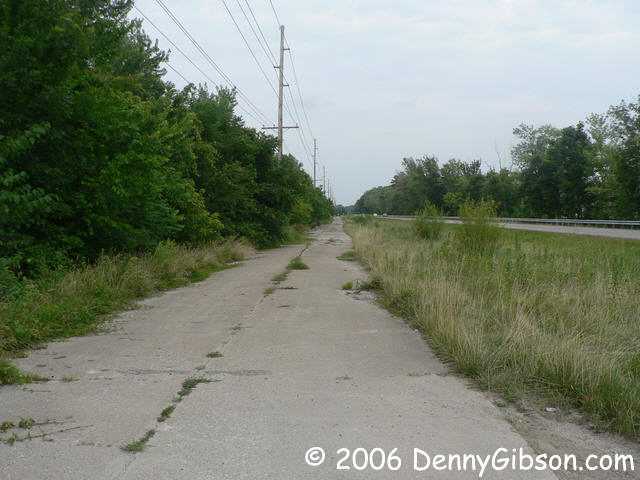

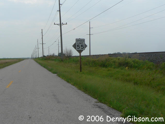 The original plan called for the road to continue on to the Mississippi at
St. Louis but squabbles of the route helped kill any hope of a National
Road west of Vandalia. Roads were eventually built, of course, and the
Historic National Road Byway is signed all the way to Eads Bridge. The road
through here is typical of early auto routes. Sometimes it follows close by
rail road tracks and sometimes it goes right through fields of corn. There
are sections that are totally abandoned, replaced by a newer road, and other
sections survive and run along the latest expressway.
The original plan called for the road to continue on to the Mississippi at
St. Louis but squabbles of the route helped kill any hope of a National
Road west of Vandalia. Roads were eventually built, of course, and the
Historic National Road Byway is signed all the way to Eads Bridge. The road
through here is typical of early auto routes. Sometimes it follows close by
rail road tracks and sometimes it goes right through fields of corn. There
are sections that are totally abandoned, replaced by a newer road, and other
sections survive and run along the latest expressway.
|
|
|

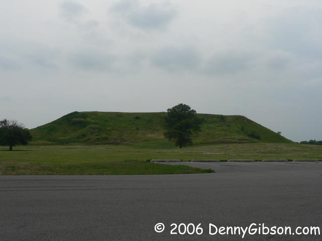
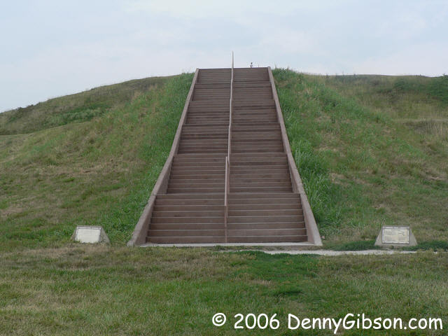 US-40 and the byway go right through
Cahokia Mounds; Actually passing between the museum and
Monk's Mound. The steps go up Monk's Mound. That dot at the top of the
steps is a man who jogged up those steps just before I took the picture.
I've walked up those step. Jog up them? Wow!
US-40 and the byway go right through
Cahokia Mounds; Actually passing between the museum and
Monk's Mound. The steps go up Monk's Mound. That dot at the top of the
steps is a man who jogged up those steps just before I took the picture.
I've walked up those step. Jog up them? Wow!
|
|
|
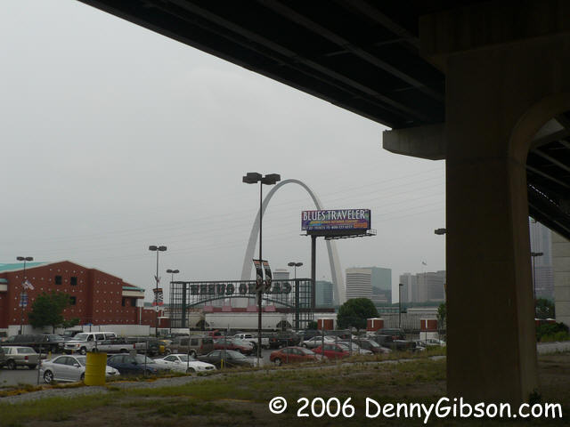
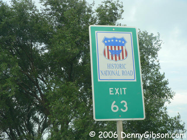
 The Historic National Road Byway ends at the river. I stopped under Eads
Bridge with the arch on the other side of the Mississippi and the Casino
Queen beside me. This concludes the official portion of my journey.
The Historic National Road Byway ends at the river. I stopped under Eads
Bridge with the arch on the other side of the Mississippi and the Casino
Queen beside me. This concludes the official portion of my journey.
|
|
|
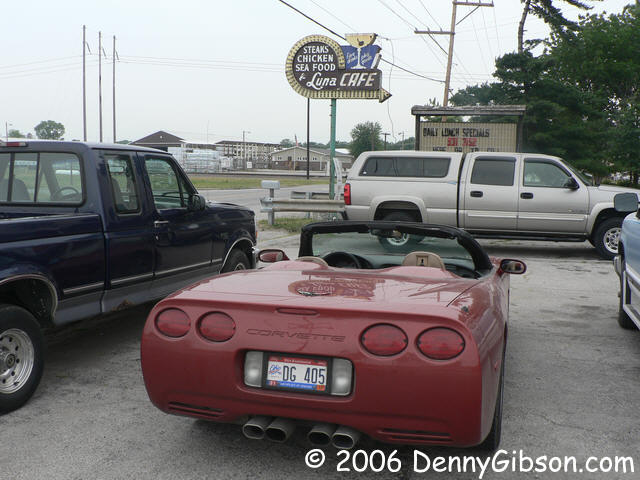
 So now I'm into the unofficial portion. I've been using a new GPS unit on
this trip and slowly figuring it out. It likes telling me how to get somewhere
and is less happy with me telling it how I want to get there. It has really aggravated
me by locking up a few times but I believe those were in response to me asking
it deal with rather long routes. I've learned to deal with it and now I let
it show off. Luna Cafe, I told it. Right this way, it responded and quickly
led me to the familiar bar on old Sixty-Six. I looked at the sky and put
the top up before going in to empty a couple of longnecks. The car and
ground were wet when I returned. On the expressway, I was pleased to see
signs letting folks know the historic route is nearby and accessible.
So now I'm into the unofficial portion. I've been using a new GPS unit on
this trip and slowly figuring it out. It likes telling me how to get somewhere
and is less happy with me telling it how I want to get there. It has really aggravated
me by locking up a few times but I believe those were in response to me asking
it deal with rather long routes. I've learned to deal with it and now I let
it show off. Luna Cafe, I told it. Right this way, it responded and quickly
led me to the familiar bar on old Sixty-Six. I looked at the sky and put
the top up before going in to empty a couple of longnecks. The car and
ground were wet when I returned. On the expressway, I was pleased to see
signs letting folks know the historic route is nearby and accessible.
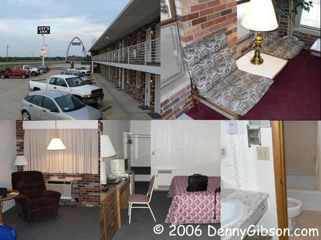
I had asked about Jay's Inn while I was in Vandalia earlier in the day and got good input. When the Vandalia exit came up, I decided that would be where the day ended and I found another independent motel worth recommending. Great value (my room was closer to $40 than to $50), spotless, and with all the goodies (microwave, fridge, & wifi). There's even a restaurant next door that is run by the same family and offers the same quality & value. Pictures from my stay are here. It was raining this morning when I got up and it has rained all the way home. That's the way to end a vacation. |
|
|
| [Prev] [Site Home] [Home] [Contact] [Next] |