Some Illinois PP-OO
Prev
Next
|
Day 3: September 30, 2007 Some Illinois PP-OO |
Prev Next |
|
|
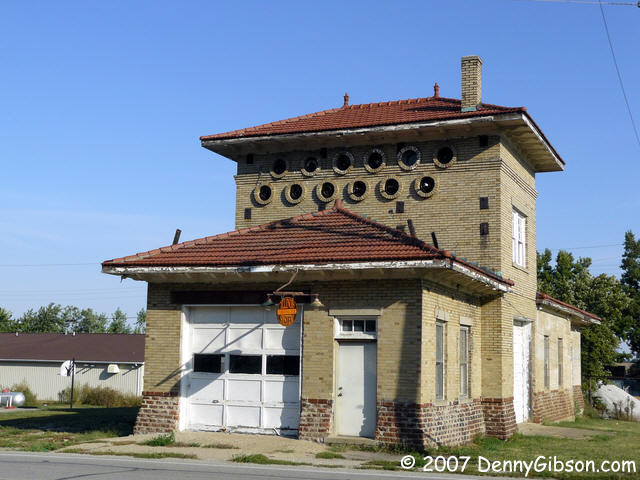
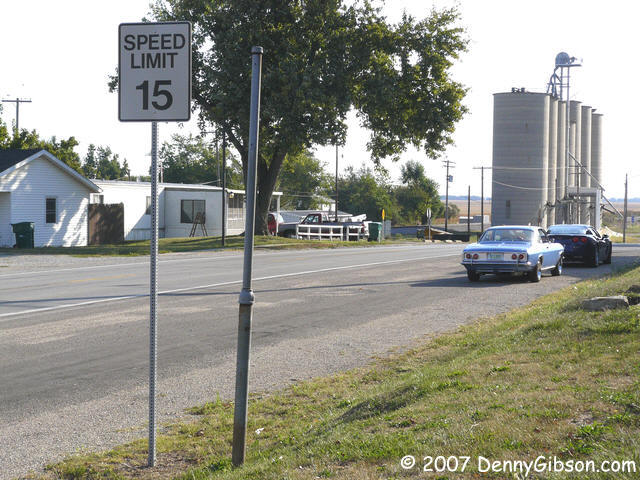
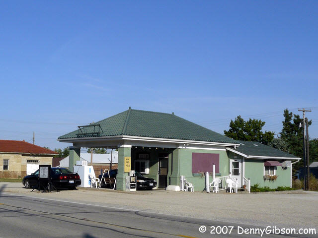 I met Pat Bremer at his motel and the two of us were on Old Route 36 at
the west edge of Springfield about 8:45. Something caught our eyes in the
little town of Buffalo and we made our first stop. I had been attracted by
the old station which I realized was a working cafe only after we stopped.
The 15 MPH Speed Limit signs on the "frontage road" (an area that was
more of a paved shoulder than a separate road) attracted Pat. We both
liked the old interurban power station. I popped into the cafe for a cup
of coffee and a dab of conversation. The present owners have had it for
about two years and it was the previous owner who made it into a cafe
which they operated for ten years or so. They showed me a 1940's photo of
the station with tall pumps across the front.
I met Pat Bremer at his motel and the two of us were on Old Route 36 at
the west edge of Springfield about 8:45. Something caught our eyes in the
little town of Buffalo and we made our first stop. I had been attracted by
the old station which I realized was a working cafe only after we stopped.
The 15 MPH Speed Limit signs on the "frontage road" (an area that was
more of a paved shoulder than a separate road) attracted Pat. We both
liked the old interurban power station. I popped into the cafe for a cup
of coffee and a dab of conversation. The present owners have had it for
about two years and it was the previous owner who made it into a cafe
which they operated for ten years or so. They showed me a 1940's photo of
the station with tall pumps across the front.
|
|
|
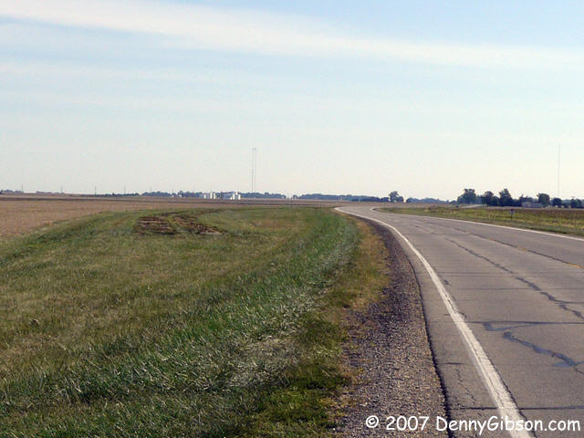
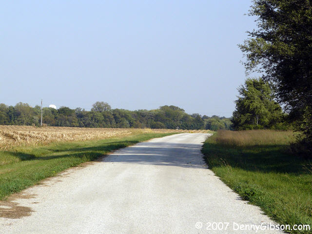
 This picture of the straight and level road was taken through my
windshield which explains that authentic early morning blurriness.
This picture of the straight and level road was taken through my
windshield which explains that authentic early morning blurriness.
|
|
|
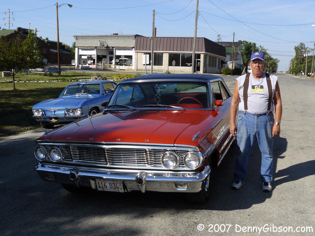 As planned, we met up with roadie Rick Martin (ppoo.org) at a park in Illiopolis and while the three
of us stood by the road looking over maps and making plans, Harold stopped
his 1964 390 4-speed Galaxie beside us. There was no traffic to be
affected by his mid-street parking and I have the impression that this is
a common occurrence in this town - at least by this driver. Harold
confirmed our suspicions that a gravel road west of town had once been the
main route and we all had a pleasant chat about cars, roads, etc.
As planned, we met up with roadie Rick Martin (ppoo.org) at a park in Illiopolis and while the three
of us stood by the road looking over maps and making plans, Harold stopped
his 1964 390 4-speed Galaxie beside us. There was no traffic to be
affected by his mid-street parking and I have the impression that this is
a common occurrence in this town - at least by this driver. Harold
confirmed our suspicions that a gravel road west of town had once been the
main route and we all had a pleasant chat about cars, roads, etc.
|
|
|
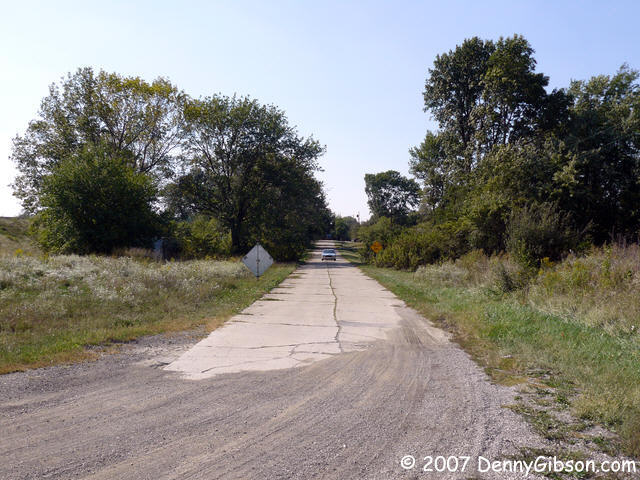
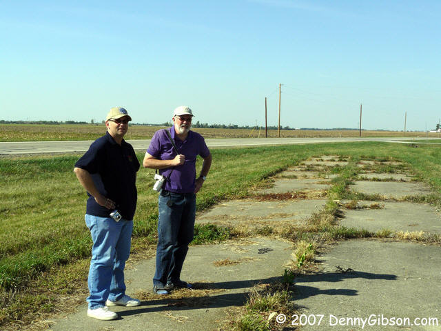 Armed with a GPS embedded route that Rick had previously looked over, I
took the lead as we continued east on Old 36. When we pulled over at what
turned out to be a Lincoln related historic marker, both Pat & Rick
were talking of some abandoned roadway we had just passed. I blame the
fact that I missed it entirely on my GPS responsibilities. We headed back
and were soon standing on a section of concrete road that appeared to have
been left behind in a minor straightening move. That's Pat & Rick in
the second picture - out standing.
Armed with a GPS embedded route that Rick had previously looked over, I
took the lead as we continued east on Old 36. When we pulled over at what
turned out to be a Lincoln related historic marker, both Pat & Rick
were talking of some abandoned roadway we had just passed. I blame the
fact that I missed it entirely on my GPS responsibilities. We headed back
and were soon standing on a section of concrete road that appeared to have
been left behind in a minor straightening move. That's Pat & Rick in
the second picture - out standing.
|
|
|
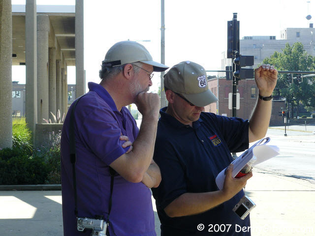
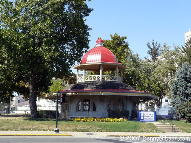 I missed again in Decatur. We had planned to stop at a park near downtown
and I was looking for a big patch of green. Fortunately I did see Rick
pull over behind me before I left town. The dome topped Transfer Station
is one of the structures in the park and Rick had a copy of an old photo
that includes it. My second photo shows the two road scholars trying to
match the old picture with today's setting. They eventually decided that
the station must have been moved and we set off on a successful hunt for
its original location. As you can tell, this was a very important
intersection. Pictures similar to the one Rick had can be seen
here.
I missed again in Decatur. We had planned to stop at a park near downtown
and I was looking for a big patch of green. Fortunately I did see Rick
pull over behind me before I left town. The dome topped Transfer Station
is one of the structures in the park and Rick had a copy of an old photo
that includes it. My second photo shows the two road scholars trying to
match the old picture with today's setting. They eventually decided that
the station must have been moved and we set off on a successful hunt for
its original location. As you can tell, this was a very important
intersection. Pictures similar to the one Rick had can be seen
here.
|
|
|
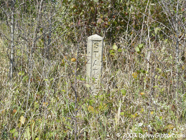 Near Monticello, I reminded the guys that my route resorted to the
expressway for the chopped up area between there and White Heath. Rick has
some possibilities and Pat had some grass to mow. Pat took to I-72 and I
followed Rick along some very pleasant side roads which may or may not
have been part of the PP-OO. Included was this spur which both Garmin and
DeLorme label "E Old Rte 47". Rick (the one with long pants)
braved the weeds to read "STATE RO". "AD 10" was our
guess at the remainder.
Near Monticello, I reminded the guys that my route resorted to the
expressway for the chopped up area between there and White Heath. Rick has
some possibilities and Pat had some grass to mow. Pat took to I-72 and I
followed Rick along some very pleasant side roads which may or may not
have been part of the PP-OO. Included was this spur which both Garmin and
DeLorme label "E Old Rte 47". Rick (the one with long pants)
braved the weeds to read "STATE RO". "AD 10" was our
guess at the remainder.
ADDENDUM: Nov 6, 2007 - Following the trip, a discussion in the American Road Magazine Forum concluded that the spur with the marker was indeed part of the PP-OO. The marker is most likely a right of way marker ("STATE R.O.W."). The full discussion is here with chatter about the spur starting with October 2 entries. |
|
|
 After a very good lunch outside a Champaign cafe, Rick took us down this
interesting road near Saint Joseph. Curiously, both Garmin & DeLorme
show a Monroe Street and a rail line (interurban?) crossing the Salt Fork
but clearly neither has in quite some time although the rail bridge does
still exist. In the middle picture, a fisherman can be seen sitting on it.
The first picture is of the road as it departs the current US-150 west of
Saint Joseph and the third is facing west (and the setting sun) in the
town. A fellow living on the road verified that this was once US-150.
After a very good lunch outside a Champaign cafe, Rick took us down this
interesting road near Saint Joseph. Curiously, both Garmin & DeLorme
show a Monroe Street and a rail line (interurban?) crossing the Salt Fork
but clearly neither has in quite some time although the rail bridge does
still exist. In the middle picture, a fisherman can be seen sitting on it.
The first picture is of the road as it departs the current US-150 west of
Saint Joseph and the third is facing west (and the setting sun) in the
town. A fellow living on the road verified that this was once US-150.
|
|
|
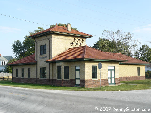
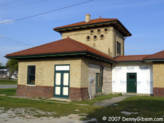
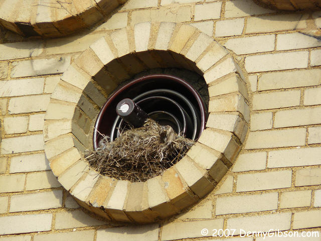 The interurban station in Fithian is in the midst of some major
rehabilitation. There were no clues as to whether the rehab involved a
civic organization, a business, or possibly an individual who was turning
the place into a residence.
The interurban station in Fithian is in the midst of some major
rehabilitation. There were no clues as to whether the rehab involved a
civic organization, a business, or possibly an individual who was turning
the place into a residence.
|
|
|
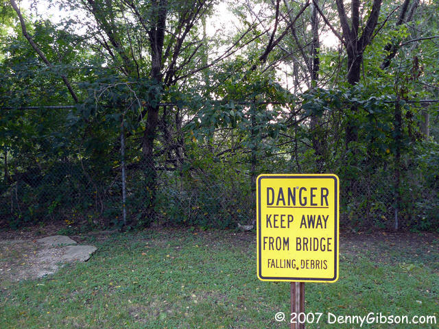

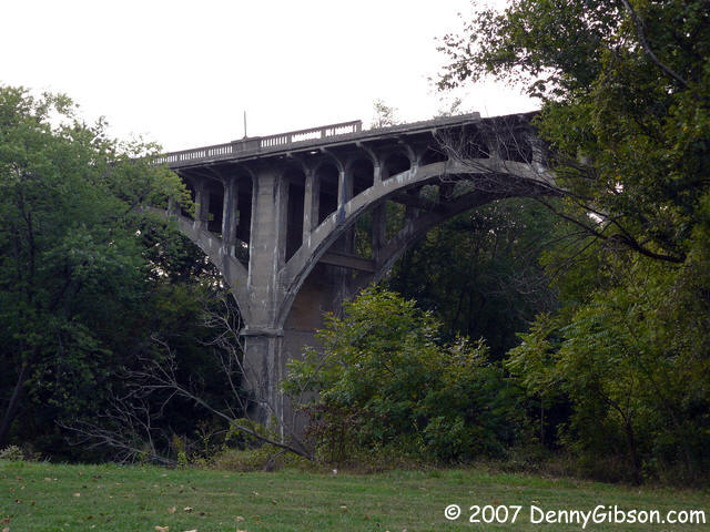
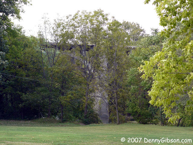
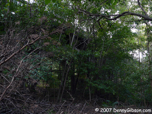
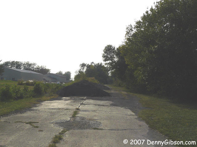
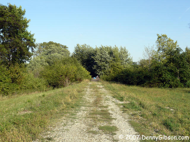
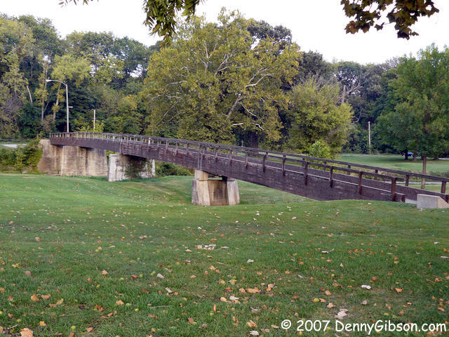
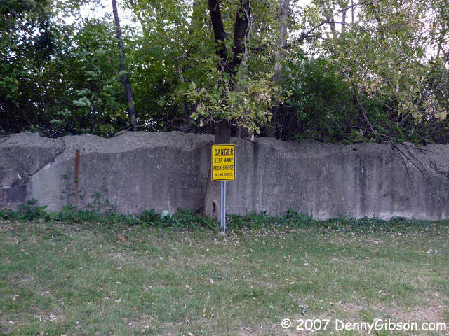 We ended the day by solving a mystery. It is fact that Oakwood Avenue once
crossed the North Fork of the Vermillion River in Danville and that the
PP-OO followed it. Some
online imagery even seemed to show a bridge still in
existence but the road definitely no longer goes that way. On site, the
situation quickly became clear. The majority of the bridge still stands
but sections near each bank have been removed. It isn't easy to get a good
view of the bridge but we tried and that includes crossing the river on a
foot bridge to get that fourth photo. The last two
pictures are from the east side after crossing over on US-150. There a
less verbose sign explains the situation quite clearly and the bridge is
even less visible and accessible.
We ended the day by solving a mystery. It is fact that Oakwood Avenue once
crossed the North Fork of the Vermillion River in Danville and that the
PP-OO followed it. Some
online imagery even seemed to show a bridge still in
existence but the road definitely no longer goes that way. On site, the
situation quickly became clear. The majority of the bridge still stands
but sections near each bank have been removed. It isn't easy to get a good
view of the bridge but we tried and that includes crossing the river on a
foot bridge to get that fourth photo. The last two
pictures are from the east side after crossing over on US-150. There a
less verbose sign explains the situation quite clearly and the bridge is
even less visible and accessible.
|
|
|
| [Prev] [Site Home] [Trip Home] [Contact] [Next] |