Which Way Did It Go?
Comment via blog
Prev
Next


|
Day 21: August 16, 2014 Which Way Did It Go? Comment via blog |
Prev Next |
|
|
|
 This was the morning of the e-Group breakfast. Before leaving the motel, I
made sure that my camera had a memory card and a charged battery. Then, as
I pulled into the parking lot at the breakfast place, I realized that
card, battery, and camera were all back in the room. When I mentioned this
to Dave Wickline, he said, "Well, at least you have your cell
phone", but he was wrong. My phone was also left behind in the room
so I have no pictures of the breakfast. Plenty of other people do, however,
so I don't feel too bad.
This was the morning of the e-Group breakfast. Before leaving the motel, I
made sure that my camera had a memory card and a charged battery. Then, as
I pulled into the parking lot at the breakfast place, I realized that
card, battery, and camera were all back in the room. When I mentioned this
to Dave Wickline, he said, "Well, at least you have your cell
phone", but he was wrong. My phone was also left behind in the room
so I have no pictures of the breakfast. Plenty of other people do, however,
so I don't feel too bad.
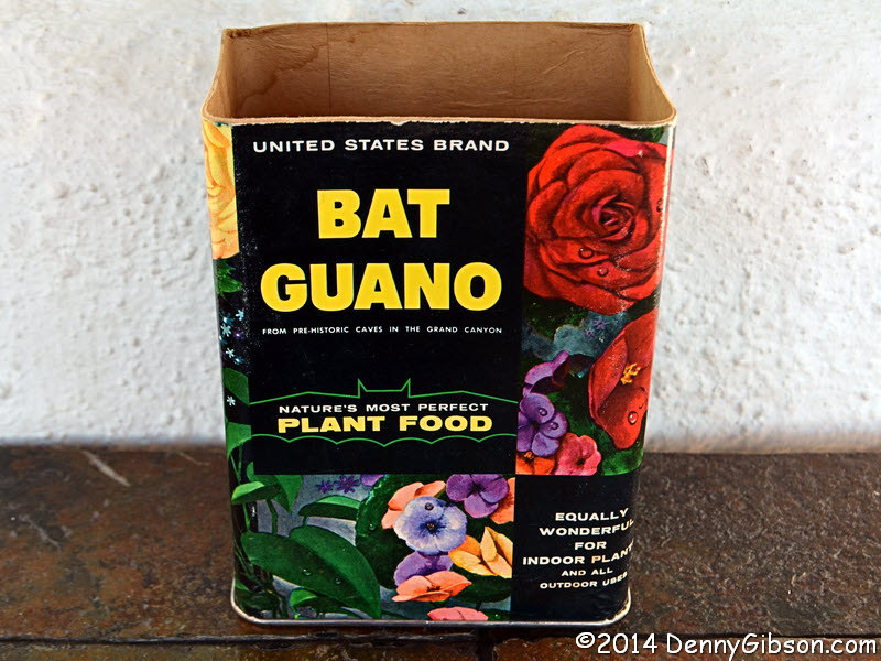
One thing I did get at the breakfast was a promise from Jim Hinckley of an unusual souvenir. Dave and I intended to do some exploring in his rental car but, before we did, he needed to drop off some things at the Artists and Authors area. When he did, we got our souvenirs. Between 1957 and 1960, the United States Guano Corporation mined bat guano from a cave at the Grand Canyon and packaged it in Kingman. The empty containers make fine mementos and Jim handed out a number of them to festival attendees. |
|
|
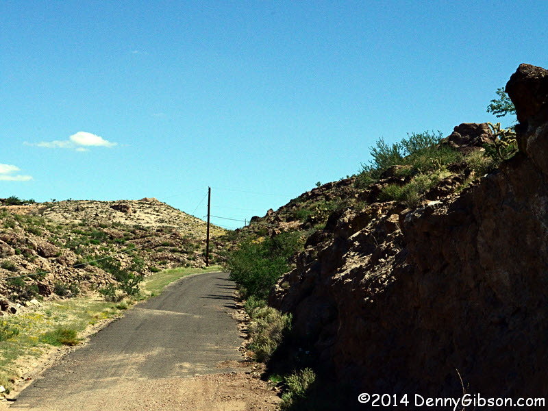
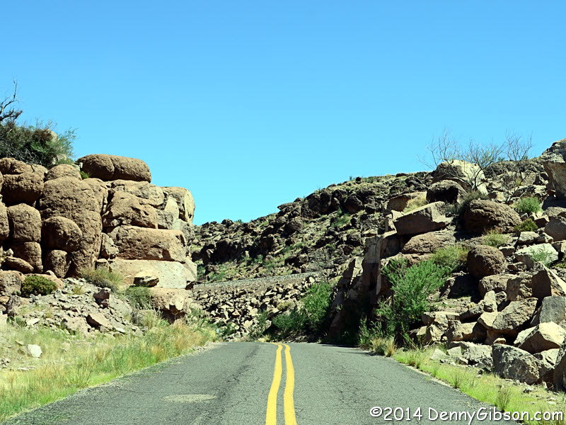
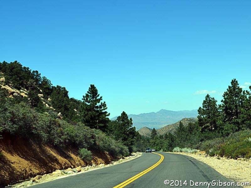
 We did the easy stuff first. This is Chadwick Drive which carried an early
US 66 down part of Trovatore Hill. There is a pretty cool natural rock
formation visible from the road an at least one of the man made variety.
We did the easy stuff first. This is Chadwick Drive which carried an early
US 66 down part of Trovatore Hill. There is a pretty cool natural rock
formation visible from the road an at least one of the man made variety.
|
|
|

 Then we went looking for a piece of the National Old Trails Road now called
Slaughter House Canyon Road. You'd think that a
couple of old roadies like me and Dave Wickline would have a few maps and
at least one GPS unit when we went off exploring but that wasn't the case
at all. We thought we knew where we were going. We would spend a lot of
time looking for Slaughter House Canyon Road.
Then we went looking for a piece of the National Old Trails Road now called
Slaughter House Canyon Road. You'd think that a
couple of old roadies like me and Dave Wickline would have a few maps and
at least one GPS unit when we went off exploring but that wasn't the case
at all. We thought we knew where we were going. We would spend a lot of
time looking for Slaughter House Canyon Road.
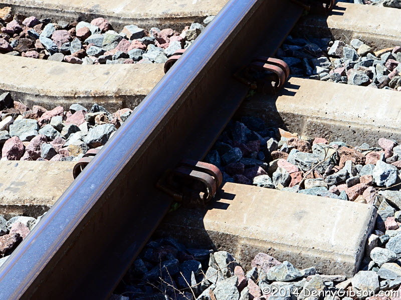
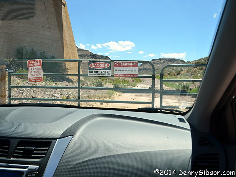
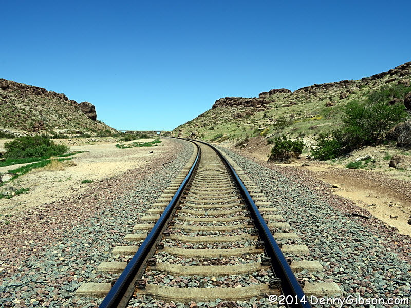
Our motel room map studies made us think that all we needed to do was roll down Topeka Street to connect with our target. We did that and watched a train pass on the track that blocked our way. We studied the situation from atop the tracks and Dave was pretty confident that the road we wanted was on the other side somewhere. He was right but it would take some time to prove it. |
|
|
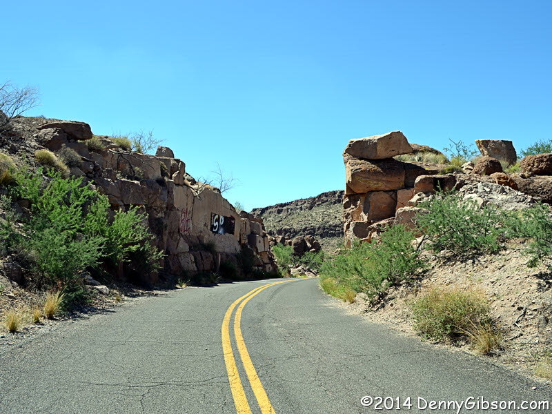

 Both of us had been on this bit, accessed from Fourth Street south of
downtown and now labeled Old Trails Road, in the past. I believe it was
not only part of the National Old Trails Road but carried Route 66 for
several years. Where the road passes between the rocks is or at least
should be one of the prettiest spots on the road. Graffiti now detracts
from the view south but can be hidden when looking north.
Both of us had been on this bit, accessed from Fourth Street south of
downtown and now labeled Old Trails Road, in the past. I believe it was
not only part of the National Old Trails Road but carried Route 66 for
several years. Where the road passes between the rocks is or at least
should be one of the prettiest spots on the road. Graffiti now detracts
from the view south but can be hidden when looking north.
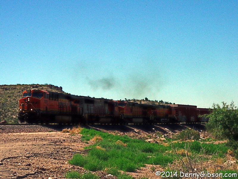
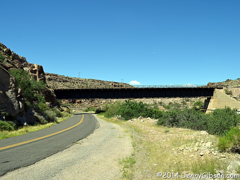
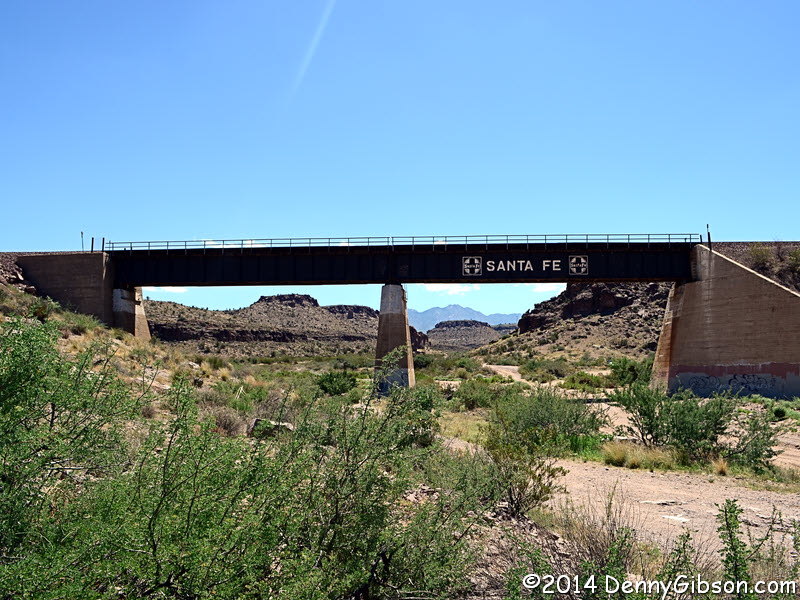
There is a brewery in Kingman, which I visited a few times, named Black Bridge Brewery. On my first visit, the bartender explained that the name came from a bridge on Old Trails Road where local high school kids did a little drinking on weekends. The bridge in the first picture is the only one that the road actually goes under and I thought that was the bridge she meant. I now believe it is the bridge in the fourth picture which can be reached on a dirt road and where a small group was getting is some target practice today. We got to watch a train cross the third bridge visible from this section and would have gone under it ourselves if the way had not been blocked. |
|
|
 In our continuing attempts to find Slaughter House Canyon Road, we asked
a couple of guys standing by their cars in a driveway and were told how to
reach the northern end of it from Hualapai Mountain Road. We thought he
said something about the twelve mile marker but maybe not or maybe we
misunderstood. The turn we wanted was about eleven miles before the twelve
mile marker but we enjoyed the beautiful drive which we were talking about
doing later anyway.
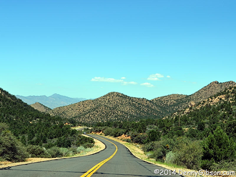
In our continuing attempts to find Slaughter House Canyon Road, we asked
a couple of guys standing by their cars in a driveway and were told how to
reach the northern end of it from Hualapai Mountain Road. We thought he
said something about the twelve mile marker but maybe not or maybe we
misunderstood. The turn we wanted was about eleven miles before the twelve
mile marker but we enjoyed the beautiful drive which we were talking about
doing later anyway.
|
|
|
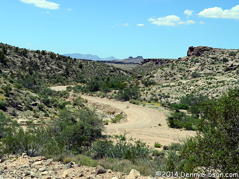
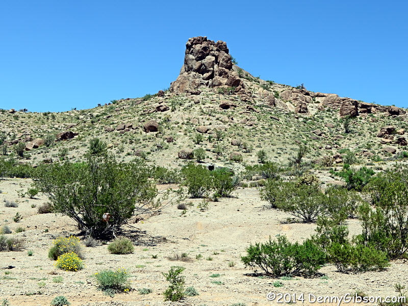
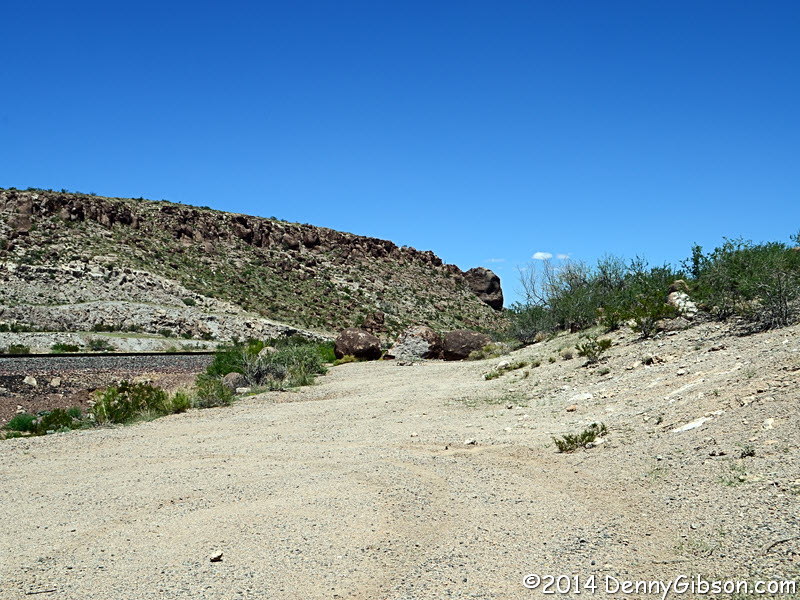
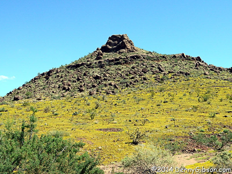
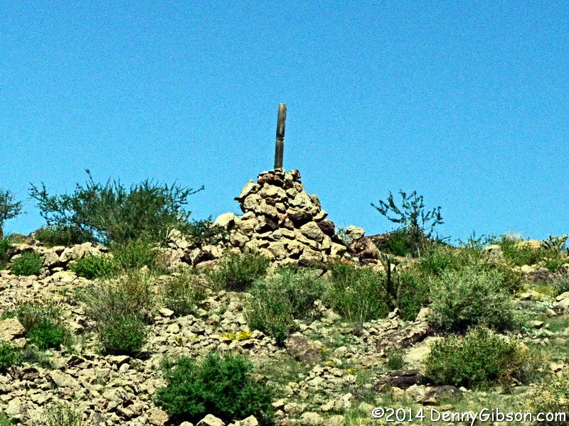
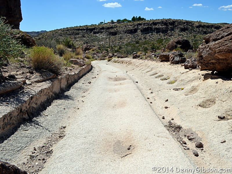
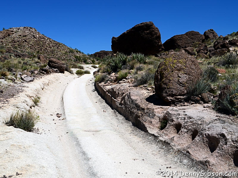
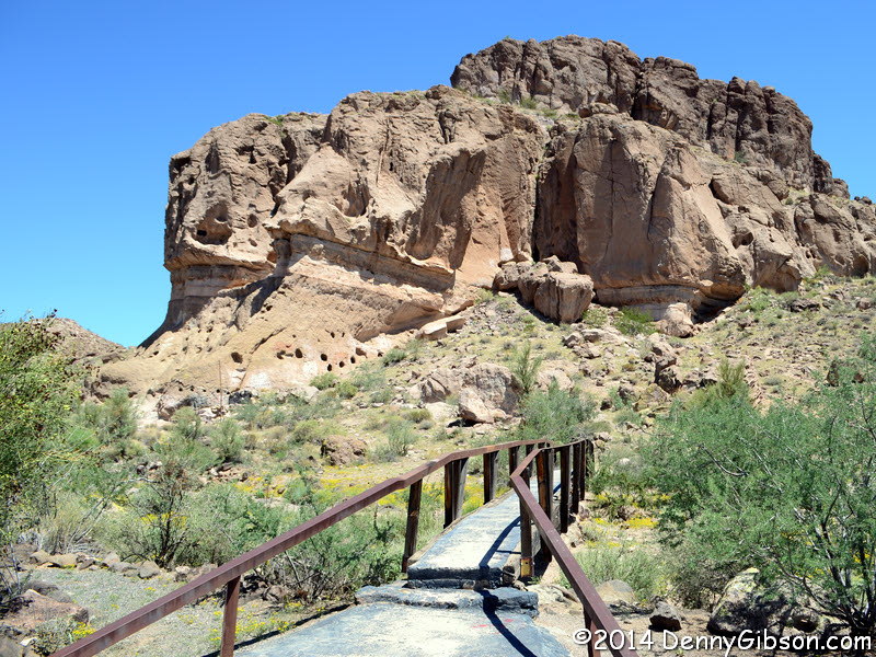
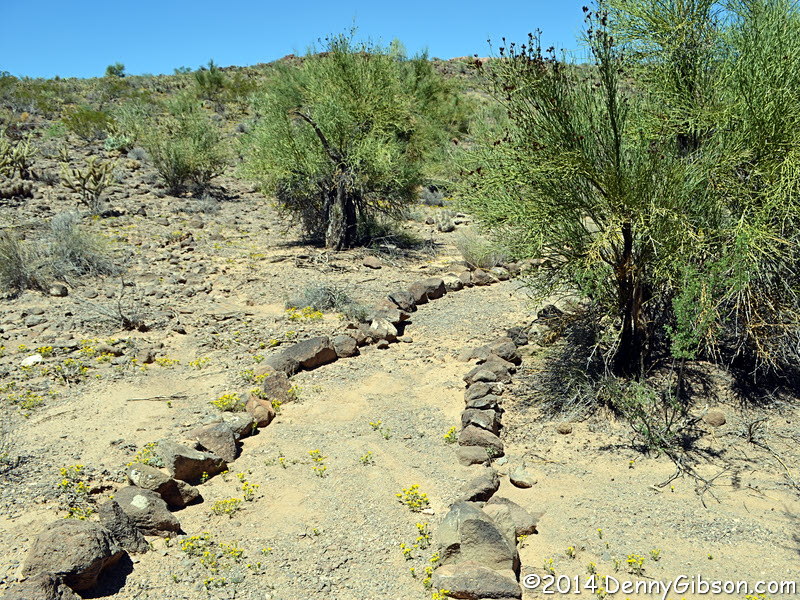
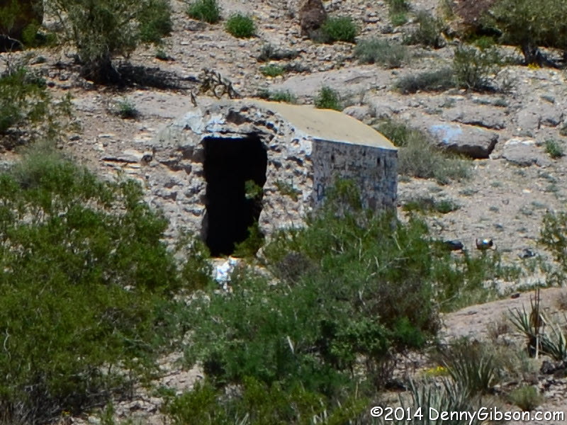
 There it is. A ranger at Hualapai Mountain State Park provided good
directions to Slaughter House Canyon Road while volunteering "there's nothing worth seeing
there". We thought differently though we didn't always know what it
was we were seeing. For example. that small dark spot near the center of
the second picture is the entrance to some sort of man made structure.
When we reached the end, however, we knew exactly what we were looking at
-- mostly. We had been at virtually the same spot about two hours earlier.
From atop the tracks, the view to the south is nearly the same as seen in
this picture from three panels back with the
addition of the rental car. For the last picture, we're back to not
knowing what it is we're looking at. Slaughter House Canyon Road was part
of the National Old Trails Road until about 1921 but was not part of US-66.
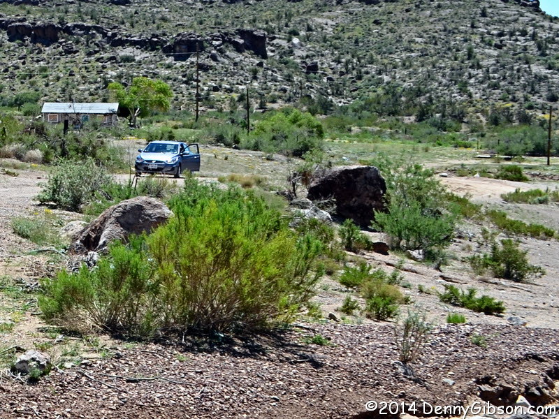
There it is. A ranger at Hualapai Mountain State Park provided good
directions to Slaughter House Canyon Road while volunteering "there's nothing worth seeing
there". We thought differently though we didn't always know what it
was we were seeing. For example. that small dark spot near the center of
the second picture is the entrance to some sort of man made structure.
When we reached the end, however, we knew exactly what we were looking at
-- mostly. We had been at virtually the same spot about two hours earlier.
From atop the tracks, the view to the south is nearly the same as seen in
this picture from three panels back with the
addition of the rental car. For the last picture, we're back to not
knowing what it is we're looking at. Slaughter House Canyon Road was part
of the National Old Trails Road until about 1921 but was not part of US-66.
|
|
|
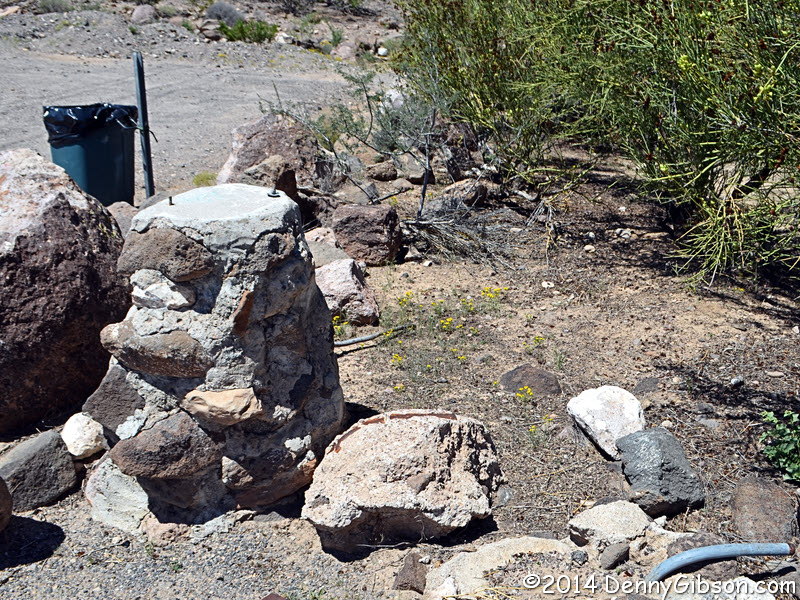
 We returned to downtown and First Street as the start point for locating
some wagon ruts. These ruts were cut into the soft stone by wagons carrying
ore from Stockton Hill copper and silver mines and are not part of the
Beale Wagon Road as we first assumed. Nothing we thought of could really
explain the large holes at the side of the tracks but we were not thinking
of a maintained commercial road. Perhaps they are post holes for some sort
of guard rail but that's just another guess.
We returned to downtown and First Street as the start point for locating
some wagon ruts. These ruts were cut into the soft stone by wagons carrying
ore from Stockton Hill copper and silver mines and are not part of the
Beale Wagon Road as we first assumed. Nothing we thought of could really
explain the large holes at the side of the tracks but we were not thinking
of a maintained commercial road. Perhaps they are post holes for some sort
of guard rail but that's just another guess.
|
|
|
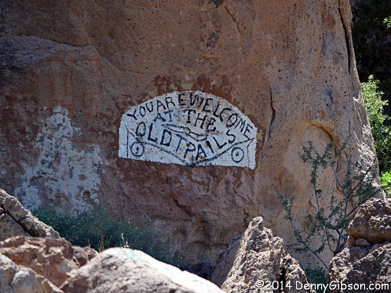
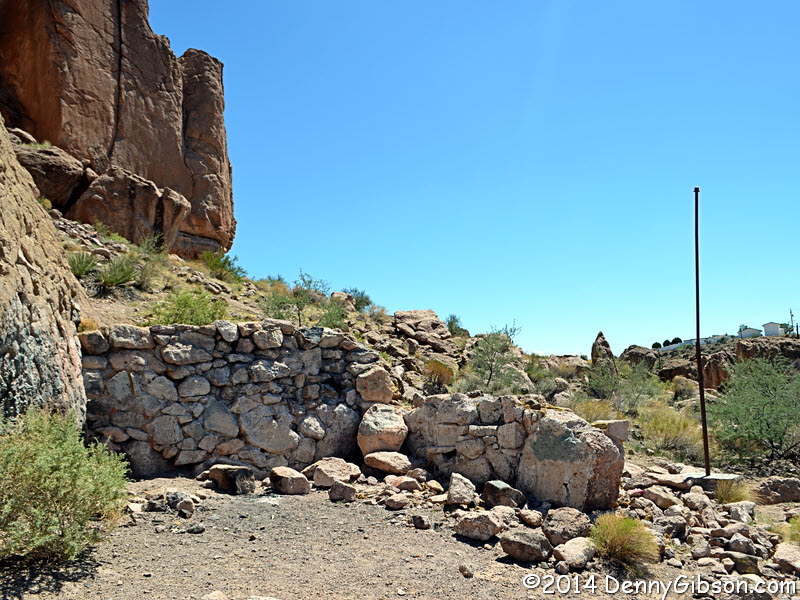
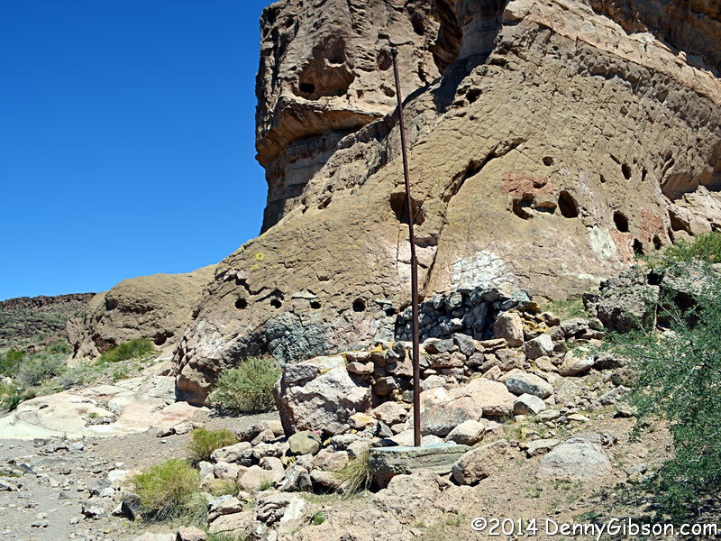
 Walking back down the hill from the tracks, we spotted the welcome sign and
the remnants of a building. Across the bridge were some rock lined trails
and what looked like something that might have once held a sign. At the
stone walls, our minds conjured up images of some settler's home but the
marked paths left us completely baffled. I later learned from Jim Hinckley,
that a nice park, constructed by the Job Corps in the 1960s, once stood
here but it eventually fell to rampant vandalism.
Walking back down the hill from the tracks, we spotted the welcome sign and
the remnants of a building. Across the bridge were some rock lined trails
and what looked like something that might have once held a sign. At the
stone walls, our minds conjured up images of some settler's home but the
marked paths left us completely baffled. I later learned from Jim Hinckley,
that a nice park, constructed by the Job Corps in the 1960s, once stood
here but it eventually fell to rampant vandalism.
That wasn't the only thing I learned from Jim. He provided information on the location and use of each of the old road segments we saw today as well as the ruts and their mining background. And a guano box, too! Big thanks to Jim for all the help. |
|
|
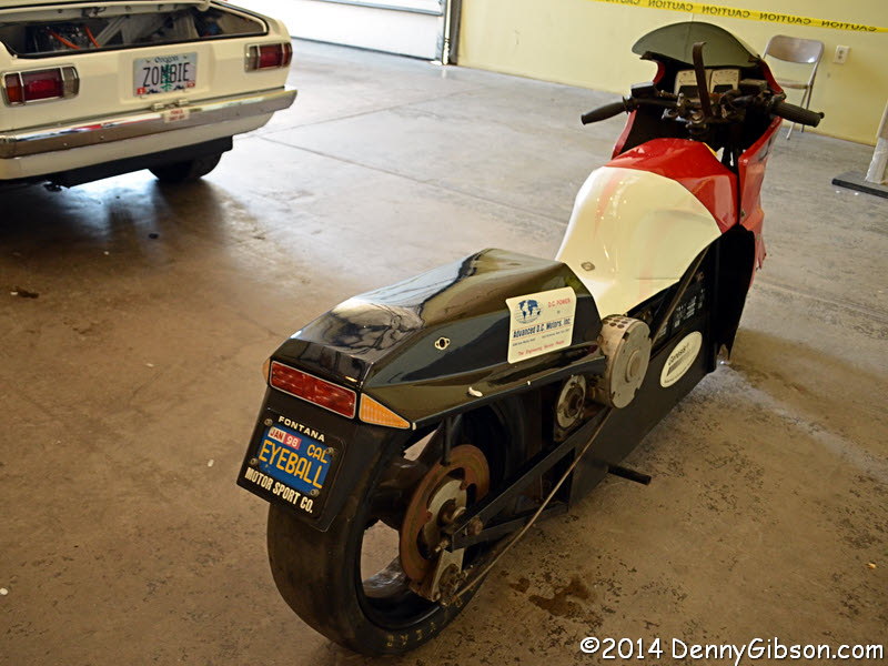
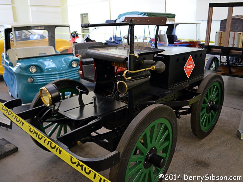
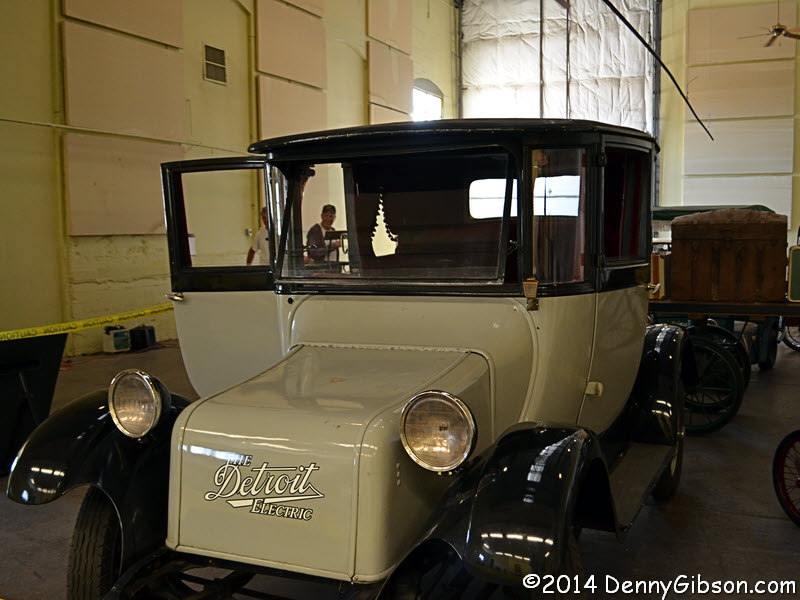
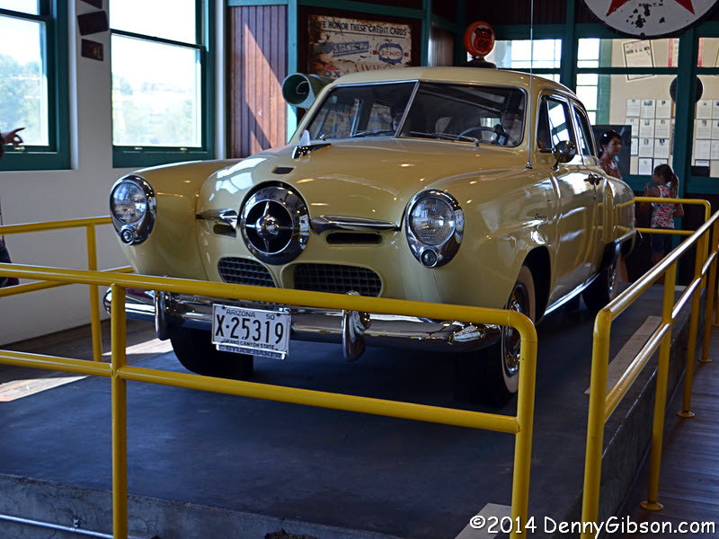
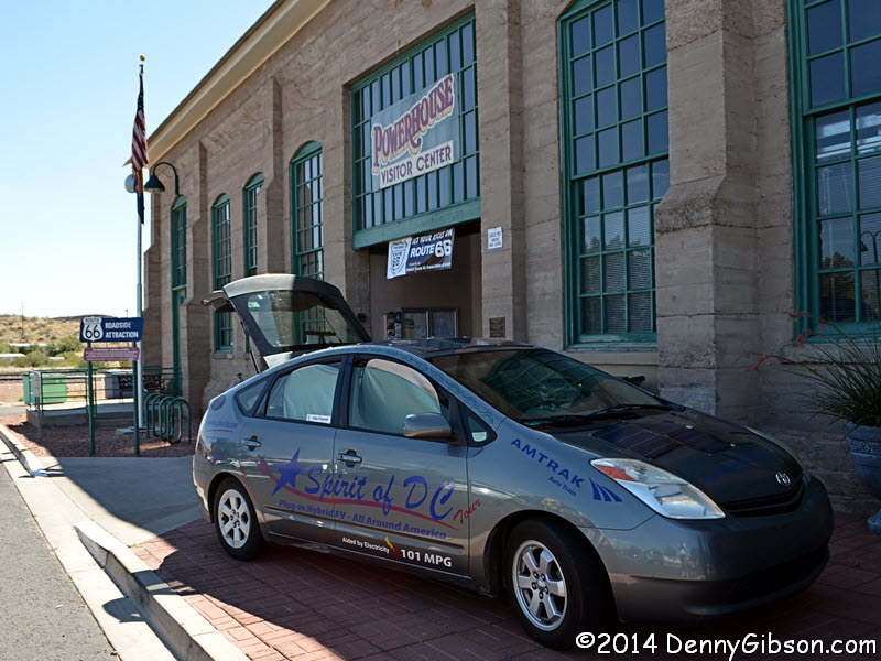 Back in civilization, I took in the Historic Electric Vehicle Exhibition
at the Powerhouse. There were some real oldies along with some more modern
vehicles and both work and sport were represented.
Back in civilization, I took in the Historic Electric Vehicle Exhibition
at the Powerhouse. There were some real oldies along with some more modern
vehicles and both work and sport were represented.
|
|
|
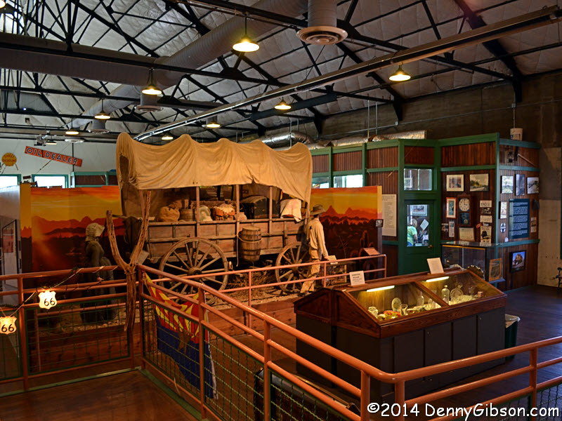
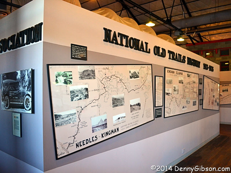
 I also took in the regular exhibits at the Powerhouse Museum. Kingman has always been a transportation
hub and the displays here convey that well.
I also took in the regular exhibits at the Powerhouse Museum. Kingman has always been a transportation
hub and the displays here convey that well.
|
|
|
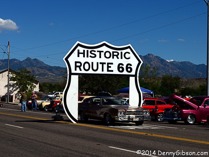
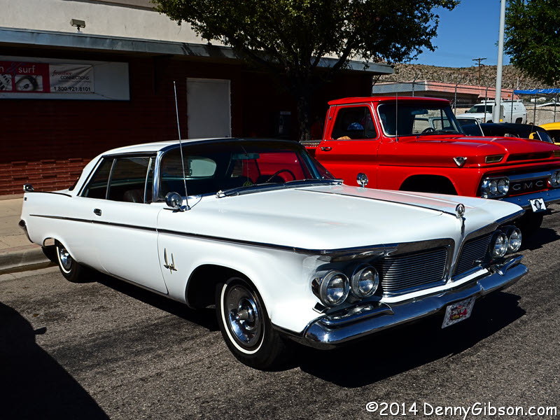
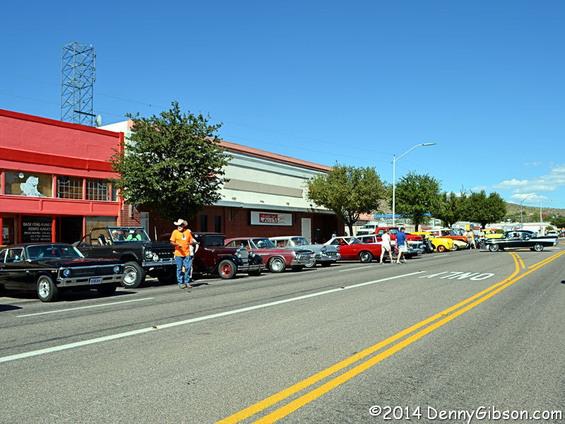
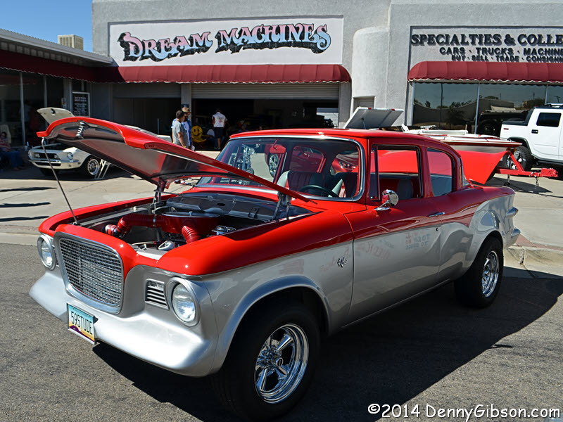
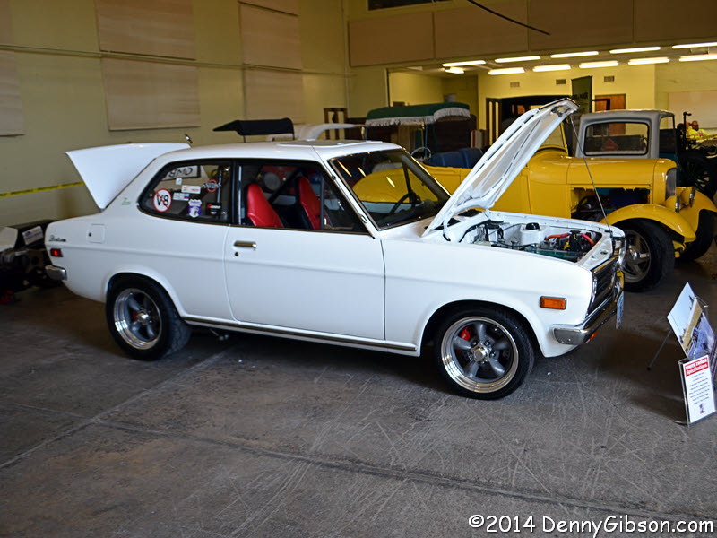
 The car show was still being assembled when I walked through so some
vacant pavement remained between the clusters of cool cars. I had seen
that V8 Lark on the streets when I got here on Wednesday. Though I don't
know that I'd like to own it, I really liked seeing that white Imperial
from the days when you could buy a two-door hardtop that was longer than
the average GMC pickup.
The car show was still being assembled when I walked through so some
vacant pavement remained between the clusters of cool cars. I had seen
that V8 Lark on the streets when I got here on Wednesday. Though I don't
know that I'd like to own it, I really liked seeing that white Imperial
from the days when you could buy a two-door hardtop that was longer than
the average GMC pickup.
|
|
|
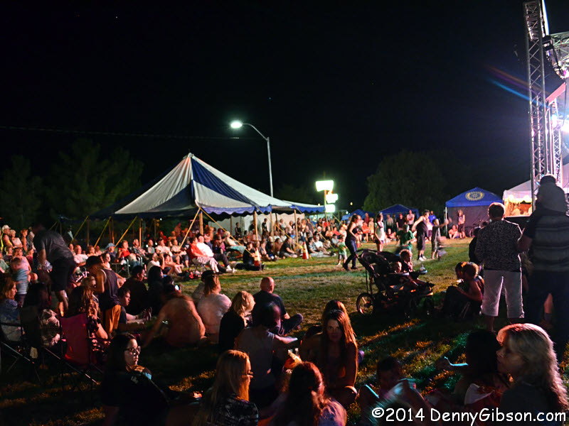
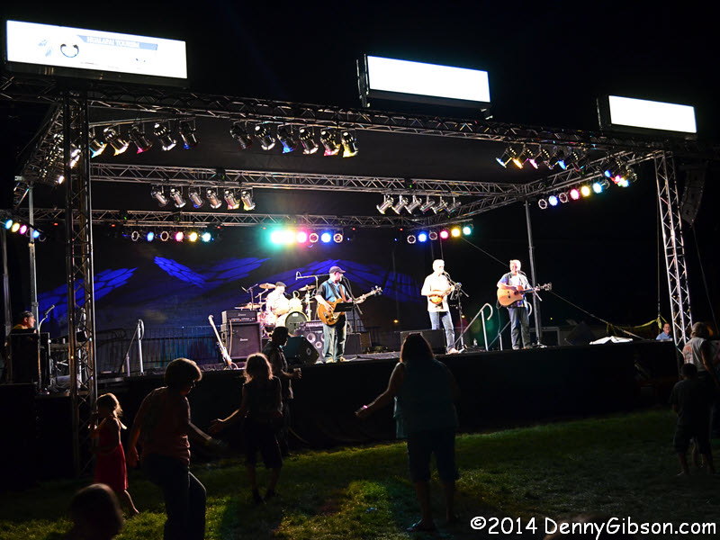
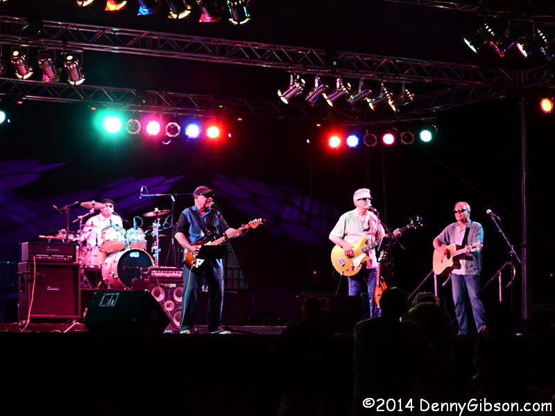
 Even though tonight's Road Crew
concert started later than last night's, it was well underway when I arrived.
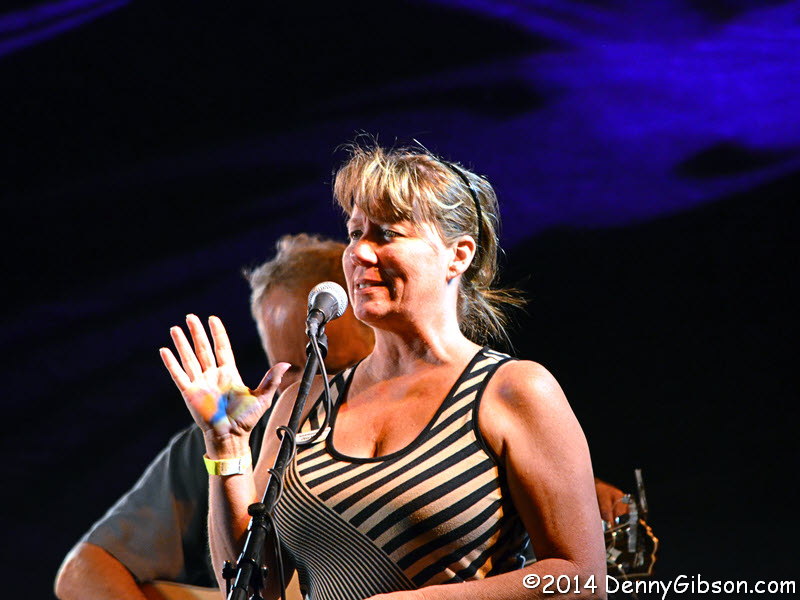
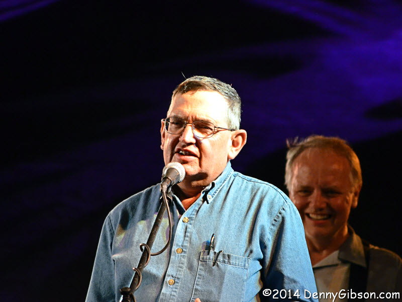
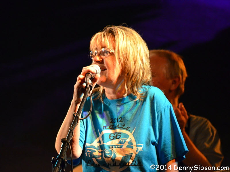
I did stay to the end, however, and saw this year's organizers (Kingman-pins?),
Dora Manley and Jim Hinckley, introduce Cheryl Eicher Jett who announced
that a Route 66 Conference would be held next year in conjunction with the
long running Edwardsville, Illinois, Halloween celebration. Note that this
is to be a conference, like what took place in the Mohave County
Board of Supervision Auditorium, and not a Route 66 festival.
Even though tonight's Road Crew
concert started later than last night's, it was well underway when I arrived.
I did stay to the end, however, and saw this year's organizers (Kingman-pins?),
Dora Manley and Jim Hinckley, introduce Cheryl Eicher Jett who announced
that a Route 66 Conference would be held next year in conjunction with the
long running Edwardsville, Illinois, Halloween celebration. Note that this
is to be a conference, like what took place in the Mohave County
Board of Supervision Auditorium, and not a Route 66 festival.
|
|
|
| [Prev] [Site Home] [Trip Home] [Contact] [Next] |