
|
Day 1: Sep 5, 2003 Ending a Great Day in a Wigwam |
Prev Next |
|
|
Day 1: Sep 5, 2003 Ending a Great Day in a Wigwam |
Prev Next |
|
|
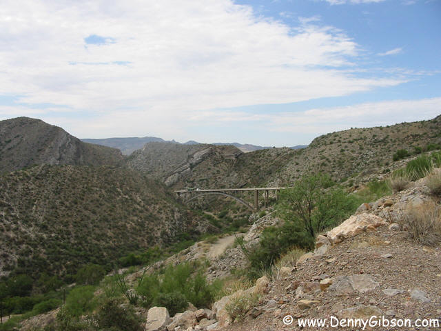
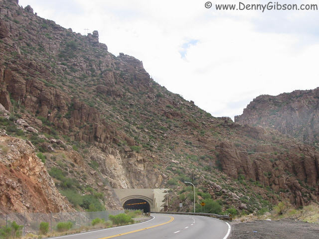
 I started the drive by dashing along I-10 to US-60. Sixty then took me
beyond the city clutter, and it didn't take long for scenic Arizona
to take over. I know that the Superstition Mountains filled the horizon
early on but my knowledge petered out quickly. This is the only tunnel
I encountered and the bridge picture was taken looking back from the
same stop.
I started the drive by dashing along I-10 to US-60. Sixty then took me
beyond the city clutter, and it didn't take long for scenic Arizona
to take over. I know that the Superstition Mountains filled the horizon
early on but my knowledge petered out quickly. This is the only tunnel
I encountered and the bridge picture was taken looking back from the
same stop.
|
|
|
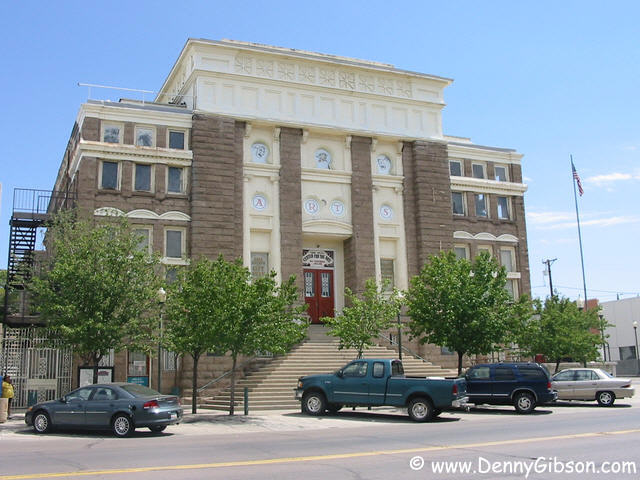
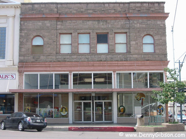
 I slipped a short distance from US-60 to visit the historic downtown
section of Globe. The town dates from the last half of the nineteenth
century but most historic buildings are from the early twentieth.
Earlier structures were either adobe or wood and real permanence came
when materials like brick and stone became available and popular. The
first picture is of the 1907 court house that now serves as an art
gallery. The Old Dominion Mercantile building has served a variety of
commercial purposes since being built in 1904. Its was most recently
home to a microbrewery but that was closed a few years back and the
building is now for sale. I'm guessing that the New Tonto Hotel was
new not all that long after the new court house and new mercantile.
I slipped a short distance from US-60 to visit the historic downtown
section of Globe. The town dates from the last half of the nineteenth
century but most historic buildings are from the early twentieth.
Earlier structures were either adobe or wood and real permanence came
when materials like brick and stone became available and popular. The
first picture is of the 1907 court house that now serves as an art
gallery. The Old Dominion Mercantile building has served a variety of
commercial purposes since being built in 1904. Its was most recently
home to a microbrewery but that was closed a few years back and the
building is now for sale. I'm guessing that the New Tonto Hotel was
new not all that long after the new court house and new mercantile.
|
|
|
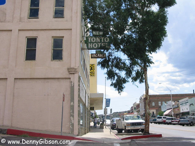
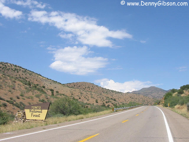 The hotel in Globe got its name, not from the Lone Ranger's buddy, but
from the national forest that surrounds it. You will no doubt notice
that the Tonto National Forest is much easier to see than many other
national forests. That is because, as we all know, sometimes the forest
cannot be seen for the trees and Tonto has clearly avoided that problem.
The hotel in Globe got its name, not from the Lone Ranger's buddy, but
from the national forest that surrounds it. You will no doubt notice
that the Tonto National Forest is much easier to see than many other
national forests. That is because, as we all know, sometimes the forest
cannot be seen for the trees and Tonto has clearly avoided that problem.
|
|
|
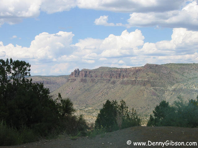
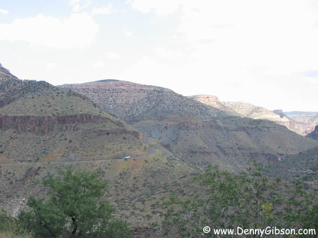
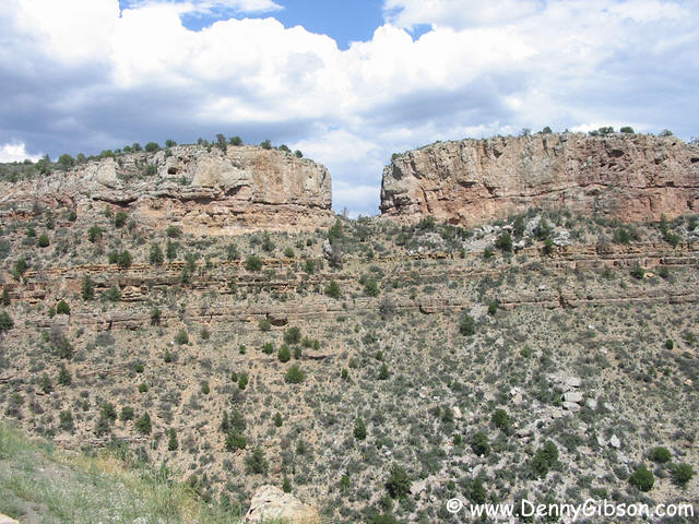
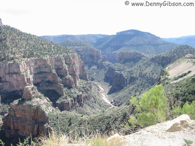
 These pictures were taken as I started down into Salt River Canyon.
Incredible views were everywhere. The second and third are from nearly
the same location. A white spot, that is actually a large tanker truck,
can be seen near the middle of the second picture. It is on the far side
of the valley heading left and will eventually disappear from view for
several minutes before reappearing climbing the grade shown in the third
picture.
These pictures were taken as I started down into Salt River Canyon.
Incredible views were everywhere. The second and third are from nearly
the same location. A white spot, that is actually a large tanker truck,
can be seen near the middle of the second picture. It is on the far side
of the valley heading left and will eventually disappear from view for
several minutes before reappearing climbing the grade shown in the third
picture.
|
|
|
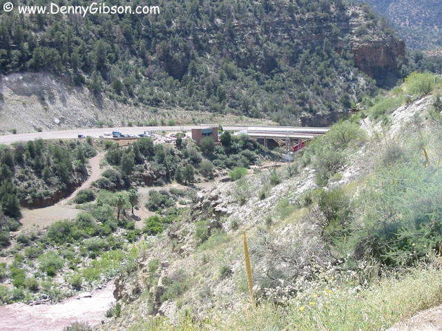
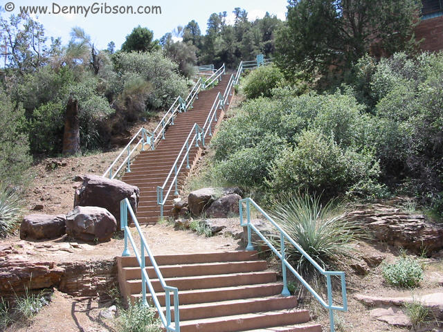
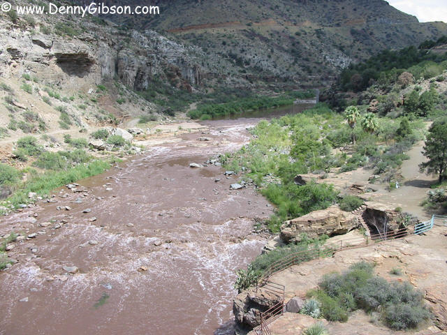
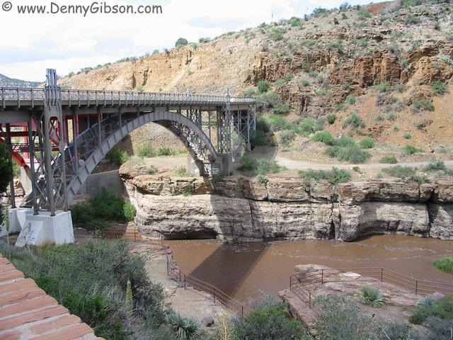 As expected, the Salt River is to be found at the bottom of the canyon.
The right hand bridge, built in the 1930s, is now closed to traffic but
provides a great place to view and photograph the river. A park area at
the bridge includes picnic tables, restrooms, and steps that lead
beneath the bridge and near the water's edge. A sign identifies this as
a "rest area" but, with a walk on the bridge and traversing
the steps, my stop was not all that restful.
As expected, the Salt River is to be found at the bottom of the canyon.
The right hand bridge, built in the 1930s, is now closed to traffic but
provides a great place to view and photograph the river. A park area at
the bridge includes picnic tables, restrooms, and steps that lead
beneath the bridge and near the water's edge. A sign identifies this as
a "rest area" but, with a walk on the bridge and traversing
the steps, my stop was not all that restful.
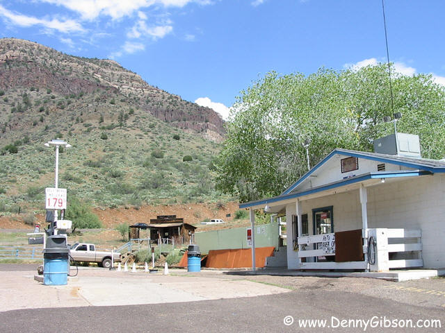
Just on the other side of the bridge, but completely hidden from view from the rest area, is a small store and gas station. Considering the location and the $2-plus prices in nearby "developed" areas, I thought gas prices were surprisingly reasonable. The last picture looks back at the bridge area after climbing a short distance up the east side. |
|
|
 This pull off, was actually marked with a "scenic view" sign.
It was certainly scenic but I couldn't help chuckling as I pondered just
what it took to qualify as the only labeled scenic view in this
incredible canyon. I tried to share my "humor" with a couple
who had already stopped but was met with, "Sorry, not much
English". It turned out not to be just a clever ploy to avoid being
subjected to bad jokes but we did manage to exchange origins (Germany,
France, Ohio - about 2000 miles) and the fact that each of us was there
for the first time.
This pull off, was actually marked with a "scenic view" sign.
It was certainly scenic but I couldn't help chuckling as I pondered just
what it took to qualify as the only labeled scenic view in this
incredible canyon. I tried to share my "humor" with a couple
who had already stopped but was met with, "Sorry, not much
English". It turned out not to be just a clever ploy to avoid being
subjected to bad jokes but we did manage to exchange origins (Germany,
France, Ohio - about 2000 miles) and the fact that each of us was there
for the first time.
|
|
|
 About a year ago, the town of Show Low received a lot more attention
than it wanted when a huge forest fire threatened the town. One room of
the museum is dedicated to that fire. Other museum displays include a
room on the life of local character Eb Lewis who rode around town on a
unicycle, made appearances in a self propelled washing machine, and had
a cannon of his own manufacture recoil through a wall of his shop. Both
Melanie, the museum's director, and volunteer Dr. Eaton seemed to know
their stuff and willingly answered questions and shared some local
stories. Not surprisingly, the most popular story involves a card game
and the winning of a large ranch by showing the low card (two of clubs)
and providing the town's name. There are a few different versions of the
story and it's possible (but not guaranteed) that one of them is true.
About a year ago, the town of Show Low received a lot more attention
than it wanted when a huge forest fire threatened the town. One room of
the museum is dedicated to that fire. Other museum displays include a
room on the life of local character Eb Lewis who rode around town on a
unicycle, made appearances in a self propelled washing machine, and had
a cannon of his own manufacture recoil through a wall of his shop. Both
Melanie, the museum's director, and volunteer Dr. Eaton seemed to know
their stuff and willingly answered questions and shared some local
stories. Not surprisingly, the most popular story involves a card game
and the winning of a large ranch by showing the low card (two of clubs)
and providing the town's name. There are a few different versions of the
story and it's possible (but not guaranteed) that one of them is true.
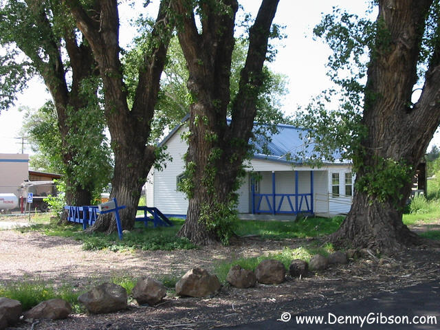
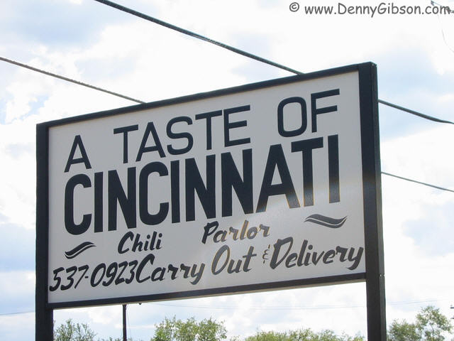
A fellow from Cincinnati could hardly pass up this large sign but the stop was a little disappointing. The blue trimmed building seemed to be connected with the sign but was empty. The blue paint looked fairly new but other aspects of the building gave a somewhat neglected impression. I don't know whether "A Taste of Cincinnati" is coming to Show Low, has been and gone, or was never more than a sign. |
|
|

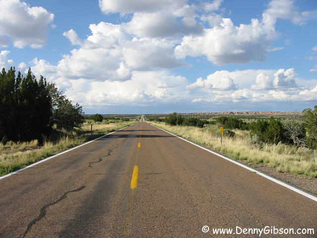
 After Show Low, the scenery never returned to the awesome level of Salt
River Canyon but was still great. The first picture is of something that
made me wonder whether it was natural or manmade. Even after studying it
in the comfort of my own wigwam, I'm not sure. There is plenty of
Arizona roadway that resembles the center photo. This picture is of a
stretch of 191 south of Sanders. At one point, a "Rough Road"
sign was posted and it was rough but in a smooth sort of way. Instead of
bone jarring potholes, the road seemed to have a wavy surface that had
the car sort of rocking like a boat. Maybe the boat like ride as more a
function of the car than the road. I realize that a Chrysler Sebring is
not a Lincoln Town Car but neither is it a Corvette with Z51 suspension.
After Show Low, the scenery never returned to the awesome level of Salt
River Canyon but was still great. The first picture is of something that
made me wonder whether it was natural or manmade. Even after studying it
in the comfort of my own wigwam, I'm not sure. There is plenty of
Arizona roadway that resembles the center photo. This picture is of a
stretch of 191 south of Sanders. At one point, a "Rough Road"
sign was posted and it was rough but in a smooth sort of way. Instead of
bone jarring potholes, the road seemed to have a wavy surface that had
the car sort of rocking like a boat. Maybe the boat like ride as more a
function of the car than the road. I realize that a Chrysler Sebring is
not a Lincoln Town Car but neither is it a Corvette with Z51 suspension.
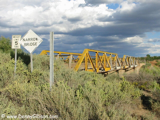
The bridge is right where 191 meets I-40. It's still in use but what its original use was (old 191 alignment?) I do not know. Not knowing what was on the other side, this was one bridge that I did not cross even after coming to it. ADDENDUM: Sep 25, 2005 - While leafing through a newly acquired copy of Jerry McClanahan's EZ66 Guide, I was surprised to see a line drawing of the bridge pictured here. I then learned that the bridge was built in 1923 and was part of the original US-66 route. |
|
|
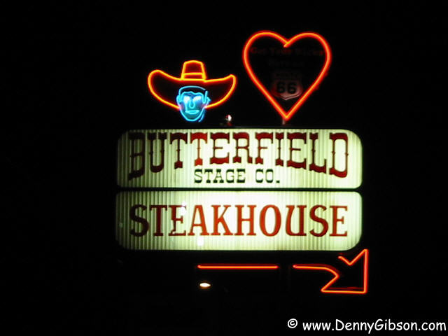

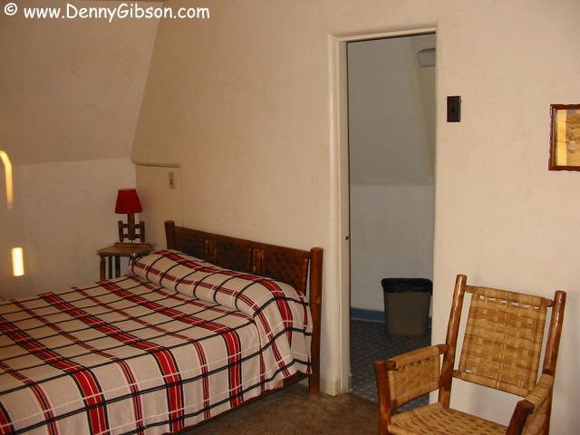
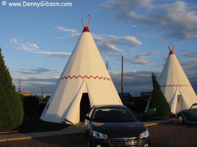 After taking several pictures here on other occasions, I finally get a
chance to spend the night. I'm sure the oddly shaped and somewhat dated
accommodations are not for everyone but I really enjoyed it. After I
walked to and from dinner at the Butterfield Stage Company, John let me
check email with the office phone and I hung around a bit longer just
chatting. I believe there was a high school football game in progress
just behind the buildings across the street and sky rockets were
periodically launched from that vicinity. My theory was that the rockets
signaled a home team score. When I once heard the announcer shout
"touchdown" and a rocket immediately followed, I figured my
theory was proven. I have no alternative theory but, if the "home
score" idea holds, the home team must have trounced someone
soundly. In addition to the game sounds, fairly frequent trains passing
just behind the motel brought a sound that I hadn't heard in a long
time. But, inside a concrete wigwam, the trains can barely be heard and
the rockets sound like nothing but a knock on the door (I opened it for
the first one:-).
After taking several pictures here on other occasions, I finally get a
chance to spend the night. I'm sure the oddly shaped and somewhat dated
accommodations are not for everyone but I really enjoyed it. After I
walked to and from dinner at the Butterfield Stage Company, John let me
check email with the office phone and I hung around a bit longer just
chatting. I believe there was a high school football game in progress
just behind the buildings across the street and sky rockets were
periodically launched from that vicinity. My theory was that the rockets
signaled a home team score. When I once heard the announcer shout
"touchdown" and a rocket immediately followed, I figured my
theory was proven. I have no alternative theory but, if the "home
score" idea holds, the home team must have trounced someone
soundly. In addition to the game sounds, fairly frequent trains passing
just behind the motel brought a sound that I hadn't heard in a long
time. But, inside a concrete wigwam, the trains can barely be heard and
the rockets sound like nothing but a knock on the door (I opened it for
the first one:-).
Oh, I almost forgot. At some point during the check-in, unload, take pictures, and look for rockets process, I noticed the European couple from the canyon looking at the Wigwam from the sidewalk. Mostly through their efforts (their broken English was much better than my broken German) we managed to communicate a few things. They were staying next door and found the bunch of white tee-pees "interesting". I understood one question to be about whether or not there was water inside. I'm not sure if they thought they had stumbled on a huge collection of water closets or if I was way off base. I satisfied their curiosity by showing them around the wigwam's interior and I do believe I got through that the motel was about 50 years old. |
|
|