A Little Damp
Prev
Next


|
Day 6, October 12, 2011 A Little Damp |
Prev Next |
|
|
|
 If the Triangle Diner had been open, I probably would have stayed the
night in Winchester. As it was, I drove on but was soon having second
thoughts about it. I would be driving in the dark before long and there
were no big towns full of motels in my immediate path. I considered
turning back but am sure glad I didn't. If I had, I would have missed out
on the Koolwink
Motel.
If the Triangle Diner had been open, I probably would have stayed the
night in Winchester. As it was, I drove on but was soon having second
thoughts about it. I would be driving in the dark before long and there
were no big towns full of motels in my immediate path. I considered
turning back but am sure glad I didn't. If I had, I would have missed out
on the Koolwink
Motel.
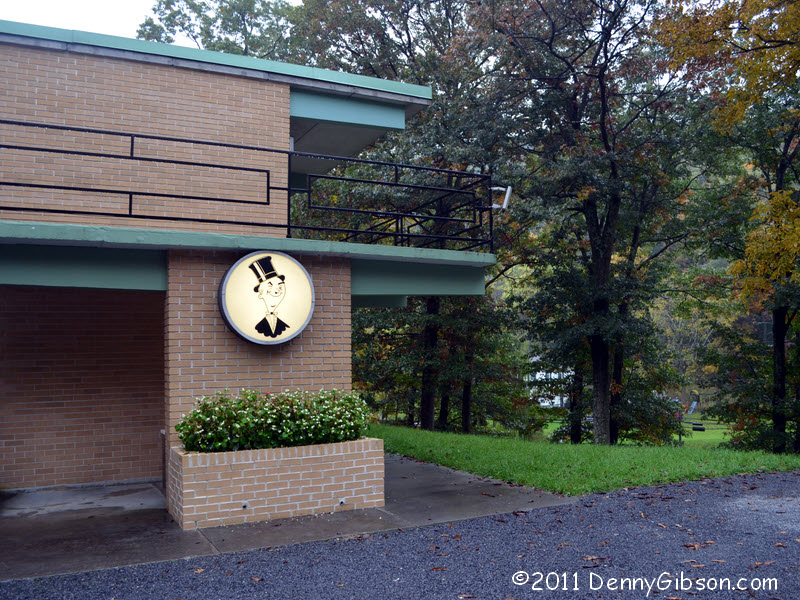
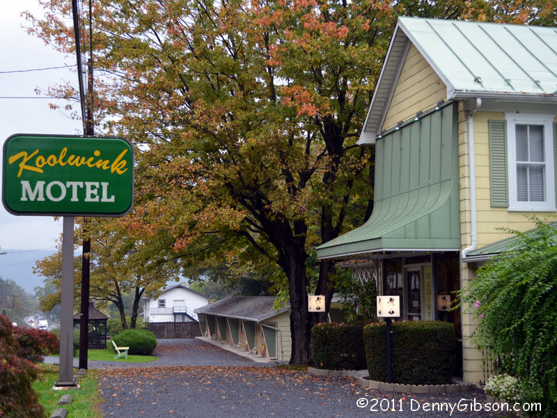
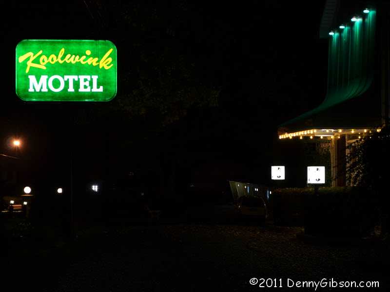
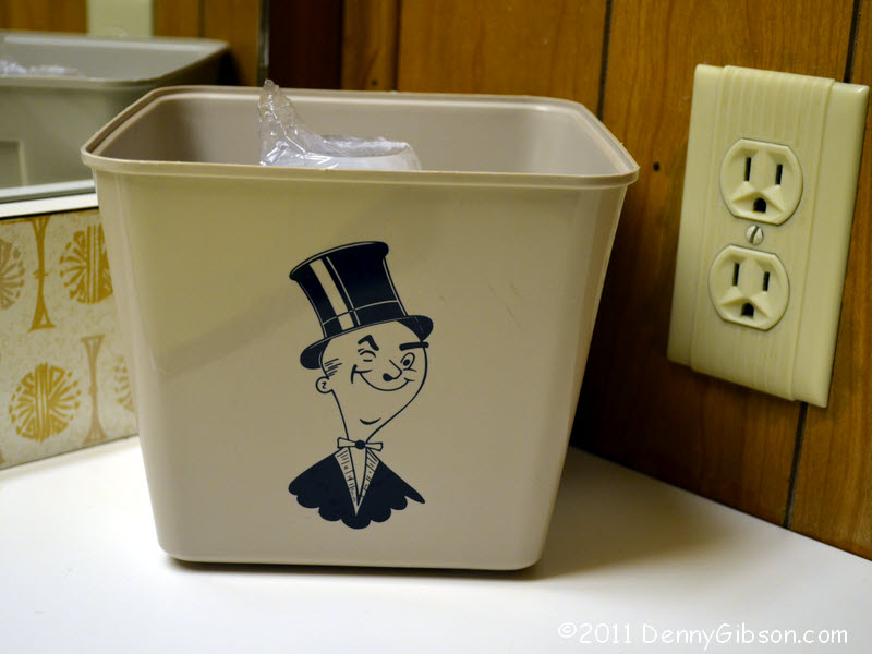
I pulled in a little beyond the sign and walked back to the office. On the way I passed three men chatting on chairs in front of their rooms and asked if this was a good place to stay. The responses were positive and enthusiastic. For about $60, I soon had my own room although it was in another building up on the hillside. The room was huge. It was also very clean, nicely furnished, and even had a couple of frills. The free Wi-Fi was some of the best I've experienced and there was a microwave, a mini-fridge, and a coffee maker. Cups and coffee weren't just laying on the counter. They were in a neat little wall mounted rack that also contained cookies. That's a frill. The mints by the TV were another. Apparently the winking guy in a top hat who appears on the mints is the motel's logo. He appears in lots of places including the ice bucket. This is a classy and classic family operation. Good thing I didn't stop in Winchester. |
|
|
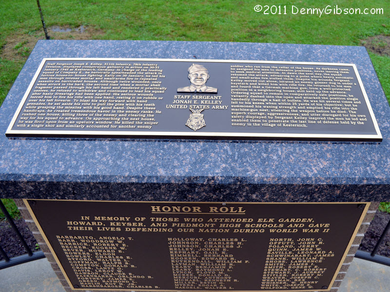 This place is about five miles off of US-50. I drove to it because of a
very slim connection. My Dad served in the 78th "Lightning"
Division in World War II. Only one member of the division was awarded the
Congressional Medal of Honor. His name was Jonah Kelley and he was from
Keyser, West Virginia. For many years, members of the 78th have recognized
a Keyser High School senior who exemplifies the values that Jonah Kelley
demonstrated in West Virginia and in Europe.
This place is about five miles off of US-50. I drove to it because of a
very slim connection. My Dad served in the 78th "Lightning"
Division in World War II. Only one member of the division was awarded the
Congressional Medal of Honor. His name was Jonah Kelley and he was from
Keyser, West Virginia. For many years, members of the 78th have recognized
a Keyser High School senior who exemplifies the values that Jonah Kelley
demonstrated in West Virginia and in Europe.
I have read several reports of the annual Kelley Award Ceremony in Keyser. I've driven Route 50 through here a couple of times in the last few years though those drives were west to east. Maybe the signs aren't as noticeable in that direction or maybe I wasn't paying attention or just didn't make the connection. Today when I saw a sign pointing to Keyser I immediately checked the distance then immediately headed that way. As I said, my connection with Keyser is slim and so is my explanation. But I'm very glad I took a look. |
|
|

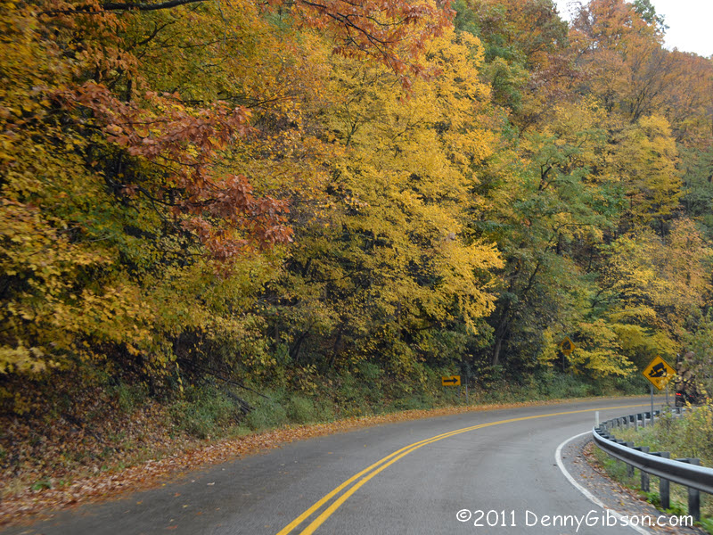
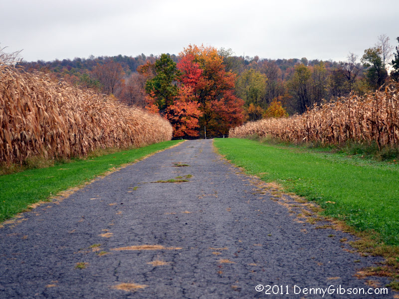
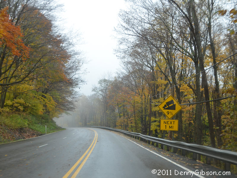
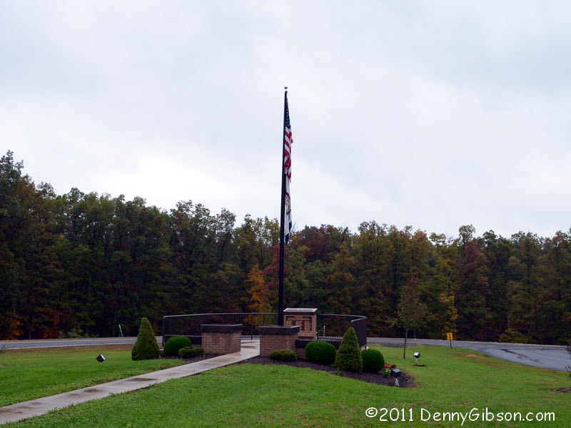
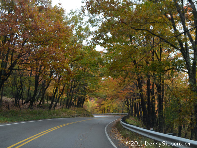
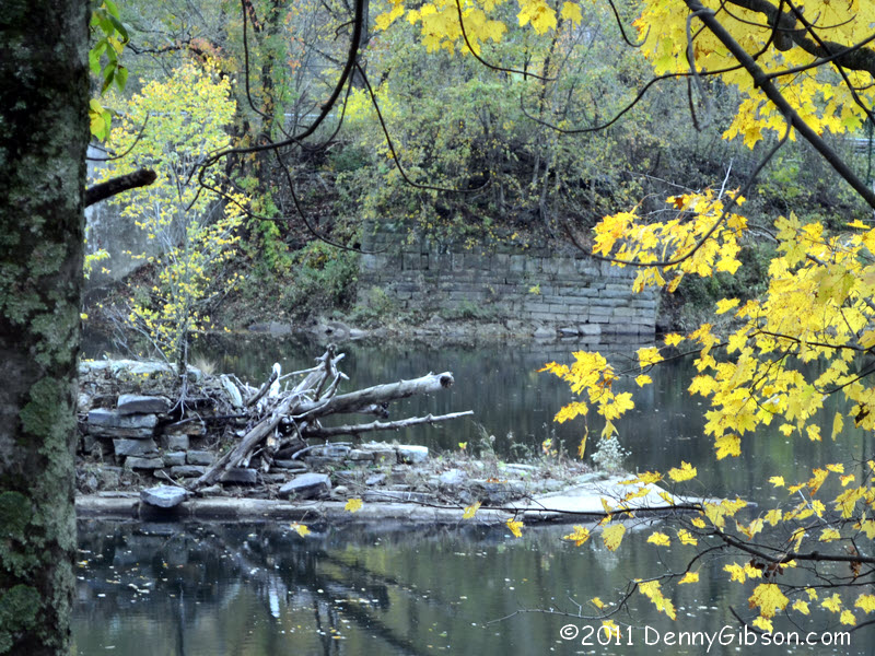
 Rain moved in overnight and continued sporadically. The rain was never
very heavy but the fog sometimes was. Neither left completely until late
in the day and the skies stayed gray even then. The middle picture
obviously isn't of US-50. It's just something down a side road that caught
my eye enough to make me pull over.
Rain moved in overnight and continued sporadically. The rain was never
very heavy but the fog sometimes was. Neither left completely until late
in the day and the skies stayed gray even then. The middle picture
obviously isn't of US-50. It's just something down a side road that caught
my eye enough to make me pull over.
|
|
|
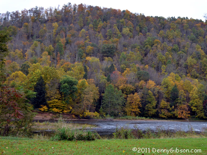
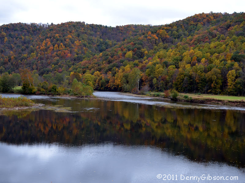
 I also pulled over at the Cheat River. The last two pictures were taken
from the US-50 bridge over the Cheat. Like most of today's pictures,
they'd look a whole lot better with a little sunshine.
I also pulled over at the Cheat River. The last two pictures were taken
from the US-50 bridge over the Cheat. Like most of today's pictures,
they'd look a whole lot better with a little sunshine.
|
|
|
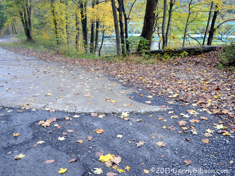

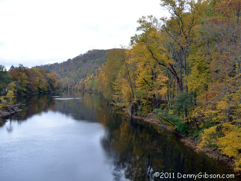
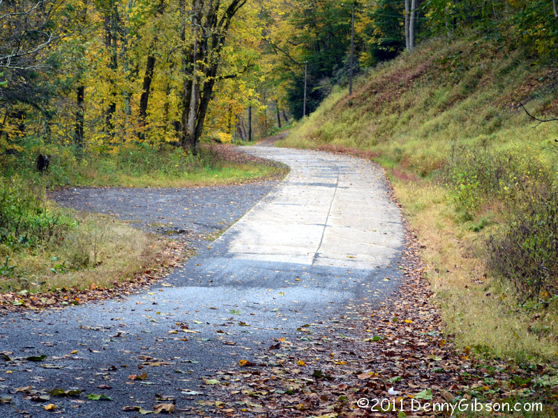 The spot where I stopped at the west end of the bridge was really a very
wide entrance to a very narrow road. Once I was out of the car, I could
see that the road appeared to turn to concrete at a little distance from
Fifty. The concrete, with its seam down the middle, looked like something
from the 1920s or '30s. After taking my bridge pictures, I drove down to
the concrete and had myself a "Wow!". The road curved then ended
at the river's edge atop the remains of a stone bridge. The east side
abutment and bits of what may have been a center support can be made out
here. The third picture is from the south side
showing the curve of the concrete and the current US-50 bridge in the
background. BridgeHunter.com says that the current bridge was
built in 1932 so it seems reasonable to think that this was US-50 for a
half-dozen years. Curiously, DeLorme tags the current bridge "Cheat
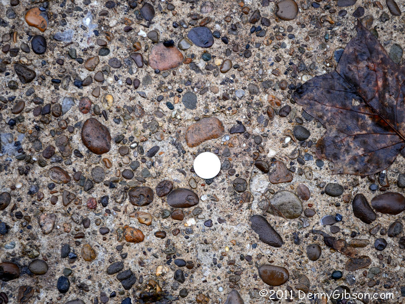
River Covered Bridge". A few months ago, some fellows over at the
American Road Magazine Forum were talking about
dating pavement by stone size. The picture with the
quarter is for their benefit.
The spot where I stopped at the west end of the bridge was really a very
wide entrance to a very narrow road. Once I was out of the car, I could
see that the road appeared to turn to concrete at a little distance from
Fifty. The concrete, with its seam down the middle, looked like something
from the 1920s or '30s. After taking my bridge pictures, I drove down to
the concrete and had myself a "Wow!". The road curved then ended
at the river's edge atop the remains of a stone bridge. The east side
abutment and bits of what may have been a center support can be made out
here. The third picture is from the south side
showing the curve of the concrete and the current US-50 bridge in the
background. BridgeHunter.com says that the current bridge was
built in 1932 so it seems reasonable to think that this was US-50 for a
half-dozen years. Curiously, DeLorme tags the current bridge "Cheat
River Covered Bridge". A few months ago, some fellows over at the
American Road Magazine Forum were talking about
dating pavement by stone size. The picture with the
quarter is for their benefit.
|
|
|
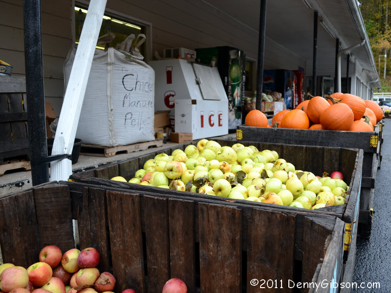
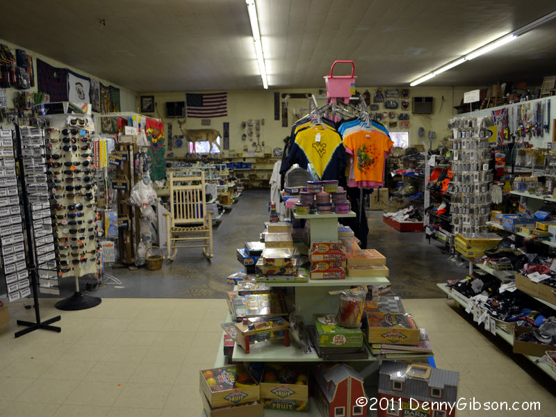
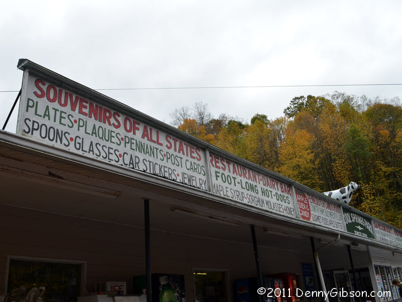 The if-we-ain't-got-it-you-don't-need-it Cool Springs Park is about a mile
and a half west of the Cheat crossing. I've posted pictures of it before
but this time there were bins of apples and pumpkins out front and I've
somehow failed to notice the "SOUVENIRS OF ALL STATES" part of
the long sign. Seems like that could really cut down on travel time and
expenses.
The if-we-ain't-got-it-you-don't-need-it Cool Springs Park is about a mile
and a half west of the Cheat crossing. I've posted pictures of it before
but this time there were bins of apples and pumpkins out front and I've
somehow failed to notice the "SOUVENIRS OF ALL STATES" part of
the long sign. Seems like that could really cut down on travel time and
expenses.
|
|
|
 The next few miles of US-50 are some of the curviest you'll find but the
two-lane is gone within forty miles. I ended my day at Parkersburg.
The next few miles of US-50 are some of the curviest you'll find but the
two-lane is gone within forty miles. I ended my day at Parkersburg.
|
|
|
| [Prev] [Site Home] [Trip Home] [Contact] [Next] |