Back in Ohio
Prev
Next


|
Day 13: May 2, 2012 Back in Ohio |
Prev Next |
|
|
|
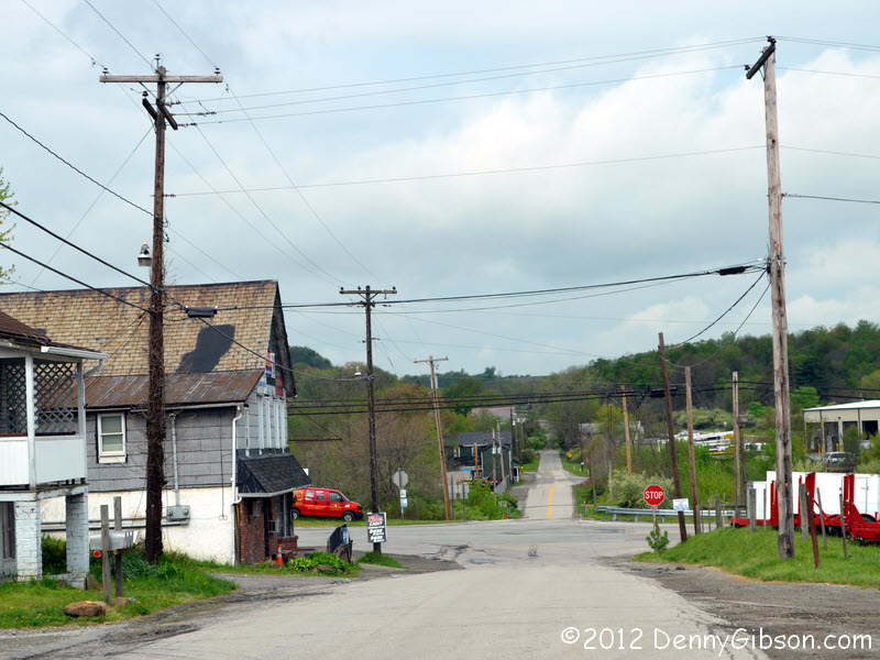

 In stumbling around the internet preparing for this trip I found a couple
of videos on old sections of US-22 posted by a fellow named
"theqman1956". The one
here is of the road east of Speal's Tavern where I
ended yesterday's journal. I had planned to drive it then stop at the
tavern but it just didn't work out that way. The first picture is where a
bridge once carried US-22 over Loyalhanna Creek. Next is the unattached
Pennsylvania Rail Road overpass with the original intersection of US-119
and US-22 beyond then a picture of the intersection itself. US-119 heads
off to the left. US-22 continues to the right and past Speal's Tavern as
shown in the last picture. The roads were abandoned in 1948 when the
building of the Loyalhanna Dam meant this area was part of the flood
plain. There is more good information in the video and, for those
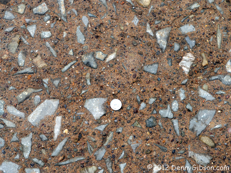
subscribing to the "bigger is older" theory of rocks in
pavement, here's a quarter for your thoughts.
In stumbling around the internet preparing for this trip I found a couple
of videos on old sections of US-22 posted by a fellow named
"theqman1956". The one
here is of the road east of Speal's Tavern where I
ended yesterday's journal. I had planned to drive it then stop at the
tavern but it just didn't work out that way. The first picture is where a
bridge once carried US-22 over Loyalhanna Creek. Next is the unattached
Pennsylvania Rail Road overpass with the original intersection of US-119
and US-22 beyond then a picture of the intersection itself. US-119 heads
off to the left. US-22 continues to the right and past Speal's Tavern as
shown in the last picture. The roads were abandoned in 1948 when the
building of the Loyalhanna Dam meant this area was part of the flood
plain. There is more good information in the video and, for those
subscribing to the "bigger is older" theory of rocks in
pavement, here's a quarter for your thoughts.
|
|
|
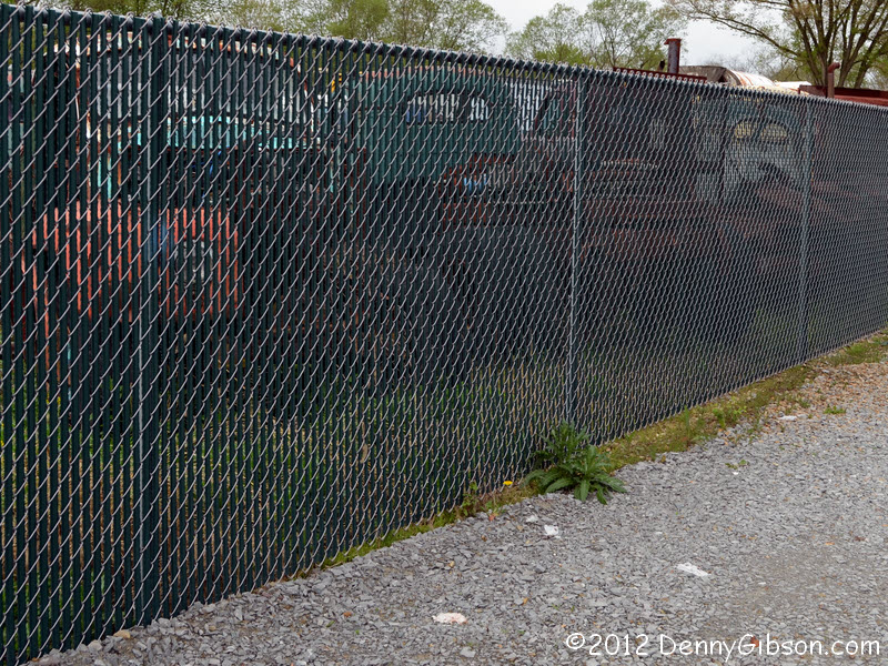
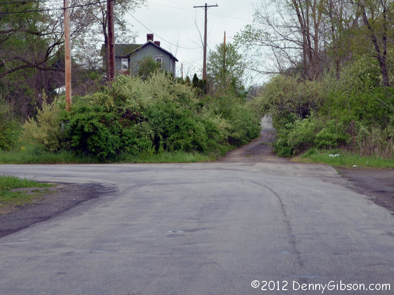

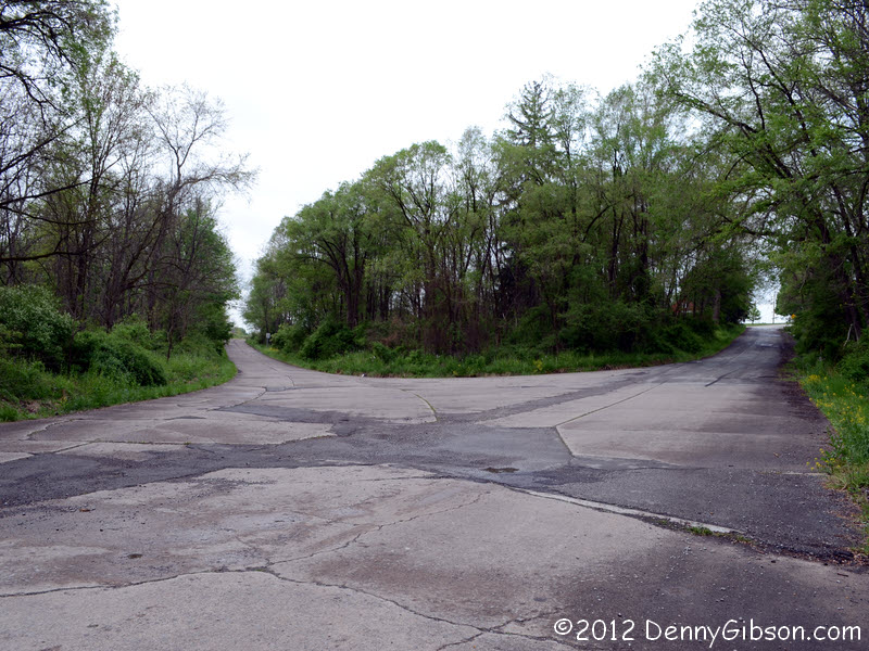
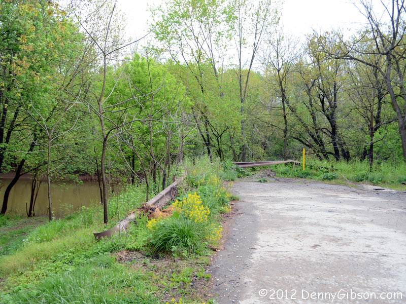
 These pictures are a little jumbled geographically but I think I can
explain them. The first pair is from the section of road visible just
beyond the current US-119 in the last photo of the previous panel. It was
also, presumedly, once US-22. The junk yard by the side of the road is
behind a slatted chain link fence but, at just the right angle, a
collection of interesting looking old trucks is visible. My assumption is
that the gravel path that goes straight when the pavement turn leads to
the current US-22 but I didn't check it out.
These pictures are a little jumbled geographically but I think I can
explain them. The first pair is from the section of road visible just
beyond the current US-119 in the last photo of the previous panel. It was
also, presumedly, once US-22. The junk yard by the side of the road is
behind a slatted chain link fence but, at just the right angle, a
collection of interesting looking old trucks is visible. My assumption is
that the gravel path that goes straight when the pavement turn leads to
the current US-22 but I didn't check it out.
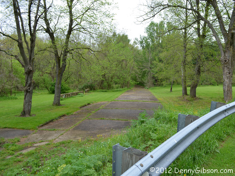
The second pair of pictures, like the first, face west but were taken a bit to the east in the town of New Alexandria. The first of the pair is essentially entering the town from the east. It can only be reached from eastbound US-22 or from the center of town as I did. Following the road through town, which I did in the reverse direction, leads to what is almost certainly a remnant of old US-22 that reached the bridge. DeLorme Street Atlas 2011 gets a big black mark here since it actually allows routing along the old alignment across a bridge that was removed in the 1970s and unused for a couple of decades before that. |
|
|
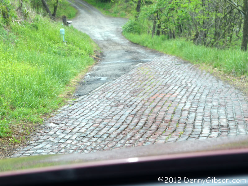
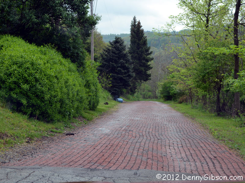 I learned of this brick section at the west edge of Murrysville,
Pennsylvania, through another of "theqman1956"'s videos. It's
here. Contrary to his experience of being chased off,
near the far end of the brick section, I received a smile and a wave from
an attractive lady getting her mail. Your mileage may vary.
I learned of this brick section at the west edge of Murrysville,
Pennsylvania, through another of "theqman1956"'s videos. It's
here. Contrary to his experience of being chased off,
near the far end of the brick section, I received a smile and a wave from
an attractive lady getting her mail. Your mileage may vary.
|
|
|
 Ohio, I'm coming home. Those seven other states meant nothing to me.
Really.
Ohio, I'm coming home. Those seven other states meant nothing to me.
Really.
|
|
|

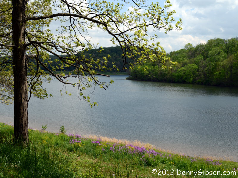
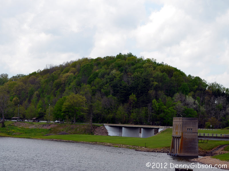
 The first picture is looking across the dam at
Piedmont Lake and the second is from atop the dam
looking back at the spillway and a small park next to it. I walked around
the park a bit then struck up a conversation with a fellow relaxing in one
of the shelters. He told me a story.
The first picture is looking across the dam at
Piedmont Lake and the second is from atop the dam
looking back at the spillway and a small park next to it. I walked around
the park a bit then struck up a conversation with a fellow relaxing in one
of the shelters. He told me a story.
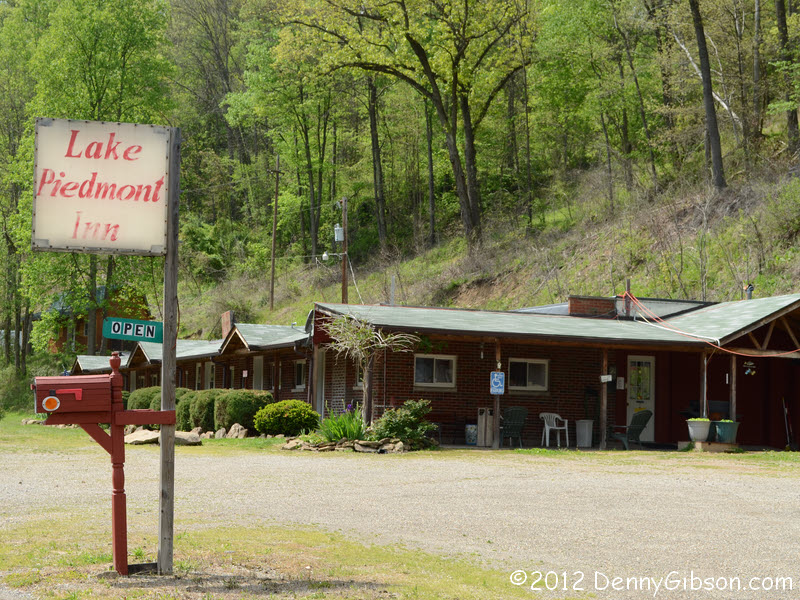
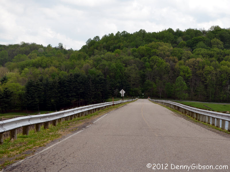
He graduated in 1959 with his class ring intact despite "loaning" to a couple of girls during that senior year. He joined the army and came back with the ring still safely in his possession but, a short time later, while showing off for a fisherman's daughter at the lake, a football pass from a friend knocked the ring from his finger. It went into the water and searches, including some dives, turned up nothing. That was in 1963. In 1985 he got a phone call. The caller had a 1959 class ring with initials that matched just four people. She had already spoken with the other three and all knew exactly where there rings were. It must be his. "No, he told her, I know exactly where my ring is, too. It's at the bottom of Piedmont Lake." But, yes, it was his. She had found the ring in the rocks near the spillway. She sent him the ring and, in gratitude, he sent her a $25 check. (The ring originally cost $35.) The check has never been cashed but he makes sure there is always enough money in the account just in case. Always has. Always will. I thought the Lake Piedmont Inn looked promising and would have checked it out closer had I been ready to stop for the day. It's right across from the lake. The last picture was taken several miles from Lake Piedmont. It's included to show that the road can be kind of pretty in these parts. |
|
|
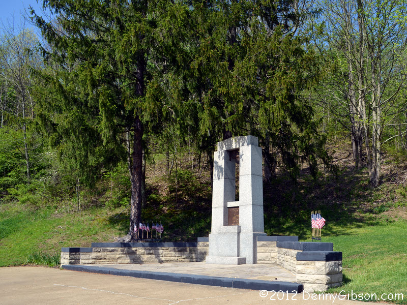
 I've long planned on visiting the
USS Shenandoah crash site when I was in the
area with a little time and today was the day. It seems I've known about
the crash forever. The ship's captain, Zachary Lansdowne, was from my home
county. His home is still there, identified by a small plaque, and the
local museum has a display on Lansdowne and the disaster. Over the years
it has gradually sunk in just how big an event this was. This was the
first rigid airship to be constructed in the US. It was the first to use
helium; The first to be moored to a floating mast. Pretty historic stuff.
It had been a long time since I'd read the
Roadside America article on the memorial and had
forgotten about the crash site marker and the museum in a trailer it
describes. I didn't make it to the south side of town so can't say whether
the trailer is still there or not. I clearly need to do this again.
I've long planned on visiting the
USS Shenandoah crash site when I was in the
area with a little time and today was the day. It seems I've known about
the crash forever. The ship's captain, Zachary Lansdowne, was from my home
county. His home is still there, identified by a small plaque, and the
local museum has a display on Lansdowne and the disaster. Over the years
it has gradually sunk in just how big an event this was. This was the
first rigid airship to be constructed in the US. It was the first to use
helium; The first to be moored to a floating mast. Pretty historic stuff.
It had been a long time since I'd read the
Roadside America article on the memorial and had
forgotten about the crash site marker and the museum in a trailer it
describes. I didn't make it to the south side of town so can't say whether
the trailer is still there or not. I clearly need to do this again.
|
|
|

 The first picture is at the east edge of Cambridge, Ohio, where US-22 and
US-40 hookup, and the second is in the middle of Zanesville where they
unhook. (Or vice versa if you're going the other way.) Between those two
points are brick
segments and a couple S-bridges that once carried both Forty and Twenty-Two.
US-40 and the
National Road are pretty much the same thing in this area and I've pictured
the brick and the bridges in National Road related outings. I'll not do
it today.
The first picture is at the east edge of Cambridge, Ohio, where US-22 and
US-40 hookup, and the second is in the middle of Zanesville where they
unhook. (Or vice versa if you're going the other way.) Between those two
points are brick
segments and a couple S-bridges that once carried both Forty and Twenty-Two.
US-40 and the
National Road are pretty much the same thing in this area and I've pictured
the brick and the bridges in National Road related outings. I'll not do
it today.
|
|
|
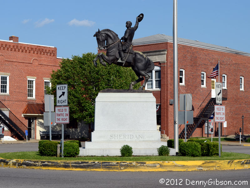
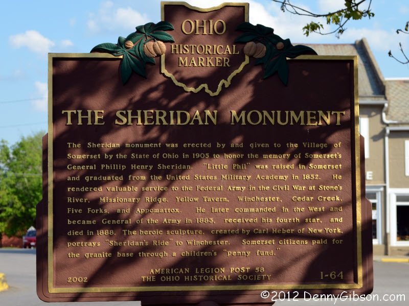 In a trip that
followed Zane's Trace, I mentioned that it passed though the home
towns of two famous Civil War generals, William Sherman and Phil Sheridan.
Since US-22 follows the path of Zane's Trace between Zanesville and a
point south of Lancaster, I suppose I could omit mentioning it again. But
that trip was a long time ago so here are some fresh pictures of the
Sheridan statue in Somerset, Ohio.
In a trip that
followed Zane's Trace, I mentioned that it passed though the home
towns of two famous Civil War generals, William Sherman and Phil Sheridan.
Since US-22 follows the path of Zane's Trace between Zanesville and a
point south of Lancaster, I suppose I could omit mentioning it again. But
that trip was a long time ago so here are some fresh pictures of the
Sheridan statue in Somerset, Ohio.
|
|
|
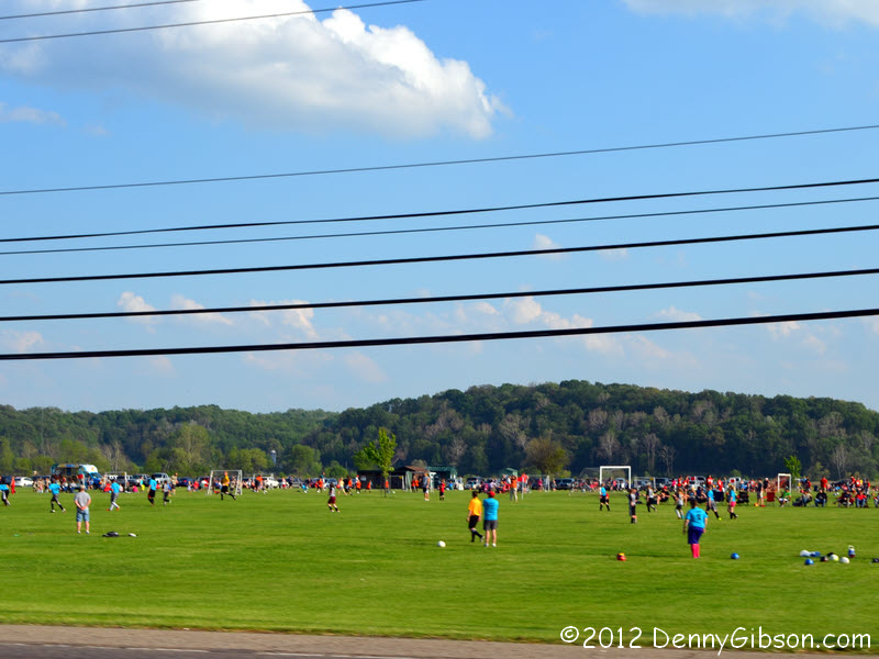
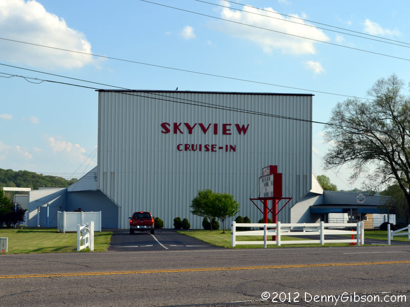 After taking this picture of the Skyview Drive-In at the east edge of Lancaster, I
learned that is has just become the first drive-in theater in Ohio to
convert to digital. It's been going since 1948 with the 2012 season
starting on the first weekend of April. The multiple fields filled with
soccer playing kids was just down the road from the drive-in and I thought
it made a fun picture despite the big black cables marring the blue sky.
After taking this picture of the Skyview Drive-In at the east edge of Lancaster, I
learned that is has just become the first drive-in theater in Ohio to
convert to digital. It's been going since 1948 with the 2012 season
starting on the first weekend of April. The multiple fields filled with
soccer playing kids was just down the road from the drive-in and I thought
it made a fun picture despite the big black cables marring the blue sky.
|
|
|
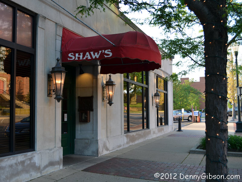


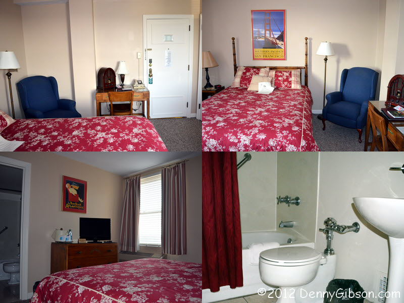
 This is where I ate and slept in Lancaster. The buildings dates from 1941
when it was the Lancaster Hotel. It became
Shaw's Restaurant &
Inn in 1989 when it was renovated and the restaurant moved in. The other
pictures are from nearby. The park, with a statue of
General Sherman, is right next door. Sherman's home is about a block
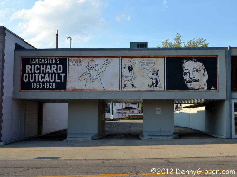
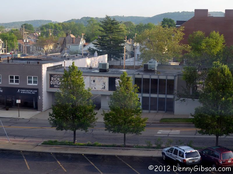
away. The Richard Outcault mural is just across the parking lot. It was
visible from my room.
This is where I ate and slept in Lancaster. The buildings dates from 1941
when it was the Lancaster Hotel. It became
Shaw's Restaurant &
Inn in 1989 when it was renovated and the restaurant moved in. The other
pictures are from nearby. The park, with a statue of
General Sherman, is right next door. Sherman's home is about a block
away. The Richard Outcault mural is just across the parking lot. It was
visible from my room.
My room was classy, comfortable, and, at about seventy dollars, a bargain. It's one of the smaller and lower priced rooms they call "Corporate" but even the larger rooms and suites are priced reasonably. Breakfast is included. Dinner isn't but mine was superb and also reasonably priced. |
|
|
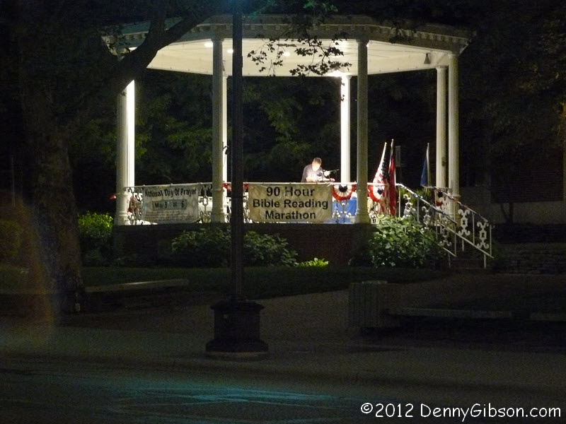
 I took a short walk after dinner and stopped at the Minute Bar (unreadable
glowing green circle) for one more beer. Then I walked back past the Bible
Reading Marathon across the street and headed upstairs to bed.
I took a short walk after dinner and stopped at the Minute Bar (unreadable
glowing green circle) for one more beer. Then I walked back past the Bible
Reading Marathon across the street and headed upstairs to bed.
|
|
|
| [Prev] [Site Home] [Trip Home] [Contact] [Next] |