A Little More Rain
Prev
Next


|
Day 3: September 13, 2008 A Little More Rain |
Prev Next |
|
|
|
 Anthony Wayne was my childhood hero. My first, I think. His name is big
around Greenville, Ohio, near where I grew up on a road that once was
signed as the Anthony Wayne Parkway. Summers weren't complete until I had
talked my parents into a fifteen-mile "road trip" to Fort
Recovery; the site of a Wayne victory. I knew that Legionville, where
Wayne first organized the troops that would eventually reach Fort
Greenville, was near here. With precipitation at about mist level, I
thought I'd backtrack a bit and see what I might have missed in the rain.
Anthony Wayne was my childhood hero. My first, I think. His name is big
around Greenville, Ohio, near where I grew up on a road that once was
signed as the Anthony Wayne Parkway. Summers weren't complete until I had
talked my parents into a fifteen-mile "road trip" to Fort
Recovery; the site of a Wayne victory. I knew that Legionville, where
Wayne first organized the troops that would eventually reach Fort
Greenville, was near here. With precipitation at about mist level, I
thought I'd backtrack a bit and see what I might have missed in the rain.
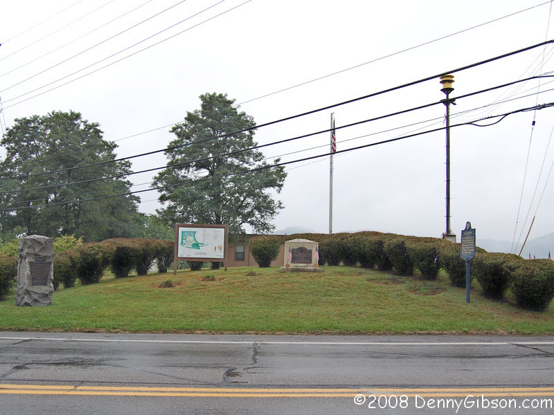
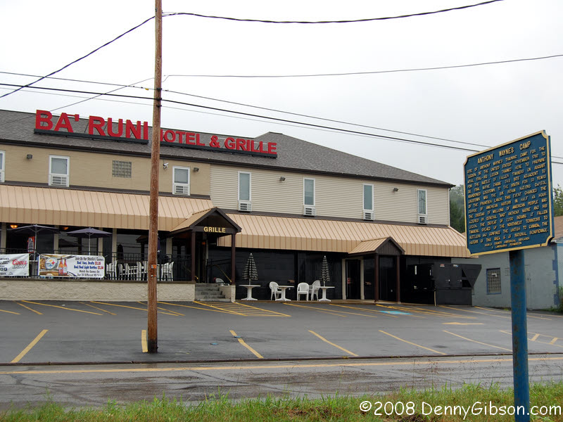
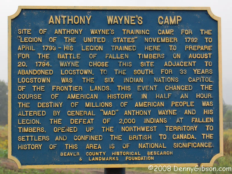
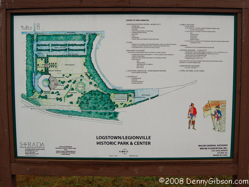
I didn't have to drive far. As I pulled from the motel lot I noticed an historical marker right across the street. I caught the words "Anthony Wayne's Camp" at the top and turned back to check it out. According to the sign, this is where the "Legion of the United States of America", the beginnings of the nation's military, started. Down the road a couple of hundred yards, a group of markers also claim to be at the site of Legionville so maybe I didn't camp exactly where Wayne did but I was close. The white sign describes a planned Legionville Historic Park & Center but it's dated 2002 and there is no sign of progress. |
|
|
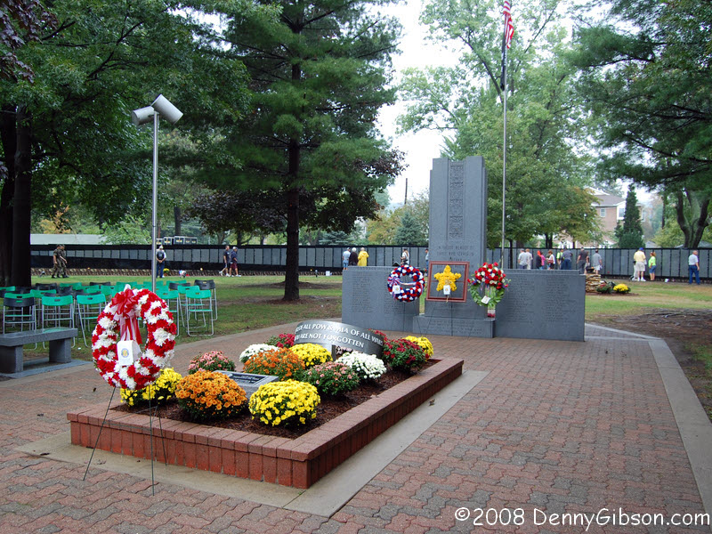
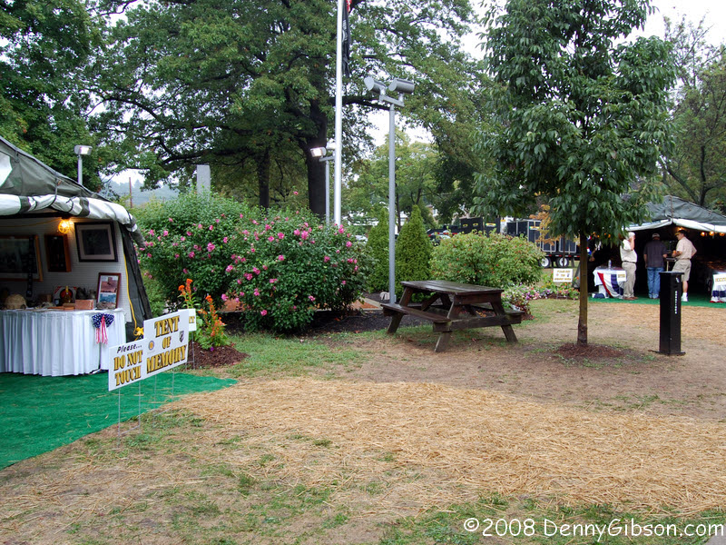
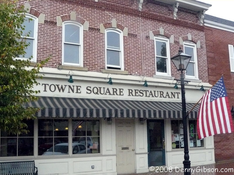
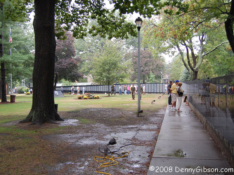 In the town of Beaver, I had breakfast at the Town
Square Restaurant and can definitely recommend it. The traveling
version of the Vietnam War Memorial was set up in the town park. The
moving wall is
about half the size of the one in Washington but its length is still
impressive - and moving. A "Tent of Memory" and a "Tent of
Valor" stood at one end. The "Tent of Valor" (not visible
in the thumbnail) contains photographs of local soldiers whose names are
on the wall. There is also a guest book for each of them. The "Tent
of Memory" is a small museum with items selected with the wall's
current location in mind. I have sought out a
classmate's name on the wall in Washington and I
did the same today. Kudos to the veterans who bring the wall to people who
might never experience it otherwise.
In the town of Beaver, I had breakfast at the Town
Square Restaurant and can definitely recommend it. The traveling
version of the Vietnam War Memorial was set up in the town park. The
moving wall is
about half the size of the one in Washington but its length is still
impressive - and moving. A "Tent of Memory" and a "Tent of
Valor" stood at one end. The "Tent of Valor" (not visible
in the thumbnail) contains photographs of local soldiers whose names are
on the wall. There is also a guest book for each of them. The "Tent
of Memory" is a small museum with items selected with the wall's
current location in mind. I have sought out a
classmate's name on the wall in Washington and I
did the same today. Kudos to the veterans who bring the wall to people who
might never experience it otherwise.
|
|
|
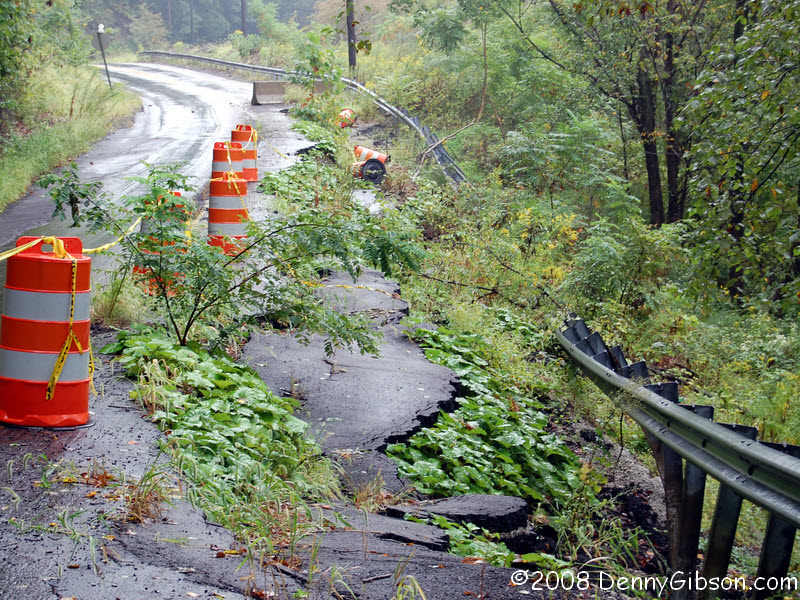

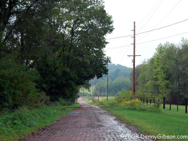
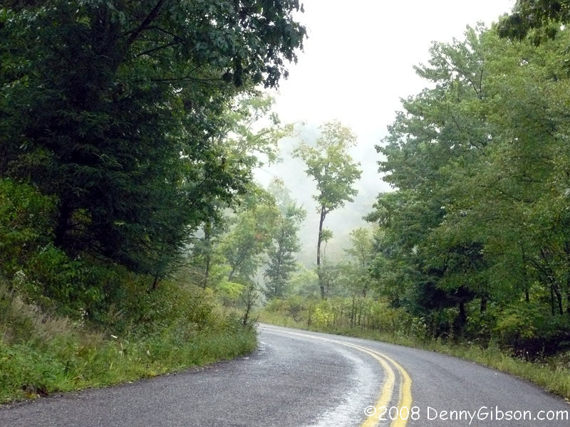 The Lincoln Highway followed a ridge away from the river then headed back
on what is today called Smith's Ferry Road. A very pleasant drive despite
the somewhat eerie mist filled valleys. When I saw the "ONE LANE ROAD
AHEAD" sign, I thought it was a minor error and was really talking
about a one lane bridge. There are many old bridges that have never been
widened to modern standards and that's what I expected to see. But the
sign was right. The west side of the road had collapsed and had done it
long enough ago that a small tree is growing amid the broken pavement.
The Lincoln Highway followed a ridge away from the river then headed back
on what is today called Smith's Ferry Road. A very pleasant drive despite
the somewhat eerie mist filled valleys. When I saw the "ONE LANE ROAD
AHEAD" sign, I thought it was a minor error and was really talking
about a one lane bridge. There are many old bridges that have never been
widened to modern standards and that's what I expected to see. But the
sign was right. The west side of the road had collapsed and had done it
long enough ago that a small tree is growing amid the broken pavement.
|
|
|
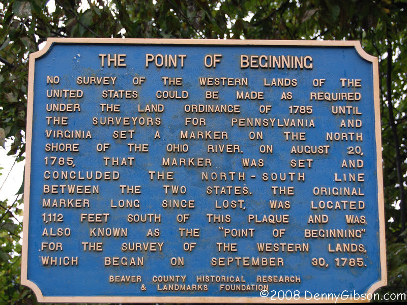
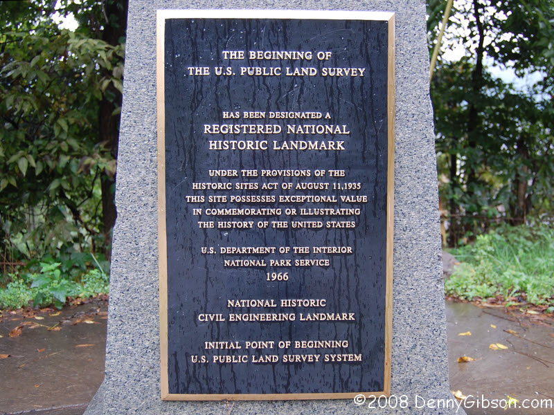
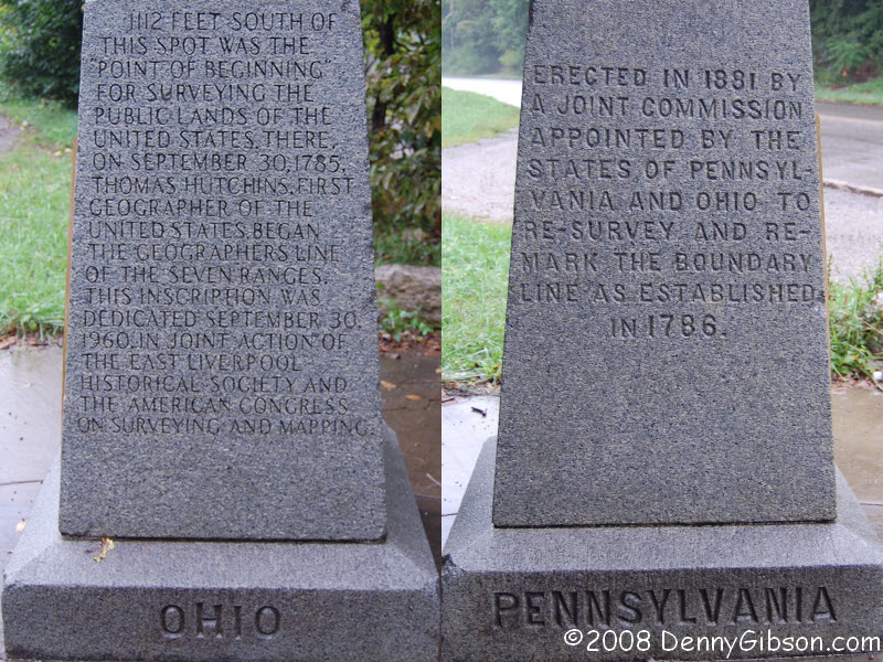
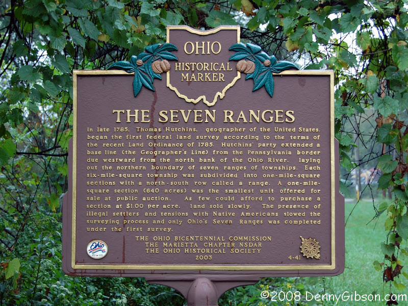
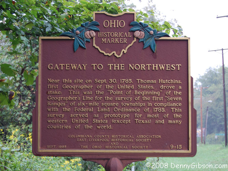
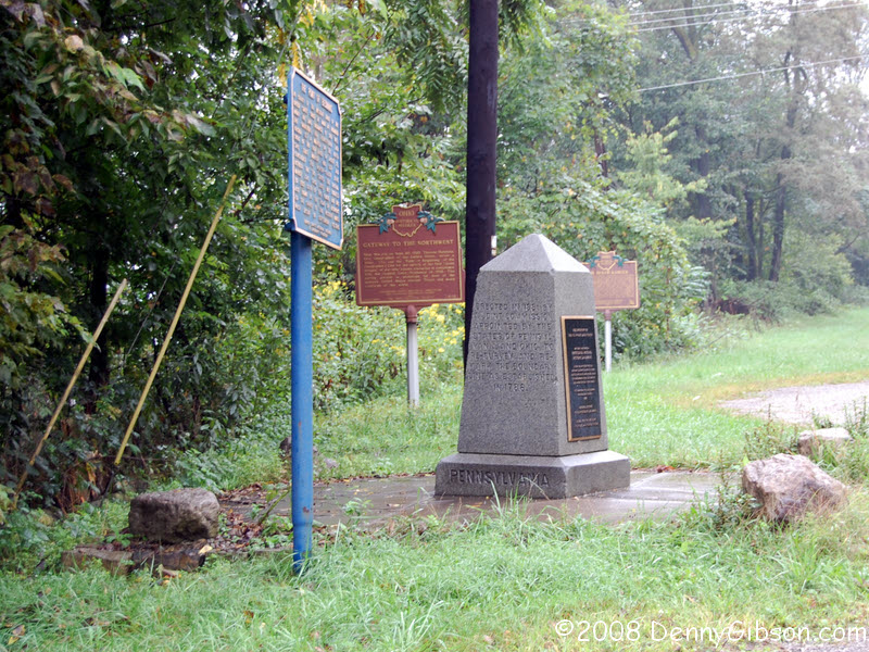 This cluster of markers commemorate the 1785 Point of Beginning for the
surveying of public lands in the United States. The marker that was
originally set on August 20, 1785, was 1,112 feet south of here. Text of
the markers can be seen through these links: 1,
2, 3,
4, 5.
This cluster of markers commemorate the 1785 Point of Beginning for the
surveying of public lands in the United States. The marker that was
originally set on August 20, 1785, was 1,112 feet south of here. Text of
the markers can be seen through these links: 1,
2, 3,
4, 5.
|
|
|
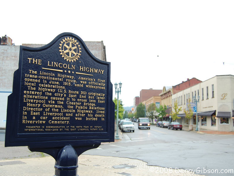
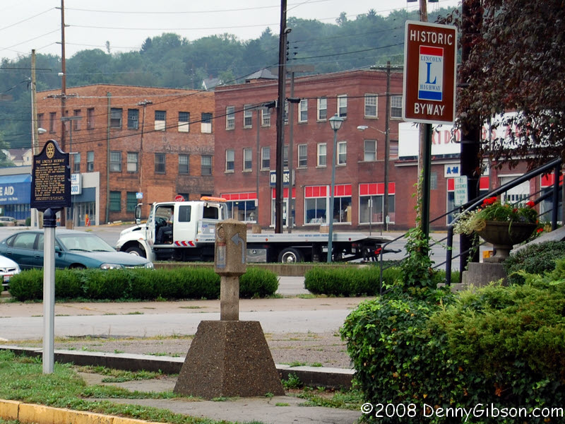 An original (but relocated) 1928 Lincoln Highway marker stands between
two Lincoln Highway signs at the corner of 5th & Broadway in East
Liverpool, Ohio. This is where Mike Buettner starts the driving directions
in "A History and Road Guide of the Lincoln Highway in
Ohio".
An original (but relocated) 1928 Lincoln Highway marker stands between
two Lincoln Highway signs at the corner of 5th & Broadway in East
Liverpool, Ohio. This is where Mike Buettner starts the driving directions
in "A History and Road Guide of the Lincoln Highway in
Ohio".
|
|
|


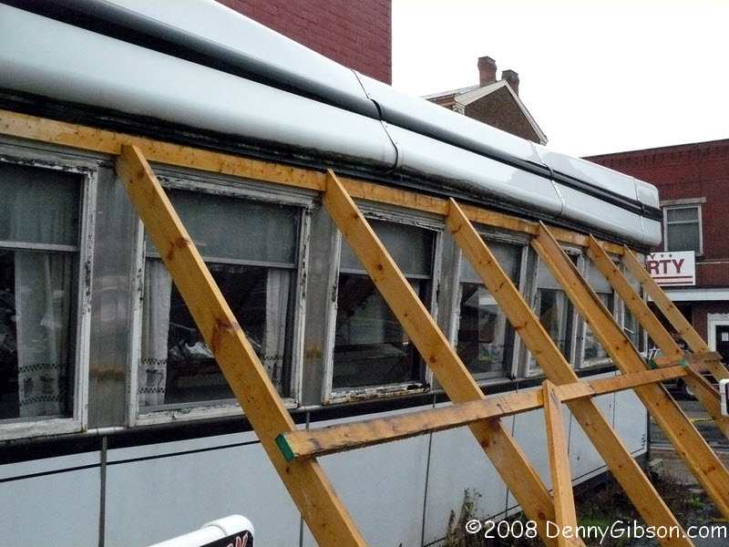 I was still digesting breakfast when I reached Lisbon but still stopped at
the Steel Trolley Diner for some apple pie. On the west side of Lisbon,
it's sad to see the condition of the Crosser Diner but encouraging to see
that a full collapse is being prevented.
I was still digesting breakfast when I reached Lisbon but still stopped at
the Steel Trolley Diner for some apple pie. On the west side of Lisbon,
it's sad to see the condition of the Crosser Diner but encouraging to see
that a full collapse is being prevented.
The Steel Trolley menu contains a "Lincoln Highway Burger" that sounds a lot like Peppi's "Roethlisburger". Both feature hamburger, sausage, egg, and American cheese. When I mentioned this to my waitress, she said, "Oh, we have a Roethlisburger, too", and pointed to the all Heinz (catsup, mustard, relish) topped offering. She asked about the other Roethlisburger and planned to mention it to Trolley owner and Steeler's fan Jacki. Could an interstate "Burger Battle" be brewing? |
|
|
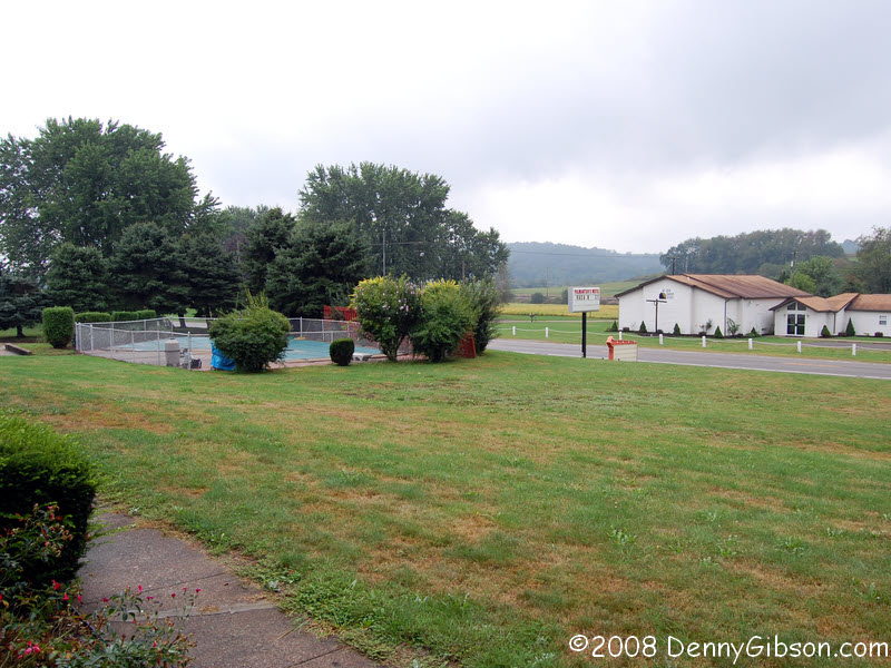
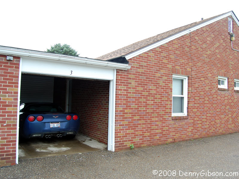
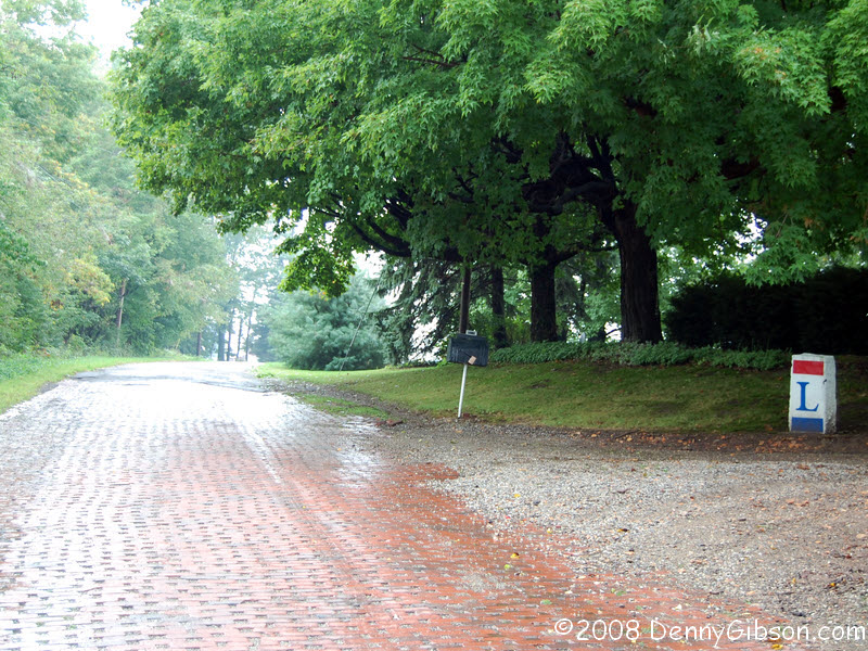
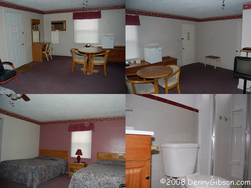
 My Saturday night home is at Palmantier's Motel near Minerva, Ohio. A door leads
directly from the garage to the huge room. There
is also a front door and the view from there includes brick paved Baywood
Road; once part of the Lincoln Highway. It's that straight line beyond
the sign and the church.
My Saturday night home is at Palmantier's Motel near Minerva, Ohio. A door leads
directly from the garage to the huge room. There
is also a front door and the view from there includes brick paved Baywood
Road; once part of the Lincoln Highway. It's that straight line beyond
the sign and the church.
|
|
|

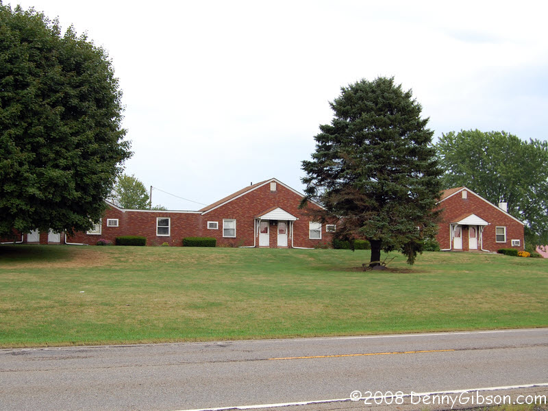
 After checking in, I headed on to Canton. The first picture in this panel
is the reverse of the last picture in the previous one and shows the motel
from the side of Baywood Road. Notice that the ends of the bricks are a
bit farther apart than normal. This is the result of a project that long
ago widened the road by two feet without the cost of more bricks. On down
the road, someone is well aware of what road this was and is quite proud
of it.
After checking in, I headed on to Canton. The first picture in this panel
is the reverse of the last picture in the previous one and shows the motel
from the side of Baywood Road. Notice that the ends of the bricks are a
bit farther apart than normal. This is the result of a project that long
ago widened the road by two feet without the cost of more bricks. On down
the road, someone is well aware of what road this was and is quite proud
of it.
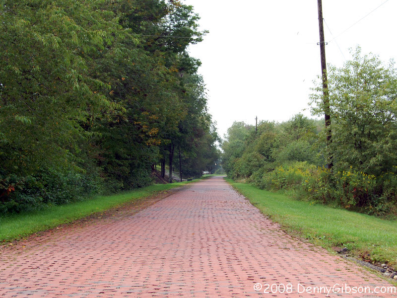
The last picture is of the endangered brick section of Cindell Road. There are some who want to see this paved over but the final decision has not been made. |
|
|


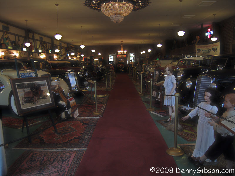
 I made it to Canton in time for quick visits to the
Canton Classic
Car Museum and Motorcar Portfolio. The museum is providing a winter
rest spot for Neil Zurcher's 1959 Metropolitan until the writer is ready
to take it out on more "one tank trips" for Cleveland's Channel
8.
I made it to Canton in time for quick visits to the
Canton Classic
Car Museum and Motorcar Portfolio. The museum is providing a winter
rest spot for Neil Zurcher's 1959 Metropolitan until the writer is ready
to take it out on more "one tank trips" for Cleveland's Channel
8.
Pickings were pretty slim at the Portfolio since most of their cars were already at the concours. They are not entrants but are on display. I got my concours ticket along with hand written directions from Norm at the museum then headed back east for dinner at the Spread Eagle in Hanoverton and a night at Palmantier's. |
|
|
| [Prev] [Site Home] [Trip Home] [Contact] [Next] |