A Day of Sun
Prev
Next


|
Day 3: March 30, 2009 A Day of Sun |
Prev Next |
|
|
|

 When asked, the desk clerk at the motel had recommended a place for dinner
that proved to be quite good. She also recommended a breakfast spot that
sounded like just he sort of place I look for. Even before we finished a
good dinner at the recommended Christo's, we planned on breakfast at the
recommended Cindy's. Believing it to be very near the motel, I scrolled
through nearby eateries on the GPS without finding it. We asked the
morning desk clerk and found out it was a little farther away than I had
thought but still close to town. It was on US-31, she said, so we took the
nearby US-30 east to US-31 and started looking for Cindy's. That section
of US-30 is an expressway style divided four-lane. No businesses are
actually "on" it. We stayed with it until we were well south of
town then gave up and headed back toward Plymouth on Michigan Road. I
looked to the GPS to see if it could offer an alternative and found that
it now showed Cindy's. It was just behind us at the Michigan Road and
US-31 intersection. We must have missed seeing it just as we turned.
When asked, the desk clerk at the motel had recommended a place for dinner
that proved to be quite good. She also recommended a breakfast spot that
sounded like just he sort of place I look for. Even before we finished a
good dinner at the recommended Christo's, we planned on breakfast at the
recommended Cindy's. Believing it to be very near the motel, I scrolled
through nearby eateries on the GPS without finding it. We asked the
morning desk clerk and found out it was a little farther away than I had
thought but still close to town. It was on US-31, she said, so we took the
nearby US-30 east to US-31 and started looking for Cindy's. That section
of US-30 is an expressway style divided four-lane. No businesses are
actually "on" it. We stayed with it until we were well south of
town then gave up and headed back toward Plymouth on Michigan Road. I
looked to the GPS to see if it could offer an alternative and found that
it now showed Cindy's. It was just behind us at the Michigan Road and
US-31 intersection. We must have missed seeing it just as we turned.
We returned to the intersection but saw no Cindy's. There was a building where the GPS indicated and it looked like it could be a restaurant and the parking lot was filled with cars but there was no sign to identify it as Cindy's or any other business. We pulled into the lot and could see people sitting at tables inside. This must be the place. We continued to look for some reassurance as we parked and walked to the door. Nothing. No street side sign or name on the front. Nothing. We couldn't be certain that this was the right place until we entered and saw "Cindy's Country Pride Family Restaurant" on the glass of the inner door. Good food, prices, and service. A sign? It blew away years ago, the waitress said. To anyone questioning whether word of mouth is effective, I present the full parking lot of Cindy's. |
|
|

 Now well fed, we set out on another search. While looking at the GPS in
the motel room, we realized that we had missed a mile post just a few
miles west of town. We rolled back through Plymouth and onto the indicated
location. The post was about as stealthy as Cindy's. We stared at the
roadside and even stopped a time or two at spots we thought promising. At
last, as we drove slowly back towards Plymouth, the post was sighted at
the edge of some bushes.
Now well fed, we set out on another search. While looking at the GPS in
the motel room, we realized that we had missed a mile post just a few
miles west of town. We rolled back through Plymouth and onto the indicated
location. The post was about as stealthy as Cindy's. We stared at the
roadside and even stopped a time or two at spots we thought promising. At
last, as we drove slowly back towards Plymouth, the post was sighted at
the edge of some bushes.
|
|
|

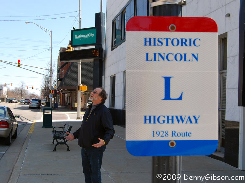
 Plymouth's downtown has plenty of nice old buildings. Here's a tiny sample
plus a shot of the courthouse to prove we were there. Jim Grey has a
gallery of Plymouth homes
here and the Marshall County section of his well done
guide to the Michigan Road includes quite a bit on Plymouth.
Plymouth's downtown has plenty of nice old buildings. Here's a tiny sample
plus a shot of the courthouse to prove we were there. Jim Grey has a
gallery of Plymouth homes
here and the Marshall County section of his well done
guide to the Michigan Road includes quite a bit on Plymouth.
|
|
|


 This park a bit west of Warsaw was a pleasant surprise and a chance to get
a snow free picture of Dale. The park is organized around the 1897
Chinworth Bridge that carried the Lincoln
Highway prior to 1924 with a three sided kiosk providing
information on the highway and more.
This park a bit west of Warsaw was a pleasant surprise and a chance to get
a snow free picture of Dale. The park is organized around the 1897
Chinworth Bridge that carried the Lincoln
Highway prior to 1924 with a three sided kiosk providing
information on the highway and more.
|
|
|


 In Warsaw, we finally found a Lincoln Highway marker without searching
through shrubbery. The fence and first class treatment are due to this
once being thought the only original marker in Indiana still at it's
proper location. Two others, the one in Hamlet and one we'll reach in a
bit, have since been found.
In Warsaw, we finally found a Lincoln Highway marker without searching
through shrubbery. The fence and first class treatment are due to this
once being thought the only original marker in Indiana still at it's
proper location. Two others, the one in Hamlet and one we'll reach in a
bit, have since been found.
Dale & I were mystified by an inscription on the front of a house directly across the street from the park. The house bears the date 1909 and the words U.S. PARSONAGE. We know what a parsonage is and what the U.S. stands for but can't imagine what a U.S. Parsonage is. Any ideas? ADDENDUM: Mar 31, 2009 - It is pretty obvious that I best stop trusting old eyes in the wild. I was so convinced that the two letters were 'U' & 'S' that I didn't even look closely at my own photograph. Fortunately, Mike Austing did and pointed out that the inscription was "U.B." and not "U.S.". He also suggested that "U.B." might be "United Brethren". Now, that makes sense. Thanks for catching my goof, Mike, and for solving the "mystery". ADDENDUM: Apr 1, 2009 - The posting of the preceding correction and a note from England crossed in the ether. Nicky Green's note was similar to Mike's in both content and tone. Nicky & Mike may have laughed uproariously when they saw my mistake but both merely offered polite corrections in their email. That's typical. I've made plenty of mistakes on this site and every correction has been polite and helpful and never critical or belittling. To Nicky, Mike, and everyone else who has let be know of errors, thank you. Your help is truly appreciated. |
|
|

 This is the Kosciusko County Courthouse in downtown Warsaw. There's no doubt
that Dale is impressed. The cement cannon replaces a real one from the Civil
War that was melted down to be reused in World War II.
This is the Kosciusko County Courthouse in downtown Warsaw. There's no doubt
that Dale is impressed. The cement cannon replaces a real one from the Civil
War that was melted down to be reused in World War II.
|
|
|
 The third of the "original location" mile markers was also free
of concealing shrubbery.
The third of the "original location" mile markers was also free
of concealing shrubbery.
|
|
|


 The first picture is of a nice stretch of old highway near a place called
Lorane. The Whitley County Courthouse is in Columbia City. Atop each corner
is a tall ornament that looks as if it might once have been a pedestal for
something more. Additional research required. About three miles east of
Coesse Corners an old routing, now called Lake Center Road, is the only
gravel section we traveled. The wooden bridge is just east of it. The
bridge caught our eye because its wooden construction made us think
"old" but a closer look showed it to be rather new. Newly built
(or rebuilt) wooden bridges are not that common. There must be
a story behind this one.
The first picture is of a nice stretch of old highway near a place called
Lorane. The Whitley County Courthouse is in Columbia City. Atop each corner
is a tall ornament that looks as if it might once have been a pedestal for
something more. Additional research required. About three miles east of
Coesse Corners an old routing, now called Lake Center Road, is the only
gravel section we traveled. The wooden bridge is just east of it. The
bridge caught our eye because its wooden construction made us think
"old" but a closer look showed it to be rather new. Newly built
(or rebuilt) wooden bridges are not that common. There must be
a story behind this one.
|
|
|

 Our last Lincoln Highway stop was for what has been named Fort Wayne's
best conies. Though I'm no expert, the dogs were good and the staff was great.
We, and several others, did carryout but eating in seemed popular too and
would make the fun last longer. We had passed this west bound on Saturday then took a more
direct path today once our return along the 1928 routing connected with the 1913
route we had followed outbound. Marsha had homemade potato soup and a freshly
baked chocolate cake waiting to accompany the conies so I headed home well fed.
Our last Lincoln Highway stop was for what has been named Fort Wayne's
best conies. Though I'm no expert, the dogs were good and the staff was great.
We, and several others, did carryout but eating in seemed popular too and
would make the fun last longer. We had passed this west bound on Saturday then took a more
direct path today once our return along the 1928 routing connected with the 1913
route we had followed outbound. Marsha had homemade potato soup and a freshly
baked chocolate cake waiting to accompany the conies so I headed home well fed.
|
|
|
| [Prev] [Site Home] [Trip Home] [Contact] [Next] |