|
Day 2: August 22, 2004 |
Prev Next |
|
Day 2: August 22, 2004 |
Prev Next |
|
|
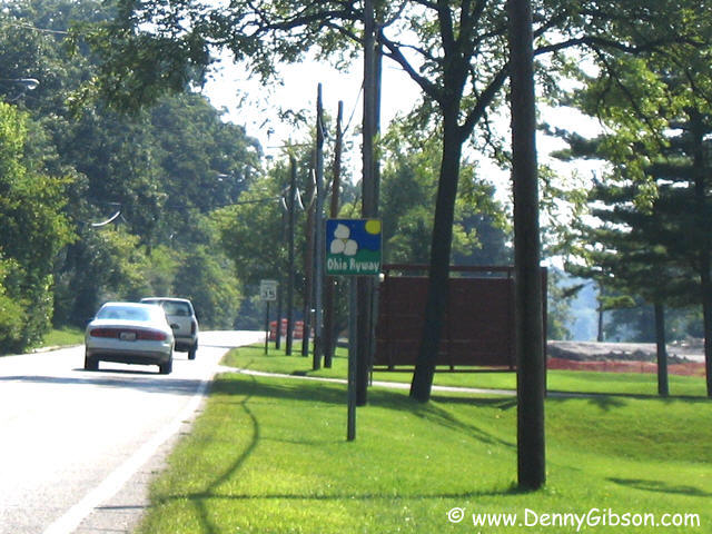
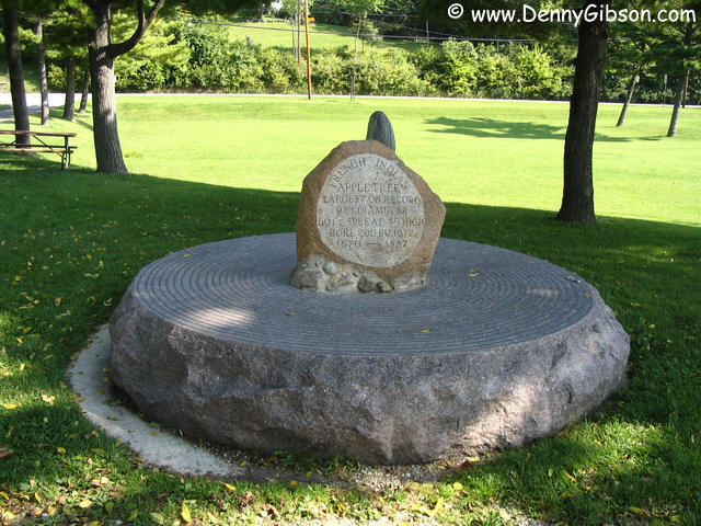
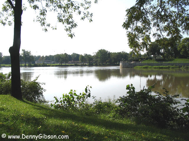 The Maumee Valley Byway offers scenery from its very
beginning. Starting at the intersection of OH-66 and OH-424, the byway
heads north-east along the north bank of the Maumee River. The north
bank's Pontiac Park provides a nice view of the south bank's Old Ft.
Defiance Park as well as the river itself. Before 1887, the worlds
largest (9 ft. diameter) apple tree could be seen here. There is even an
Ohio Byway marker. Something that seemed to be missing from the entire
canal byway I followed yesterday.
The Maumee Valley Byway offers scenery from its very
beginning. Starting at the intersection of OH-66 and OH-424, the byway
heads north-east along the north bank of the Maumee River. The north
bank's Pontiac Park provides a nice view of the south bank's Old Ft.
Defiance Park as well as the river itself. Before 1887, the worlds
largest (9 ft. diameter) apple tree could be seen here. There is even an
Ohio Byway marker. Something that seemed to be missing from the entire
canal byway I followed yesterday.
|
|
|

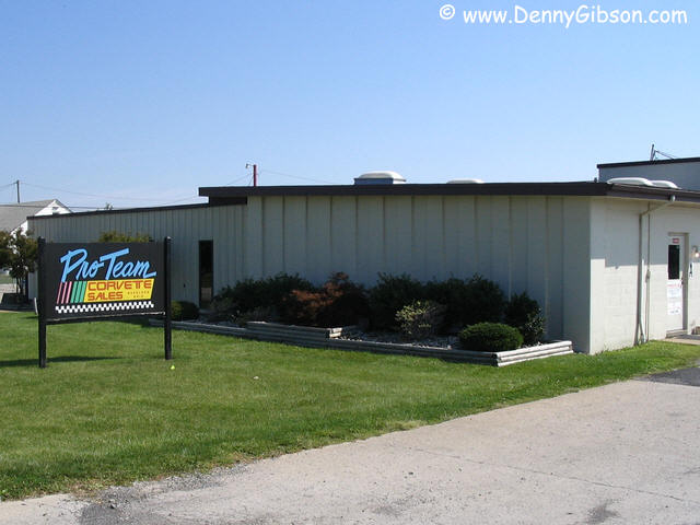
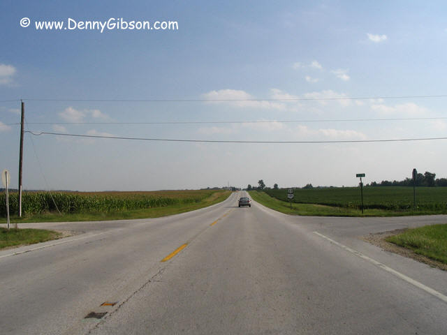
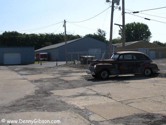 After about twenty miles of very nice, often riverside, two-lane, I
reached Napoleon. I spent several weekends here in the very early '70s
and had not thought of it as a waypoint on scenic byway. Of course, I
probably wasn't thinking of scenic byways all that much in those days.
Car folks might recognize Napoleon as the home of
Proteam
Corvette sales. I had expected to see a few cars but the old Plymouth was
only vehicle visible. I'm guessing that the "Vettes are locked up
behind closed doors.
After about twenty miles of very nice, often riverside, two-lane, I
reached Napoleon. I spent several weekends here in the very early '70s
and had not thought of it as a waypoint on scenic byway. Of course, I
probably wasn't thinking of scenic byways all that much in those days.
Car folks might recognize Napoleon as the home of
Proteam
Corvette sales. I had expected to see a few cars but the old Plymouth was
only vehicle visible. I'm guessing that the "Vettes are locked up
behind closed doors.
|
|
|
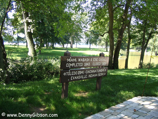

 This park, at the Providence Dam, is one of several in the area across the
river from Grand Rapids, Ohio. Notice the fellow happily fishing with the
Maumee up to his waist. A solid 1941 WPA build shelter house overlooks the
dam. Others were fishing from the banks and there were even some anglers
at the section of canal that lies between the road and the dam. As the
sign shows, this was once part of the same canal that I followed
yesterday.
This park, at the Providence Dam, is one of several in the area across the
river from Grand Rapids, Ohio. Notice the fellow happily fishing with the
Maumee up to his waist. A solid 1941 WPA build shelter house overlooks the
dam. Others were fishing from the banks and there were even some anglers
at the section of canal that lies between the road and the dam. As the
sign shows, this was once part of the same canal that I followed
yesterday.
|
|
|
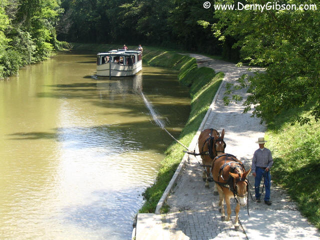

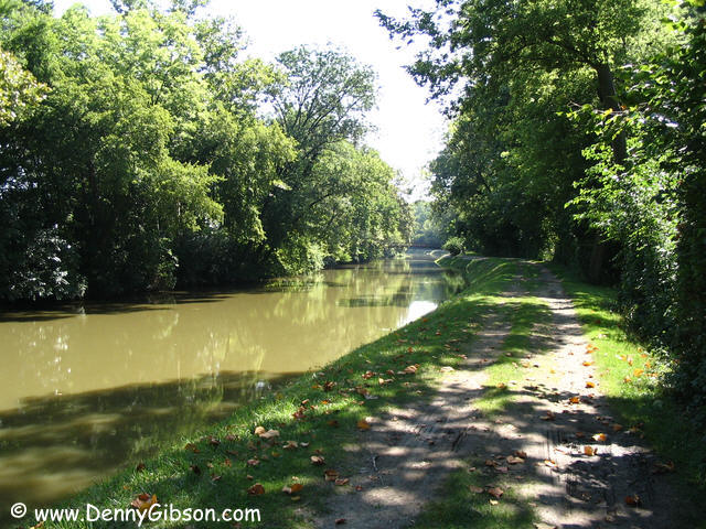
 At another
park area, just down the road, there is more preserved
canal and a working canal boat. This one passes through a working lock so,
just as I did yesterday in Piqua, I put driving on hold in order to get a
boat ride. Power is provided by Dolly & Molly with Larry in control.
Note the historically accurate tandem arrangement of the mules. This not
only provided better pulling power but allowed teams to more easily pass
each other when boats met each other in the canal's busier times. As Jim
had explained yesterday, the Piqua team had already spent years working
with a double-tree and pretty much balked at the traditional tandem
single-trees. With no passing boats to contend with, trying to teach old
mules new tricks wasn't even considered.
At another
park area, just down the road, there is more preserved
canal and a working canal boat. This one passes through a working lock so,
just as I did yesterday in Piqua, I put driving on hold in order to get a
boat ride. Power is provided by Dolly & Molly with Larry in control.
Note the historically accurate tandem arrangement of the mules. This not
only provided better pulling power but allowed teams to more easily pass
each other when boats met each other in the canal's busier times. As Jim
had explained yesterday, the Piqua team had already spent years working
with a double-tree and pretty much balked at the traditional tandem
single-trees. With no passing boats to contend with, trying to teach old
mules new tricks wasn't even considered.
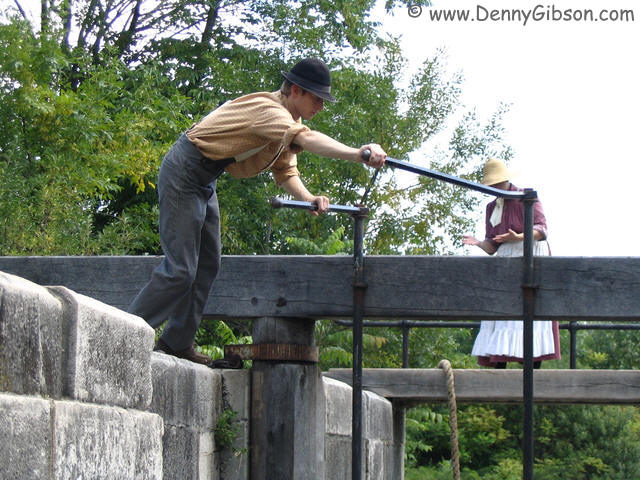
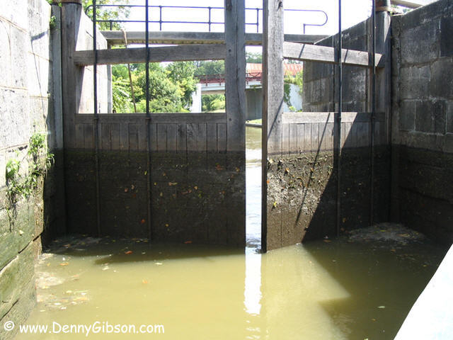
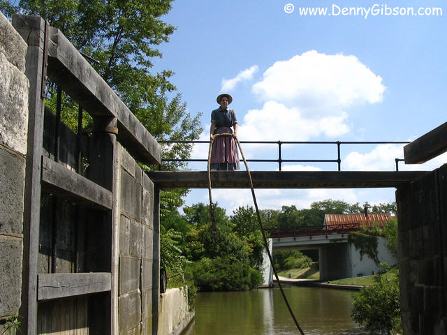
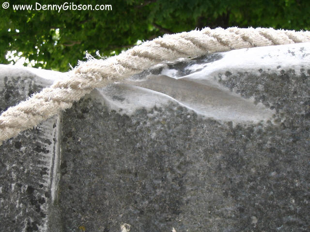
We actually got to experience passing through the locks in both directions. Once the boat was in the lock and the wooden gates closed behind us, wicker gates in front of us were opened to allow water to raise or lower the boat to the proper level. That's the boat's cook, Mrs. McMoresyllablesthanIcanremember, waiting to swing the tow rope back on board. The crew lives in an 1876 world and her passenger orientation drills let us see just a bit of it. This particular lock, Number 44, is one of the few built on bedrock which is the reason it is still standing and functional after 160+ years of use. Evidence of that use is seen in the rope grooved rocks. |
|
|
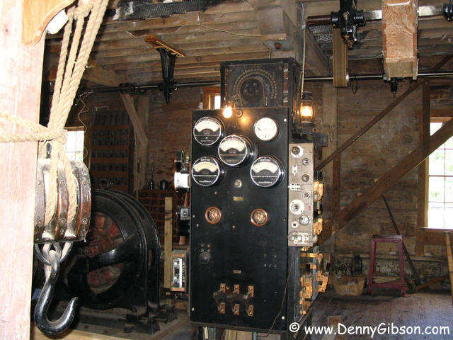
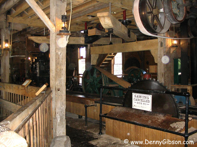
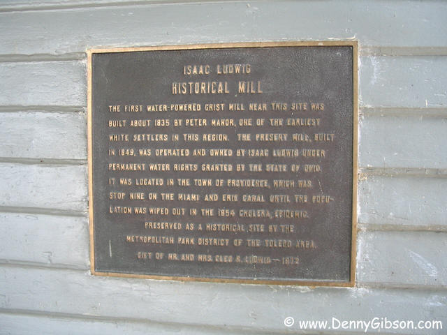
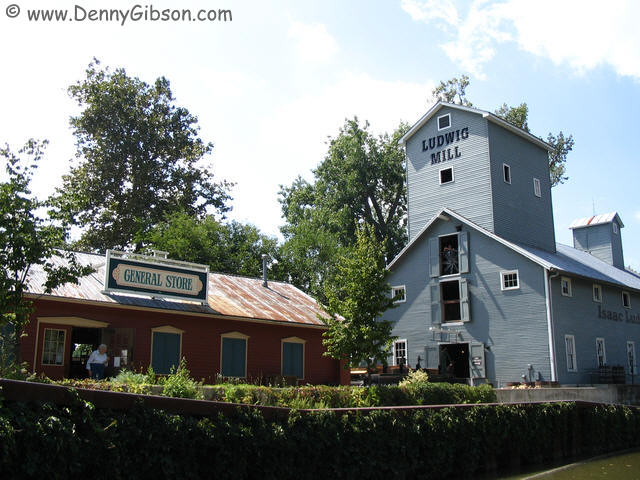 Isaac Ludwig's mill sits right next to Lock 44. This structure dates from
1849 but there has been a mill on this site since 1835. In addition to
equipment for the grinding and other processing of a variety of grains,
the building houses a saw mill. Grinding demonstrations were ongoing but
the saw operations were on hold until everything could be verified as OK
following a recent encounter with a nail. Early last century, the mill
even provided that new-fangled electricity for the surrounding area.
Isaac Ludwig's mill sits right next to Lock 44. This structure dates from
1849 but there has been a mill on this site since 1835. In addition to
equipment for the grinding and other processing of a variety of grains,
the building houses a saw mill. Grinding demonstrations were ongoing but
the saw operations were on hold until everything could be verified as OK
following a recent encounter with a nail. Early last century, the mill
even provided that new-fangled electricity for the surrounding area.
|
|
|
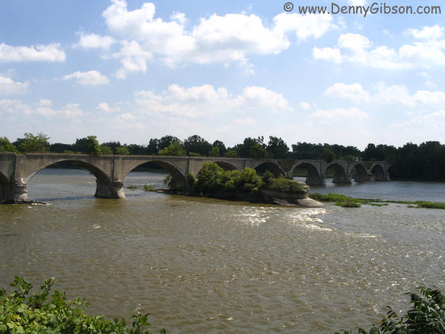
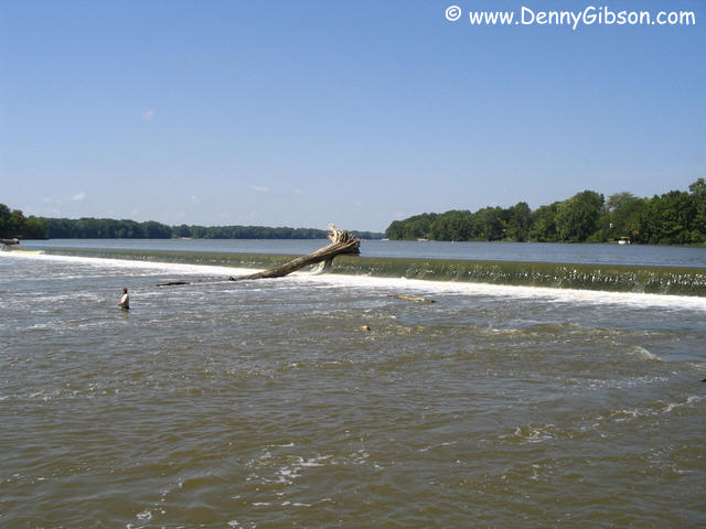
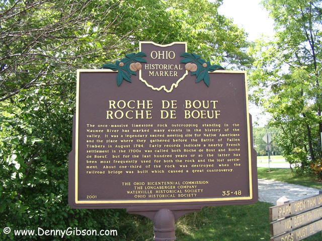 Roche de Boeuf is the name of the unusual mid-river rock formation.
Building the railroad bridge in 1907 destroyed about a third of the
formation but the other two-thirds seems likely to outlast the already
crumbling concrete bridge.
Roche de Boeuf is the name of the unusual mid-river rock formation.
Building the railroad bridge in 1907 destroyed about a third of the
formation but the other two-thirds seems likely to outlast the already
crumbling concrete bridge.
|
|
|
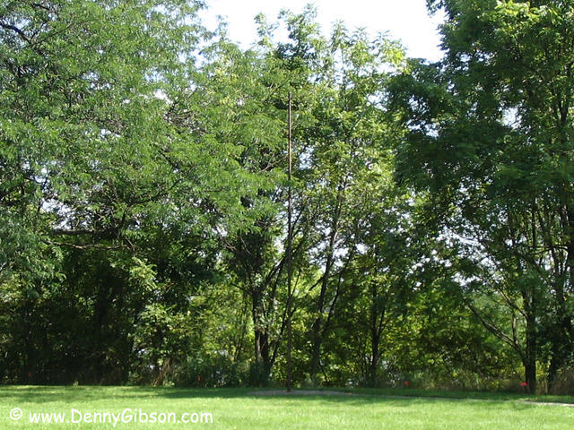
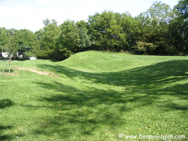
 This park marks the site of Fort Miamis and the end of the Maumee Valley
Byway. The British fort was surrendered to the United States in 1796 but
was reoccupied by them in the War of 1812. Nothing is left of the fort
and even the more modern flagpole at the end of a paved walkway is unused
and rusted.
This park marks the site of Fort Miamis and the end of the Maumee Valley
Byway. The British fort was surrendered to the United States in 1796 but
was reoccupied by them in the War of 1812. Nothing is left of the fort
and even the more modern flagpole at the end of a paved walkway is unused
and rusted.
|
|
|
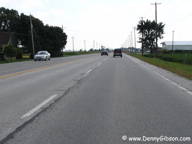
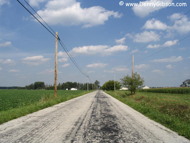 From Fort Miamis, I back tracked a little to cross the river on US-20 and
then head south on OH-25. I believe that this was once US-25 and it is
certainly one of the longest stretches of undivided! four-lane
that I've seen lately. The second picture is of Devil's Hole road. While
looking over my route on a map, the name had caught my eye and finding an
internet story made it part of my agenda. Nothing
horrible happened (except that I got caught by a train and failed to take
a usable picture) but I did notice that name signs were rare.
From Fort Miamis, I back tracked a little to cross the river on US-20 and
then head south on OH-25. I believe that this was once US-25 and it is
certainly one of the longest stretches of undivided! four-lane
that I've seen lately. The second picture is of Devil's Hole road. While
looking over my route on a map, the name had caught my eye and finding an
internet story made it part of my agenda. Nothing
horrible happened (except that I got caught by a train and failed to take
a usable picture) but I did notice that name signs were rare.
|
|
|
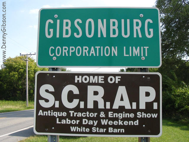 I also spotted Gibsonburg on the map and, once I had decided to drive
Devil's Hole, visiting this namesake seemed unavoidable. What a surprise.
When I was just beginning a career as a computer programmer, someone, who
had just received some sort of accreditation, suggested I look into it.
At the time, my title was "Associate Programmer". I realized
that if I registered myself, I could be a "Registered Associate
Programmer" and use the letters "R.A.P." after my name. I
could then pass the test to be come certified and, after several years as
"C.R.A.P", I could be a "Senior Certified Registered
Associate Programmer". The group that calls Gibsonburg home is the
"Sandusky County Restorers of Antique Power".
I also spotted Gibsonburg on the map and, once I had decided to drive
Devil's Hole, visiting this namesake seemed unavoidable. What a surprise.
When I was just beginning a career as a computer programmer, someone, who
had just received some sort of accreditation, suggested I look into it.
At the time, my title was "Associate Programmer". I realized
that if I registered myself, I could be a "Registered Associate
Programmer" and use the letters "R.A.P." after my name. I
could then pass the test to be come certified and, after several years as
"C.R.A.P", I could be a "Senior Certified Registered
Associate Programmer". The group that calls Gibsonburg home is the
"Sandusky County Restorers of Antique Power".
|
|
|
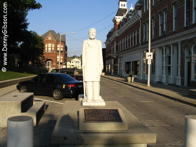
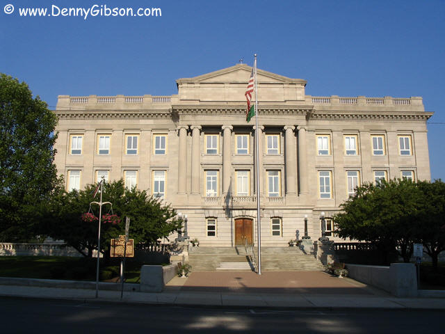 Back to US-23, where Devil's Hole ends, then US-30 to US-68. Pretty major
roads to my way of thinking. That's Hardin County's courthouse in Kenton.
Back to US-23, where Devil's Hole ends, then US-30 to US-68. Pretty major
roads to my way of thinking. That's Hardin County's courthouse in Kenton.
|
|
|
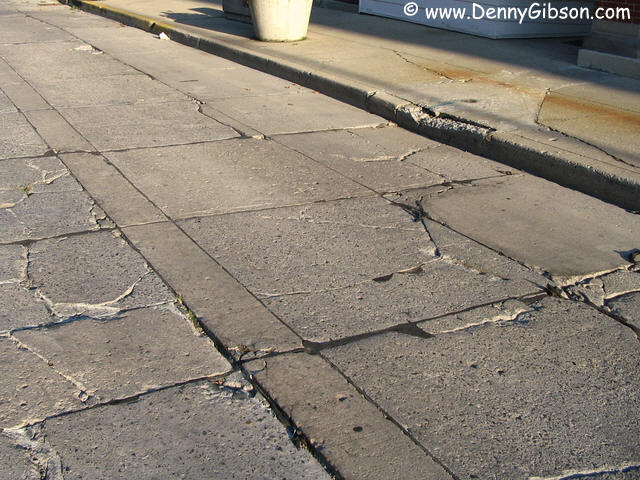
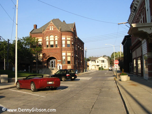

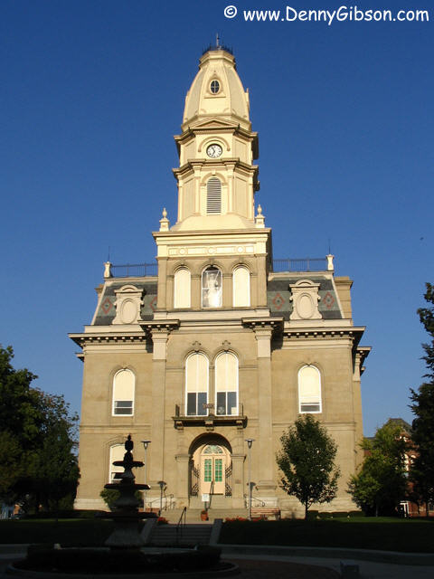 Bellefontaine was actually a sort of target for this trip. It's a nice
enough courthouse but the real attraction is the street next to it. In
1893, fifteen years ahead of the first Model T, streets forming the square
around the courthouse were paved with concrete. On Court Avenue, one block
of the original paving of the
first concrete street in the US is still is use today.
Bellefontaine was actually a sort of target for this trip. It's a nice
enough courthouse but the real attraction is the street next to it. In
1893, fifteen years ahead of the first Model T, streets forming the square
around the courthouse were paved with concrete. On Court Avenue, one block
of the original paving of the
first concrete street in the US is still is use today.
|
|
|
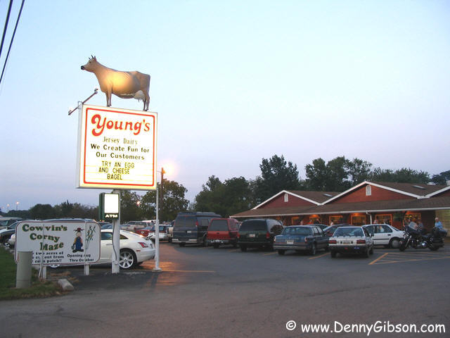
 On down 68 to a place I just can't pass without stopping. As the crowds
indicate, Young's Dairy
Farm has great ice cream and other treats. What the pictures don't
show are the ball diamonds, petting zoo, driving range, and picnic areas.
Then there is "Putters & Udders", one of the busiest
miniature golf courses in the world.
On down 68 to a place I just can't pass without stopping. As the crowds
indicate, Young's Dairy
Farm has great ice cream and other treats. What the pictures don't
show are the ball diamonds, petting zoo, driving range, and picnic areas.
Then there is "Putters & Udders", one of the busiest
miniature golf courses in the world.
|
|
|