Lost Pics
Prev
Next


|
Day 3: February 18, 2008 Lost Pics |
Prev Next |
|
|
|
 It was cold when I left Pocahontas but no snow was falling.
That wouldn't start until shortly before I reached Vandalia. By then I
had explored some bits of abandoned National Old Trails Road just east of
Pocahontas and enjoyed breakfast at a diner in downtown Greenville. And I
took pictures. In Vandalia, I took pictures of the Madonna of the Trail
with the rapidly increasing snow blowing past her. By the time I reached
Saint Elmo, the snow was steady and viability was suffering. I left
US-40 for the interstate. I passed a few cars that slid off of the road
and, on the opposite side of the divided highway, a furniture van that was
completely upside down. A man I took to be its driver leaned against one
of the cars that had stopped; Uninjured, it appeared, but badly shaken.
Then there was a semi on its side. This must have happened much earlier as
a crane was already working at righting the big trailer. I took a picture
as I passed. Traffic was stopped briefly near Effingham. A truck loaded
with new golf carts was in front of me. Beyond the truck, Effingham's giant
cross was barely visible through the snow. I took a picture of carts, snow,
and cross. I pulled
into Greenup specifically to get pictures of those balconies in the snow and I
snapped several. The snowfall was lessening so I stayed with the old road. Near Clark Center I
drove some of the disjointed old brick roadway that was once the National
Road then became US-40 and got out of the car to get pictures of it sitting
on the bricks and snow. I veered from today's Forty to follow the old road
in to Marshall.
It was cold when I left Pocahontas but no snow was falling.
That wouldn't start until shortly before I reached Vandalia. By then I
had explored some bits of abandoned National Old Trails Road just east of
Pocahontas and enjoyed breakfast at a diner in downtown Greenville. And I
took pictures. In Vandalia, I took pictures of the Madonna of the Trail
with the rapidly increasing snow blowing past her. By the time I reached
Saint Elmo, the snow was steady and viability was suffering. I left
US-40 for the interstate. I passed a few cars that slid off of the road
and, on the opposite side of the divided highway, a furniture van that was
completely upside down. A man I took to be its driver leaned against one
of the cars that had stopped; Uninjured, it appeared, but badly shaken.
Then there was a semi on its side. This must have happened much earlier as
a crane was already working at righting the big trailer. I took a picture
as I passed. Traffic was stopped briefly near Effingham. A truck loaded
with new golf carts was in front of me. Beyond the truck, Effingham's giant
cross was barely visible through the snow. I took a picture of carts, snow,
and cross. I pulled
into Greenup specifically to get pictures of those balconies in the snow and I
snapped several. The snowfall was lessening so I stayed with the old road. Near Clark Center I
drove some of the disjointed old brick roadway that was once the National
Road then became US-40 and got out of the car to get pictures of it sitting
on the bricks and snow. I veered from today's Forty to follow the old road
in to Marshall.
That
The memory card that was in the camera was the one from which a small piece of the plastic housing had flaked off a day or two before. At the time I had not thought much of it but soon realized that I should have taken that as a warning. It seemed OK in the camera. I reviewed the occasional photo and nothing was amiss. But that was no longer the case. I'm guessing that, either when I removed the card from the camera or when I put it in the reader, I put pressure against the weakened housing and damaged it further. Despite the best repair and recovery efforts of a coworker (Thanks, Alan!), all of Sunday morning's pictures are gone. I have been holding off and hoping that some would survive but it's now time to face the facts and put up this abbreviated page. |
|
|
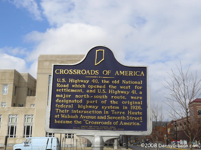
 With another memory card in place, I headed over the state line to Terre
Haute. The intersection of Wabash and Seventh, where US-40 once crossed US-41,
is proudly labeled "Crossroads of America". There's no doubt
the Forty & Forty-One meeting was pretty significant but where was
the "Crossroads of America" back when roads had names? One
candidate lies about eighty miles to the east where Meridian (a.k.a. Dixie
Highway West) crosses Washington (a.k.a. National Road) in downtown
Indianapolis. Another candidate lies a hundred miles beyond that where the Dixie
Highway East and the National Road once crossed and where streets bearing
those names still cross today in Vandalia, Ohio.
With another memory card in place, I headed over the state line to Terre
Haute. The intersection of Wabash and Seventh, where US-40 once crossed US-41,
is proudly labeled "Crossroads of America". There's no doubt
the Forty & Forty-One meeting was pretty significant but where was
the "Crossroads of America" back when roads had names? One
candidate lies about eighty miles to the east where Meridian (a.k.a. Dixie
Highway West) crosses Washington (a.k.a. National Road) in downtown
Indianapolis. Another candidate lies a hundred miles beyond that where the Dixie
Highway East and the National Road once crossed and where streets bearing
those names still cross today in Vandalia, Ohio.
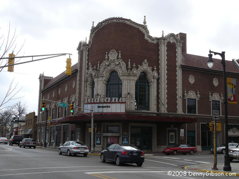
The really cool looking Indiana Theater is just a block away. |
|
|
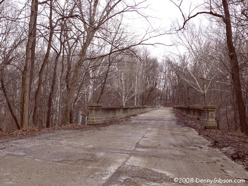
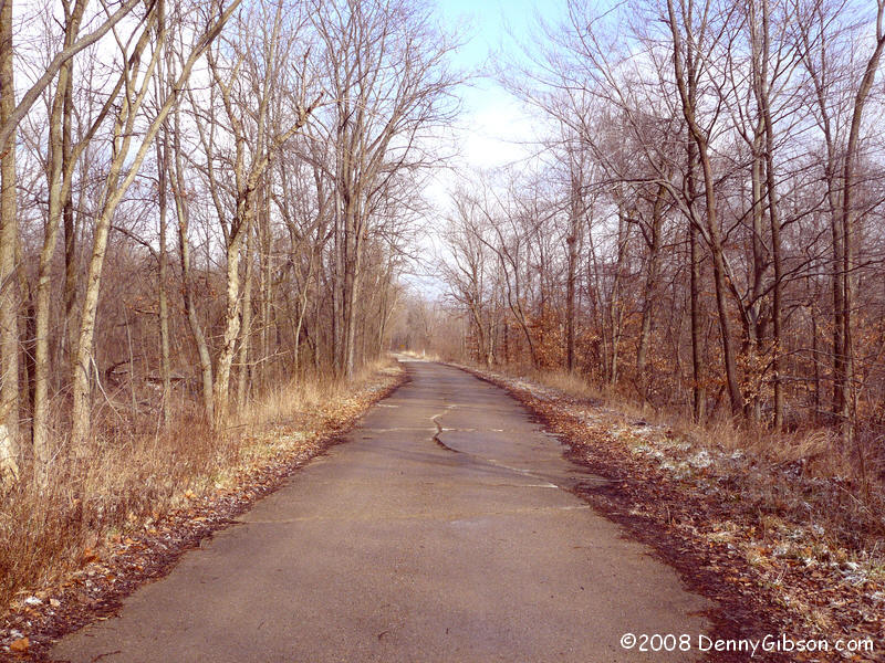 These pictures are of an old National Road segment that crossed Deer
Creek near Putnamville.
These pictures are of an old National Road segment that crossed Deer
Creek near Putnamville.
|
|
|
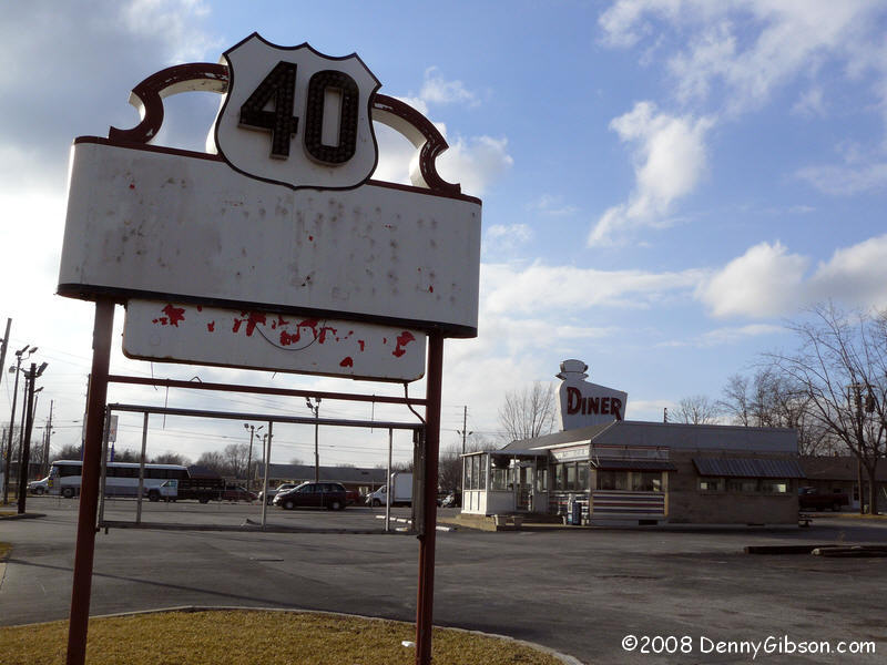
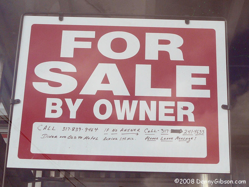
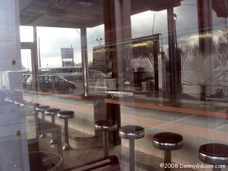 Knowing that there wasn't even the slightest chance, I still kind of hoped that
someone had purchased the Diner in Plainfield and had hot coffee waiting
for me. But, as expected, the Mountain View, which closed in December,
remains empty and for sale.
Knowing that there wasn't even the slightest chance, I still kind of hoped that
someone had purchased the Diner in Plainfield and had hot coffee waiting
for me. But, as expected, the Mountain View, which closed in December,
remains empty and for sale.
|
|
|
| [Prev] [Site Home] [Trip Home] [Contact] [Next] |