A Pair of Ghost Towns
Comment via blog
Prev
Next


|
Day 8: October 9, 2024 A Pair of Ghost Towns Comment via blog |
Prev Next |
|
|
|
 The PPOO split in two back in Colorado Springs and I took the northern
route because I wanted to see Pike's Peak. Grand Junction, CO, is where
the paths rejoin and where I spent the night.
The PPOO split in two back in Colorado Springs and I took the northern
route because I wanted to see Pike's Peak. Grand Junction, CO, is where
the paths rejoin and where I spent the night.
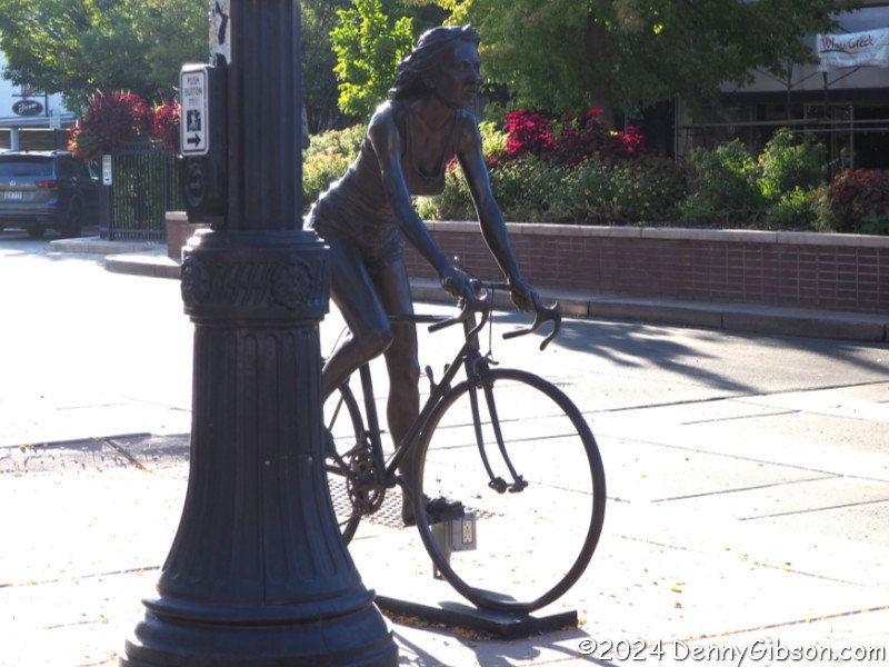
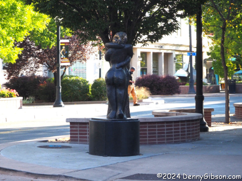
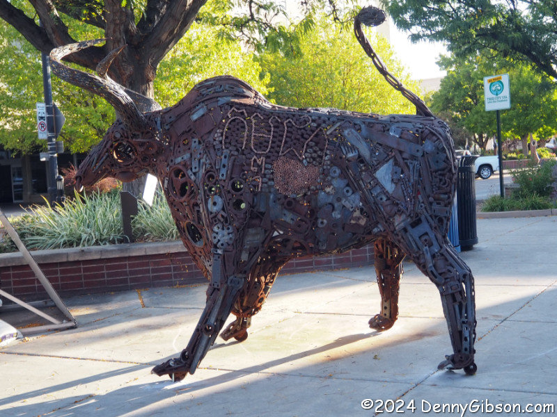
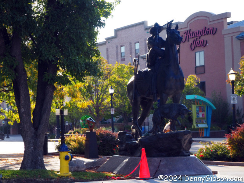
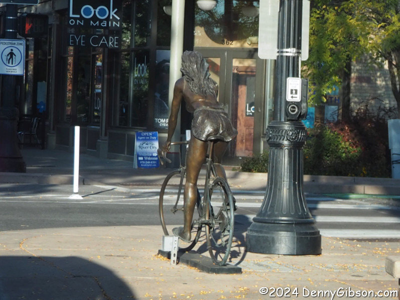
As I left town on Grand Junction's Main Street, I almost immediately noticed that there were sculptures almost everywhere. I snapped the photo of the girl and bicycle while stopped at a light. I turned around to grab a picture of the horse and rider then took advantage of my retrace to grab pictures of a few other statues including the bicycle girl's other side. Sorry about the lighting but I was too anxious to get the day started or maybe just too lazy to get out of the car. |
|
|
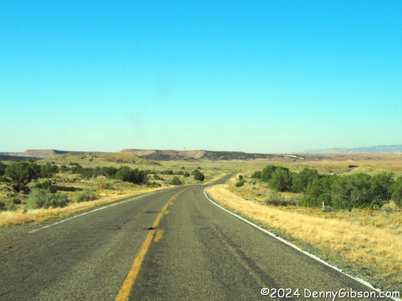
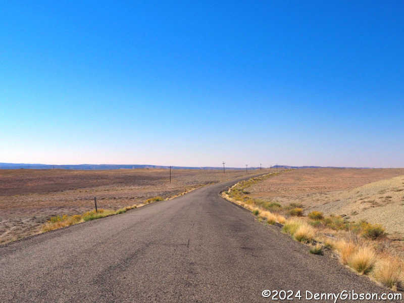
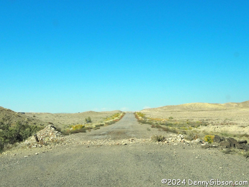
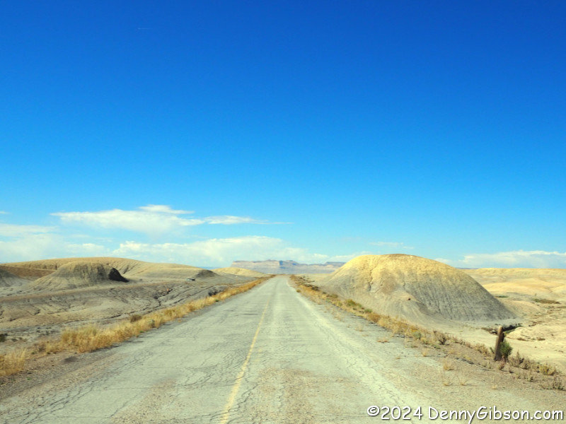
 I was soon in Utah and driving the last ten miles of a near twenty-mile
long stretch of former PPOO/US-6. Apparently it had been decommissioned in
sections and the farther I went the more neglect could be seen.
I was soon in Utah and driving the last ten miles of a near twenty-mile
long stretch of former PPOO/US-6. Apparently it had been decommissioned in
sections and the farther I went the more neglect could be seen.
|
|
|
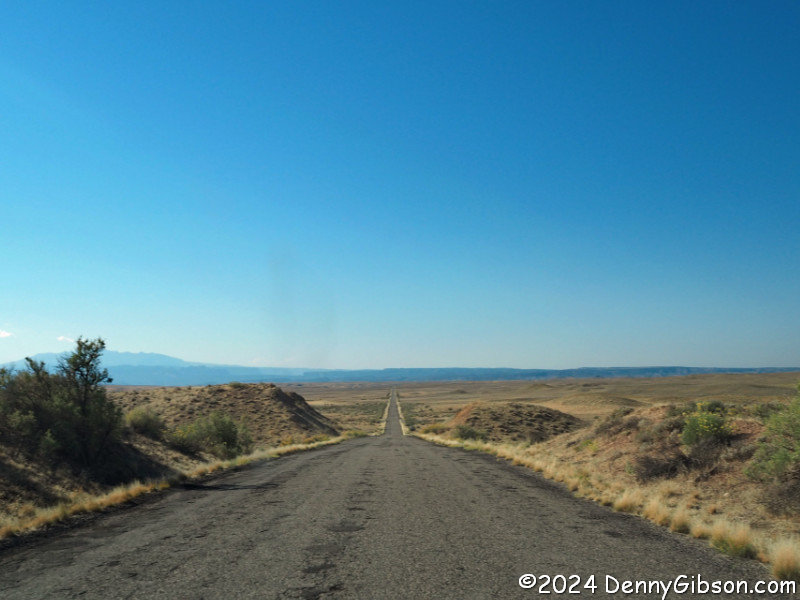
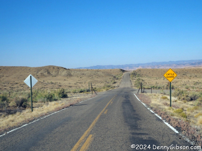
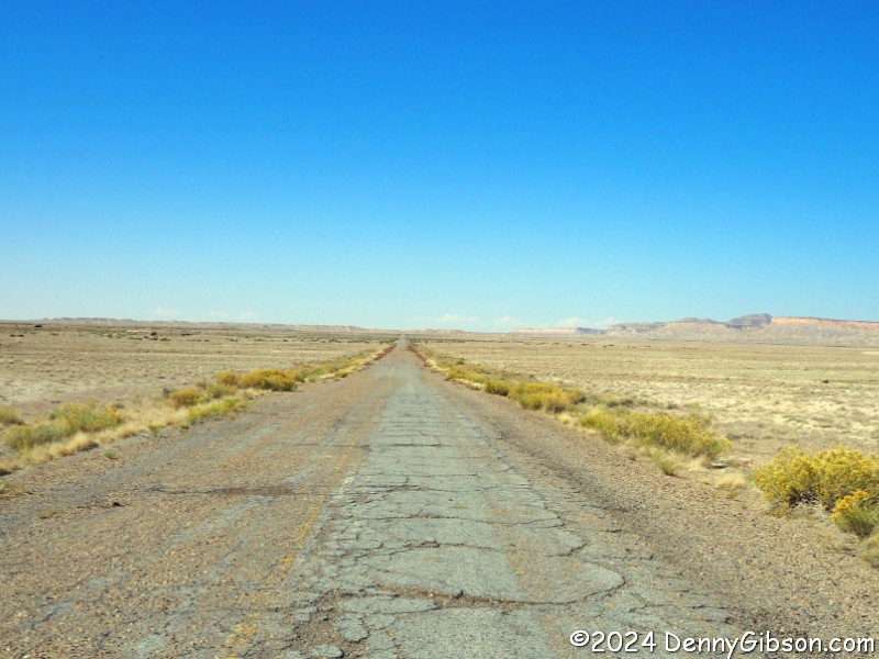
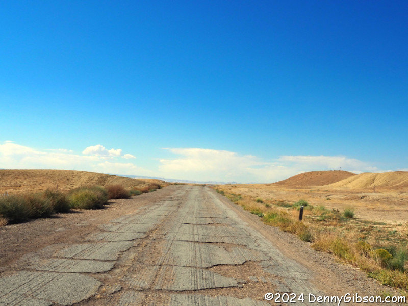
 Reaching the end of that twenty-mile segment did not end my time on old
roadway. After a few miles of expressway, an exit led to the old road
which ducked under I-70 and continued.
Reaching the end of that twenty-mile segment did not end my time on old
roadway. After a few miles of expressway, an exit led to the old road
which ducked under I-70 and continued.
|
|
|
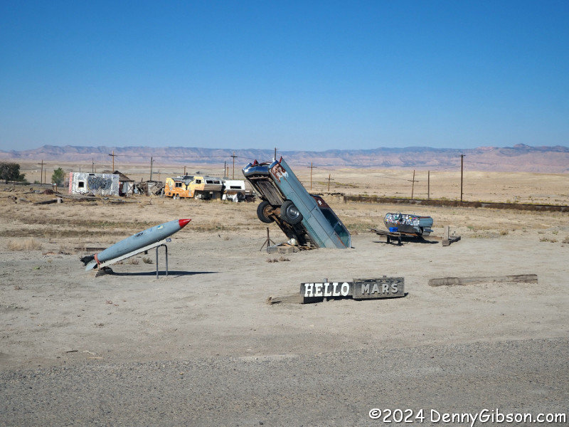
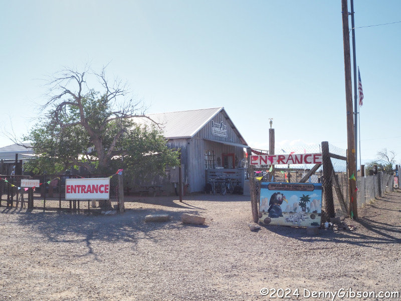
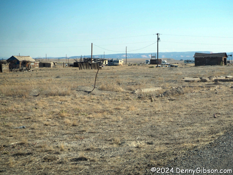
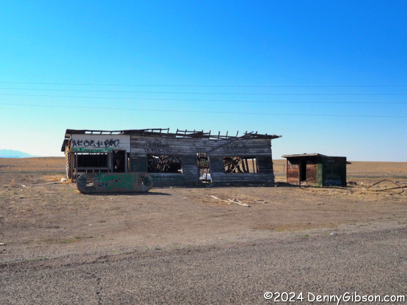
 And people do get off of that exit. Some get off to just look at
Cisco and some get off to camp there but the nearly
empty ghost town is by far the main reason people leave the expressway
there. The campers come because Cisco is in the
Harvest Hosts
program. A couple of buildings look like they might be occupied but I'm
not at all sure. I failed to ask when I bought a cold drink at
Buzzard's Belly.
And people do get off of that exit. Some get off to just look at
Cisco and some get off to camp there but the nearly
empty ghost town is by far the main reason people leave the expressway
there. The campers come because Cisco is in the
Harvest Hosts
program. A couple of buildings look like they might be occupied but I'm
not at all sure. I failed to ask when I bought a cold drink at
Buzzard's Belly.
|
|
|
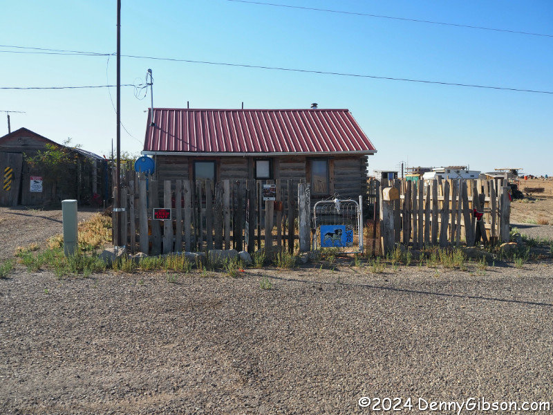
 It seems entirely possible that these are Cisco's only permanent
residents.
It seems entirely possible that these are Cisco's only permanent
residents.
|
|
|
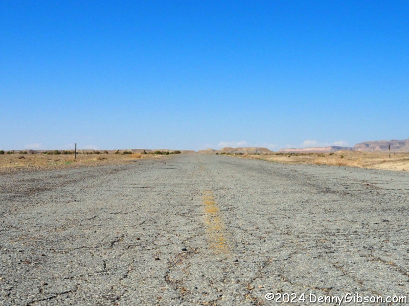
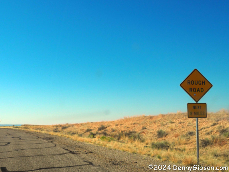
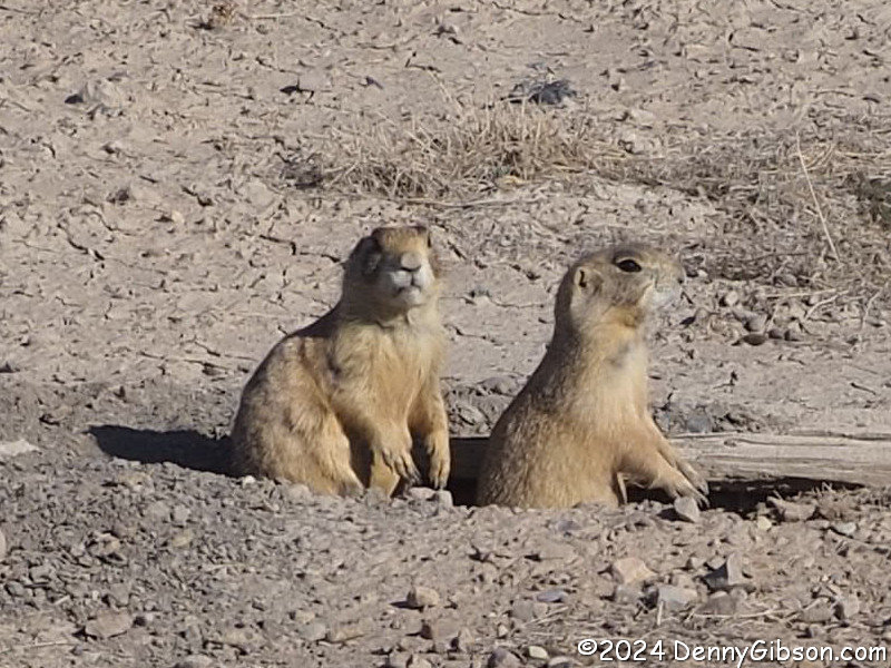
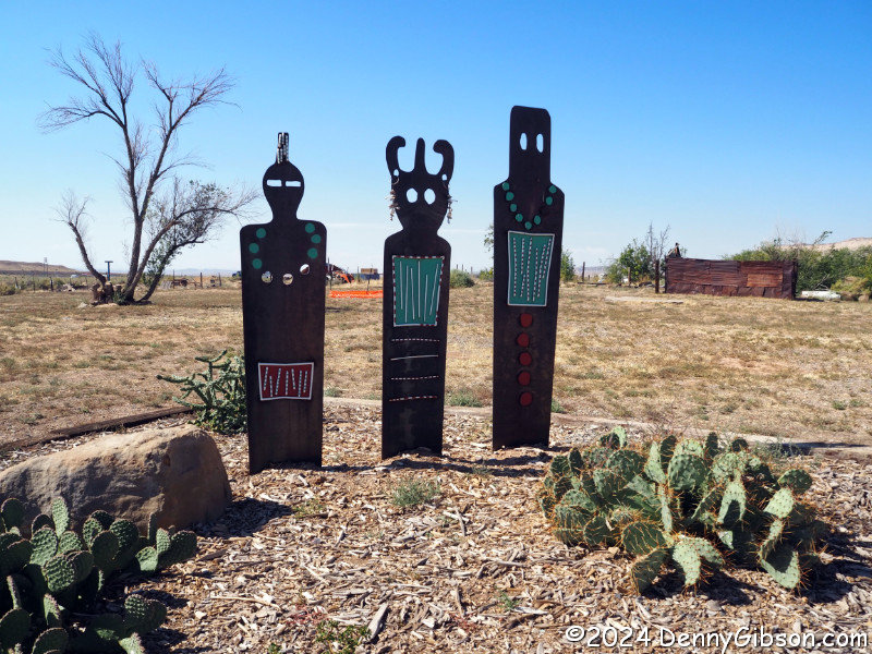
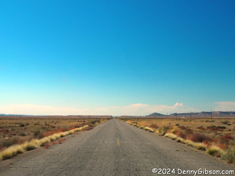
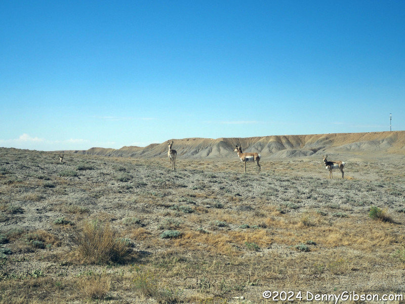 Cisco is about five mile from where I ducked under I-70 and in another
five miles I ducked under it again. What came next was about fifteen miles
of old rough roadway paralleled by the new smooth expressway. Thoughts
that those people on the interstate might be getting the same scenery as
me with less bouncing and shaking were just starting to enter my head when
the quartet in the last picture appeared. Those foolish thoughts
evaporated instantly.
Cisco is about five mile from where I ducked under I-70 and in another
five miles I ducked under it again. What came next was about fifteen miles
of old rough roadway paralleled by the new smooth expressway. Thoughts
that those people on the interstate might be getting the same scenery as
me with less bouncing and shaking were just starting to enter my head when
the quartet in the last picture appeared. Those foolish thoughts
evaporated instantly.
|
|
|
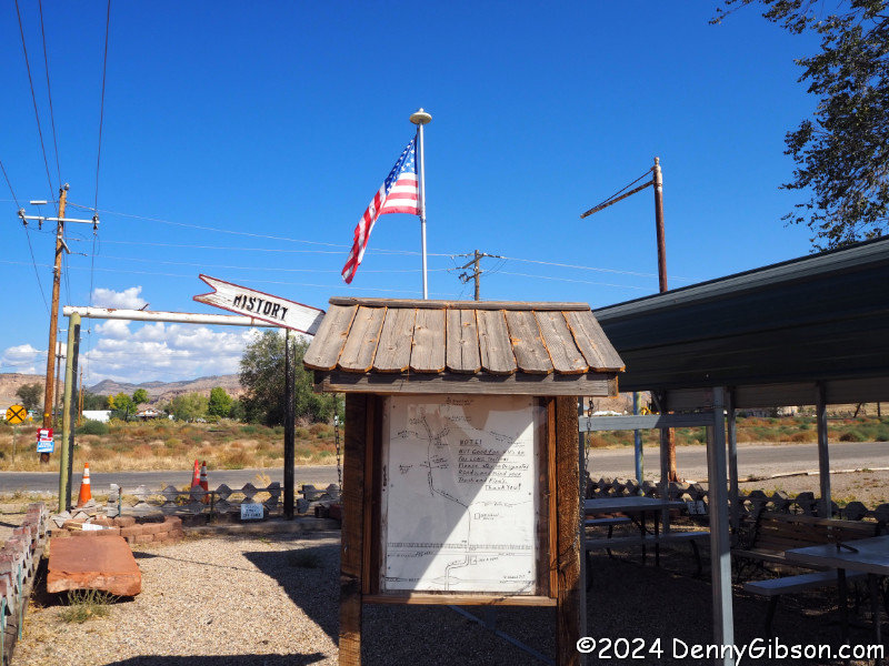

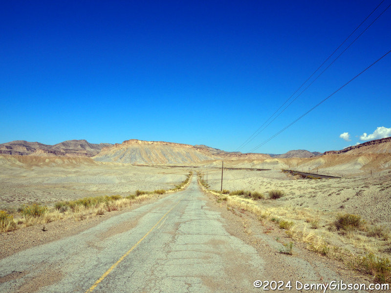
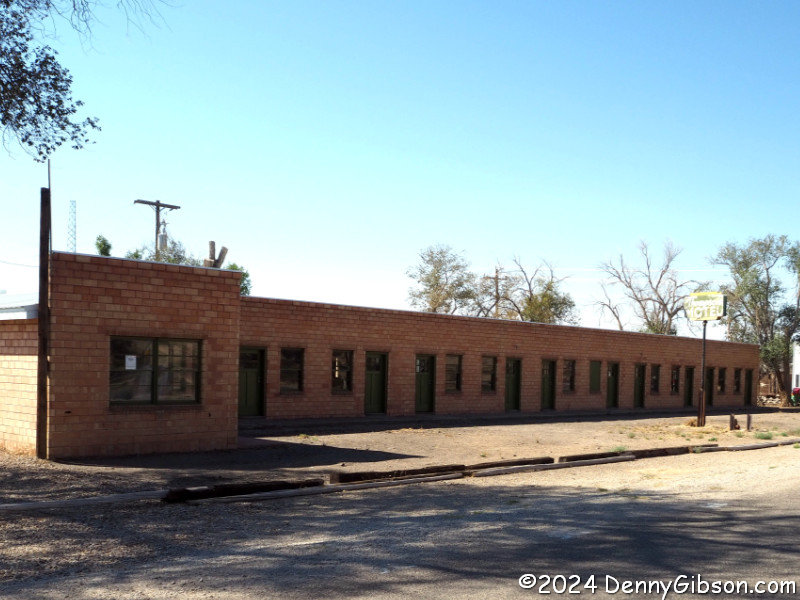 Even better was that the town of Thompson Springs lay just around the next
bend. Thompson Springs has one abandoned and empty hotel and one
functioning one. The Desert Moon is also an RV park. There is an art
installation with a question and explanation.
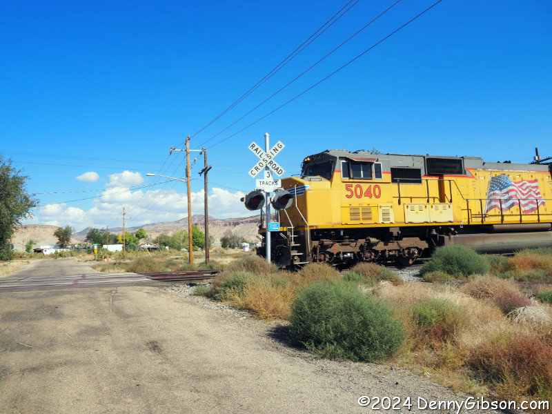
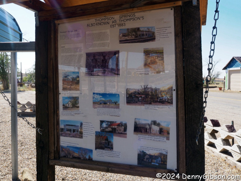
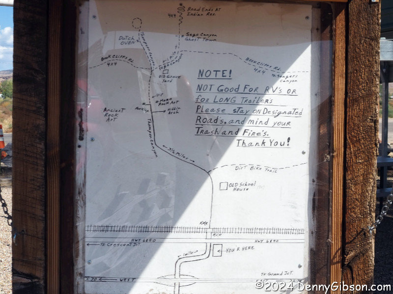
In the small park across the way, a kiosk displays some history and
a map. That map prompted the best adventure of the
day and maybe the whole trip but first I had to wait for a six car train
to pass.
Even better was that the town of Thompson Springs lay just around the next
bend. Thompson Springs has one abandoned and empty hotel and one
functioning one. The Desert Moon is also an RV park. There is an art
installation with a question and explanation.
In the small park across the way, a kiosk displays some history and
a map. That map prompted the best adventure of the
day and maybe the whole trip but first I had to wait for a six car train
to pass.
|
|
|
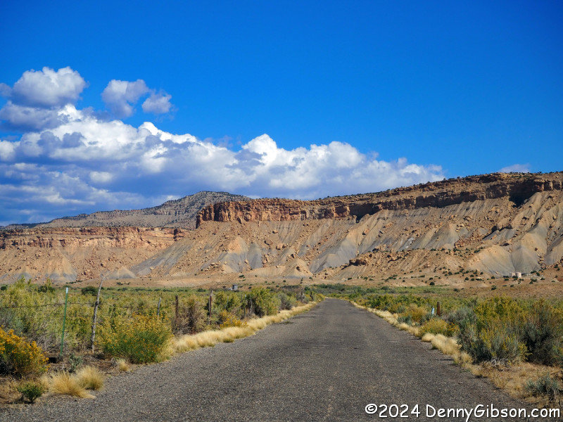
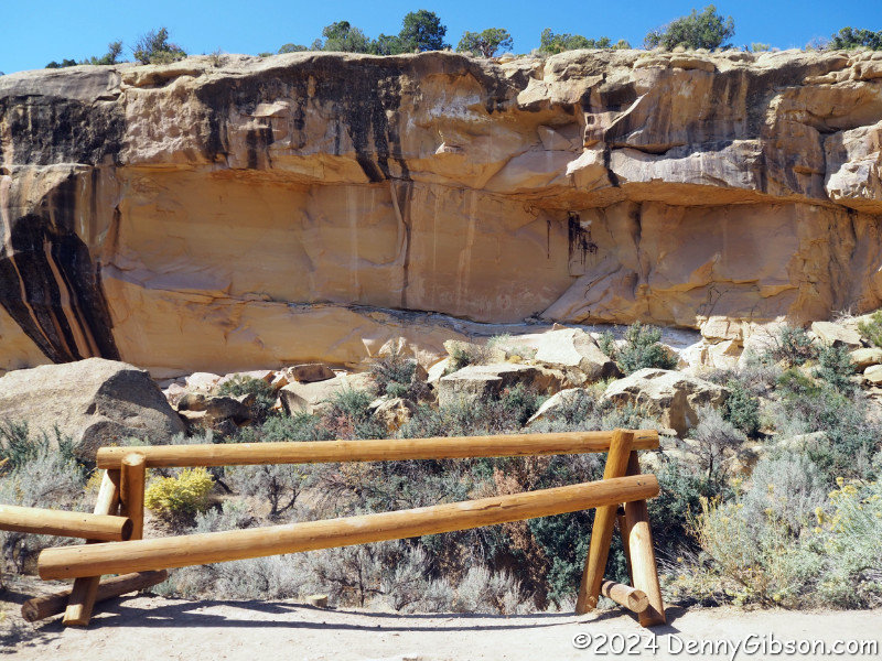
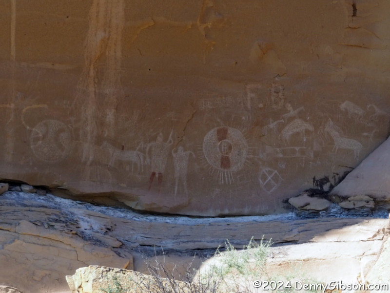
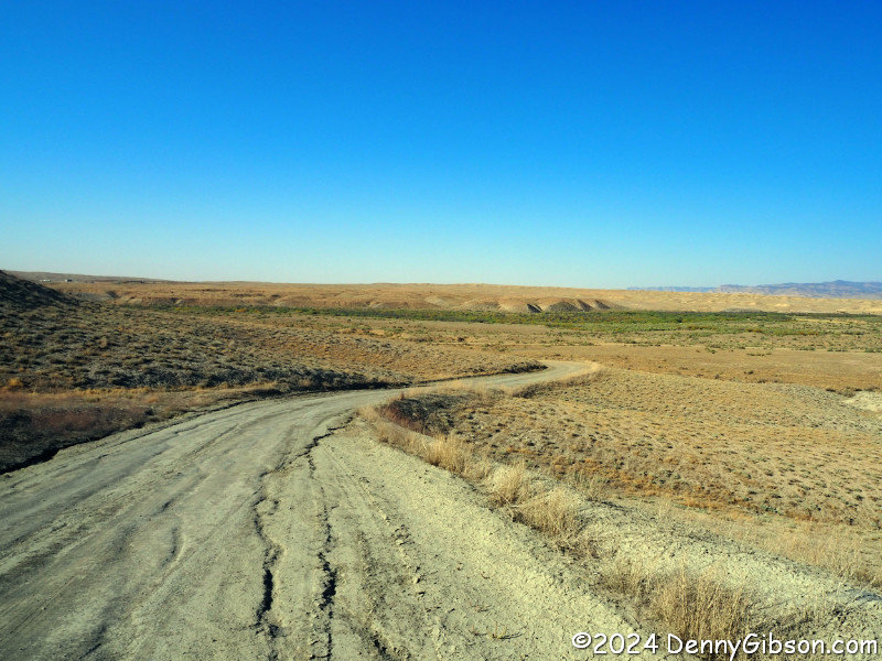
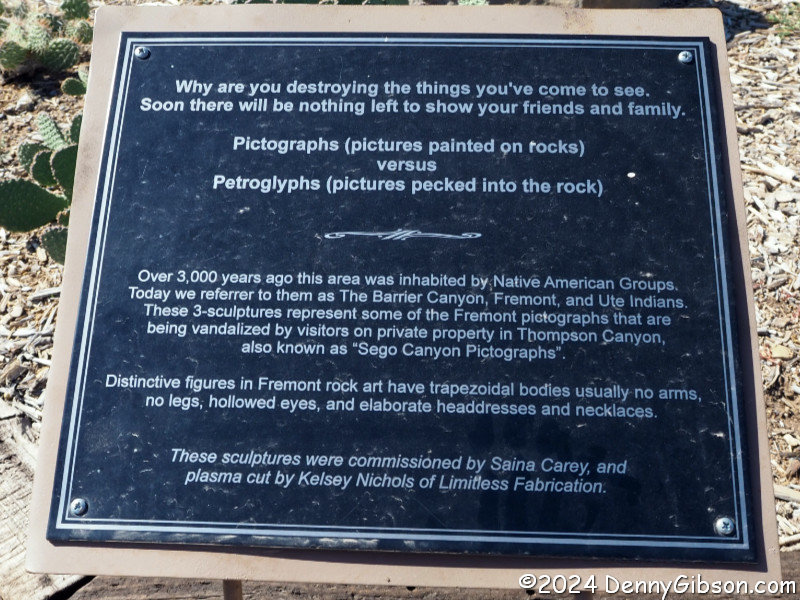
 The three and a half mile drive to the pictographs is paved and the
pictographs were wonderful to see. Beyond, the road is less developed.
The three and a half mile drive to the pictographs is paved and the
pictographs were wonderful to see. Beyond, the road is less developed.
|
|
|

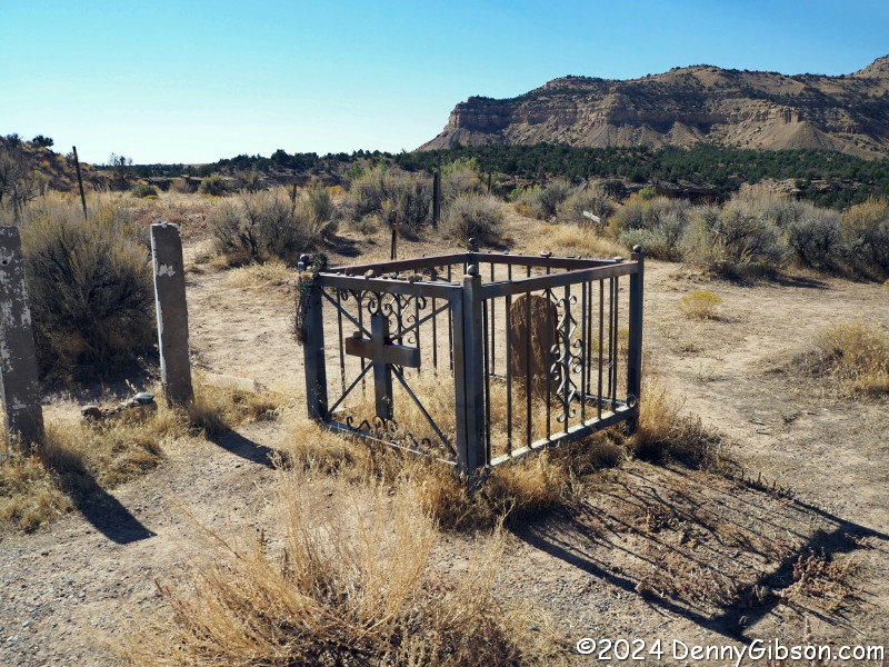
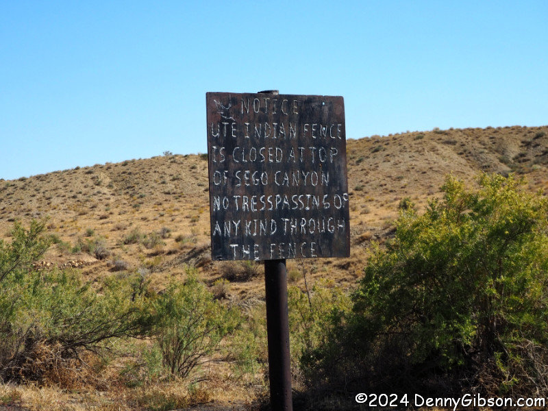
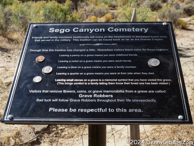
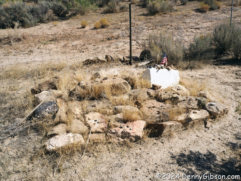 The Sego Canyon Cemetery is an easy half-mile
drive beyond the pictographs. Apparently it is still active. The white
stone marks the grave of someone whose life spanned 1958 to 2017.
The Sego Canyon Cemetery is an easy half-mile
drive beyond the pictographs. Apparently it is still active. The white
stone marks the grave of someone whose life spanned 1958 to 2017.
|
|
|
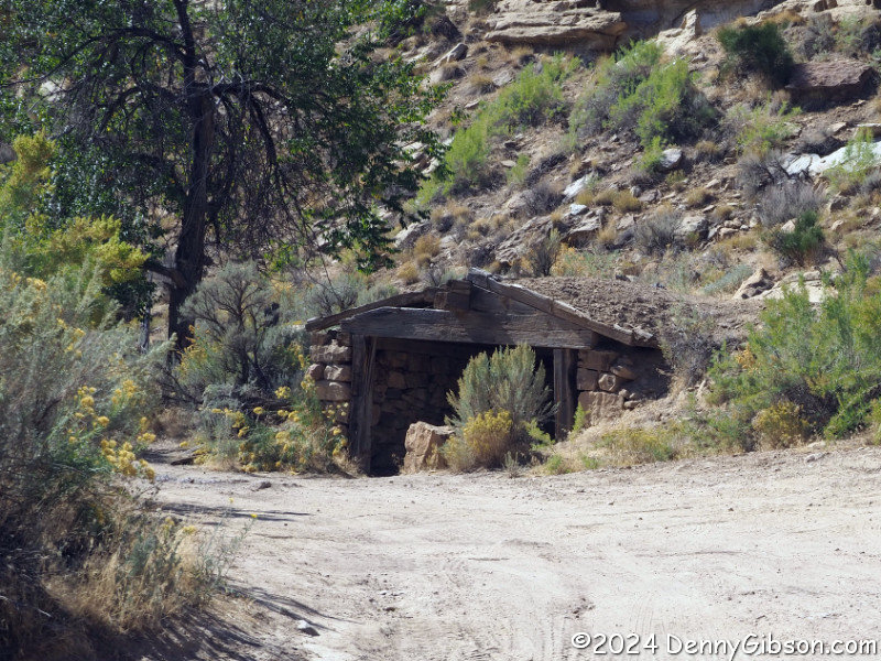
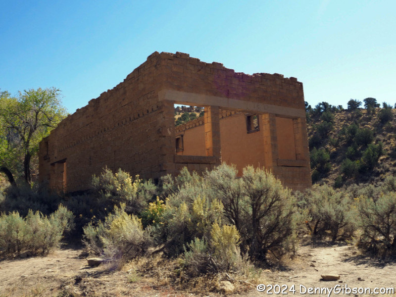
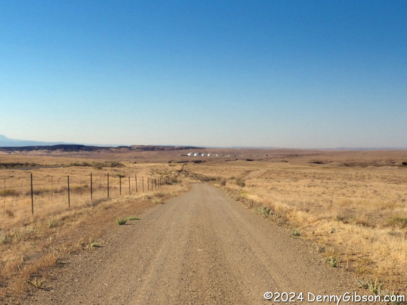
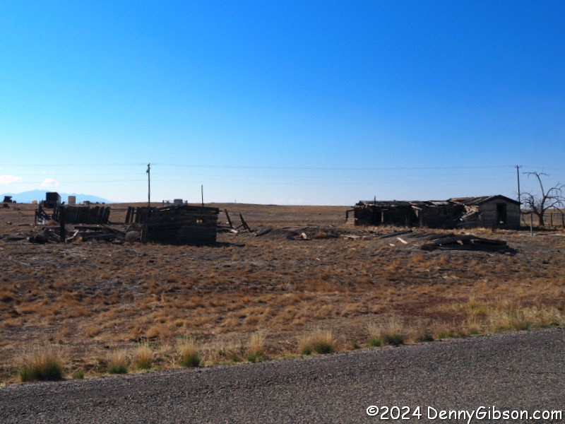
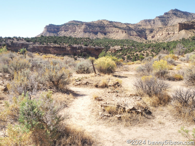
 There was a town of Sego but only a couple of buildings and some piles of
lumber that were once buildings remain. This was a coal mining town that,
according to Wikipedia, was occupied between 1910 and 1955.
There was a town of Sego but only a couple of buildings and some piles of
lumber that were once buildings remain. This was a coal mining town that,
according to Wikipedia, was occupied between 1910 and 1955.
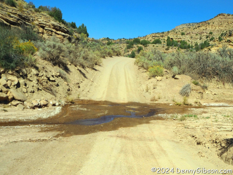
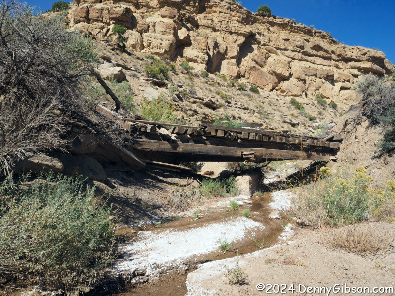
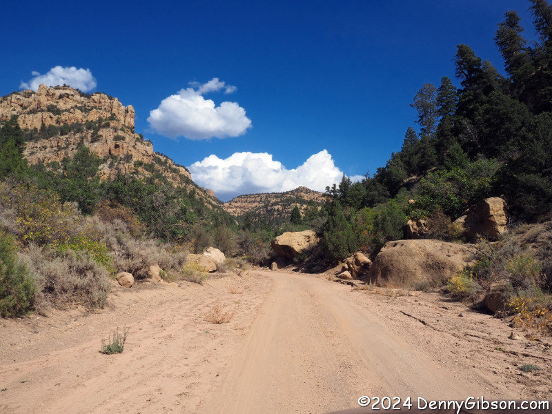
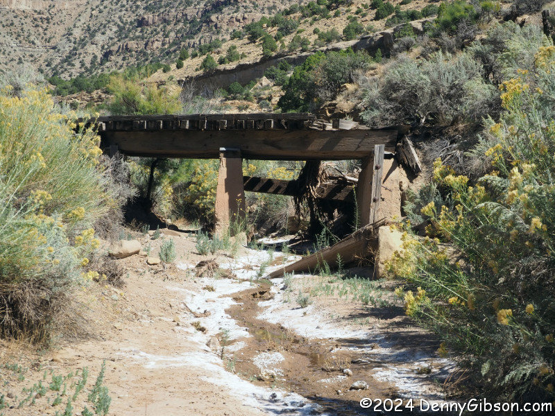
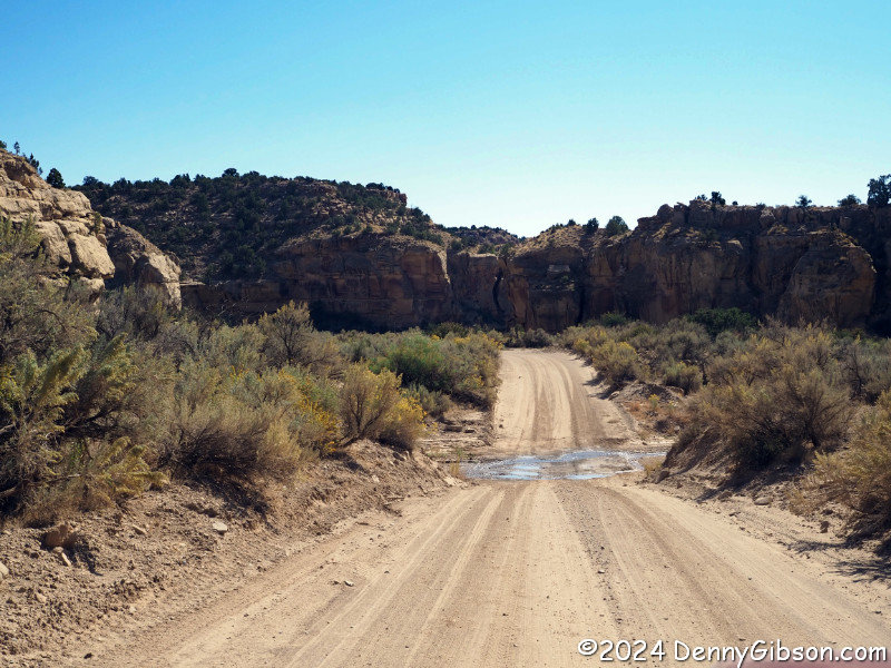
I drove about four miles beyond the cemetery before prudently turning back. That turned out to be about five miles from the Uintah and Ouray Reservation. The second bridge and wet spot were photographed on the return. |
|
|
 I continued west on a combination of old road and expressway before
turning north on US-191 and going to roost in Price, UT.
I continued west on a combination of old road and expressway before
turning north on US-191 and going to roost in Price, UT.
|
| [Prev] [Site Home] [Trip Home] [Next] |