
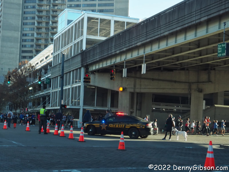
 The daily rate and a two-night minimum put the kibosh on preliminary thoughts of spending Thanksgiving night at a nearby state park lodge and other things got in the way of even making a reservation for the buffet there. Even so, I went to bed on Wednesday thinking that I would call about a last minute spot in the morning. By morning, however, I was ready to acknowledge that I would rather be driving than eating and set off to cruise some bits of the Dixie Highway that I had not been on for some time. In downtown Cincinnati, I was quickly reminded of the Thanksgiving Day Race that blocks several streets including the Roebling Bridge on which the Dixie Highway entered Kentucky from Ohio. I climbed onto the interstate and picked up the old auto trail on the other side of the river.
One reason the Dixie Highway makes for a good day trip south is that two alignments exist between Cincinnati and Lexington. The original path was pretty much straight south through Dry Ridge and Corinth. At some point, a path through Falmouth and Paris was proposed and recognized as an alternative by the Dixie Highway Association. Plans were to eventually pick one or the other but the Numbered US Highways came along and the DHA disbanded before a selection was made which leaves both alignments as somewhat official.
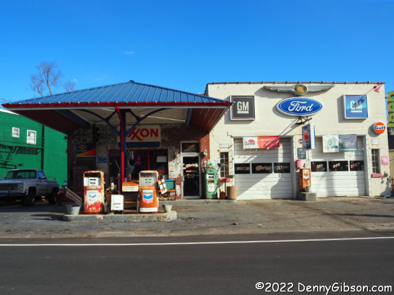
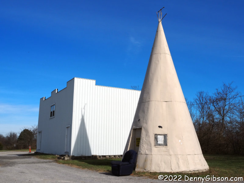
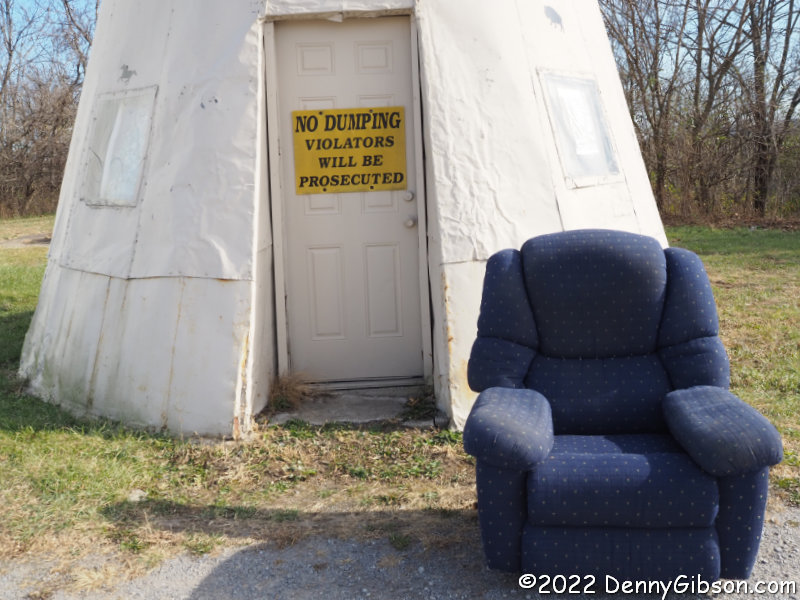
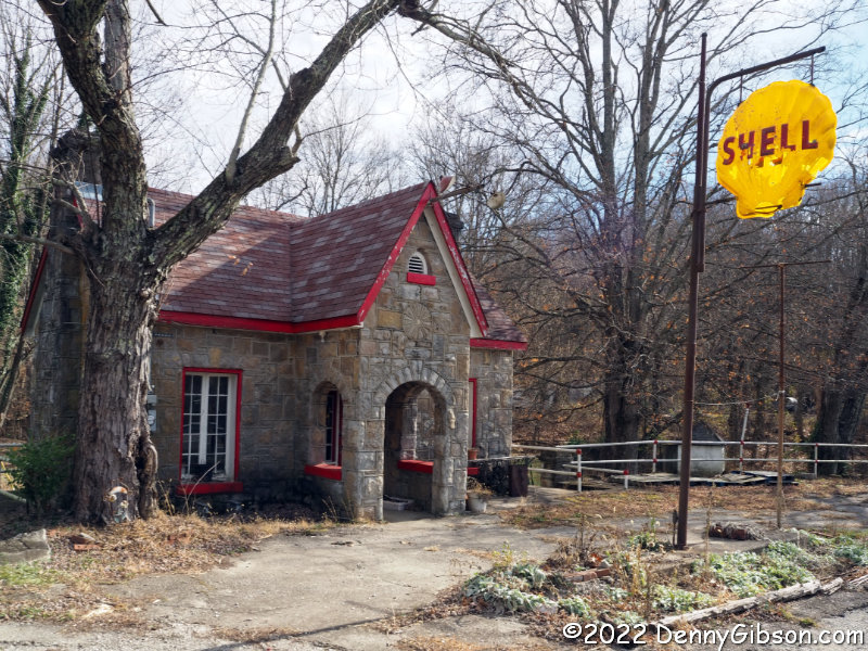 My pathway south was on the original alignment past the old gas station in Dry Ridge, the tin tepee (with recliner) near Williamsburg, and remnants of Fisher’s Camp near Corinth.
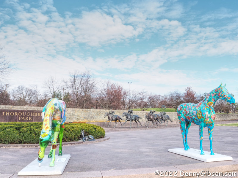
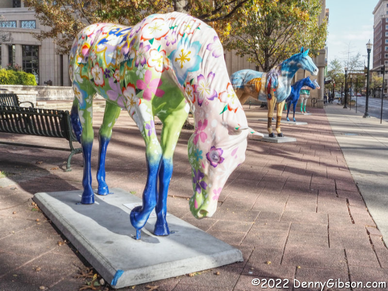
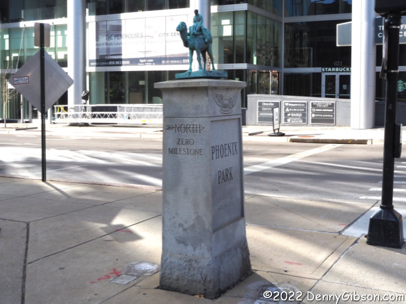
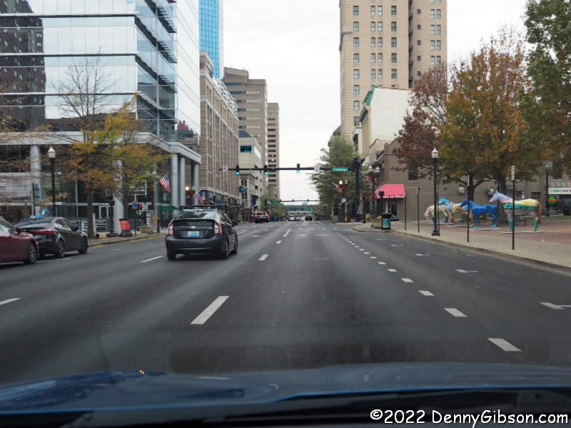
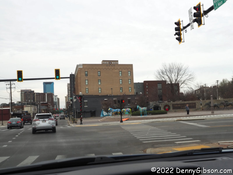
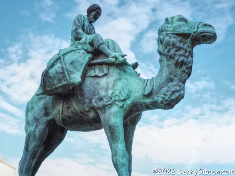 Lexington’s Main Street, which carried the Dixie Highway, is now one way northbound so I briefly left my southbound route to photograph the camel-topped Zero Mile Marker at Main and Limestone. While there, I slipped across the street to photograph just a few of the many painted ponies (actually thoroughbred racehorses) that decorate the city. I also snapped a picture at Thoroughbred Park before leaving town.
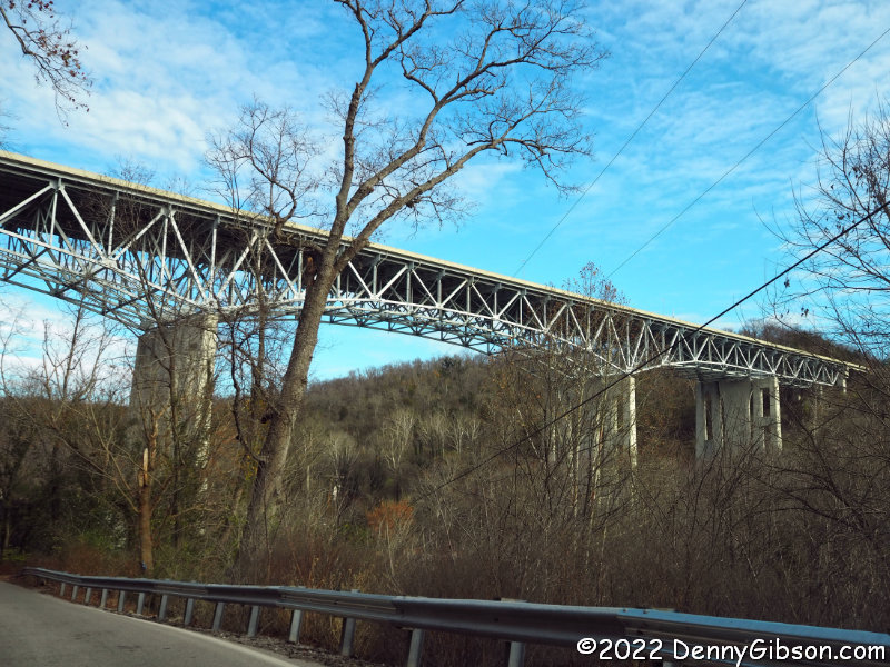
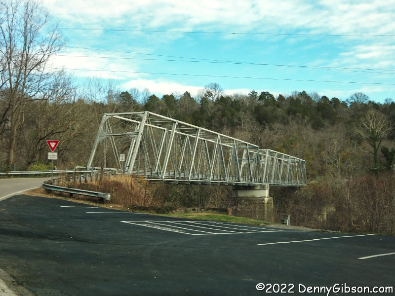
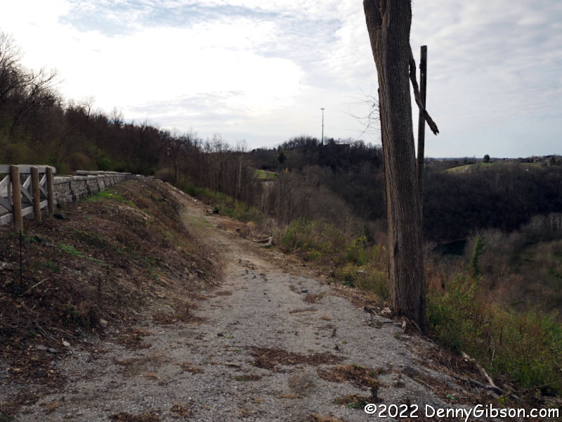
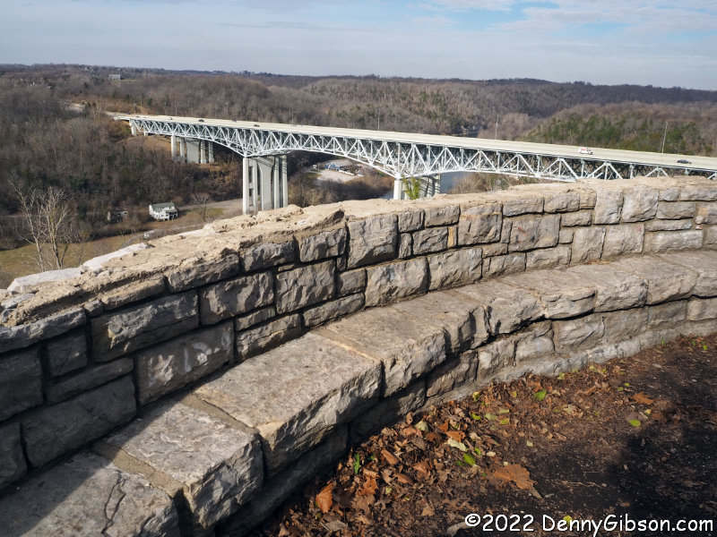 I had originally planned to pick up the other alignment in Lexington and head home but it was still fairly early and I decided to drive on to a place I had been interested in for a while. The first picture is of the modern bridge that currently carries I-75 and US-25 over the Kentucky River. The second picture shows the 1871 bridge that carried the Richmond-Lexington Turnpike, the Dixie Highway, and US-25 across the river. The third picture was taken from Clays Ferry Overlook on the south side of the river. Jay and Ashley Webb purchased this about a year ago and the Webbs have removed hundreds of truckloads of trash and cleared away trees to make it a real overlook again. Check out their Facebook page here. I did not prepare very well for my visit and I know there’s a lot of history here that I don’t yet know. I do know that the stone wall was built by the WPA in the early 1930s. This section of the road was relocated shortly before that but after it had become US-25. I believe that this is where the Richmond-Lexington turnpike and the Dixie Highway would have run.
 I’d driven to Clays Ferry because of the big cleanup and because it wasn’t much more than a dozen miles from Lexington and I drove on to Richmond because it was only a dozen or so miles farther. In Richmond, I was definitely tempted to drive the dozen or so more miles to Berea but managed to stop myself. I took the expressway back to Lexington and the southern end of that Falmouth alignment. The slightly off-route moves I’d made earlier had not actually been necessary, I now discovered. Not only did my northbound route take me right by Thoroughbred Park, the route to Falmouth begins at Main and Limestone and the Zero Mile Marker.
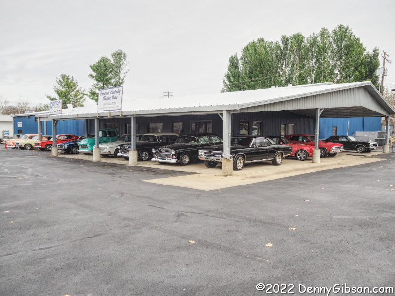
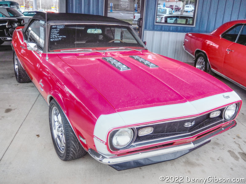
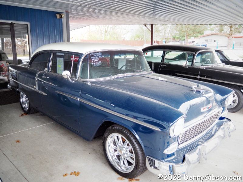
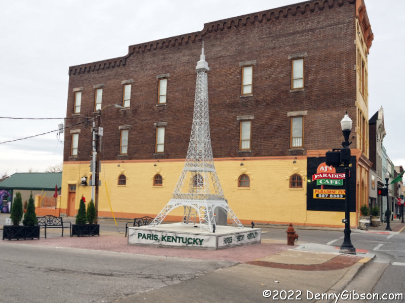 The Dixie Highway, as I’m sure almost everyone knows, passes right through Paris. At its southern edge, Central Kentucky Classic Cars pulled me in to drool over a 1968 Camaro, lower my sights slightly to consider a ’55 Chevy sedan, then eventually move on with the free digital photos that were a better fit for my budget. Every Paris deserves an Eiffel Tower and this Paris finally got one in the summer of 2021. At 20 feet tall, it is considerably shorter than the original in France (1024 feet), and the replica just up the road from me in Kings Island (314 feet), but it’s still pretty cool. Incidentally, the Edward Shinner Building in the background was declared the “Tallest 3-story Building in the World” by Ripley’s Believe It or Not! which explains why its top got clipped in the photo.
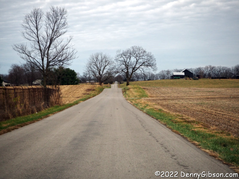
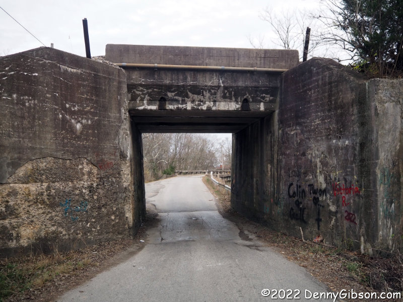
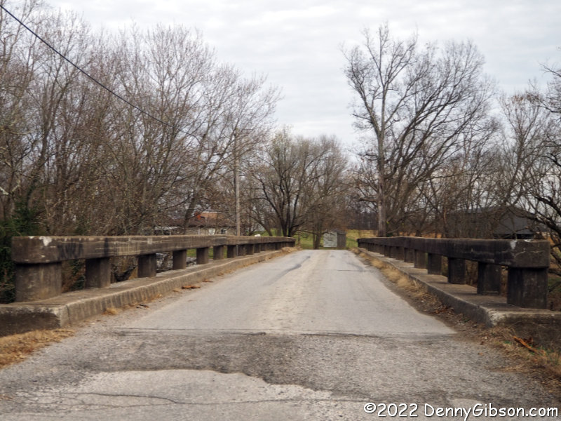
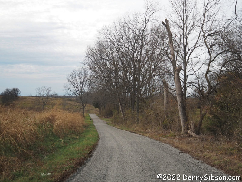 Much of this Dixie Highway alignment has been taken over by US-27 but a few miles south of Cynthiana it moves to the west side on Mark Road then cuts back across the US route, slips through a narrow underpass, crosses a narrow bridge, and heads straight (but not quite level) into the Kentucky countryside on Old Lair Road.
 Sunset occurred almost simultaneously with my reaching Punkyville so things were starting to dim when I took this driveby shot. When I first drove this alternate alignment in 2015, I stopped and explored Punkyville and I’ve done that a time or two since but not today.
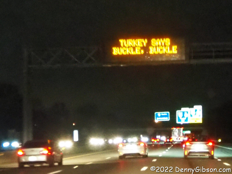 Despite increasing darkness, I stayed with the Dixie Highway through Falmouth and Independence but encountered a road closure about three miles north of the latter town. By then, even though it was not yet 5:30, full-on darkness had arrived and I abandoned the DH for a more direct route home. I grabbed a shot of the last electric overhead sign I passed so I could share ODOT’s Thanksgiving greeting.
Wow! Great article!
Thanks so much for coming to see the Overlook, if you are in the area again let me know, I’d love to meet you.
It’s really looking good and I’m sure I’ll be back although probably not before next spring or summer. When that happens I’ll certainly give you a heads-up if possible. Look forward to meeting you.
Pingback: TG ’24 | Denny G's Road Trips Blog
Pingback: TG ’25 – Some Dixie Redux | Denny G's Road Trips Blog