
 It’s probably not hard to guess that this post was triggered by two recent reviews of books with titles (Route 66: The First 100 Years & Route 66: 100 Years) that closely resemble the one above. Just like someone’s list of the best guitarists or best albums, those books could not possibly include everybody’s favorites. Reading them stirred up my own memories of the route, and when I finished, it was clear that some of the things and people that stood out in those memories had been omitted. I even briefly thought of pointing that out in the reviews, but quickly and wisely dropped the idea. Including everyone’s ideas of what was significant about a hundred years and more than 2,000 miles is even more challenging than naming everyone’s favorite album in a top 100 list. So, I started planning an entry about a few of the “omissions” on my mind and almost immediately realized that some context was required. Thus, this post.
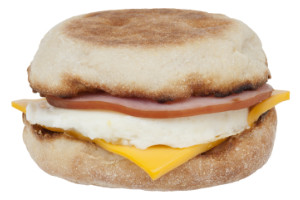
I initially had 26 in this post’s title to account for the 26 years since my first full drive of Historic Route 66 in 1999. Then I remembered my one and only real-life encounter with a real live US 66. In 1981, my future ex-wife and I were headed toward Las Vegas on I-40 when we exited at Winslow, AZ, for breakfast. I knew almost nothing about Route 66, but recognized the name Winslow from the Eagles song. I even think that had something to do with picking the town for breakfast. I recall grabbing an Egg McMuffin, then driving through a bit of the town, and returning to I-40 on the west side. I believe that at least a tiny bit of that drive was on a still commissioned US 66. I always learn something while writing a blog post, and in writing this one, I learned that “Take It Easy” and the Egg McMuffin were both released in 1972.
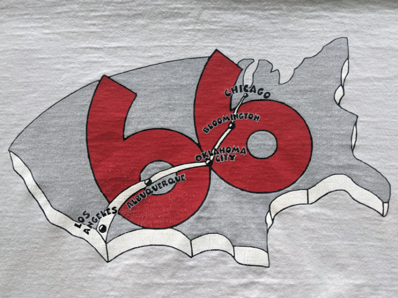 As we all know, the route ceased to officially exist a few years later. My next encounter with the route, and probably first encounter with the renaissance, was in 1998 when I attended the Bloomington Gold Corvette gathering in Bloomington, IL, with a friend. I imagine I was already thinking of driving the route when I bought this T-shirt. I still have it and even still wear it occasionally. I recently wore it at the Milles of Possibility conference, where it got a little attention because of the unusual set of cities marked on the back. Most Route 66 folks, including Bobby Troup, forget Bloomington.
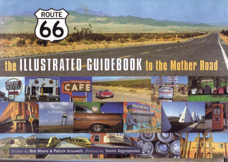 A more serious relationship with Sixty-Six began the next year when I made my first full-length drive. The book shown at right was my guide. It was a true mile-by-mile guide with accurate distances to turns, cities, and roadside attractions. Its ring binding (similar to EZ66) allowed it to be laid open in the car. Co-author Bob Moore was a key player in Route 66 Magazine. In 2003, he and Rich Cunningham published a two-volume Route 66 Guidebook and Atlas. I never met Bob, although I did stop by the magazine’s office and gift shop on that first trip. The journal for that trip is still available here.
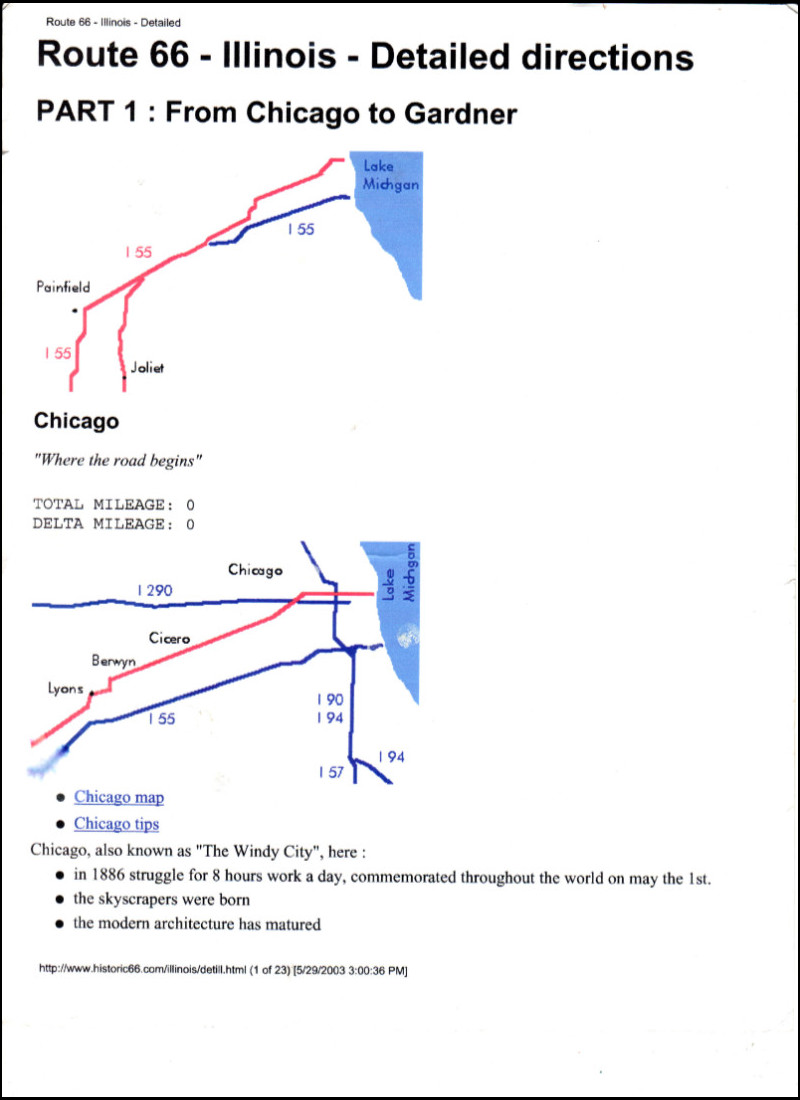 At left is a scan of the first page of the directions I followed on my second full-length trip in 2003. By then, I had discovered Historic66.com and gave my printer a workout by printing every page of the turn-by-turn directions at the site. What would become Historic66.com was started in 1994 by Belgian Swa Frantzen and his wife, Nadine Pelicaen. This was near the leading edge of the internet, and the website is generally accepted as the first dedicated to Route 66. Swa and Nadine turned the site over to Route 66 Navigation founders Marián Pavel and Jan Švrček in 2021. Details of this cyber-pioneering are told here.
I did meet Swa and Nadine several times, but since their retirement, they have pretty much cut out international travel. The last US visit that I am aware of was in 2018, when they were here partially to photograph the total solar eclipse of that year. I was alone in an open car on that 2003 trip. I kept the directions in the seat beside me with large spring clips at top and bottom. As I finished each page, I pulled it from the clips and crumpled it up behind the passenger seat to keep it from blowing away. At the next stop or at the end of the day, I would straighten them out and place them at the back of the stack. I still have them. The journal for the 2003 trip is here.
 There has always been a GPS in my car, starting with the very first of my documented road trips. The earliest ones I used showed me my position on a map and the straight-line distance to cities and other places. They did not offer routing. I actually doubt that routing was even possible before the government dropped “selective availability”, which limited the accuracy of civilian receivers, in 2000. I acquired a unit capable of routing in 2006 and started plotting downloadable routes for my trips. This included some partial Route 66 outings using directions in a first-edition EZ66 Guide, which I’d bought from Jerry in 2005. For my third full-length trip in 2012, I used a store-bought route.
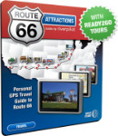
River Pilot began releasing Route 66 products for certain Garmin GPS models in 2010. I purchased his Ready2Go Tours app (reviewed here) in 2012, and used it for a Chicago to L.A. run later that year. I was quite happy with the product. It was available for purchase for several years, and GPS units could be rented with it pre-loaded. Incompatibility with new Garmin models basically doomed the product. That also seems to have doomed a line of pre-planned routes that were once available from MAD Maps for Garmin units. I had several email and telephone conversations with River that included comments about how we were part of a seemingly small subset of GPS users who understood the difference between being guided to a point and being guided along a route. He had some hope of developing products that would take advantage of the exploding availability of GPS in smartphones, but I don’t believe they were ever seriously pursued. MAD Maps’ similar intentions also went unrealized. To the best of my knowledge, Touch Media’s Route 66 Navigation (reviewed here) is the only successful use of a smartphone to truly follow a route.
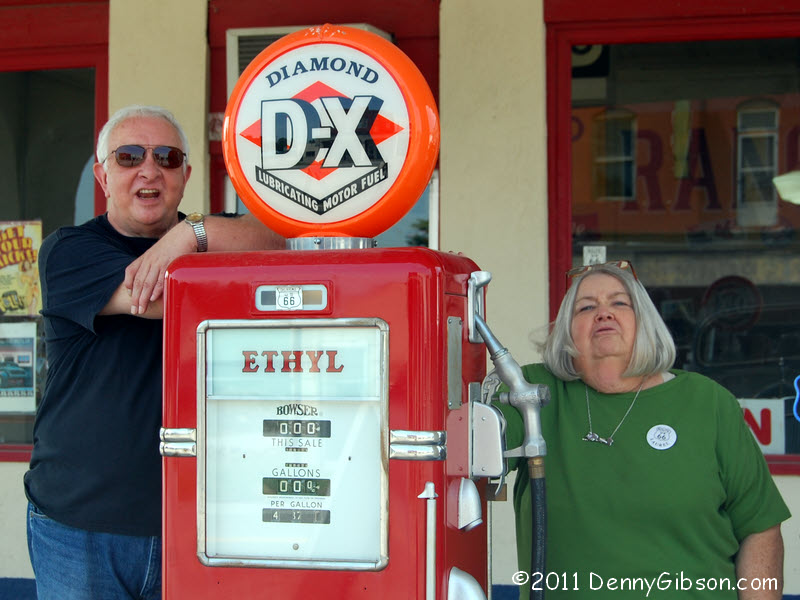 I’ve always liked this picture of Ron, Ethel, and Laurel. Laurel Kane operated a small museum and gift shop in Afton, OK, from sometime around 2000 until her death in 2016. Ron McCoy frequently rode along on Laurel’s eighty-mile commute from Tulsa to help with something at the station or to just keep her company. She might sell a few souvenirs while she was there, but that wasn’t really the point. She was there to greet the world travelers passing by and to tell them about her part of Route 66. I mentioned in the review of Route 66: 100 Years that it included a picture from her sizable collection of photos, postcards, and other memorabilia. She would have liked that. My “remembering’ post for Laurel is here.
For me, Bob, Swa, Nadine, River, and Laurel have played significant roles during my 45 (really 26) years on Route 66. I bet they are also big players in some others’ memories of the route, too. Egg McMuffins, maybe not.
Pingback: American Sign Museum: 20 Years | Denny G's Road Trips Blog