Trip Peek #12
Trip #75
Madonnas and Signs

Foot Print Rock, National Road, OHThis picture is from my 2009 Madonnas and Signs road trip. This was a short trip organized for a small group of friends. On the first day, we drove from Richmond, Indiana, to Springfield, Ohio, on the National Road then to Lebanon, Ohio, primarily on US-68 and US-42. The “Madonnas” in the title refers to the Madonna of the Trail monuments in Richmond and Springfield. The “Signs” in the title comes from the American Sign Museum which we visited on the second day. Since I was acting as a guide and the places we stopped were familiar to me, my journal for the trip is fairly sparse. Other folks on the trip took a lot more pictures than I did.


Trip Pic Peeks are short articles published when my world is too busy or too boring for a current events piece to be completed in time for the Sunday posting. In addition to a photo thumbnail from a completed road trip, each Peek includes a brief description of that photo plus links to the full sized photo and the trip journal it is from.

Trip Pic Peek #11 — Trip #24 — East End of 62

This Was the Walk That Was…
Risky

TW3-1I once rode my bicycle through this intersection. Twice, technically, because I had to return, but never again. My bicycle’s power plant is not the sort that delivers instant acceleration or quick sprints and it seemed that about the only thing in question was whether I got run over before or after I collapsed. Walking through it would have been even worse but I did manage to get to the “land beyond” on a few occasions by crossing each road at some distance from the intersection and being very patient. That changed this summer when pedestrian signals were installed here and at other nearby locations.

The photo shows the intersection of Mason Montgomery Road and Fields Ertel Road with I-71 overpasses in the background. I-71 exits onto Mason Montgomery Road and entry is from Fields Ertel which help make this intersection quite busy. A major project is underway to improve the flow of traffic getting on and off of the expressway at this point. It has its own website, AdvancingFieldsErtel, which tells not only about the project’s components and progress but what led to it. Few, if any, of the new pedestrian signals I mentioned have anything to do with the highway project. I believe that people really are trying to make this area walkable.

TW3-2I live north of Cincinnati inside the triangle bounded by Mason Montgomery Road, Fields Ertel Road, and Montgomery Road (a.k.a. US-22/OH-3). I-71 misses the northwest corner of this triangle by roughly a hundred yards. An overhead view of the triangle can be had by clicking on the small map at left. Some signs and maps refer to Mason Montgomery Road as simply Mason Road and that is what I’m going to do in the remainder of this article.

TW3-3The Mason and Fields Ertel intersection is the busiest corner of the triangle but the Fields Ertel and Montgomery intersection is not far behind. That’s it on the right. I once spent many minutes trying to cross Fields Ertel there before walking far from the intersection and crossing at a slightly narrower point. Mason Road essentially ends at Montgomery Road (It changes name and enters a residential area.) so that corner of the triangle isn’t particularly troublesome but it does have considerable traffic as do all three of the triangle’s sides.

I like to eat and I like to walk. I don’t like to cook. That means that an attractive meal for me is one that I didn’t cook and which, at least in fair weather, I walked to. There are several decent eateries (Fridays, Frisch’s, Golden Corral, Honey Baked Ham, Pizza Tower, etc.) inside the triangle so I could somewhat satisfy my walk-to-dinner proclivities without risking life and limb but other restaurants beckoned just beyond the lines of cars.

TW3-3TW3-4And now my walking world has exploded. I am able to escape the triangle on foot with some sense of safety. The first picture is of the Mason and Fields Ertel intersection with the new “WALK” signals circled in red. The second was taken as I began to walk across Mason Road while keeping a watchful eye on every car I passed. I can now safely reach the area northwest of the triangle where numerous restaurants, quite a few stores, and a 16 screen movie theater await. The intersection at Fields Ertel and Montgomery road can also be crossed safely and there are attractions in that direction, too. There are also crossing signals at several locations along Fields Ertel and Montgomery Roads and to help with crossing Mason Road north of Fields Ertel but none where it borders the triangle. More on that later.

TW3-6TW3-5Sidewalks help increase an area’s walkability almost as much as pedestrian signals. The west side of Mason Road has long had a sidewalk north  of I-71. Montgomery Road got one on its north side, in the area of the triangle, this summer. It is a fact that the sidewalk on Montgomery Road was an afterthought and it sometimes shows. The need to curve around existing infrastructure, as in the first picture is easily understood. The reason behind the long bulge around the fire hydrant, or maybe the drain, is much less clear. It doesn’t matter, though, whether they curve, bulge, or run perfectly straight, I really appreciate the sidewalks. A map at the end of the Symmes Township Sidewalk Plan shows that sidewalks have been proposed but not funded for parts of Mason and Fields Ertel Roads. I’ll be very happy when that happens.

Incidentally, although it isn’t precisely true, the northern boundary of Hamilton County is often considered to be Fields Ertel Road. That means that all these improvements are split between two counties. The local entities responsible are Symmes Township in Hamilton County and Deerfield Township in Warren County. I suppose that makes things more difficult in some ways but it may also make things more evenhanded.

TW3-7TW3-8As things now stand, only two danger zones remain along my various popular paths. One is on Mason Road beneath the I-71 overpasses. It seems to never drain completely and there is no sidewalk. Although I almost never see vehicles there, the pattern of ruts in the mud is constantly changing. Maybe people pull over there every night while I sleep. Because of the standing water and squishy mud, walking in the roadway is more or less required here. Synchronizing the dash to the next dry spot with an empty curb lane helps but is challenging. I’m hoping that this gets improved somehow when the nearby ramp project is completed. The other danger zone is where I cross Mason Road to reach the building in the second picture. The line of cars in the picture have come from an office park and are waiting to turn left. Because of the traffic on Mason road, turning left can take a long time and the line rarely goes empty. This means that anyone attempting to cross the road in front of the building will very likely have to deal with a car from the side street whenever there is an opening in the Mason Road traffic. I handle the problem by crossing at about the point where the picture was taken so that those left turning cars are not an issue. Why would I go to this much trouble to reach that building? It’s called Flippdaddy’s with the subtitle “Burgers & Beer”. Any other questions?

Book Preview
Walking to Listen
Andrew Forsthoefel

Walking to Listen - Andrew ForsthoefelYes, that says “Preview”. The book does not yet exist. I don’t know exactly when it will exist or if Walking to Listen will even be its title. But I am confident that it will exist and that it will be worth reading.

In a recent blog post, I told how, when I travel, I quickly get behind on the RSS feeds I subscribe to. The same thing happens to the few podcasts that I follow. Heck, I even get behind on them when I don’t travel. So I am seriously behind on This American Life. So much behind that yesterday, October, 15, I listened to the program from May 3. My timing was perfect.

It was a three act program named “Hit the Road”. Act one was “The Slowest Distance Between Between Two Points” which was Andrew Forsthoefel’s story. Andrew had walked across the country, from Philadelphia to the San Francisco, covering 4000 miles in eleven months. He wore a sign bearing the phrase “Walking to Listen” and that is what he did. He met lots of people and he listened to them. He recorded lots of what he heard. From that he produced a one hour audio program that can be heard here. In some regards, the This American Life program is a trimmed down version. It can be heard here.

I was walking when I listened to the podcast and I suppose that might have had a tiny bit to do with my liking of the podcast but only a very tiny bit. The idea of seeing the USA through its people is always intriguing and that’s what Andrew was doing with his walk. He was twenty-three years old and he was asking people what advice they might give to a twenty-three year old version of themselves. Listening to some of the answers was intriguing to the extreme. So too was Andrew’s commentary recorded both during and after the walk.

Near the end of the program the host, Ira Glass, shared information about the one hour program and also mentioned that a book was in the works. When I got home, I listened to the longer audio program and I visited Andrew’s website at WalkingToListen.com. There are pictures there and more information about the walk and a blog. Andrew started the blog about two weeks into the walk. I haven’t read the entire thing but it looks as if he posted every few days during the walk and mentioned everyone he had recently talked to. Thanked them, actually. After the walk, the entries slowed, as they should, to a trickle. The most recent was posted on October 14; The day before I first heard the podcast and the second anniversary of the walk’s beginning. In addition to noting the anniversary, the post announced that Houghton Mifflin had picked up the book. As I said, my timing was perfect. I’ve subscribed to Andrew’s blog and will be anxiously watching for a publication date.

The picture at the top of this post was taken by Andrew’s mother as he set off to walk and listen. I hope neither she nor Andrew are too angry at me for snitching it.

Geeks in the ‘Hood

Cincinnati 2013 Road MeetI attended my third Road Meet on Saturday; This one in Cincinnati. The previous two were in Columbus and Dayton. I did a blog entry on the Dayton meet in which I tried to define “roadgeeks” and describe how they differ from “roadies”. That generated a little discussion on the blog post and more on a Facebook post pointing to it. The much condensed version is that I described “roadies” as liking old roads and “roadgeeks” as being attracted to new roads. The gist of the comments, mostly from those calling themselves “roadgeeks” was, “Hey, we like old roads, too.” And I know they do. As a result, I’ve been shying away from both names and mostly using “road fans” to describe folk who like roads and/or the stuff beside them. It remains true that members of Route 66 and Lincoln Highway groups often refer to themselves as “roadies” and that many of the Yahoo Roadgeek group postings concern new road construction but, as the discussion triggered on that earlier blog entry indicated, the old vs. new distinction really is just one of degree. On Saturday, a bunch of road fans, who are members of a group named Roadgeeks and who know a lot about the way roads are built and signed, met in Bellevue, Kentucky, just across the river from Cincinnati.

Cincinnati 2013 Road MeetThe Cincinnati meet had more of a mix of old and and new than the other meets in my limited experience. It started with drivebys of some old signs on a railroad overpass, which I did not photograph, and this embossed “END OF…” sign. We drove a bit further south before moving onto expressways to head back toward the river. That picture at the top of the article, taken in Devou Park, should have two more people in it. We lost them during on the expressway section and I am responsible for that.

The meet’s organizer, Jeremy Mose, was in my car so I was leading. Behind me, the other four cars shuffled a bit but I thought all were with me as we moved from I-275 onto I-75. But, when we left the interstate, I soon realized that a grey car I believed was part of our group was not. Before too long, I was feeling helpless as well as guilty. The lost couple were attending their first road meet. The first time any of the other attendees had met them was at the restaurant where the meet started. No one had a phone number for them. They had not been part of the group associated with the Facebook event entry for the meet which meant they had not received the cellphone number Jeremy had sent to everyone signing onto that event. They did have a set of driving instructions so it seemed a good possibility that they would find their way to Devou Park on their own but that did not happen during the hour or so we were there. There was only one car in the group which could be lost with no means of contact available and I did it.

EDIT 14-OCT-2013: I have just learned that the missing couple received a phone call from a son in need of a ride and, in their words “had to bolt the meet”. My guilt is gone but I will make more of an effort in the future to see that anyone following me can contact me.

Cincinnati 2013 Road MeetCincinnati 2013 Road MeetWe eventually headed across the river and through what Jeremy called the 6th Street viaduct project and which I, in my few encounters, thought of as a US 50 project. It apparently has an official name which is neither of those though, unless my memory surprises me by tucking away Valdvogel Viaduct, I may continue to use US 50 as the identifier. Valdvogel Viaduct is kind of fun to say so it could happen. We also got a view of part of the project and a lot of Cincinnati from Olden View Park near where the Price Hill Incline once terminated.

Cincinnati 2013 Road MeetThis is a view of the “Lockland Canyon” that I had never seen before. In fact, I don’t recall ever before hearing this section of southbound I-75 referred to by that name though it is apparently fairly common. The canyon aspect of the road comes largely from the fact that locks of the Miami & Erie Canal once occupied this space. Widening the “canyon” is part of a project planned for 2016. Although this was my first time at the “scenic overlook”, I have driven through here countless time. I have also ridden a motorcycle here and can attest to the buffeting that a semi-truck and those concrete walls can create.

Cincinnati 2013 Road MeetOur last stop was near the Kennedy Connector project. I couldn’t get much of a picture of the project itself so here is a picture of a sign assembly associated with it. The photo illustrates two things. One is the odd mixes that can show up on roadside signs. The right hand panel contains button copy (reflective “buttons” on sign elements). Ohio was one of the last three states to use button copy (The last was Arizona in 2000.) so it is not as rare here as elsewhere but it is an old technology. The left hand panel contains Clearview Font which is sort of the leading edge of highway sign lettering. The second thing the photo illustrates is that roadgeeks notice these things — and the orange “detour arrow”, too.


1832 culvert, Richmond, IN1832 culvert, Richmond, INI had visited another construction project on Monday. A few days earlier, a Richmond, Indiana, newspaper published a story about a repair crew uncovering an 1832 stone culvert underneath US-40 (a.k.a., National Road). The uncovering was temporary and the culvert would again be hidden when the repairs were complete. I headed over for a look but it was already too late. Although the article had appeared just days before, the project it described had taken two months and was very near completion when I visited. The culvert was likely out of sight before the article was printed. Still, it’s nice to know it is intact even though it is out of sight and it is a wonderful thing that pictures were taken during the culvert’s brief appearance.

Book Review
Ten Years Behind the Mast
Fritz Damler

Ten Years behind the Mast Cover
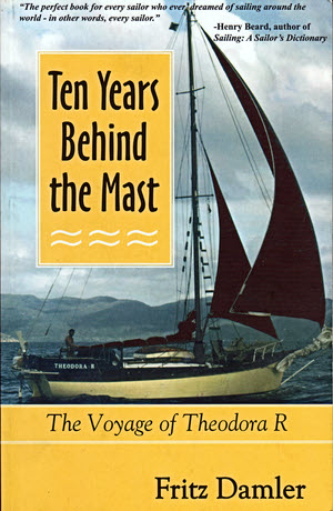
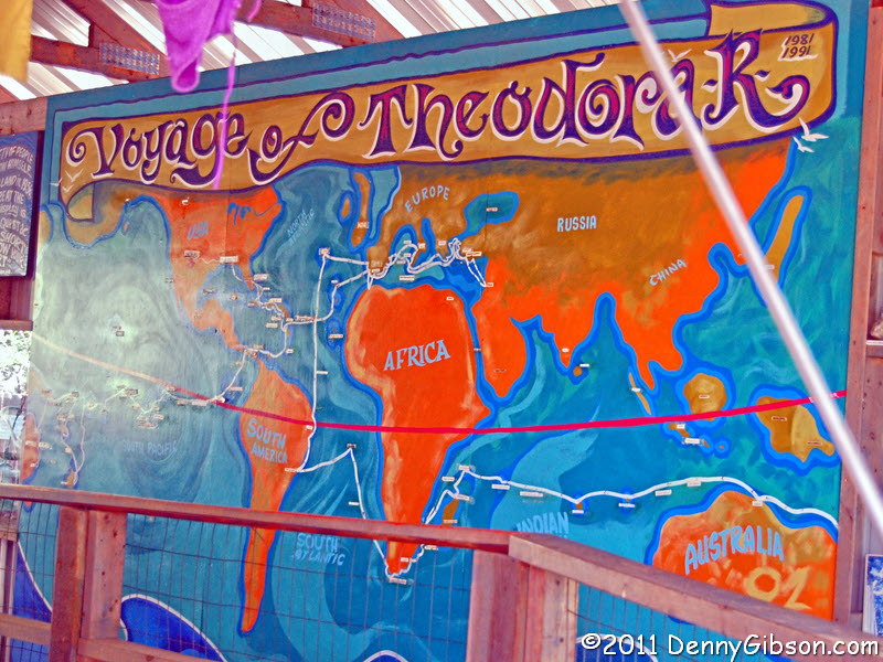
Before I get around to actually talking about this book, I am going to tell how I learned of its existence. I first saw Theodora R, the boat whose mast the author was behind, in July of 2011. I was in Albuquerque, New Mexico, when a friend tipped me off to a nearby museum called Tinkertown. The museum was different than anything I’d ever seen and the boat was different than anything else in the museum. There were similarities, of course, because the same man who created the museum of small items, many hand carved, had also created the signage and other details in the display of the thirty-five foot boat. Then another similarity occurred to me. The unique folk art museum created by Ross Ward represented his “Follow Your Heart” attitude and the boat that Fritz Damler sailed around the world represented that same attitude. Now the boat didn’t seem out of place at all.

TinkertownTinkertownI had chatted with Ross Ward’s widow, Carla, when I first arrived and learned just a bit about the man who passed away in 2002. I spoke with her again before leaving and learned that Fritz Damler was her brother and that he now lived in the Bahamas. I can’t recall why I didn’t buy this book on that first visit. Maybe I was really watching cash flow on the way home from a west coast road trip or maybe I wasn’t even aware that it existed. Carla is not much into high pressure sales. I bought it three months ago on my second visit.

Ten Years Behind the Mast was published seven years ago. Fritz Damler completed his circumnavigation fifteen years before that. Maybe taking fifteen years to finish a book about a ten year journey is a little higher than average but it makes me feel less guilty about coming to it seven years later. A friend and I once met a couple who were sailing south along the Americas’ east coast. Fritz’s publishing — and living — schedule reminds me of something they said often: “If we were in a hurry, we wouldn’t be on a sailboat.”

You also wouldn’t be living on a sailboat without wide ranging skills and the willingness to learn more — sometimes instantly. It isn’t too far fetched to believe that Fritz spent his first thirty-two years training for this journey. He was building guitars for a living immediately before acquiring the Theorora R and he was actually well into building his own wooden boat for the trip when he was betrayed by the epoxy he used and it fell apart. Some of his other jobs included paramedic, volunteer fireman, musician, and ski instructor. Each of those, and no doubt others, provided experience and training that served him well on his journey.

His wife was along when the trip started but it turned out she wasn’t as keen about living on a thirty-five foot boat as she initially thought and she was nowhere near as keen on sailing around the world as Fritz was. Before long, Fritz was without a wife which also meant he was without a permanent crew. Some of the sailing was done solo but most of it was done with an ever changing cast of characters which are all identified and described to some degree. So too are most, if not all, of the ports where Fritz and Theodora R dropped anchor and many of the people he met in those ports. It is a lot to pack into a couple hundred pages but Damler does a pretty good job of covering the ten years evenly.

There are visits from friends and family and Damler never really loses connection with the USA but he does get up close and sometimes personal with a lot of different cultures. He is able to report that fruit bat, the daily special of a Madagascar restaurant “tastes like sweet chicken”. He determined that a small village on New Guinea’s Sanaroa Island was the most remote he ever visited with the help of his guitar. It was the only place where not one person showed even a flicker of recognition when he played “House of the Rising Sun”. That is remote indeed.

Through lots of little glimpses, Damler provides something of a feel for what cruising through far off waters is like. Theodora R was far from alone in doing this. Apparently a sizable “cruisers” culture exists though not everyone is heading around the world or living aboard full time. It is ever so slightly like the RV culture with distances and degree of isolation cranked up to imagination challenging levels.

This is not a guide book or a how to sail book. It is a story book that tells a true and entertaining story. Damler’s writing style makes the reading easy without excess tension or artificial suspense. The final phrase of the back cover blurb sums it up pretty well. “…his story of a decade at sea has it all: Discovery. Heartbreak. Misadventure. Salt.”

Ten Years Behind the Mast, Fritz Damler, Jackson Harbor Press, 2006, paperback, 8.4 x 5.5 inches, 211 pages, ISBN 978-1890352202.
Available through Amazon.


On my first visit to Tinkertown, seeing and reading about Damler’s boat instantly reminded me of one of my favorite Michael McCloud songs, Chasin’ the Wind. I quoted from it in the journal entry for that 2011 visit. Here is a little longer quote:

The job got to feel just like an anchor
and that young wife started to roll just like the waves.
So he traded them both for a sturdy old boat
and the one dream that he’d always saved.

And another couple of lines:

Seen most of the world and a few lovely girls
who spent a short time working as the crew.

When I left Tinkertown after the 2013 visit, I had Damler’s book in my trunk and McCloud’s song in my head. The day after arriving home from that trip I listened to Chasin’ the Wind as I drove to meet friends. Before the song was even half over, I had decided where I would be going for Christmas. For several years now, I have made a “Christmas Escape Run” around the year end holidays. I have been to Key West and seen Michael McCloud just twice; Most recently on on my 2008 “Christmas Escape Run”. Sometime around Christmas 2013, I intend to be in Key West, Florida, where I can listen to Michael McCloud and at least look at some sailboats.

ADDENDUM 21-Aug-2015: It took a new comment to draw my attention to one I’d missed over a year before and, when that happened, I reread my announcement of firm intentions to head to Key West for Christmas. It didn’t happen. It wasn’t until Christmas of 2014 that I made it to Key West.
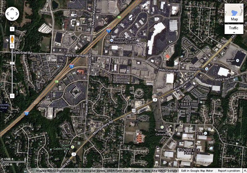
Valiant Still

Pumpkin Run 2013
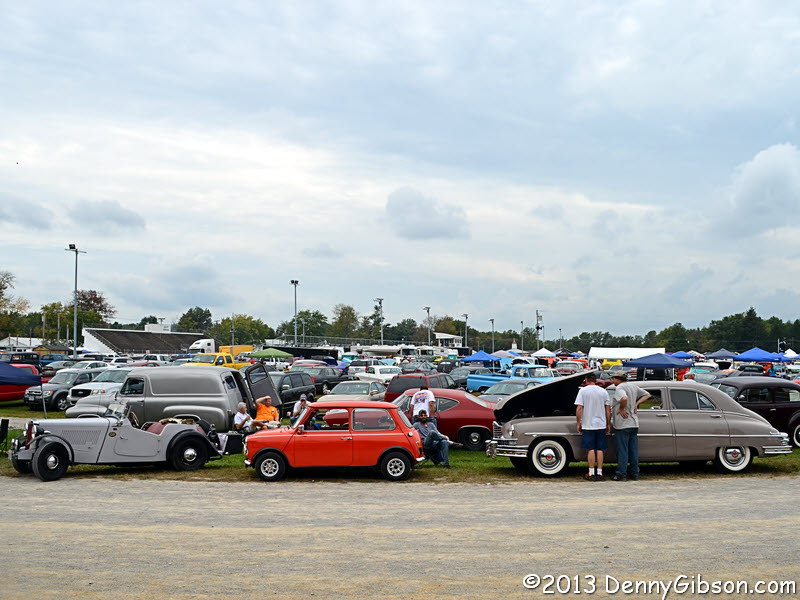
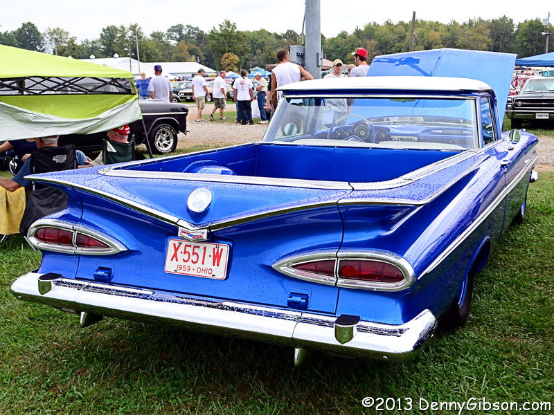
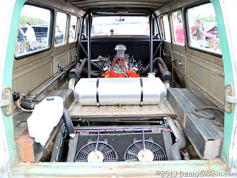
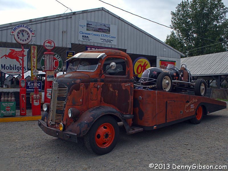
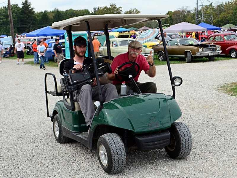
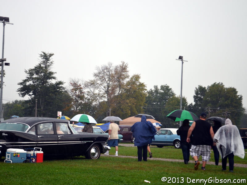
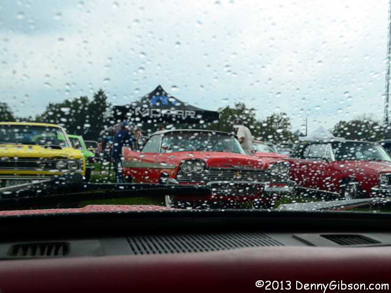
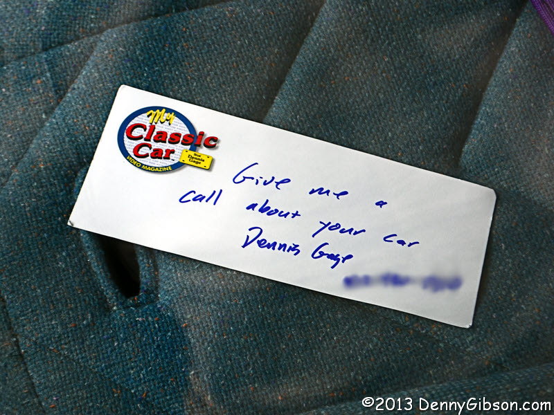
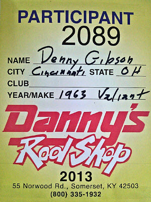
I made my first attempt to sell the Valiant this weekend. It was feeble and half-hearted and impressively unsuccessful. What I did was put the car on display in southwest Ohio’s largest car show with a “For Sale” sign on it. At the end of two days, I had not a single indication of serious interest in the car but I’m neither disappointed nor particularly surprised. The whole thing was something of an experiment and I think I learned quite a bit which is essentially what experiments are for. I certainly hope I no longer own the car when next year’s show rolls around but I’m pretty sure I could generate a little more interest if that were the case. I’ve got a somewhat better handle on the crowd and I’ve got a much better handle on pricing.

Pumpkin Run 2013Danny’s Rod Shop is a key player and gets a ton of name exposure by supplying the window tags but the Pumpkin Run Nationals is managed by Fastiques Rod & Custom, Inc., a  car club based in Owensville, Ohio. The show, which typically has 2600-2800 entries, is held in Owensville at the Clermont County Fairgrounds. This is their 38th year. I’ve attended before as a spectator but this was my first time as a participant. Cars must be running and registered and can be no newer than 1970. That’s it. Gates open at 6:30 Friday morning and cars are waiting. The picture of the Valiant was taken about 9:30. The place seems rather full by Friday afternoon but there is another burst on Saturday morning that makes the fairgrounds seem packed.

Pumpkin Run 2013The picture at right hints at the variety of cars on display. That is an original MINI between the MG-TD and the big Packard. It is hard to identify specific cars beyond the three in the foreground but I do see a panel truck, a couple of Chevrolet hardtops from the sixties, a pickup truck, and at least one decades old sedan.

Pumpkin Run 2013Pumpkin Run 2013Pumpkin Run 2013I picked these three as some of the more unusual stock cars I saw. The 1959 El Camino is beautiful as well as unusual. Then there’s a 1960s era Chevrolet 4-cylinder and a 1969 Rolls Royce.

Pumpkin Run 2013Pumpkin Run 2013Pumpkin Run 2013There is no shortage of variety but the Pumpkin Run is the brainchild of a hot rod club so there is a general air of performance. Among the stock entries, Muscle Cars are plentiful, and real drag and even track racers are well represented. The middle picture is of a Corvair window van based dragster with a big V8 where a bench seat once sat and electric fans where the original flat-6 once was. There were several Studebaker Lark based dragsters which I found surprising.

Pumpkin Run 2013I happened to look inside that green Lark and noticed a message. Dennis Gage of the TV show My Classic Car was known to be on the grounds doing interviews and such for a show to be broadcast in January. Looks like one of those interviews just might be with the owner of the Lark. I ran across Dennis himself a bit later and got a friendly pose when I raised my camera. He was coming from the general vicinity of my car but I found no note on my front seat.

Pumpkin Run 2013Pumpkin Run 2013The weather on Friday was great and, although it rained a little overnight, Saturday started out just about as good. Then, a little before 2:00, some rain fell. It was short lived but so was the sunshine the followed it. Starting about 3:30, the rain became increasingly steady. I was one of the car owners who retreated to their vehicle and quite a few actually headed for the gate. That yellow car seen through my windshield is a Super Bee. There was another on my left side and a Road Runner a couple of cars beyond that. The rain wasn’t too heavy and the temperature remained high so people continued looking at cars but the numbers had definitely decreased. Anyone who had a poncho or umbrella, put it to use.

Weather reports called for a stop to precipitation around 5:00. I mostly stayed in the car until, at about a quarter until 5:00, I saw clearing skies approaching the fairgrounds. With predictions of storms and heavy rain overnight and a rather wet Sunday, I decided to truncate my first (and probably only) participation in the Pumpkin Run at two days. I headed home.