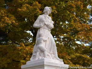
 The Madonna of the Trail statues were one of the first things that entered my mind when I initially started thinking of sets of things I had seen all of. When the era of named auto trails came to an end, a couple of the major auto trails undertook projects aimed at keeping their names alive for posterity. The Lincoln Highway was marked by nearly 2,500 concrete posts that literally guided travelers along the entire route. The National Old Trails Road Association’s project was, in some sense, less ambitious in that only twelve markers were placed; One in each state the highway passed through. The markers themselves were much larger and more intricate than direction markers and all twelve still exist at or near their original locations which makes seeing the whole caboodle possible. Photos of the statues follow in the sequence in which I first saw them with the exception of the photo at right. That’s a 2018 photo of the Madonna in Richmond, Indiana. Comments accompanying the pictures include the date of dedication, its position in the sequence of dedications, and the coordinates of its location.
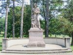
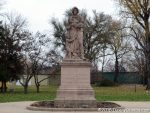
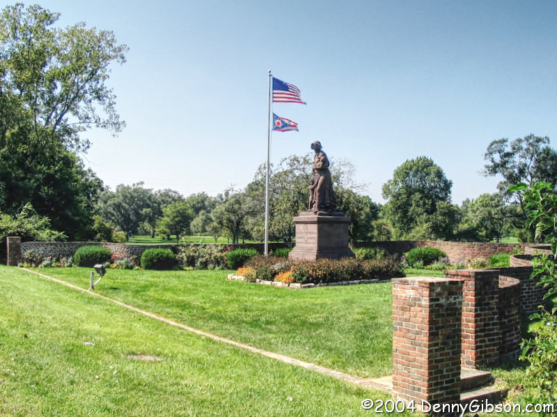
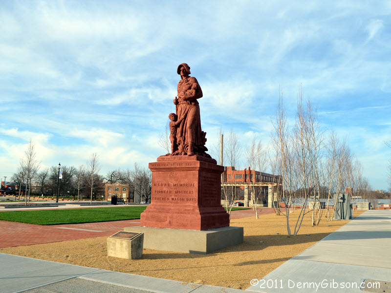
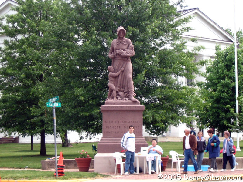
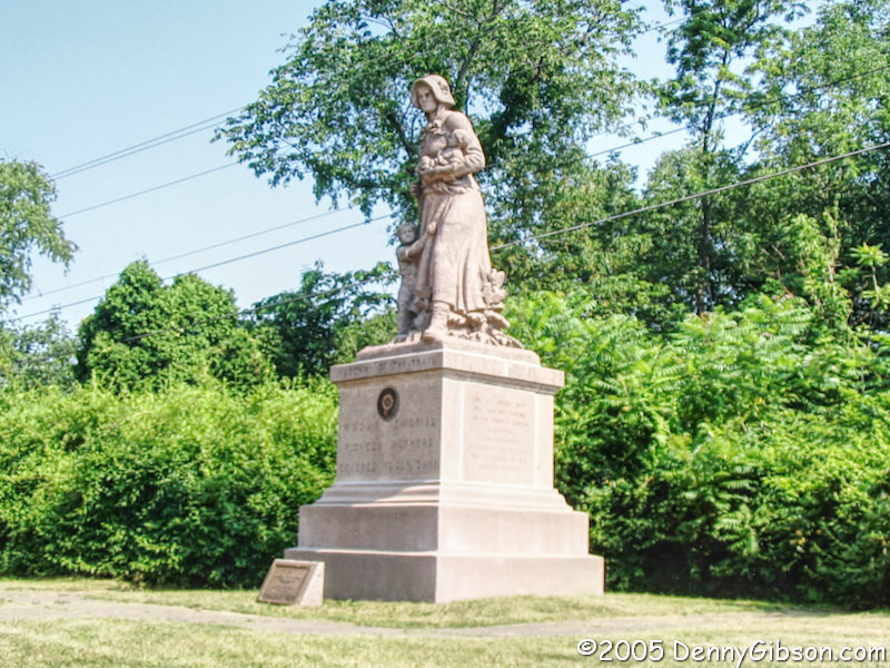
 1. The first Madonna of the Trail monument I ever saw was, unsurprisingly, the one in my home state of Ohio. It originally stood about three miles west of downtown Springfield but was moved a little closer to town in 1956 or ’57. The first picture was taken in 2004 at the second location. I never saw her at her original location. The second picture shows her at her current home in downtown Springfield where she moved in 2011. Dedicated 1st, July 4, 1928. N39° 55.496′ W83° 48.677′
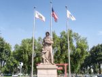
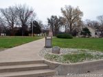
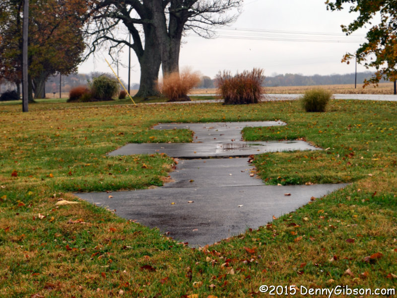
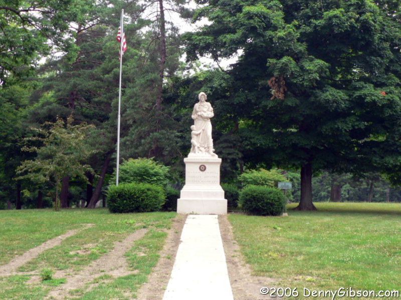
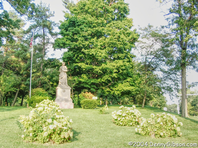
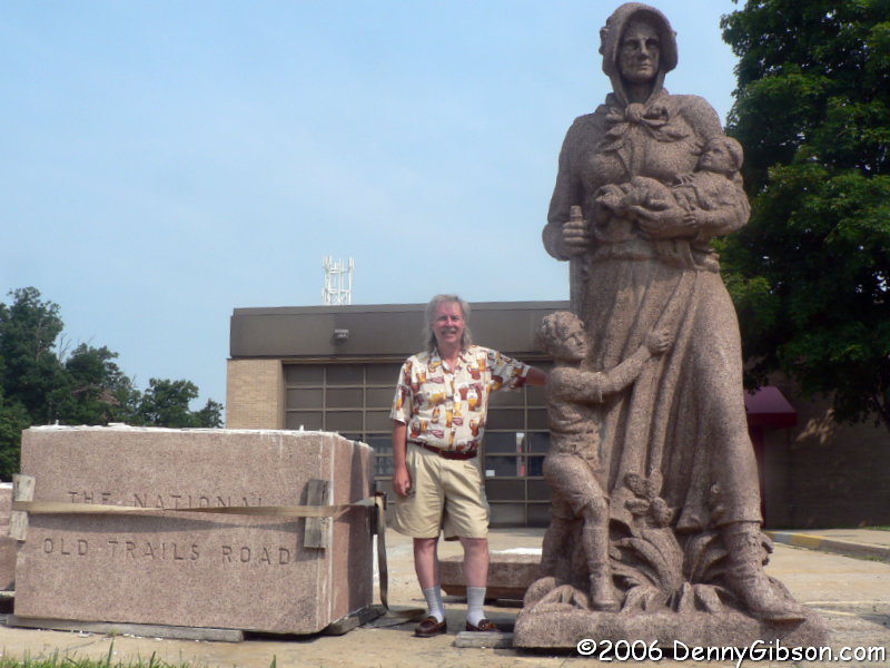
 2. Of course, there’s also no surprise in the fact that my second Madonna was the one in Richmond, Indiana. Not only are these two Madonnas the closest to me, I believe they are closer to each other than any other pair. The first picture was taken in 2004 on the same day as a preceding picture of the Ohio Madonna. The second picture, with a clearer and brighter Madonna and a new walkway, was taken just two years later. Dedicated 9th, October 28, 1928. N39° 49.835′ W84° 52.334′
 3. In 2005, I ventured one state beyond Indiana to visit my third Madonna of the Trail monument in Vandalia, Illinois. A festival that I never did identify, was in progress in the former state capital when we arrived. As part of the festival, raffle tickets were being sold at the base of the monument which sits on the grounds of the old capitol building. Dedicated 7th, October 26, 1928. N38° 57.649′ W89° 05.671′
 4. A month later, I added two Madonnas in the states just east of Ohio. The sightings occurred on the way home from a business trip to central Pennsylvania so that state’s Madonna, at Beallsville, was encountered first. Dedicated 10th, December 8, 1928. N40° 03.630′ W80° 00.776′
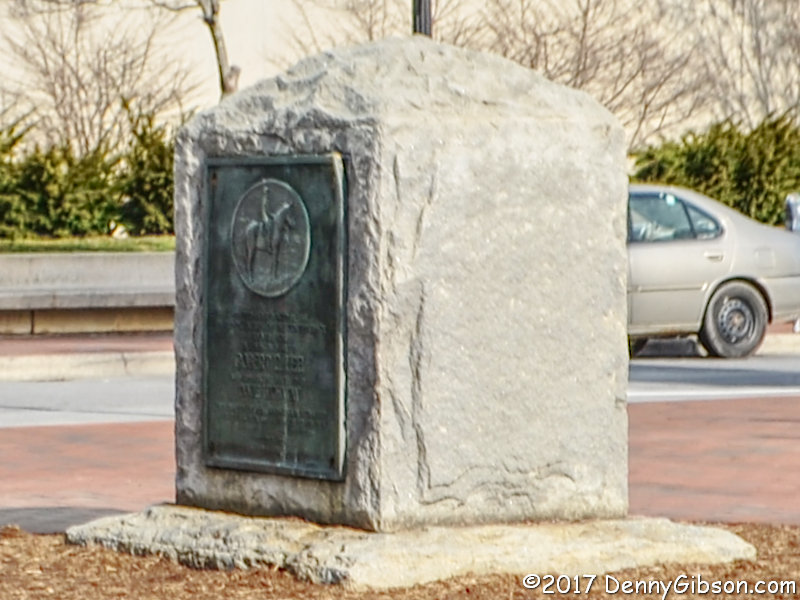
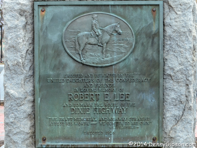
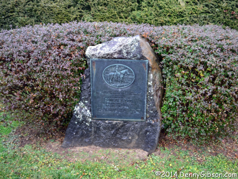
 5. West Virginia’s Madonna of the Trail came next. It is positioned a little east of Wheeling. At this point, 80% of the Madonna monuments I had seen were situated on or very near golf courses and I began to think there might be some sort of symbiotic relationship between the two. Dedicated 2nd, July 7, 1928. N40° 03.362′ W80° 40.157′
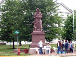
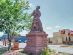
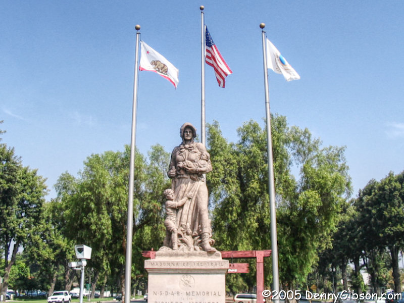
 6. In September 2005, I bagged my fourth Madonna of the year and sixth overall. The California monument is not near a golf course or any other open space. It is in the city of Upland in the median of a busy street near an intersection with an even busier street. I would, in fact, never find another Madonna and golf course pairing. Dedicated 11th, February 1, 1929. N34° 06.434′ W117° 39.073′

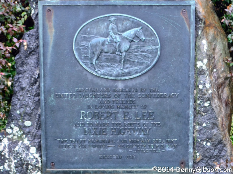
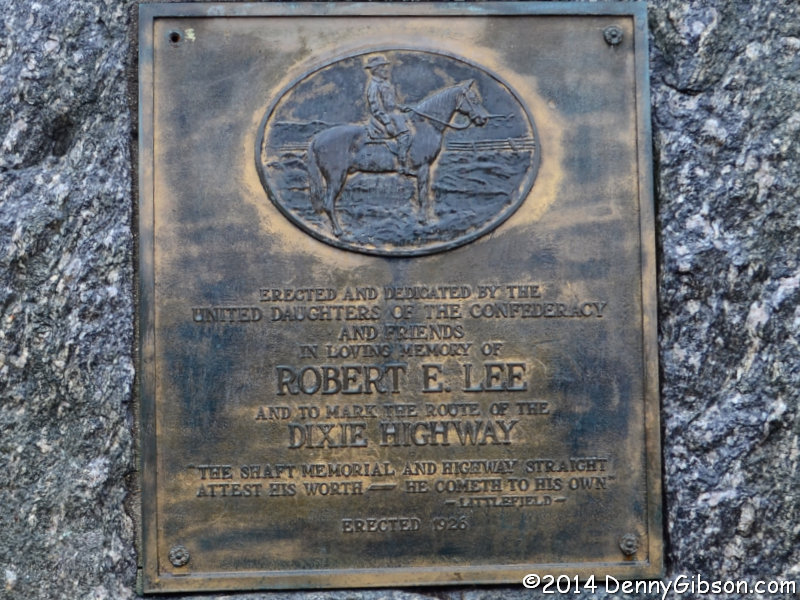
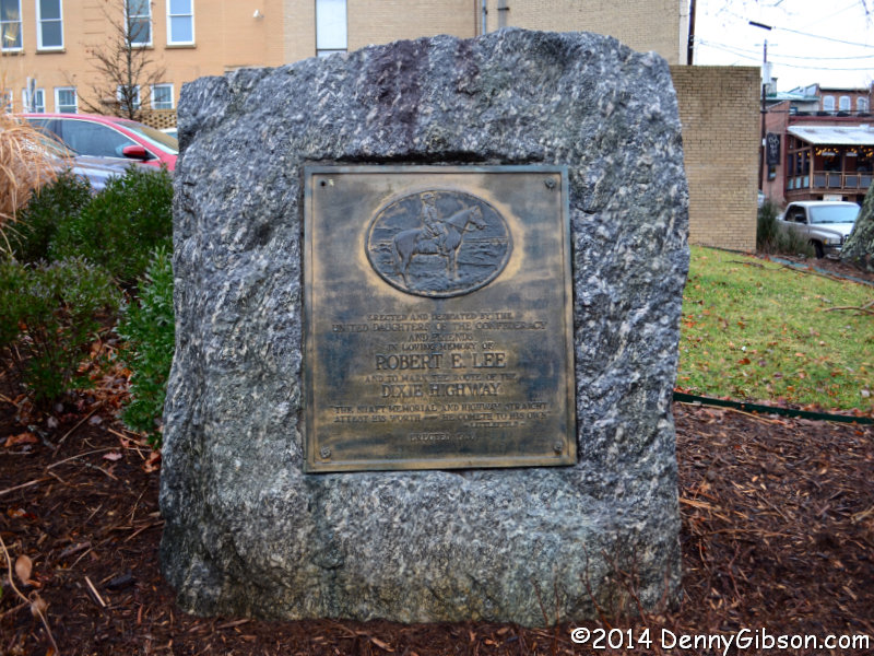
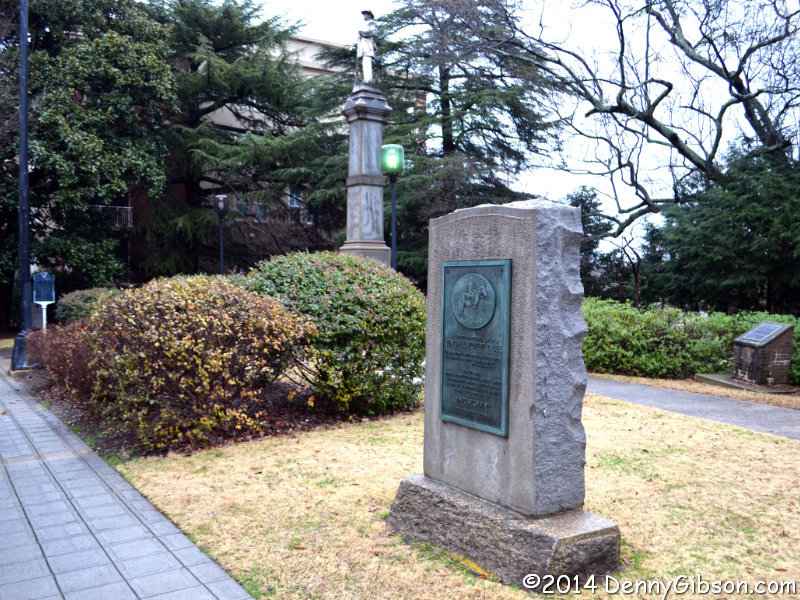
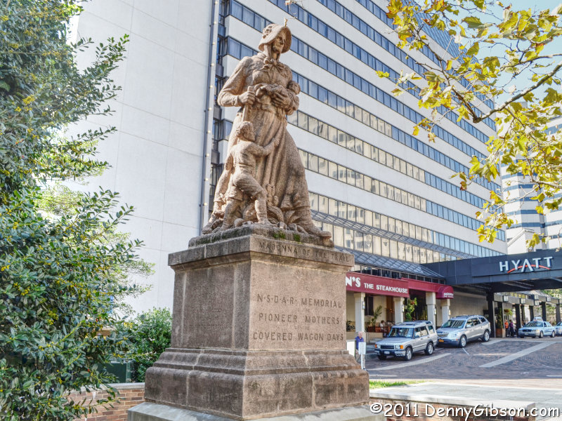
 7. In 2006, I drove the full length of the National Road in celebration of the 200th anniversary of the legislation that first authorized it. That took me past all of the Madonnas east of the Mississippi but only one of those was new to me. It was also missing. A sinkhole had endangered the Bethesda, Maryland, monument prior to my visit and it was stored a few miles away awaiting site repairs. That turned into an opportunity for my absolute favorite Madonna of the Trail photo ever. I was able to get a shot of the lady in her rightful place in 2011. Dedicated 12th, April 19, 1929. N38° 59.046′ W77° 05.655′
 8. On the west edge of Lexington, Missouri’s Madonna of the Trail became my eighth in May 2007. Getting to two-thirds of the caboodle took just four years but it would be another four years before I would even get started on the last third. Dedicated 4th, September 17, 1928. N39° 11.197′ W93° 53.177′
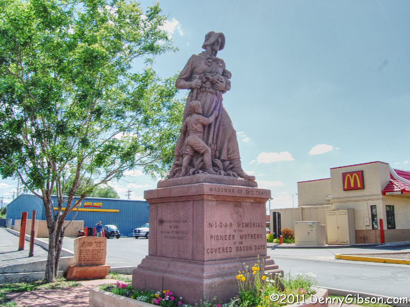
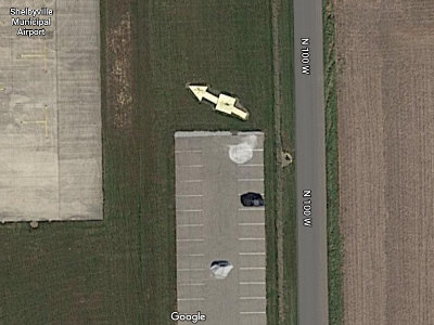
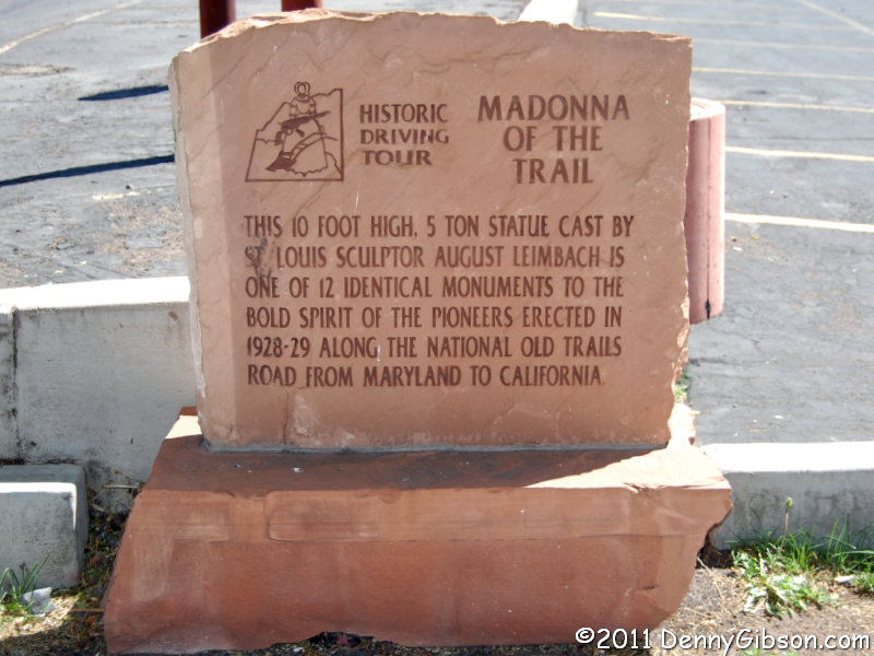
 9. A two Madonna day started in 2011 with the monument in Springerville, Arizona. Here the idea of Madonna of the Trail monuments being given scenic pastoral settings really took a beating. This lady occupies a small plot adjacent to a MacDonald’s. The marker behind her identifies this as a stop on a historic driving tour. Dedicated 7th, September 29, 1928. N34° 07.993′ W109° 17.108′

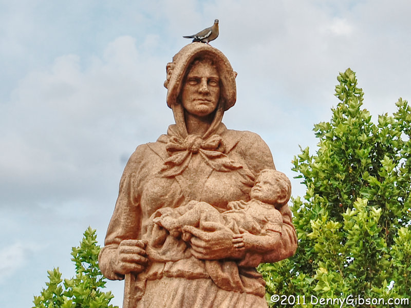
 10. The second Madonna of the day was in Albuquerque, New Mexico. I’d been in Albuquerque before but had missed the monument. I had previously driven through the city on Historic US 66 which was the National Old Trails Road successor in these parts but I had not driven the original pre-1937 alignment which had followed the NOTR and on which the statue had been placed. Another complication was that the monument had been moved to the north corner of the area it was in which put it nearly a block away from even the old Sixty-Six alignment. To make up for missing it on earlier visits, I’ve included a picture of Madonna with a friend. Dedicated 6th, September 27, 1928. N35° 05.572′ W106° 38.991′
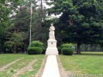
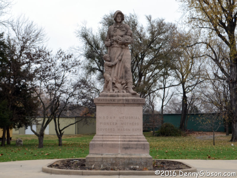
 11. The count stayed at ten for another five years. I reached the final pair on consecutive days in 2016. The Madonna of the Trail monument in Lamar, Colorado, is next to an old train station now serving as a visitor center. Dedicated 5th, September 24, 1928. N38° 05.360′ W102° 37.147′
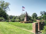
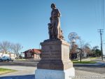
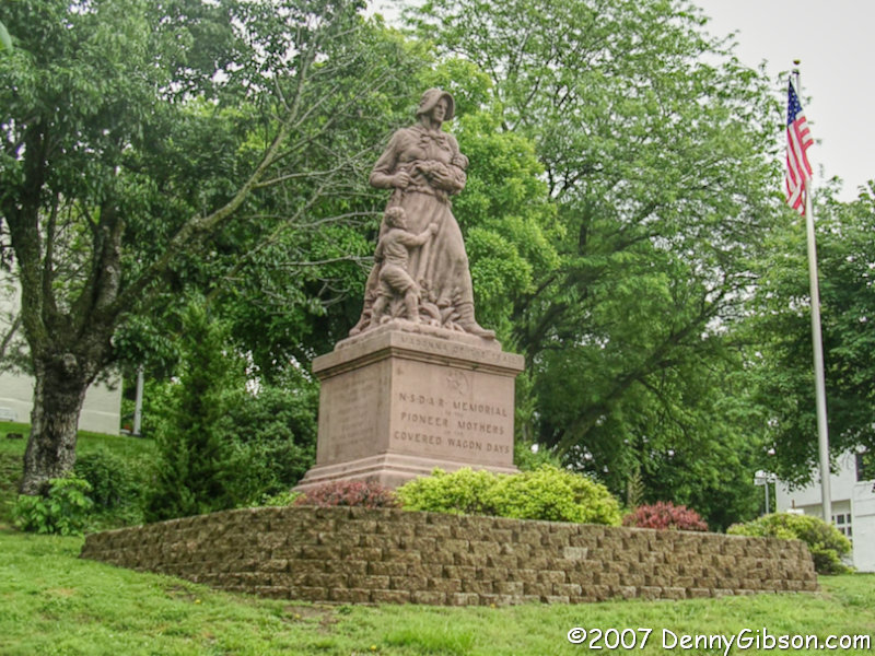
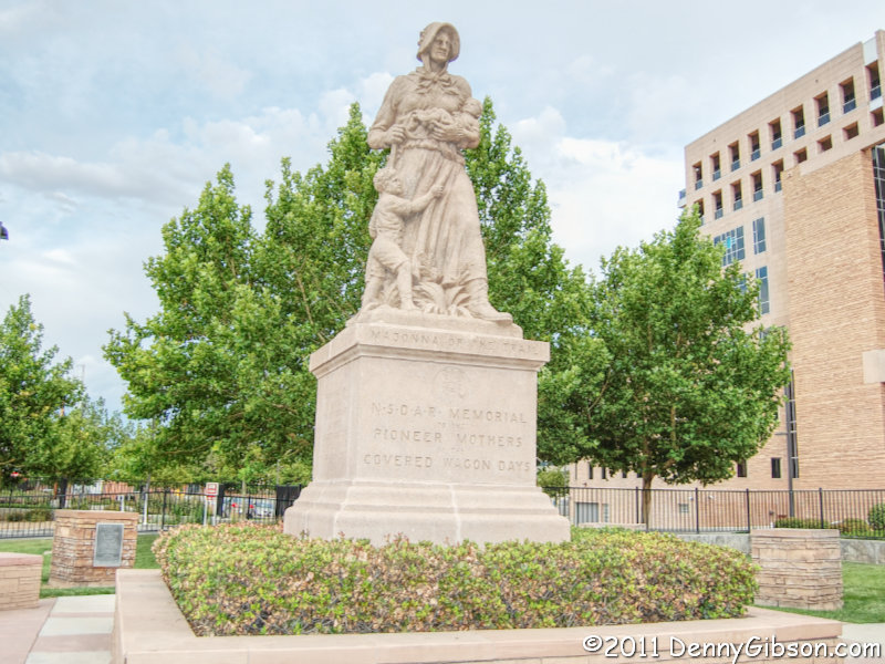
 12. In Council Grove, Kansas, the setting for the Madonna of the Trail monument is pretty open. It’s a bit reminiscent of the park-like settings of my early Madonna visits even though there isn’t a golf course in sight. Dedicated 3rd, September 7, 1928. N38° 39.724′ W96° 29.212′
ADDENDUM 14-Jan-2024: After gathering the coordinates of all the Madonnas for another project, I decided to add them here.

 How tough could it be? There are only three of them, and they are all on a single historic auto trail. Granted, the auto trail runs all the way across the country and there is a marker at each end but that just means there’s some distance involved. Collecting another three-member caboodle seemed like something that should be rather straight forward and it would have been at any time other than the summer of 2014.
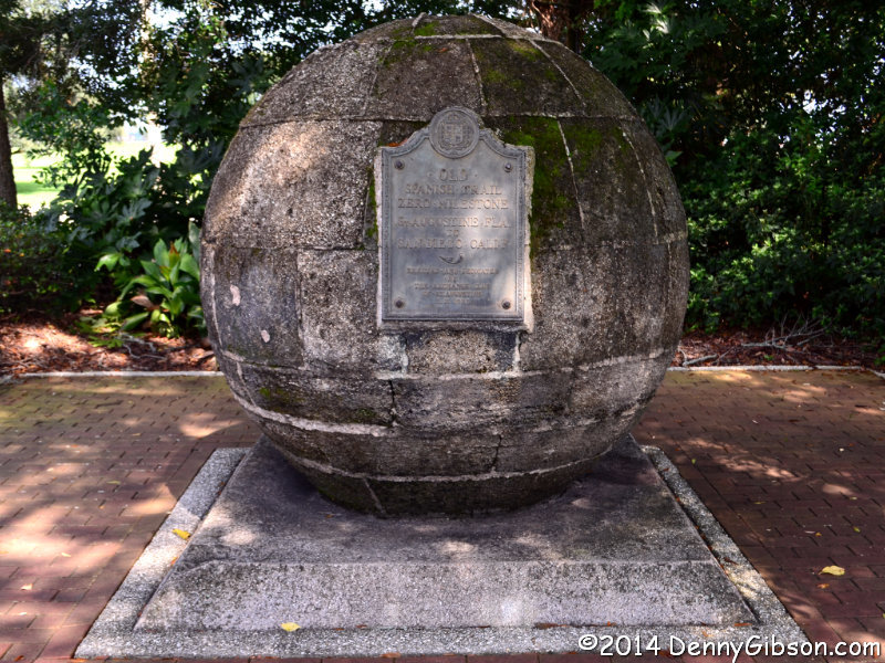
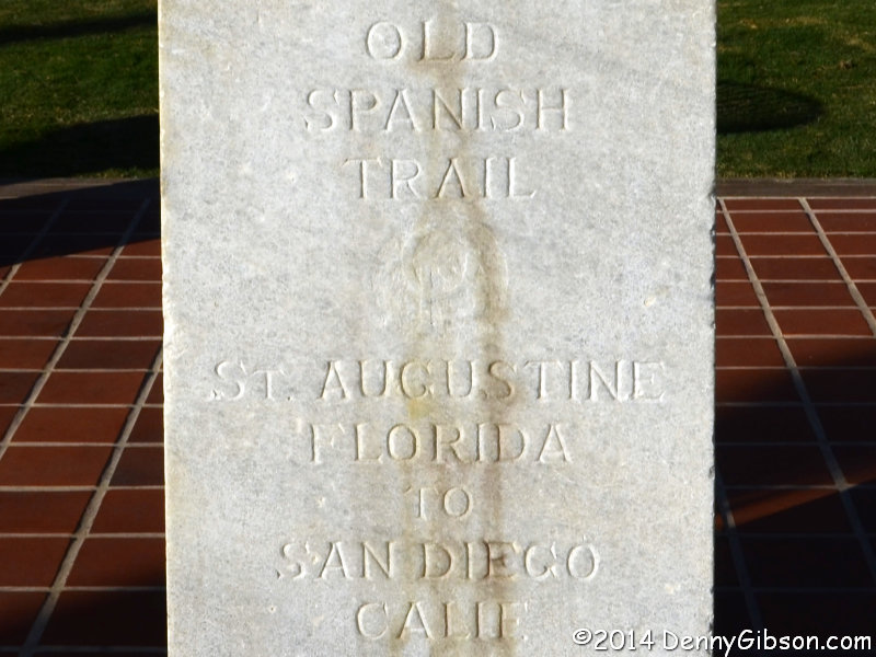
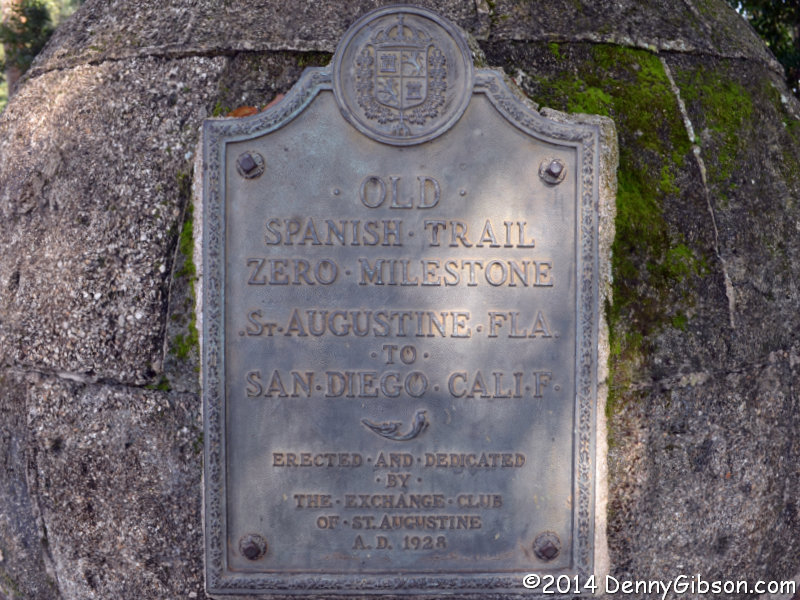 1. The first one was pretty easy. It’s a hundred yards or so north of Castillo De San Marcos on the opposite side of San Marco Avenue (US-1). It can partially be seen from the street but you need to enter the small park that houses it to see and read the plaque. This is not, as is sometimes claimed, part of an old Spanish “colonial trail” but the eastern terminus of an early twentieth century named auto trail.
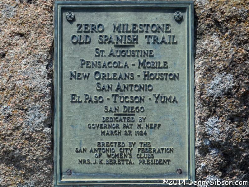
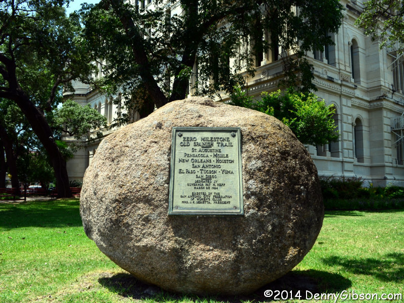 2. The second one sits outside San Antonio’s city hall and is also pretty easy to find and photograph. It is near the midpoint of the 2,750-mile-long route but is still labeled a “Zero Milestone”. The best reason I can think of for this is that the Old Spanish Trail Association was headquartered in San Antonio and considered this the starting point for trips to either end.
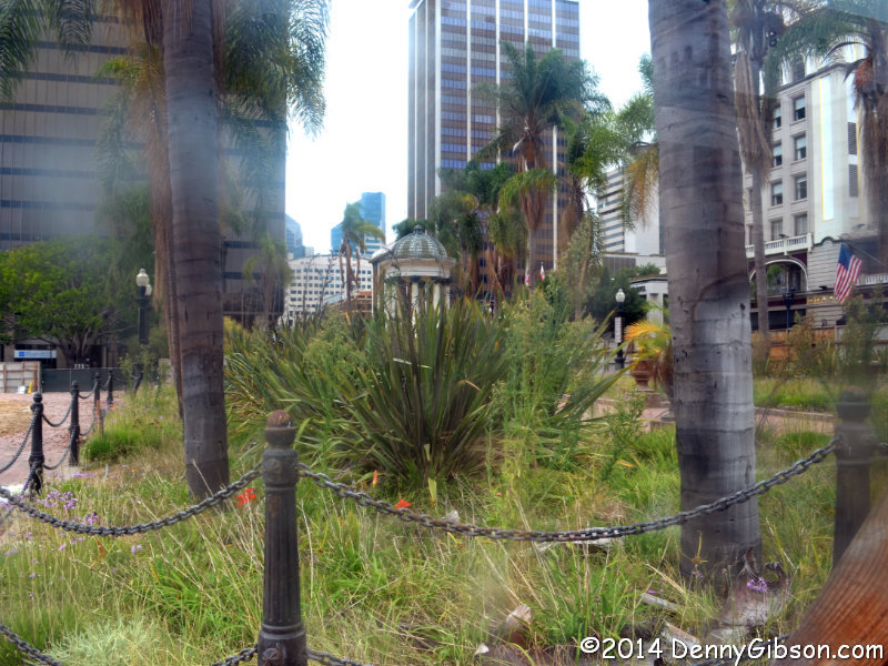
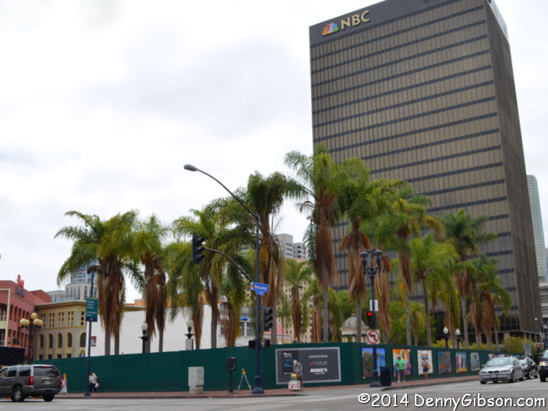
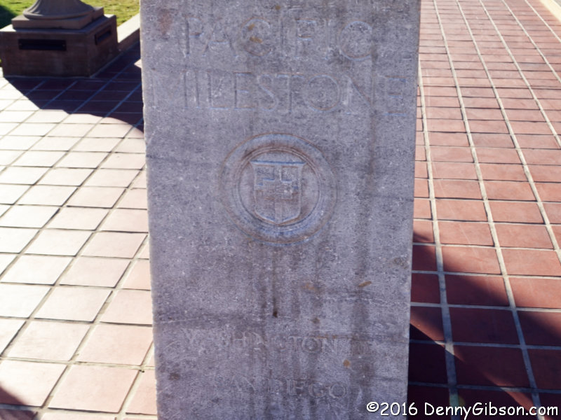
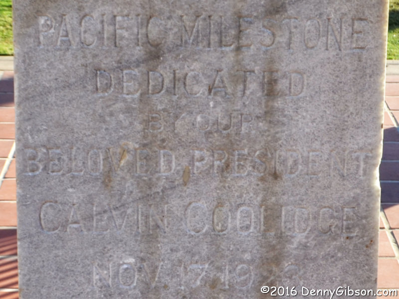
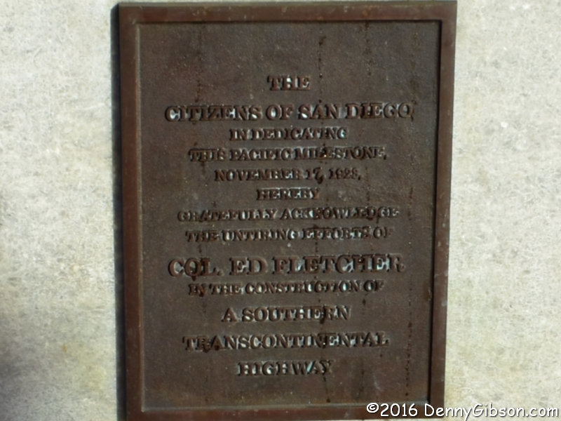
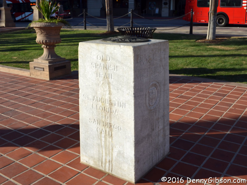 3. But that 2014 trip hit a snag when it reached the western end of the OST. The picture at the top of this post shows what I saw when I pulled up to Horton Plaza in downtown San Diego. The plaza was in the middle of a multi-year redo that had caused the marker to be moved to a warehouse. The first picture at left, taken through a gap in the fence, shows the area where the marker would reappear in May 2016. The second picture shows the marker in November 2016. Although the marker is commonly referred to as a Zero Milestone, it is inscribed Pacific Milestone. Here are somewhat readable views of the south, east, north, and west sides.


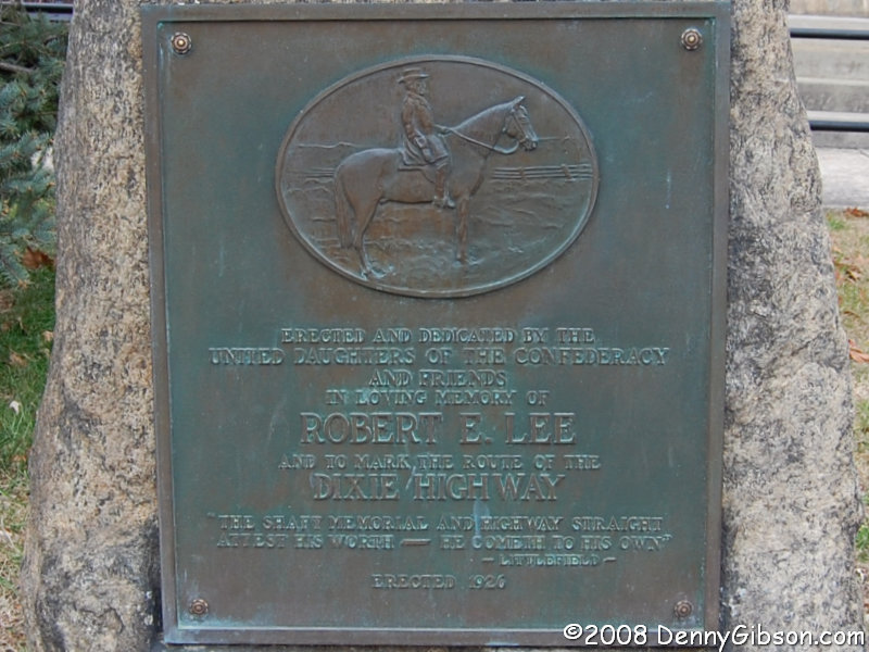
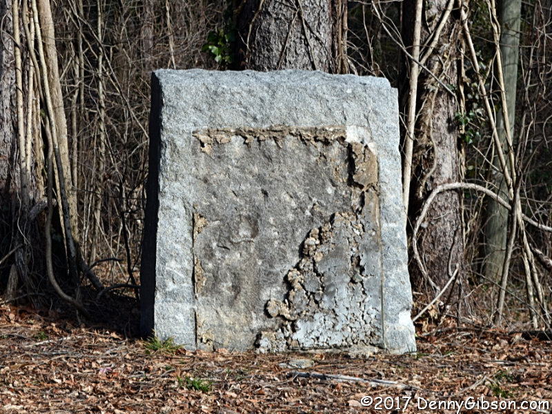
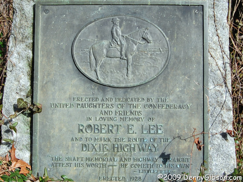
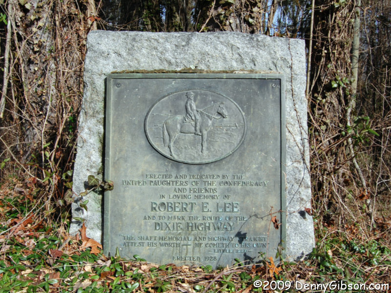
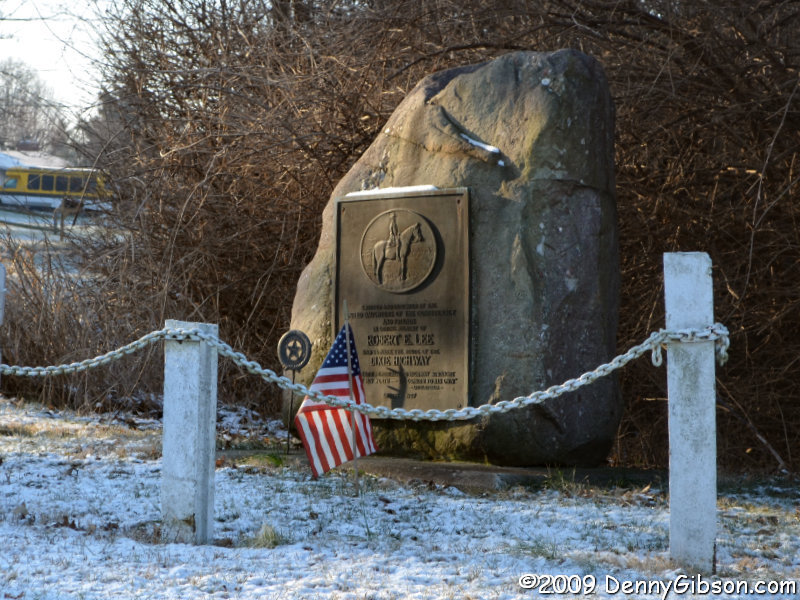
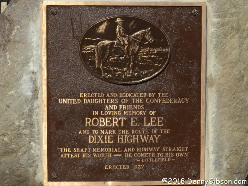
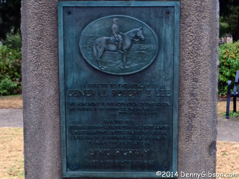
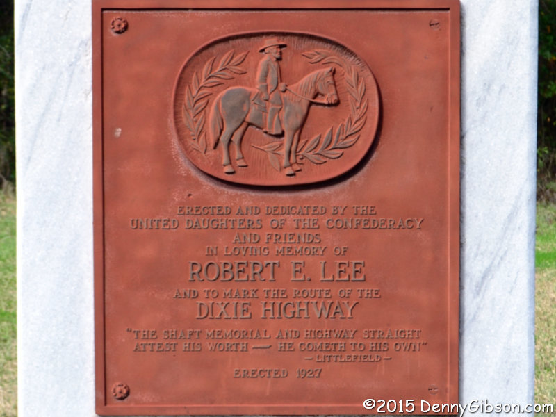
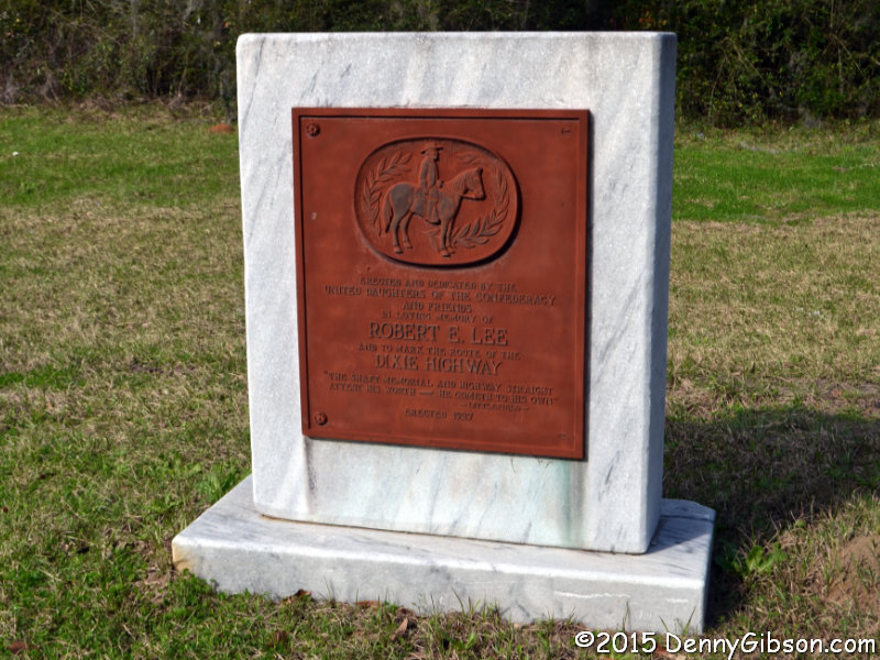
 Like the Madonna of the Trail monuments in
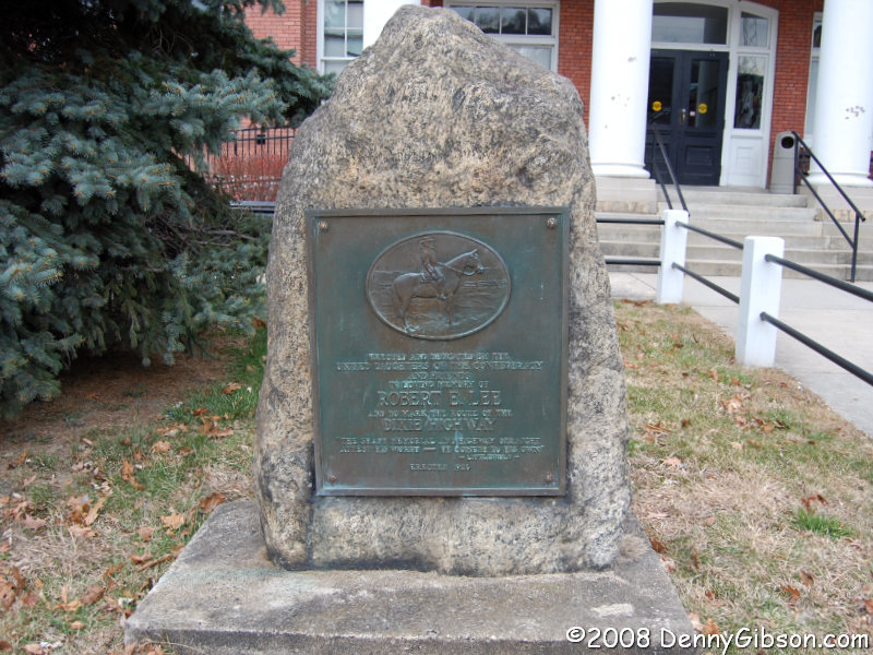
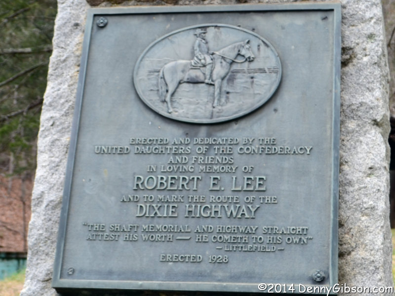
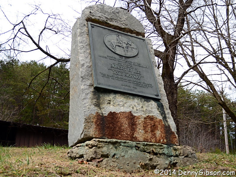
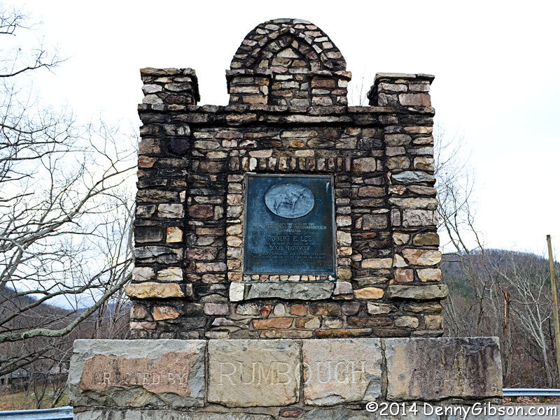
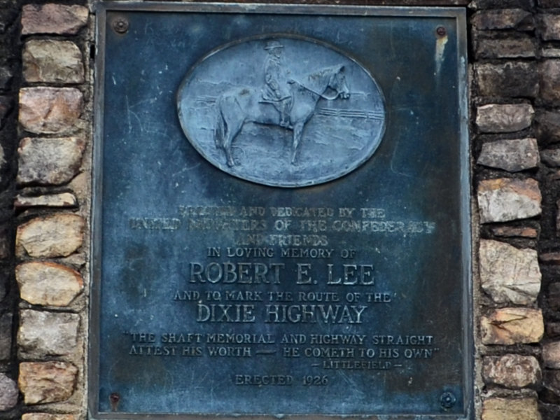
 Like the first My Caboodles chapter, this third installment contains just three items. Some might consider it less than a full caboodle and I suppose, if a National Caboodle Association is ever formed, I might be called out on it. Here’s my thinking.


