Sub Terrain and Marine

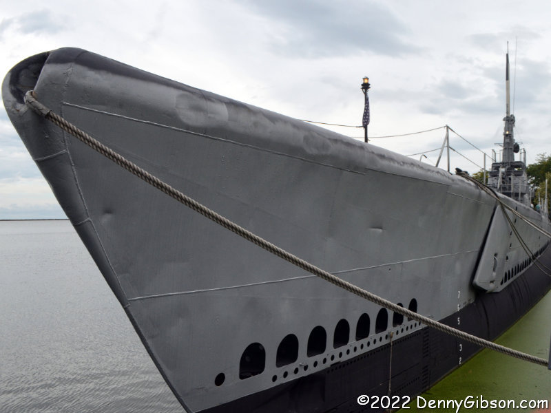
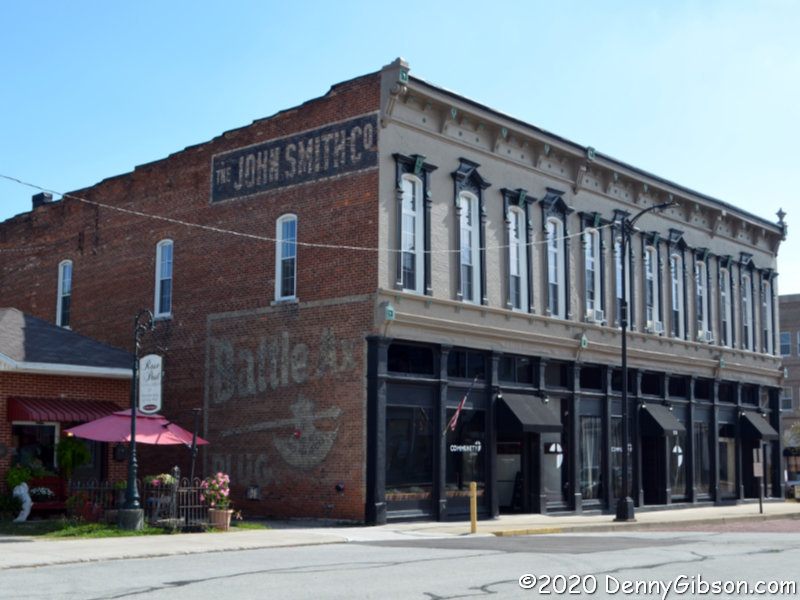
This week my friend Terry and I succeeded in seeing something we’ve been talking about for quite a while. That something is in the picture at right. It’s the USS Cod moored in Cleveland, Ohio. We toured the retired WWII submarine on Tuesday after a leisurely drive to within striking distance on Monday. range the day before. That leisurely drive included a little sightseeing and something of an unplanned adventure.

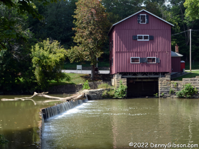
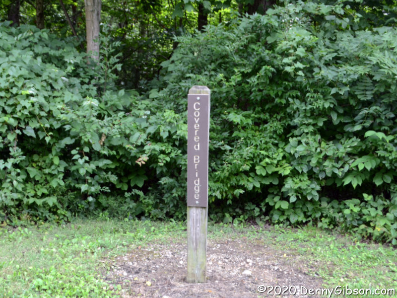
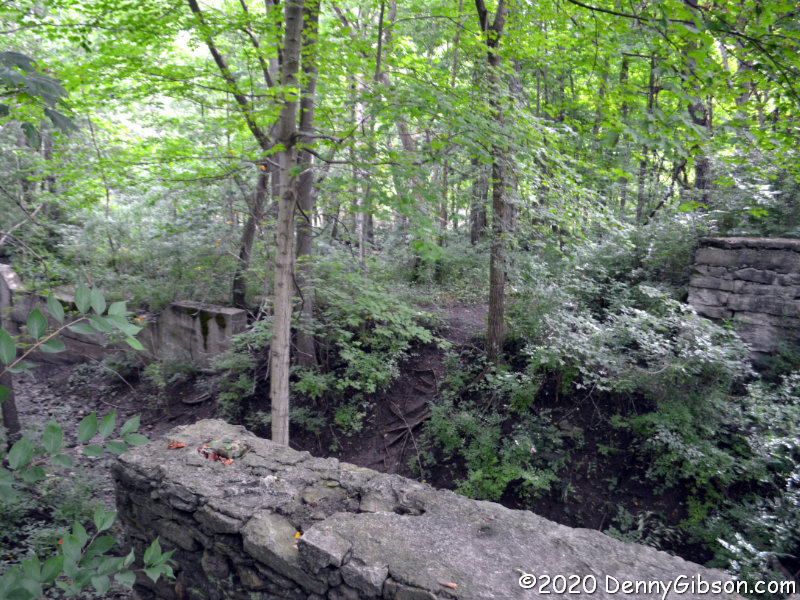
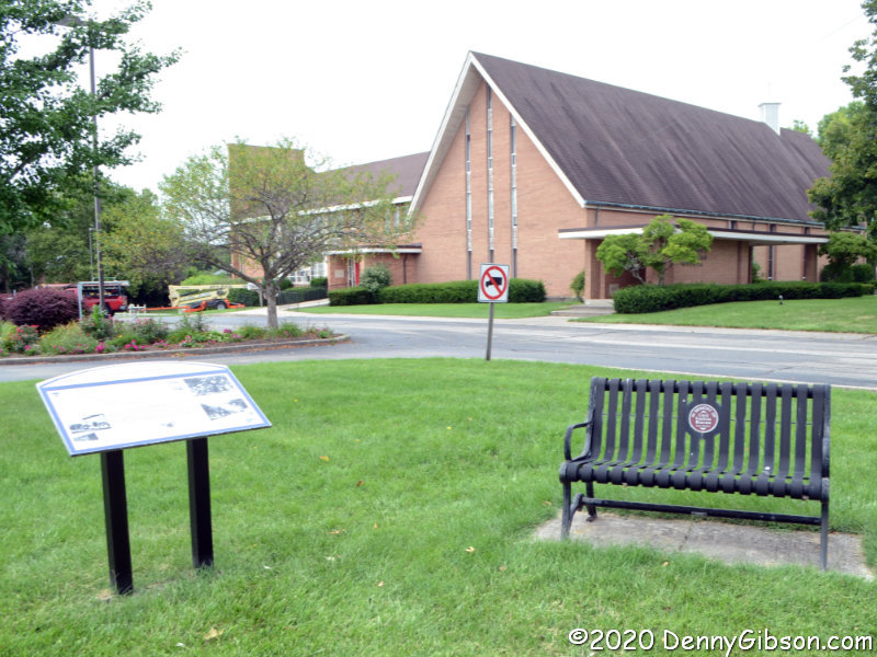
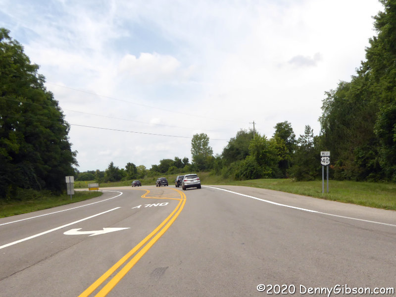
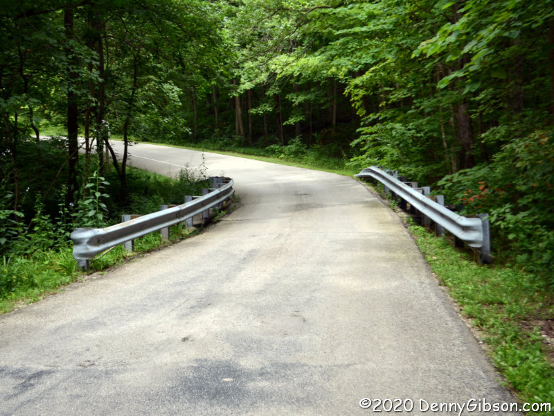
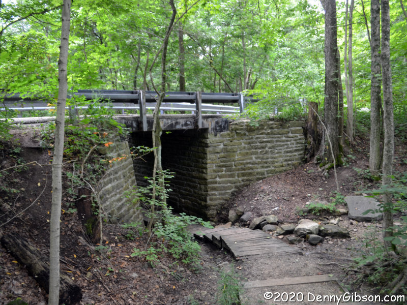
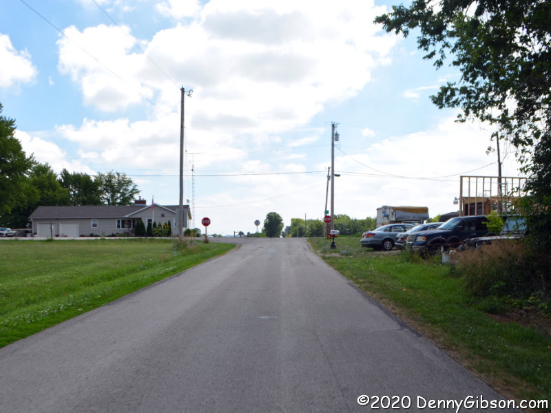
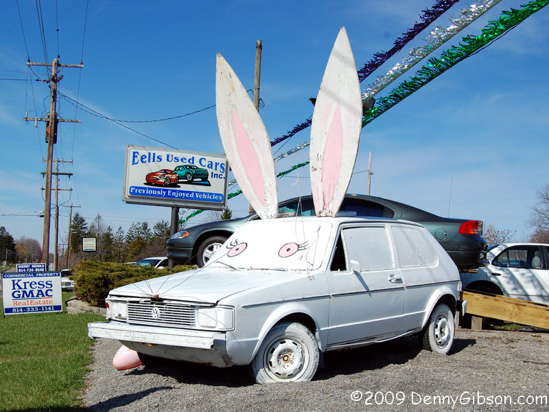
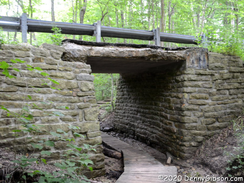
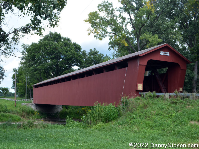
We drove on “America’s Oldest Concrete Street” (1893) in Bellefontaine, then stopped at Indian Mill and crossed over the Parker Covered Bridge near Upper Sandusky.

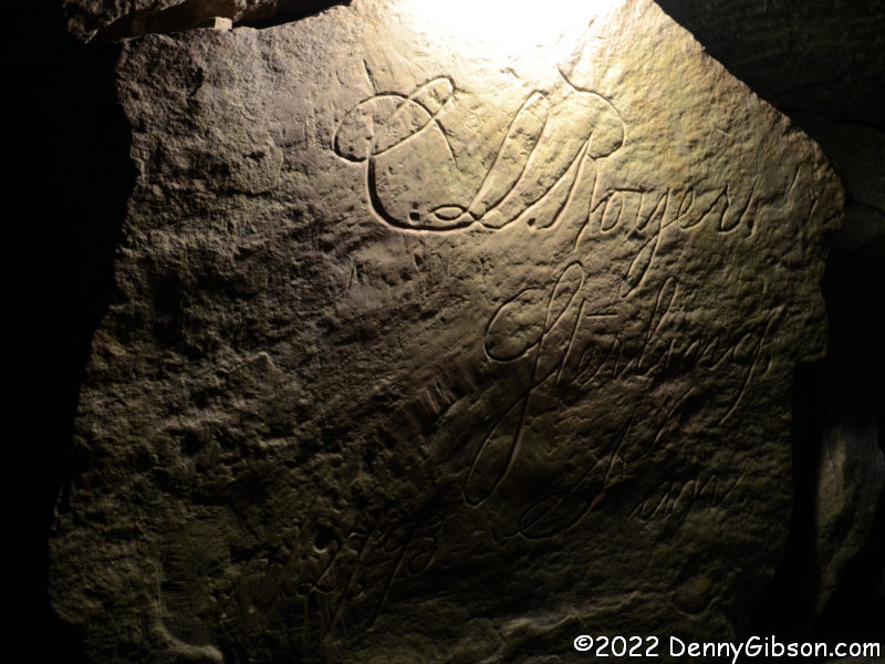
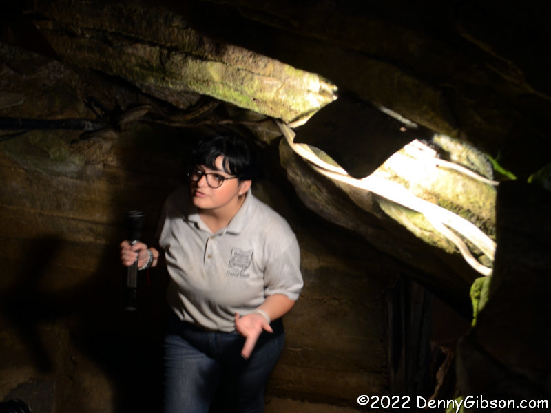
I knew absolutely nothing about Seneca Caverns and Terry knew only that we would be passing nearby. Both of us thought it would be a nice diversion which is exactly the sort of thinking that can lead to, as it did this time, an unplanned adventure. The pictures here are of our guide Allie, a fairly rare horizontal section of the cave, and an elegant 1893 done-by-candlelight inscription.

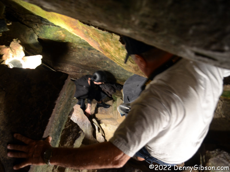
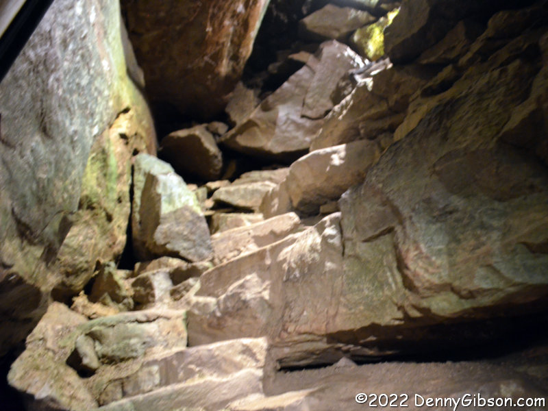
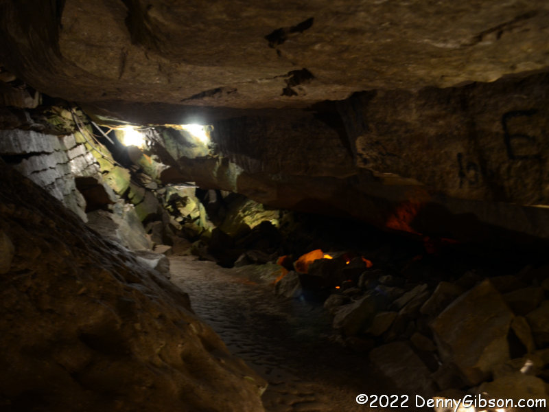
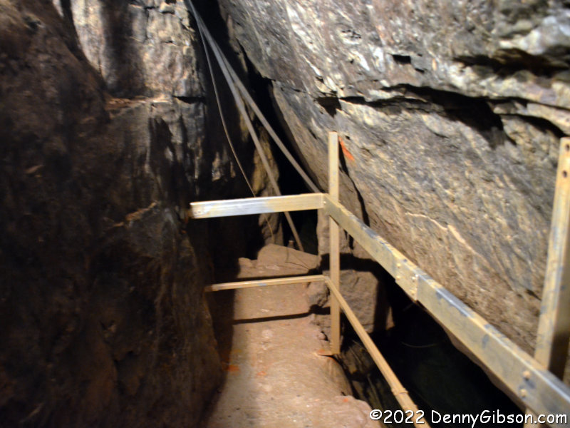
Seneca Caverns is unique among Ohio show caves in being formed by an earthquake crack and by being maintained pretty much in its natural state which explains its nicknames of “Earth Crack” and “Caviest Cave in the USA”. These pictures show Terry and others descending one of the stairways made of natural stones, another natural stone stairway without people, and our farthest penetration (110 feet below the surface) into the cave.

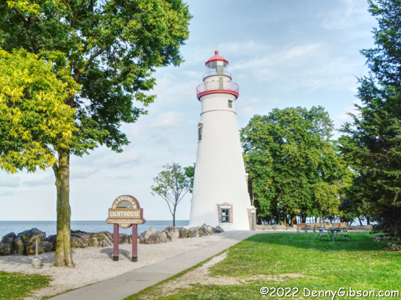
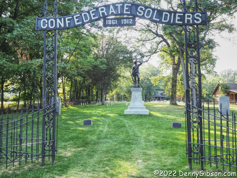
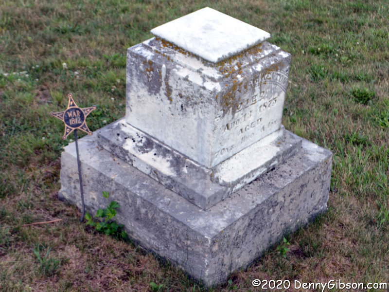
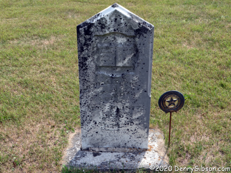
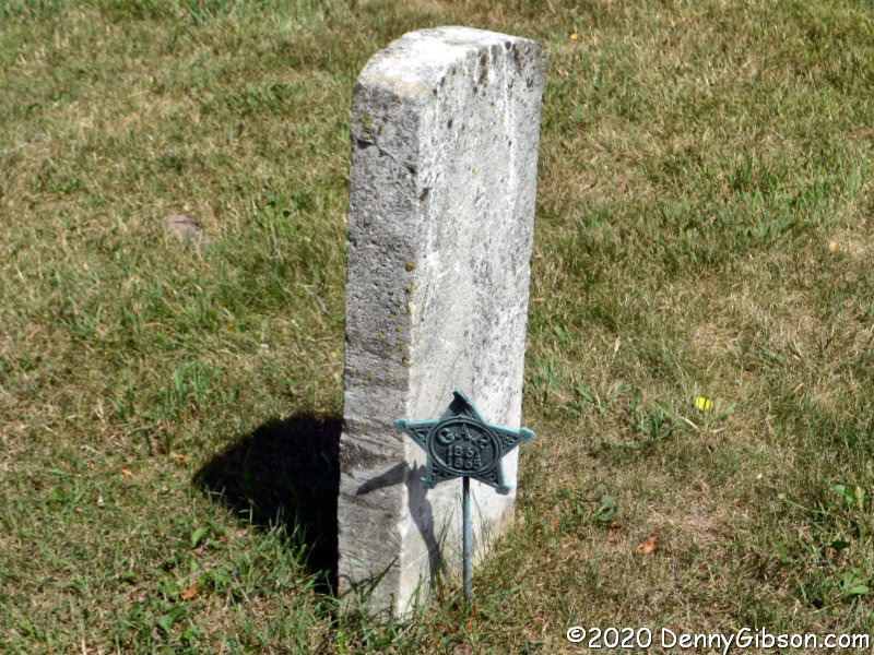
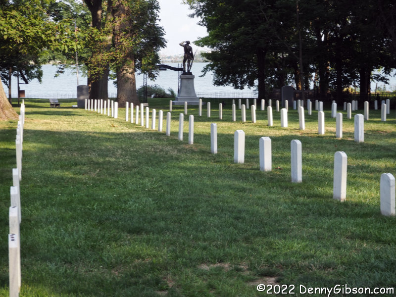
After returning to the surface, we still had time to check out the cemetery for Confederate soldiers on Johnson’s Island and the nearby Marblehead Lighthouse before ending our day. Confederate prisoners, mostly officers, were kept on the island between April 1862 and September 1865. More than 200 died here and are buried in this cemetery. By the time we arrived, the lighthouse was closed for the day but we were not overly disappointed. Having just climbed up from 110 feet below the Earth’s surface, we didn’t feel a burning need to climb 50 feet above it.

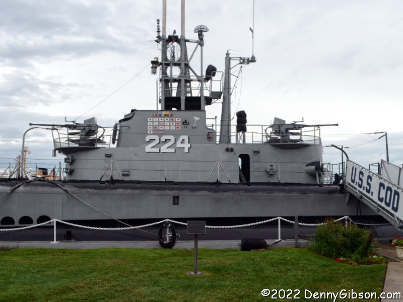
Our short drive to the trip’s primary target was fairly wet but the rain was really letting up by the time we got there and we were headed inside anyway. The USS Cod was commissioned on June 21, 1943, and completed seven successful patrols before the war’s end. Following the war, she served a variety of training roles until 1971 when a group of Clevelanders campaigned to save her from being scrapped. The submarine was turned over to the civilian group in 1976.

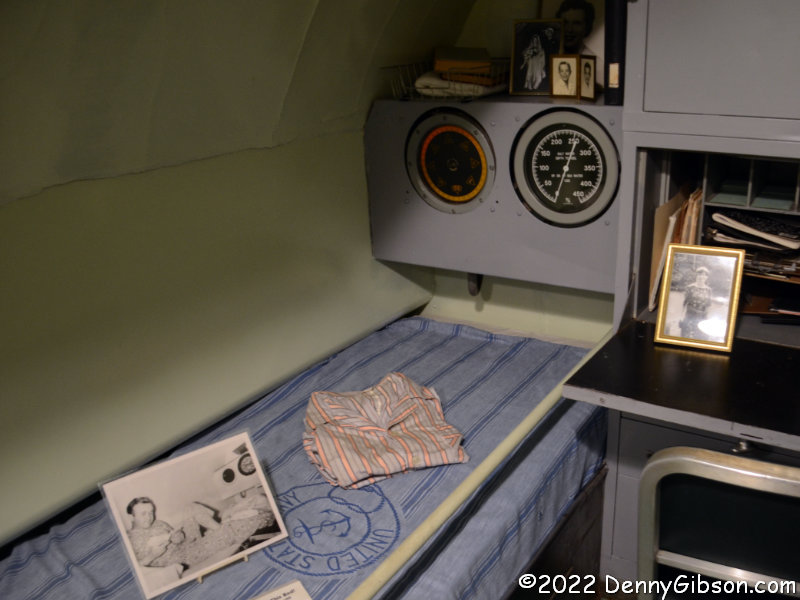
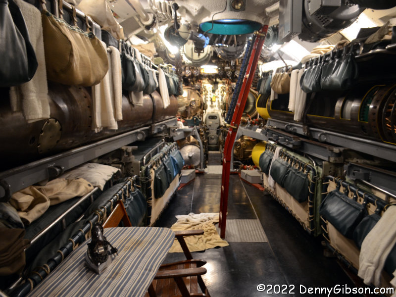
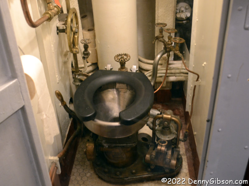
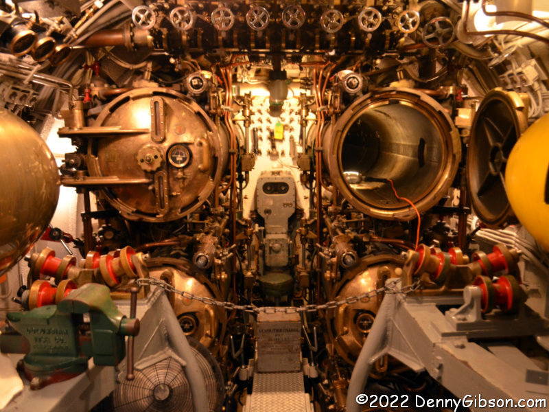
Entry to the submarine’s interior is through a hatch in the forward torpedo room. Stepping back from the torpedo tubes shows folding bunks where crewmen sleep in the space between torpedos. The aft torpedo room is similarly equipped and there are other sleeping areas midship. Other necessities are nearby. The third picture is of the captain’s quarters showing that one’s concept of luxury clearly depends on perspective.

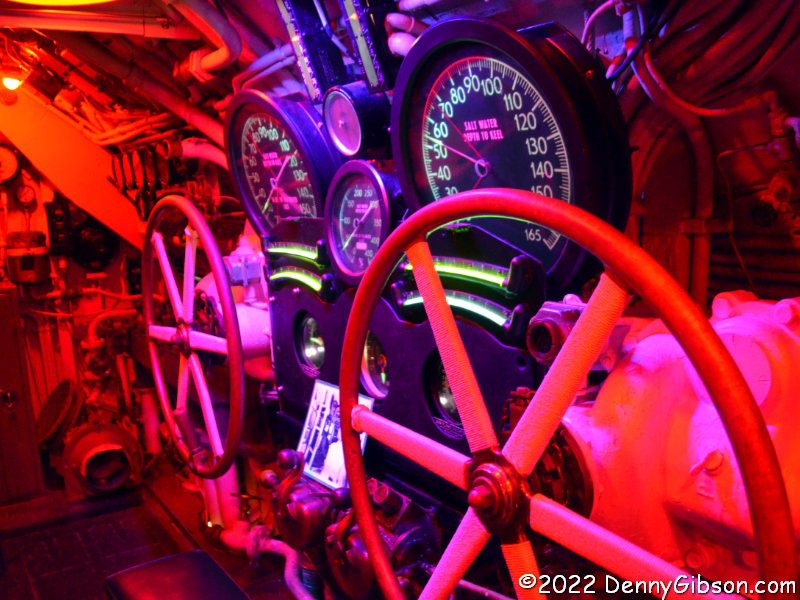
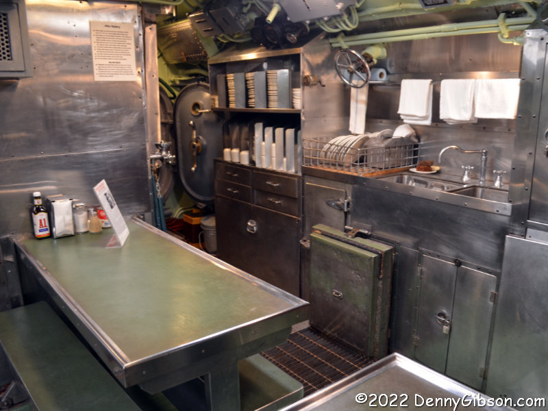
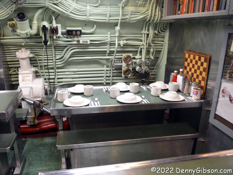
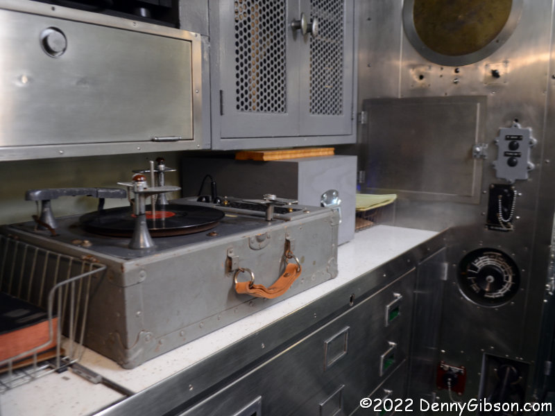
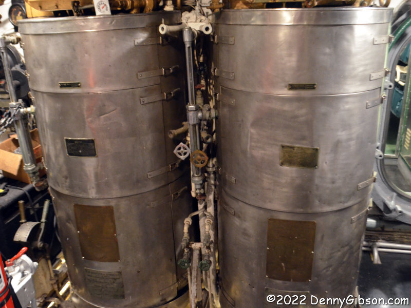
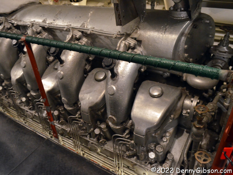
Red light is used to preserve sailors’ night vision and some sections of the Cod are illuminated in red to let visitors see what this was like. Submariners reportedly ate better than any other members of the military. Meals were prepared in this stainless steel galley and most were consumed here. Note the books and games stored near the tables and other entertainment was also available. Movies were sometimes shown in the dining area. One of the four 1,600 HP diesel engines is shown and there is a 500 HP auxiliary engine as well. These engines generate electricity which is stored in batteries to turn the propellers. Two stills at the front of the forward engine room provide fresh water for batteries, drinking, and other uses.

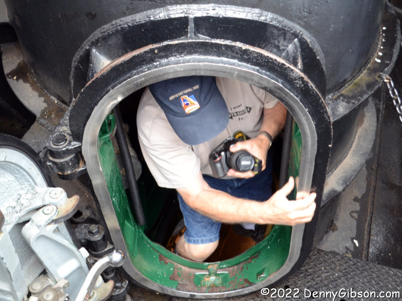
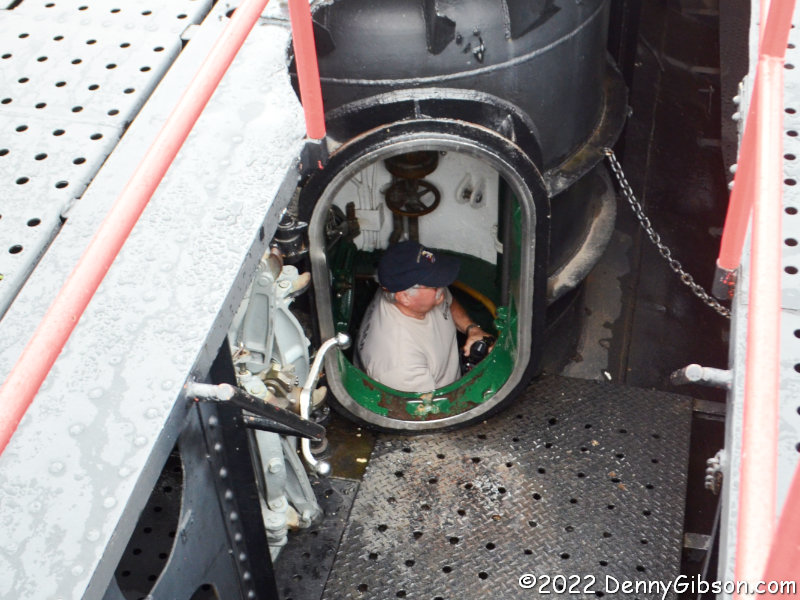
Visitors normally exit the USS Cod through a hatch in the aft torpedo room but that was closed because of the rain. We traveled back through the ship and where we had entered in the forward torpedo room. I exited first and got a picture of Terry climbing the ladder and another proving he made it out.

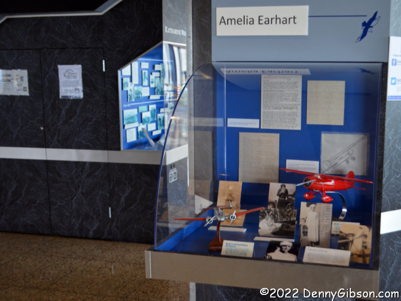
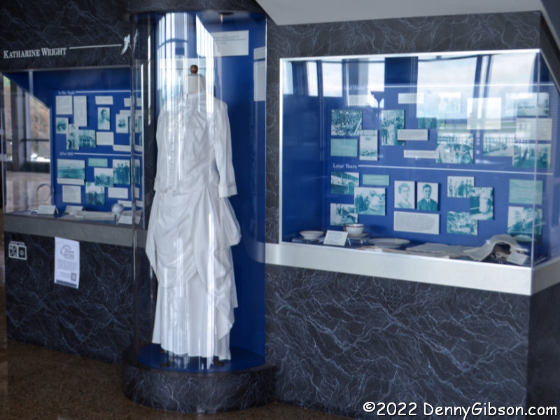
The fellow at the gate of the USS Cod suggested we walk over to the International Women’s Air & Space Museum which we took as permission to leave our car in the Cod’s parking lot while we did so. Amelia Earhart and Katerine Wright are among the many women honored with exhibits there. 

Dam Dents Revisited

I know I can’t do this forever, but I let the Facebook crowd steer me to another blog post this week. This one is somewhat different in that it doesn’t involve something new to me but some things I’d seen multiple times in the past that I was due for a refresher on. Back in 2006, I did Oddment pages on two dams that altered the path of the National Road north of Dayton, Ohio. Those pages are here, for the Taylorsville Dam, and here, for the Englewood Dam. The next year, I wrote an article for American Road Magazine (Vol V Num 3) that talked about both dams. The name of this post comes from the name of that article.

The first photo at left shows the easternmost edge of the easternmost dent. The road runs south for about a mile and a half before turning west to cross the mile-long dam then turning north to rejoin the original route. The dam is shown in the opening photo, which some will recognize as my attempt to reproduce George R. Stewart’s Photo #27 from 1953’s US 40: Cross-Section of the United States of America. Stewart’s photo and my “update” concentrate on the spillway and the bridge that crosses it. More of the massive earthen dam can be seen in the picture at left. The dams were completed in 1922 in response to the horrific 1913 flood. At that time, this was still known as the National Road. It would become US-40 in 1926. The 1953 and 2020 photos show some differences in the bridge itself due to a 1979 rehabilitation. The National Old Trails Road, a continent crossing named auto trail that existed from 1912 to 1926 never crossed these dams since the NOTR followed the “Dayton Cutoff” south through Dayton and Eaton.

There is a small paved area at the east end of the Taylorsville Dam where I parked to photograph it. On the west end, there is an actual park area with considerably more parking space and several informative signs including one from the Ohio National Road Association on Tadmor and Taylorsville. A section of the extensive Miami Vally Trails system passes through here and makes it easy to get to the former location of the town of Tadmor about 1.3 miles away.

The first of these pictures was taken looking back to the south after I’d strolled beyond Tadmor. I have been to the site since the dual purpose plaque (readable here and here) was placed but there are more labeled posts than I remember. Another difference is the rather impenetrable growth between the path and the river. There is a narrow path next to the previously pictured Tadmor sign that leads directly to the abutments of a short bridge that crossed the canal. Because of the growth and my aging sense of adventure, I did not go beyond this today as I did in 2006. The third picture shows a wall of the canal sluice gate with the canal bridge abutments in the foreground.

The rules called for the National Road to follow a straight line to the capital city Columbus with no grade greater than 10%. At Tadmor, following both of these rules in the early 19th century was impossible and it was the straight-line rule that lost. The road turned to the south on the west bank of the Great Miami and curved around a large hill. The grade, though not as bad as climbing the hill, still gave westbound travelers and their animals quite a workout. A spring near the top was certainly a welcome sight. The spring can be reached by heading east a bit where US 40 picks up the original path of the National Road. Although it’s not easy getting a clear view of the spring-fed waterfall, it is pretty easy imagining how refreshing it was to a team of horses dragging a Conestoga wagon up from the riverbank. A less blown-out version of the plaque is here.

An intersection between the dents has a legitimate claim on the Crossroads of America. In the days before US Numbered Highways, the National Road and the Dixie Highway crossed here. With the coming of numbers, the crossing routes became US-40 and US-25. A fair amount of traffic still passes through the intersection today though not nearly as much as through the nearby intersections of the successors to these routes, I-75 and I-70. The memorial bench and explanatory sign are just west of the intersection. A detail lifted from the sign explains a detail lifted from the photo of the intersection.

Continuing west, I came to the beginning of the second dent. Behind those trees on the right is a bypassed earlier curve which I slipped onto for a photograph. The entrance to the eastern portion of Engelwood Metropark is right at the eastern end of the dam. There is parking space for several cars and that is where I paused to photograph the dam and explanatory sign.

The road through the park is one-way which requires the former National Road, now called Patty Road, to be driven from west to east. Since all my other driving in this post has been east to west, that’s the sequence in which I’ve arranged these photos. The little bridge doesn’t look particularly historic when driving over it but the underside is a different story. The second picture shows the bridge from the north side and there’s a view from the south here. A sign that once stood near the bridge has gone missing so I’ve included a photo of it from 2006. The third photo shows where the National Road once continued westward. I walked down it in 2006 but did not today. There really isn’t much to see as a water-filled borrow pit prevents reaching the river.

This is on the west side of the Stillwater River in the smaller portion of Engelwood Metropark. I’ve been in the park before but did not do much exploring. Today I walked an abandoned section of the National Road down to the river. I’ve heard, and have even told others, that there are pieces of bridge abutments along the river. That might be true, but I didn’t see any today. I also didn’t see an explanatory sign mentioned in a Facebook post by William Flood, author of the upcoming Driving the National Road & Route 40 in Ohio: Then and Now. Further online discussion indicated that it might have gone missing from this wooden post. Not finding the sign certainly wasn’t an issue since looking for it is what led me to the riverside and that’s a good thing.


Yes, I had breakfast. The Mell-O-Dee Restaurant isn’t exactly on the National Road, but about two miles to the south where it’s been since 1965. COVID-19 precautions include a closed counter, plexiglass dividers between booths, and masked staff. They bake their own bread and pies and their French toast is made with that bread. It’s what I ordered and devoured with another COVID-19 precaution, disposable utensils.

A Darke Drive

A sixteen-mile long driving tour some fifty miles from home is what passes for a road trip when cabin fever and a coronavirus collide. Several years ago, the Arcanum Wayne Trail Historical Society folks put together a self-guided driving tour of the nearby area. That area is the southern part of the county where I was raised so the tour naturally interested me. As I recall, when the tour was first announced, there was some sort of museum event associated with the launch. I couldn’t make it but copied the tour description to my phone and plotted the route on my GPS. My intent was to combine driving the tour with a visit to the museum, but it never became a high priority and, with the museum open just one day a month, it never happened. The COVID-19 pandemic has eliminated even that single day of museum operation while elevating my need for some sort of outing. Road trips planned for April, May, and June have evaporated, those envisioned for July are all but gone, and August doesn’t look any better.

The tour passes one street south of the museum but I stopped by for a picture. The other pictured building is just up the block and some may remember it from this 2017 post. Sadly, the restaurant that was housed in the building and which triggered the post has closed. I’ve since seen a couple more Battle Ax Plus signs, but this was the first.

Arcanum’s Main Street runs north and south. I’m guessing that George Street, where the museum sits, was the original main east-west street since the first street north of it and the first street south of it are called, respectively, North Street and South Street. The tour begins at the intersection of Main and South and heads west, toward the water tower, on South Street. Arcanum isn’t a large town (population 2129 in 2010) so it doesn’t take long to reach open countryside.

South Street quickly becomes Arcanum-Hollansburg Road and intersects State Route 503 in just a few miles. At the corner, a church that was once part of a settlement named Beech Grove has been converted to a home. The tour turns south here, but I headed a short distance north to pause at the cemetery. Someone keeps the cemetery mowed but there is little evidence of any other sort of maintenance. A neighbor’s tractor display helps make the stop worthwhile.

I returned to the tour route and followed it to another cemetery. This is Ithaca Cemetery just north of the town by that name. Going backwards in time, we have veterans of the Civil War, Mexican War, and War od 1812. There are quite a few Civil War veterans buried here including one with a modern military plaque. That sort of plaque is common but I don’t recall ever seeing one for a Civil War vet. Sure is easier to read than weathered stone.

The tour description identifies four burials of significance here but I only managed to locate two. The first is Arcanum’s founder, William Gunder, who is buried next to his wife Nancy. The other is Revolutionary War veteran William Ashley although calling it a burial isn’t really accurate. Ashley was buried on a family farm nearby and when a new owner refused public access to the site, the marker was relocated here. Presumedly, Ashley himself was not moved. The other markers in the picture are for Revolutionary War veterans Ezekiel Farmer and William Walker. These are fairly recent additions and are not mentioned in the tour description. My guess is that these are also markers only.

The tour makes two passes through Ithaca. The directions discuss the impressive three-story I.O.O.F. building on the second pass but I paused for this photo when I entered from the north. The two passes actually overlap only at this intersection. This small crop of Corvairs, which look overly ripe and may have missed their harvest date, is at Ithaca’s western edge.

This is Darke-Preble County Line Road and, since I’m on the south side driving east, I may actually be in Preble County taking these pictures. The trees and bridge mark Miller’s Fork which is, according to the tour directions, “the speculated location of the first settlement of white people in southern Darke County.” The second picture is of the intersection with OH-503 which once contained a toll house, a one-room school, and the aforementioned Ashley farm. The tour directions do not indicate where the farm was in relation to the intersection so the location of William Ashley’s remains may or may not be in the picture.

The tour heads north on OH-503 but turns off of it on the second pass through Ithaca. It then returns to its starting point on Arcanum-Ithaca Road which becomes Main Street at the city limits. It was great to get out and drive some back roads even if it was for less than two hours including graveyard loitering. It helped with road trip withdrawal for the very short term, but overall it may have aggravated it by reminding me of what I’m missing. 

Kitty Hawk Holidays

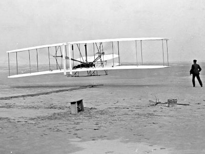
The Outer Banks and the Wright Brothers’ first flight are firmly joined in my mind. Although I’ve no problem remembering the year (1903), the month and date weren’t as easily recalled. I quickly looked it up the instant I first started thinking of the Outer Banks as a target for this year’s Christmas Escape and was very happy to learn it was December 17; Barely a week before Christmas Day, four days before the Winter Soltice, and five days before a full moon.

I’m beginning the trip with a dash to the Wright Brothers National Memorial at Kitty Hawk to celebrate the 115th anniversary of the flight. I’ll stay on the Outer Banks for a few days so may be in the area for those other holidays too. If not, I’ll be somewhere along the route home. That route is not yet determined although I’m leaning toward picking up US-64 at its eastern terminus and following it all the way through North Carolina. Then all I’ll have to do to get home is turn right.

This entry is to let blog only subscribers know about the trip and to provide a place for comments. The journal is here.

Trip Peek #62
Trip #51
2007 National Route 66 Festival

This picture is from my 2007 National Route 66 Festival trip. The festival was in Clinton, Oklahoma. It was the centennial year for the state of Oklahoma which was a factor in holding the festival there and it also meant there were other things going on. One of those was the opening of a time capsule in which a brand new 1957 Plymouth had been buried. This was a fly-and-drive trip and I arranged my flights to be in Tulsa for the Plymouth resurrection then cover a little Route 66 before the festival. The capsule had leaked and the Plymouth pretty much ruined but it was still a cool event. My time on Route 66 was enough to get me to my first overnight at the Blue Swallow in Tucumcari, New Mexico, and a look at two almost but not quite ready to open new businesses on the Route: Boothill Restaurant in Vega, Texas, and Pops in Arcadia, Oklahoma. Among the things making the festival itself memorable was the one and only appearance of Route 66 e-group founder Greg Laxton and the first of many appearances of the now legendary Road Crew.


Trip Peeks are short articles published when my world is too busy or too boring for a current events piece to be completed in time for the Sunday posting. In addition to a photo thumbnail from a completed road trip, each Peek includes a brief description of that photo plus links to the full sized photo and the associated trip journal.

Trip Peek #61
Trip #70
Some Lincoln Highway

This picture is from my 2008 Some Lincoln Highway trip. It was one of those cost cutter things I often tacked onto the end of work assignments. This assignment was near Philadelphia, Pennsylvania, and the picture is of an abandoned bridge over Poquessing Creek northeast of the city. Built in 1805, it carried the early Lincoln Highway. It was where I started the personal part of the trip that would follow the Lincoln Highway west as far as Canton, Ohio. After visiting several roadside attractions along the way I spent the final day admiring classic cars at Canton’s Glenmoore Gathering. As I looked over the journal to prepare this entry, I couldn’t help but smile when I saw that the “66 the Hard Way” idea came from preliminary planning for this trip.


Trip Peeks are short articles published when my world is too busy or too boring for a current events piece to be completed in time for the Sunday posting. In addition to a photo thumbnail from a completed road trip, each Peek includes a brief description of that photo plus links to the full sized photo and the associated trip journal.

Trip Peek #55
Trip #10
A Few Indiana Towns

This picture is from my 2003 A Few Indiana Towns day trip. The picture is from Columbus, Indiana, which was the trip’s destination. The town is known for its architecture and painting these vents to look like a pipe organ is the kind of thing that makes the place interesting. Other Indiana towns visited along the way include New Trenton, Cedar Grove, Brookville, Metamora, Oldenburg, and Versailles.


Trip Peeks are short articles published when my world is too busy or too boring for a current events piece to be completed in time for the Sunday posting. In addition to a photo thumbnail from a completed road trip, each Peek includes a brief description of that photo plus links to the full sized photo and the associated trip journal.

Trip Peek #54
Trip #74
Easter Weekend 2009

This picture is from my Easter Weekend 2009 trip. I found the VW Rabbit in appropriate holiday garb on the second day of the three day outing. The trip was something of a catch-all with some old roads, a stop at the Rock and Roll Hall of Fame in Cleveland, and a stop at Pymatuning Reservoir spillway “Where the Ducks Walk on the Fish”. A highlight of the trip, and one reason for its direction, was a Patrick Sweany concert with his father, “Hot Tub” Sweany. accompanying him on washtub bass.


Trip Peeks are short articles published when my world is too busy or too boring for a current events piece to be completed in time for the Sunday posting. In addition to a photo thumbnail from a completed road trip, each Peek includes a brief description of that photo plus links to the full sized photo and the associated trip journal.

Trip Peek #51
Trip #18
Big E, DC, and the Cardinal

This picture is from my 2004 Big E, DC, and the Cardinal trip. The trip appears in my top ten “Decent” list and it certainly deserves to be there. The Big E in the title is the USS Enterprise, the world’s first nuclear powered aircraft carrier. My youngest son was serving aboard the huge carrier at the time and I was privileged to be part of a three day Tiger Cruise as she moved from Florida to her home port at Newport News, Virginia. With no military experience of my own, those few days sleeping and eating with my son’s crew mates was quite educational even though it was a spruced-up danger-free family-style version of life at sea. All airplanes were removed from the carrier before we civilians came on board but a few returned to provide landing and take-off demonstrations. The photo shows a S-3B Viking being launched.

After a couple of days in Newport News with my son and his family, I took a train to Washington, DC, and checked out a few museums and monuments. The Amtrak train that runs between Chicago and New York City is named the Cardinal. It provides Cincinnati’s only passenger rail connection and it carried me home at the end of the trip.


Trip Peeks are short articles published when my world is too busy or too boring for a current events piece to be completed in time for the Sunday posting. In addition to a photo thumbnail from a completed road trip, each Peek includes a brief description of that photo plus links to the full sized photo and the associated trip journal.

Road Crew Redo

It was just about a year ago that I set out for what was supposed to be a Nashville musical triple play. After a night in Louisville, I would head to “Music City” for a night at the Bluebird Cafe, a night at the Grand Ole Opry, and a night listening to road fan favorites The Road Crew. Major snowfall kept me from the Opry and totally wiped out the Road Crew performance. I did catch three talented musicians at the Bluebird. The story of that trip is here.

I’m trying again. When snow kept me from the Opry I was told I could apply the price of the ticket to another anytime during the next year. When I learned that the Crew would be performing this Saturday, I called the Opry and managed to beat the one year expiration date by a day. Not surprisingly, prices have gone up so that I had to cough up an additional six bucks but I’m set for the Opry on Friday and the Road Crew on Saturday. Two Thursday night shows at the Bluebird were sold out.

The journal for the trip is here. This entry is to let blog subscribers know of the trip and to provide a place for comments.