
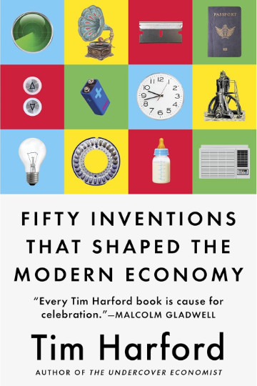
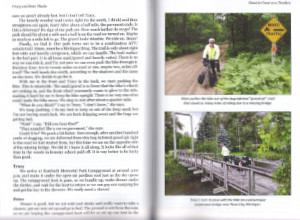
 Although I have since figured it out, when I pulled Fifty Inventions That Shaped the Modern Economy from my to-read list, I wasn’t sure how it got there. I was, however, quite certain that beginning it immediately after reviewing Cities of Gold was a real piece of luck. That’s not because of any overlap in subject matter. There is virtually none. It is because that review had ended with me seriously considering whether or not the invention of the automobile had been a good thing. I guess I was in the mood to think about inventions.
Harford leads us to think about inventions differently than we otherwise might. Of course, just considering their impact on the economy, the focus of this book, is new for some inventions and some readers. But Harford has us thinking about how they came to be, why some took so long to be created or accepted, and yes, good versus bad.
Some inventions create clear winners and losers, and that is the name of the book’s first section. A good example, and the one Harford talks about first, is the gramophone. As he does with all fifty of his chosen inventions, he tells its story through real-world examples that illustrate why it was chosen. In pre-gramophone days, top-tier performers made more money than those who weren’t quite as good, but second- and third-rate performers could do alright since the only way to hear a hit (or any sort of) song was via a live performance. Once it became possible for a star to record a single performance and sell copies, the market for not-quite-star performers dropped dramatically.
Several of the listed inventions require a large array of other inventions to even exist. The premier example of this is the iPhone and the other smartphones that followed. Harford notes that economist Mariana Mazzucato has identified a dozen technologies needed to make this device practical and useful. Several are specialized miniature electronic components, but things like analog-digital conversion, a cellular network, and the World Wide Web are also obviously necessary. I was reminded of those pictures of a guy weighed down by all the devices replaced by a modern smartphone, and made to realize that if all of those functions didn’t already exist, smartphones wouldn’t be very smart at all.
There are other inventions that do not require a bunch of prior breakthroughs but do require a lot of coordination. I have passed harbors filled with ships loaded with identically sized shipping containers and have watched trains carrying the big cubes pass me. It never occurred to me just how much coordination it took to create ships and railcars to hold the containers and cranes and other devices to move them. The story of how that happened is fascinating.
Naturally, a lot of what Harford has to say about an invention concerns its impact. The book’s purpose, after all, is to identify those that shaped the modern economy. Some of that impact is intentional, some is not, and some of the unintentional impact is not good. It was the negative environmental impact of the automobile described in Cities of Gold that got me to consider it differently, and there are plenty of negative unintended consequences described in Fifty Inventions…. But there are also plenty of positive unintended consequences connected with those inventions.
Air-conditioning is a great example. Its invention was driven by the effect of varying humidity on color printing. It solved the problem – but also led to a lot of comfortable and happy people in their cars, homes, and offices. Along with the safety elevator, reinforced glass and concrete, and a few other things, air-conditioning is one of the inventions that allow glass-covered skyscrapers to exist.
That the inventions Harford identifies have overall been good things is reinforced in the Epilogue, when he recounts economist Timothy Taylor asking his students whether they would rather be making $70,000 a year now or in 1900. The answer might seem obvious at first, but it requires just a little thought to realize that while that money would definitely buy more stuff in 1900, much of the stuff that makes life enjoyable today was not available in 1900 at any price.
Fifty Inventions That Shaped the Modern Economy, Tim Harford, Riverhead Books (August 28, 2018), 5.5 x 8.21 inches, 336 pages, ISBN 978-0735216143
Available through Amazon.
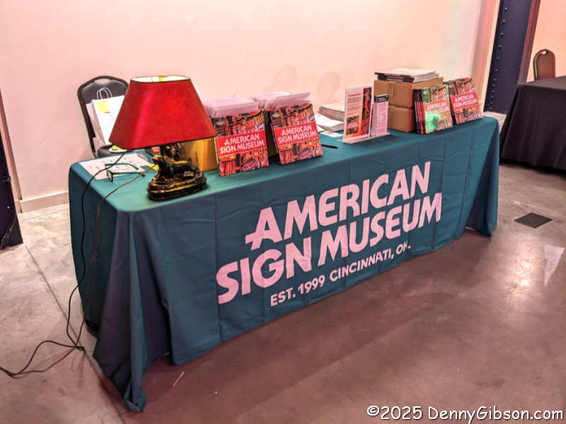
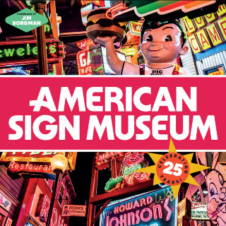 This book, just like its subject, is bright, colorful, eye-catching, and informative. That subject, quite obviously, is the 25-year-old
 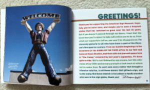 Museum founder Tod Swormstedt provided a welcome page and an introduction, and his influence is evident throughout. It’s a given that some of the information presented in Roberts’ text came from Tod and others. To me, it seems almost as obvious that a guy so adept at organizing walls, rooms, and buildings filled with signs would have a hand in organizing sign-filled pages, and I have a strong hunch that he might have suggested a few targets for Grilli’s camera.
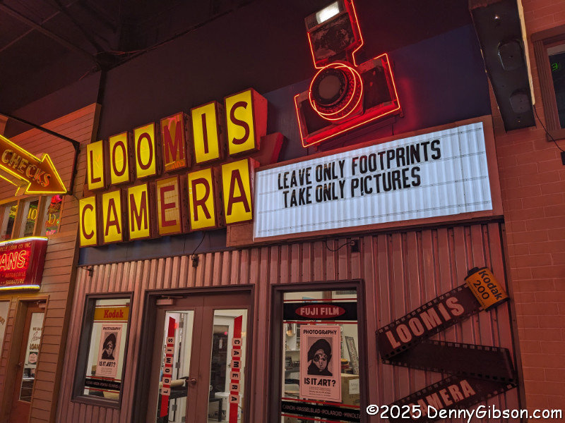
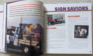 As Tod describes in the introduction, the book consists of three sections. The first describes what the museum is. It begins with some statistics, such as size (40,000 sq ft), oldest sign (155 years), and tallest sign (21 ft). That is followed by “A Founder’s Vision” (written by Tod), some words about the museum’s mission and its relationship with the community, and recognition of some of the many individuals who have been instrumental in the museum’s development and ongoing operation.
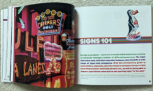 The second section concerns signs in general. There is a condensed history of signs in America that starts with carved and painted signs and progresses through materials like glass and plastic. The major changes electricity brought and the development of various illumination methods are covered. The section concludes with a glossary of sign types and the techniques and materials used in their construction.
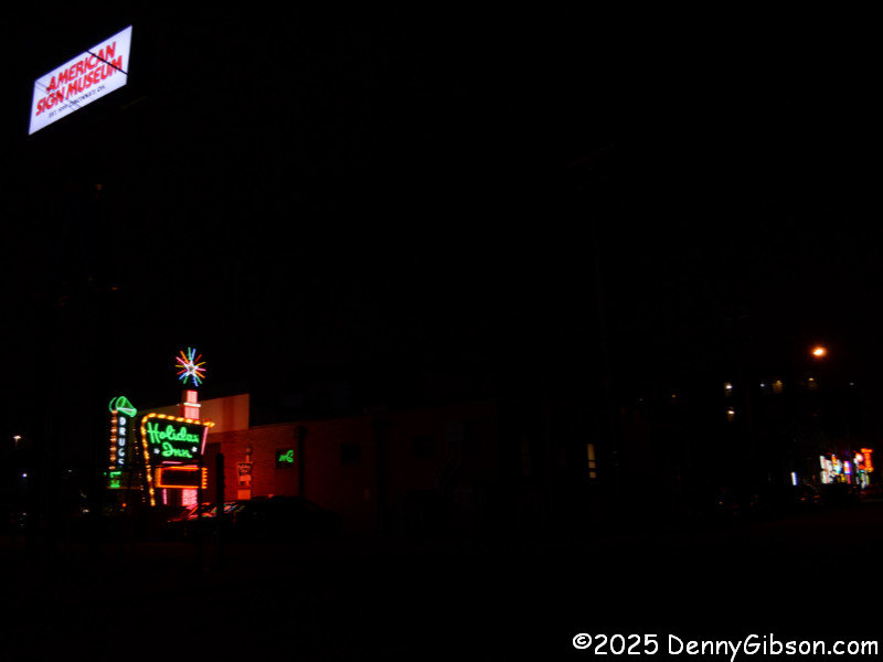
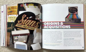 I first became aware of the museum with the 2005 opening of its original Walnut Hills location. To someone not involved with the sign business in any way, it seemed to me that this wonderful new attraction had magically appeared, fully formed, in my city overnight. However, we all know that’s not how things work, and I soon learned about some, but far from all, of the work behind that magic. The first part of section three nicely covers the period between forming a board of directors in 1999, incorporating as a non-profit in 2000, and that delightful grand opening on April 28, 2005. This is also where I found more photos of Tod wearing a tie (3) than I’d ever seen before.
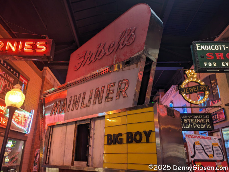
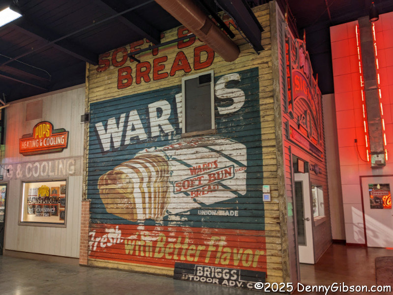
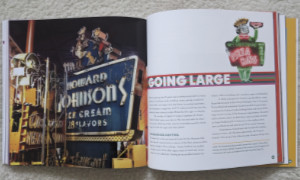 That first home in Essex Studios in the Walnut Hills neighborhood of Cincinnati was outgrown before it was occupied. Behind-the-scenes coverage continues as the current location in Camp Washington is acquired and made ready for another grand opening in June 2012. Central to “A Founder’s Vision” was the desire to not just display signs but to tell the story of American signage. Two envisioned methods for doing that were a Letter Wall showing the evolution of sign lettering and a faux street where signs were displayed in period-appropriate settings. A short Letter Wall existed at Essex, and some signs were sort of arranged as if they were on a street, but the backing was mostly plain white walls. In the new location, there was room to create proper versions of these two features. A much longer Letter Wall was constructed at the entrance to the main display area, and a Main Street was built with various storefronts lining both sides. To add another layer of realism, a diverse group of sign painters known as Letterheads descended on the museum to add signs to windows and doors to augment the big signs hanging on the storefronts and standing in the street. The store windows serve as natural display locations for items like painter kits and books.
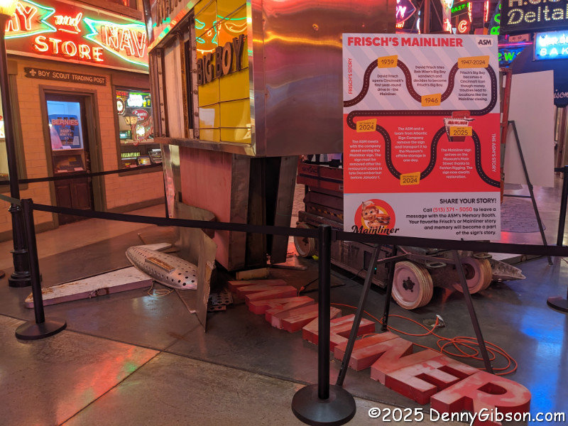
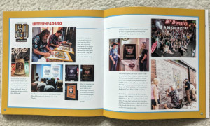 The Letterheads and the museum have a wonderful relationship that is well documented in the book. The museum hosted the group’s 40th and 50th reunions in 2015 and 2025, and the group added murals and other features to the museum each time. When the museum expanded and Main Street doubled in length in 2024, the Letterheads returned to work their magic on the new storefronts. The Letterhead story is just one of many that show how the museum is appreciated by sign makers as well as sign fans.
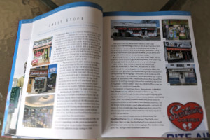
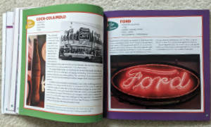 There is something akin to a fourth section spread throughout the book. It is made up of things called “Sign Stories”, which are like sidebars in that they are standalone and not tied to the main flow of the book. But each is at least one full page, and some fill a two-page spread. Most describe a sign or group of signs in the museum’s collection. They typically provide a date and original location and identify the sign material and type. Then the page is filled with details about the sign’s original owner, its acquisition, or some other truly interesting aspect of the sign. I didn’t count them, but there’s a bunch. Enough to believe that some people might think the book worthy of purchase if these were all it contained.
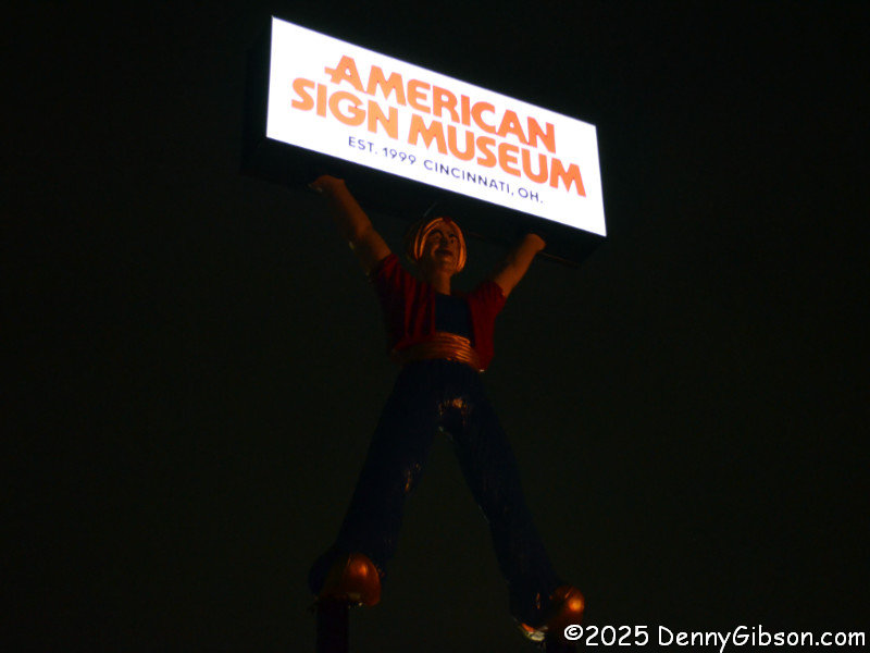

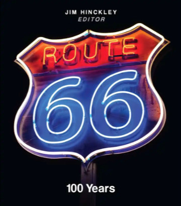 That title may look familiar. If so, one reason might be the similarly named Route 66: The First 100 Years, reviewed
 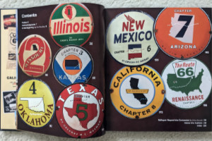 Route 66: 100 Years is an anthology edited by Jim Hinckley of
 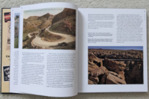 Like the beginning pages of many books about historic highways, the introduction includes tales of how the early automobile roads followed native trails, animal migration paths, and train tracks. And it talks about the impact that the popularity of bicycles had on the desire for and development of roads outside of cities toward the end of the 19th century. What makes it a little different from most similar writings is that it provides some details about organizations and specific events during road development during this era of pedal-powered transportation.
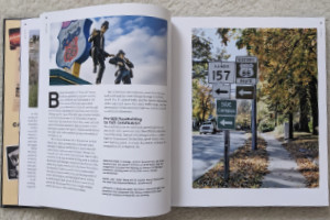 The state chapters appear in geographic sequence, east to west, which is the direction most people travel the route. Together, they provide a sort of combination travel guide and history lesson. I’m not talking about a travel guide with turn-by-turn directions, motel phone numbers, and such. However, most towns along the route are mentioned — and US 66 was a great connector of small towns — along with numerous points of interest. There is usually some history given about each town and POI, and there is plenty of history about the route itself.
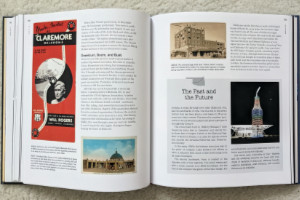 The book is definitely well-illustrated. I don’t believe there is a single page, besides the index and authors’ bios, without at least one image. These include modern and period photographs, postcards, advertising brochures, and other items. Joe Sonderman supplied some of those postcards and brochures, as did big-time collectors Mike Ward and Steve Rider. I was extremely pleased to see a photo from the collection of the late Laurel Kane included. Many of the modern photos were taken by Jim Hinckley and his wife, Judy. I saw no photos from either Rhys Martin or Greg Hasman, although I know both are excellent photographers. I did see photos from Shutterstock, Alamy, and Getty. I thought both situations were curious, but the final product comes off well.
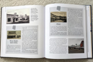 The quality of the book is quite good. Color and black-and-white images show nicely on the heavyweight glossy pages, and the layout serves them well. All have descriptive cut lines that include source credits. There are numerous sidebars, most with their own images, providing extra information outside of the main text flow.
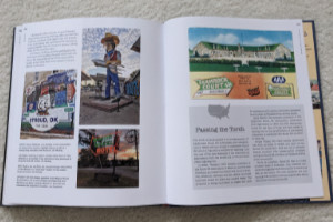 The individual states that carried US 66 account for eight chapters. The book has nine. Dries Bessels, a resident of the Netherlands, authored a chapter named “Renaissance”. Dries has guided multiple tours down the length of Route 66 and provides an outside-the-country view of the historic road. The “renaissance” he writes about is its emergence as a travel destination for both Americans and foreigners after being bypassed and decommissioned. America, essentially spared the devastation that WWII brought to Europe, was the land of dreams to post-war Europeans, and Route 66 was a tangible thing that rolled right through those dreams. Today, Route 66 is still regarded as a way to experience a diverse range of America.
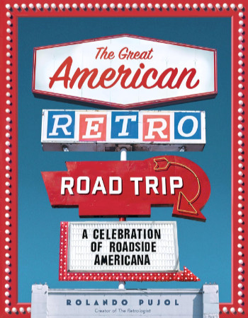 There’s no road trip here. The Great American Road Trip is not a travelogue. Nor is it a guide for traveling to or through a particular place. It is a well-done, very inclusive, nicely illustrated catalog of stuff that people like me drive around the country to see.
 This is the second book that I’m aware of about Medal of Honor recipient Doug Dickey. I was aware of the first one,
  The book includes several maps and diagrams to help describe things like locations and organization hierarchies. There are even a few black and white pictures mixed in with the text. That’s nice, but they are on matte paper. What is even nicer is the section of twenty-two glossy pages containing higher quality images, many of which are in color.
 As mentioned several times on this website, Doug Dickey was a classmate of mine. I have attended events that honored him and read much that has been written about him. Two things from this book that I’d not heard before stood out. The common belief was that Doug fell on top of a single grenade, and that is what the Medal of Honor citation describes. But years later, when witnesses were able to compare notes, it was determined that there was a second grenade that Doug pulled under his body after falling on the first one. I was also struck by the sentence that Lang ends his book with, and with which I’ll end this review. It’s something that Doug’s mother, Leona Dickey, said when talking about her oldest son. “The guy who threw the grenade — he would have loved him, if he could have just met him.”
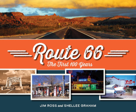 It’s a beauty. That was my initial thought when I first held this book in my hands and flipped it open. I wasn’t surprised, of course. I’ve seen enough of Jim and Shellee’s work to make me expect great photography and writing, a top-tier knowledge of history, and a rock-solid commitment to quality. I’m not quite as familiar with Reedy Press, but what I have seen smacks of the quality targeted in that previously mentioned commitment. My instant declaration of beauty came from seeing great images accurately reproduced on thick glossy pages. Including the text in my appraisal took only a little more time.
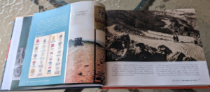 Unlike many other Route 66-related books, Route 66: The First 100 Years is not organized geographically. Nor is it organized chronologically as history books often are. There is a slight hint of chronology in discussing the roads that preceded US 66 in Chapter 1, “Revolutionizing Travel”, and covering “Renaissance” and “Preservation” in the last two chapters. In between, chapter subjects might be eras (e.g., “Hard Times”), collections of people (e.g., “Ladies of Legend”) and businesses (e.g., “Trading Posts and Tourist Traps”), or something else. Whatever the subject, a wide-ranging set of examples is included. But 100 years and 2400+ miles cover a lot of space and time, and anyone with more than a passing familiarity with Route 66 will probably come up with a personal favorite or two that didn’t get included. The selection process could not have been easy, but the selections are excellent.
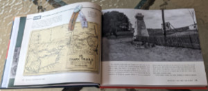 Every chapter, like the vast majority of real-life road trips, has a “Detour”. The book’s detours are deep dives into one of the chapter’s subjects, and not all of them are obvious. The detour for the “Revolutionizing Travel” chapter is “The Ozark Trails”. This was an early named auto trail, or actually a system of auto trails, that, in my experience, doesn’t seem to get enough recognition. The “Hard Times” chapter takes a detour into an area that has been overlooked far too often for far too long: “The Green Book and Threatt Filling Station”.
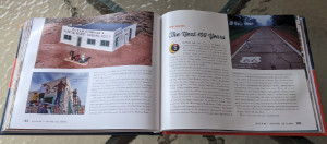 It’s probably not all that surprising that Route 66: The First 100 Years overflows its twelve numbered chapters. It starts with a full page of Acknowledgments, followed by a Forward written by Route 66’s storytelling king, Michael Wallis. Jim and Shellee follow that with a Preamble, then include an Epilogue, Road Facts, and a few other sections after Chapter 12. One of these sections, titled “Happy Trails”, is a collection of roadside photos taken over the Mother Road’s first 100 years. Many are of unidentified travelers, but there are some real celebrities in the mix. There’s Jack Rittenhouse standing beside a California U.S. 66 sign, Lillian Redman by an Arizona 66 sign, and Cynthia Troup gazing at a U.S. 66 sign in New Mexico. As I said earlier, 100 years and 2400+ miles cover a lot of space and time. Jim and Shellee have done an impressive job of capturing the big picture and quite a few of the small picture details, too.
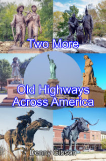 I had so much fun driving twice across the country for
  I also bragged about the title of the Yellowstone Trail and US 20 book and bemoaned the fact that it wasn’t as clever as initially envisioned. Of course, clever sometimes also means cryptic, and that might have been the case here. Anyone who thought 20 in ’21 and the YT Too overly cryptic will be happy to see that the title of this book isn’t cryptic at all and not the least bit clever either. It really is about going across America on two old highways and, since I’ve done that before, it really is about two MORE old highways. It just occurred to me that some folks might be unhappy about having to guess which two, and I can understand that. But putting the wordy names of these two auto trails in the title would have made it entirely too long, and it’s too late to do anything about it now anyway. Sorry.
 To be honest, though, even if the names National Old Trails Road and Pikes Peak Ocean to Ocean Highway were right there in the title, they would not be recognized by everyone. Out west, some would recognize the NOTR as something that turned into US 66. Back east, a similar number might recognize it and think it had become US 40. In the middle of the country, I suspect that just a few would even recognize the PPOO’s name. Of those who did, some might say it was replaced by US 36, while others would claim it became US 22. There is a little truth in each of these claims, but my point is that not all that many people know that the PPOO and NOTR were both once routes that connected the East Coast with the West. Their names in the title would not be any more enlightening to many than the words “Old Highways”.