Trip Peek #126
Trip #163
PA Cars

This picture is from my 2021 PA Cars trip. PA, or Pennsylvania, is where I went and cars is what I went for. The first big car exposure was in Allentown, PA, where my friend Dave Reese gave me another personal tour of the America on Wheels museum. From Allentown, my farthest point east, I headed west to Hershey and the AACA Museum. The trip was more or less organized around the museum’s Model T Driving Experience and that’s what the photo is from. Of course, I worked in a stroll through all of the AACA exhibits and a stop at The Hershey Story Museum too. I got in some miles on both the Lincoln Highway and the National Road and enjoyed a night of historic lodging on each. The National Road miles were eastbound and I spent the first night of the trip at the Headley Inn near Zanesville, OH. The last night of the trip was spent at the Lincoln Motor Court beside the Lincoln Highway near Bedford, PA.


Trip Peeks are short articles published when my world is too busy or too boring for a current events piece to be completed in time for the Sunday posting. In addition to a photo thumbnail from a completed road trip, each Peek includes a brief description of that photo plus links to the full-sized photo and the associated trip journal.

Book Review Building the Bridges Along the National Road Through Ohio Cyndie L. Gerken

Cyndie’s done it again. As I began to write this review of Cyndie L. Gerken’s fourth book on the National Road in Ohio, I revisited my reviews of the previous three thinking I might come up with a better opening line but everything I saw just reinforced my initial thought. Cyndie has indeed done it again.

The words “accurate” or “accuracy” appear in the opening paragraphs of all three along with words like “precision” and “thoroughness”, and all those words certainly fit once again. In my review of the third book, Headley Inn and Cliff Rock House, I noted that it differed from the previous two by focusing on a small stretch of roadside rather than all of the state. That difference struck me again as I read Building the Bridges Along the National Road Through Ohio but in a slightly different way. The “Along the National Road Through Ohio” in the title tells us that this is something of a “return to form” but it occurred to me that the set of four is just a bigger version of something going on within each of the individual books. There is no denying that reading lots of details about lots of very similar things can become repetitious. In Marking the Miles… and Taking the Tolls… and again in Building the Bridges…, Gerken often intersperses human-interest style stories among the facts and statistics to help fend off boredom. Thinking of Headley Inn and Cliff Rock House playing a similar role in the series, despite having its own sets of facts and statistics, brought a smile to my face. It might have had just as much value in that regard to the writer as to the reader.

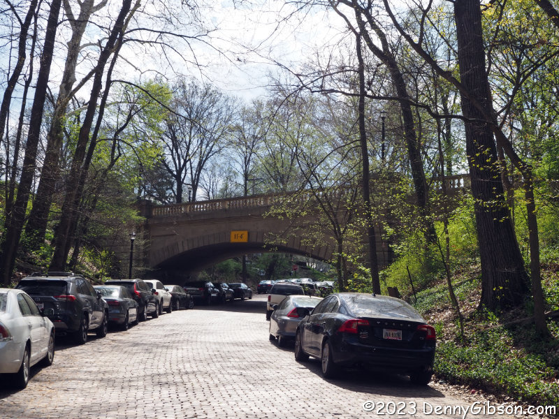
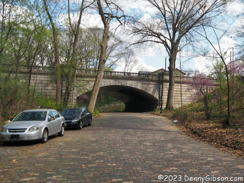
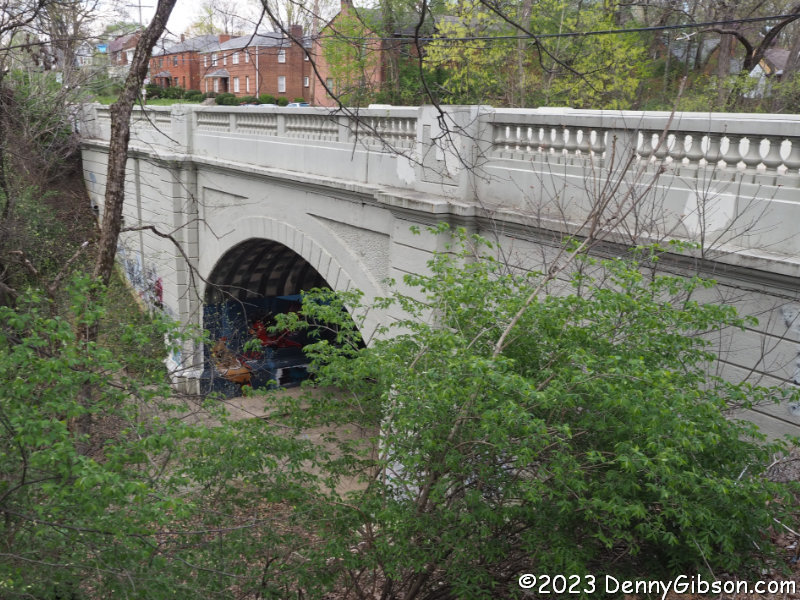
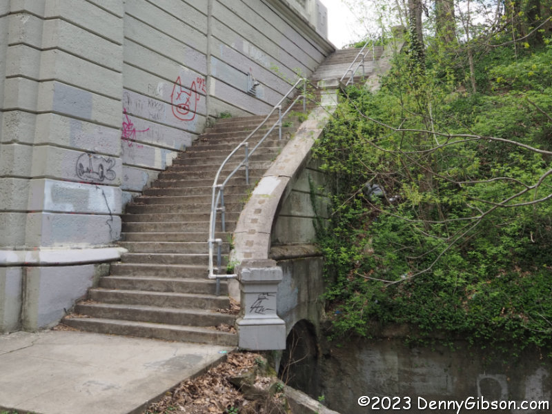
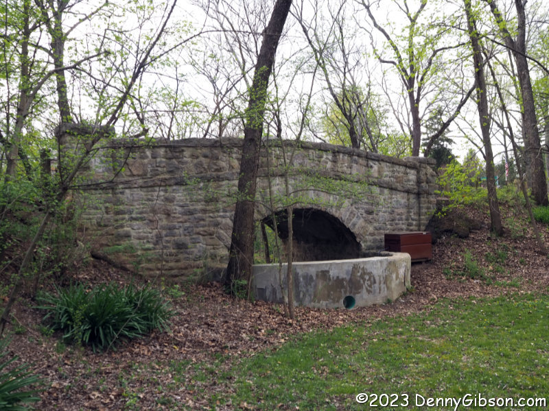
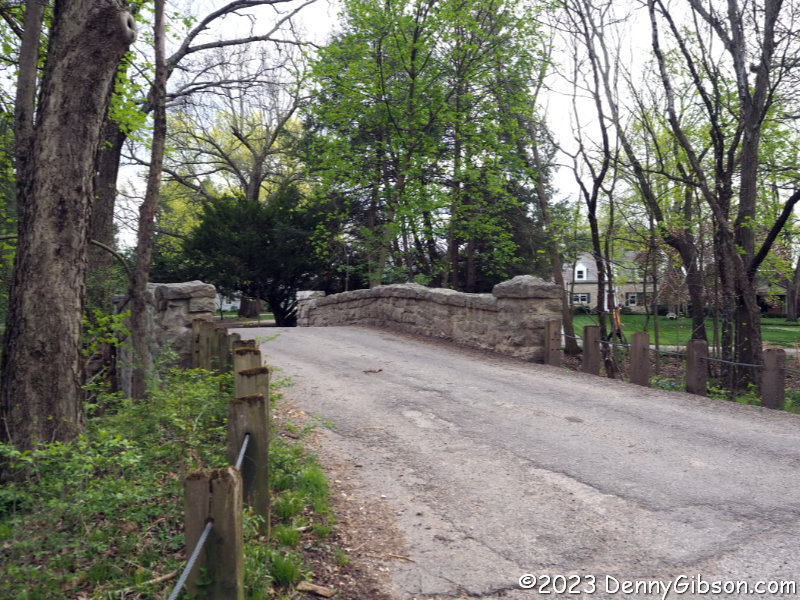
Although I certainly know better, I tend to instinctively think of big stone arches when I hear the phrase “National Road bridges”. One reason is that many of those stone bridges, some of them S-shaped, are still in existence. There were also many wooden bridges along the road but all were much shorter-lived. Building the Bridges… includes both. It identifies twenty-one covered wooden bridges built for the National Road in Ohio in addition to probably forty-some stone bridges. There were also well over a thousand stone culverts and one reason an accurate count of stone bridges is difficult to produce is that not everyone followed the same rules when distinguishing culverts and bridges. Span length was and is the distinguishing characteristic. Twelve feet, twenty feet, and no doubt some other numbers of feet were used to make the distinction and some reports did not distinguish the two at all.

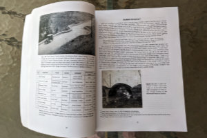
Gerken talks about culverts vs. bridges in the introduction along with many other topics related to the Ohio National Road bridges in general and some that simply concern all bridges in general. Building techniques are described as are bridge types and bridge components. Thanks to an annotated picture of one of the Blaine Bridge arches, I now know what a voussoir is although I’ve no idea how to pronounce it. (Voussoirs are the wedge-shaped stones that form an arch.)

A chapter titled “The Builders of Ohio’s National Road Bridges” follows the introduction. Its opening pages contain information about the road’s Superintendents, how the road was divided, what contracts looked like, and similar subjects. Then comes fifty+ entries on individual builders.

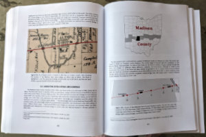
After telling us about as many of the bridge builders as she could identify, Gerken touches on some of the iconic National Road bridges east of Ohio, including the Wheeling Suspension Bridge, before beginning a county-by-county trek across the state. Each county chapter begins with a thumbnail of the county and the National Road through it. A map locating the National Road bridges in the county appears very early in each chapter. Sections on each of the bridges and some of the culverts in the county appear also in east-to-west sequence. Just as some bridges east of Ohio were touched upon preceding the border-to-border coverage, a few in Indiana follow it. 

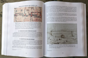
At a minimum, the location of each structure and what it crossed is given. The builder or builders are identified if known and, thanks to some pretty good sleuthing, many of them are. Beyond that, the information given for each bridge or culvert varies widely but it is a natural variation. For unnamed culverts over unnamed intermittent streams, location might be just about the only thing known. For major structures, lots of additional information might be included and usually supported by various graphics. Topographic maps are fairly common and there are lots of historic photographs and drawings. Plenty of modern photos also appear and if a structure is still standing there’s a good chance that the book contains a very modern picture of it taken by the author herself. Stories about events associated with happenings at or near a particular bridge can pop up anytime and are often fleshed out by reproducing contemporary reports.

The current status of each structure is always given if known. I’ve long been impressed with the number of National Road bridges still standing. Maybe I should be even more impressed after reading about all that failed and had to be replaced within a year or two of completion due to shoddy materials or workmanship. The number of contracts that had to be reissued after being abandoned by the initial winning bidder was also somewhat surprising. Building the first interstate was no simple task.

Ample anecdotes and news reports are mixed in with or printed beside all the facts and statistics. Some are funny and some are sad but almost all provide a glimpse into another time. I’ll share a piece of one that struck a chord with me. In her reminisces on the two-lane covered bridge over the South Fork of the Licking River, Minnie Moody describes a sound from another time.

What I liked was to go clattering through one lane of the bridge at the same time another vehicle was passing through on the other side of the center partition. Whang, bang, clickty-clack! With a roof over our heads the uproar was terrific.

I believe I have passed through a two-lane “double barrel” covered bridge but I’m not 100% certain. I am 100% certain that I’ve not done it in the presence of even one, let alone two, horse-drawn vehicles. I’m nearly 100% certain that I never will but thanks to Minnie — with the help of Cyndie — I have a pretty good idea of what it was like.

Yep. Cyndie has done it again. Building the Bridges… is quite clearly a valuable reference book for National Road fans but it’s something of a storybook, too. It has people in it along with the stones and lumber. The Ohio Genealogical Society hands out awards to several books each year. One of these is the Henry Howe Award which goes to a book on “Ohio state, county, or local history”. Each of Gerken’s previous three National Road books has won the award and I’ve a hunch this one will as well. Yeah, I think Cyndie’s going to do that again, too. 

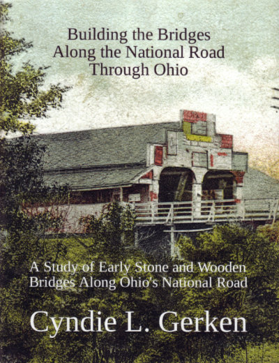
Building the Bridges Along the National Road Through Ohio: A Study of Early Stone and Wooden Bridges Along Ohio’s National Road, Cyndie L. Gerken, Independently Published (May 14, 2023), 8.5 x 11 inches, 521 pages, ISBN ‎ 979-8393147471
Available through Amazon.
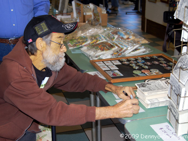
Trip Peek #124
Trip #50
Boone’s Lick Road

This picture is from my 2007 trip on Boone’s Lick Road. The picture is of some of the chairs lined up in front of Crane’s Country Store in Williamsburg, Missouri. The store is still there so the chairs might be too. I sure hope so. As I reviewed the original journal to make this post, I realized that a disheartening number of things mentioned in it are gone. It’s a realization that started with a bang in the first paragraph of the first day. The east end of Boone’s Lick Road was in St. Charles, MO, a little northwest of St. Louis. I had learned that Vandalia, IL, was a reasonable drive from home and a good starting point for doings in the St Louis area. I spent the first night of the trip in Vandalia at a place I was familiar with, Jay’s Inn. I say that in the first paragraph and mention the restaurant next door although I ate dinner that night downtown at The Depot. Jay’s restaurant would be closed in less than two years. Within three years The Depot would burn, reopen, burn again, and close permanently. Jay’s Inn is now shown as closed permanently.

It was Nathan Boone that was involved with the creation of Boone’s Lick Road but his more famous father, Daniel, eventually moved to Missouri and was buried near the road. The large bronze plaque at his grave which I photographed in May 2007 was stolen barely a year later. A black granite plaque has replaced it. The journal tells of eating my second dinner of the trip at Trailhead Brewery in St. Charles. It closed, I just now learned, in January 2020. Stein House in Boonville, which sported a really cool neon sign and where I had dinner on the third night, is listed on Yelp as permanently closed. With so many things mentioned in the journal closing or disappearing, finding the Crane’s Store website active was a real bright spot. The delightful Marlene Crane, who is pictured in the trip journal, died in 2015 at the age of 84 but the family business continues under son David. And Boone’s Lick Road can still be found along with its DAR markers.

The trip occurred during a period when I was regularly writing articles for American Road Magazine’s “Our National Road” department. It resulted in an article in the Spring 2008 issue. In writing this post, I revisited that article which triggered a couple of memories and a couple of smiles. Articles I submitted were naturally edited before publication but I was rarely consulted about changes or even aware of them before seeing them in print. I don’t recall exactly how I described the Corps of Discovery’s departure from St Charles aside from calling it “the last bit of civilization” they would see. Whatever I said was not, apparently, sufficiently energetic and it was changed to “galloped into the unknown”. The Corp had floated away from civilization on the Missouri River with not even a pony aboard their boats. I was kind of upset over what I considered an inappropriate change but I was also a bit amused by the image of Lewis and Clark galloping away in their pirogues. The second memory involved the last sentence of the article and the only “fan mail” I ever got through American Road. The preceding paragraph talked of the actual Boone’s Lick Road which had previously been described as initially traced by “eighty men on horseback”. Maybe that’s what was on the editors’ minds when they put in that “galloping” phrase. It was certainly what was on mine when I closed the article with “Calvary saddles, after all, didn’t have cup holders.” The “fan” correctly pointed out that mounted soldiers are called cavalry and that Calvary is the name of a spot near Jerusalem. It would have been cool if whoever tossed in galloping had noticed and fixed this instead.


Trip Peeks are short articles published when my world is too busy or too boring for a current events piece to be completed in time for the Sunday posting. In addition to a photo thumbnail from a completed road trip, each Peek includes a brief description of that photo plus links to the full-sized photo and the associated trip journal.

2023 Ohio Road Meet Columbus

I attended my sixth road meet yesterday which provided a good topic for this week’s post while simultaneously removing any possibility of completing a post about it by 6:00 AM today. Rather than posting a canned article to meet the 6:00 schedule, I decided to defy the self-imposed deadline and post this report on the Columbus Road Meet at whatever time it was complete. Whether or not it is worth waiting for is not for me to say.

The group gathered at Tommy’s Diner for a pre-tour meal. Sandor Gulyas, the meet’s organizer, and I are pretty familiar with Tommy’s but it was something new for the other four attendees. Being there for lunch was also something new for me since I believe all of my previous visits had been for breakfast. I was prepared to order a sandwich when the menu reminded me of the “breakfast all day” policy. It was not quite noon when I tackled a 3-cheese omelet.

Our first stop was at the Dodge Skatepark from where we could see some of the ongoing construction of a new ramp to I-70/I-71. I’m always something of the odd man at these meets since they lean toward the new and my interest leans toward the old. Of course, it’s really a continuum and I always find something that interests me. However, it might explain why my pier picture includes kayakers and I have a skyline picture facing away from the construction entirely.

While stopped at the skatepark, we walked over to an art installation named The Slingshot for a group photo. I don’t yet have access to that photo (I’ll add it when I do.) but I do have this picture of Sandor about to be launched in the direction of downtown and the opening photo shows Sandor’s final pre-launch view. ADDENDUM 16-Apr-2023: The group photo has been added at the end of this post.

We then circled through downtown for a view of the construction from the south side of the Sciota River. I was quite impressed with the stationery supervisor watching over things from the hilltop with the tip of the LeVeque Tower peeking up behind him. There’s a closer look here.

The brick house is where author James Thurber grew up. It is now a museum and the area around it is called Thurber Village. A parking lot there was our base for a walk to the murals on the Long Street I-71 overpass.

This pair of bridges bracket a brick-paved section of Iuka Avenue running through Iuka Ravine. The Summit Avenue Bridge (least cars) was built in 1916 and restored in 2001. The Indianola Avenue Bridge was built in 1996 to replace one built in 1912. Kudos for retaining the original appearance of both bridges.

Here are outside and inside pictures of Glen Echo Bird Tunnel on Indianola Avenue. The inside shot should make the difference between art and graffiti quite clear to anyone. If I was younger and lived closer, I’d definitely be making plans for the next Bird Tunnel Party. I’ll probably give it some thought anyway. There are photos of some individual birds here, here, and here.

Remnants of the old pavement can be followed to a still-functioning Glen Echo Drive on the other side of Arcadia Avenue. I again gripped the handrail returning to Indianola despite having a different opinion of that bottom column than I had coming down.

Formally named Rustic Bridge, this structure was part of a short-lived zoo and amusement park more than a century ago. The zoo was pretty much a failure and closed in 1907 after just four years of existence. My joke about the bartender not being in till later was pretty much a failure too. From the vantage point of the bridge, I thought this looked exactly like four guys hanging out at a bar but I guess it didn’t make the same impression from ground level.

Following our return to Tommy’s, I headed west on US-40/National Road to the recently reopened Red Brick Tavern. After being closed for nearly four years, this historic tavern had a Grand (re)Opening on Valentine’s Day and less than two months later it appears to be off to a great start. I didn’t catch the musician’s name but I did enjoy his mix of music and I also enjoyed my salmon Ceasar salad. Welcome back!

Apparently, I did not publish a report on that first road meet in 2011 but here are the others:
2012 — Dayton, Ohio
2013 — Cincinnati, Ohio
2019 — Portsmouth, Ohio
2019 — Delaware County, Ohio

ADDENDUM 16-Apr-2023: Here is the Slingshot group photo plus one on Long Street that I had not mentioned. Thanks, Brandon.

Trip Peek #119
Trip #34
PA Potpourri

This picture is from my 2005 PA Potpourri trip. It is of the incline built in Johnstown, PA, just two years after the infamous 1889 flood. This trip was one of a cluster of work-related trips to central Pennsylvania augmented with some personal time. Previous trips had been focused on US-6, the Lincoln Highway, and the National Road. This one, as the name suggests, focused on nothing in particular. I used it to visit some sites that those roads did not. The potpourri included, in addition to Johnstown, the still-burning town of Centralia, a coal mine in Ashland, the nation’s oldest brewery (Yuengling), the world’s oldest roller coaster (Leap the Dips — not operating on the day I was there), and some parts of the National Road.


Trip Peeks are short articles published when my world is too busy or too boring for a current events piece to be completed in time for the Sunday posting. In addition to a photo thumbnail from a completed road trip, each Peek includes a brief description of that photo plus links to the full-sized photo and the associated trip journal.

Fallingwater and…

After checking out Frank Lloyd Wright designed buildings in 2018 and 2019, I planned to keep the string going with a visit to Fallingwater in 2020. It didn’t happen, of course. Tours were shut down for COVID-19 in March of that year and did not return until March of this year. So a trip once planned for April is taking place in August (Hey, they both start with ‘A’!) two years later. Some Lincoln Highway and National Road mileage is included along with some historic lodging.

This entry is to let blog-only subscribers know about the trip and to provide a place for comments. The journal is here.

Trip Peek #116
Trip #63
National Road Festival

This picture is from my 2008 National Road Festival trip. It was taken in Addison, PA, where I encountered a wagon train encampment on the way to join a different wagon train in Clear Springs, MD. I became “embedded” in the Clear Springs train for the purpose of producing an article for American Road magazine. Because of that, I avoided using photos or other items destined for the article in my journal. Even so, I managed to include a few pictures from my two days with the train and plenty from the before and after travel days. Post-train travel included a visit to Antietam National Battlefield and some time on the Lincoln Highway as I headed home. That Lincoln Highway time included a stop at the Flight 93 Memorial which still had a very “homegrown” appearance.


Trip Peeks are short articles published when my world is too busy or too boring for a current events piece to be completed in time for the Sunday posting. In addition to a photo thumbnail from a completed road trip, each Peek includes a brief description of that photo plus links to the full-sized photo and the associated trip journal.

PA Cars

I pieced together a trip from odds and ends and leftovers then slapped on the name PA Cars because it includes a couple of Pennsylvania car museums. I’m going to learn to drive a Model T at one of them. The first day’s journal has just been posted despite it being the end of the trip’s fourth day in real life.

This entry is to let blog only subscribers know about the trip and to provide a place for comments. The journal is here.

Book Review
Tracing a T to Tampa
Denny Gibson

Just like all but one of my previous books, Tracing a T to Tampa is a travelogue. Unlike any of those books, it is not about following a specific road or reaching specific destinations. It is about following a single specific trip. That trip is one made by my great-grandparents in 1920 in a Model T Ford. Throughout the 1920 journey, my great-grandmother sent a series of letters to her daughter in which town names were often included in her reports of what they were seeing and doing. Those town names allowed me to roughly reproduce their route. There are multiple reasons why my reproduction is a rough one. One is that roads have changed in the intervening years and another is that I usually had to guess at the path they took between the towns my great-grandmother mentioned. Some of those guesses are almost certainly wrong but proving it, should you be so inclined, would not be easy. Parts of the 1920 trip were clearly on the Dixie Highway and National Old Trails Road although neither is identified by name in the letters.

Frank and Gertrude, my great-grandparents, headed south from their western Ohio home and entered Florida almost directly south of Valdosta, GA. They reached Jacksonville and Miami on the east coast then crossed the center of the state to check out Tampa. Despite the book’s title, Tampa was not their stated destination when they left home but it was more or less where their exploration of new Flordia territory came to an end. The rest of their time in Florida would be spent mostly revisiting places from just a few “base camps”. 

I began the trip chronicled in this book on the exact 100th anniversary of the original: November 4, 2020. The original was four months long; the recreation a little less than four weeks. My great-grandparents reached Tampa after a little more than a month on the road. They would leave Florida a little more than two months later and spend just over two weeks getting home. Although they left Florida on the same path that brought them there, they would move away from it in the middle of Georgia to visit the nation’s capital in Washington.

Tracing a T to Tampa is illustrated with more than 100 photographs; primarily from the 2020 trip. There are, however, several historical photos mixed in. A transcript of the original letters is included.

1920 and 2020 can both be considered “interesting times”. Both contained a presidential election and were in a period of considerable racial unrest. 2020 was in the middle of a major pandemic and one had just ended in 1920. 1920 was also made interesting by the recent ending of a worldwide war and the passage of the 18th and 19th amendments to the U.S. Constitution. All of these are noted, but not dwelled upon, in the book.

Tracing a T to Tampa, Denny Gibson, Trip Mouse Publishing, 2021, paperback, 9 x 6 inches, 217 pages, ISBN 979-8739822550.

Signed copies available through eBay. Unsigned copies available through Amazon.

Reader reviews at Amazon are appreciated and helpful and can be submitted even if you didn’t purchase the book there. Other Trip Mouse books described here.

Trip Peek #103
Trip #41
Zane’s Trace

This picture is from my 2006 three day trip over Zane’s Trace in southeast Ohio. Now called the Olde Wayside Inn, the pictured building was named the Bradford Inn when it opened in 1804. It’s where I spent the first night of the trip. East of Zanesville, the National Road generally followed the 1797 Trace when it entered Ohio in 1825. Even so, there are many remnants of Zane’s Trace that are distinct from the National Road. I scheduled this outing to coincide with an open house at the National Road Museum east of Zanesville where a new guide to the road, written by Glenn Harper and Doug Smith was introduced.


Trip Peeks are short articles published when my world is too busy or too boring for a current events piece to be completed in time for the Sunday posting. In addition to a photo thumbnail from a completed road trip, each Peek includes a brief description of that photo plus links to the full-sized photo and the associated trip journal.