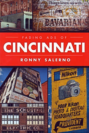
 Buying local is a good thing and so is reading local. I was able to combine the two recently. November 30 was the official release date for a new book about Cincinnati and in the early evening its author made the book and his signature available at a downtown location that appears between its covers. The book was Fading Ads of Cincinnati, the author Ronny Salerno, and the location Igby’s Bar inside a building with a fading “TWINE PAPER” painted on its side. Those two dim words are typical of the fading ads that are the book’s subject. How could I not?
Although this was my first time meeting Salerno, I knew the name. I first spotted it on some photographs in a small exhibit near downtown Cincinnati a few years back. I wasn’t clever enough to find his wonderful Queen City Discovery blog from that prompt but I did find it eventually and I’ve followed it for some time now. Salerno loves taking photographs and he’s really good at it. He especially loves taking pictures of old abandoned buildings with a story. A third love is also apparent in that blog: the city of Cincinnati. He brings all three loves to Fading Ads of Cincinnati.
The book is the latest in the Fading Ads of… series published by History Press. About the only reference to a publisher I’ve made in past reviews is an identification at the end. Saying a bit more seems appropriate here. Until last year, the USA’s History Press Inc. was part of the UK’s History Press Ltd. It was acquired by Arcadia Publishing in the middle of 2014. All of those entities deal with local and regional topics and often use something of a formula approach. Although it is not all they do, Arcadia is probably best known for their sepia-toned Images of America books. As hinted at by the title, these books are filled with images most of which are historical. The images are selected and described by local experts who typically also provide several pages of introductory text at the book’s beginning. More often than not, these experts are not just knowledgeable but have a personal attachment and attraction to the subject. Saying that most love what they write about would not be wrong. History Press publications tend to be wordier and, although historical images are sometimes used, include plenty of modern color photos. But, just like those Arcadia books, History Press books rely on local experts for their creation and, just like those Arcadia book writers, these experts are often in love with their subjects, too. Kind of sounds like Ronny Salerno, doesn’t it?
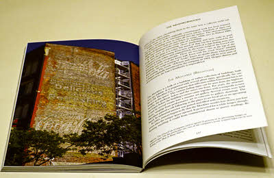
Salerno is a good match for the Fading Ads… series. Before reading the book it had actually occurred to me that he might have had every subject identified and many photographed long before he even took on the job. That wasn’t quite the case, however. He was naturally familiar with many of the area’s old signs but not all. He conferred with other “sign hunters” and got tips from friends but he also found his own senses sharpening as he strolled through both unfamiliar and familiar neighborhoods. The result is nearly one hundred new color photos of mostly — but not entirely — old stuff. There are also several historical photos from places like the Library of Congress.
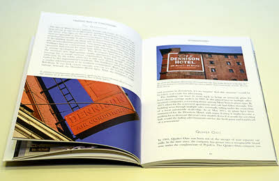 The photos aren’t left to stand alone. Captions describe each of them, of course, and many get multiple paragraphs of attention. Salerno has been successful in digging up many of the signs’ histories with some of the best stories coming from signs identifying local or regional companies that are no longer with us. Names like Shillito’s and Brendamour’s will be recognized by many Cincinnatians and probably some others as well. Out-of-towners might not be familiar with local landmarks like Davis Furniture (“The Friendly Store”) or the Dennison Hotel (“105 Rooms – 60 baths”) but they are exactly what I and some other locals think of when we think of “fading ads” or the more common “ghost signs”.
 Salerno brings up the phrase “ghost signs” in the introduction and says people often thought he was writing about the supernatural when he used the term. “Fading advertisements”, he says, doesn’t have that problem. Fair enough but it’s just possible that his position also has something to do with the book’s predetermined title. “Ghost sign” slips into the book a time or two and in the final chapter Salerno more or less acknowledges the validity of both. As for me, I’m comfortable and most familiar with the term “ghost signs” (and “ghost bridges” and “ghost towns”) so I’ll just continue to think of Fading Ads of Cincinnati as a book about ghost signs.
Geography has a lot to do with the book’s organization and the bulk of the photos are in three chapters titled “Downtown”, “Northern Kentucky”, and “The Neighborhoods”. Like any city of any size, Cincinnati has official and unofficial neighborhoods with their own identities. It’s southern boundary is defined by a river that also defines the border of Ohio. In some ways, the Kentucky communities on the south side of the river are quite different from those on the north but the ease with which a cluster of bridges usually allows interstate traffic makes them often seem like Cincinnati suburbs. The prominent “John R. Green Co” sign in Covington, Kentucky, fits in this book as comfortably as the “Little Kings” sign in Cincinnati’s West End.
I mentioned that not everything pictured in the book is old. One chapter in particular shows almost exclusively new unfaded and non-ghostly signs. The photos were taken at the Cincinnati Reds’ home field and include a shot of a huge sign announcing the 2015 All-Star Game which Cincinnati hosted. The “fading ads” connection is solid and arrow straight. Those stadium signs and many more around the area are the work of Holthaus Lackner Signs, a company headed by Kevin Holthaus. Kevin is the grandson of Gus Holthaus who started the company and whose signature appears on many signs in the area including several in Fading Ads of Cincinnati. The only old sign appearing in the “Signature Legacy” chapter is a remnant of a sign possibly painted by Kevin’s great-grandfather, Arnold Holthaus.
A link at the end of this article leads to the book on Amazon. An entry on Salerno’s blog identifies other online outlets and several area stores where it is also available. Another option is to catch the author at a local bar with a faded sign but you’ll have to be both patient and vigilant.
Fading Ads of Cincinnati, Ronny Salerno, The History Press, November 30 2015, 9 x 6 inches, 160 pages, ISBN 978-1467118729
Available through Amazon.

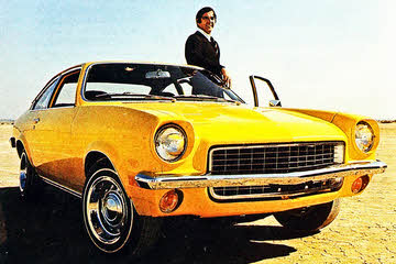 No. That’s not my Vega and that’s not me. It’s John DeLorean in the August 1970 issue of Motor Trend where he was singing the praises of Chevrolet’s new small car. The editors were singing right along with him and even adding some verses of their own. A month later, Car and Driver and Road & Track joined the choir. In February, Motor Trend named the Vega 2300 their 1971 “Car of the Year”. All this for a car that today has a reputation just slightly better than Yugo.
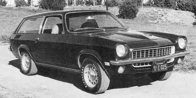 I could’t find any pictures of the dark green 1971 Kammback that I bought in the summer of 1974 so I took to the internet. I didn’t have much better luck there. This black & white photo of what is identified as a 1972 model is the best I could do. The shortage of photos surprised me but so too did the abundance of early praise. I can’t explain the absence of decent Kammback photos so maybe my surprise at that is justified. My surprise at the praise isn’t. In fact, what those magazines said about the car — great handling, sporty looks, comfortable ride — is exactly what I thought of it forty years ago. I was surprised only because I had forgotten.
 It has been three decades since the slogan “Wander Indiana” came and went but I’m going to do just a tiny bit of that over Christmas. The first day, with plenty of that Indiana rain, has been posted.


 I could have called this a pamphlet review. That’s technically what it is. Or, since one definition of pamphlet is “a small book”, I could have called this a small book review. I decided to leave the title be but, in line with the publication’s size, I’ll try to be brief and do a small small book review.


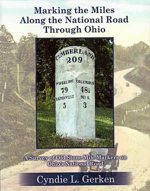 That’s a pretty long book title. There’s a subtitle, too, which makes the whole thing Marking the Miles Along the National Road Through Ohio: A Survey of Old Stone Mile Markers on Ohio’s National Road. It’s long because it, just like the book it identifies, is accurate and precise. The book accurately and precisely locates the 175 mile markers originally set, as accurately and precisely as early nineteenth century technology and local politicians would allow, beside the Ohio portion of the very first federal highway. With all that accuracy and precision you might think this volume would be completely dry and boring but that’s not the case. Stories about the road, the countryside, and even the markers themselves lighten and soften things considerably. Color photos and maps make the book attractive.
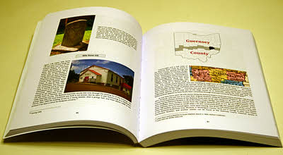 Seven of the ten Ohio counties through which the National Road passed are covered in individual chapters following the introduction. No markers were ever placed in the three westernmost counties on the route as federal funding ended near Springfield in Clark County. Each of these chapters begins with an overview of the county that includes a summary of how many original markers there were, how many remain at their original location, how many exist elsewhere, and how many are lost. Each marker is then addressed individually. With few exceptions there is at least one picture. If a given marker survives, a current photo is included and one or more historical photos are usually presented regardless of whether or not the marker is still around. Understandably, markings on many of the older stones are not exactly legible. Not to worry. Appendix B contains crisp drawings of the inscription of every marker. Markers can often be seen, accidentally perhaps, in old postcards and other photos and many of these appear in the book. Each marker’s history is given and stories about the marker or the area around it frequently add a little fun and background. Placed among the individual marker descriptions are sections of US Geological Survey 7.5 minute topographical maps showing the location of the markers three at a time. Other National Road related landmarks are often shown on the maps as well.
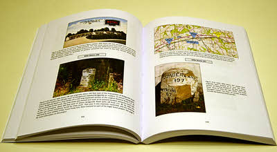 Bringing all of this information together is clearly a major accomplishment but Gerken, a past ONRA president herself, says the information is only a portion of what she has collected on the National Road in Ohio. A well deserved breather follows wrapping up Marking the Miles Along the National Road Through Ohio. Nothing is currently scheduled or promised but the future could see a Gerken penned treatise on bridges or taverns or toll houses or something else. I certainly hope so. I like accuracy and precision and I also like anecdotes and insight. Marking the Miles… provides a pretty good mix.