
 I last spent Christmas in Cincinnati in 2005. I slipped out of town for Thanksgiving that year, and it went so well I did it again in 2006. Then, with a full week available at Christmas, I again hit the road to start a string of December twenty-fifths spent away from home that was unbroken until this year. My 2020 Christmas plans shared the fate of many others: COVID clobbered ’em. Whether or not a new streak is launched next year remains to be seen, but it’s a fact that there is no new Christmas trip journal entry for 2020. In its stead, I’m using the blog to recount the fourteen entries already there. All photos were taken on Christmas Day.
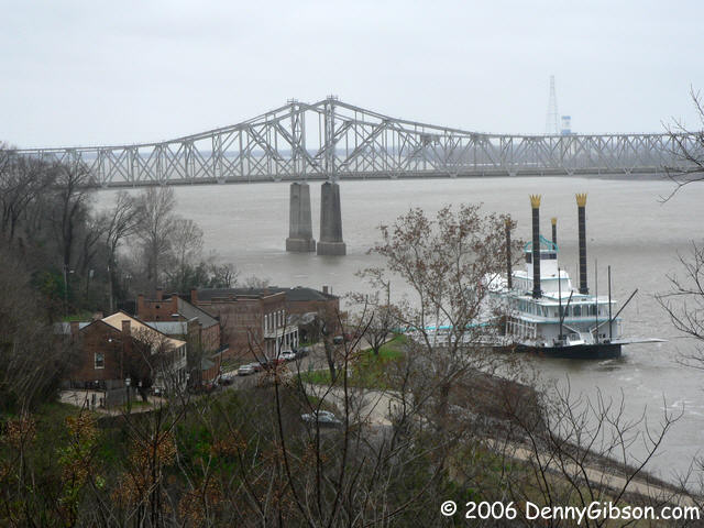 2006 — Natchez Christmas was organized around a drive of the Natchez Trace Parkway that began the day after Christmas. Christmas Eve and Christmas Night were spent in a room above the Under the Hill Saloon in Natchez, MS. It’s between the two white-fronted buildings in the picture.
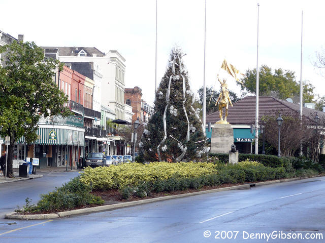 2007 — I decided to go a bit farther south the next year for Crescent City Christmas. New Orleans had recovered sufficiently from Katrina’s 2005 devastation to welcome tourists to bolster the recovery effort, and it’s a pretty good place to celebrate anything. The tree and Joan of Arc statue are in front of the French Market.
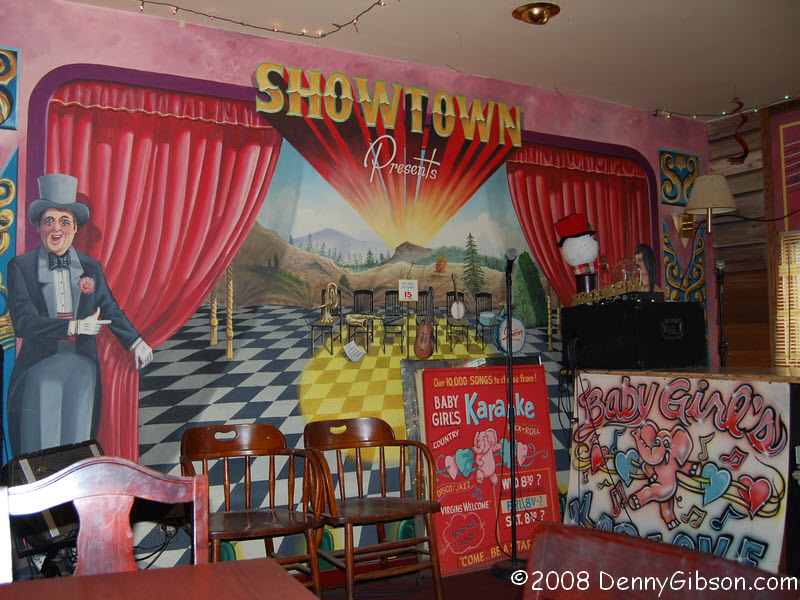 2008 — My great-grandparents spent Christmas on the Alafia in 1920, and I tried to do something similar. I could not camp on the river bank as they did but I could stay in a nearby motel. On Christmas Day, I had breakfast at Showtown USA in nearby Gibsonton. At the time, Showtown still had plenty of carnival people as both employees and patrons.
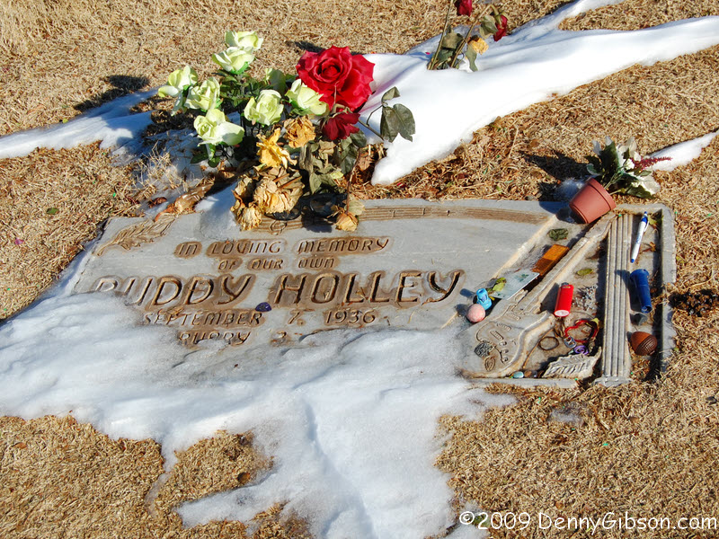 2009 — My retirement in mid-November meant I now had time to drive to US-62’s West End from my most western contact with the route in western Kentucky. After spending a day snowed in in Altus, OK, I reached Lubbock, TX, on Christmas Day and stopped by Buddy Holley’s grave. Lubbock possesses no snowplows so most of the record five inches that fell the day before was still there although much had been blown from the area in the photograph.
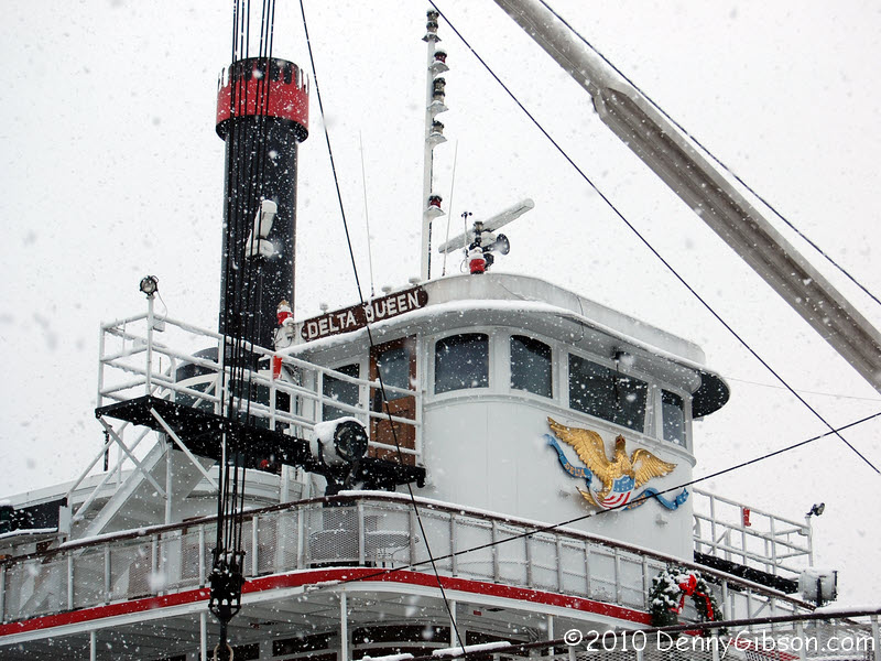 2010 — My Chattanooga Christmas was also a white one. The depth may not have been a record but the fact that this was the first Christmas Day snowfall in Chattanooga in forty-one years meant it was something special. The Delta Queen had been forced to quit cruising in 2009 and was serving as a stationary hotel. I had spent Independence Day 2009 aboard her, and couldn’t resist the chance to spend another holiday on board.
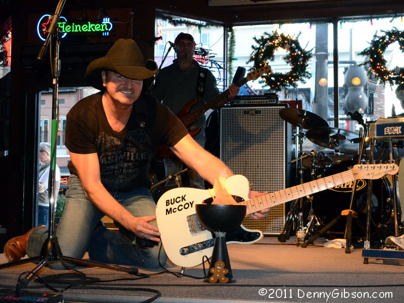 2011 — Although my path reached as far south as Alabama, Nashville, TN, was the target for George for the Holidays. The title refers to George Harrison whose 1970 album All Things Must Pass was performed by The Long Players on December 23. Oven Master Mary had supplied me with a whole gingerbread family for the trip, and I photographed one family member on stage at Legends Corner.
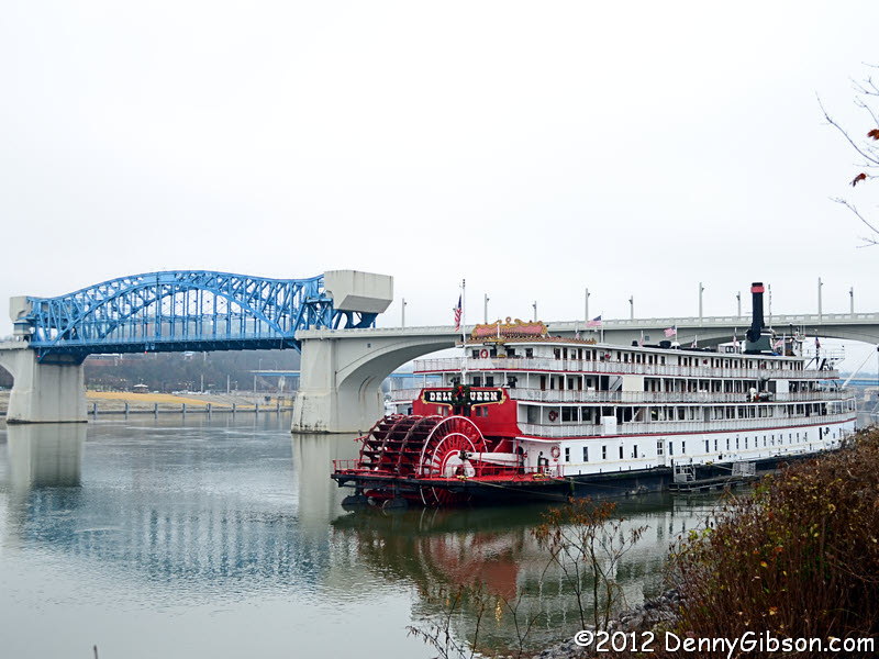 2012 — The plans for Christmas Escape Repeat included New Year’s Eve in Raleigh, NC, and some time in Atlanta, GA, but were timed to allow me a second Christmas stay — this time without snow — on the Delta Queen in Chattanooga. It was the first of only two times I used the word “escape” in the title.
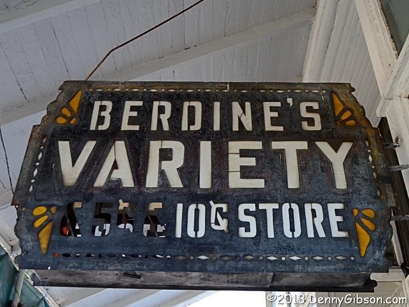 2013 — A Wild and Wonderful Christmas was spent at North Bend State Park in West Virginia where “Wild and Wonderful” is a slogan. After a fine holiday meal at the lodge, I went for a drive that took me to “America’s Oldest Five and Dime” in Harrisville. Berdine’s was not open on Christmas Day but was open the day after so I got to check out this delightful store on my way home.
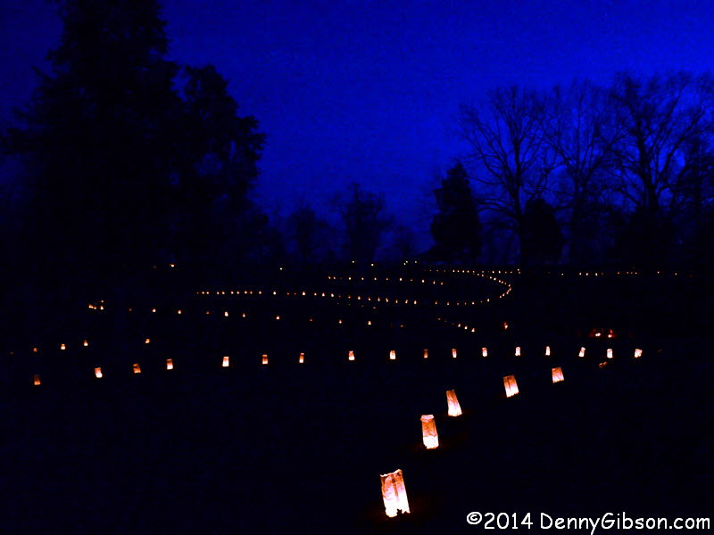
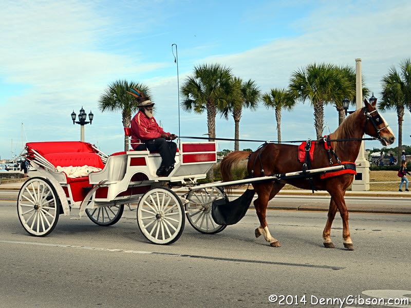 2014 — Christmas Escape 2014 turned out to be quite the escape indeed. There was Christmas Eve with friends in Savannah, GA, Christmas Day with a friend in St Augustine, FL, (where the picture was taken), and some time with an uncle near Lake Alfred, FL, to start the new year. Plus a lot of Dixie Highway and a little time in the keys.
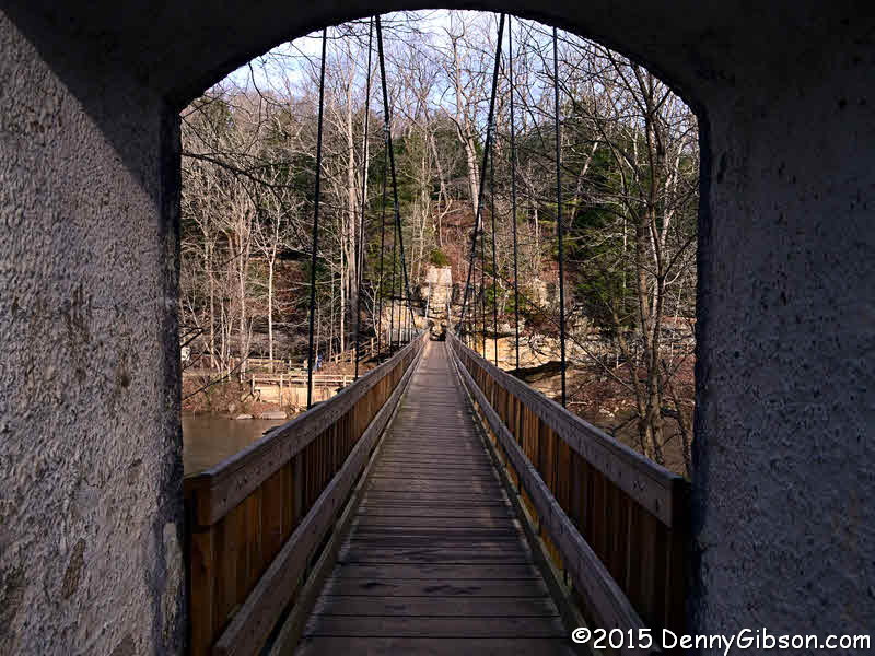 2015 — That WV state park had worked out well in 2013 so I tried out a neighbor on the other side for It’s a Wanderful Life. The holiday meal at Indiana’s Turkey Run State Park was fairly late in the day so I helped my appetite by doing a little hiking before dinner.
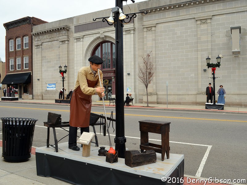 2016 — I stayed fairly close to home and used Ohio’s new tourism slogan for Finding It Here. Home base was the lodge at Burr Oak State Park. A Christmas Day drive took me to the town of Cambridge and a long stroll through the Dickens Victorian Village erected there each year.
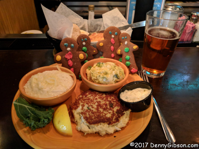 2017 — With this trip, I proved that I Can Drive Twenty-Five. I followed the current US-25 from its beginning at the Ohio River to its other end in Brunswick, GA. Holiday dining options were somewhat limited and I ended up with a not so traditional Christmas dinner of crabcake, grits, broccoli, and cookies. In honor of the holiday, I named these four gingerbread men — a gift from Oven Master Mary, of course — Matthew, Mark, Luke, and Ringo.
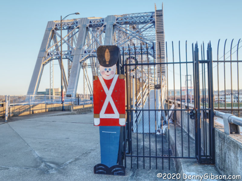
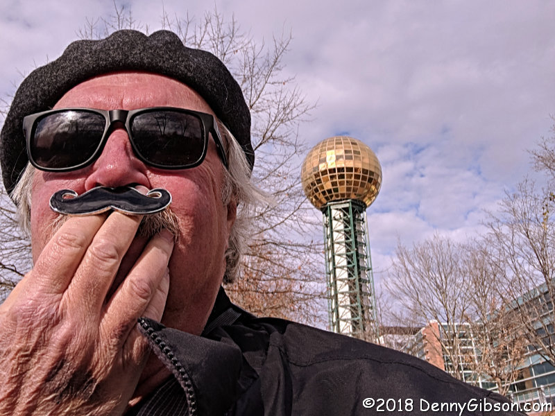 2018 — The focus of Kitty Hawk Holidays was the 115th anniversary of the Wright Brothers’ first flight at Big Kill Devil Hill. That was on the 17th so I did a bit of running around before ending up in Knoxville, TN, on Christmas Day. A selfie in Worlds Fair Park let me show off the new mustache my grandson had given me for Christmas.
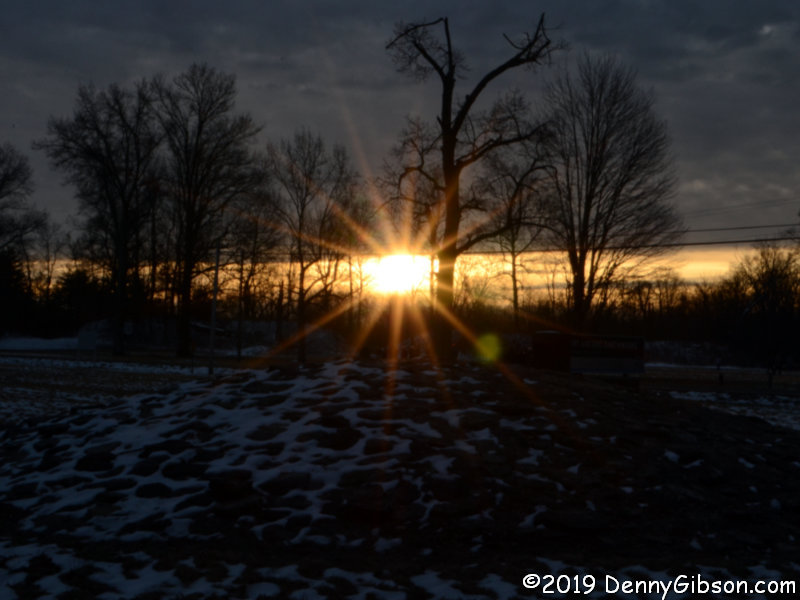
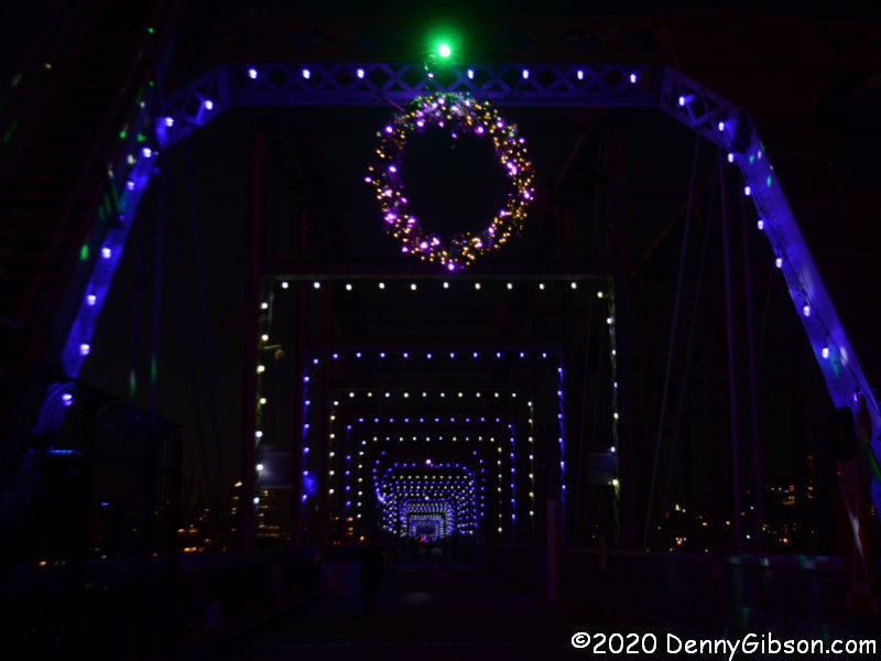
 2019 — Finding (More Of) It Here had me back in Ohio at a park lodge. This time it was at Geneva-on-the-Lake State Park. The photo was taken just before dinner as the sun set to my left and illuminated the clouds over Lake Erie.
 I was understandably alarmed when I first saw the news at right. However, reading beyond the headline reassured me that it was only the program planned for Fort Ancient that has been canceled and that the Sun and Earth and other heavenly bodies are to continue as is. The program was held last year and I attended. It was on a Saturday and the following article was published the next day as the regular weekly post. I am reusing it as a regular weekly post 364 days later, a day ahead of the 2020 Winter Solstice which will occur at 5:02 AM December 21.
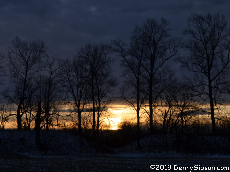
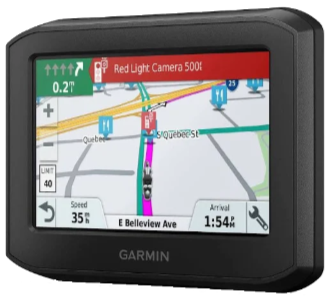 Everybody’s out of step except my boy Denny. That’s sure how it seems when the subject is GPS routing. I have once again purchased a Garmin product that disappoints me. It’s not that it doesn’t have some wonderful features or that it’s shoddily made. It’s because it doesn’t handle predefined routes the way I think it should. The out-of-step feeling comes from the fact that almost no one else sees any problem at all with the manner in which the unit plays back what it calls “Saved Trips” while I see some very big problems.
 With the 396, you MUST select one of the route’s waypoints before starting and you MUST physically reach it or manually skip it which simply selects the next one. Of course, I really don’t want to manually pick a starting point, but even if I did my routes contain mostly automatically generated point names which provide little help in selecting one.
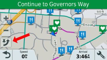 I guess that isn’t an issue when starting a route at the very beginning but it certainly is an issue when joining (or rejoining) a route in the middle. I did try to simulate the desired operation by selecting a point prior to the one I knew to be next, driving to intersect the plotted line, then skipping (red arrow) the selected point. I’m not 100% sure this actually works without altering the path to the next point, but even if it does, it’s a complication that did not exist in the prior model.