
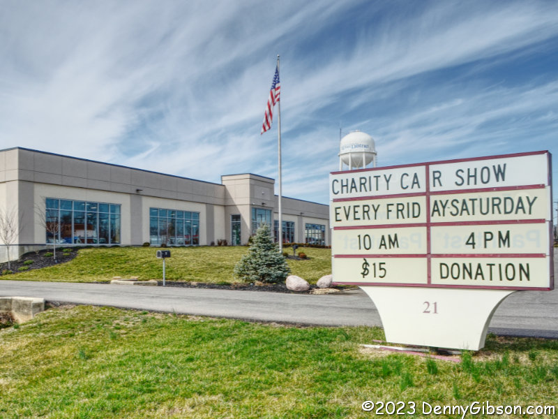
The Butlers made a little money selling bathtubs on the internet. Actually, bathtubs aren’t the only things Matt Butler and his dad Mike sell at Signature Hardware, and saying they made a little money might not be telling the whole truth either. In Mike’s case, he made enough to buy a couple of hundred used cars. All were built in America between 1903 and around 1980. Apparently, Mike has occasionally let groups see his collection of cars and recently started letting the public at large in to see them — for a cause.
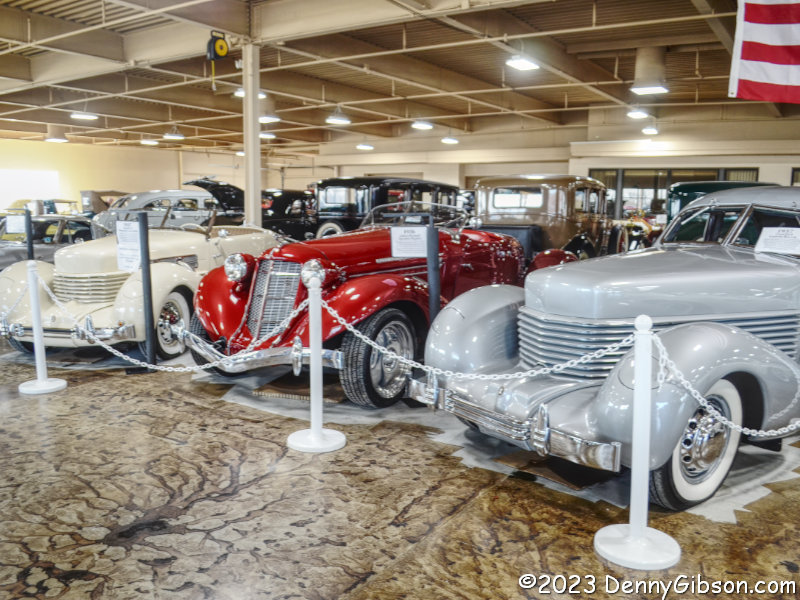
I first learned of Collection 21 last month when I saw this Citybeat article. The collection is available for viewing on Fridays and Saturdays from 10 AM to 4 PM. 100% of the requested $15 donation goes to Housing Opportunities of Northern Kentucky. I visited last Friday and the trio at left more or less greeted me when I entered. The red car is a replica of a 1936 Auburn Boattail Speedster built on a modern GM chassis. It was the only replica I noticed in the collection. The pair of 1937 Cord 812s that bracket it are very real as was every other car I took note of.
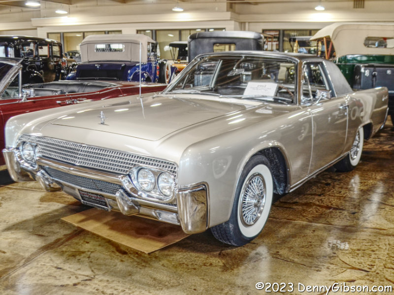
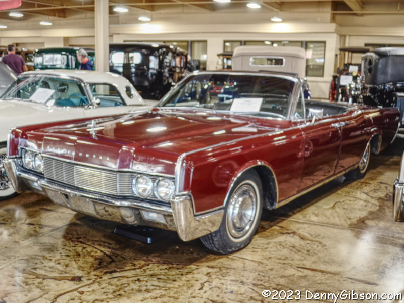
I had barely moved beyond those Cords when these Lincolns caught my eye. The 4-door is a 1967. I remember seeing a slightly older model in high school and thinking it was one of the coolest cars ever. Lincoln 4-door convertibles still fascinate me. The 2-door should fascinate everybody. The Derham Body Company made two of these 2-seaters in 1962 by drastically shortening full-size Lincoln Contentials. The resulting car is actually four inches shorter than a same-year Corvette. The idea never went beyond the prototype stage and one of the cars was totaled making this the only one of its kind.
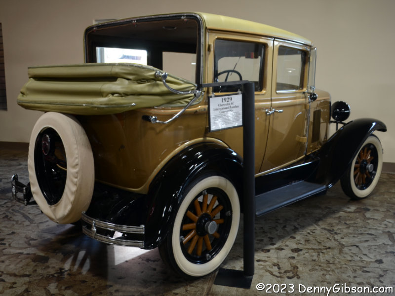
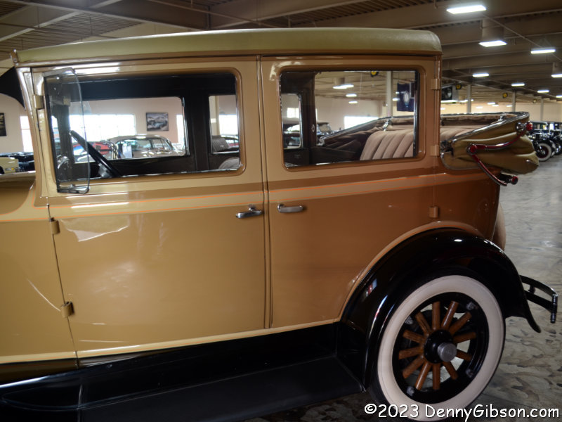
This car was factory built and it’s not one of a kind but it sure is strange. It is a 1929 Chevrolet AC International Landau Convertible and there were supposedly about 300 of them made. I guess it’s for people who enjoy open-air motoring just a wee tiny bit.
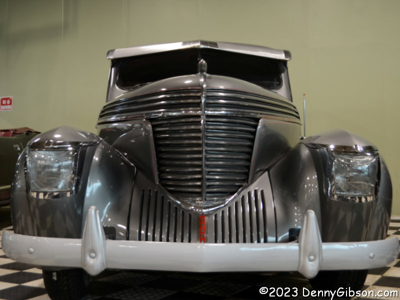
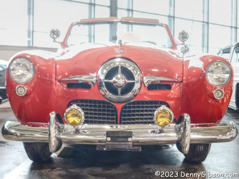
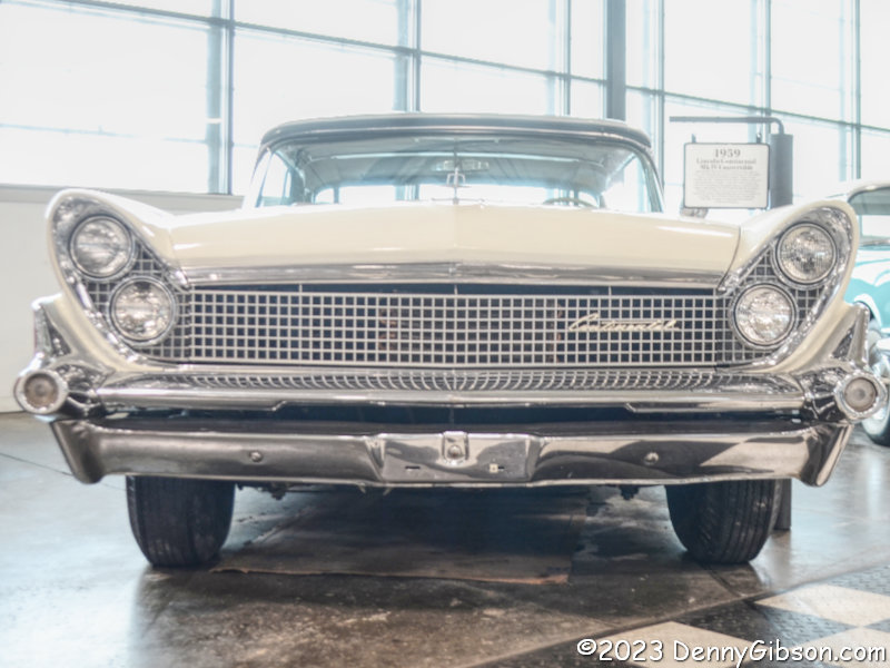
The cars are not formally arranged although there are clusters of similar vehicles. I’ve clustered three cars with distinctive front ends together in this panel. The 1959 “slant-eyed” Lincoln and 1950 “bullet-nosed” Studebaker were physically side-by-side’ although I can’t say why. The 1940 “sharknose” Graham was several cars away.
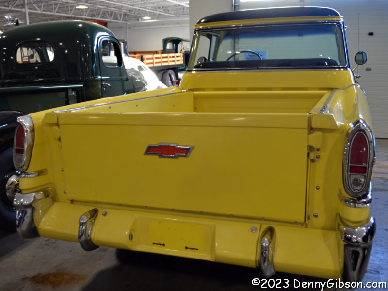
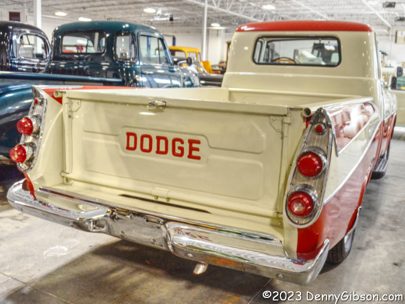
The first Ford Ranchero car/truck was a 1957 model. The Chevrolet El Camino would not appear until 1959. Maybe the carlike fiberglass trim on the 1958 Apache Cameo Carrier was intended to fill the gap. Dodge put station wagon fins on their Sweptside pickups in 1957 and ’58 but they never did make a full-size Ranchero/El Camino equivalent.
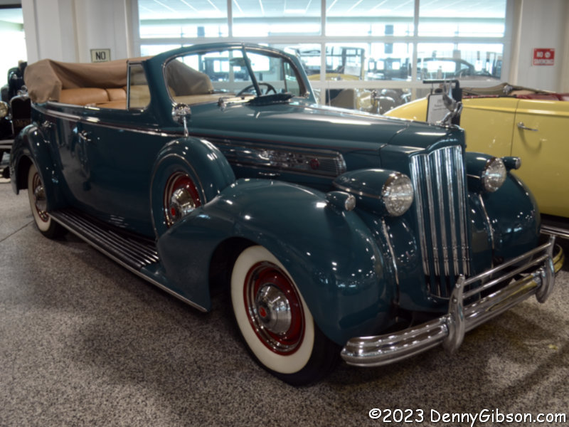
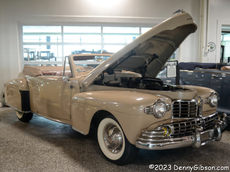
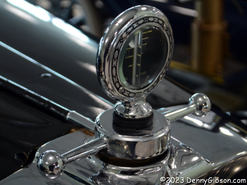
The 1946 Lincoln Continental and 1939 Packard 1703 were parked next to each other. If there is a need to impress the neighbors, I’m pretty sure that either of these would do the job. That’s a 1931 Ford Model A in the foreground of that third picture but the thing that caught my eye was the shiny temperature gauge on the 1928 Dodge Brothers Victory Six beside it. The next car in line is a 1912 Maxwell Messenger.
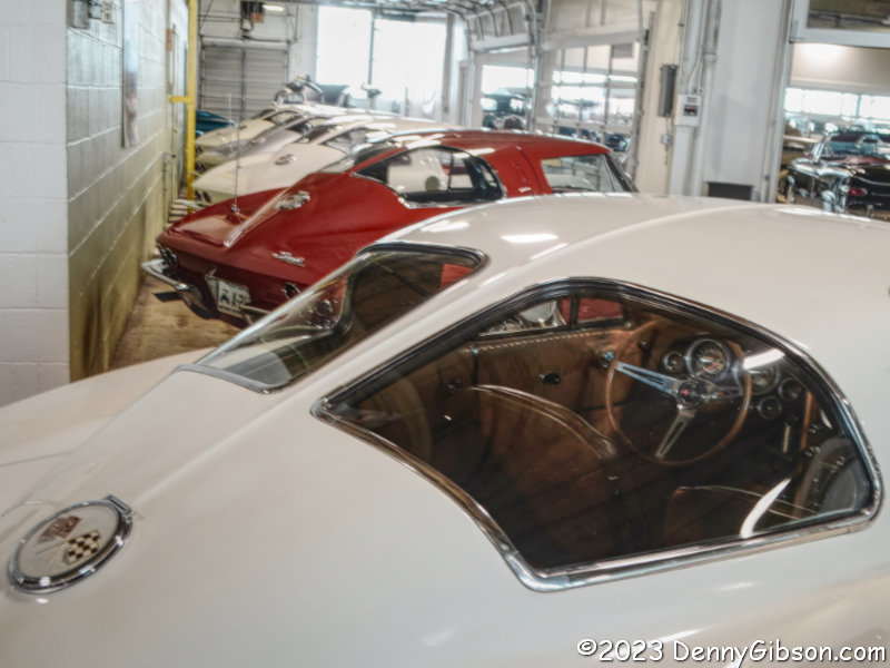
When I eventually exited the building, two other fellows were beside me. We all made comments about how impressive the collection was. I mentioned that I had never seen so many split-window Corvettes in one place. They both agreed but when I said I thought there were seven of them, I was corrected. I had forgotten one near the front which made eight. I’d never had to count them before and just didn’t do well. There are five in this picture. The others are scattered here and there.
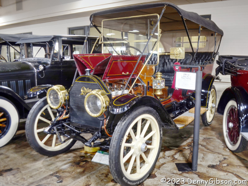
Among the brass-era cars in the collection is this 1911 Model 30 Cadillac. The Model 30 was manufactured from 1908 through 1914 with the price growing from $1400 to nearly $2000. When this particular car was built, the base price was about $1700. In 1912, the Model 30 became the first production car with an electric starter.
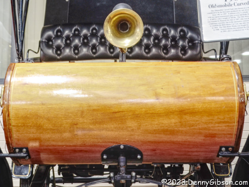
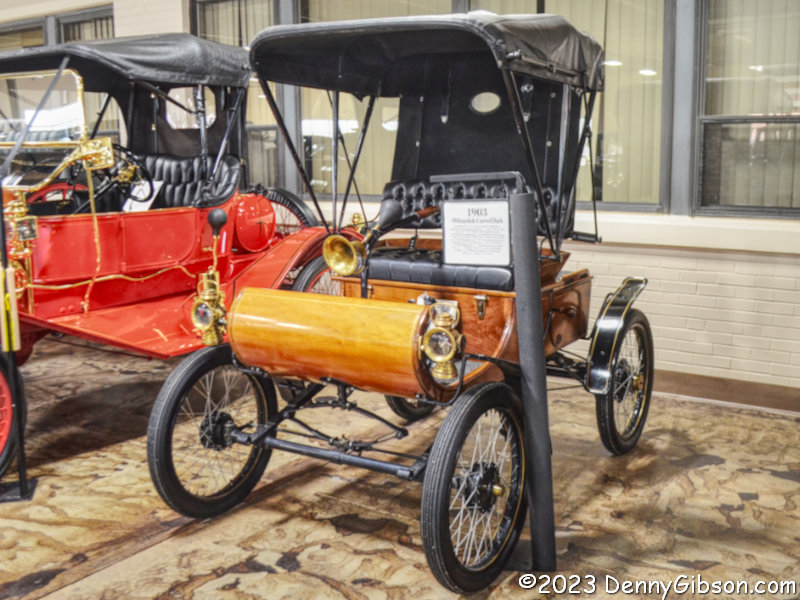
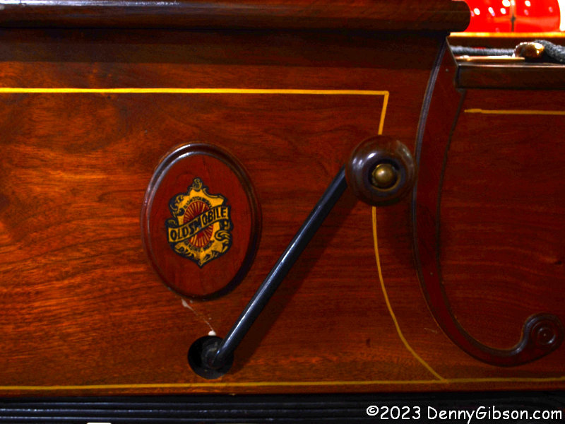
I could have included this 1903 Curved Dash Oldsmobile in the earlier panel of distinctive front ends. No electric starter for this guy. With production starting in 1901, this is generally considered the first mass-produced automobile. By the time production ended in 1907, roughly 19.000 of these one-cylinder wonders had been built.
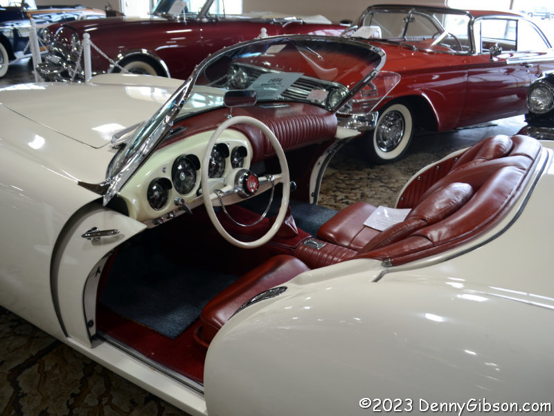
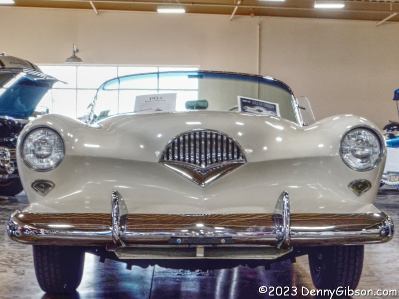 If I had turned left instead of right when I came in, this 1954 Kaiser Darrin, with its own distinctive front end — and doors — would have been one of the first cars I saw rather than nearly the last. They say there are between 220 and 230 cars here at any time and that all can be started and driven. I have obviously shown just a tiny fraction in this post. Seeing cars as rare as many of those here at way under a dime a piece is a great deal and knowing you’re helping a charity makes it even better.


