
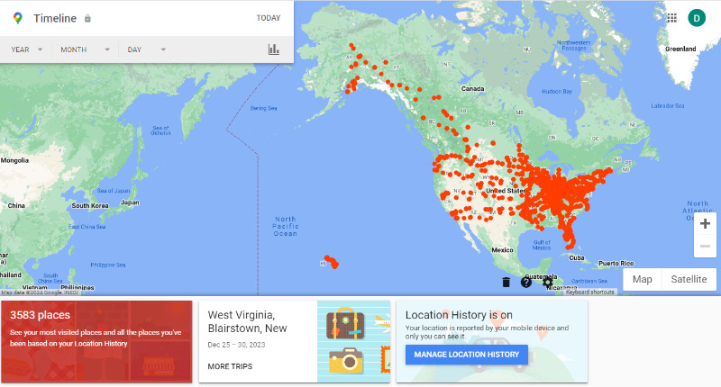
 My parents would be absolutely appalled to see something like this. It’s my Google Maps Timeline which I was reminded of in an email about a week ago. Seeing a record of their travels that they did not create would have truly alarmed my parents. They, and most of their generation, guarded their privacy to the nth degree. Subsequent generations, including mine, have each been a little less guarded than the one before. In at least one regard, I am less protective of my privacy than many of my own generation. That, of course, would be travel. A guy with a website that exists primarily to tell people about his road trips is obviously not going to be upset that somebody knows about them. I’m much more likely to be upset that more people don’t.
For any that are appalled or upset or even a little uncomfortable, please note that maintaining the timeline is enabled by a Google account setting called Location History. The email that reminded me of its existence also reminded me that I “can view, edit, and delete this data anytime in Timeline.” I cannot speak to how well disabling the feature or deleting the data works because I’m not interested in either.
The map above includes all data from when Google Maps started watching me sometime in 2014. A drop-down list goes back to 2010 but 2014 seems to be the first year with any data recorded. There are also drop-downs for month and day for drilling down to some details.
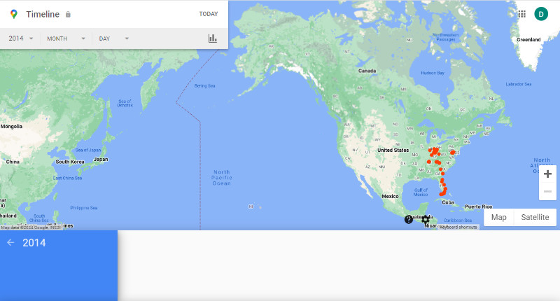
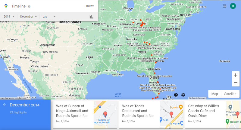
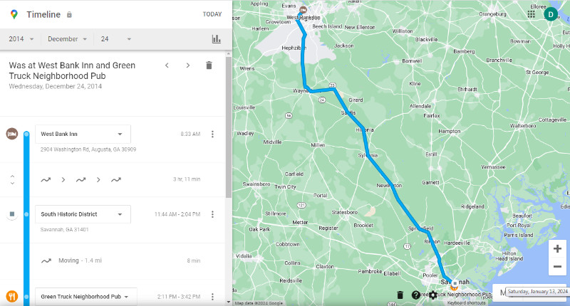 Here are the maps for all of 2014, the month of December, and Christmas Eve when I drove from Augusta, GA, to Savannah, GA. At the day level, the route and most stops are shown.
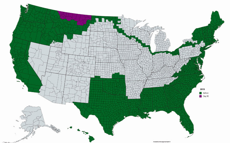
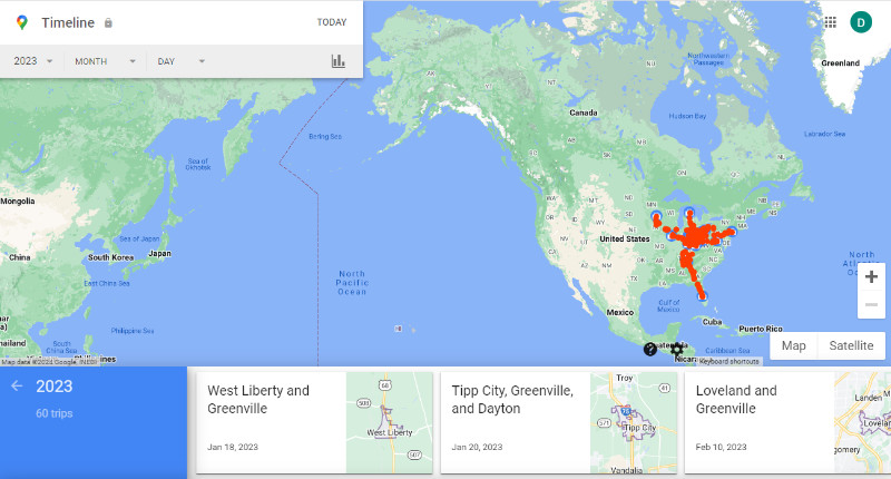 This post was triggered by that Google Maps reminder email, of course, but also by the fact that this blog’s 2023 in the Rear View post was fresh in my mind. There is another view of 2023 at the right.
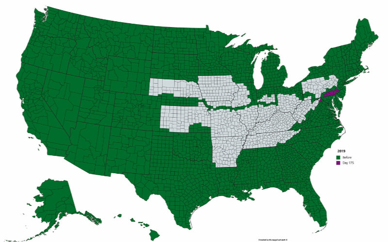
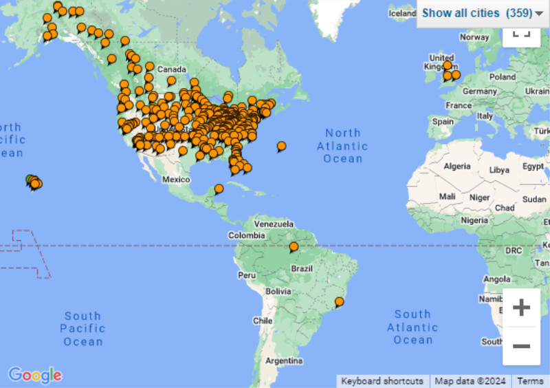 Clearly, all of my travel that Google Maps knows about (i.e., mid-2014 and later) was in North America. To be honest, that’s also true of nearly all of my travel before that but there were a few exceptions. Tripadvisor is a service I joined in 2005. It provides a map of contributions and also allows direct entry of locations for the map. I’m including the Tripadvisor map for an even bigger look in the rear view. Some of the stuff on that map is from the last century.
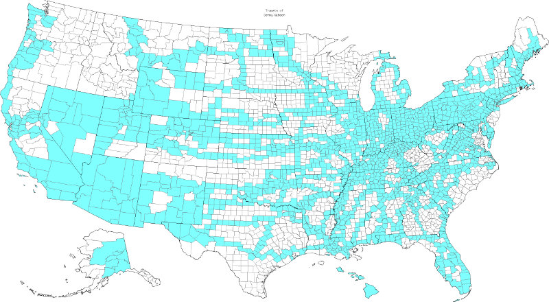
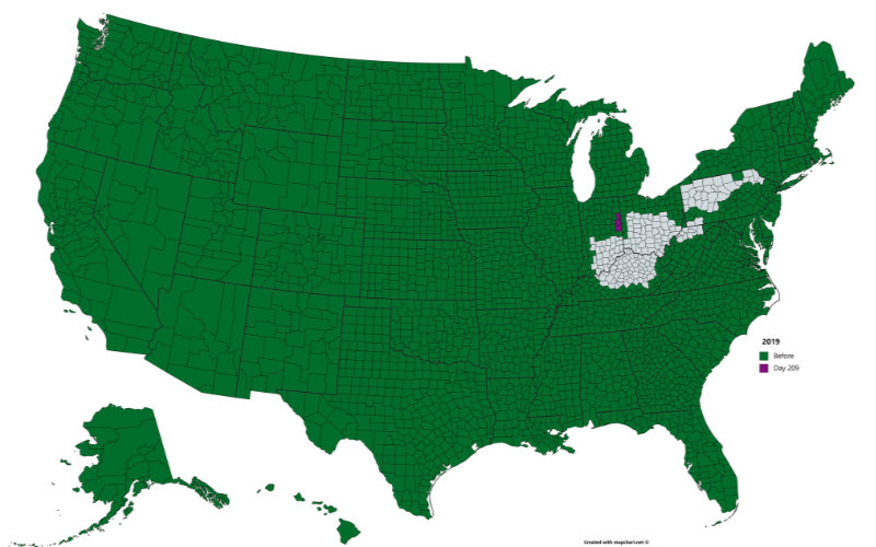
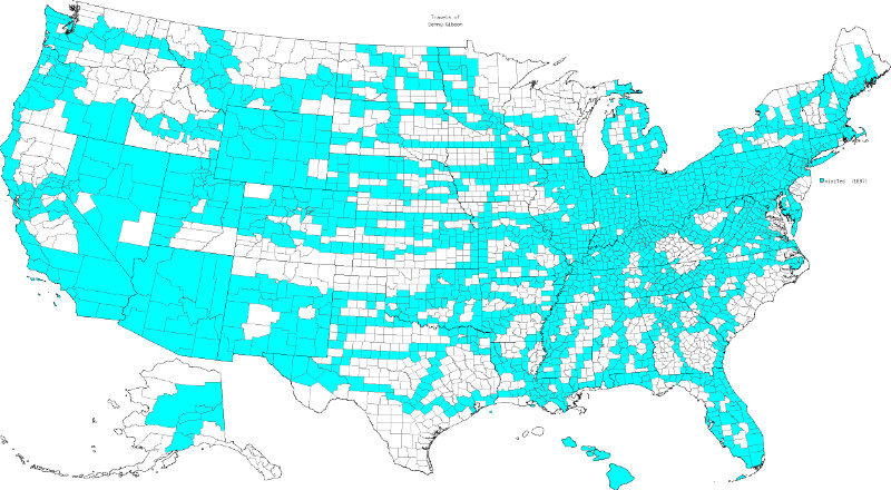 I had this post completed and scheduled when an online discussion reminded me of yet another view of my travels. The image at right is my current map of U.S. counties visited from the MobRule website. I included the May 1, 2017 version in the book published after I visited my 50th state (“50 @ 70“). The current count is 1887 of 3144 or 60%. I failed to record those details about the 2017 map so cannot quantify travels since then but I think the only readily noticeable change between the two maps is a few more shaded areas in the northwest. As I said in 2017, maps like these are extremely misleading in terms of territory covered. Visiting New York County in New York State (the smallest on the mainland) let me shade in less than 23 square miles of area. I got to shade in just under 145,900 square miles when I visited Yukon-Koyukuk County in Alaska.
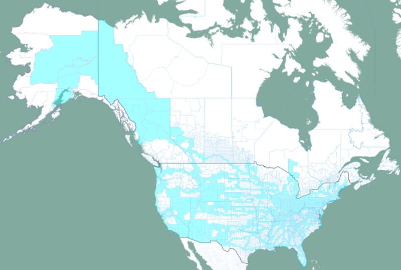 MobRule also supports tracking county equivalents in Canada, Mexico, Great Britain, and U.S. Territories. The only one of these I use is Canada where I have accumulated just 62 of 669 or 8.5%. Overlaying these counts on Google Maps is supported but zooming seems to lose the data. Open Street Map is also supported and does not have this problem. The map at left is from Open Street View.


 Although a locator map wasn’t initially part of a trip journal, I did start doing it fairly early on then retrofitted one to journals already posted. A small button shaped like the contiguous US accesses the maps. For multi-day trips, the button is at the top of the cover page next to the trip title. For single day trips, it’s next to the trip title on the only page there is. The general model is a map of the route “zoomed” to fill the available space sitting atop a map of the US with a red rectangle marking the area involved.
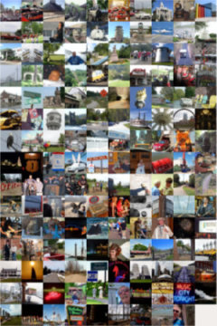
 DeLorme Street Atlas is one of my oldest tools. I started using it in 2001. I’ve talked about it in a few posts but was surprised to see that it has never been the primary focus of a post. The reason, I suppose, is the old story of taking something for granted until you lose it. The first version I used was 9.0. There were a few more numbered revisions and a misstep into a Road Warrior version before the numeric year was used in the product name and a string of annual releases began. I didn’t grab every one. I more or less fell into biennial mode and upgraded just every other year. 2016 was to be my next planned update but plans changed. In early 2016 Garmin closed a deal to acquire DeLorme and all Street Atlas development was stopped. 2015 was the final version produced. This first post with DeLorme in the title will also be the last.
 I’m talking about travel advice and I’m really talking about one particular website. It’s a site,
 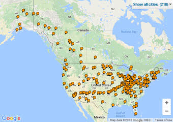 It really was the realization that I had used TripAdvisor so regularly on the Alaska trip that made me think of doing a post to thank and praise them but it is also a chance to talk about my part in the crowd that’s doing the sourcing. I don’t know when I first used TripAdvisor but I know it was well before I submitted my first review in August, 2008. I obviously warmed to it slowly and submitted just one review per year in 2008, 2009, and 2010. The gates finally opened with a western Lincoln Highway trip but I think it was a couple of trips later and a desire to boost a mom & pop motel in Michigan that got me to thinking differently and belatedly post several reviews from the Lincoln Highway outing.
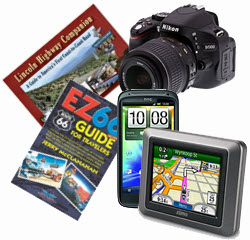 I recently received a request/suggestion for a post on “must have” road trip items. I initially blew it off but returned to it a week or so later. Since I am about to actually head out on a road trip, I need to stockpile some “dateless” (“timeless” almost, but not quite, fits) articles for posting while I travel. You know, the “Trip Peek” or “My Wheels” sort of things that have no connection to what I’m actually doing but can be posted at anytime to meet the blog’s every Sunday schedule. In the middle of generating a couple of “Trip Peeks”, I remembered the email and realized that the suggested “Road Trip Essentials” was as good a topic as any. Of course, it would take more time than a “Trip Peek” but it could be sort of a consolidated “My Gear” and it might be fun. If it also made somebody (the requester) happy, even better.
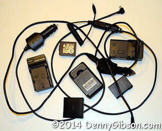 Of course, all of those accessories have their own accessories. For many years, I only bought gear that used AA batteries on the theory that I could always buy power at the corner drug store if required. I believe that happened once. I carried around a bag of nicads and the chargers to fill them in either car or motel. I eventually had to abandon that position but I still cling to the ability to recharge everything whether stopped or on the go. I now carry spare proprietary batteries and AC/DC chargers for two different cameras and a cell phone. I do not carry a spare for the GPS since I seldom operate it on battery power.
 I started using Garmin’s MapSource when I got that first GPS back in 1999. That
  I really don’t remember it but there is hard proof that I used Microsoft Expedia Trip Planner 98 to plot a drive to Florida even before my first documented trip on Route 66 in 1999. In January of that year, my girl friend, Chris, and I drove to Daytona for the Rolex 24 Hour Race then to Pass Christian, Mississippi, to visit my daughter. The photos used in that first practice page I mentioned in the
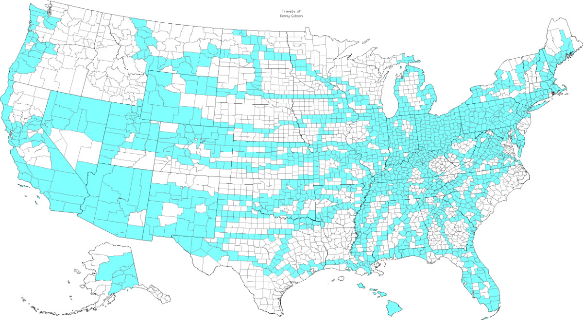