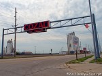
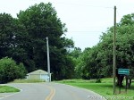
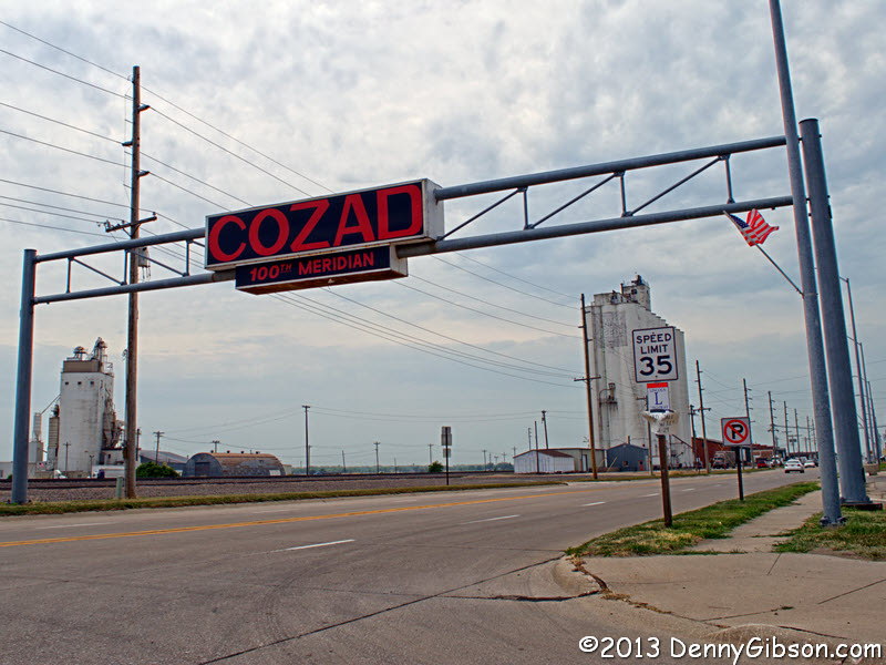
 I live a little over eight miles from Cozaddale, Ohio, and have driven through it numerous times. The most recent was June 9 when I took the first picture at right. I live a little over eight hundred miles from Cozad, Nebraska, and have driven through it exactly twice. The most recent was Friday when I took the second picture at right. As you might suspect from the names, there is more to connect these two towns than my visits. Both were named for, or more accurately by, the same man.
John Jackson Cozad was born in 1830 near Allensville, Ohio, but he didn’t stick around long. He ran away at the age of twelve and before long found his way onto riverboats plying the Mississippi and Ohio Rivers. He also found his way into a successful career as a faro dealer. I’ve found no indication that his success came from anything other than a carefully developed ability to read the faces of opponents, but I did find a claim that this ability led to him being barred from riverboats and other gambling operations.
Although he never completely gave up cards, Cozad moved into real estate speculation/development around 1870. He laid out an eight street village on land he owned along the Marietta and Cincinnati Railroad and formed a building association. Things began well enough and a few buildings were completed in this place he called Cozaddale before some “trouble” (of which I’ve found no details) brought about the end of the association and Cozad’s development of his first town.
Horace Greeley may or may not have said “go west, young man” a few years earlier but John J Cozad probably didn’t need any such encouragement anyway. Nebraska had become a state in 1867 and, apparently while still postmaster of Cozaddale, Cozad went to look it over in 1872. The way railroad section boss John Cusack tells the story, he was checking track on a handcar headed west when he spotted Cozad, in top hat and tails, walking east. The Ohioan had been on a westbound train when he spotted a 100th meridian sign and left the train at the next stop. Inspired by the sign, Cozad developed an almost instant vision for a town that he described to Cusack. After hitching a ride on the handcar, Cozad returned to Ohio, bought 40,000 acres of Nebraska, then came back with about thirty others to build a namesake town at the 100th meridian.
Cozad, the town, grew and Cozad, the man, became a “hay tycoon”. As a big time farmer in cattle country, Cozad, the man, had his share of conflicts with ranchers. One such conflict was with an Alfred Pearson. Some reports say Pearson pulled a knife and some reports say Cozad thought Pearson reached for a knife. All reports say that Cozad pulled a gun and fired. Pearson died of his wounds a couple of months later and Cozad the man left Cozad the town almost immediately. Teresa Cozad, John’s wife, stayed around long enough to dispose of the family’s holdings then, with their two sons, she too vamoosed.
To most people, the Cozad clan seemed to have simply disappeared then, in the 1950s, a descendant revealed some of the missing bits of the story. Using the name Richard Henry Lee, John Cozad opened a place called Lee’s Pier on the boardwalk of Atlantic City, New Jersey. Son Johnny posed as a brother-in-law using the name Frank Southern and son Robert posed as a nephew or foster son named Robert Henry. Perhaps not surprisingly, Richard Lee managed to stir up things in Atlantic City, too. In a conflict with the city over selling his property, Lee/Cozad built a barricade across the boardwalk that earned his place the name “Fort Lee”. He eventually lost but it took the state legislature to beat him.
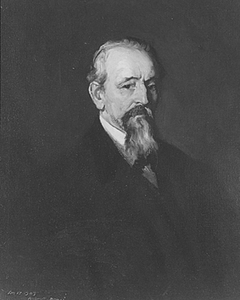 John A. Cozad, a.k.a. Frank Southern, eventually went back to his real first name and became, as Dr. John Southern, a well respected physician in Philadelphia. Robert Henry Cozad retained a slightly modified version of his Atlantic City alias and went on to great fame as an artist. His childhood home in the second town his dad founded is now the Robert Henri Museum. At left is a portrait that Robert Henri painted of his father, John J. Cozad, in 1903.
This is obviously one of those pre-written pieces but, unlike most of the My Gear and My Wheels sorts of things, this one is tied ever so slightly to real-time. I suppose it was sometime after I drove through Cozad, Nebraska, in 2009 that I discovered the connection between there and Cozaddale, Ohio. When I realized that I would be passing through Cozad again this year, I thought it might be cute to get a picture of the Cozaddale limits sign and do something with it in my journal entry when I again reached Cozad. I did a couple of searches hoping to find something interesting to say and the wild stories just kept tumbling out of the internet. It was soon apparent that it would take much more than a journal panel to do the John Cozad story anything near justice. Knowing I would be using several canned entries during the Lincoln Highway drive, I decided that this, with a single new picture, would be one of them. It was primarily constructed with information from here, here (via WayBackMachine), and here. Those three sources don’t agree on everything and there are other, slightly different, versions out there, too. That certainly doesn’t surprise me. I’ve a feeling that John J himself couldn’t get his life story completely right even if he was trying to be entirely honest and I also have a feeling that being entirely honest wouldn’t come easy to him.

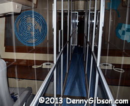
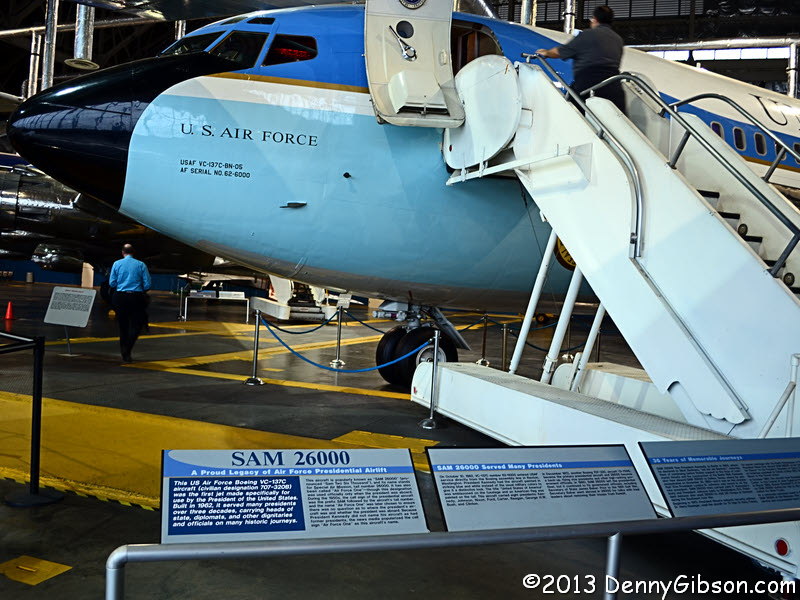 On Friday, November 22, 2013, a friend and I visited the National Museum of the US Air Force near Dayton, Ohio. Among the many historic items on display is the Boeing VC-137C that carried John F Kennedy to and from Dallas, Texas. The two pictures below were taken of the same general area of the plane just a few hours shy of fifty years apart.
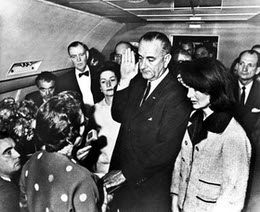
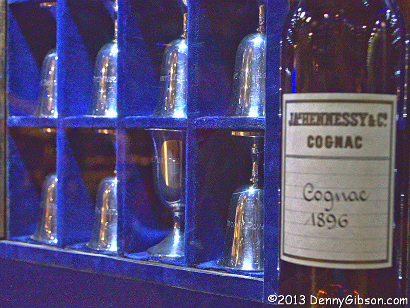
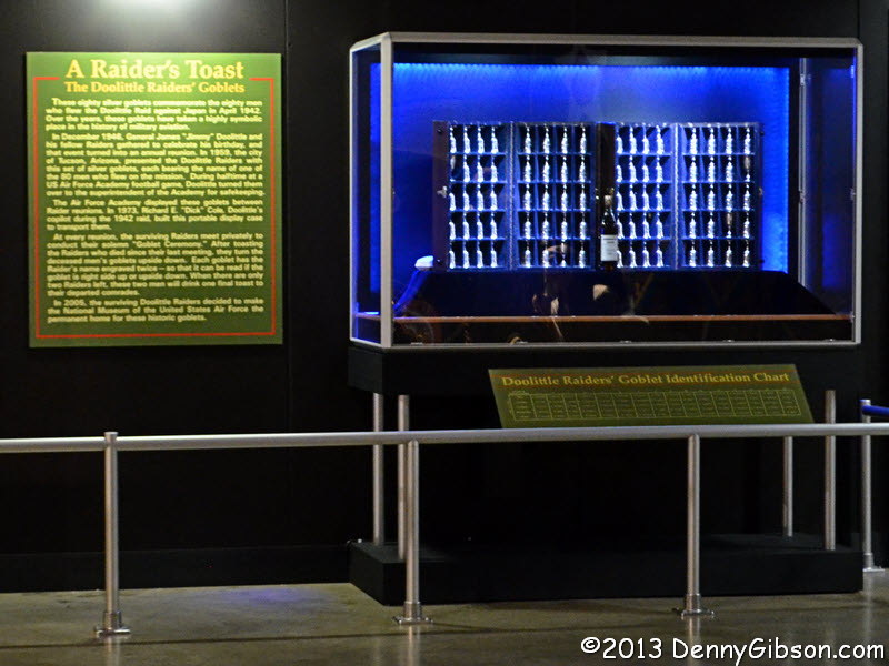 Another museum display recently in the news is associated with the Doolittle Raiders. A “Last Man Standing” pact had been established in which the last surviving Raider would drink a toast to all those who had gone before him.On the most recent anniversary of their 1942 bombing run over Toyko, the last four living Raiders decided not to wait but to have their final public reunion and drink their toast now. That toast took place at the museum on November 9 and can be seen here. Their eighty silver goblets, with the seventy-six belonging to diseased Raiders standing up side down, are displayed at the museum. My report on last year’s 70th reunion is here.
 On this day fifty years ago I was a high school junior. I do not even remember most of the day and some that I do remember is foggy and questionable. I remember some very small pieces all too well. I remember going to my chemistry class and taking a seat in the second or third row. It was the rightmost seat facing the teacher’s desk and the wall of blackboards. My memory is that the principal, Mr Pawlowski, entered before class actually started and gave us the news though it might have come from Mr Conrad, the instructor. In my memory, Mr Pawlowski quickly moved on to personally deliver his message in other classrooms so that every student heard the same version. It is logical and might indicate how important he thought the message — and its uniform delivery — was but I cannot be certain that my memory is accurate. The message was, of course, “The President has been shot.”
 President John F Kennedy was officially pronounced dead at 1:00 PM CST; The same time as the posting of this article. The scan at left is of an introductory page of my high school’s 1964 yearbook. I imagine something similar appeared in the yearbooks of thousands of schools across the country. I believe the picture is a closely cropped version, with the background removed, of the official one at the beginning of this article.
 Everyone loves a winner and, in 1794, the United States Army finally became one. In his earlier work,
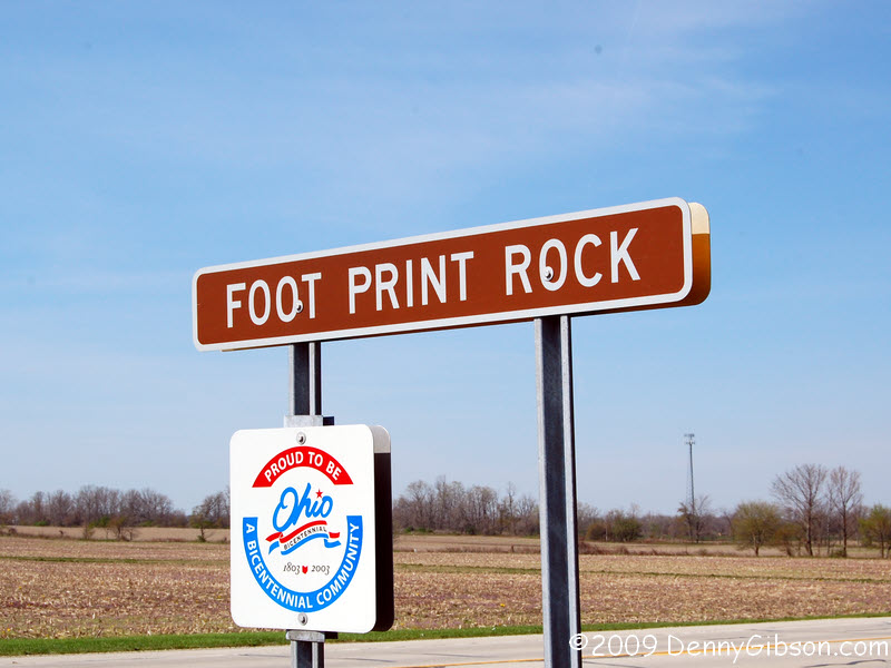
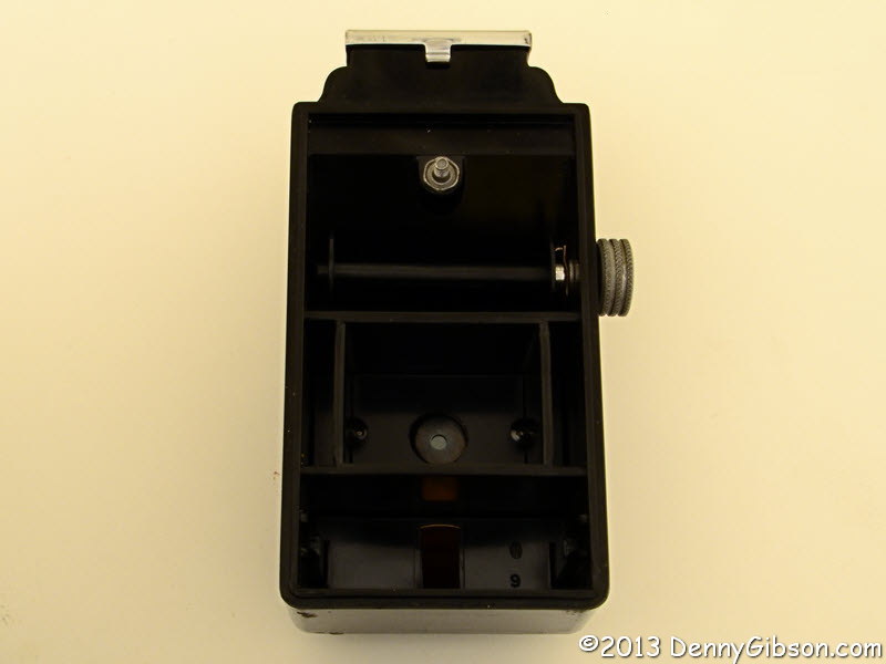
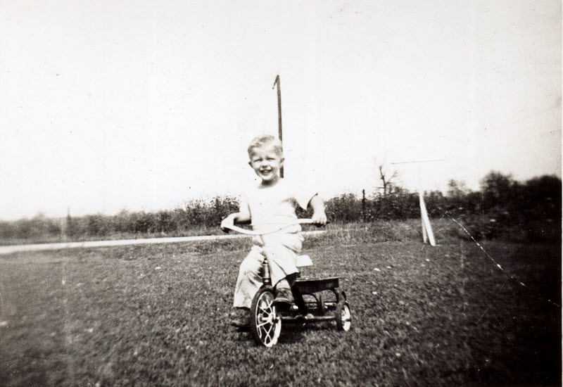
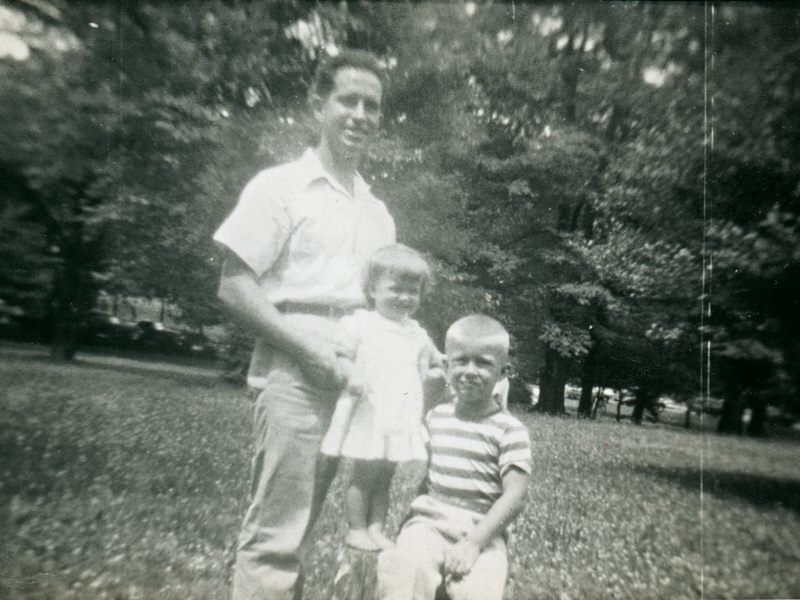
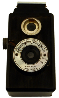 I am not someone who delights in using old film cameras. I can appreciate that others do and I can appreciate the phenomenal engineering and manufacturing accomplishments embodied in high-end film cameras. But I like the convenience and economy of digital photography far too much to spend my own time and money on anything else — with one exception.
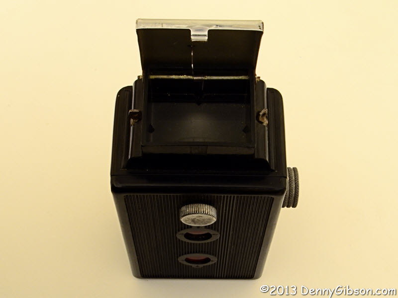


