
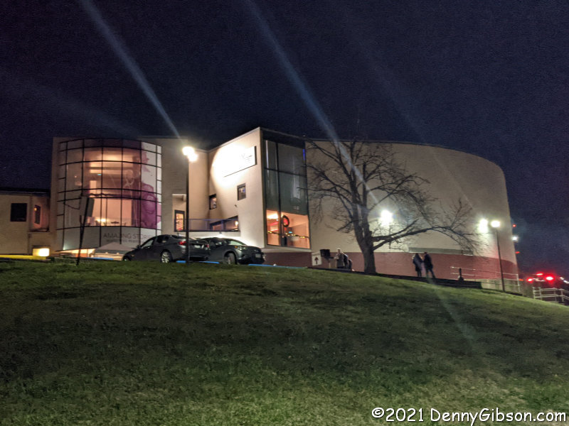
 Back in 2015, I attended a reading of KJ Sanchez’s Cincinnati King in Washington Park and wrote about it here. Three years later, I saw it performed at Playhouse in the Park and wrote about that here. At the time, I really expected that I would next encounter the name KJ Sanchez when Cincinnati King opened in another theater in another city. That hasn’t happened yet — although I very much believe it should — so my next Sanchez encounter was back at Playhouse in the Park where her second play with King Records connections is now playing.
Cincinnati King is the story of King Records told through three main characters. There are other cast members but company founder Syd Nathan, long-time session drummer Philip Paul, and star recording artist Little Willie John are all that Sanchez needed to paint her King Records picture. Her latest play is about just one member of that trio and she is every bit as efficient this time out as last. If three characters can tell the story of a large record company, how many are required for a single artist?.
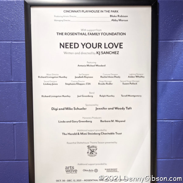 For KJ Sanchez, the answer is one. I first realized that Need Your Love is essentially a one-man play while reading the program in the playhouse lobby before the show. I say “essentially” only because the four-piece band is an integral part of the performance, is always on stage, and occasionally interacts with the only cast member. But that cast member, Antonio Michael Woodard, speaks every line, sings every song, and dances every step. OK, technically — and only technically — that “speaks every line” claim isn’t entirely true but it is impossible to watch Woodard’s performance and not be impressed with the collection of talents he brings to the production.
The band’s performance was also impressive. Half of the quartet, drummer Richard Huntley and bassist Terrell Montgomery, were also part of the Cincinnati King combo. Pianist Ian Axness and guitarist Joel Greenburg may have missed Cincinnati King but they are hardly rookies. The group convincingly delivered a variety of styles. Naturally, “Fever”, John’s biggest hit, is included in the show’s thirteen songs as is his first King release, “All Around the World”. They supply a glimpse of Jack White’s somewhat edgy cover of “I’m Shakin'” then follow it with the original Little Willie John R & B version. The title inspiring “Need Your Love So Bad” is there too, of course.
The technicality that results in Woodard not quite speaking every line is one of the production’s coolest features. Syd Nathan, who died in 1968, recorded some instructions about how King Records should operate. At several points in the performance, excerpts from those recordings and possibly others are played from off stage. Sometimes the on-stage Willie John sort of has a conversation with the disembodied voice. This isn’t an attempt to pretend that a living Syd and Willie are chatting in the 1960s. The play’s setting is the empty King Records building in Cincinnati. The time is now. It opens with a group of musicians entering the building for a not exactly kosher jam session. Something about the old building transforms the group into Little Willie John and friends and the music begins to flow. It is, I suppose, the spirits of Little Willie John and Syd Nathan having those conversations.
 It was an all-around great performance and it was KJ Sanchez’s script that enabled it. Regrettably, I cannot praise the script quite as freely as the performance. Little Willie John’s life certainly had its ups and downs and its ending was truly tragic. There is little doubt that racial prejudice affected his treatment in prison and probably in the courts. It is entirely possible that John was quite innocent of the crime for which he was enprisoned. There is, however, room in the real world for doubt but little such room to be found in Need Your Love. Some of those rough spots in John’s life were his own doing. He had some problems with alcohol and drugs and even his temper. Sanchez did not omit these from Cincinnati King and I don’t believe they made me any less angry about the injustice John encountered. For some reason, though, those things seem to be missing from Need Your Love.
Sanchez made contact with Willie John’s sister Mable during the writing of Need Your Love. Mable had her own musical career both as a solo artist and as a Ray Charles Raelette. Now 91, she recorded some remembrances of her brother that are played near the end of the show to further dilute that “speaks every line” claim. It was a real surprise and a nice touch. It even occurred to me that Sanchez may have left out alcohol and drug references to keep Willie’s image a little cleaner for sister Mable. If so, I guess I can live with that.
Need Your Love wraps up its run at Playhouse in the Park on December 12.


 This is a PIP: a Pandemic Inspired Purchase. It has pre-pandemic roots, but it was the lack of travel and its associated reasons to take pictures that triggered the purchase of another device for taking them. I know that’s not very logical but I think quite a bit of what we did, and continue to do, during the COVID-19 pandemic is like that — especially what we purchase. I’ll tell about the purchase before I say much about the camera.
 I am surprised to see that Olympus still offers the OM-D E-M10 Mark IIIs (not sure what the ‘s’ means) with a 14-40mm lens for $600. The E-M10 Mark IV is available with the same lens for $700. In September 2020, I bought the pictured kit, which includes a 40-150mm lens that Olympus currently offers for $200, for $598 in what was once pocket change. The included case and SD card were icing.


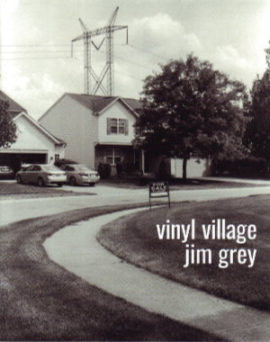 Jim Grey blogs, collects film cameras, uses those cameras, develops the film himself, walks, bikes, and observes. Put them together and what have you got? This book.
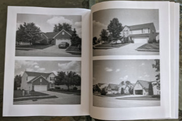 It is a story about the neighborhood in which he lives, and where he interspersed COVID-triggered working-at-home with some calorie-burning walking-near-home. We are introduced to the neighborhood as a collection of modestly priced homes in an area of pricier residences. A big attraction is access to very good schools at somewhat bargain prices. Although the location makes them bargains, they are hardly shabby and actually look quite attractive — from the front.
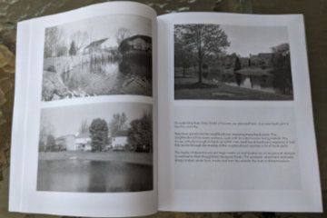 Construction is wood frame with vinyl siding and brick accents. Those accents, however, are almost entirely on the front of the houses. The other three sides are the focus of the story. Part of Grey’s story is about these sides being exposed by the curving streets, numerous retention ponds, and open spaces created by electric and gas lines.
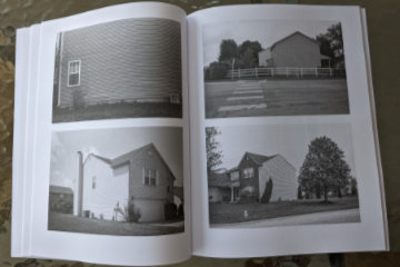 The rest of the story is about those exposed surfaces and areas being a long way from handsome. The story’s name comes from the large expanses of vinyl siding exposed by those curves and ponds. Windows are few and from the outside often appear to be placed rather randomly and often awkwardly. Many side walls are unbroken by any windows at all.
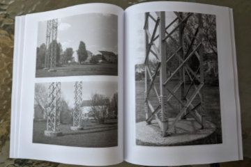 There are few words but lots of pictures. The pictures are black and white and large. The most common arrangement is two 4×6 inch photos to a page. Where words do appear, they typically share a page with one of those 4×6 photos. Occasionally a photo gets a page all to itself which lets it grow to approximately 5 1/2 by 8 1/4 inches. Grey has changed publishing platforms (from Blurb to Amazon) for this project which results in some physical differences from the previous essays. The pages are slightly smaller (8×10 vs 8.5×11) and the paper used is uncoated rather than semi-gloss. Photo quality does suffer but again it is the subject of the picture that is important. The pictures are here to document the subject and illustrate Grey’s story, not to be admired in and of themselves. It’s an assignment they handle quite well.


