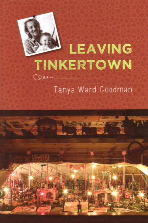
 My October Tinkertown visit began with a nice chat with owner Carla Ward. We had exchanged a few emails when I reviewed her 2020 book, The Tinker of Tinkertown, so of course, that was a topic, and talking about that book naturally led to her mentioning that the Tinker of Tinkertown’s daughter had also written a book about her dad. Leaving Tinkertown was published about a month after what had been my most recent visit to the museum, so maybe I can be forgiven for not knowing about it. It took a while for the copy that went home with me in October to reach the top of my reading list, but once it did, it quickly made an impression. Tanya Ward Goodman has remarkable writing talent — and she’s not afraid to use it.
There is a lot of not being afraid, or more accurately, overcoming fear, in Leaving Tinkertown. Ross Ward, Tinkertown’s creator and Tanya’s father, was diagnosed with Alzheimer’s Disease at age 57. Everyone around him had plenty of fear to overcome.
 Tanya was living in Los Angeles at the time but was present in New Mexico when the diagnosis was delivered, and even moved back to the museum that had been her childhood home for a while to help with things as the disease progressed. On the day of the diagnosis, she found herself remembering stories her dad told her as a child and wondering just how the plaques and tangles the doctor tried to describe would affect her father’s brain. She asks herself, “Will he survive this? If he doesn’t, who will tell the story?”
It seemed pretty obvious that it would be Tanya who told the story, and that sort of reinforced the idea that the book was about Ross Ward. I did certainly learn a lot about the incredibly creative artist from this book, but I soon realized that the book really was about its author. I suppose I should have known that from the title.
 Tanya’s life wasn’t exactly typical. That her parents divorced and her dad remarried when she was quite young is hardly unusual, but that her mother and stepmother were both important influences as she grew up was a bit so. Even more unusual were occasional trips with her father as he traveled the country, painting rides and signs for carnivals and the like. The house she grew up in had walls made of concrete and empty bottles. It was filled, like a museum, with her dad’s artwork, and part of it was an actual museum open to the public.
Alzheimer’s is a main character in the book. When Ross is diagnosed with it, his mother insists on leaving South Dakota to be with her son in New Mexico. Before long, the disease had grabbed her too. It moves fast and is a sort of high-speed preview of what to expect with Ross. Tanya writes about the strain this places on everyone in the family with complete frankness and uncommon skill. This is what I had in mind when I spoke of her not being afraid to use her writing talent.
Of course, she must have overcome a considerable amount of fear in writing about other aspects of her life, such as the budding romance she put on hold in California to spend time in New Mexico. And overcoming fear and other emotions surely played a role in dealing with all those issues in real life, too.
I have some experience with Alzheimer’s. It is what took my dad. But he was in his 80s, not 50s, and was as far from rebellious as it is possible to be. Also, I was close to it for only a few months and not a few years. So, there are many problems Tanya and others had to deal with that I cannot relate to. But watching a guy that could once do anything turn into someone who can do nothing… Yeah, that’s tough.
Leaving Tinkertown is part of the Literature and Medicine Series from the University of New Mexico Press. Part of their stated mission is to showcase “the texture of the experience of illness,” which this book does incredibly well. It’s been out for more than a decade now, so I don’t think anyone would call it a spoiler if I let it be known that the budding romance bloomed and that Tanya is happily back in LA with a husband and a couple of kids.
Leaving Tinkertown, Tanya Ward Goodman, University of New Mexico Press (August 15, 2013), 6 x 9 inches, 232 pages, ISBN 978-0826353665
Available through Amazon.
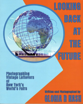 Before I even opened this book I was aware of Gloria Nash’s childhood fascination with the 1964 World’s Fair, the family circumstances that brought her back to the neighborhood, and her visits to the old fairgrounds that ultimately led to creating Looking Back at the Future. I was not aware of a high school photography class assignment to “locate and photograph remnants of the fair” that had recently closed. A few black-and-white pictures taken at that time are included in this volume where she wraps up that assignment in style.
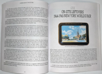 The book’s subtitle, “Photographing Vintage Leftovers of New York’s World’s Fairs”, accurately describes its main thrust. Well-written text provides background on both fairs, and there are descriptions of buildings and other items that no longer exist, but photographs of what that subtitle calls “leftovers” fill the bulk of the book. Most were taken by the author although a few come from other sources. Some images from postcards and other promotional materials are also used sparingly. The book is printed on good quality fairly heavy stock but it is not coated gloss stock. All of the modern photos are bright and clear and look quite good but this is not a “coffee table” book.
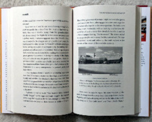
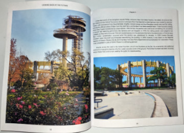 Nash has done a phenomenal job in tracking down fair remnants and makes sure that others can “locate and photograph” these leftovers, too. The location of all leftovers at the fair site (now Flushing Meadows Corona Park) is shown on a map with color coding to distinguish 1939 leftovers from 1964 leftovers. Both chapters on “On-Site Leftovers” contain what amounts to a tour guide for a walk that visits each of them. Chapters on “Off-Site Leftovers” describe locations and give addresses where appropriate. An appendix provides these locations in a list format.
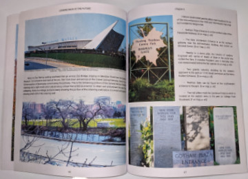 Although both of these fairs made lasting impressions on the people who attended them. neither was a success from the organizers’ point of view. Organizers in 1939 hoped for 50 million visitors but got only 45 million. The target in 1964 was 70 million, but only 51 million showed up. I wasn’t around in 1939, and even though I was very much around in 1964 and well aware of the fair, I did not attend. I have only attended one world’s fair in my life, and that was in 1983 in Knoxville, TN. Nash says that was the last profitable world’s fair held in this country. Coincidence?
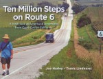
 I’ve been anticipating this book for a few years now. Henry was probably well into his research for the book when he gave a presentation at the 2017 Lincoln Highway Association conference on trekkers who had incorporated all or part of the highway in their travels. The Lincoln Highway and other trails aimed at automobiles appeared in the latter half of the golden age of trekking, which Trekking Across America focuses on. Henry identifies this as roughly 1890 to 1930. Merriam-Webster defines a trek as “an arduous journey” and during that period just about any long-distance journey that did not involve the railroad was unquestionably arduous. I ordered the book as soon as I became aware of its publication but my own non-arduous travels and the winter holidays kept me from reading and reviewing it until now.
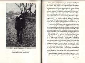 A fellow named Edward Weston is credited with getting the walking craze started by walking from Boston to Washington to satisfy a bet made on the wrong guy (Stephen Douglas) in the 1860 presidential election. Apparently, Weston decided that he really liked walking and was quite good at it. He proceeded to set records and win awards into his seventies. In some circles, the rampant pedestrianism of the time was referred to as Westonianism.
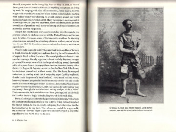 Postcards are also a rather natural way to provide a visual connection with a trek’s story. Henry divides these stories into five chapters based — not all that rigidly — on the reason for the trek. Following a chapter’s introduction are several segments featuring one or two specific treks with at least one related image. Postcards often provide those images. These two or three page standalone segments allow “Trekking Across America” to be read in small doses if desired.
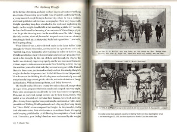 Individual males were hardly the only ones undertaking these long arduous journeys. Buddies, siblings, newlyweds, whole families, and even a few lone women appear on these pages. Incidentally, little evidence is presented here that a trekking honeymoon will lead to marital bliss. The rules for some of the contests and challenges were also interesting. Virtually every trek involved some sort of time limit but rules about clothing, starting with little or no money, and working en route were also common. After the turn of the century, gimmicks such as the aforementioned skating or rolling a hoop might be involved. One fellow fiddled every step of the way as he walked from New York to Los Angeles and on to San Francisco.
 I am more familiar with Stuckey’s signs than their products. As a kid, I probably didn’t even know the company existed since my family did not travel much. They were still going strong when I started doing some traveling on my own and I believe I bought gas at their stores a few times along with a pecan log roll or two but there was very little money in my travel budget for candy and none at all for rubber snakes. By the time my own fortunes had improved to the point that snacks were regularly permitted on road trips, Stuckey’s fortunes were headed in the other direction. The main reason that I am familiar with Stuckey’s signs is that I drove by a bunch of them. Many, maybe most, were for stores that were closed.
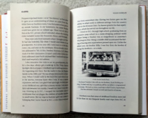
 Like pictures? It’s got ’em. Like variety? Got that too. There are enough pictures to fill a deck of cards or a weekly calendar, which is not accidental. The premise for the book was writing an article to accompany a photograph every week for a year. That could very well be a student assignment in an overly long writing course and in a sense it is. Jim Grey assigned himself the exercise to, as he says, “strengthen this muscle”. He is referring to the writing muscle which can surely benefit from practice just as much as a musician’s skill or an athlete’s strength.
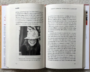
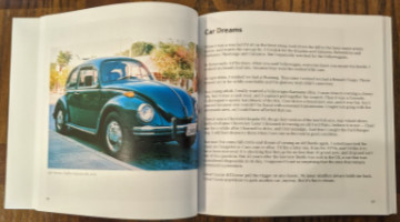 Even though photographs are at the heart of Under the Catalpa Tree, the book’s subtitle mentions only “stories and essays”. I’m guessing that is at least partially because only the stories and essays needed to be newly created for the book. The photos already existed from Grey’s many years of photographing the world around him. He doesn’t explain how the photos were selected. I am sure it was not completely random but there is tremendous variety. They range in quality from slightly fuzzy black-and-white snapshots taken years ago with a yardsale camera to crisp color images taken with high-end gear and well-developed skills. Some photos are digital but film is the source of many of the images since Grey collects — and heavily uses — film cameras. Among the subjects are family, friends, cars, houses, nature, and an abbey in Ireland.
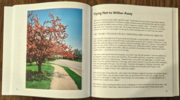 A detail I appreciate is laying out the book so that all images are alone on a left-hand page. That happens naturally when the text occupies a single page, which is common, or three pages, which is not. There are quite a few two-page essays where a blank is used to get things back in synch. Totally worth it, in my opinion. Those pages, by the way, utilize Amazon’s premium paper which has the photos looking their best.
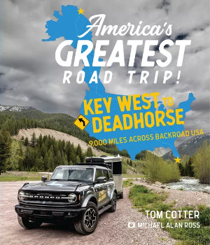 It’s a simple concept. Position yourself at the southernmost point in the continental United States then drive to the northernmost point in the U.S. accessible by road. The former is Key West, Florida. Deadhorse, Alaska, is the latter. The two are separated by a little over 4,000 miles as an extremely hardy all-weather crow might fly. Limited to traveling on the earth’s surface, Tom Cotter and Michael Alan Ross clocked 8,881 miles in making the connection. The difference is easily justified. Tom and Michael had more fun than any crow could even dream of.
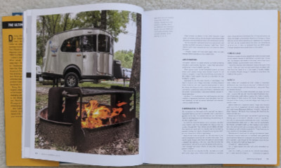 That camper was a new Basecamp 16X on loan from Airstream. The tow vehicle was a 2021 Bronco Outer Banks on loan from Ford. As Cotter tells it, he got the Bronco by telling Ford that Airstream had promised him a camper and he got the camper by telling Airstream that Ford had promised a Bronco.
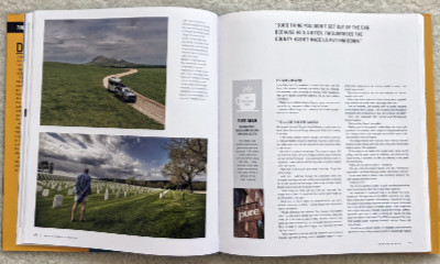 They clipped a corner of Georgia, then crossed Alabama (with a stop in Muscle Shoals) before turning north in Louisiana to reach Tennessee. They entered Missouri via the bootheel and maintained a west-by-northwest course through that state and Kansas with appropriate adjustments to take in the big ball of twine in Cawker City. Then it was a little more directly north through Nebraska and the Dakotas with a Memorial Day pause at the Black Hills National Cemetery in South Dakota. There was a different sort of pause at the North Dakota line. Despite all of Cotter’s past travels, he had, at this point, visited just forty-nine states. North Dakota was number fifty.
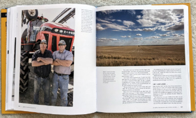 North of Bismarck, Cotter and MAR picked up US 2 and headed west. That might not be the most direct route to Alaska but there were friends near Seattle and, as any good road-tripper knows, anything can be “on the way” if you look at it just right. Hitting Glacier National Park and the Going-to-the-Sun Road might have also been a factor in route selection but the scenic road was not yet open for the summer when they arrived. There was, of course, plenty of great scenery even without Going-to-the-Sun, and plenty of interesting people, too.
 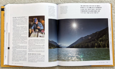 With the break out of the way, it was time to enter Canada and head for the beginning of the Alaska Highway in Dawson Creek, British Columbia. Cotter had a recent (but not quite current) edition of The Milepost with him. The Milepost is published annually and is close to indispensable for anyone traveling the Alaska Highway. That road is its primary focus and its initial reason for being but it now not only covers the Alaska Highway but just about every path for getting to and from it. That includes coming from Vancouver which is what Cotter and MAR were doing.
 British Columbia and the Yukon Territory contain the bulk of the Alaska Highway with only the northernmost two hundred miles or so being in Alaska. Cotter reports that any pride associated with returning to the U.S. was short-lived and declares this “absolutely the worst roads” they had driven so far. The Alaska Highway officially ends at Delta Junction but Fairbanks is easily reached on what is sometimes seen as an extension, the Richardson Highway.
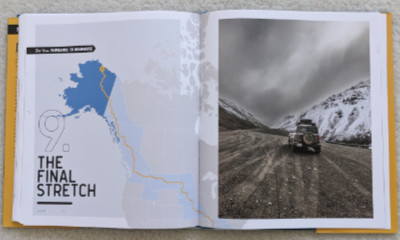 The Airstream was left with a cousin while Cotter and MAR tackled the final stretch to Deadhorse in the Bronco. Several aspects of this trip reminded me of my own 2016 drive to Alaska but perhaps none so much as the mention of “a mandatory pit stop at the Hilltop Restaurant north of Fairbanks”. Even though I did not drive north of Fairbanks on my own but used a commercial tour company to visit the Arctic Circle, we had breakfast at the Hilltop before hitting the Dalton Highway.
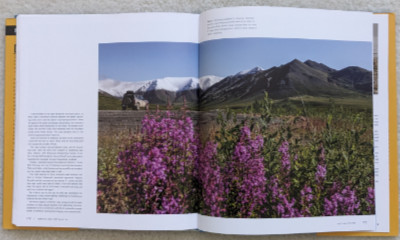 My visit to the Arctic Circle had been a one-day there-and-back affair. Cotter and Mar spent a night on the Dalton Highway in Wiseman and two nights at the end of the road in Deadhorse. Just reaching the end of the road would be enough for most people but Cotter went above and beyond by joining the Arctic Polar Bear Club with a dip in the 40°F Prudhoe Bay to bookend his dip in the “warmer than my morning shower” water at the start of the trip in Key West.
 Last Wednesday’s post was the 100th book review published on this blog. Eight were of my own books and one (