
 I was hesitant to post a review of this book because some of those “Photos Through Time” are mine but I decided that it would be a bad thing only if I rave about how marvelous the book is. No harm in simply describing it, right? So here are the facts.
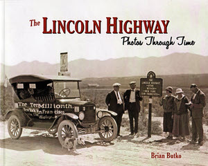
The Lincoln Highway: Photos Through Time was created for the Lincoln Highway Association as part of its centennial celebration. One of the most visible parts of that celebration was the pair of car tours traveling the Lincoln Highway from its two ends to a meeting in the middle. A copy of the book was part of the tour package and it is also available for sale exclusively through the Lincoln Highway Trading Post.
It’s a sampler. Its purpose is to give an overview of a century of Lincoln Highway. It is not a guide book or a scholarly history book. It does not contain pictures of every scenic spot along the road or every notable building or every key association member. It does, however, contain a whole bunch of each of those.
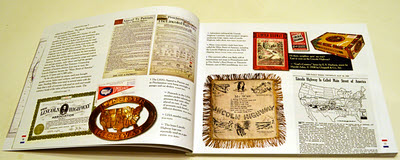 It is organized neither geographically nor chronologically. The first section following the foreword is titled “History”. Here, among pictures of collectibles and artifacts, Butko gives a very brief history of the road’s birth and short life. It is enough to give someone who knows little or nothing about the Lincoln Highway a starting point and someone who knows everything a quick refresher on key dates and events. It is a stripped down but adequate introduction to the pictures that follow.
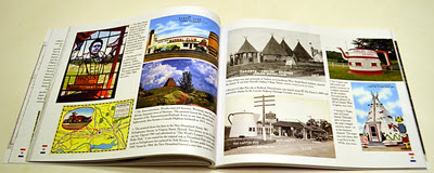 Those pictures are organized by their subjects. Butko identifies ten things that comprise the Lincoln Highway and gives each one a chapter. They are “People”, “Gas”, “Food”, “Lodging”, “Vehicles”, “Attractions”, “Signs”, “Markers”, “Bridges”, and “Roads”. The chapters are themselves samplers. Historic images from postcards and other sources are combined with modern photographs. Images of things along the road, which is every chapter other than “People”, are from locations spread over the road’s entire length.
The sources of the photos are pretty diverse, too. Butko lists more than fifty contributors. He supplied a large number of images himself and, at a presentation at the Centennial Celebration in Kearney, Nebraska, he singled out Russell Rein, Jeff Blair, and me as next in number of contributions. Many of the historic images came from Russell’s huge collection. Jeff and I are both amateurs who happened to be the the right place fairly often but our pictures get to appear alongside stuff from real pros like Michael Williamson, Drake Hokanson, Rick Pisio, Shellee Graham, and Jim Ross and Brian has made sure they all look as good as possible.
I described the “History” chapter of having value for two very different audiences. Maybe that’s true of the whole book. Most of its first recipients, members of those centennial tours, are probably somewhat familiar with almost everything in the book. For them and others like them, the book might be a memory booster or a chance to see an image of something they’ve only heard about. On the other hand, there is a large group of people who ask “What’s that?” when hearing of the Lincoln Highway. Flipping through the pages provides glimpses of what’s there today and some of what was there in times long past. Turn the pages slowly and read all the captions for an even better answer to the question.
The Lincoln Highway, Photos Through Time, Brian Butko, Lincoln Highway Association, 2013, paperback, 10 x 8 inches, 136 pages, ISBN 978-0989208000
Available at Lincoln Highway Trading Post.
 The Lincoln Highway turns a hundred this year. Brian Butko’s Greetings from the Lincoln Highway turns eight. At first glance, the 2013 Greetings… looks an awful lot like the 2005 Greetings… with a soft cover and a “Centennial Edition” banner on the front and it’s a fact that, in many ways, it is the same. It has the same organization with an introductory chapter and a chapter, with map, for each state the highway passed through and a very high percentage of the words and pictures in those chapters are the same, too. Another thing that remains the same and which accounts for the small in percentage but large in number changes is the care and attention to detail. Butko probably didn’t catch everything in the book that the passage of time has altered but he sure tried and he sure got a lot.
 Aside from the occasional new photo, the most visible changes may be in the statistics and maps at the front of each state chapter. Here population numbers from the 2010 census replace those from the 2000 census and the maps get a line for the Proclamation Route. The Lincoln Highway Proclamation Route was a list of cities published by the Lincoln Highway Association on September 14, 1913. Shifts started happening almost immediately and a detailed route was never signed or published that matched the September 14 announcement. But several of the cities dropped in 1913 fought unsuccessfully to return and many have fought more recently and more successfully to be recognized. Butko acknowledges that by including the ephemeral route. All of the quotes from postcards and other period communication that appeared in the margins of the original are still there and a few more have been added.
 I’m reading this book for the third time. I read it around 2005 when I was dabbling with short drives on the Lincoln Highway to my east. I reread it in 2009 when I was getting ready to drive the Lincoln from the east edge of Illinois to the west coast. My current read is in anticipation of another long, hopefully full length, drive of what Drake Hokanson calls Main Street across America. I never read the original, only the pictured Tenth Anniversary Edition which is now fifteen years old itself.
 If you think this looks like it belongs here, you haven’t been paying attention. No, books about cosmology, quantum physics, and beyond aren’t what I typically read and I’m clearly not qualified to review them. I was given the book as a gift, I read and enjoyed it, and I intend to tell somebody about it.
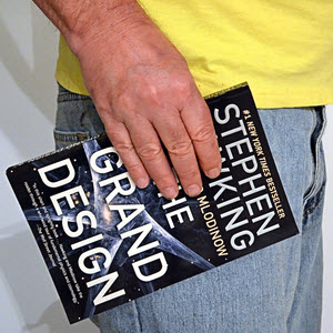 I started off admitting that this book was really out of place here. I do a lot of my reading over meals in restaurants and it was rather out of place in some of the joints where I eat, too. I quickly worked out a way to carry the book that cut down considerably on the funny looks aimed my way.
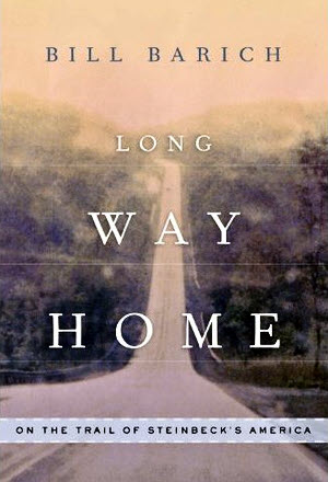 Not long ago, a friend mentioned a couple of travel related books he had just read and, when I found one of them available at the local library, I decided to give it a read. It’s Bill Barich’s Long Way Home – On the Trail of Steinbeck’s America. The subtitle is a reference to Steinbeck’s Travels with Charlie which Barich cites as an inspiration for his own road trip and book. The books’ basics are certainly similar. Each is the product of a successful American writer of a certain age undertaking a cross country road trip with hopes of learning something of a nation he’s been out of touch with for awhile. Steinbeck did it in 1960; Barich in 2008. Forty-eight years is not the only difference. Steinbeck did it in a custom built camper with unlimited time and, for all practical purposes, an unlimited budget. Barich did it in a rented Ford Focus, with a six week schedule, and a budget he calls “tight”. Steinbeck sort of circled the country, starting and ending at his home in Sag Harbor, New York. Barich makes one more or less straight pass through the center of the nation. But, for me, the biggest difference is that, while I’ve never really cared for Travels with Charlie, I ended up enjoying Long Way Home. Of course, Steinbeck didn’t seem to enjoy his own trip very much; Barich did. I think that rubbed off on me.
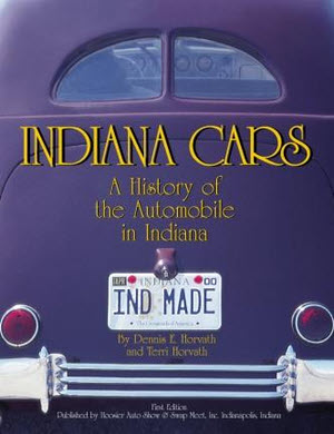 Yes, I am late to the party. This book on Indiana’s automotive history was published in 2002 but, since it’s about old cars, none of the history has changed and the cars have only gotten older.
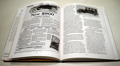 Once the background is set, the book moves onto the various manufacturers. Not every mark ever built in the state is covered but there are sizable sections on what the Horvaths consider “Significant Automobiles”. The reading isn’t so dry now. There are fairly lengthy articles on the likes of Duesenberg and Studebaker and shorter ones on others. The book is well illustrated with photographs and clippings from period literature. Facts are seasoned with entertaining anecdotes. Joe Cole got his first car running and took off without installing the brakes. Lack of fuel finally stopped it after many laps around Monument Circle in Indianapolis. In 1891, Charley Black’s six-block drive in a Benz included crashing into both a surrey and a shop window. Those were the good old days.
 E-N-C-Y-C-L-O-P-E-D-I-A
 This is not my first exposure to Hinckley’s work and, as I’ve said before, the man does his homework. Of course, everybody knows about the Gemini Giant and it’s not too tough to learn that it was made by International Fiberglass. But learning how many cowboys the company made for Phillips Petroleum and how they managed to make some giants with beards and some without and that the company’s founder once set a world record in sailing? That takes some digging. And practically any book with 66 on the cover will tell you how Cyrus Avery was instrumental in getting the pair of sixes for the route after the desired Highway 60 designation was assigned elsewhere. Hinckley does that and also tells us quite a bit about some of his other activities such as his prior role in creation of the Albert Pike Highway and his subsequent role in helping form the U.S. 66 Highway Association. Incidentally, although I have not read every article in the encyclopedia, that is the only mention of the U.S. 66 Highway Association I found. Its post-WWII spark plug, Jack Cutberth, was one of the names I thought I might see in the book but didn’t.
 Even without Cutberth, the Route 66 Encyclopedia includes an impressive number and range of articles and many of those articles go into significant depth. The writing isn’t flowery but neither is it terse. It’s lean and efficient. The goal is to get as much factual information between the covers as possible and keep it readable. Hinckley does that rather well. Moreover, I think you’d probably still get your money’s worth if you decided to forgo the text altogether and just look at the pictures.
 “It’s not the destination but the journey.”
 Sometimes Lindhorst’s photos are coordinated tightly with Hurley’s text and sometimes they just represent the general area. Either way they are always wonderful additions to the story. Some would be right at home in a super-wide hardback coffee table book but then I probably couldn’t afford it. The fairly large format paperback with glossy pages serves the photos well in an affordable package.
 In 1990, Tracy Lawson’s parents gave her a stack of twenty-one photocopied pages as a Christmas present. Transcribed onto the typewritten pages was the journal of her third great-grandfather’s 1838 trip from a Cincinnati suburb to New York City. In 2012, Lawson is sharing those pages and the experiences they triggered, in Fips, Bots, Doggeries, and More. The book is comprised of two sections. “Section I — 1838” contains the journal along with Lawson’s illuminating comments and notes. “Section II — 2003-2009” contains accounts of the author’s own trips along the route. Both sections are liberally illustrated with black and white photos and drawings.
 I like this book so much that I have three copies of it. Well, maybe not three exactly but more than two. I got my first in 2007 in anticipation of an Oklahoma trip. It didn’t take me long to discover that the copy was flawed and it didn’t take much longer for a replacement to be provided. A printing error had caused many pages of that first copy to be omitted, duplicated, or otherwise jumbled. The replacement, with all pages present and in the right place, was quite an improvement. This second edition is also an improvement though not that drastic. With it’s accidental mishmash of pages, that first copy was essentially unusable. Every other copy of first edition Oklahoma Route 66 was eminently usable. The second edition is even more so.