
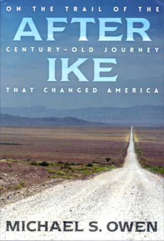
 There are things that fans of old roads or of transportation history in general falsely assume that everyone knows about. One such item is the continent crossing Motor Transport Corps convoy of 1919. In the summer following the end of the first World War, a group of military personnel and vehicles set off from Washington, DC, to test the nation’s roads all the way to San Francisco. Although he was primarily an observer on the trip, his future accomplishments make Dwight Eisenhower the member of the convoy best-known today. Michael Owen uses the future president’s nickname in naming this telling of his own retracing of the 3,250-mile-long path that some 300 men and 81 vehicles of all shapes and sizes followed a century ago.
As one might expect, Owen mixes lots of information about the military convoy’s trip with the description of his own journey. Much less expected is the fact that he is not one of those long-time fans of old roads or transportation history that I mentioned earlier. As a US Ambassador, he spent considerable time in Africa and Asia. Now retired, he is happily becoming better acquainted with the roads and attractions of his homeland.
On his coast to coast drive, Owen is part researching author and part curious tourist. He often spends multiple days in one place and digs into local history and points of interest. Some of what he finds relates to the convoy and some is simply interesting on its own. A sampling includes a stop at Carnegie-Mellon to talk with a professor about autonomous vehicles and a visit to the Pro Football Hall of Fame which provides an opportunity to talk about Ike’s time as running back at West Point. He visits several museums including the Studebaker museum in South Bend, IN, and the El Dorado County Historical Museum in Placerville, CA. He spends time in small libraries and chatting with locals.
Much of the convoy related information Owen shares comes from journals and official reports written by the participants but local newspaper archives are also used extensively. The motorized convoy was a major event in those early days of the automobile and much attention was focused on its progress. Communities along the route often vied with each other to host the convoy and the dinners, dances, and demonstrations were documented by the local press. More or less typical is the South Bend [Indiana] News-Times report of the convoy’s arrival and departure that included the observation that “…lemonade was given to them in abundance by the Chamber of Commerce.” In Austin, NV, the Reese River Reveille reported that officials “…placed shower baths in the four cells of the jail…” for use by the soldiers.
Some non-convoy related items Owen finds in those old newspapers are used to provide a peek at the world of 1919. A headline from that South Bend News-Times issue reads “Seven Women Take Aeroplane Rides!” From the DeKalb [Illinois] Daily Chronicle, he quotes an article about the convoy’s “3,000,000 candle power searchlight” followed by quotes from an advertisement for the latest Thor Electric Washing Machine. In writing about his modern-day travels, Owen uses signs he sees in a manner similar to the way he uses those period newspaper items. It’s kind of like having a passenger who reads signs aloud; Signs like “Farm fresh eggs! Laid by Happy Chickens”, “Food! Liquor! Wine! Beauty Products!”, and “Gardening for God Brings Peas of Mind”.
Eighteen pages of black and white photos are placed just past the book midpoint. All were taken by the author. Readers familiar with the Lincoln Highway and the modern Lincoln Highway Association will find some familiar places and faces.
The book cover bio says Owen has “driven over the Lincoln Highway several times” but he doesn’t come across as a seasoned road tripper. On one hand, that brings some freshness to the writing. Things like reading aloud signs about eggs bring a sense of sharing the surprises to the reporting. On the other, it may be responsible for allowing a few minor errors to slip in. Early in the book, Owen notes his awareness of “America’s penchant for superlatives: biggest, oldest, first, fastest, best.” He does not list “only” and does pass along a couple of not quite true “only” claims. Qualifying it with the word “purportedly”, he writes that the bust of Lincoln at Wyoming’s Sherman Hill is “…the only statue of Lincoln on the entire Lincoln Highway” and says that the rotary jail in Council Bluffs, IA, “…is the only one of its kind in the US”. Regarding Lincoln statues on the LH, those in Jefferson, IA, and Fremont, NE, come immediately to mind. As for rotating “squirrel cage” jails, the one in Crawfordsville, IN, is not only standing but operational. These errors, and a few others, are not terribly significant but I couldn’t just ignore them.
After Ike is an enjoyable read that delivers an overview of an important event in US transportation history along with a sense of what a modern-day long and leisurely road trip is like. Owen’s fresh eyes and all those signs make it a bit unlike many travelogues.
After Ike: On the Trail of the Century-Old Journey that Changed America, Michael S. Owen, Dog Ear Publishing, LLC, July 22, 2019, 9 x 6 inches, 224 pages, ISBN 978-1457570421
Available through Amazon.
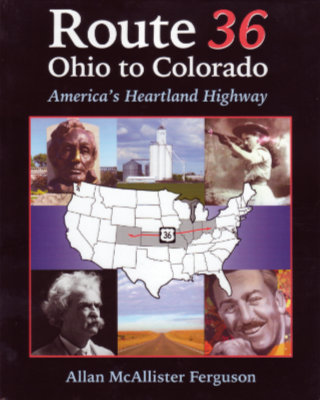 US-36 is kind of special to me. It is one of just a handful of US highways with an endpoint in my home state and one of just two that pass through my birth county. It’s even more special to Allan Ferguson. He grew up near the route in Illinois, has ancestral connections to the eastern end in Ohio, and currently lives near its western end in Colorado. It has had a role in much of his life from childhood vacations and visits to relatives to business trips and drives between old and new homes as an adult. Not all of his travels between Colorado and Illinois have been on Route 36. Not surprisingly, his early trips back home were on expressways. At some point, he tried US-36 and came to realize three things. The first was that it took no more time than driving the interstates. Between Denver and central Illinois, the US-36 is quite straight and about 100 miles shorter than either I-70 or I-80. Secondly, it was relaxing rather than stressful. The third thing he realized was that the drive was actually interesting and that realization eventually led to this book.
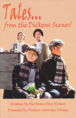 This book is unusual and unusually good. The Dickens Scenes of the title are those in Cambridge, Ohio, that starred in this blog’s most recent regular weekly post. There are currently 94 of those scenes and each began life as a sketch by a fellow named Bob Ley. Bob is one of a group of writers, known as
  The individual photos are not credited but acknowledgments at the front of the book identify Tom Davey and Lindy Thaxton as the photographers. The photos are all quite good and do a nice job of capturing each scene from its best vantage point. Together, the book’s even-numbered (i.e., lefthand) pages make up the sort of catalog often prepared for a museum display. The village really is such a display with the sidewalks of Cambridge forming the museum.
 Sometimes I astound my friends with my knowledge, admittedly quite useless, of unusual and obscure roadside attractions. Othertimes I astound myself with my complete ignorance of a major and fairly well-known piece of public art.
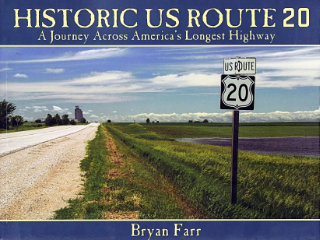 This book didn’t put US-20 on my to‑drive list, that happened long ago, but it did move it up quite a bit. At 3365 miles, Route 20 is currently the longest of the U.S. Numbered Highways so it’s quite naturally a road I’ve thought about driving. I have driven bits of it, of course, and crossed over it many times. It would be pretty hard to completely avoid a road that crosses the entire country as this one does. In Historic US Route 20: A Journey Across America’s Longest Highway, Bryan Farr documents an east to west drive over the entire length of the highway and the entire breadth of the nation with a couple hundred great color photos. There is something I’d like to see in just about every one of those photos.
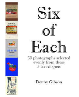 And now for something completely different. Anyone who thought releasing two books within three months might be overdoing it will have no doubts about that being the case when they see another appear a week later. But this is a different kettle of fish. Really. Six of Each is a collection of photographs drawn from the previously published travelogues. Each of those travelogues is available in two forms. There is a black-and-white printed version and a color digital version. Photo-quality color printing is still relatively expensive in the low-volume print-on-demand world. Printing the books in black and white keeps them reasonably priced. On the other hand, color in digital files is free. Offering B&W paperbacks and color ebooks isn’t ideal but it keeps the books affordable and color at least available.
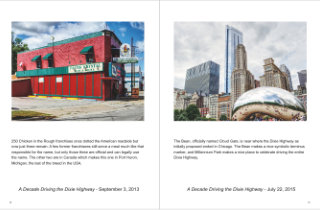 So what I’ve done is pick a half dozen pictures from each of the existing travelogues and combine them in a Blurb magazine. The magazine is only available through Blurb (that’s one of those magazine restrictions) and there is no digital version available (that’s my restriction). It’s also more expensive than it seems a 32-page “magazine” ought to be. But it does let me see what some of my photographs would look like using something besides black ink on stationary paper. And it’s there for anyone else who would like to look.
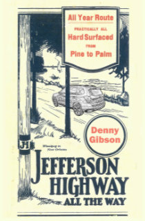 Too soon? What had been my most recent travelogue,
  This is my fourth self published book; All are travelogues. This one is a midquel that covers the omitted middle section of a trip that formed part of the previous book,
  A funny thing happened on the way to this review. Not funny ha ha; Funny peculiar. This is Jim Grey’s second book. I reviewed the first, Exceptional Ordinary, in April, 2017. I figured that this review would reference that one, make some comparisons, make some jokes. It would be fun; Maybe even funny ha ha. But that review has gone missing. I don’t know how or even when. I’ve
  I photograph a fair number of signs as I travel, and I know quite a few people who photograph many more than I. Not one, however, is in the same league as Debra Jane Seltzer. If sign hunting was an Olympic sport, the petite Seltzer would be buried under gold medals. Her photo expeditions are legendary. Until recently, when she and her dogs (currently four) headed out in the white Chevy van named Sparkle, they would take along a big stack of notes and marked up map printouts. Today there might still be a printed list of targets but Google maps and a smartphone have reduced the need for paper considerably. The target list is never limited to signs. It’s almost certain to include interesting buildings and other roadside attractions of all sorts.
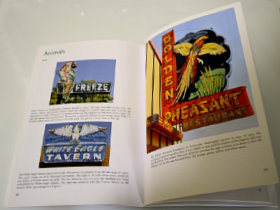 The “Animals” chapter is probably my favorite. Colorful birds, fish, and dogs draw customers to businesses of all sorts. Sequenced neon segments can make birds appear to fly and dogs and horses appear to run. A pig almost always indicates a BBQ restaurant although one sign shows a line of pigs merrily leaping in to a grinder to be made into sausage.
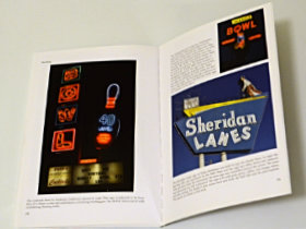 “Things” is as varied as you might imagine. Bowling balls and pins are popular as are skates, cars, and assorted food items. Donuts and ice cream cones seem to be the most common edibles used to attract customers. Bowling balls lend themselves to animation and when a neon bowling ball rolls, a strike is virtually guaranteed. Together, “Types of Signs” and the three chapters of the “theme” section make up a sort of sampler of the massive Roadside Architecture site. Picking less than 200 images to populate this sampler had to be tough but the choices made were excellent.