
 If I maintained a list of questions I frequently ask myself, “Why another Route 66 book?”, would be high on the list. I have never arrived at a reason that another one is actually needed; only justifications for ones at hand. Those justifications generally take the form of answers to two questions. They are, “What makes this book different from all others?”, and “Why should I buy it?” In practice, I ask them in the reverse order which means that, if I don’t have a good reason to buy a book, I’ll probably never get around to discovering what, if anything, makes it different.
For the last several years, it seems that the only reason I’ve had for buying another Route 66 book is a connection with the author and that is again the case this time. I have never actually met Blue Miller, but am familiar with some of her online activity, and have been impressed with her sleuthing ability. In addition, several people that I do know seemed happy with this book or at least eager to see it. I decided to take a look myself, and I don’t regret it a bit.
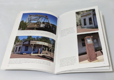 Although not of the coffee table variety, this is first and foremost a photo book. It contains upward of a hundred photographs, in color, printed on good quality semi-gloss paper. They are primarily documentary photos. That does not mean that they are boring, but it does mean that properly recording each subject is the main goal. The book is certainly not without its share of creative composition, but there are no abstract-light-patterns-on-pavement style pictures. There are usually two or more photos on a page for a max size somewhere around 5.5 by 3.5 inches. That might keep you from displaying it on your coffee table, but it is plenty big enough to show off bridges, buildings, and signs.
As for what makes it different, I guess I could point to it being exclusively (with one exception) concerned with abandoned things and to those things being limited to Arizona. Let’s be honest, though, abandoned things are a mainstay of Route 66 publications. Concentrating on them entirely may technically be different, but, if that merely led to a subset of what is featured in all those other books, it would not be particularly impressive. It’s the abandoned stuff that hasn’t been photographed over and over — like Ash Fork buildings that aren’t DeSoto’s and the emptiness of Yucca — that moves this book a bit away from the pack.
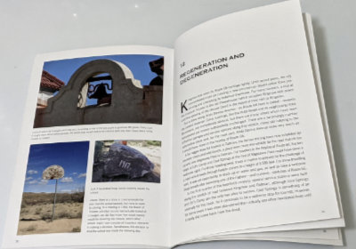 Yes, the pictures are cool and those of some fairly obscure places enlightening, but it is the words that made me happy with my purchase. The histories of most of the pictured buildings are told. Some are reasonably well known and available elsewhere, but Miller’s telling is both complete and concise. Others are not so well known, and I’ve little doubt that Miller’s aforementioned sleuthing ability brought out some details and possibly some entire stories. Maybe others knew all those details about the schools of Valentine, but I sure didn’t, and the story of the Ostermans and Peach Springs was all new to me. There are other examples of what I take to be sleuthing in the book, and all of them add to my appreciation of it.
As I’ve said about other books on the Mother Road, this should probably not be the first one on your Route 66 shelf, but it is certainly a worthwhile addition.
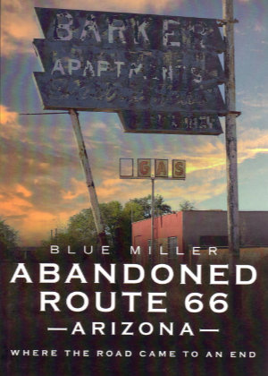
Abandoned Route 66 Arizona, Blue Miller, America Through Time (March 29, 2021), 6.5 x 9.25 inches, 96 pages, ISBN 978-1634993043
Available through Amazon.
 I knew nothing of this book or its author until just before it was reviewed in the Jefferson Highway Association newsletter, The Declaration. The only reason I learned of it that early was because the reviewer, Wayne Shannon, is a friend whom I happened to chat with by phone while he was putting his review together. He was quite positive in talking about the book but, like me, unfamiliar with the name Stephen H. Provost.
 At first glance, this probably looks like a perfect fit for my bookshelf. Like many of the other books there, its subject is a historic highway and its authors are people I know. In this case, the highway is Route 66 and the people are the husband-and-wife team of Jim Ross and Shellee Graham. Both are accomplished historians, photographers, and writers with Jim probably having a bit of an edge in the history department, Shellee having an equally small lead on the photography side, and their writing skills being too close to call. A second glance, however, just might turn up something about this book that is different from most of the others with which it now shares shelf space. It is the word “secret”.
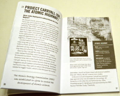 So how is this book I didn’t exactly want? Surprisingly good. I’m not really all that surprised, of course. To my relief, the idea of revealing secrets doesn’t get much further than the title. I doubted that a pair of respected authorities would suddenly become conspiratorial sounding characters sharing dark secrets from the shadows but it was good to have that verified. To some extent, the subtitle also does that. Weird, wonderful, and obscure accurately describe the book’s contents.
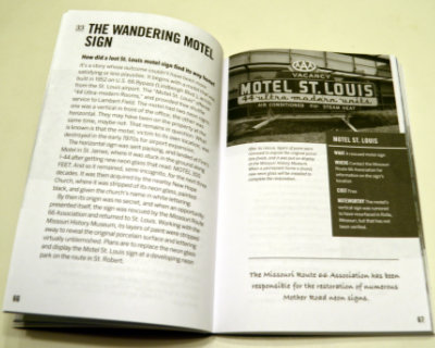 Almost everything in Secret Route 66: A Guide to the Weird, Wonderful, and Obscure is something that, while not actually a secret, is not likely to be found in mainstream guides. Even when the subject is something commonly known, Ross and Graham provide some detail or backstory not commonly known at all. Sometimes the subject isn’t a place or a thing but simply that uncommon detail or story. Among the things that struck me as weird is the true tale of a proposal to use atomic bombs for roadway excavation. Everyone has their own definition of wonderful but my definition is matched by the story of the Motel St. Louis sign that wandered off to help people find another motel (Finn’s in St. James) and then a church (New Hope) before being rescued and returned home. I thought learning about the annual reunion for the ghost town of Alanreed was kind of wonderful, too. Topping my personal list of obscure things is the chapter on several abandoned bridge abutments on the original route through Santa Fe.
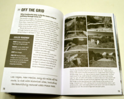 A pair of facing pages make up each of the ninety chapters so that everything about an item can be studied without flipping back and forth. A sidebar contains appropriate information, such as location. These pages are printed in black and white, but they are augmented by sixteen pages of color photographs (plus 2 b&w to make the positioning work) in the middle of the book. Some page flipping here is appropriate but the subject and associated page number are shown for each photo to make it easy. Images in the book are a mixture of historic and modern. Most of the modern photos are the work of the authors but not all. Other researchers and photographers are always credited with images provided.
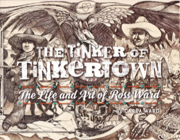 I guess my purchase of this book fits the technical description of an impulse buy, but I sure don’t think of it that way. Yes, I bought it without a hint of hesitation the instant I learned of its existence and there was certainly a lot more emotion than logic involved in the decision. But I sincerely believe that the logical part of my brain had long ago decided that acquiring this book was something I needed to do as soon as it existed. If it ever did.
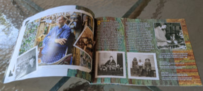 Sometime between the book being ordered and its arrival, I revisited its description and noticed its length of thirty-six pages. I wasn’t worried but I did wonder how Carla could tell Ross’ story in just three dozen pages. The answer, as I think I already knew, is “Just fine.” She tells it with pictures and just enough well-chosen words to properly place those pictures in Ross Ward’s life and to tell some details of that life that the pictures do not.
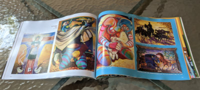 There are several delightful photos of Ward, but the bulk are of his art and the bulk of those are in a section of “2D Work”. It’s a section I found quite interesting as most of its contents are things not displayed at Tinkertown. Items range from posters to etchings to fine art paintings representing nearly every period in Ward’s life. A personal favorite is a circus parade that he drew on thirty feet of adding machine paper at the age of eight.
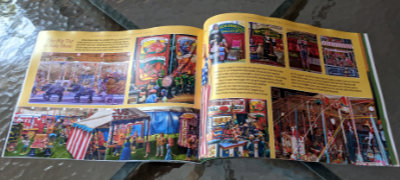 A “Tinkertown” section follows. The pictures in it are of things I’ve seen but that doesn’t make me enjoy it any less. The well-done photos provide an excellent look at the exhibits that got me interested in Ross Ward to begin with. A timeline of Ross Ward’s life appears on the final page.
 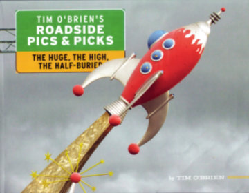 The subject of
  The bonus section comes first. “Roadside Art Parks” documents seven of the more famous examples of the genre with quite a few pictures of each. I got an exaggerated opinion of my own worldliness when I counted two of the first three as ones I’d visited. I was put back in my proper place when I ended the section with a score of 3 out of 7.
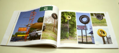 The “high” of the subtitle appears next in “Things-On-A-Pole”. I’d quickly learned my lesson and made no attempt to count and compare what I’d seen. In addition to tires, there are pictures of elevated fish, airplanes, cars, trucks, boats, etc. Et cetera includes a category labeled “Stuff”.
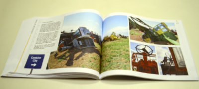 In addition to famous installations such as Cadillac Ranch, Carhenge, and the sadly vanished Airstream Ranch, “Half-Buried” includes quite a few of the not so well known examples of things poking out of the ground. The pages pictured at left show a personal favorite. When I visited Combine City in 2007, there were ten retired machines planted in the Texas field. There are fourteen in O’Brien’s description so it apparently kept growing for at least a while. On the other hand, the dedicated website that existed in 2007 has gone missing.
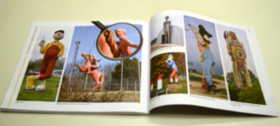 Section four, “Roadside Giants” fulfills the promise of the subtitle’s “huge”. There are subcategories like animals, donuts, people, and the ever-popular stuff. The donuts category offers a find-the-bagel challenge you can play at home.
 There’s not much point in counting the number of books published about Route 66; The likelihood that the count would increase before you were done is just too great. An Amazon search simply says “over 2,000”. So why review this one? What sets it apart from the others? The most obvious reason for reviewing it is a simple one: I know one of the people whose name is on the cover. The things that set it apart are not as obvious (or benignly biased). In fact, I’ve only found one thing about the book that I think is actually unique, and I’m not really sure about that. The book has no author; It has a narrator.
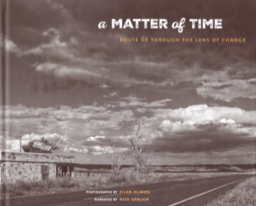
 The photos are black and white, which is unusual but not unique. What may be unique is how they came to be at all. Klinkel tells that story in the book’s preface. It begins in 2013. She lives in Germany and was in the western U.S. with her husband for a four-week vacation which she describes as “the first time I ever had a serious camera in my hands”. Planned visits to several national parks fell victim to the sixteen-day government shutdown in October of that year and driving a portion of Route 66 was substituted. Klinkel credits this very first time on the historic highway coupled with the “serious camera” as having “instantly sparked my passion for photography”.
 Most, but far from all, of the photos are of places I recognize from my own travels on Sixty-Six, and some of those nearly reproduce visions I’ve had myself. There are plenty of pictures of places I do not recognize. Sometimes that’s because they are from a location where I’ve never stopped or maybe even passed, but sometimes it’s because Klinkel sees and shares a vision that never occurred to me even though I’ve stood at or near the very spot she did. I don’t mean to imply that I expected anything else. It’s great to be shown something you’ve never seen, but it can be even better to be shown something known in a new way. Although it is a place I instantly recognized, a favorite example of being shown something in a new way is the early morning shot of the Bagdad Cafe with the coming sun just a tiny but significant twinkle. Another is the low-level shot of a protective wall of tires at a long-abandoned gas station at Texas Exit 0 of I-40.
 However, something clicked on a rereading of that preface that hadn’t quite registered on the first pass. Klinkel explains the title quite clearly:
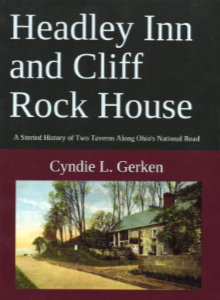 Cyndie Gerken’s third big helping of National Road knowledge was served up a bit more than a year ago, and I have no good excuse, or even enough bad ones, to account for waiting so long to take a look. Of course, once I did, the same accuracy and thoroughness that marked her earlier books were instantly apparent in this one. In 2015, she documented Ohio’s National Road mile markers with
 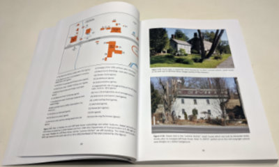 Both of the book’s subjects appeared almost immediately after the National Road passed by the land they would occupy. The first section of the Cliff Rock House was completed in 1830 and the Headley Inn’s first section in 1833. Other dates have appeared in articles and even on signs but Gerken sorts through the various claims and presents a solid case for these dates. Both structures have been enlarged and modified over the years. Despite their nearness to each other, the inns were constructed and operated independently by two separate families. That has not always been the case although it is again today.
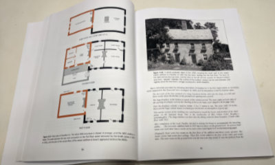 It is generally thought that the Headley Inn initially served as a stagecoach stop while the larger Cliff Rock House catered more to drovers herding sheep and other animals to market. That sort of division was never iron clad, of course, but that kind of thinking does serve to justify the two businesses being so close.
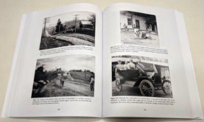 Living memory provides even more input to the post-tearoom era and here the living memory is sometimes Gerken’s own although it is more often her personal interviews with the short series of owners. The book is heavily illustrated with historical photos, maps, diagrams, newspaper clippings, and more. Modern photos include many taken by the author herself.
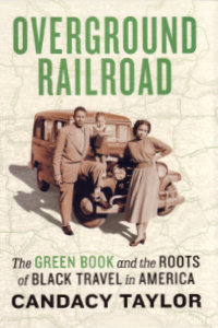 “This is not a book about the history of road-tripping and black travel”, is the first sentence of the last paragraph of the introduction. That’s something I knew long before I read it. It was something Candacy Taylor said early in the presentation I attended in Indianapolis back in February. It may even have been something she said during another presentation of hers I attended back in 2016. I discovered Taylor the same way she discovered the Green Book. Well, not exactly the same way. She learned of the Green Book while doing research for a Moon Travel Guide on Route 66. I learned of Candacy Taylor as a mere attendee at a conference on the historic road. Research for the book was well underway when Taylor spoke at that conference in Los Angeles but Overground Railroad: The Green Book and the Roots of Black Travel in America was still a concept. It was a reality when she spoke in Indianapolis, and that’s where I acquired my copy.
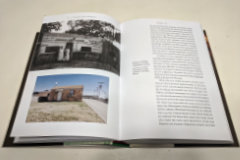 Overground Railroad is heavily illustrated. Taylor’s research for this project included cataloging and visiting businesses listed in the Green Book, and several of her photographs of sites that remain appear throughout the book. She also includes some personal photos. Numerous historic photos along with reproductions from the Green Book accompany the text. A section in the back of the book lists surviving “Green Book sites” and includes Taylor’s photos of many. It is followed by a section with reproductions of every known Green Book cover other than the very first edition of 1936.
 I read this book by accident and belatedly. The accident comes from a spontaneous purchase. The belated reading comes from me not realizing how good it is. I picked the book up back in June of 2018 when I went to hear Mary Stockwell talk on her just-published