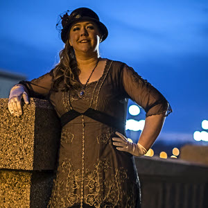
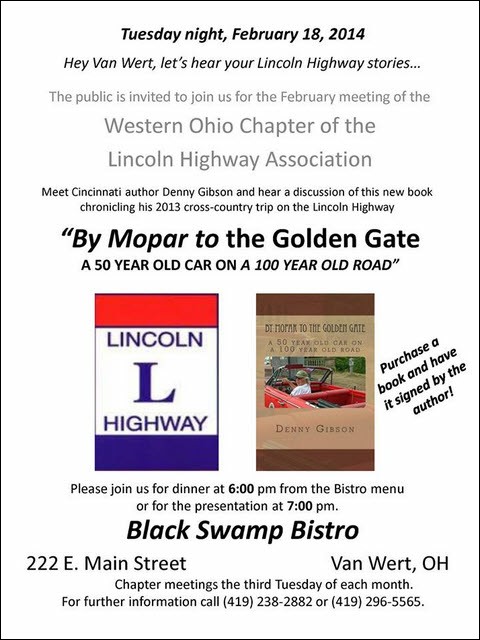
 When the Lincoln Highway Association was reborn in 1992, Ohio’s organization took the form of three chapters operating as a “league”. However, until late last year, that was on paper only. In October, a West chapter was formed to join the existing East and Central chapters and Larry Webb was elected its first president. Larry knows my cousin who lives in Van Wert and one day she mentioned my recently published book to him as something he might be interested in. He ordered his own copy and gave me a call after he’d looked it over a bit. He asked if I was making presentations related to the book and I answered, “No, but I probably should be.” He then offered up the recently formed chapter as “guinea pigs” at their next meeting on February 18. Although I put him off for a bit, I eventually agreed and found myself asking, in a conversation with myself, “Just what have you gotten us into now, Bunkie?”
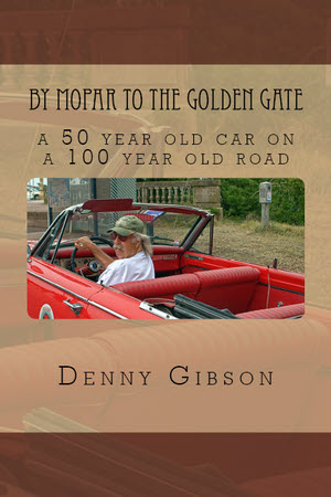
During my working days, I had spoken to a few small groups but was never very comfortable with it and it was a long time ago. The book in question is By Mopar to the Golden Gate which tells of a cross country drive on the Lincoln Highway which is why a Lincoln Highway Association group was interested. It contains a lot of photos and I had taken many more on the trip so that’s where my planning headed. A few pictures would help a bunch. Not only would each one reduce my speaking requirement by a thousand words and give the audience something to look at, they could be my notes. With a little time to refresh myself on dates and such, I could rattle on about some pictures I’d taken without a teleprompter or learning a lot of new stuff.
I started browsing through my pictures and, at the same time, started looking for a way to present them. Larry had told me a projector and screen would be available that I could (hopefully) run from my laptop. I looked at a few slide show programs and ended up settling on OpenOffice Impress, a free PowerPoint-like application. It allowed me to add information (reminders) to photos as well as create non-photo slides to provide other information.
I made a pass through the photos picking out candidates. I reduced this rather large list to about 125 photos that I thought might be good for some presentation then to about 50 that I thought would be good for this presentation. I recorded myself going through things a couple of times to get a handle on the length and to determine where my memory was going to need more help than a photograph provided. I made up a couple of slides with some general statistics and other items. I decided I was as ready as I was going to get.
When I’m on the road, leaving a motel is often a slapdash sort of thing. Half the time I’m packing up the power supply while my computer is doing its shutdown on batteries. As I got ready to leave home on the day of the presentation, I took no short cuts and made sure everything shutdown in the right sequence. I drove to Van Wert and, as soon as Larry arrived, carried my computer in and turned it on. “Gotcha!”, it said. Or something along those lines that meant things are not right and I’m going to run a disk check. It ran the check, it fixed a thing or two, and it completed powering up. All was well and any risk of me becoming too relaxed during the evening was effectively eliminated.
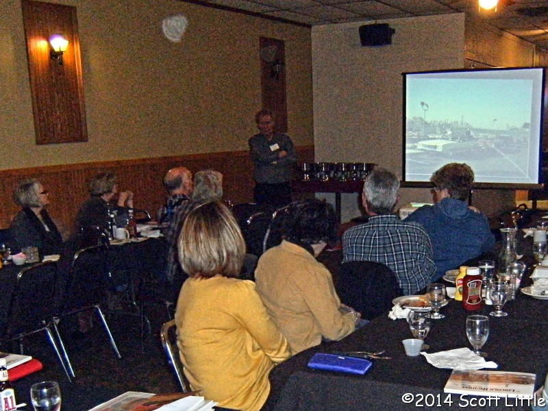
 All really was well. Not only did the computer function properly, so too, within limits, did I. The audience of approximately twenty-five was just about perfect. They knew enough about the Lincoln Highway to be interested but not enough to be bored. There was even applause, which is something I’m not at all familiar with, at the end and their interest was further demonstrated through several very good questions. It remains to be seen whether I do any more presentation of this sort but I survived this one and even enjoyed it. For me, the primary purpose was to get some experience and not to sell books but I did sell some. Four copies were sold and a few more placed on consignment with the canal museum in Delphos. Add to that the fact that I arrived in Van Wert early enough to take advantage of a $1 pie sale at Balyeats (apple) and that I spent the night and chattered away the next morning with friends who came to the presentation and I count this as a darned good trip.
 This book has thousands of words, many with multiple syllables, and dozens of pictures in 50+ shades of grey. It tells the story of an old man in an old car on an old road and is available
 Carl Fisher was a busy man in 1913. His Prest-O-Lite Company and his automobile dealership were both going great guns, the Indianapolis Motor Speedway he co-founded looked like it might amount to something, the Ocean-to-Ocean Rock Highway he had proposed in September of 1912 was taking off, and then there was the Indiana Automobile Manufacturers’ Association.
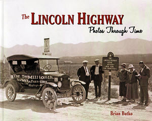 I was hesitant to post a review of this book because some of those “Photos Through Time” are mine but I decided that it would be a bad thing only if I rave about how marvelous the book is. No harm in simply describing it, right? So here are the facts.
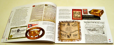 It is organized neither geographically nor chronologically. The first section following the foreword is titled “History”. Here, among pictures of collectibles and artifacts, Butko gives a very brief history of the road’s birth and short life. It is enough to give someone who knows little or nothing about the Lincoln Highway a starting point and someone who knows everything a quick refresher on key dates and events. It is a stripped down but adequate introduction to the pictures that follow.
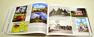 Those pictures are organized by their subjects. Butko identifies ten things that comprise the Lincoln Highway and gives each one a chapter. They are “People”, “Gas”, “Food”, “Lodging”, “Vehicles”, “Attractions”, “Signs”, “Markers”, “Bridges”, and “Roads”. The chapters are themselves samplers. Historic images from postcards and other sources are combined with modern photographs. Images of things along the road, which is every chapter other than “People”, are from locations spread over the road’s entire length.
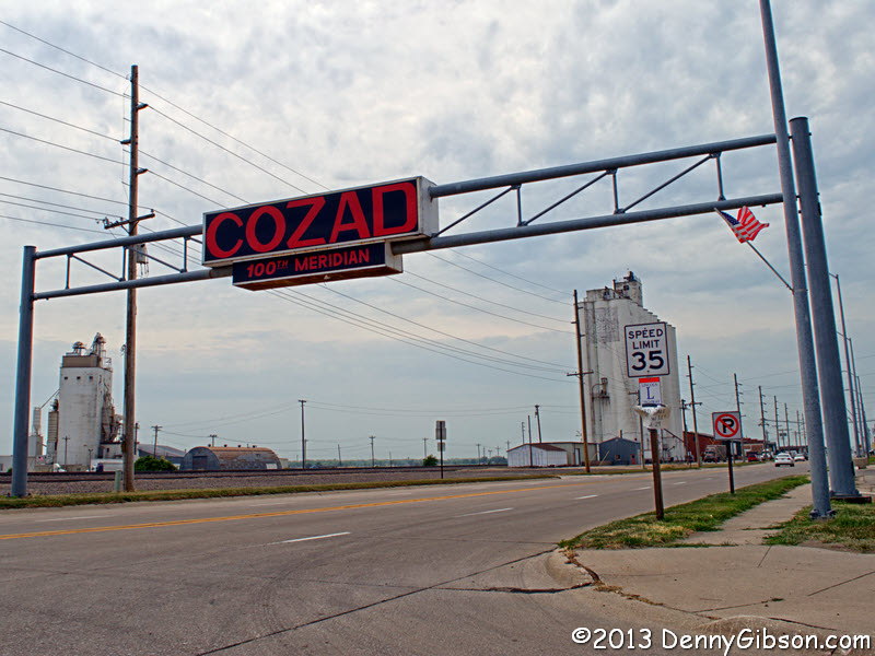
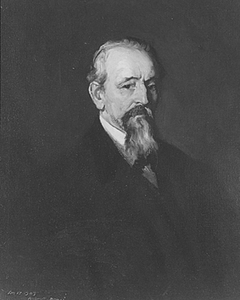 John A. Cozad, a.k.a. Frank Southern, eventually went back to his real first name and became, as Dr. John Southern, a well respected physician in Philadelphia. Robert Henry Cozad retained a slightly modified version of his Atlantic City alias and went on to great fame as an artist. His childhood home in the second town his dad founded is now the
 The Lincoln Highway turns a hundred this year. Brian Butko’s Greetings from the Lincoln Highway turns eight. At first glance, the 2013 Greetings… looks an awful lot like the 2005 Greetings… with a soft cover and a “Centennial Edition” banner on the front and it’s a fact that, in many ways, it is the same. It has the same organization with an introductory chapter and a chapter, with map, for each state the highway passed through and a very high percentage of the words and pictures in those chapters are the same, too. Another thing that remains the same and which accounts for the small in percentage but large in number changes is the care and attention to detail. Butko probably didn’t catch everything in the book that the passage of time has altered but he sure tried and he sure got a lot.
 Aside from the occasional new photo, the most visible changes may be in the statistics and maps at the front of each state chapter. Here population numbers from the 2010 census replace those from the 2000 census and the maps get a line for the Proclamation Route. The Lincoln Highway Proclamation Route was a list of cities published by the Lincoln Highway Association on September 14, 1913. Shifts started happening almost immediately and a detailed route was never signed or published that matched the September 14 announcement. But several of the cities dropped in 1913 fought unsuccessfully to return and many have fought more recently and more successfully to be recognized. Butko acknowledges that by including the ephemeral route. All of the quotes from postcards and other period communication that appeared in the margins of the original are still there and a few more have been added.
 I’m reading this book for the third time. I read it around 2005 when I was dabbling with short drives on the Lincoln Highway to my east. I reread it in 2009 when I was getting ready to drive the Lincoln from the east edge of Illinois to the west coast. My current read is in anticipation of another long, hopefully full length, drive of what Drake Hokanson calls Main Street across America. I never read the original, only the pictured Tenth Anniversary Edition which is now fifteen years old itself.