 The question was never if there would be another book, just when and what. The answers are “now” (actually February) and “toll gates”. In my review of Cyndie L. Gerken’s first book, Marking the Miles Along the National Road Through Ohio, I noted that the huge amount of information presented in that book was only a portion of what Gerken has collected and that we would probably someday see “a Gerken penned treatise on bridges or taverns or toll houses or something else” which shows that taking three or four guesses really improves one’s chances of being right. Nailed it!
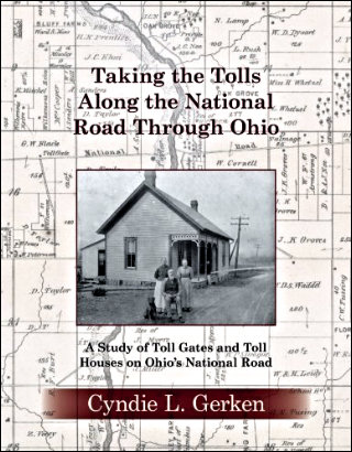
Taking the Tolls Along the National Road Through Ohio: A Study of Toll Gates and Toll Houses on Ohio’s National Road duplicates the form of Gerken’s first book. Both are rather large paperbacks. Both books are also filled with accurate and precise information, but that part’s not duplication; That’s just what Gerken does.
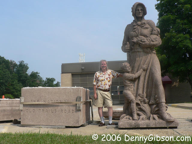
Federal funds for building the National Road dried up somewhere around Springfield, Ohio. Federal funds for maintaining it seem to have never existed. The “Gates Bill” of 1822 was a valiant attempt to finance ongoing maintenance through federally operated toll gates, but President Monroe vetoed the bill. At the time, the role of the federal government in internal improvements was a hotly debated topic. Regarding the power to establish and collect tolls, Madison was “…of the opinion that Congress does not possess this power…” The Feds solved the problem by giving the road to the states. The states solved the problem by charging to use the road. Sometimes the state charged the users directly by collecting tolls. Sometimes the state leased sections of the road to counties or even privately owned companies who then collected tolls.
In Ohio, things got started with seventeen toll gates which were soon augmented by three half gates. One thing this book taught me is that half gates are not, as I convinced myself, gates where a toll is charged in only one direction (Hey, it’s not that dumb!), but gates placed between full gates to catch traffic entering and leaving the road without paying any toll at all. Over the years, individual gates were moved and closed and new ones added.
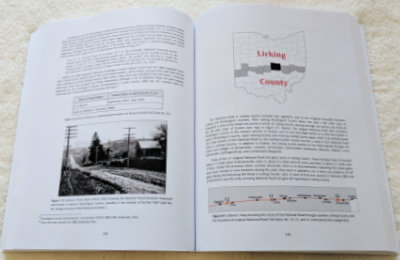 As she did with her first book, Gerken details her subject in a chapter per county moving east to west. However, before that happens, there is an introduction filled with information about the road and toll gates in general, then chapters on vehicles, toll house architecture, and bridges. Each of these, and the county chapters too, contain numerous photos and stories that color in the detailed information and keep things from becoming boring.
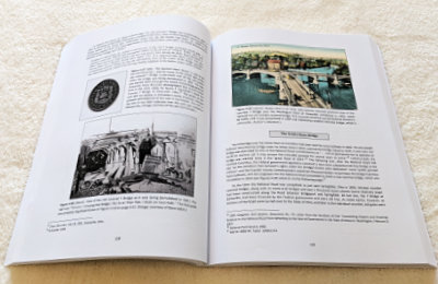 Pictures of gate houses and gate keepers are to be expected, but they are not the only photo subjects presented. This might be the only book available with pictures of the world’s longest bar, grave robbers, a two-headed calf, a Spanish dime, Hopalong Cassidy, and the author’s mother riding in a goat cart. And every one of them belongs.
People almost always keep things from being boring, and Gerken didn’t just compile data on buildings and locations. She dug up facts and stories on the people who occupied those buildings. Although much of that information is sprinkled throughout the book, even more is concentrated in a chapter titled “Meet the Gate Keepers” that follows the county chapters.
At this point, the book could be called boring without triggering a big argument from me. It is here that Gerken lists her numerous references and places several appendices of source material for rates, dates, and so on. Because of Gerken’s thorough research, the entire volume is certain to find work as a reference book but that is especially true of the last fifty or so pages. Three hundred pages of a nice blend of information and entertainment followed by fifty pages of “just the facts” is a pretty good mix.
Taking the Tolls Along the National Road Through Ohio: A Study of Toll Gates and Toll Houses on Ohio’s National Road, Cyndie L. Gerken, CreateSpace Independent Publishing Platform, February 8, 2018, 11 x 8.5 inches, 366 pages, ISBN 978-1981653515
Available through Amazon.

 Friday’s date was eleven eleven. I spent the day at the 2016 Los Angeles Route 66 Festival where the ninetieth anniversary of Route 66 was celebrated. November 11, 1926, was when the United States Numbered Highway System was officially approved so US 66 did indeed come into being on that date but so did another 188 routes. I’ve always thought the big deal some folks make of Sixty-Six’s “birthday” to be somewhere between silly and chauvinistic. Sort of like New Hampshire celebrating its independence — and only its own independence — on the Fourth of July.
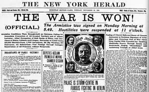 But November 11 was an actual national holiday well ahead of the creation of the United States Numbered Highway System and it marked something more meaningful than identifying one nation’s roads. When I started to school in 1953, November 11 was known as Armistice Day. During the next year, the name was officially changed to Veterans Day although people around me didn’t start using the new name immediately. Nor did they immediately embrace the new definition. Armistice Day marked the anniversary of the end of The Great War on November 11, 1918. It began in England but soon spread to virtually all the allied nations. Two minutes of silence — one minute to remember the 20 million who died in the war and a second minute to remember those left behind — at the eleventh hour of the eleventh day of the eleventh month was an important part of the day. Things started changing when the world had another “great war” and had to start numbering them. England and many other nations changed the name to Remembrance Day to include those lost in both conflicts and, as I mentioned, the United States changed the name to Veterans Day. This may be when we began observing a single minute of silence on the day or maybe it was always that way in the US. We observed one minute of silence at the festival.
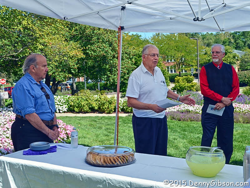
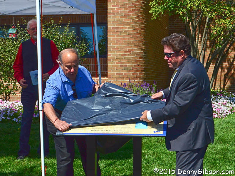
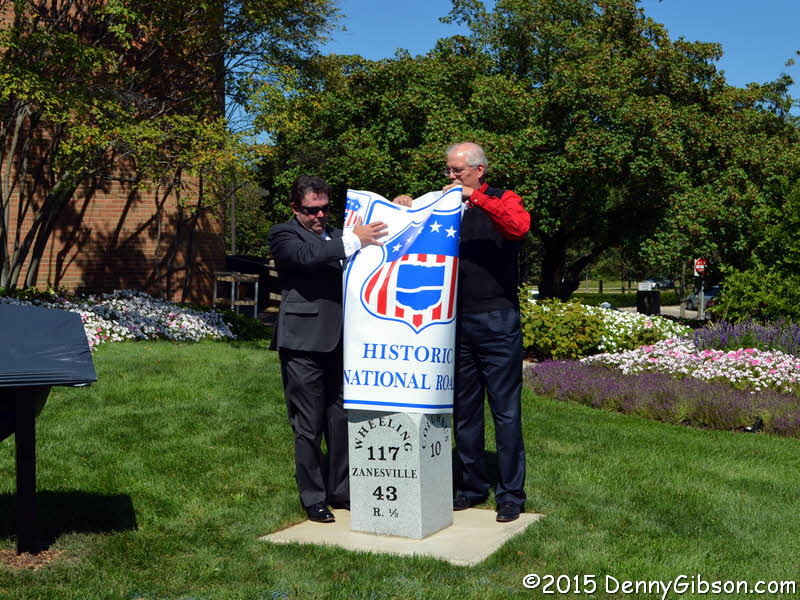
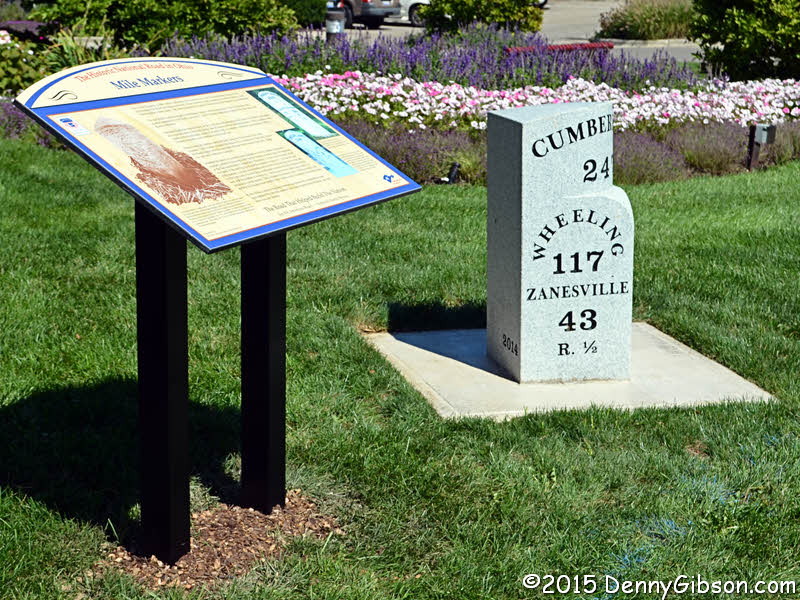
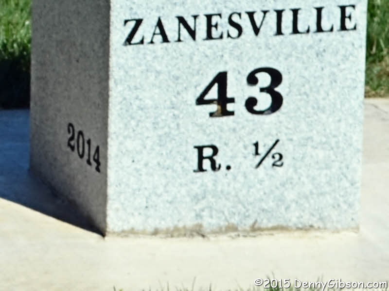
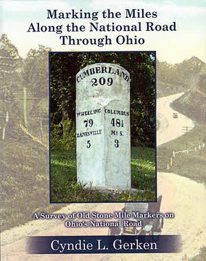 That’s a pretty long book title. There’s a subtitle, too, which makes the whole thing Marking the Miles Along the National Road Through Ohio: A Survey of Old Stone Mile Markers on Ohio’s National Road. It’s long because it, just like the book it identifies, is accurate and precise. The book accurately and precisely locates the 175 mile markers originally set, as accurately and precisely as early nineteenth century technology and local politicians would allow, beside the Ohio portion of the very first federal highway. With all that accuracy and precision you might think this volume would be completely dry and boring but that’s not the case. Stories about the road, the countryside, and even the markers themselves lighten and soften things considerably. Color photos and maps make the book attractive.
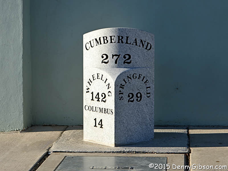
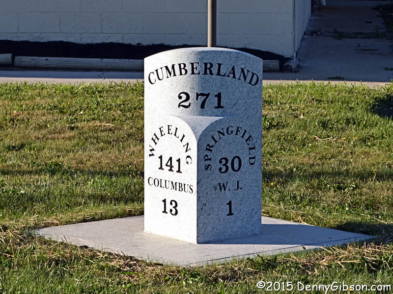
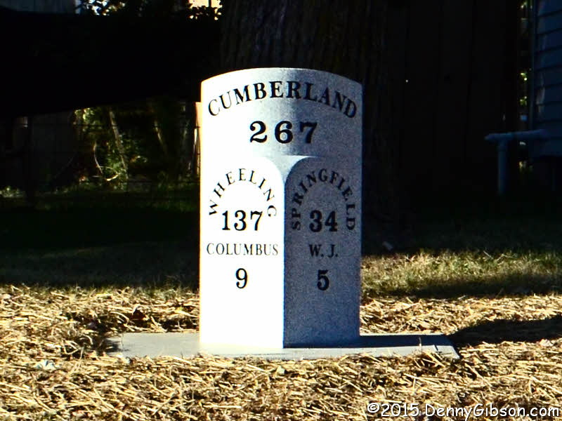
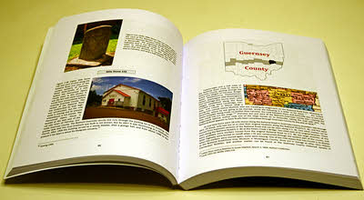 Seven of the ten Ohio counties through which the National Road passed are covered in individual chapters following the introduction. No markers were ever placed in the three westernmost counties on the route as federal funding ended near Springfield in Clark County. Each of these chapters begins with an overview of the county that includes a summary of how many original markers there were, how many remain at their original location, how many exist elsewhere, and how many are lost. Each marker is then addressed individually. With few exceptions there is at least one picture. If a given marker survives, a current photo is included and one or more historical photos are usually presented regardless of whether or not the marker is still around. Understandably, markings on many of the older stones are not exactly legible. Not to worry. Appendix B contains crisp drawings of the inscription of every marker. Markers can often be seen, accidentally perhaps, in old postcards and other photos and many of these appear in the book. Each marker’s history is given and stories about the marker or the area around it frequently add a little fun and background. Placed among the individual marker descriptions are sections of US Geological Survey 7.5 minute topographical maps showing the location of the markers three at a time. Other National Road related landmarks are often shown on the maps as well.
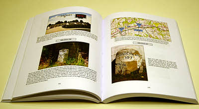 Bringing all of this information together is clearly a major accomplishment but Gerken, a past ONRA president herself, says the information is only a portion of what she has collected on the National Road in Ohio. A well deserved breather follows wrapping up Marking the Miles Along the National Road Through Ohio. Nothing is currently scheduled or promised but the future could see a Gerken penned treatise on bridges or taverns or toll houses or something else. I certainly hope so. I like accuracy and precision and I also like anecdotes and insight. Marking the Miles… provides a pretty good mix.