
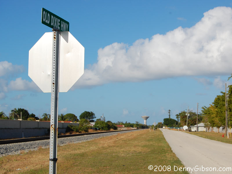
 A recent Facebook post reminded me of some roadside markers I’ve been meaning to check out since 2012, and another post made me newly aware of some totally unrelated markers in the same general area. That area also happens to contain a restaurant that’s been on my to-do list for over a year. In these days of dissolved and dissolving travel plans, this trio of minor roadside attractions was sufficient justification for a correspondingly minor road trip. Although not one of the three has any real connection to the Dixie Highway, it once ran by all of them.
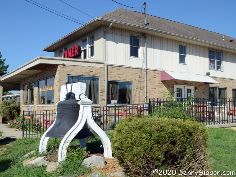
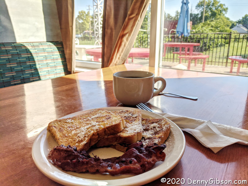
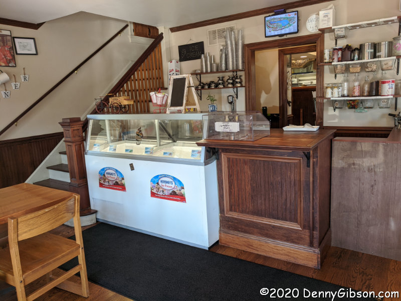 The restaurant came first. I first learned of the Fantasy Diner and Ice Cream Parlor from a January 2019 Ronny Salerno blog post. The name comes from its home in what was once the gift shop for the Fantasy Farm Amusement Park. Ronny’s post not only does a much better job than this one in documenting the restaurant but also provides some park history. There are a couple of reasons that I wish I had refreshed my self on Ronny’s post before I left home. One is that I’d have been shocked to find that the great looking wooden counter he photographed has been largely sacrificed for an ice cream cooler and would have at least asked about it. The second is that I might have changed the timing of my arrival in order to try the fried chicken he called “fantastic”. But I was there for breakfast and quite enjoyed my French toast with a view.
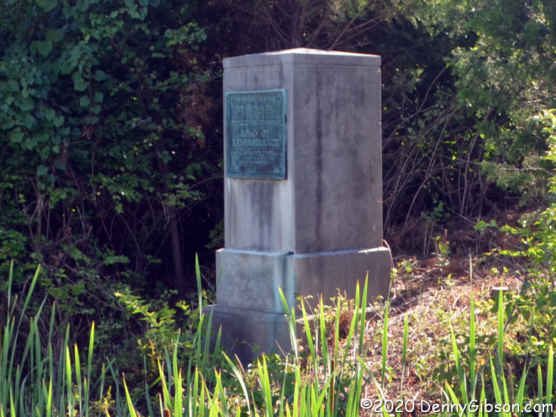
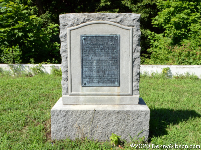
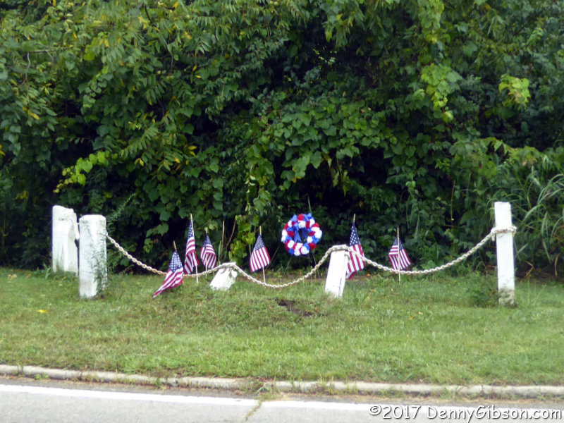
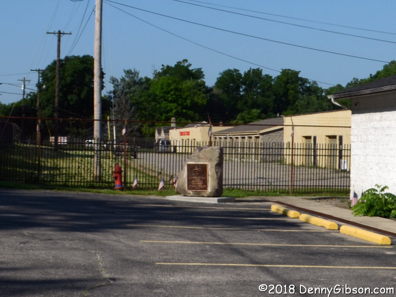
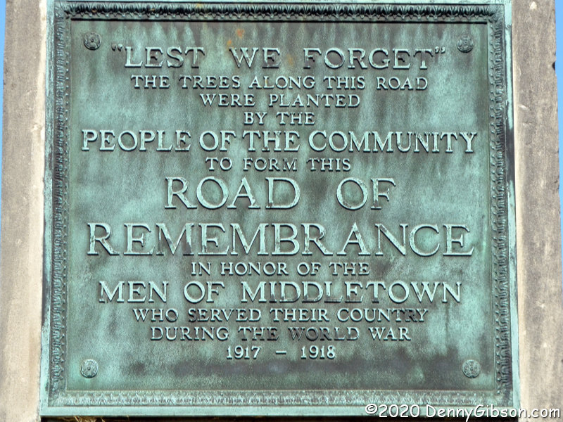
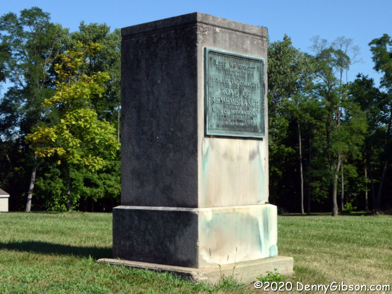 Following breakfast, I continued north on the former Dixie Highway to Middletown and made a stop at a marker I’d first noticed eight years ago. The marker is from 1920 when it was erected as part of a Road of Remembrance project. The Road of Remembrance was a proposal to plant a tree for every American soldier who had served in the Great War. A matching marker can be seen almost directly across the road in the second picture and up close in the third. The plaques on both markers look like this. These currently stand near Truth Tabernacle on OH-4, but originally marked the south end of Middletown’s Road of Remembrance a short distance away.
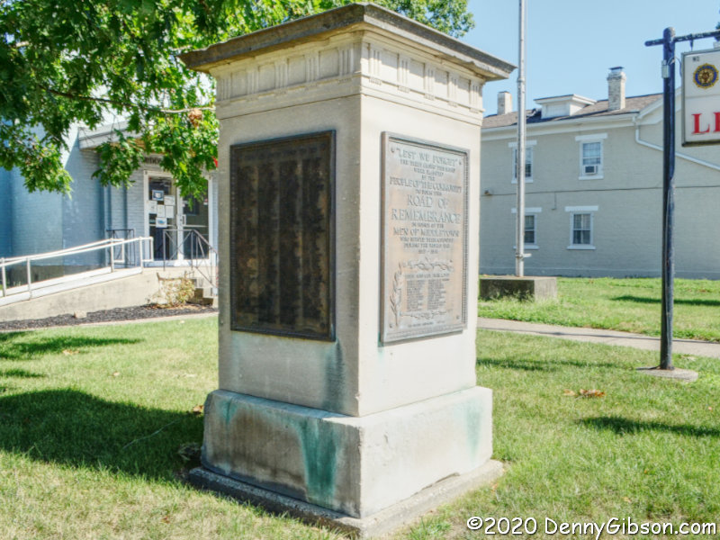

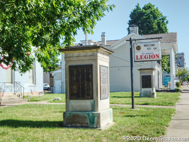
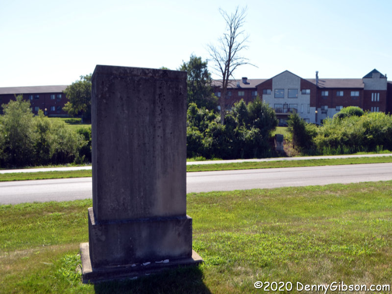
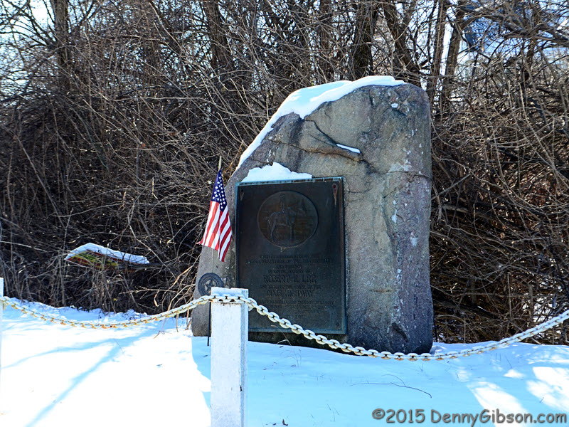
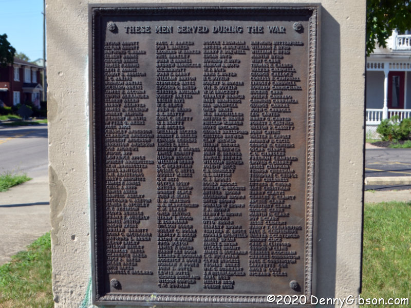 Another pair of markers once stood at the north end of the long rows of trees. Both are shown in the opening photo standing in front of the local American Legion Post. Identical plaques, bearing the names of twenty-four local boys killed in the war, are mounted on the front of both markers. The names of more than a thousand who served in the war are on six plaques mounted on the other sides of the pillars.
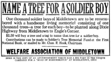 References to the Middletown Road of Remembrance often mention a thousand trees lining a mile of roadway. Both seem to have been considerably exceeded. The markers that now stand at the Legion, originally stood at 14th and Main. The southern markers originally stood about a mile and a half away at Oxford and Main. Plans to construct arches over the road where the markers stood were mentioned, but I’ve seen nothing to indicate that ever happened. Middletown’s Road of Remembrance was dedicated on Labor Day, September 6, 1920, and there are possibly legitimate claims that this was the nation’s first Road of Remembrance to be completed. The ad image is from American Forestry, Volume 26.
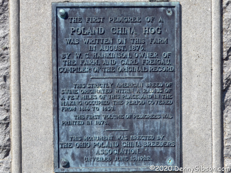
 The day’s third set of targets was on a later Dixie Highway alignment which I turned south on when I reached the split near Franklin. This photo is not of an active target, but when you are looking for things on the DH and not in the least related to it, this marker certainly qualifies. I’ve previously stopped and photographed this salute to the Poland China hog, and I did it again.
 The real goal of my drive on the later DH alignment was a couple of Great Miami Turnpike mile markers. The turnpike was constructed in 1840 so the markers have been waiting quite a while. I learned of them only recently through a Dixie Highway Facebook group post by road fan Karl Howat. I’d already located and taken a drive-by photo of the southernmost of the two and thought I knew enough to find the other one as I drove south. I was wrong. I visually scoured the roadside as I drove but came up empty. I eventually reached the marker I had already located and parked nearby to take some less blurry photos. According to the markings, C(incinnati) is 17 miles away and D(ayton) is 33 miles away. The current name of this path that has had many is Cincinnati-Dayton Road.
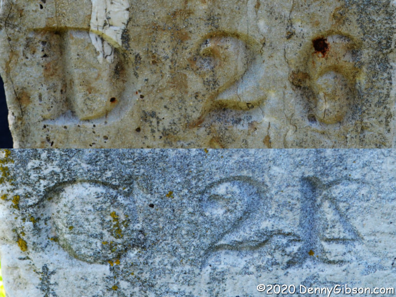
 I headed back north in search of the other marker and found it with a fortuitous and pretty much accidental glance to the right. Karl had posted photos of both markers and I could see that both were made to be placed on the west side of the road. Northbound travelers would see the distance to Dayton and those headed south would see the distance to Cincinnati. It appears that this marker switched sides at some point in its past. But that’s not the most interesting thing about it. Perhaps understandably, when I first saw the marker, my mind registered D 26 and C 24. But I quickly realized that the 4 my mind saw was reversed and that it must really be the number 1 with some accidental scratches beside it. That, however, would mean this stone claimed that Dayton and Cincinnati were 47 miles apart rather than the 50 indicated on the other marker. I next tried to mentally convert that 6 to an 8 to make the distance a closer match at 49 miles. That didn’t work and I became pretty certain that the numeral was a 6. A one mile difference between the two stones seems possible if not likely. A three mile difference seems very unlikely and I’ve become convinced that the carver goofed and carved the 4 in backward. Form your own opinion from this composite or go check out the original at N39° 25.809′ W84° 21.947′. The other marker is at N39° 20.126′ W84° 24.144′.
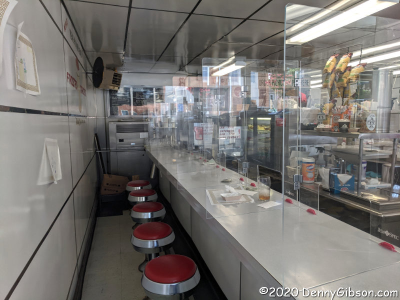
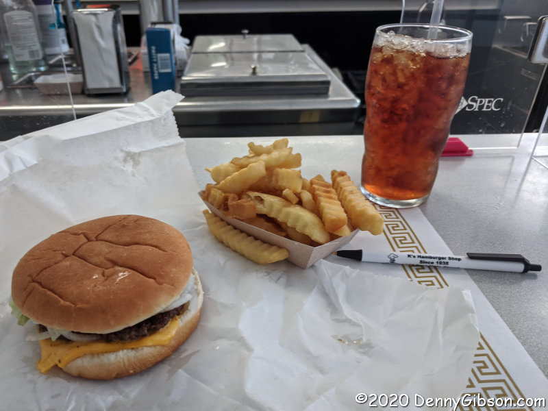
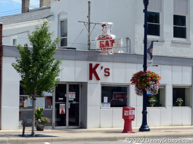 For the second consecutive week, here’s a diner tacked on to the tail of the primary subject. K’s Hamburger Shop isn’t exactly on the Dixie Highway but it’s less than two blocks away and that’s close enough for Mike Curtis to include it as a POI on his Dixie Highway Map. Plus there are some unverified rumors that a temporary DH alignment ran right past the location (even though it wasn’t K’s yet). DH or not, they celebrated their 85th anniversary Friday and I was there. They were totally closed for eleven days due to the COVID-19 pandemic, then open for carryout only. Three weeks ago, with the addition of some fancy plexiglass dividers, dining in became an option. Says Marcia, the owner, “My parents kept this place going through the depression and we’ll keep it going through this pandemic.”
Booths are separated by fixed panels and the panel separating counter customers and staff is fixed, but the panels between individual counter positions are hinged so that couples can chat and sneak fries from each other. Panels and everything else are sanitized frequently, of course. The only not-yet-cleaned spot in the counter picture is where I just finished this. Among the many articles written about K’s over 85 years is an American Road Diner Days installment from an unknown (both then and now) writer. Winter 2007 if you’re a curious collector of old magazines.
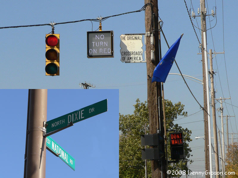
 Seeing things like signs, banners, and menus for local businesses bearing the logo of some large corporation is quite common. Details vary but the basic model is that the big corporation shoulders some or all of the cost and the small business gets some advertising for little or nothing. The idea is hardly new and the concept has never been restricted to purely commercial enterprises. During the last half of the 1920s, a pairing of this sort existed between a major highway and an American hereditary association. The major highway was, of course, the Dixie Highway. The hereditary association was the
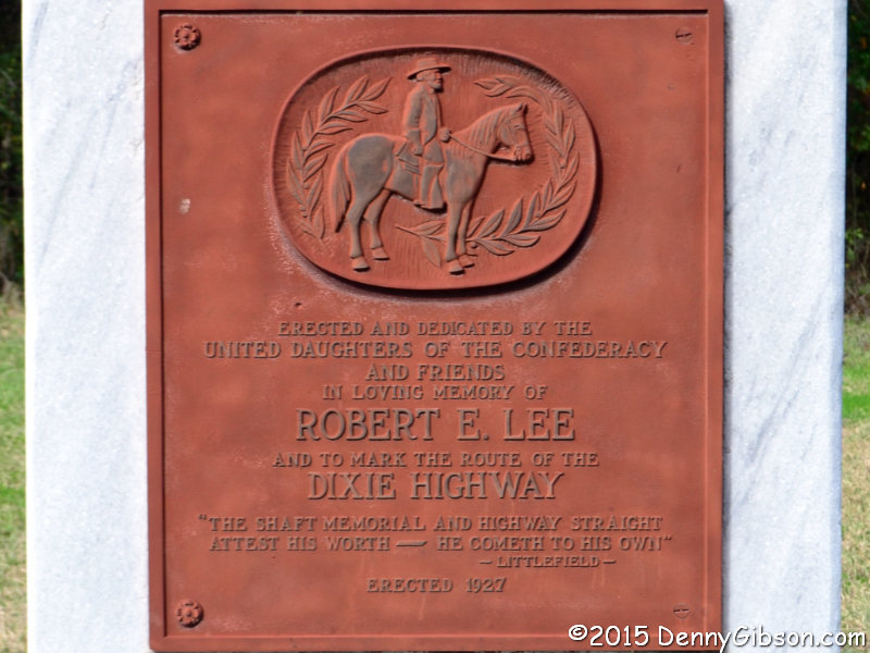
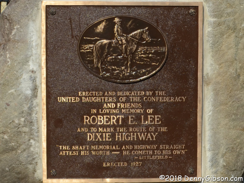
 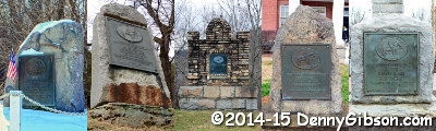 The UDC was the “advertiser” in this instance. Between 1926 and 1935 the organization was responsible for at least ten plaques being erected beside the highway. It’s unclear whether or not the Dixie Highway Association was an active participant in this arrangement. Because the 1926 creation of the United States Numbered Highway System brought an end to all of the named auto trails, the DHA was not very active at this point.
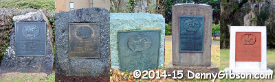 Combined, the previous picture and the one at right show the ten plaques in north to south sequence. The northernmost marker is in Ohio, the southernmost is in Florida, the one preceding it is in South Carolina, and the others are in North Carolina. Except for the date erected, eight of the plaques are identical. The one in Florida contains the same text as those eight but has a different image of Lee. The one in South Carolina contains different text but has the same image as the bulk of the plaques.
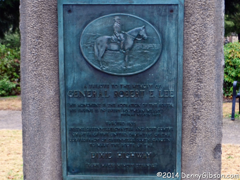
 If something called a dixie existed, I have little doubt that we could refer to it differently without changing its aroma, but the word “dixie” doesn’t really identify anything. It is not, in other words, a common noun. As a proper noun — with a capital ‘D’ — it is used as both a surname and a given name and to identify a wide variety of things including a region of our country. People with a first, last, or nickname of Dixie surely outnumber things bearing the name but there are certainly plenty of those. It has been used to identify buildings, songs, currency, music groups, towns, counties, movies, beer, boats, ships, taverns, race tracks, waterways, restaurants, mountain ranges, athletic conferences, grocery stores, airports, schools, universities, and much more. With an ‘X’ made of a stylized flower, Dixie is a registered trademark of Georgia-Pacific for a brand of paper products.


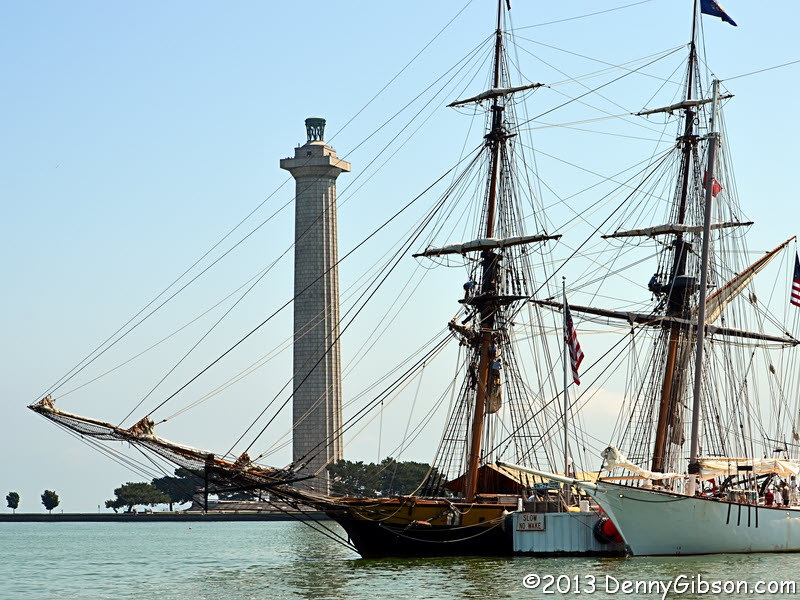
 I’m off to Georgia and I’m driving an entire US highway to get there. I’ve had the idea of driving all of US-25, which now ends/begins at the Ohio River, for several years. As I was weighing ideas for this year’s Christmas Escape Run, I finally took a look at what was at its other end and I liked what I saw. Brunswick, where the highway actually ends, has some history and so does nearby Jekyll Island.
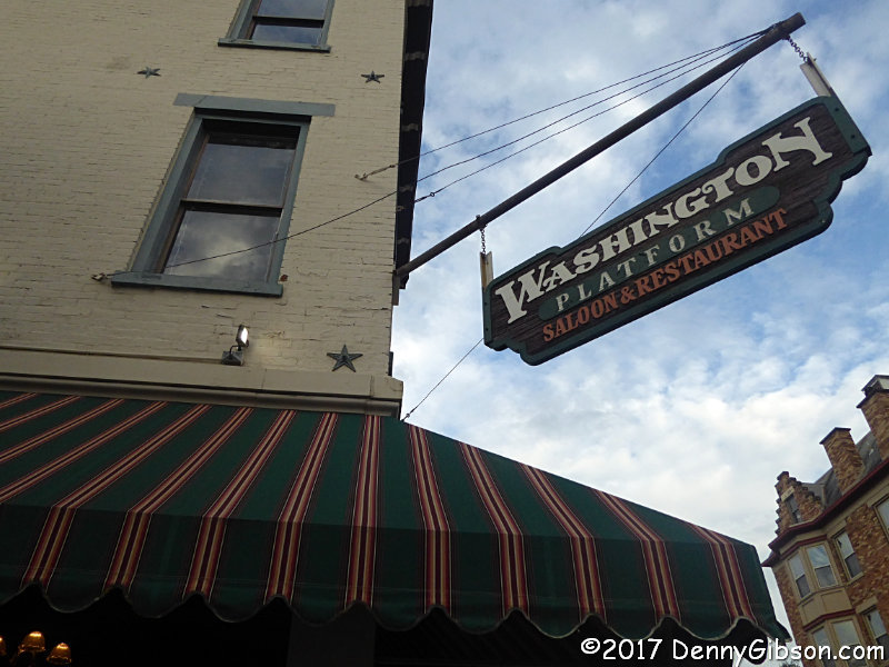