
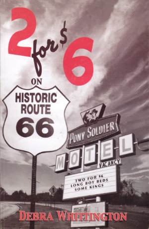
 I wish I had $6 or even 6¢ for every time I’ve stood by an old motel or diner and wished that the aging walls could talk. There are no talking walls here but 2 for $6 on Route 66 does contain the memories of someone who spent a whole lot of time with some very interesting walls. Author Debra Whittington married into the motel business; The man she married was born into it.
In 1954 Mark Whittington’s parents built a motel on the west side of Tucumcari, New Mexico. They sold it after a few years, but before the decade was over they were building another one on the east side of town. Mark went off to college, met Debra, and the two were married just about the time he graduated. Another motel came up for sale just a few days before the wedding and Mark’s dad, thinking it would be a good business for the young couple, bought it. With little notice and less input, Debra found herself more or less in charge of a motel where she would interact with travelers on Historic Route 66 for nearly thirty years.
2 for $6… is divided into two main parts. Whittington calls the first part “History of the Area”. The subject area is centered on Tucumcari and the history includes that of Tumcumcari’s main drag, US-66. Some of what’s written here will be familiar to anyone who has looked at all into the history of Sixty-Six and other early highways but it is necessary background for the local details that Whitting relates. Many of those details she gathered from people who lived in Tucumcari long before she arrived. I personally enjoyed references to the town’s two Ozark Trails markers and descriptions of early cars and campgrounds.
Things get more personal in the book’s second part, “One Family, 50 Years in the Motel Business”. The first few chapters of this section give the history of the Whittington family’s motel experience before Debra arrived. It starts with that first motel, the Golden W, they built in 1954. Then on to the second, the Sahara Sands, built in 1959. The motel’s name and giant sign came from a motel in Amarillo, Texas, that was turning into a Holiday Inn.
The book’s name comes from the Sahara Sands period. A rash of motel construction in the mid-1960s resulted in Tucumcari having more rooms than tourists. During a 1965 price war, a hand-painted “2 for $6” sign went up in front of the Sahara Sands. A photo of the sign, which still exists, is in the book.
The motel that was purchased in 1978 was the Pony Soldier. It was built in 1964. Once Debra has described the extensive work that went into getting it ready to reopen, she proceeds to share lots of stories of her time there. What results is a picture, painted from the inside, of operating an independent motel in one of Historic 66’s hot spots. It’s funny, sad, scary, and heart-warming. It might be similar to pictures that could be painted of many other motels but it’s Debra’s picture and it’s unique. And it exists. the inside story of most of those other motels haven’t been recorded and probably won’t be.
2 for $6 on Route 66, Debra Whittington, 2015, 8.6 x 5.5 inches, 140 pages
I believe the book is available in several shops in Tucumcari. I bought my copy in the coffee shop at the Historic Route 66 Motel. According to a review at Route 66 News, the book is available direct from the author “by sending $10 plus $3 shipping in the U.S. in check or money order to Debra Whittington, Debra Whittington, 923 S. Hawthorne St., Tucumcari, NM 88401″

 Friday’s date was eleven eleven. I spent the day at the 2016 Los Angeles Route 66 Festival where the ninetieth anniversary of Route 66 was celebrated. November 11, 1926, was when the United States Numbered Highway System was officially approved so US 66 did indeed come into being on that date but so did another 188 routes. I’ve always thought the big deal some folks make of Sixty-Six’s “birthday” to be somewhere between silly and chauvinistic. Sort of like New Hampshire celebrating its independence — and only its own independence — on the Fourth of July.
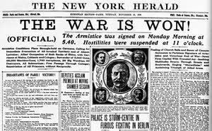 But November 11 was an actual national holiday well ahead of the creation of the United States Numbered Highway System and it marked something more meaningful than identifying one nation’s roads. When I started to school in 1953, November 11 was known as Armistice Day. During the next year, the name was officially changed to Veterans Day although people around me didn’t start using the new name immediately. Nor did they immediately embrace the new definition. Armistice Day marked the anniversary of the end of The Great War on November 11, 1918. It began in England but soon spread to virtually all the allied nations. Two minutes of silence — one minute to remember the 20 million who died in the war and a second minute to remember those left behind — at the eleventh hour of the eleventh day of the eleventh month was an important part of the day. Things started changing when the world had another “great war” and had to start numbering them. England and many other nations changed the name to Remembrance Day to include those lost in both conflicts and, as I mentioned, the United States changed the name to Veterans Day. This may be when we began observing a single minute of silence on the day or maybe it was always that way in the US. We observed one minute of silence at the festival.
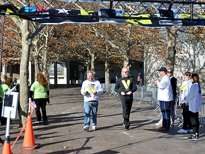
