There are twenty “Underrated Attractions in Cincinnati” identified in the CityBeat article that motivated me to visit the Lucky Cat Museum last week. With that museum visit, I could count thirteen of the twenty as things I have seen. There are a few more that I will probably get to before long and a couple of others that I have little interest in. I thought it highly unlikely that I would ever experience one listed attraction despite being interested in it very much. “Stricker’s Grove“, the article said, “is closed to the public…”. It could be rented for private events but, unless I could get myself invited to somebody’s company picnic, it seemed I was out of luck.
Then, barely a week after the CityBeat article appeared, I saw another article announcing that the park would be open to the public on July 4th. I had, I now realized, stopped reading that opening sentence too soon. “Stricker’s Grove is closed to the public for most of the year”, is what it really said. It is actually open to all on a handful of days each year and Independence Day is one of them.


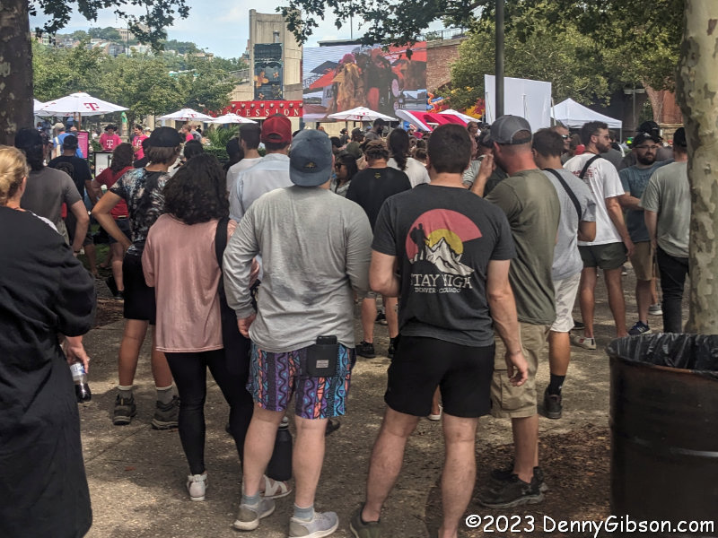
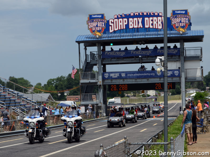
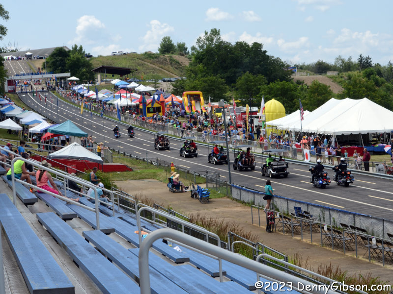
But the amusement park next to cornfields and a two-lane state highway would not open until 2:00 o’clock. I filled the morning and put myself in the general area by attending the Fourth of July parade in Hamilton, Ohio.
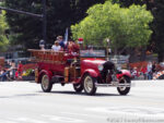

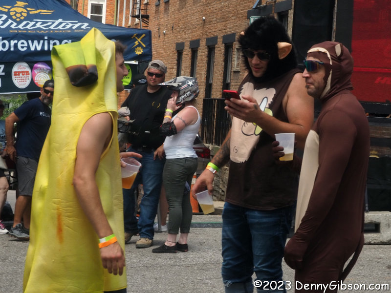
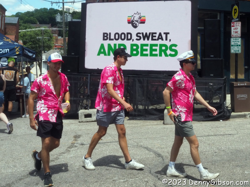
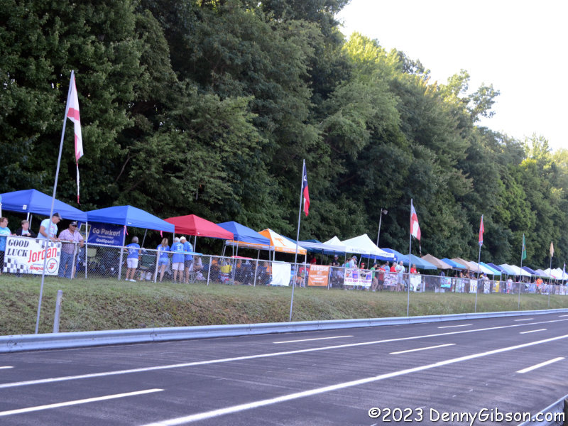
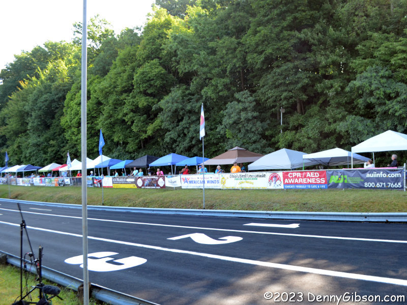
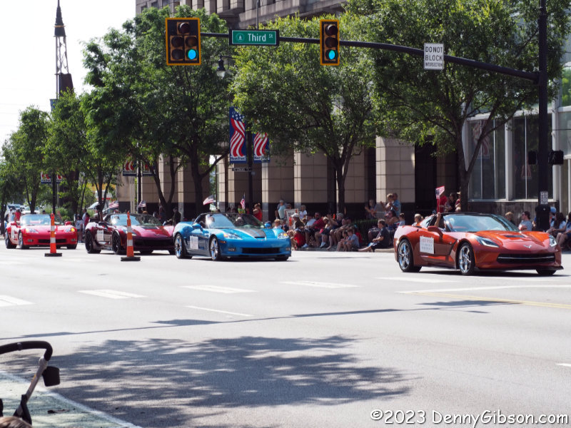
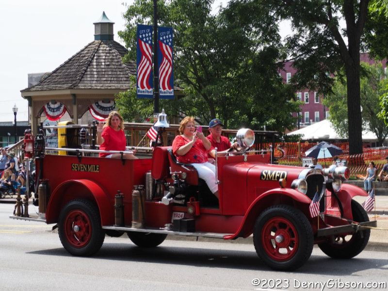
This parade was significantly different from the only other parade I recall attending in Hamilton. That was the Short, Sweet, Wet, and Irish inaugural Saint Patrick’s Day parade held earlier this year. That parade had just one fire engine and, with a route length of approximately 575 feet, barely had room for it. This parade route was well over two miles long with several fire department vehicles including a couple of real classics.

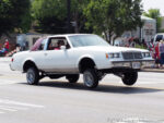
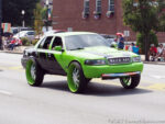
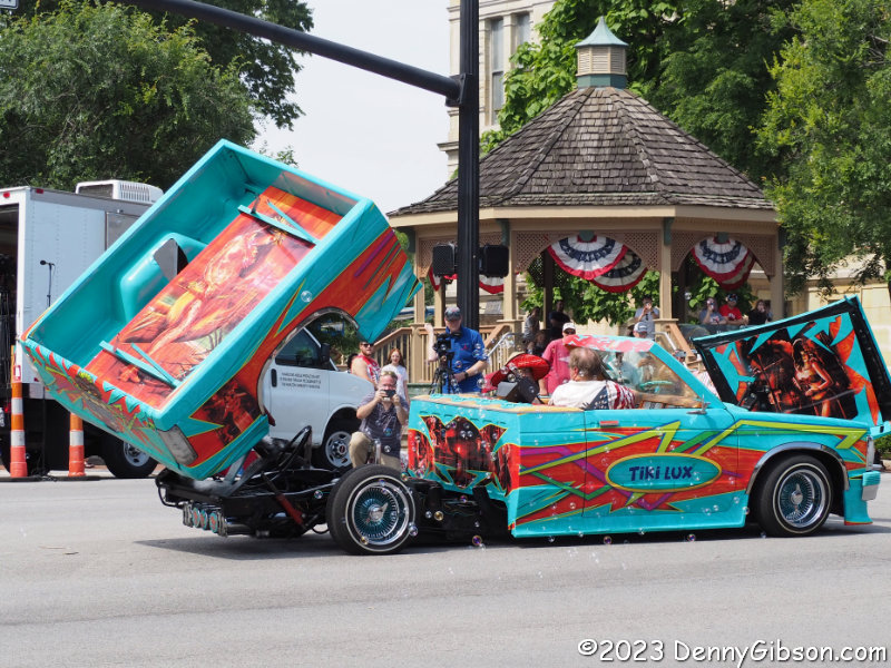
The Corvettes and firetrucks did not surprise me but the low riders did. And it wasn’t just one or two. The number of these incredibly tricked-out cars rivaled the number of Corvettes and they jumped higher, too.

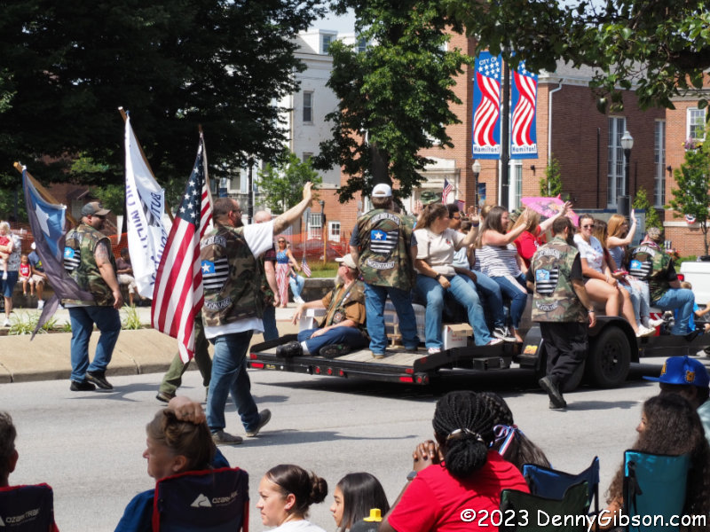
I was also surprised by this group’s presence. They had already passed me when the word “militia” caught my eye. I snapped this belated photo then looked up The Last Militia at the end of the day. They describe themselves as “a preparedness organization that focuses on the needs of families during times of strife” and dispute their classification as an antigovernment movement by the Southern Poverty Law Center. Their camouflage-patterned vests display the motto, Molṑn Labé. Greek for “Come and take them”, the phrase is often considered an expression of defiance but in this case is probably just an invitation to avail oneself of some of the bottled water pictured on their website.
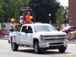

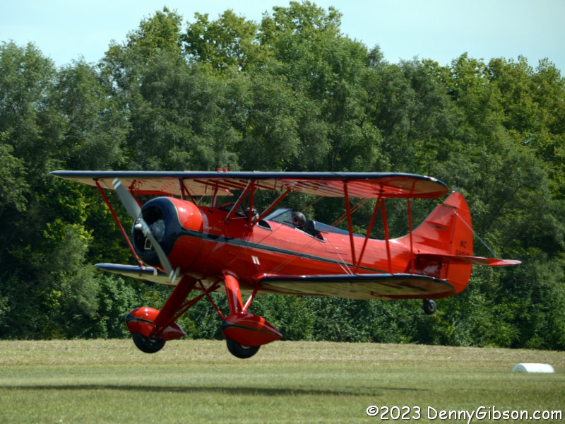
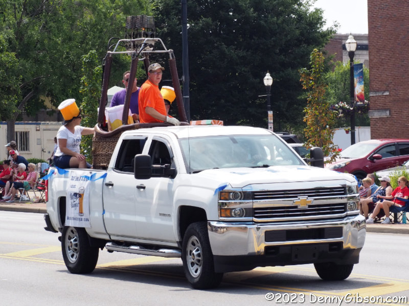
I had no trouble Identifying the hot air balloon burner and gondola in the bed of this truck but sorting out the headgear took a bit longer. Only when I saw the Hops in the Hangar sign did I realize they are foam-topped beer mugs.

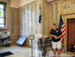

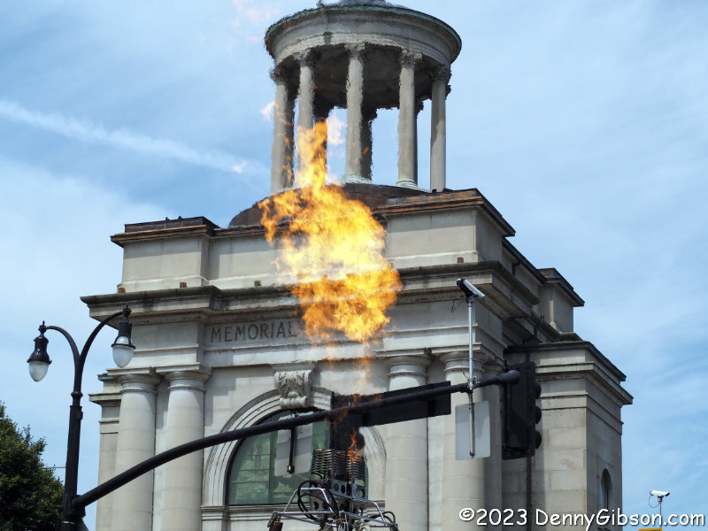
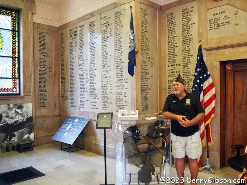
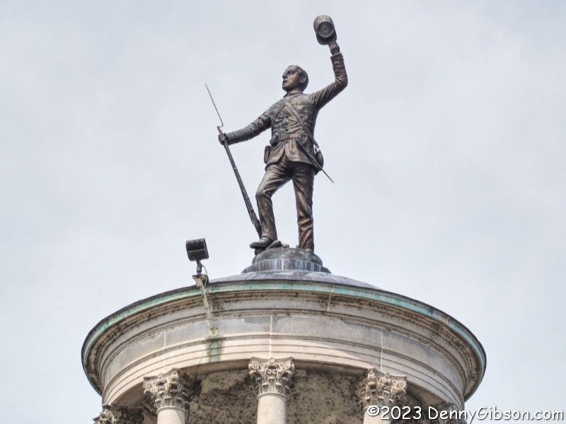
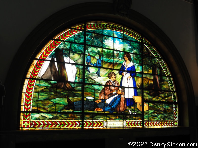
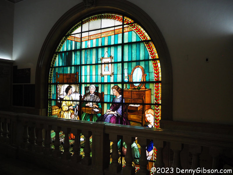
Getting inside the structure behind the four-foot flame was a bonus. I am fairly familiar with the Butler County Soldiers, Sailors and Pioneers Monument from the outside but had never been inside. It is even more impressive than I anticipated. Built on the site of the original Fort Hamilton, it honors all county residents who served in wars fought before its construction in 1902. Non-military pioneers are also recognized on the second floor. Original stained glass copies of the seals of the State of Ohio and the Grand Army of the Republic are opposite each other on the first floor.


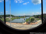
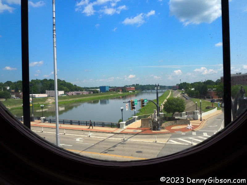
Even larger stained glass windows on the second floor honor Civil War nurses and mothers. A clear glass window provides a wonderful view of the Great Miami River.

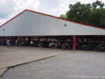
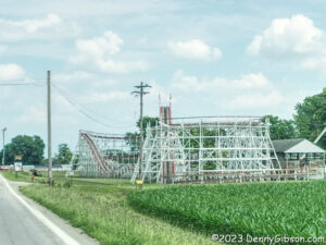
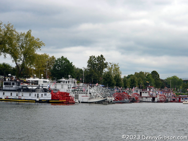
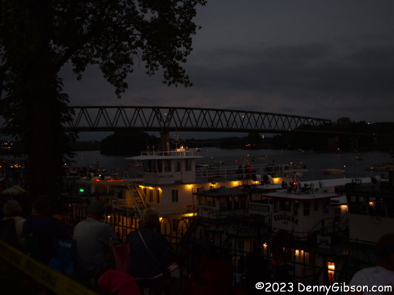
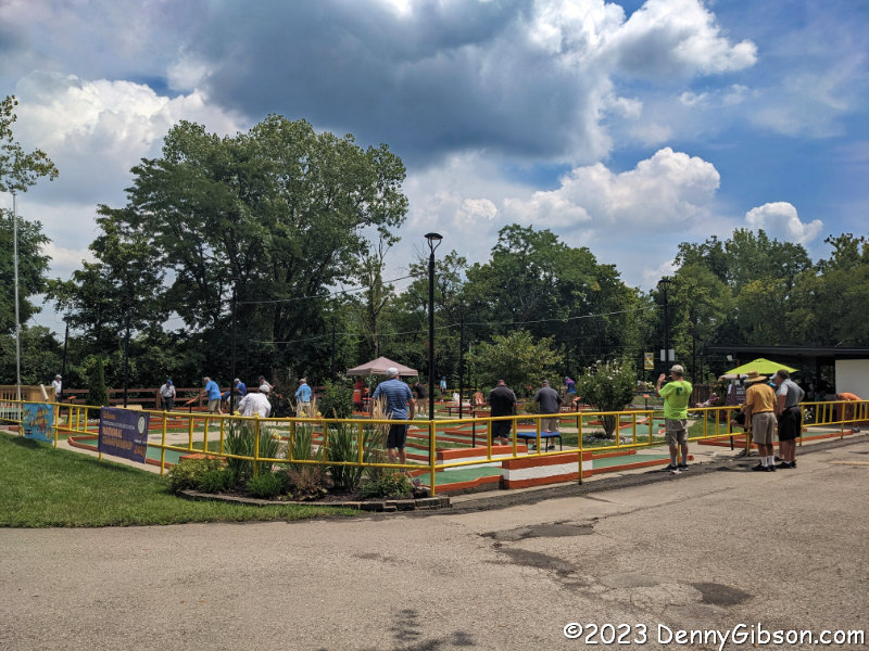
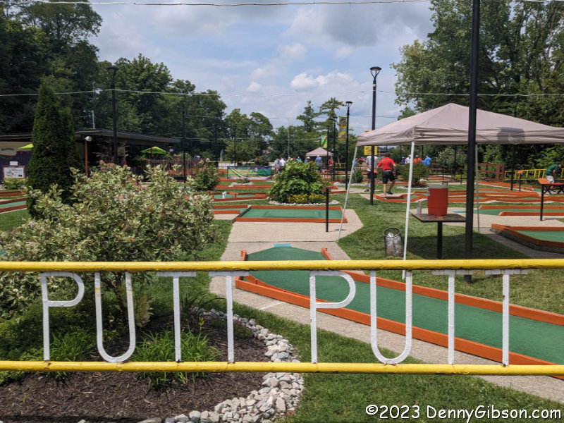
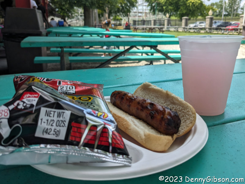
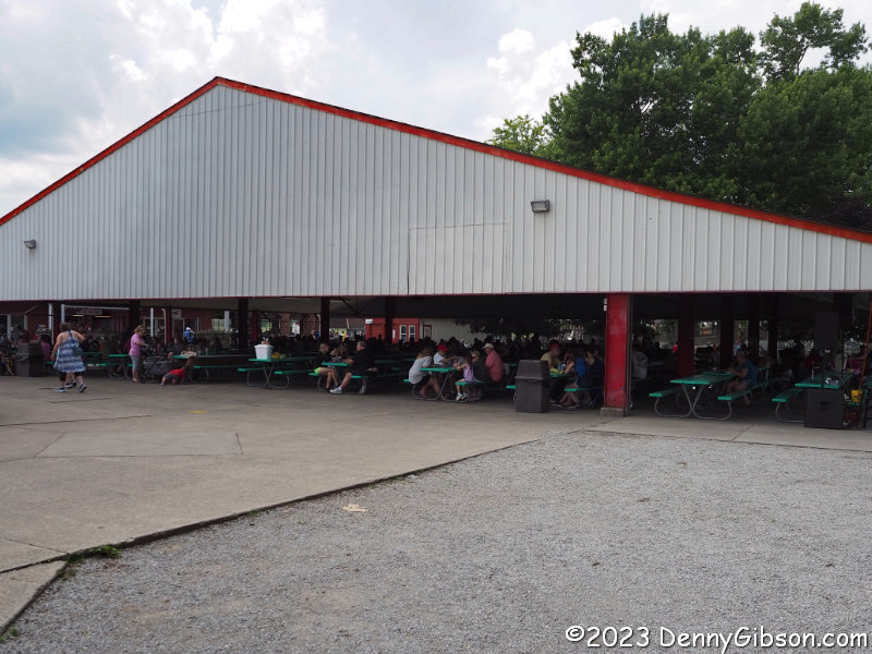
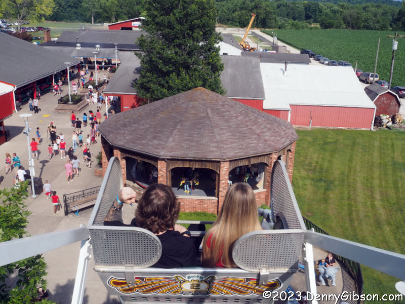
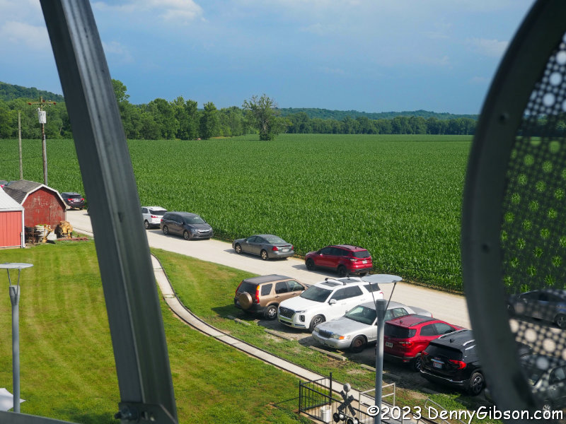
This is the place the day was organized around. Stricker’s Grove opened at 2:00 with the rides beginning at 3:00. Admission is free. Parking is $5. The pictured pavilion filled with picnic tables is just inside the park. There are also lots of tables outside the pavilion. Picnicking is not just tolerated; it is encouraged. The one-hour lag between opening and the rides firing up might actually be part of that encouragement. Reasonably priced food is available for anyone not packing a cooler at home. I had actually started the day thinking of a place to eat but when I learned of the parade I had just enough time to drive directly there. I now had time for breakfast — mett $4, chips $1, pink lemonade $2. Hotdogs were available for $2 and a 14 once draft beer for $4.


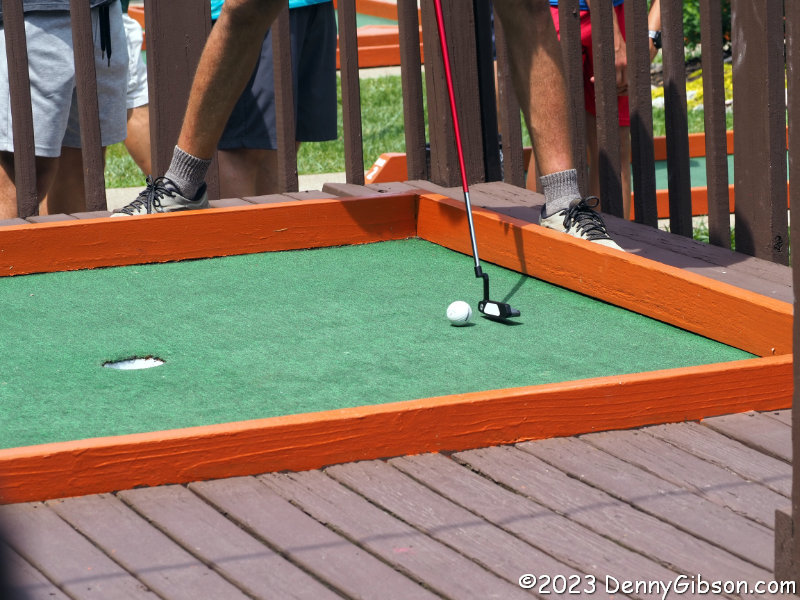
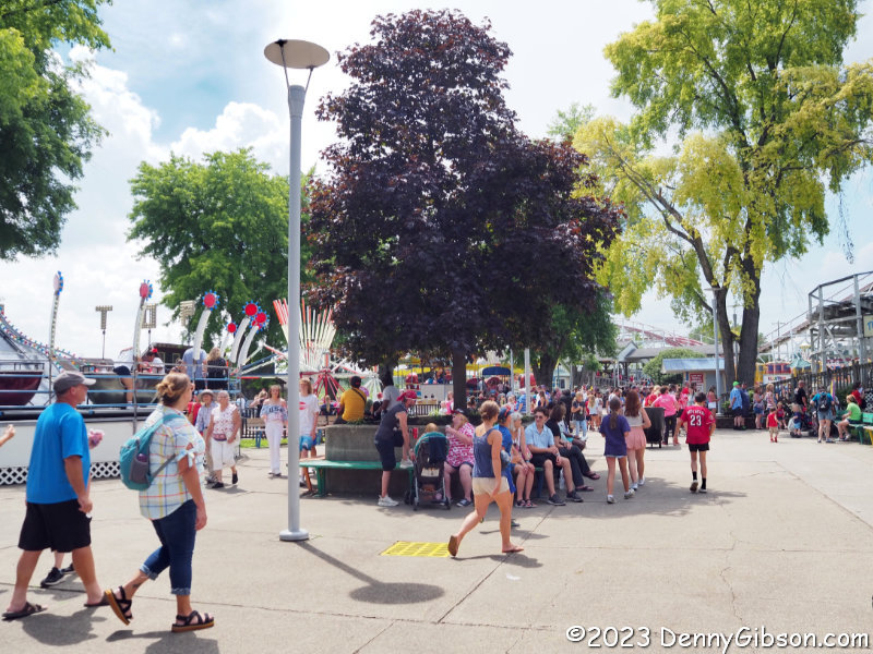
Eating was not the only thing available for filling in that rideless hour. A couple of Skee Ball areas and a large arcade filled with video games and pinball machines were in full swing as were other games of skill.


The rides had been operating for a while by the time I made it to the midway and purchased tickets. The best deal was clearly the $20 armband that let you ride anything all day. Single tickets were $2.50 or 5 for $10 or 20 for $25. That last option only makes sense if the tickets were to be shared by multiple riders. The only thing I really cared about riding was the Tornado roller coaster which was one of the very few rides, or possibly the only ride, that required three tickets. $7.50 seemed like a lot for one ride so I went for the five-ticket deal which made it seem like a bargain. It was then that I saw the coaster in motion for the first time ever but I decided not to get in the line just yet.


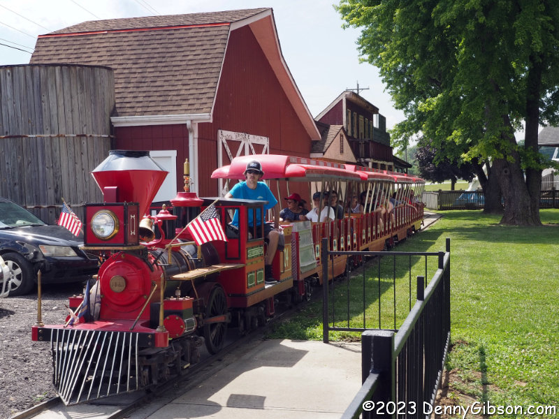
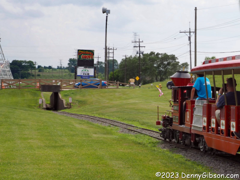
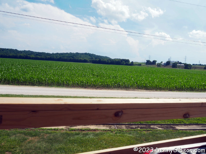
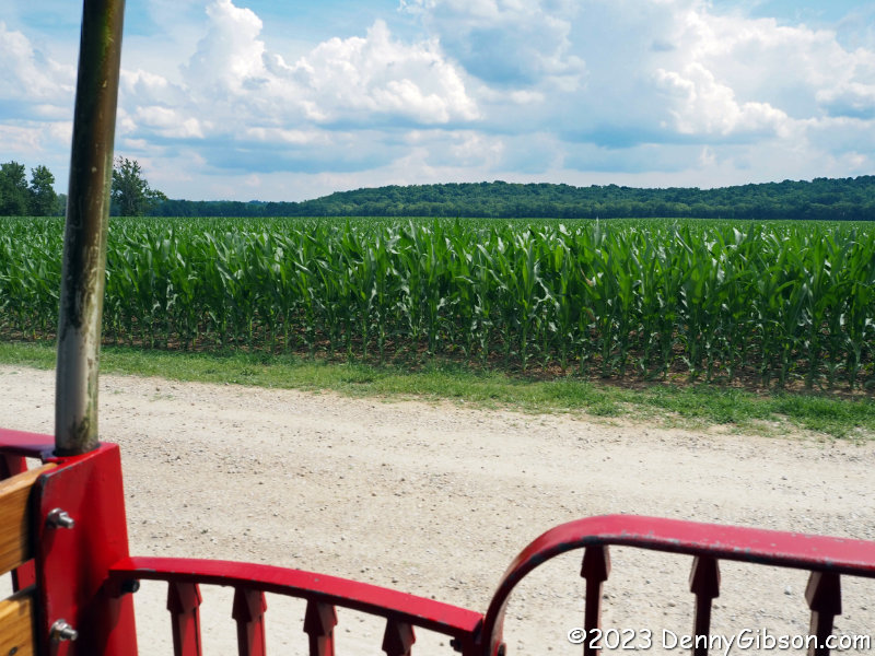
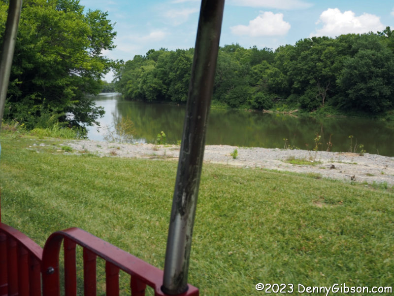
I had already decided to start off with a ride on the train (1 ticket) thinking it might give me a better feel for the park layout. Disappointingly, it did not go through the park but around its periphery of which corn and the Great Miami River are major components. It did give me a different view of the Tornado, however.

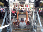
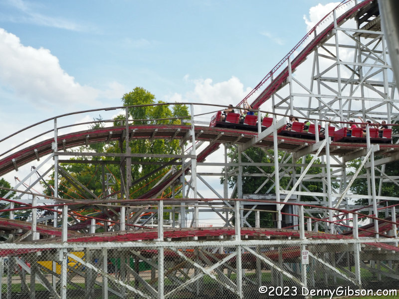
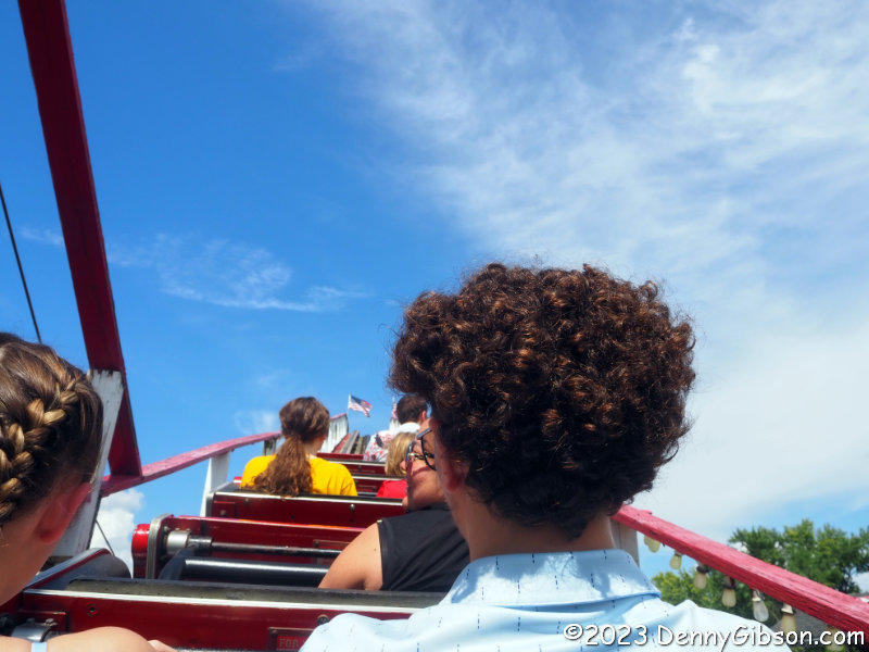
With the train ride behind me, it was time to join the queue at the Tornado. Reportedly there has been only one man in the United States to build his own roller coaster That man was Ralph Stricker and this is that coaster. Al Collins designed it and Stricker built it between November 1990, and June 1993.


The line was fairly long but it moved with reasonable speed. I used to ride roller coasters quite a bit but it has been a while. It felt good to climb into the car and start through that first slow curve past that corn. Being “homemade” and all, I kind of expected this to be a little wimpy. Not so. It was a good ride and all the coaster this old man needed. Nicely done Ralph and Al.


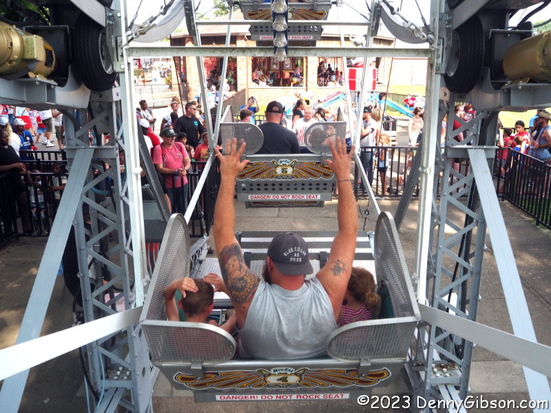
I used my one remaining ticket on another ride with a view. The extra fallout protection blocked the view to some degree but I could still see the corn and some people seem to always find a way to live life on the edge.


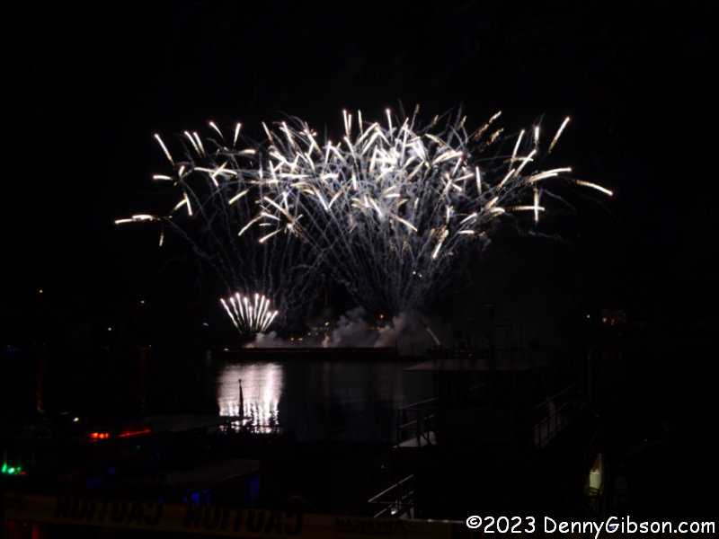
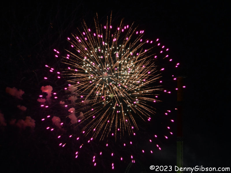
I submit these pictures not as examples of good fireworks photography but as evidence that I did expose myself to Independence Day pyrotechnics as required of all U.S. citizens. Fireworks were scheduled at Stricker’s Grove but I left long before that happened. I watched these from the parking lot across from King’s Island. Note that I live close enough to the park to hear these every night. The structure at the right edge of the first photo is the Drop Tower which I assume was closed during the fireworks.

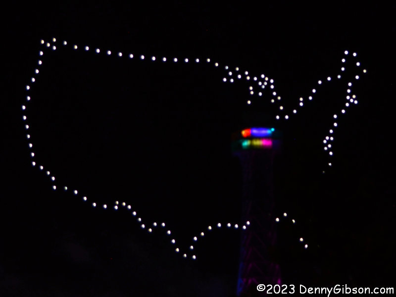
 The show also included the synchronized drones that the park introduced during last year’s 50th-anniversary celebration. I reported on my first viewing of them here. Formations not shown here included the Liberty Bell, the Statue of Liberty, and more. A good con man might be able to convince you that the lights in the middle of the map are there to mark King’s Island’s location but they are really lights on the replica Eiffel Tower standing between the camera and the drones.

 Until last Friday, I don’t believe I had attended a single football game played by my high school alma mater since I graduated. Furthermore, it seems quite likely that I had not attended a game as a spectator ever. I had attended every game in the four years prior to graduation but it was always as a member of the marching band. Friday night was a new experience for me in several ways not the least of which was the favorable final score.
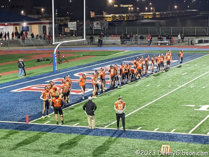 Of course, I’d thought about attending a game on several occasions but never followed through. I probably would not have made it to Friday’s game if my friend Terry had not been paying more attention to things than I was. Although our friendship goes back even further than high school, we did not attend the same school. Terry’s son did attend Ansonia High School and played on successful teams there in the 1980s.
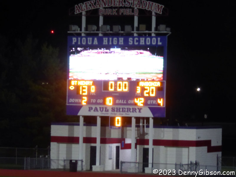
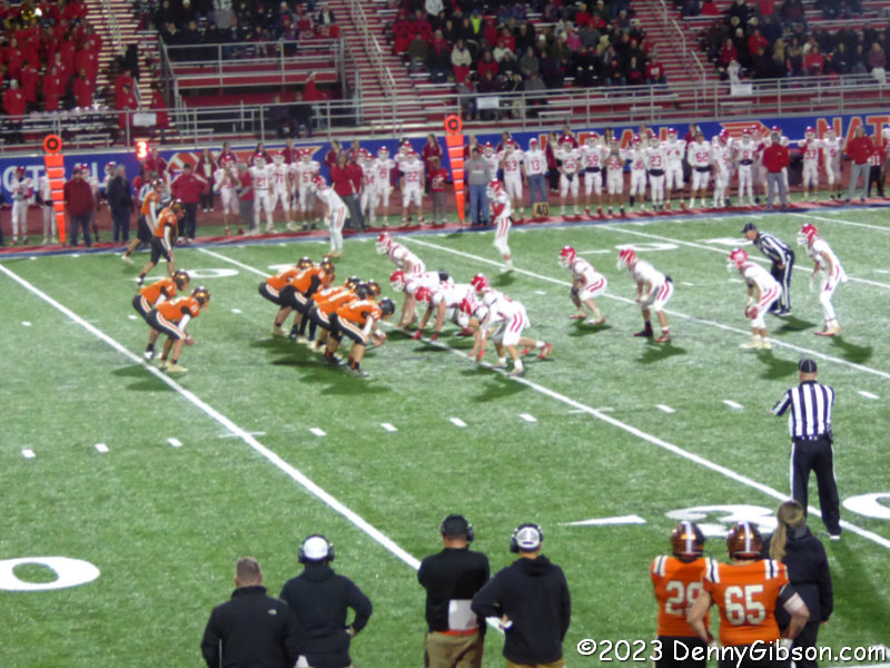 As the regular season ended, it was Terry who made me aware of Ansonia’s 10-0 record and their entry into the 2023 playoffs. As the #2 seed for Division VII, their first two playoff games were on their home field but I was, unfortunately, out of town for both. Fortunately, they won them both (52-7, 34-8) to set up Friday’s match with St Henry at a neutral site. Also on the fortunate side of things, I was home for this one.
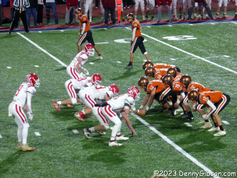
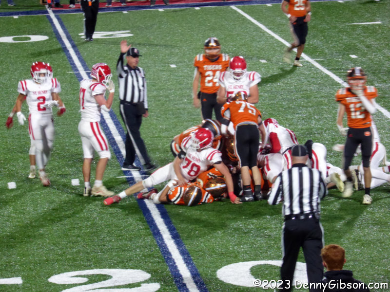
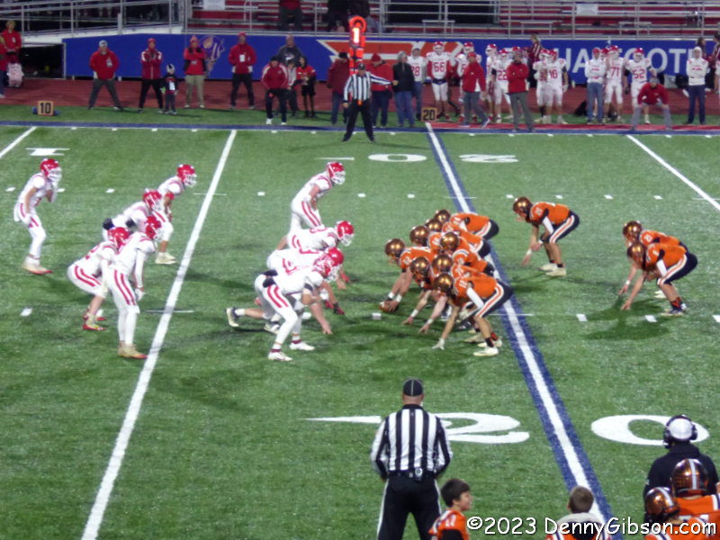 The game was a good one. Ansonia never trailed but our victory was not assured until the closing moments. With no kicking and little passing, the Tigers repeatedly moved the chains on third and fourth down with what often seemed like just inches to spare. The officials thought only one of their two-point conversion attempts was successful although there was serious disagreement from AHS fans on one of the others. Ansonia will play #1 seed Marion Local next Friday but where has not been determined. Whether or not Terry and I are there will depend a lot on the location.
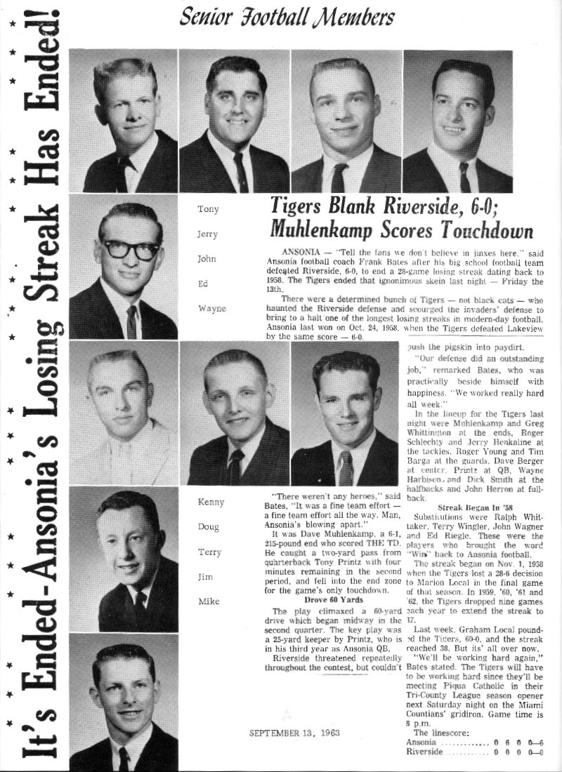
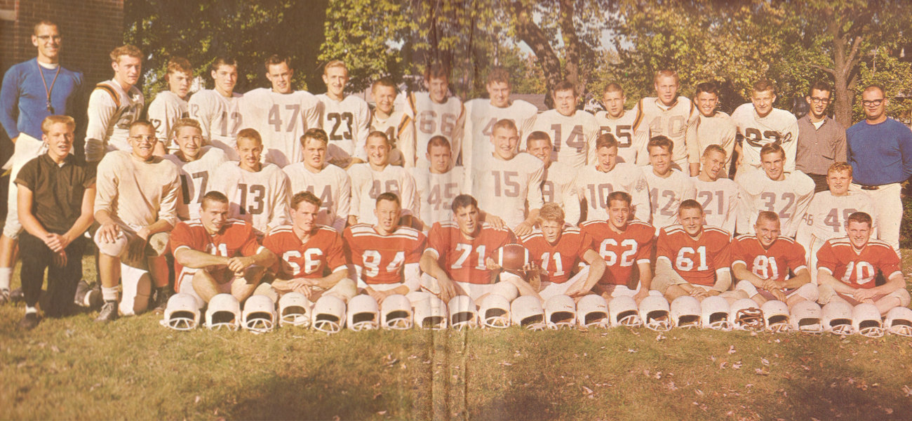 Both of these images are from the 1964 Ansonia High School yearbook. The first contains photos of the seniors on the team that ended the streak along with a local newspaper report of the event which attracted some national attention as well. The second image shows the entire team. In those days, yearbooks, at least those for small Ohio schools, were entirely black and white with the exception of the endpapers. There could be no better use of the book’s only splash of color than recognizing the group that ended what I believe was the longest losing streak in the nation at the time.
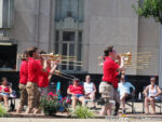
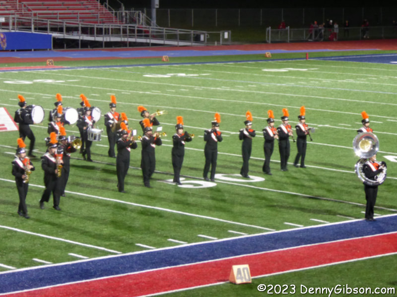 I mentioned that my previous AHS football game attendance involved the school band. The band’s fortunes over the last six decades do not appear to match those of the team. The picture at right shows the band during halftime of Friday’s game. I counted about twenty members, and Terry said that was noticeably more than what he remembered from the last game he attended.


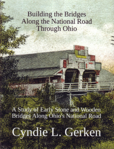 Cyndie’s done it again. As I began to write this review of Cyndie L. Gerken’s fourth book on the National Road in Ohio, I revisited my reviews of the previous three thinking I might come up with a better opening line but everything I saw just reinforced my initial thought. Cyndie has indeed done it again.
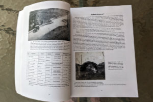 Although I certainly know better, I tend to instinctively think of big stone arches when I hear the phrase “National Road bridges”. One reason is that many of those stone bridges, some of them S-shaped, are still in existence. There were also many wooden bridges along the road but all were much shorter-lived. Building the Bridges… includes both. It identifies twenty-one covered wooden bridges built for the National Road in Ohio in addition to probably forty-some stone bridges. There were also well over a thousand stone culverts and one reason an accurate count of stone bridges is difficult to produce is that not everyone followed the same rules when distinguishing culverts and bridges. Span length was and is the distinguishing characteristic. Twelve feet, twenty feet, and no doubt some other numbers of feet were used to make the distinction and some reports did not distinguish the two at all.
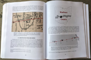 After telling us about as many of the bridge builders as she could identify, Gerken touches on some of the iconic National Road bridges east of Ohio, including the Wheeling Suspension Bridge, before beginning a county-by-county trek across the state. Each county chapter begins with a thumbnail of the county and the National Road through it. A map locating the National Road bridges in the county appears very early in each chapter. Sections on each of the bridges and some of the culverts in the county appear also in east-to-west sequence. Just as some bridges east of Ohio were touched upon preceding the border-to-border coverage, a few in Indiana follow it.
 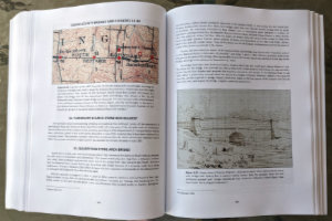 At a minimum, the location of each structure and what it crossed is given. The builder or builders are identified if known and, thanks to some pretty good sleuthing, many of them are. Beyond that, the information given for each bridge or culvert varies widely but it is a natural variation. For unnamed culverts over unnamed intermittent streams, location might be just about the only thing known. For major structures, lots of additional information might be included and usually supported by various graphics. Topographic maps are fairly common and there are lots of historic photographs and drawings. Plenty of modern photos also appear and if a structure is still standing there’s a good chance that the book contains a very modern picture of it taken by the author herself. Stories about events associated with happenings at or near a particular bridge can pop up anytime and are often fleshed out by reproducing contemporary reports.


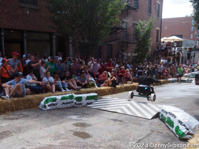
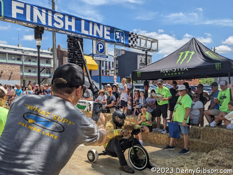
 History does repeat itself. In the early 1970s, I lived with my wife and two sons in a house with a driveway that sloped to a paved area in the back. That driveway was an ideal spot for the four-year-old to give his Big Wheel a workout. While I worked on something on a car behind the house, he repeatedly pushed the three-wheeler to the top of the hill so he could come rocketing down the hill, brace his feet on the pedals to stop the big front wheel, and throw the rear wheels into a perfect 180-degree slide. This was exactly what Big Wheels were designed for. After one of his countless slides, he looked up at me and made an incredibly insightful observation. “Dad”, he said, “I bet you wish you could do this.”


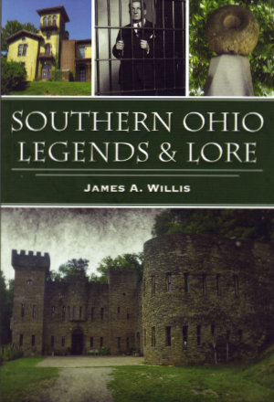
 The stories are divided into six sections: “Ghostly Legends”, “Legendary Characters”, “Legendary Villians”, “Legendary Places”, “The Unexplained”, and “Legendary Events”. Having lived my entire life in southern Ohio, I was already at least somewhat familiar with most of them. There are exceptions including all four “Ghostly Legends”. It is the only section where every story is new to me and it is the only section dealing more or less directly with possibly supernatural phenomena. I’m thinking those two facts might very well be related. I’m also thinking that this is the right place to mention that Willis is the founder and director of the paranormal research group The Ghosts of Ohio. I find it somehow reassuring that this is also the only section where that comes into play and even here there is no straying from the “verifiable facts” approach.
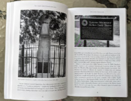 I don’t believe I learned anything new about any of the “Legendary Characters” but I appreciate the concise and complete descriptions. Willis’ reporting on John Symmes and his hollow earth theory is among the most even-handed and comprehensive I’ve read. Likewise, his tale of “Legendary Villian” George Remus where I did learn a few details for the first time.
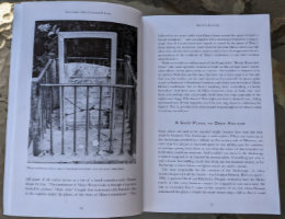
 “Legendary Places” combines a place I had never heard of (Athens Pentagram) with three that I am quite familiar with. That somehow makes it my favorite section. One of the three familiar places, the Loveland Castle, was the subject of a blog post here


