
 Frogman is a horror movie. I’m pretty sure the last horror movie that I paid to see in a theater was The Exorcist in 1973. I did that because I liked the book. I went to see Frogman because I liked the festival.
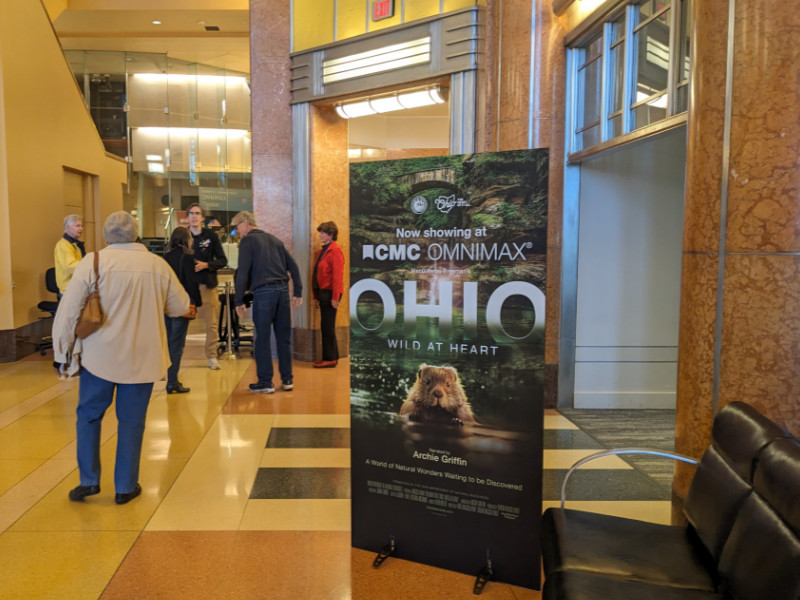
The legend of the Loveland Frog/Frogman can be traced to 1955. It got a little boost in 1972, but only recently has this creature of widely varied descriptions been seen as a crypid to embrace, promote, and maybe make some money off of. Perhaps the first example of the latter was the musical play Hot Damn! It’s the Loveland Frog in 2014. I missed it then and only became aware of it as the second attempt (AFAIK) to make something of the legend — the Frogman Festival — was taking shape. That first festival, which I attended, took place in 2023, with the fourth annual event set for March 2026.
Just over a year ago, Hot Damn! It’s the Loveland Frog was revived for a few performances in Loveland itself. I jumped at the chance to attend and reported on it here. About the same time, plans were announced for a city-connected Return of the Frogman Festival, which would take place that October and every leap year thereafter. I was out of town during that festival and may have been most disappointed by a missed opportunity to see the recently released Frogman movie. When I heard of plans for an October 2025 showing, I jumped again.
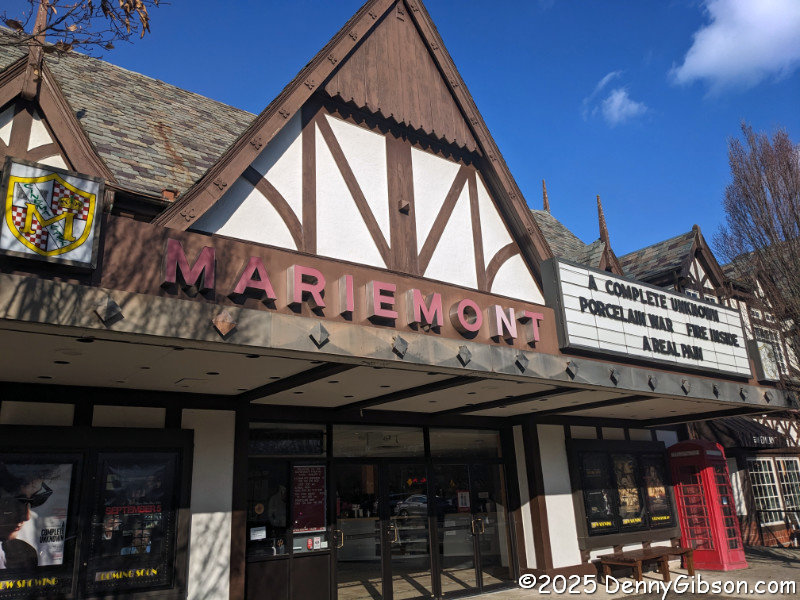
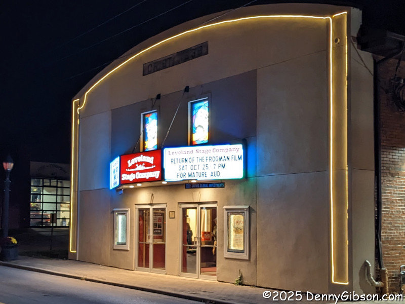 By the time I arrived at the Loveland Stage Company theater, I had read many of the reviews at IMDB and was prepared for a pretty bad movie. In hindsight, I think some of those negative reviews were well off the mark. To be clear, there are probably at least as many positive reviews as there are negative. It’s just that the negative ones had made more of an impression on me. After seeing the movie, I’m firmly in the “not as bad as expected” camp.
The audience no doubt had something to do with that. Of course, anything connected to the Loveland Frog is best experienced in Loveland. This crowd was there to have fun — several wore frog suits — not to be frightened. There are a few something-suddenly-jumps-at-you scenes, but they were, at least in this setting, pretty ineffective. I heard no gasps or screams. I did hear many laughs.
The Loveland of the movie is not the Loveland of the viewing. The movie was shot in Stillwater, MN, which isn’t all that much bigger than Loveland, OH (19,000 vs. 13,000), but somehow feels like it is, and the St. Croix River really is much bigger than the Little Miami. Some scenes in Fargo were shot in Stillwater, so there is that.
The Frogman of the movie may or may not be the Frogman of the legend. The frogish creature in the movie only appears in very brief glimpses and usually with less than optimal lighting and focus. My size appraisals range from about the size of a large cat to bigger than the biggest grizzly. In the novel The Exorcist, much of the supernatural goings on happened out of sight or were caught ever so briefly from the corner of one’s eye, leaving the reader to accept them or not. In the movie, that ambiguity got lost. There is no doubt that I, her on-screen mother, and everybody else in the theater saw Linda Blair’s head spin like a top. That, in my opinion, was a major shortcoming of the movie. Although the thing appearing in those on-screen Frogman glimpses might not exactly match any of the descriptions reported in real life, the quality of the glimpses is sort of similar.
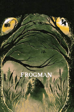
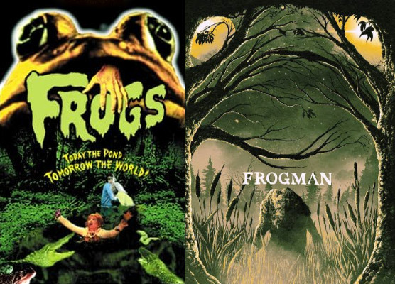 While writing this, I’ve learned that Frogman is available for streaming from several services, including my go-to freebie Tubi. I’m rather happy that I didn’t know that earlier, as I might have just watched it in my living room and missed the fun gathering at the theater. After being alerted to this by IMDB, I searched for it on Tubi and found it listed beside a 1972 movie named Frogs with Ray Milland and Sam Elliot. In my mind, I had already awarded the Frogman promotional artwork bonus points for its creative facial image formed by branches. After seeing that there’s a good chance it intentionally resembles that of the earlier film, I’m just going to double those points.
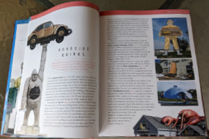
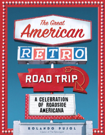 There’s no road trip here. The Great American Road Trip is not a travelogue. Nor is it a guide for traveling to or through a particular place. It is a well-done, very inclusive, nicely illustrated catalog of stuff that people like me drive around the country to see.
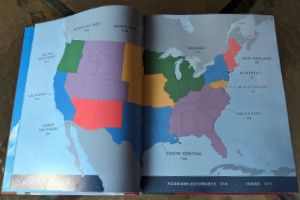
 This is the second book that I’m aware of about Medal of Honor recipient Doug Dickey. I was aware of the first one,
 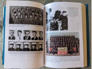 The book includes several maps and diagrams to help describe things like locations and organization hierarchies. There are even a few black and white pictures mixed in with the text. That’s nice, but they are on matte paper. What is even nicer is the section of twenty-two glossy pages containing higher quality images, many of which are in color.
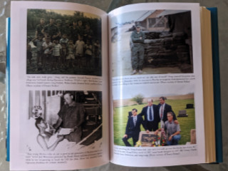 As mentioned several times on this website, Doug Dickey was a classmate of mine. I have attended events that honored him and read much that has been written about him. Two things from this book that I’d not heard before stood out. The common belief was that Doug fell on top of a single grenade, and that is what the Medal of Honor citation describes. But years later, when witnesses were able to compare notes, it was determined that there was a second grenade that Doug pulled under his body after falling on the first one. I was also struck by the sentence that Lang ends his book with, and with which I’ll end this review. It’s something that Doug’s mother, Leona Dickey, said when talking about her oldest son. “The guy who threw the grenade — he would have loved him, if he could have just met him.”
 It’s a beauty. That was my initial thought when I first held this book in my hands and flipped it open. I wasn’t surprised, of course. I’ve seen enough of Jim and Shellee’s work to make me expect great photography and writing, a top-tier knowledge of history, and a rock-solid commitment to quality. I’m not quite as familiar with Reedy Press, but what I have seen smacks of the quality targeted in that previously mentioned commitment. My instant declaration of beauty came from seeing great images accurately reproduced on thick glossy pages. Including the text in my appraisal took only a little more time.
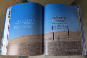
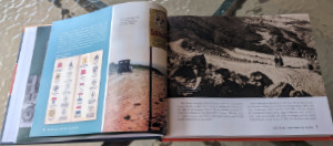 Unlike many other Route 66-related books, Route 66: The First 100 Years is not organized geographically. Nor is it organized chronologically as history books often are. There is a slight hint of chronology in discussing the roads that preceded US 66 in Chapter 1, “Revolutionizing Travel”, and covering “Renaissance” and “Preservation” in the last two chapters. In between, chapter subjects might be eras (e.g., “Hard Times”), collections of people (e.g., “Ladies of Legend”) and businesses (e.g., “Trading Posts and Tourist Traps”), or something else. Whatever the subject, a wide-ranging set of examples is included. But 100 years and 2400+ miles cover a lot of space and time, and anyone with more than a passing familiarity with Route 66 will probably come up with a personal favorite or two that didn’t get included. The selection process could not have been easy, but the selections are excellent.
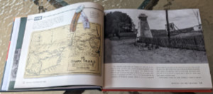 Every chapter, like the vast majority of real-life road trips, has a “Detour”. The book’s detours are deep dives into one of the chapter’s subjects, and not all of them are obvious. The detour for the “Revolutionizing Travel” chapter is “The Ozark Trails”. This was an early named auto trail, or actually a system of auto trails, that, in my experience, doesn’t seem to get enough recognition. The “Hard Times” chapter takes a detour into an area that has been overlooked far too often for far too long: “The Green Book and Threatt Filling Station”.
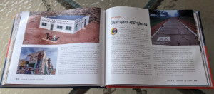 It’s probably not all that surprising that Route 66: The First 100 Years overflows its twelve numbered chapters. It starts with a full page of Acknowledgments, followed by a Forward written by Route 66’s storytelling king, Michael Wallis. Jim and Shellee follow that with a Preamble, then include an Epilogue, Road Facts, and a few other sections after Chapter 12. One of these sections, titled “Happy Trails”, is a collection of roadside photos taken over the Mother Road’s first 100 years. Many are of unidentified travelers, but there are some real celebrities in the mix. There’s Jack Rittenhouse standing beside a California U.S. 66 sign, Lillian Redman by an Arizona 66 sign, and Cynthia Troup gazing at a U.S. 66 sign in New Mexico. As I said earlier, 100 years and 2400+ miles cover a lot of space and time. Jim and Shellee have done an impressive job of capturing the big picture and quite a few of the small picture details, too.
 I had so much fun driving twice across the country for
 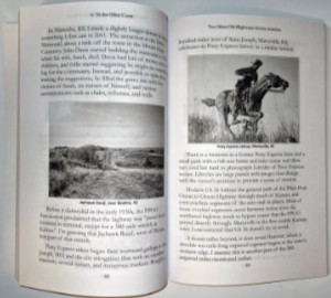 I also bragged about the title of the Yellowstone Trail and US 20 book and bemoaned the fact that it wasn’t as clever as initially envisioned. Of course, clever sometimes also means cryptic, and that might have been the case here. Anyone who thought 20 in ’21 and the YT Too overly cryptic will be happy to see that the title of this book isn’t cryptic at all and not the least bit clever either. It really is about going across America on two old highways and, since I’ve done that before, it really is about two MORE old highways. It just occurred to me that some folks might be unhappy about having to guess which two, and I can understand that. But putting the wordy names of these two auto trails in the title would have made it entirely too long, and it’s too late to do anything about it now anyway. Sorry.
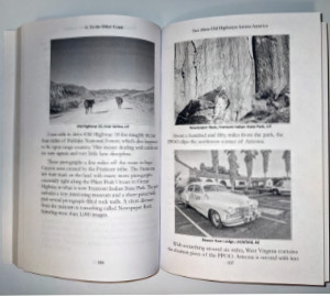 To be honest, though, even if the names National Old Trails Road and Pikes Peak Ocean to Ocean Highway were right there in the title, they would not be recognized by everyone. Out west, some would recognize the NOTR as something that turned into US 66. Back east, a similar number might recognize it and think it had become US 40. In the middle of the country, I suspect that just a few would even recognize the PPOO’s name. Of those who did, some might say it was replaced by US 36, while others would claim it became US 22. There is a little truth in each of these claims, but my point is that not all that many people know that the PPOO and NOTR were both once routes that connected the East Coast with the West. Their names in the title would not be any more enlightening to many than the words “Old Highways”.
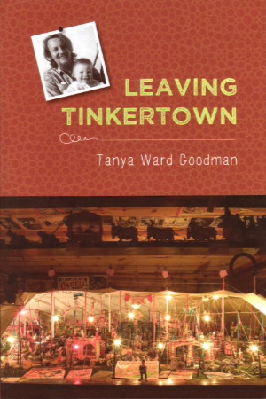 My October Tinkertown visit began with a nice chat with owner Carla Ward. We had exchanged a few emails when I reviewed her 2020 book,
  Tanya was living in Los Angeles at the time but was present in New Mexico when the diagnosis was delivered, and even moved back to the museum that had been her childhood home for a while to help with things as the disease progressed. On the day of the diagnosis, she found herself remembering stories her dad told her as a child and wondering just how the plaques and tangles the doctor tried to describe would affect her father’s brain. She asks herself, “Will he survive this? If he doesn’t, who will tell the story?”
 Tanya’s life wasn’t exactly typical. That her parents divorced and her dad remarried when she was quite young is hardly unusual, but that her mother and stepmother were both important influences as she grew up was a bit so. Even more unusual were occasional trips with her father as he traveled the country, painting rides and signs for carnivals and the like. The house she grew up in had walls made of concrete and empty bottles. It was filled, like a museum, with her dad’s artwork, and part of it was an actual museum open to the public.
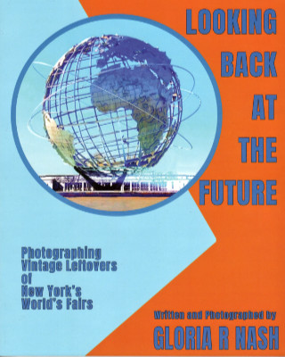 Before I even opened this book I was aware of Gloria Nash’s childhood fascination with the 1964 World’s Fair, the family circumstances that brought her back to the neighborhood, and her visits to the old fairgrounds that ultimately led to creating Looking Back at the Future. I was not aware of a high school photography class assignment to “locate and photograph remnants of the fair” that had recently closed. A few black-and-white pictures taken at that time are included in this volume where she wraps up that assignment in style.
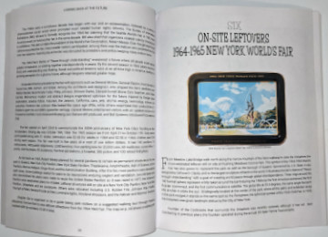 The book’s subtitle, “Photographing Vintage Leftovers of New York’s World’s Fairs”, accurately describes its main thrust. Well-written text provides background on both fairs, and there are descriptions of buildings and other items that no longer exist, but photographs of what that subtitle calls “leftovers” fill the bulk of the book. Most were taken by the author although a few come from other sources. Some images from postcards and other promotional materials are also used sparingly. The book is printed on good quality fairly heavy stock but it is not coated gloss stock. All of the modern photos are bright and clear and look quite good but this is not a “coffee table” book.
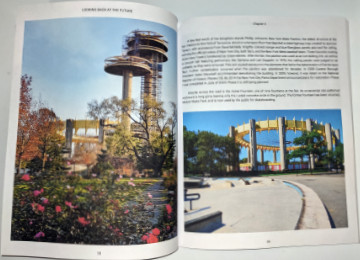 Nash has done a phenomenal job in tracking down fair remnants and makes sure that others can “locate and photograph” these leftovers, too. The location of all leftovers at the fair site (now Flushing Meadows Corona Park) is shown on a map with color coding to distinguish 1939 leftovers from 1964 leftovers. Both chapters on “On-Site Leftovers” contain what amounts to a tour guide for a walk that visits each of them. Chapters on “Off-Site Leftovers” describe locations and give addresses where appropriate. An appendix provides these locations in a list format.
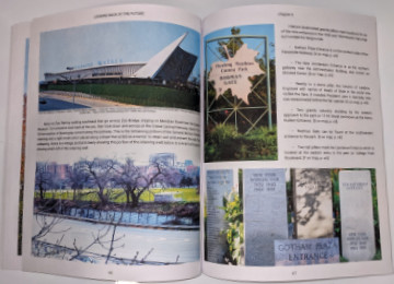 Although both of these fairs made lasting impressions on the people who attended them. neither was a success from the organizers’ point of view. Organizers in 1939 hoped for 50 million visitors but got only 45 million. The target in 1964 was 70 million, but only 51 million showed up. I wasn’t around in 1939, and even though I was very much around in 1964 and well aware of the fair, I did not attend. I have only attended one world’s fair in my life, and that was in 1983 in Knoxville, TN. Nash says that was the last profitable world’s fair held in this country. Coincidence?
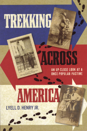 I’ve been anticipating this book for a few years now. Henry was probably well into his research for the book when he gave a presentation at the 2017 Lincoln Highway Association conference on trekkers who had incorporated all or part of the highway in their travels. The Lincoln Highway and other trails aimed at automobiles appeared in the latter half of the golden age of trekking, which Trekking Across America focuses on. Henry identifies this as roughly 1890 to 1930. Merriam-Webster defines a trek as “an arduous journey” and during that period just about any long-distance journey that did not involve the railroad was unquestionably arduous. I ordered the book as soon as I became aware of its publication but my own non-arduous travels and the winter holidays kept me from reading and reviewing it until now.
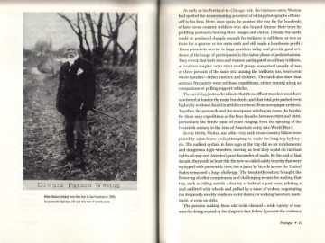 A fellow named Edward Weston is credited with getting the walking craze started by walking from Boston to Washington to satisfy a bet made on the wrong guy (Stephen Douglas) in the 1860 presidential election. Apparently, Weston decided that he really liked walking and was quite good at it. He proceeded to set records and win awards into his seventies. In some circles, the rampant pedestrianism of the time was referred to as Westonianism.
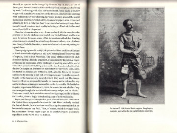 Postcards are also a rather natural way to provide a visual connection with a trek’s story. Henry divides these stories into five chapters based — not all that rigidly — on the reason for the trek. Following a chapter’s introduction are several segments featuring one or two specific treks with at least one related image. Postcards often provide those images. These two or three page standalone segments allow “Trekking Across America” to be read in small doses if desired.
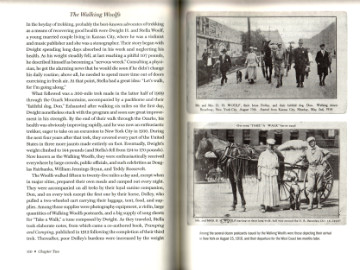 Individual males were hardly the only ones undertaking these long arduous journeys. Buddies, siblings, newlyweds, whole families, and even a few lone women appear on these pages. Incidentally, little evidence is presented here that a trekking honeymoon will lead to marital bliss. The rules for some of the contests and challenges were also interesting. Virtually every trek involved some sort of time limit but rules about clothing, starting with little or no money, and working en route were also common. After the turn of the century, gimmicks such as the aforementioned skating or rolling a hoop might be involved. One fellow fiddled every step of the way as he walked from New York to Los Angeles and on to San Francisco.


 It looks like tomorrow (Jan 9) is the last day