
 I am not someone who delights in using old film cameras. I can appreciate that others do and I can appreciate the phenomenal engineering and manufacturing accomplishments embodied in high-end film cameras. But I like the convenience and economy of digital photography far too much to spend my own time and money on anything else — with one exception.
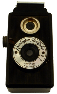
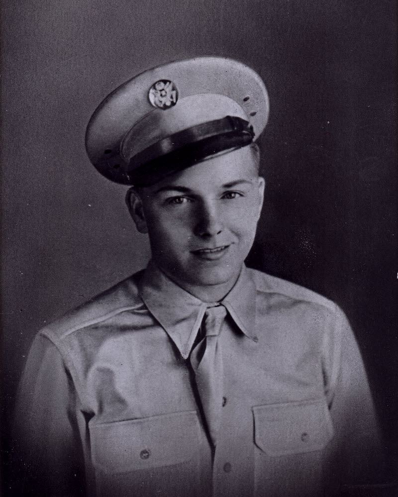
That exception is the camera at right. It’s certainly old and it uses film but it is about as far from high-end as you can get. The exact same camera was sold under a variety of names with prices around three or four dollars. An uncle won this one by investing a quarter in a punch-board in 1940. I never knew him. He went off to war and never came home. My Mom, his sister, ended up with the camera. I remember it being our family camera in the early 1950s.
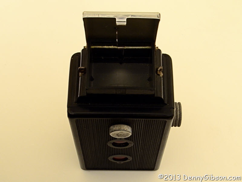
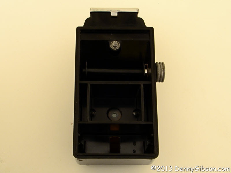 There’s not much to it. It’s called a pseudo-TLR. TLR stands for twin lens reflex which means one lens for the photo and an identical twin for the viewfinder. I’m not sure that what feeds the viewfinder on this camera can properly be called a lens at all. It does somehow produce a dim right-side-up but reversed left-to-right image on an upward facing screen. There’s no focus or aperture control and not exactly any shutter speed control. There is a shutter release and a little lever that selects “INST.” or “TIME”. The length of an “instant” isn’t specified but I’m guessing it’s somewhere between 1/50 and 1/100 second. As you’d expect, “TIME” holds the shutter open as long as the the release is held down. The back is held in place by a thumbscrew. Remove it to thread the paper backed film onto the relocated empty spool from the previous roll then close it up tight. Turn the knob on the side to move a frame number into first one then the other red window.
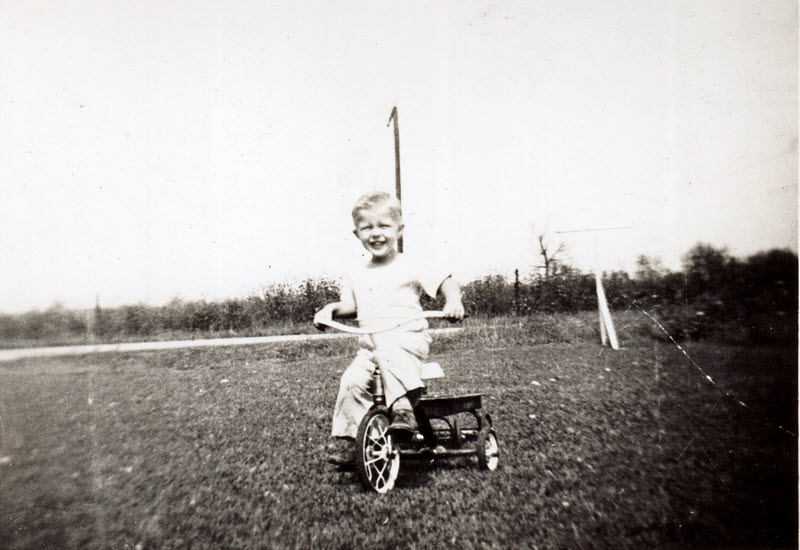
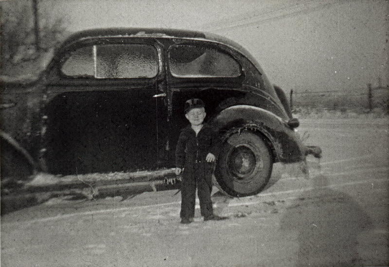 I believe both of these pictures were taken with the Flex-Master. The first one is known to be from the winter of 1950. The other is probably from the next spring. It’s one I frequently use as an “on the road” Facebook profile picture.
I said I appreciate folks who work with film cameras and I know some, too. One in particular, Jim Grey, lives close enough that I’ve passed a few junk classic cameras his way. Jim not only gets a lot of pleasure from his cameras, he gets some very nice pictures from them, too. I recently asked Jim about the Flex-Master and he told me where I could buy film for the camera and also where to get it developed. There aren’t many choices. It’s tough enough finding processing for film from a still-in-production Canon or Nikon let alone something out of a seventy-three year old punch-board prize. Nor is it cheap. With postage, two rolls of 127 black & white film came within pennies of twenty-eight dollars. Processing, with postage but without prints (you get jpgs), is $16.50 a roll.
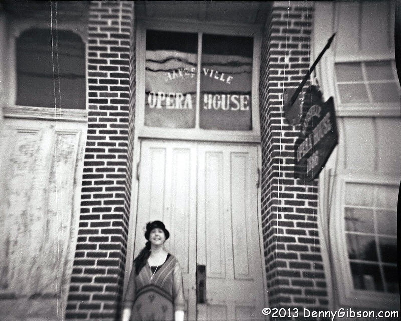
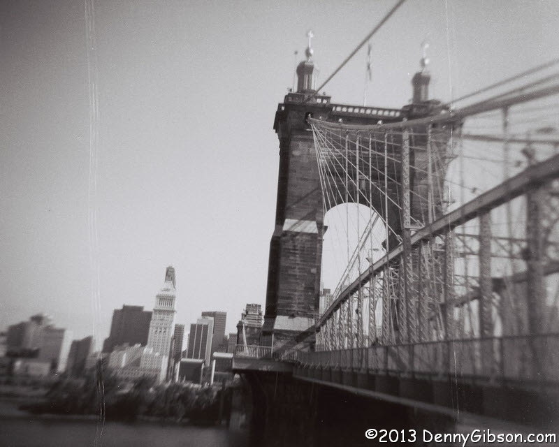 One of the first places I tried the camera was in front of the 1886 Hayesville Opera House after Cece Otto’s American Songline concert. I managed to totally botch two of the three pictures I took of Cece by doing double exposures (Now, there’s something you don’t hear of much in the digital world, Chauncey.) and the one that did kind of turn out has a building that looks like a reflection in a fun-house mirror. I’m guessing that the film wasn’t held flat but I don’t know why. The picture of the Roebling Bridge with Cincinnati in the background doesn’t seen so distorted so maybe the film got pulled tighter later in the roll… or something. Both pictures have a pair of vertical scratches that I think line up with rails molded into the camera back which I’m guessing are there to press the film flat. Matching scratches can be seen in some of the pictures taken with the camera in the ’50s. Just remember that “far from high-end” statement near the beginning of this article.
If the first roll had been a complete disaster, I’d have given the other one to a friendly Hoosier camera collector and saved my self $16.50 in processing. Since the disaster was less than complete, I’m going to take the “seventy-three year old punch-board prize” along on my upcoming ride in a fifty year old car on a one hundred year old highway and see what develops.
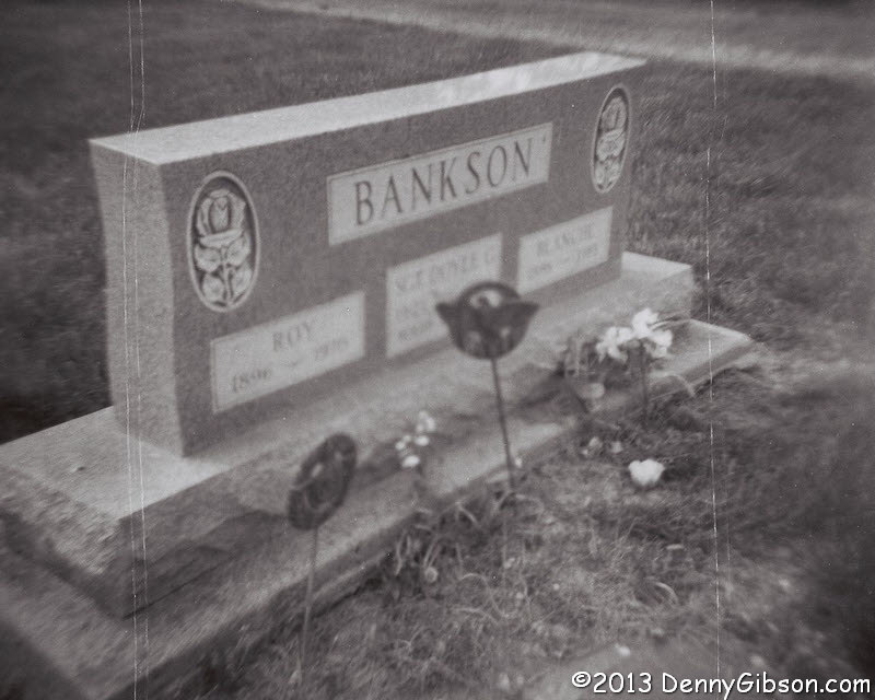 Doyle Bankson, that camera winning uncle, is buried at Colleville-sur-Mer in France. His parents (my grandparents) placed his name between theirs on this tombstone in Ohio. Part of me felt really silly using the camera he won as a teenager to take a picture of a stone more than four-thousand miles from his grave. Part of me didn’t.
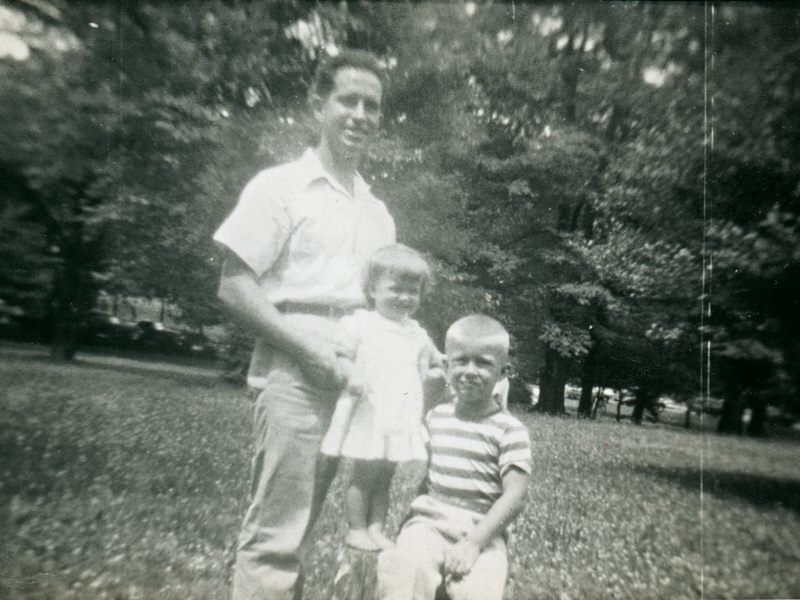 This article is being posted on Father’s Day. That’s somewhat, but not entirely, a coincidence. Dad took quite a few pictures with the Flex-Master. He was in some, too. Here’s a picture of Dad, my sister, and me that was taken with a twelve year old punch-board prize.


 The
The 


