BLINK II

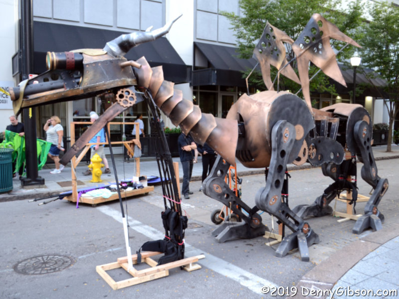
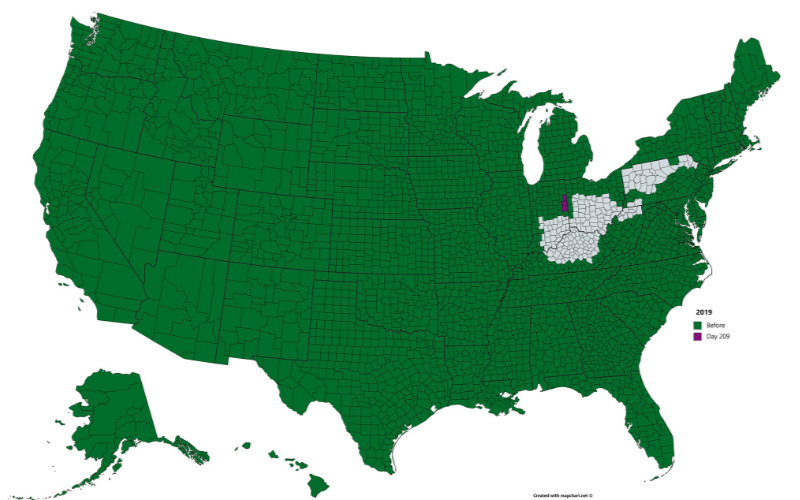
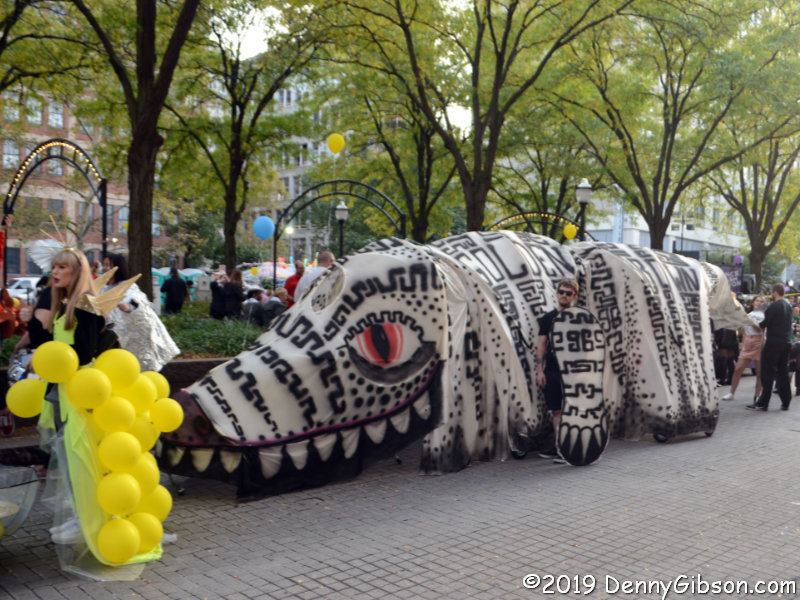
This is the second coming of BLINK. The first was in 2017 when I underestimated the crowd, arrived too late, and missed the parade entirely. That story is here. This year I arrived in plenty of time, again underestimated the crowd, and missed the parade mostly. Reinforcing the claim that I arrived in plenty of time are pictures, like the one at right, of parade entries in the staging area. I could have taken up a spot in the front row of spectators but chose to roam around rather than stand still for an extra hour or so.

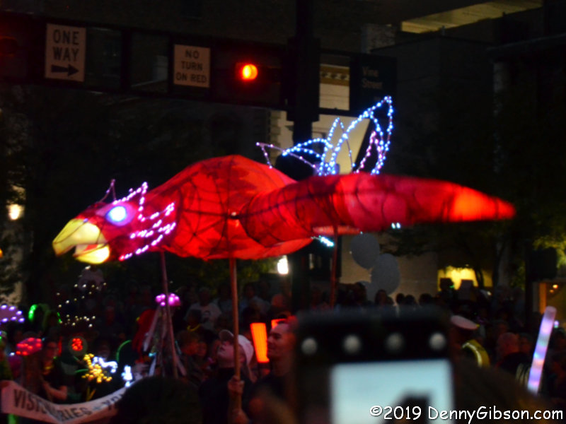
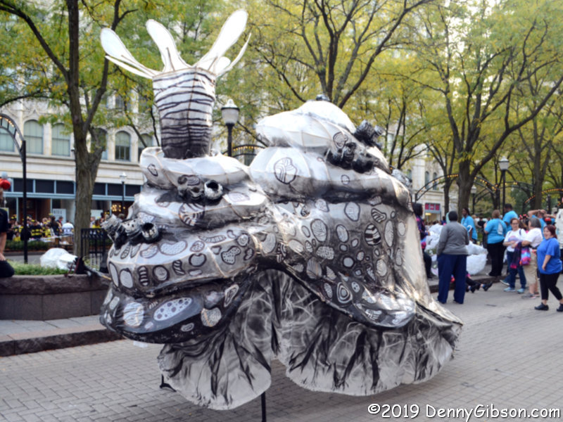
When I did decide to settle down, I thought I’d found a spot near the start behind a single row of spectators that I could see over. That turned out to be something of an illusion, however. There was a row of cell phone wielders seated on the curb and a steady wall of passers-by who tended to pause for extended periods until “encouraged” to move by the folks whose view they were blocking. Even so, I managed a few only slightly blurry pictures, including one of a glowing snail I had caught unlit in the staging area, before my phone rang.

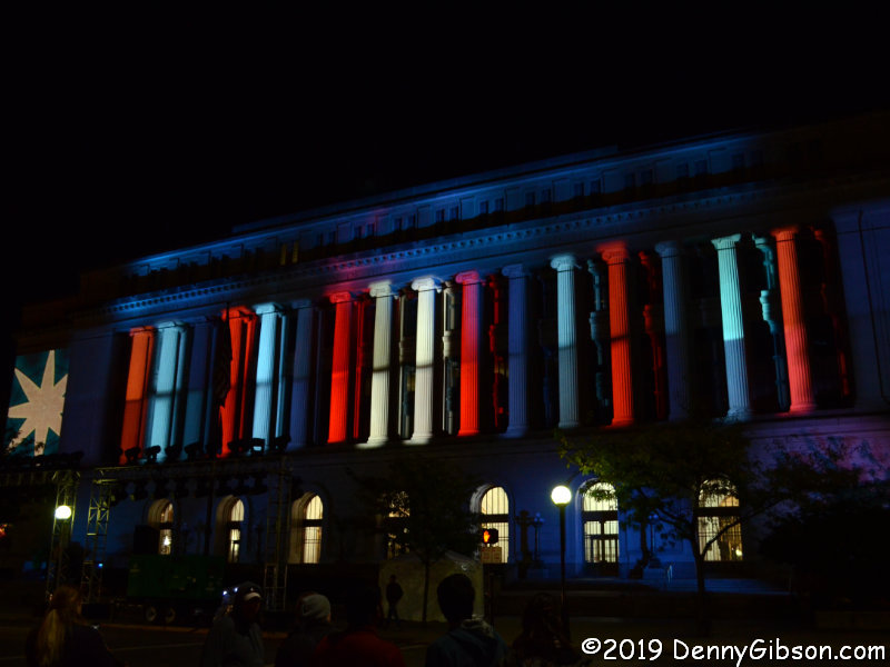
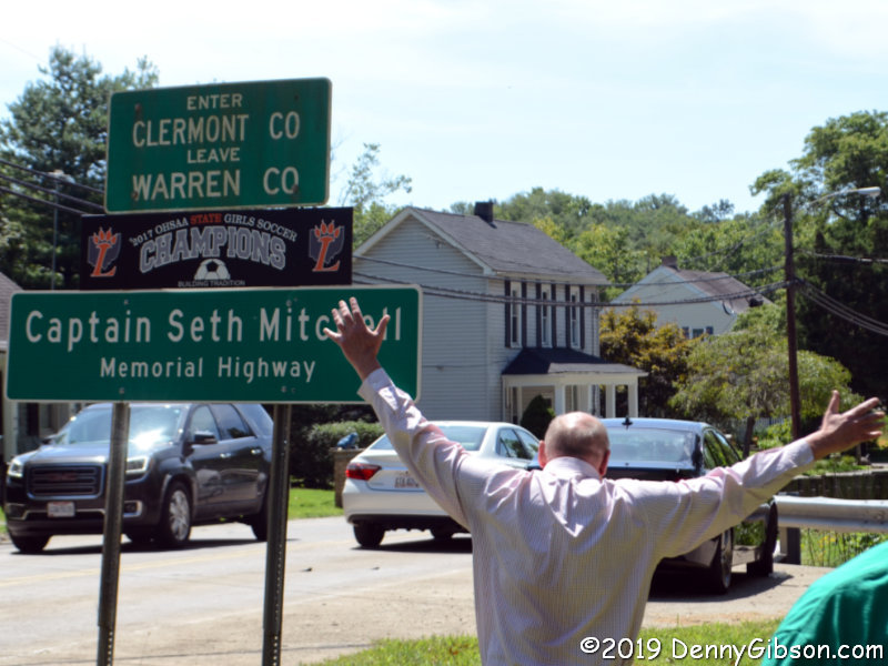
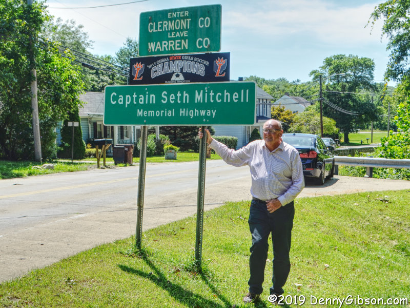
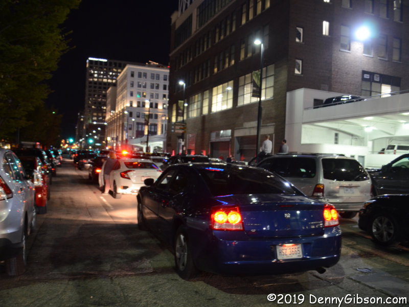
For something more than a day, I had been expecting (or at least hoping for) an important phone call. My fears that it would arrive at the worst possible moment were justified. The parade started moving around 7:20; The call came at 7:32. I simultaneously accepted the call (it really was important) and the fact that I would see no more of the parade. I paralleled the parade route one block away but the route itself was lined by a more or less impenetrable wall of spectators about six deep. The picture is of 3rd Street. Despite being crossed by the parade, plans called for the westbound 3rd and eastbound 2nd to be kept open. That was clearly easier said than done. The cars at the left of the picture are in curbside parking spaces; The rest are not. The car in the foreground is running with its lights on; The rest are not. They are effectively parked in the street with many drivers and passengers beside or on top of their vehicles.

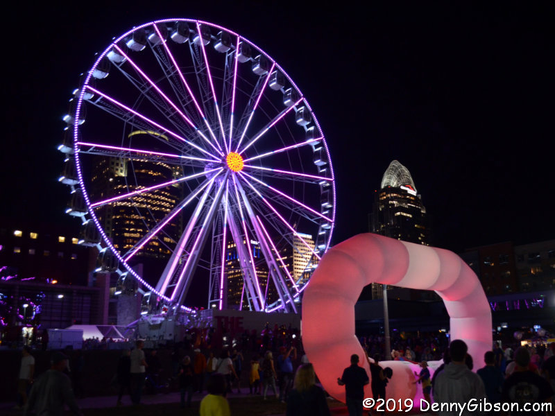
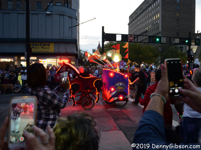
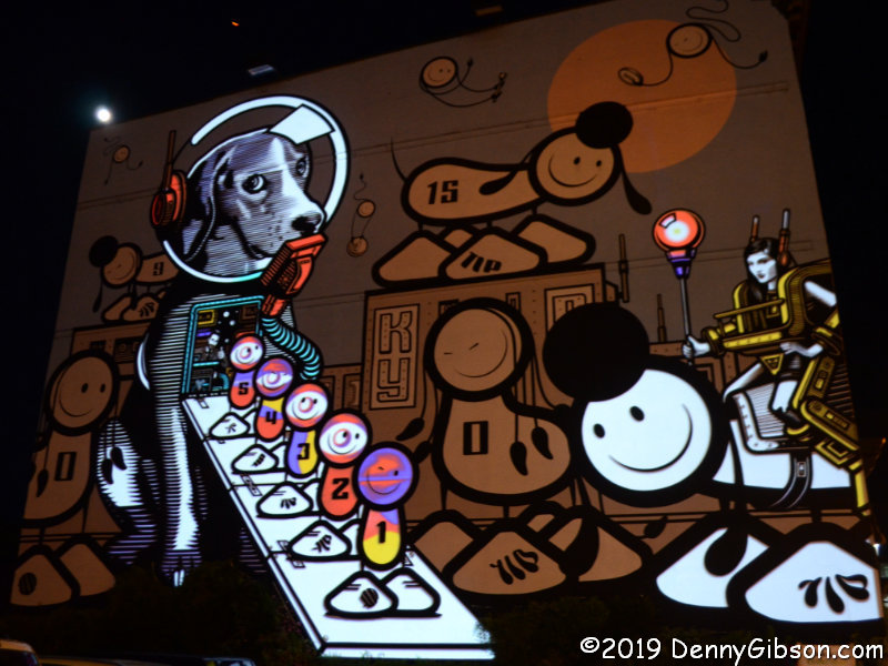
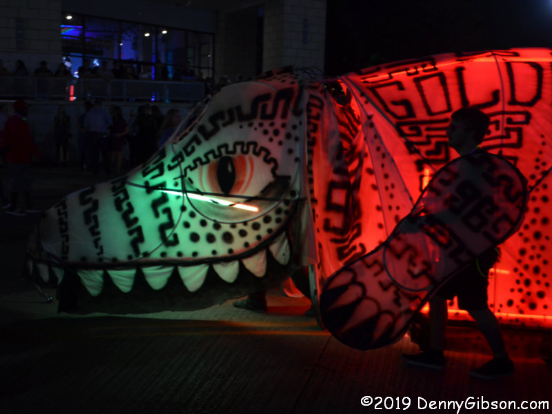
I believe the giant ‘O’ is the one I could see above the parade route people wall. The big wheel is a permanent fixture on Cincinnati’s riverfront. I snapped the picture of the big dog as it headed off to a garage at the end of the parade. It’s another entry that I’d caught in an unlit state. I never did see the dragon in the opening photo in motion.

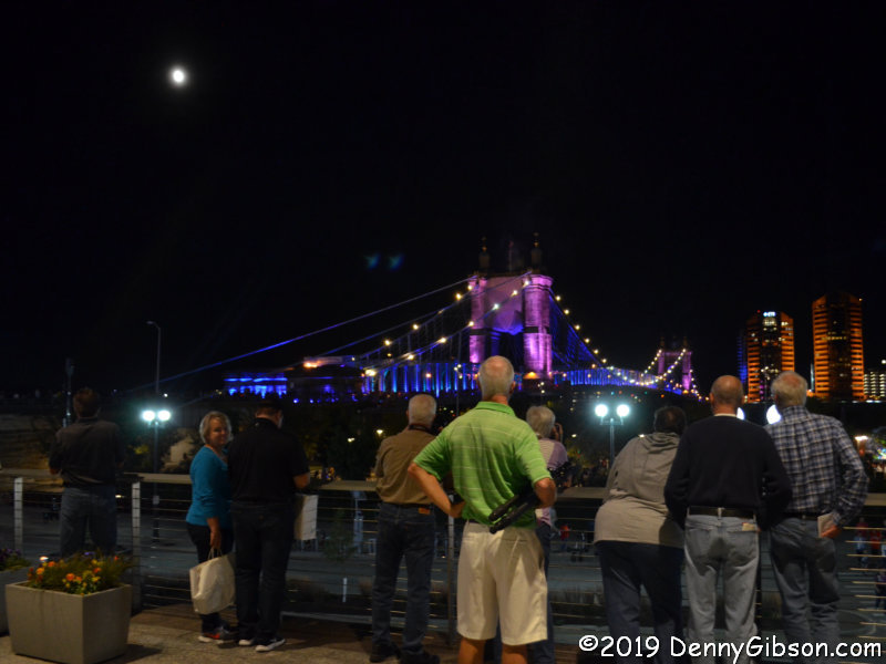
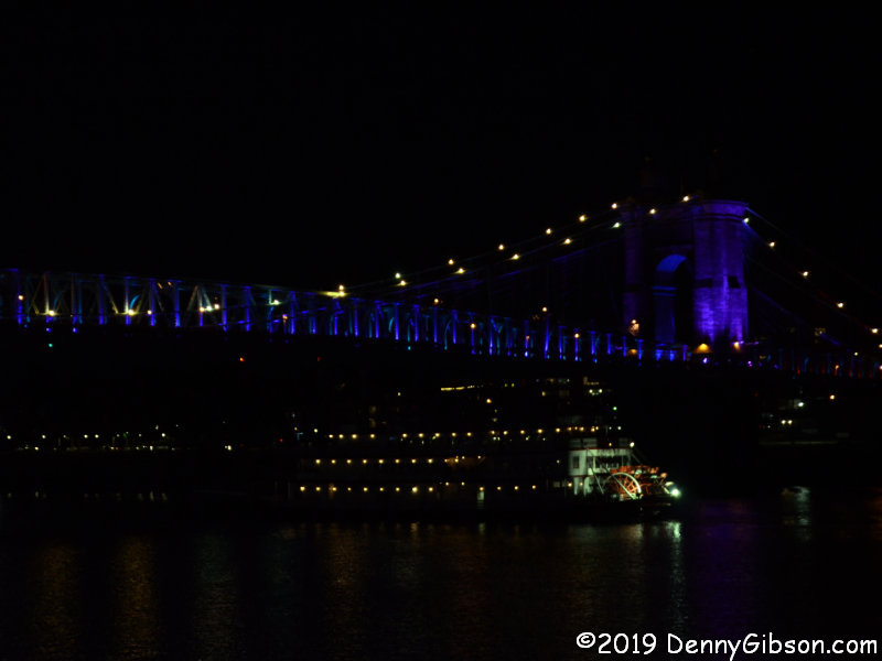
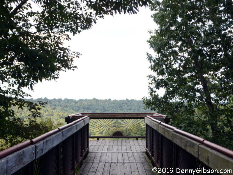
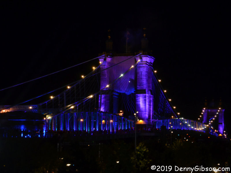
Even though I couldn’t actually see that parade, I went ahead with my plans to reach its endpoint because I wanted to see the nearby Roebling Bridge. It had been the subject of a lot of BLINK promotion but I wasn’t nearly as impressed as I thought I’d be.

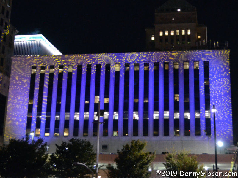
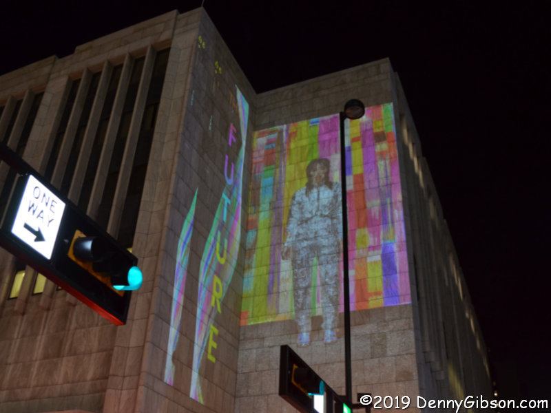
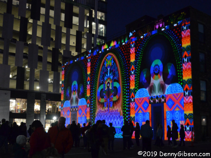
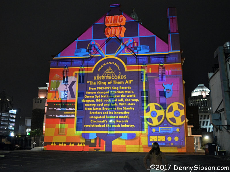
I’d read the advice about picking your targets at BLINK, but I ignored it. I’d done no planning in 2017 and stumbled into something impressive every block or two. I expected to do the same as I headed back north from the riverfront. It didn’t happen. I wondered if my sense of awe was dulled by having seen the technology before. Or maybe my disappointment at missing out on the parade was spilling over into other areas. Both of those are probably at play but I decided there was more to it when I reached the lot in the third photo. In 2017, one of my favorite projections had been here. The brick wall had been the target of a King Records themed projection. This year the lot held the light source for shadow puppets.

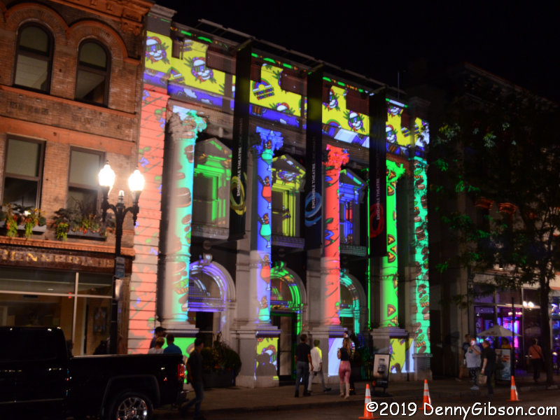
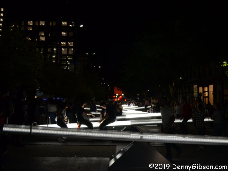
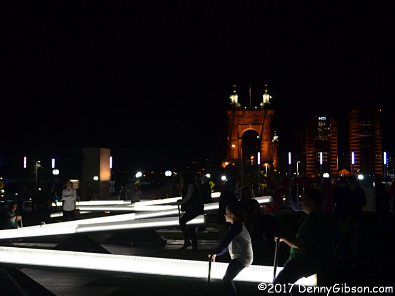
I crossed the street and ducked into the Bay Horse Cafe for a Hudy and contemplation. I developed no insight but enjoyed the beer and stepped out with my attitude slightly adjusted and ready to enjoy whatever I encountered. A rather nice projection (Purpose and Play) at 8th and Walnut was followed by the lighted seesaws on Court Street. The seesaws were down by the river in 2017. I think they looked better in that location, but folks were definitely having a good time with them here. My favorite projection of the few I actually saw was Razzle Dazzle at the Ensemble Theater.

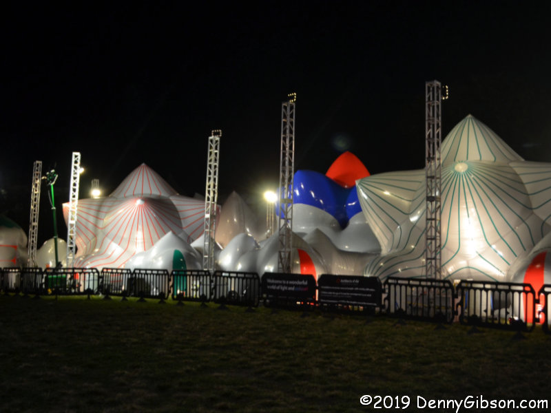
In Washington Park, I captured the giant bouncy house that is Dodecalis. It’s one of the few BLINK installations with an entry fee and the only one (AFAIK) that requires shoes to be removed. My car was nearby and I headed there undecided if my sense of being underwhelmed was justified but too exhausted from walking to really care.


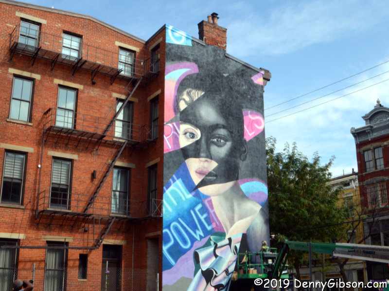
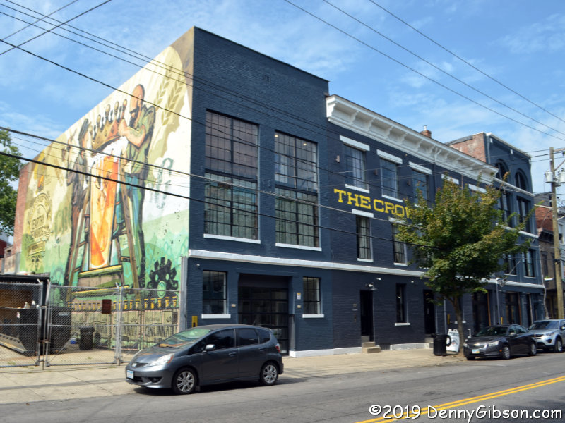
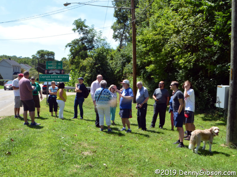
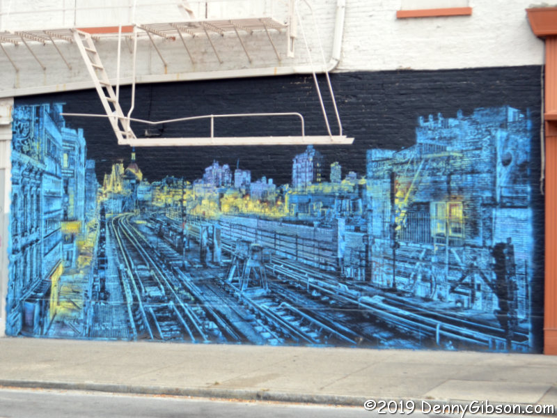
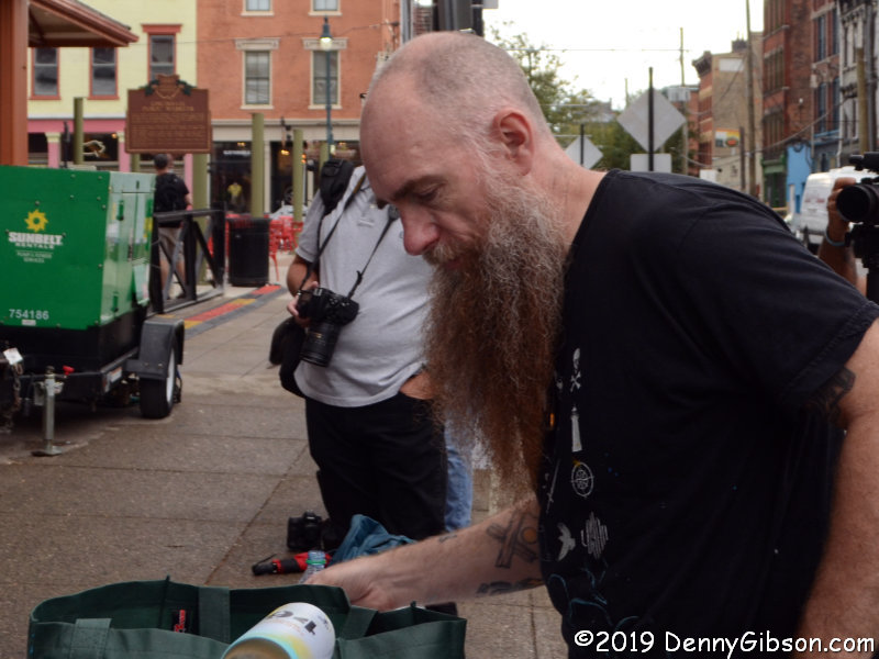
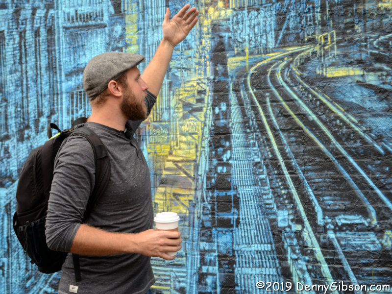
On Friday, I was back. B & H Photo Video, where I’ve spent a little money over the years, sponsored several BLINK related walks led by professional photographers. I took advantage of one in the Findlay Market area led by Derek Hackett of ChopEmDown Films. That’s Derek at our first stop, a mural literally just completed by Logan Hicks.

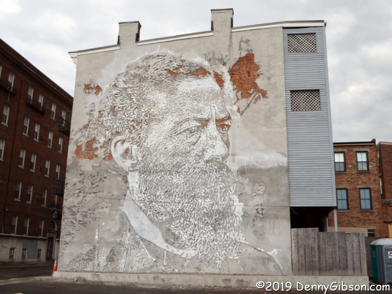
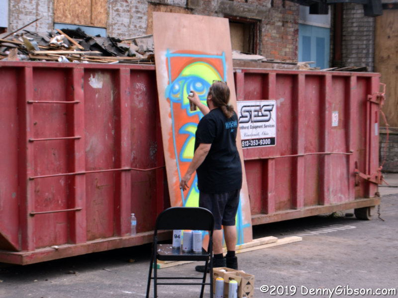
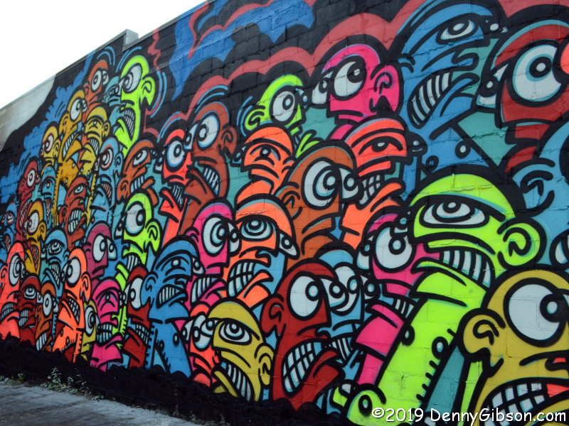
I found the face-on-the-wall extra interesting because it is carved into the surface. It is the work of a Portuguese artist using the name Vhils. The many eyes and bright colors of the second mural make quite a contrast to the photo-like monochrome carving. A bit further on, we encountered Galo, the artist who did it, working on a standalone piece.

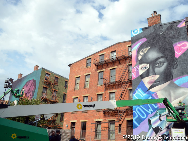
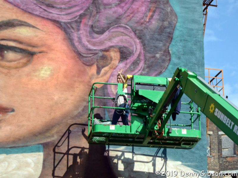
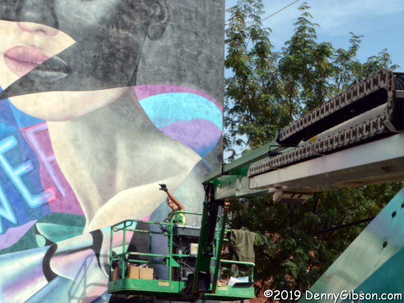
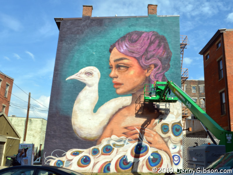
Even though BLINK officially opened Thursday, Galo wasn’t the only artist at work on Friday. Two of them were finishing projects almost side by side, and both Tatiana Suarez and Elle waved to members of our group as we watched them at work. It was immediately obvious that, in addition to having fantastic artistic talent and the ability to work on a very large scale, these people must be able to operate that lift with controls mounted on the platform.

We visited several more murals and I took bunches of pictures but I’m only going to include one more from Friday’s walk. It’s another work in process. It is the work of a group calling themselves the London Police and I found it extra interesting because of the subject. The face in the center of the mural belongs to Tatiana Suarez who we just saw painting the mural of the lady and the swan.


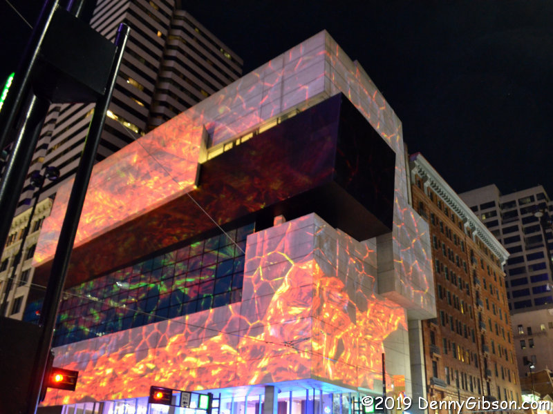
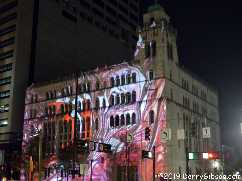
I returned to BLINK yet a third time on Saturday. There are installations on both sides of the river this year and my original plan had been to attend two nights so I could check out the displays in Kentucky. After Thursday’s mild disappointment, I wasn’t quite sure I wanted to go back, but Friday’s experience and seeing photos posted by others convinced me that I’d been the victim of bad luck, my own attitude, and a lack of planning. Saturday’s experience was more in line with my expectations. I parked in Covington, walked across the Roebling Bridge into Cincinnati, and checked out a few specific installations. They included an untitled work from Saya Woolfalk and the projections at the courthouse and the Contemporary Art Center.

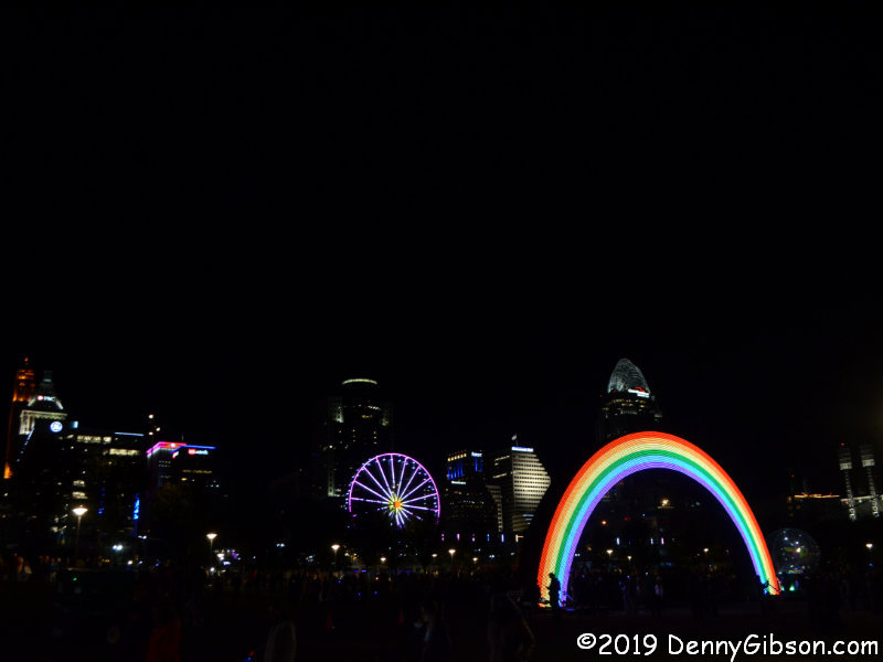
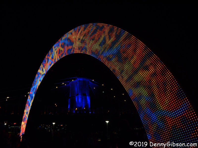
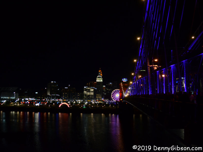
Then I headed to the riverside and the giant rainbow that first appeared at Burning Man. The constantly changing LEDs make the thirty-foot arch much more than a rainbow. In the second photo, it frames one tower of the Roebling Bridge which I appreciated much more this time than I had on Thursday. The bridge is sometimes called the “singing bridge” because of the sounds made by tires on its grated deck. Recordings of some of the bridge’s sounds have been used to produce some slightly eerie but overall very pleasant music that is played through speakers in the park. My improved appreciation was no doubt aided by that music and the view of the bridge from water level.

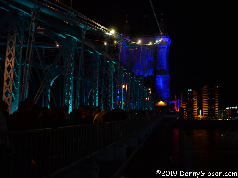
There had been very few people on the bridge when I came north. It was now packed. It is closed to vehicles during the festival but both pedestrian walkways are open and filled. It had taken me several minutes to reach the point on the bridge where steps lead to the park. It took right at half an hour to reach the Kentucky shore from those steps. I probably spent a total of forty-five minutes shuffling over the bridge and overheard claims of an hour didn’t now seem as preposterous as they had when I first heard them on the Ohio side.

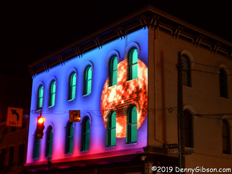
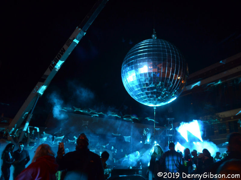
In Covington, a London Police mural is the base for an animated projection. I can’t help wondering who the model for the female figure was. Could it be mural artist Elle? I’m fairly confident that the model for the projection in the second picture is the world’s largest disco ball which people are dancing beneath just half a block away.

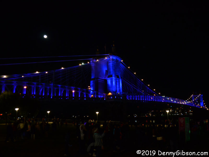
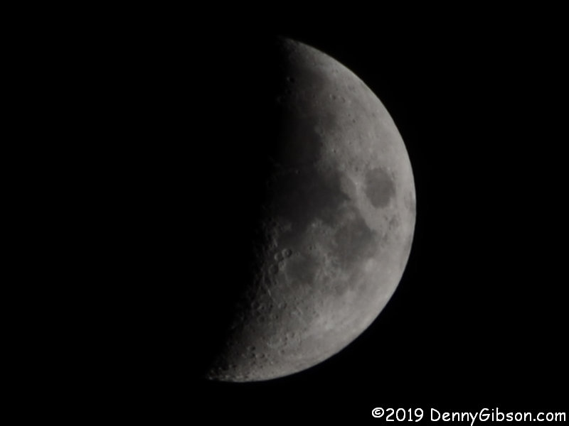
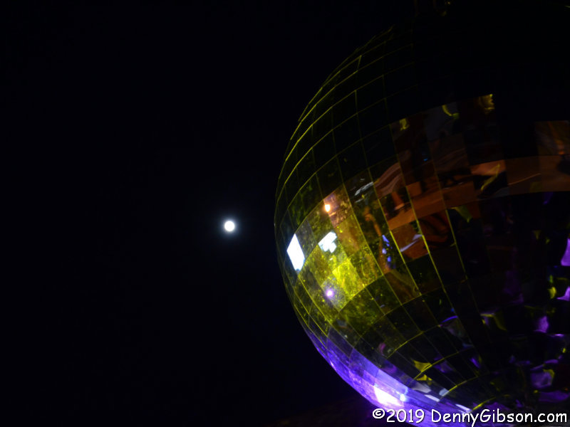
There is one day of BLINK remaining but I don’t anticipate another visit. It could happen though. Tonight that moon will be completely full.  

Destination Moon (in Cincinnati)

The vehicle that Michael Collins flew in circles waiting for his buddies to return is currently parked in the Cincinnati Museum Center. Apollo 11’s Command Module Columbia is on tour and doing a little overtime. The traveling exhibit, Destination Moon: The Apollo 11 Mission, was originally scheduled to appear in just four cities but the tour has been extended to include Cincinnati as a fifth and final stop. When the showing closes here in February, everything returns to a revamped home at the Smithsonian in Washington, DC.

The exhibit reminds visitors of mankind’s long-time dreams of reaching the moon and of the specific events that led to the first manned landing. The space race started to get serious — and scary — with the Soviet Union’s 1957 launch of Sputnik 1. Their hitting the moon less than two years later really underscored our second-place position. On May 25, 1961, after considerable discussion, President Kennedy announced plans to leap ahead of the Soviets by putting a man on the moon by the end of the decade.

The exhibit contains several artifacts from the mission but the star is the Command Module Columbia. Its hatch door is displayed separately which permits both sides to be studied.

Columbia is, of course, the largest item in the exhibit. Surrounded by flat information panels and much smaller items, it automatically draws interest and initially looks rather big. It shrinks considerably, however, when viewed as a home for three men for eight days. It’s not quite 13 feet in diameter and the 218 cubic feet of space in the cabin isn’t much more than that of a typical minivan.

I had difficulty photographing most of the smaller mission artifacts in the exhibit such as the medical and survival kits, but Buzz Aldrin’s helmet and gloves were the things I was most interested in and a little extra effort produced a satisfactory picture.

Seeming to fill just about as much space as the physical artifacts, is a display of photographs taken in the decades since humans last visited the moon in person. For those having and seeking knowledge of the moon’s surface, these large images are possibly even more interesting than the fifty-year-old hardware.

Whiteboards in the hallway leading in and out of the exhibit invite comments on some moon related questions such as “Should we return?” and “What would you take if you went?” A couple of people said they’d take Skyline Chili. Others planned on taking a Mars Bar or green M & Ms. Those are all good ideas but maybe not quite as practical as taking extra underwear. As for how the moon should be used, one person thought it would be a good place to explode stuff and another saw it as a good location for a Disneyland. I was encouraged by multiple “stepping stone to Mars” ideas and discouraged by at least two “leave it alone” suggestions.

I attended Destination Moon as part of a Friday evening members-only event. Other portions of the museum center open for the evening included the Neil Armstrong Space Exploration Gallery where a movie about the famous Ohioan is shown and several artifacts are on display. The gallery opened as part of the Apollo 11 fiftieth anniversary celebration. Future additions are planned. The suit in the picture is an accurate replica. The suit Armstrong wore on the moon is in the Smithsonian. Its backup and the suit he wore on Gemini 8 are at the Armstrong Air & Space Museum which I visited on the anniversary of the Apollo 11 launch. That blog entry is here.

The Museum Center’s OMNIMAX theater was also open Friday evening so I watched Apollo 11: First Steps Edition for the second time. The first time was on the anniversary of the Apollo 11 landing which was also part of the blog entry previously mentioned. When I finally stepped outside the museum, I was surprised to see several large telescopes set up in front of the building. I was aware of an Observe the Moon Night scheduled for Saturday but not this. I guess they decided to do an extra night in conjunction with the members-only Destination Moon event. I stood in line for a bit and was treated to an incredible view of the moon’s surface. At my car, I put on a long lens, steadied the camera against the roof, and got an OK picture but nothing remotely like what I had just seen inside the museum or through the telescope.

Trip Peek #88
Trip #29
Rock and Stone

This picture is from my 2004 Rock and Stone trip. It was one of those working trips that I stretched into a personal trip with a weekend and a couple of vacation days. The work site was in Ty Cobb’s birthplace, Royston, Georgia, so that’s where the trip journal really begins. The title comes from stops at Rock City and Stone Mountain. The picture comes from a ride on Chattanooga’s incline.


Trip Peeks are short articles published when my world is too busy or too boring for a current events piece to be completed in time for the Sunday posting. In addition to a photo thumbnail from a completed road trip, each Peek includes a brief description of that photo plus links to the full-sized photo and the associated trip journal.

Kentucky Giants

Just like the subject of last week’s post, I’ve been aware of the subject of this week’s post, since it — or they — first appeared in early spring. And, just like last week’s walk, a visit to Bernheim Forest and Thomas Dambo’s giants has been waiting for good weather and available time. However, it took more than clear sky and schedule for me to actually make it. It took two tries.

The first try was on Monday. Bernheim Forest lies just twenty-some miles south of Louisville, KY, and I planned to drive most of the way on US-42. I used I-71 to get through Cincinnati then left it for US-42 — and the Dixie Highway. This gave me a chance to stop by a restaurant that has been on my to-eat list for quite some time. Colonial Cottage has been serving Dixie Highway travelers since 1933 while establishing itself as the “Kentucky’s # 1 Goetta Restaurant“. They are also known for their omelets so my first meal there was naturally a goetta & mushroom omelet. I returned to US-42 but the trip was cut short by a flat tire. A broken wheel key/spline meant the car had to be towed to get the wheel off. I’ll make the story as short as that Monday trip by saying that I did eventually get home and the tire did get replaced.

Friday began as an exact repeat. I-71 through the city, exit on the Dixie, and stop at Colonial Cottage. There things started to change. Monday’s omelet had been absolutely wonderful and today’s breakfast was too but today I had no goetta. Then no flat tire. Then I made it all the way to the forest with no problems. It isn’t possible to reach the giants without some walking although there are parking spots, marked by big wooden feet, that can be used to lessen it. Maps are available at the Visitor Center where a trail leading to all the giants begins. The lady handing out maps provided a very good overview and told me the trail was approximately one mile each way.

From the trail, the first giant sighting is across the Olmsted Ponds not far from the Visitor Center. This is Little Nis. The road in the second picture leads to the Visitor Center and a glimpse of Little Nis can be had from it on the way in. I believe this is the only one of the three giants visible from a drivable road.

This is Mama Loumari, mother of Little Nis and the yet to be seen Little Elina. It’s rather obvious that a third little giant is on the way. Nis didn’t seem to have much of an expression at all and I thought that same about Elina. When viewed straight on, Loumari looks sad or maybe just tired. However, in the second picture, taken from her right side, there’s the hint of a smile on her lips. Maybe she’s thinking about the coming birth or maybe it’s because she knows, as Warren Zevon would say, her hair is perfect.

The path between Loumari and Elina leads right behind Sunset Amphitheater at the south end of Lake Nevin. This 25-acre lake appears to be the largest body of water in Bernheim Forest. Fishing from the bank is permitted but I don’t know the details.

Having detected the beginnings of a smile on Mama Loumari’s face, I’m really starting to doubt my belief that both of her children lack any sort of facial expression. Maybe I just didn’t look hard enough or from enough angles. You know? I believe I can actually see Little Elina at least thinking about smiling if I look hard enough.

The lady at the Visitor Center had marked this installation just beyond Elina and I think she even told me who the artist was. You can probably guess just how long I remembered that. It reminds me of other pieces I’ve seen built of twigs including a large maze-like structure in front of the Taft Museum in Cincinnati.

An imprecise visual study of the map indicated that there wasn’t a great deal of difference in length between retracing my steps and continuing on around Lake Nevin. I opted for the new-to-me path and almost immediately encountered this solitary duck. A peaceful spot at the lake’s northern end offered a view back towards Sunset Amphitheater. I first encountered the sea-serpent head-on and had no idea what it was. The side view (and the sign;-) cleared things up.

Back at the Visitor Center, I rested a bit then headed off to another spot marked on my map. I drove a couple of miles then parked near a 75-feet high platform overlooking the forest. This is Canopy Tree Walk. On the way back, I checked out the trees directly below the walkway.

The area around Canopy Tree Walk was to close at 6:00. When I passed back through the gate about 5:30 a ranger was in place waiting to lock it. No one was being rushed but I’m guessing he wasn’t letting any more cars in. I got to see a little more of the forest as I worked my way back to the main exit. I didn’t see it all, of course. This isn’t the sort of place that can be seen in a single afternoon. I came only to see the giants and I saw much more including this tree with prosthetic limbs. Really wasn’t expecting that.

Book Review
A Mythic Obsession
Tom Kupsh

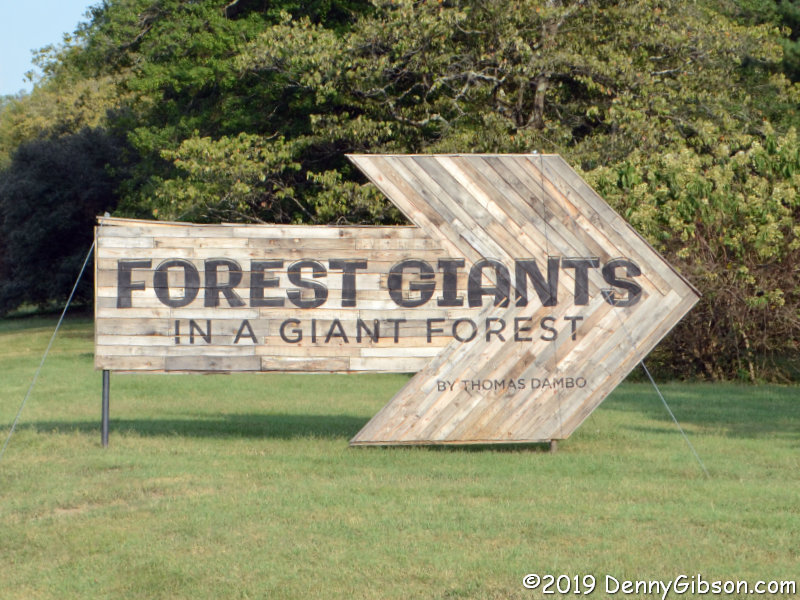
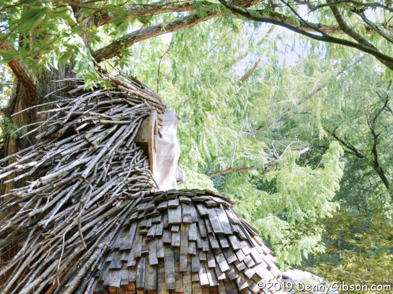
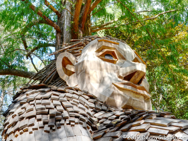
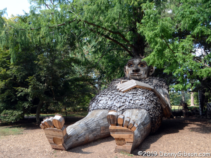
Sometimes I astound my friends with my knowledge, admittedly quite useless, of unusual and obscure roadside attractions. Othertimes I astound myself with my complete ignorance of a major and fairly well-known piece of public art. A stop on a recent Society for Commercial Archeology bus tour was an occasion of the latter sort. I imagine readers of this review will have thoughts that are similarly divided. Some will wonder just what is that pile of junk and why would anyone put it on the cover of a book. Others will smile with instant and delighted recognition. Ah yes, the Forevertron.

From one perspective, the Forevertron is a 65-foot tall sculpture made of various bits of scrap metal. From another, it is a fantastic device waiting to propel Dr. Evermor “up to the celestial spheres.”  From a third, it is a marvelous project that helped Tom Every deal with the real world. Tom Kupsh covers all three of these perspectives in A Mythic Obsession.

The book contains something of a Tom Every biography. It describes his early attraction to unwanted stuff and what seems to be a natural talent for getting some good out of what other people throw away. It tells about his ups and downs in salvage and professional scavenging and his long-time involvement with Alex Jordan and his House on the Rock. His relationship with Eleanor Gryttenholm, a.k.a., Lady Eleanor, that continues today, having survived both marriage and divorce, is in there too. It’s a life that Kupsh describes as rocky but never dull.

It is Every’s artwork, however, that attracts all the attention and warrants a book. Much of it is big, like the Forevertron, but he has also produced some rather small pieces. The common attributes are whimsey, creativity, and scrap metal. Kupsh describes most if not all of Every’s major works. His descriptions usually include information about when and how the piece was made and sometimes even why. He often tells what the components actually are and where they came from. This is very much the case with the Forevertron and that is something I very much appreciated. The book and the sculptures are a natural pair. At times, while reading the book, I found myself wishing I had read it before visiting the collection so I would have been aware of various details about what I was seeing. On the other hand, I’m kind of glad I had my first look with few preconceptions. I’m thinking that neither sequence is wrong and that whether you start with reading or visiting, you’re going to have to repeat. Seeing the sculptures will raise questions that only the book will answer and the book will fuel curiosity that only a visit will satisfy. I intend to return with book in hand.

The biographical bits are aided by several pictures and there are pictures included of the various pieces of art described. Most are black and white but there is a section of really nice color photos that includes an annotated view of the Forevertron. You can bet on me having that page bookmarked when I next head to Wisconsin.

A Mythic Obsession, Tom Kupsh, Chicago Review Press, June 1, 2008, 6 x 9 inches, 196 pages, ISBN 978-1556527609
Available through Amazon.


I purchased my book onsite from Lady Eleanor. Tom is in a nursing home and rarely gets to the Forevertron these days. Both had inscribed the copies available about nine months previous. I selected one with a fairly lengthy message from Tom even though that message wasn’t quite clear to me at the time. I figured it would become readable when I was sitting still in good lighting. It hasn’t. Among the few phrases I can make out are “80 years” (His 80th birthday was five days earlier.), “I can’t see”, “don’t stop your art”, and “The House on the Rock”. All help from those with better eyesight or insight is appreciated.

Brewing Heritage Trail

I wasn’t around when the first phase of Cincinnati’s Brewing Heritage Trail opened in April and checking it out has been on my to-do list ever since. Some nice weather finally lined up with some idle time this week, so off I went. There really isn’t an official beginning or end and the designated Hop On points are essentially just suggestions. Even so, I wasn’t feeling particularly rebellious and following the suggestion seemed easier than not so I did. This is the Hop On point at Findlay Market.

My first stop was physically on the trail but not part of it. I had thought of grabbing something to eat at the market but decided to skip ahead on the trail just a bit and have breakfast at Tucker’s, a Cincinnati institution since 1946. I’ve eaten here in the past but not since a 2015 fire that threatened to permanently close the place. And I’d never met Joe Tucker. Today I sat at the counter while Joe worked the grill and chatted easily with me and everyone else who walked in the door. A great way to start the day.

From Tucker’s, I backtracked just a little to begin following the trail in earnest at Vine and Elder. The current trail is a loop plus the beginnings of an extension on McMicken Avenue and the Elder Street connection to Findlay Market. Signs like this one identify segments of the trail as well as the turns. A map is part of the signage at the Hop On points. It is also available online and I referenced it a couple of times from my phone. Apparently an actual smartphone app was available at one time but it has been withdrawn while “we tweak a few items”.

The former Hudepohl Bottling Plant sits on McMicken at the end of Elder Street. Opposite the building is a display featuring a smiling Louis Hudepohl and lots of information about the company. Hudepohl was one of the few Cincinnati breweries to survive prohibition and was once one of the largest in the state. The main Hudepohl brewery was abandoned in the late 1980s but its 170-foot smokestack bearing the company name remained a Cincinnati landmark until its demolition in June of this year.

Just yards beyond the Hudepohl kiosk, I found something unrelated to the trail but too cool to ignore. It was the mural that first caught my eye but I soon realized that I was standing by a large — and slightly out of place — garden. When a voice invited me in, I stepped through the gate to meet Christina, the Flower Lady of OTR and a volunteer gardener. Started in 1980, the Over the Rhine People’s Garden was the first community garden in Cincinnati. It is filled with flowers, vegetables, and fruit and there there is a weekly free distribution. Food not taken is donated to a local food bank. I even found a small connection to the trail I was following. At least one volunteer does some home brewing and is growing hops for that purpose.

The trail is also marked with medallions pressed into the sidewalks. I’m sure I walked right past some of the smaller ones where they appear all by themselves without even noticing. Just past the green space and playground of Grant Park, this cluster at the corner of McMicken and Moore is pretty hard to miss.

The second Hop On point is just around the corner on Moore Street. It is next to one of the largest murals on the trail and includes multiple information displays. Among the many pieces of information presented is one regarding local per capita beer consumption. That statistic has been cited as one of the reasons that Cincinnati, despite having around forty breweries, was not known as a national distributor. There just wasn’t much left to distribute.

I slipped down the unfinished McMicken Street segment and even backtracked a bit to capture some of the numerous murals along the trail. The Crown Brewery is just one of several buildings in the Brewery District being spruced up to reflect their former lives.

This was once home to Kaufmann Brewery and is now home to Christian Moerlein. In between, it was the Husman Potato Chip factory. Besides containing a brewery and taproom, the building houses the Brewing Heritage Trail Tour Center. A wide variety of tours — both above and below ground — is available. Check them out here. I’d kind of been thinking about a cold brew in the taproom but hadn’t really considered the time. “It’s not yet noon and the taproom is hours away from opening,” I observed to myself dryly.

There were plenty more informative things to read and decorative things to admire. I even have evidence that I didn’t miss ALL of the solo medallions. Reading about history while standing where it actually occurred is always cool.

I finished the loop then the short extension back to the Hop On point at Findlay Market. I’m impressed. An incredible amount of Cincinnati’s brewing history can be learned in an hour’s time walking the trail. As much as I enjoyed the walking and reading, I must admit that two of the day’s highlights were not listed trail features. I really enjoyed talking with Joe and Christina. Both were familiar with and supportive of the trail even without an official connection. I also enjoyed speaking with John Donaldson who owns buildings near the Moore Street Hop On point and who paused to chat as I looked over the nearby signs. If only I could have chatted with a bartender over a cool pint inside the Moerlein taproom.

Trip Peek #87
Trip #141
Lincoln Highway Conference 2017

This picture is from my 2017 Lincoln Highway Association Conference trip. The conference was in Denison, Iowa. The photo was taken during a bus tour stop at Lions Club Tree Park near Grand Junction, Iowa, where bridges from three different periods can be viewed. I made it to the conference in a little more than a day by sticking mostly to expressways. My drive home was a bit more leisurely as I revisited some of the same areas that conference bus tours had covered only I did in on narrow — and sometimes dirt — old alignments that the busses had not been able to follow.


Trip Peeks are short articles published when my world is too busy or too boring for a current events piece to be completed in time for the Sunday posting. In addition to a photo thumbnail from a completed road trip, each Peek includes a brief description of that photo plus links to the full-sized photo and the associated trip journal.

Book Review
Historic US Route 20
Bryan Farr

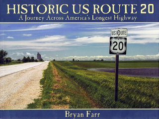
This book didn’t put US-20 on my to‑drive list, that happened long ago, but it did move it up quite a bit. At 3365 miles, Route 20 is currently the longest of the U.S. Numbered Highways so it’s quite naturally a road I’ve thought about driving. I have driven bits of it, of course, and crossed over it many times. It would be pretty hard to completely avoid a road that crosses the entire country as this one does. In Historic US Route 20: A Journey Across America’s Longest Highway, Bryan Farr documents an east to west drive over the entire length of the highway and the entire breadth of the nation with a couple hundred great color photos. There is something I’d like to see in just about every one of those photos.

A chapter on each of the twelve states crossed by US-20 follows an introduction and a brief history of the highway. Each chapter’s opening page contains a small map and some statistics such as length and highest and lowest elevation. A few pictures also appear on those opening pages but the best pictures form the chapter’s body. Many get a page all to themselves and few pages contain more than two. That means they are generally big enough to appreciate and the good print quality also helps.

Some images are of noted man made landmarks, such as the Wayside Inn in Sudbury, Massachusetts, and the Veterans Memorial Bridge in Cleveland, Ohio. Others capture the natural beauty of places like the Driftless Area near Elizabeth, Illinois, and Yellowstone Lake. Together they show off the wide range of experiences available along the highway as well as Farr’s photographic skills.

Although it’s certainly not overdone, the book is not without text. There is that one-page introduction and two-page history that open the book and virtually every picture gets some sort of description. Some get a one-line caption while others get a paragraph or two. Most descriptions that go beyond a sentence provide some history about the subject and all are interesting. There are essentially no travel directions. This is not a travel guide. It is a photographic trip journal and a very attractive one. Even without directions, it will certainly be an aid in planning my own trip. As I said, just about every one of those photos contains something I’d like to see and something likely included in any itinerary. Plus, just flipping through it randomly keeps my desire to drive “America’s Longest Highway” at least on simmer.

A Kindle version of the book is available through the Amazon link at the end of this article. New paperback copies are available directly from the publisher at Historic US Route 20.

Historic US Route 20, Bryan Farr, The Historic US Route 20 Association, Inc., February 16, 2015, 8.5 x 11 inches, 166 pages, ISBN 978-1628476880
Available through Amazon.

A Lesser Count of Counties

I was about to queue up a Trip Peek for today’s post when it occurred to me that a follow on to last week’s post on Hugh Donovan completing visits to all 3134 U.S. counties might be better. I had actually thought I might include something about my own county counting when I began writing about Hugh’s counting in An Awesome Travel Accomplishment but, in the end, I didn’t. The truth is that neither the counts nor the counting are all that similar. There are, you see, quite a few differences between a man on a mission and a guy just wandering into places.

For one, I am not an Extra Miler Club member. That’s not because I don’t think it is a good organization or because I don’t respect its goals. It’s because I do not see visiting every U.S. county as realistic for me personally. It might have been feasible if I’d started when I was 30 or 40 or, like Hugh’s grandson, 15, but not now. That doesn’t mean I don’t track the counties I visit. The map above is mine from Mob‑Rule.com (a.k.a., Why do you think they call them counties?) which anyone can use to track their travels free. There are 1731 counties marked on the map. That’s just over 55% of the total. Hugh’s count was a bit less than that when I first learned of his quest back in April, but that didn’t last long. My “live” map, which also contains numeric counts by state, is here

For another, I’ve never made a trip or plotted a route specifically to accumulate counties. On the other hand, if I see that an unvisited county is just a few miles away, I’ll quite happily make a jog or even drive straight there and back for the score. Again, that doesn’t mean a lack of respect for folks who plan their travels primarily or exclusively to reach different counties. After all, I’m a guy who will turn around to drive a missed bit of old alignment that looks exactly like the road I was already on.

If we weren’t all crazy, we would go insane.
    Changes in Latitudes, Changes in Attitudes,
    Jimmy Buffet, 1977

An Awesome Travel Accomplishment

There are 3142 counties in the United States of America and a surprising number of people have visited all of them. The Extra Miler Club is an organization for folks who have that as a goal. Prior to yesterday, its 100% Club had 61 members. Member number 62 is Hugh Donovan who completed the task by entering Clermont County, Ohio, at 1:50 PM, August 24, 2019.

Hugh’s accomplishment is different from and even more impressive than the others because of time. Those people took years or decades to visit every U.S. county or county-equivalent. Hugh’s stated goal, when he started counting on January first, was to do it within the year. He did it in 236 days, about 2/3 of a year, and that included marking time for several days so as not to get to the party too early.

I first heard of Operation 3142 sometime in April, about the time that Hugh reached the halfway point of his quest. Even then it was hardly a given that he would succeed. Ripping through multiple counties per day was one thing on the eastern mainland but quite another in other areas. In his favor was the fact that one of the big challenges, Hawaii, was already tallied. On the other hand, another big challenge, Alaska, remained and would be even tougher.

Impulsively I thought that Alaska might be the place for the big finish. Hugh and his team were much wiser. Getting the last county in some remote spot might be dramatic but it was also risky. If the end of the allotted year was approaching, reaching anywhere in the far north would be iffy. If December came with places like the Aleutians not yet visited, those visits just might have to wait until spring. There was another reason for not finishing in Alaska that I hadn’t considered at all. It would simply be more fun to celebrate victory where friends and family could join in. Maybe that’s why Hawaii, reachable and highly enjoyable in December, was knocked off early.

Even in summer, hitting all of Alaska had some hiccups and took more than two weeks but by mid-June it was done. Although the to-go count had been dropping rapidly, Hugh had resisted revising his target date. Things now seemed much more predictable and he announced that he now anticipated completion at the end of September. That would beat the original goal by three months and reality would be even better. There were still nearly 1000 counties to be reached but they were all grouped in the heart of the mainland, and for the first time I started thinking that the final county might be within some reasonable distance of my home.

But not only would this revised completion date be soundly beaten, the final county would be within an unbelievably reasonable distance of my home. The white area on his scoring map was steadily shrinking with its center moving to the east. On August 1 a revised — and quite precise –completion date was announced that trimmed more than a month from the end of September target. Hugh planned to enter his 3142nd county on August 24. That was barely three weeks away from the announcement date but astonishing me even more was the news that the final county would be one barely three miles away from my door. In addition to the county itself being ridiculously close, a planned celebration would be taking place nearby at a familiar brewery. Attending was an instant no-brainer.

There was a small group gathered at the county line a little ahead of when Hugh planned to cross it. Fortunately, some in the crowd were more attentive than I and knew what to look for. My first glimpse of Hugh was after he had exited the car driven by his son and was beginning to walk the last 50 or so yards to the sign marking the country boundary. He stepped across to cheers and applause.

Several posed photos followed with many including family and friends who had assisted in planning and executing the numerous journeys. That’s the A team in the middle picture. Hugh is in the center with, left to right, his son, wife, daughter, and grandson. As you probably suspected, the third picture was not posed.

In time, things moved to the nearby Narrow Path Brewery where some fairly informal formalities took place. Extra Milers Club Vice President, Jonathan Riehl, was on hand to present Hugh with a plaque honoring his accomplishment. The club also awards certificates for hitting certain milestones like 500 or 1000 counties but Hugh blew through those so fast there was no time to mail them so Riehl just handed them over en masse. Then Hugh did a little talking but most of what he said was thanks. It was pretty clear that he considered the most impressive part of what he had accomplished to be the routing and other logistics management that others had contributed. He was proud of what he had done but seemed even more proud of what his son, daughter, wife, and grandson had done. Cool guy.

There may be a book coming out of this adventure. I certainly hope so. Until then, pieces of a most interesting story can be glimpsed by scrolling through the posts at Operation 3142. Nicely done Hugh. Congratulations. Thanks for wrapping things up in my neighborhood.