
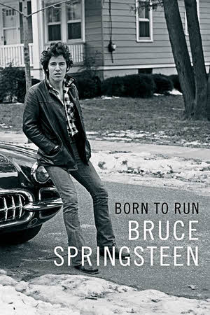
 It’s exactly what you’d expect. That’s not to say that there is no new information and no surprises but the sometimes almost poetic writing style is exactly what I expected from a man who has produced some of the most notable English language lyrics of the last four decades. It’s no secret that some of those lyrics were just a bit autobiographical so it’s possible to think of this as sort of a much longer and more detailed version of the story he’s been singing since he first greeted us from Asbury Park.
It’s all intertwined, isn’t it? Central to the story that he tells so compellingly is the fact that he is a compelling story teller. The reason we know the name Bruce Springsteen and the reason we are interested in his biography is that he is a phenomenal performer, talented musician, skilled song writer, masterful band leader, and… compelling story teller.
As a long time fan, I knew the basics so the book really did do a lot of detail filling in for me and most of those details weren’t surprising. They were just additional and better information that fit what I already knew about his family, early bands, management squabbles, and the like. To a lesser degree that’s even true about the battles with depression. There’s no doubt that one of the highest highs in the world is being Bruce Springsteen on stage so it’s not hard to accept that being Bruce Springsteen off stage can sometimes be one of the lowest lows. He writes candidly about it as he does with everything else.
Although not all do, an autobiography, besides being able to include some otherwise unknown details, can include intimate thoughts and attitudes not available to biography writers. I had read almost the entire book before it finally registered with me that this was the case with Born to Run from the very first page. By “almost the entire book” I mean the last sentence of the next to last chapter. In a paragraph that may have been the final one in some not quite finished version of the book, Springsteen tells us that “Discretion and the feelings of others…” have kept certain things out of the book but that the inside of his head isn’t one of them. “But in a project like this, the writer has made one promise: to show the reader his mind. In these pages I’ve tried to do that.”
The book contains plenty of insightful serious glimpses into that mind but a couple of insightful fun ones really registered with me. Both were in the relatively recent past. One shows his unstoppable ambition and the other his sheer love of rock and roll.
The E Street Band’s 2009 Super Bowl appearance has been cited as the seed for this book. I’d seen the four song performance and kind of assumed it was no big deal to Springsteen. It was and he was extremely nervous in the days and minutes before show time. He had played to plenty of filled stadiums but not to 150 million TV viewers. He still had worlds to concur. “I felt my band remained one of the mightiest in the land and I wanted you to know it.”
In 2012 the Rolling Stones were playing in Bruce’s neighborhood and asked him to join them for “Tumbling Dice”. There’s a video online and in it Bruce never stops grinning. It’s possible he hadn’t stopped grinning since the night before when they rehearsed it — one time! — in a warehouse. “…these are,” as Bruce explains it, “the guys who INVENTED” my job!”
The last chapter, titled “Long Time Coming”, could serve as an epilogue if a labeled epilogue didn’t begin on the next page. It begins with some thoughts about the Springsteen generations immediately before and after his own. Writing this book helped him understand his parents and he has some hope that it will help his kids understand him. The sentence that begins the chapter’s second paragraph is “I work to be an ancestor.” Like so many magic snippets of his lyrics, those half-dozen words say more than most people can say in a full page. Almost everything he’s written about his own ancestors throughout the book and about his own offspring in its most recent chapters is brought into sharp focus with that one sentence.
The epilogue follows and there is even an essentially unnecessary “About the Author” page. The book ends with several pages of photographs that begin with baby Bruce and end with Bruce and wife Patti on horseback leaning together to share a kiss. My guess is he’s going to be a pretty good ancestor.
Born to Run, Bruce Springsteen, Simon & Schuster; September 27, 2016, 9.2 x 6.1 inches, 528 pages, ISBN 978-1501141515
Available through Amazon.
 I’m not really going to review this twenty-seven-year-old book that I’m guessing thousands of professional reviewers have written millions of words about. When I first read it, more than two decades ago, I thought it was one of the best books I had ever encountered. A recent re-read only reinforced that. The re-read was prompted by plans to attend a performance of a play based on the novel. I’m going to say some things about that performance but this really isn’t a review of it either. In fact, I find myself stumped in trying to explain just exactly what this is. Whatever it is, it was triggered by my recent experience with a book and a play.
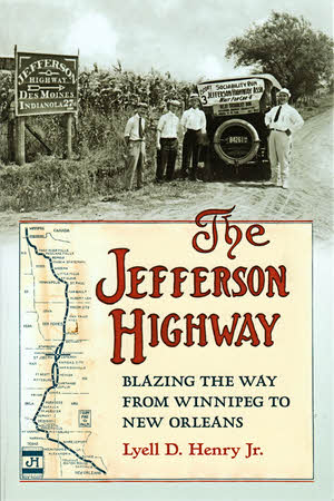 In its preface, Lyell D. Henry Jr. suggests that this book is something of a compromise. The reason is that he once set out to write about every detail of the Jefferson Highway and the association behind it. That’s a lot of details and, especially with no known central source for records or maps, a formidable task. Henry says he “…settled on writing a book that would open with a general accounting of JHA’s early pursuit of the entire highway but then narrow its focus to the highway through Iowa.” The Jefferson Highway: Blazing the Way from Winnipeg to New Orleans is indeed a book of two parts. The first four chapters cover the history of the organization responsible for the entire highway; The last three tell the story and describe the route of the road in Iowa. The scale may be less and the focus may be narrower than what Henry once had in mind but, within that narrowed focus, there is certainly no detectable compromising of accuracy or completeness.
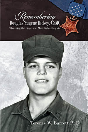 Remembering Douglas Eugene Dickey is something I’ve done for a long time. We were classmates through twelve years of school. We weren’t super close. Not like the teammates on the football squad that broke a thirty-eight game losing streak and not nearly as close as the four other classmates who enlisted in the Marines with him but we were friends. With something like sixty-five students in our graduating class everybody knew everybody. Yes, I’ve been remembering Doug Dickey for a long time.

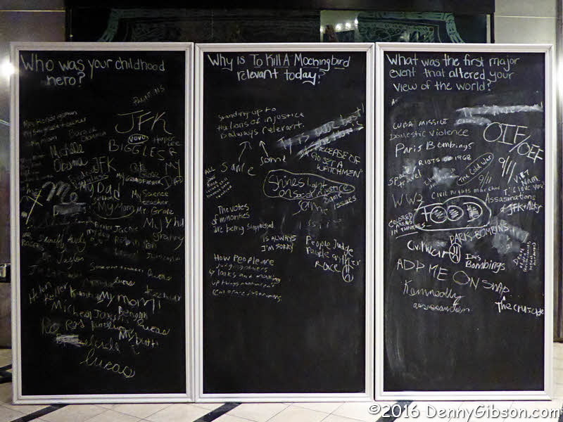
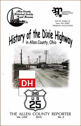 I could have called this a pamphlet review. That’s technically what it is. Or, since one definition of pamphlet is “a small book”, I could have called this a small book review. I decided to leave the title be but, in line with the publication’s size, I’ll try to be brief and do a small small book review.
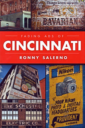 Buying local is a good thing and so is reading local. I was able to combine the two recently. November 30 was the official release date for a new book about Cincinnati and in the early evening its author made the book and his signature available at a downtown location that appears between its covers. The book was Fading Ads of Cincinnati, the author Ronny Salerno, and the location Igby’s Bar inside a building with a fading “TWINE PAPER” painted on its side. Those two dim words are typical of the fading ads that are the book’s subject. How could I not?
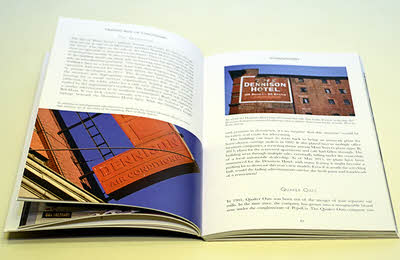 The photos aren’t left to stand alone. Captions describe each of them, of course, and many get multiple paragraphs of attention. Salerno has been successful in digging up many of the signs’ histories with some of the best stories coming from signs identifying local or regional companies that are no longer with us. Names like Shillito’s and Brendamour’s will be recognized by many Cincinnatians and probably some others as well. Out-of-towners might not be familiar with local landmarks like Davis Furniture (“The Friendly Store”) or the Dennison Hotel (“105 Rooms – 60 baths”) but they are exactly what I and some other locals think of when we think of “fading ads” or the more common “ghost signs”.
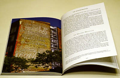 Salerno brings up the phrase “ghost signs” in the introduction and says people often thought he was writing about the supernatural when he used the term. “Fading advertisements”, he says, doesn’t have that problem. Fair enough but it’s just possible that his position also has something to do with the book’s predetermined title. “Ghost sign” slips into the book a time or two and in the final chapter Salerno more or less acknowledges the validity of both. As for me, I’m comfortable and most familiar with the term “ghost signs” (and “ghost bridges” and “ghost towns”) so I’ll just continue to think of Fading Ads of Cincinnati as a book about ghost signs.
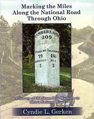 That’s a pretty long book title. There’s a subtitle, too, which makes the whole thing Marking the Miles Along the National Road Through Ohio: A Survey of Old Stone Mile Markers on Ohio’s National Road. It’s long because it, just like the book it identifies, is accurate and precise. The book accurately and precisely locates the 175 mile markers originally set, as accurately and precisely as early nineteenth century technology and local politicians would allow, beside the Ohio portion of the very first federal highway. With all that accuracy and precision you might think this volume would be completely dry and boring but that’s not the case. Stories about the road, the countryside, and even the markers themselves lighten and soften things considerably. Color photos and maps make the book attractive.
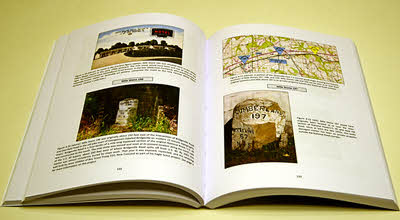
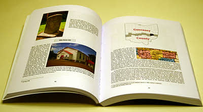 Seven of the ten Ohio counties through which the National Road passed are covered in individual chapters following the introduction. No markers were ever placed in the three westernmost counties on the route as federal funding ended near Springfield in Clark County. Each of these chapters begins with an overview of the county that includes a summary of how many original markers there were, how many remain at their original location, how many exist elsewhere, and how many are lost. Each marker is then addressed individually. With few exceptions there is at least one picture. If a given marker survives, a current photo is included and one or more historical photos are usually presented regardless of whether or not the marker is still around. Understandably, markings on many of the older stones are not exactly legible. Not to worry. Appendix B contains crisp drawings of the inscription of every marker. Markers can often be seen, accidentally perhaps, in old postcards and other photos and many of these appear in the book. Each marker’s history is given and stories about the marker or the area around it frequently add a little fun and background. Placed among the individual marker descriptions are sections of US Geological Survey 7.5 minute topographical maps showing the location of the markers three at a time. Other National Road related landmarks are often shown on the maps as well.
 Bringing all of this information together is clearly a major accomplishment but Gerken, a past ONRA president herself, says the information is only a portion of what she has collected on the National Road in Ohio. A well deserved breather follows wrapping up Marking the Miles Along the National Road Through Ohio. Nothing is currently scheduled or promised but the future could see a Gerken penned treatise on bridges or taverns or toll houses or something else. I certainly hope so. I like accuracy and precision and I also like anecdotes and insight. Marking the Miles… provides a pretty good mix.
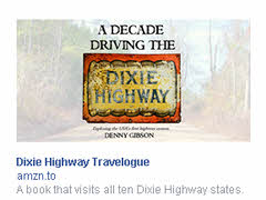 On Friday morning a friend observed on Facebook that he was getting email from every website he had ever visited that had something to sell. His situation was hardly unique. I’m rather confident that everyone with any sort of internet connection was seeing an uptick in activity on the official beginning of open season on customers. The barrage had been building as anxious hunters fired off emails and other communications telling us that their Black Friday started on Thursday or Wednesday or even earlier. This is, I assume, the same sort of time warp that allows certain drinking establishments to advertise “The world’s longest Happy Hour”. I considered emailing him some sympathy but didn’t for two reasons. One was that to do so would be to add to the tide of useless messages in his inbox. The other was that I would soon be part of the problem.
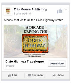 The image at the top of this article shows the ad that appears in what Facebook calls the “Desktop Right Column”. The one at left is for the “Mobile News Feed”. Other variations appear in other channels. As can be seen in the “News Feed” version, the ads are sponsored not by me but by
 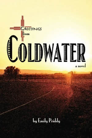 I’m going to admit right up front that defending this post against my About page claim that readers will “not be seeing a review of the latest novel” is pretty much a lost cause. I proclaimed my earlier review of