A Pair of Parks and a Pint

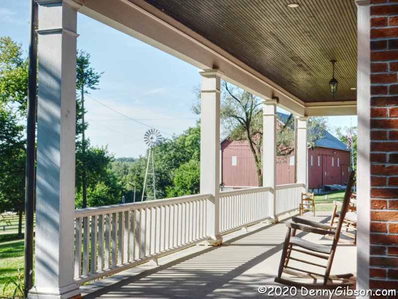
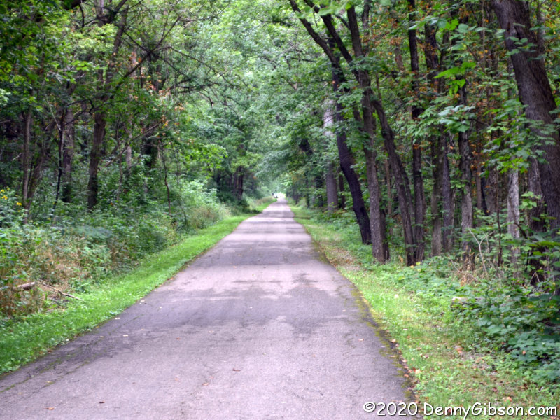
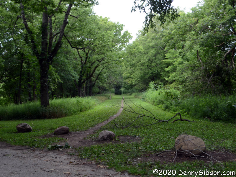
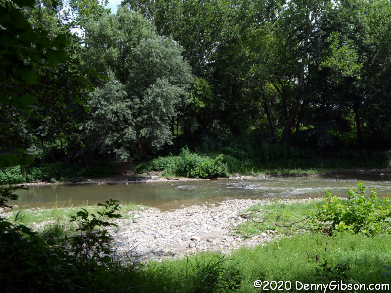
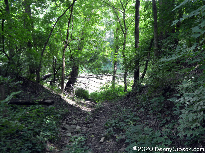
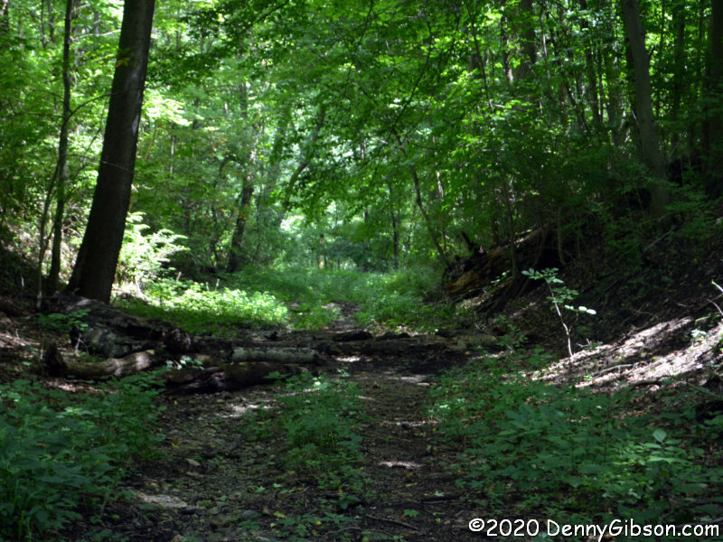
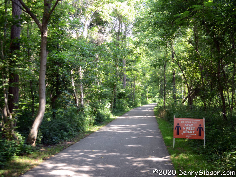
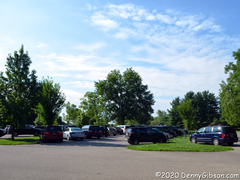
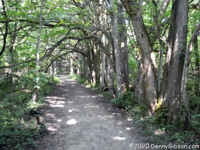
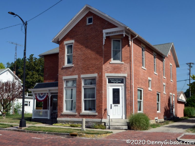
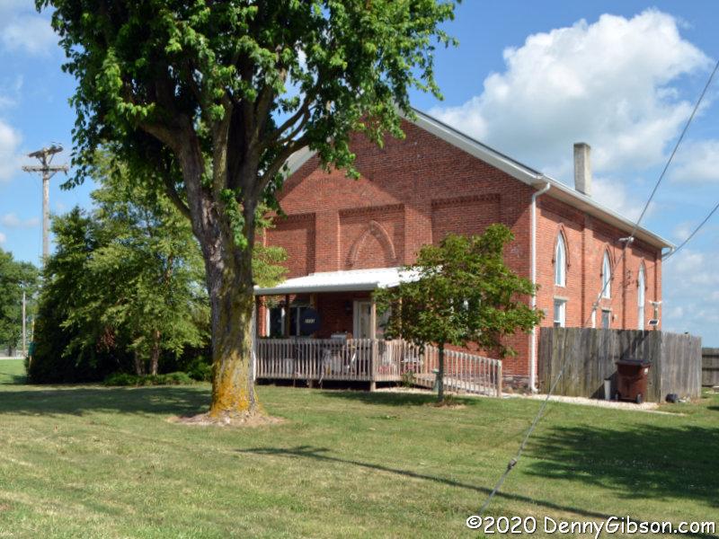
Parks are pretty good places to go when one of your goals is not getting close to people, and Friday’s extra fine weather made doing something outdoors all but mandatory. I had only recently heard of Chrisholm MetroPark and the fact that it was fairly close to another park I’d been thinking of revisiting made it the choice for my first stop of the day. The opening photo was taken from the east end of the full-width porch on the front of the Augspurger House.

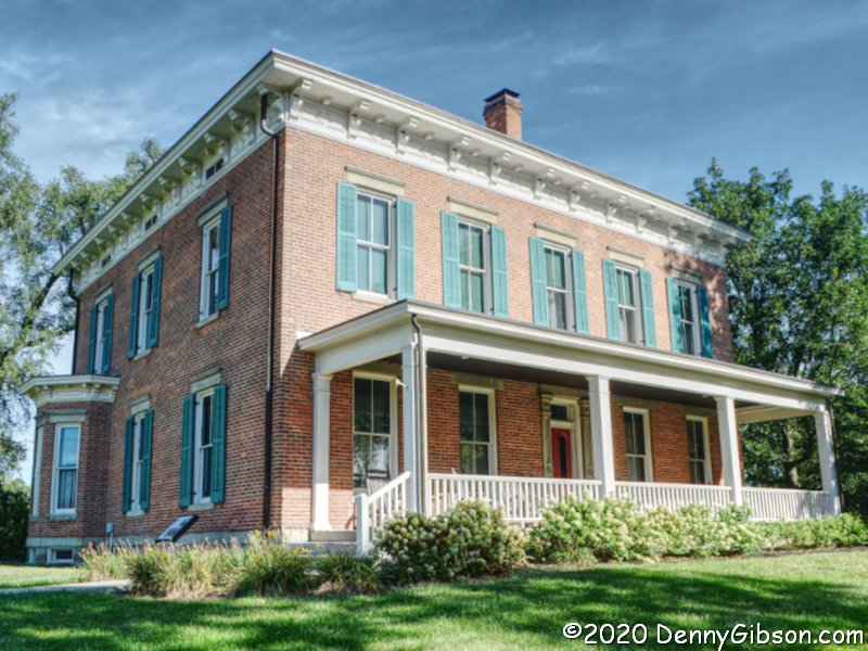
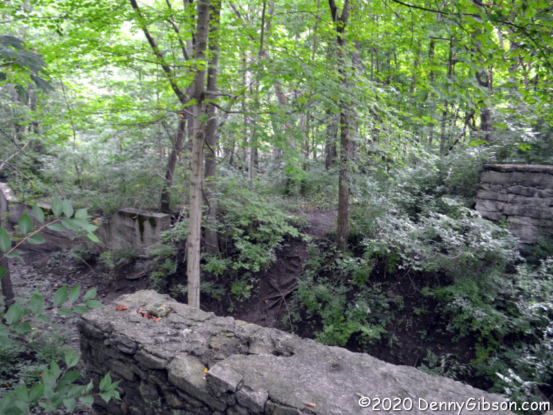
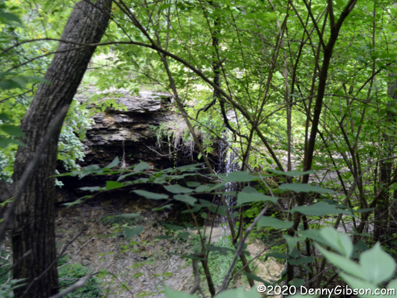
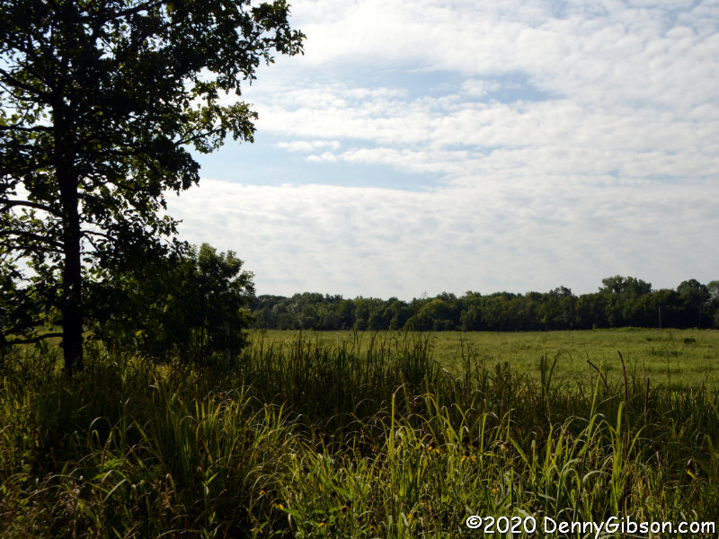
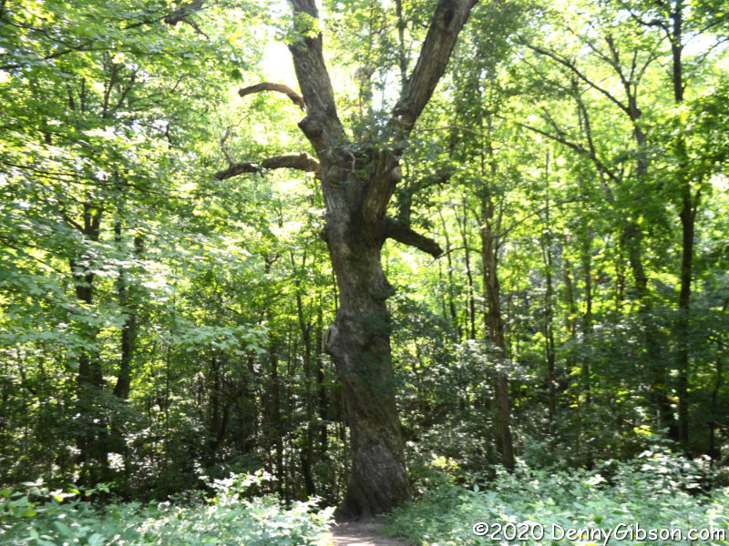
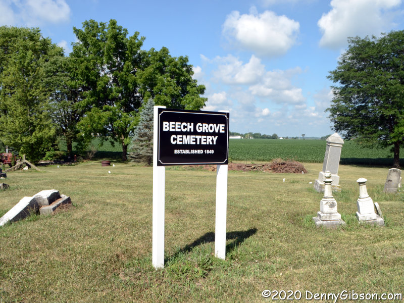
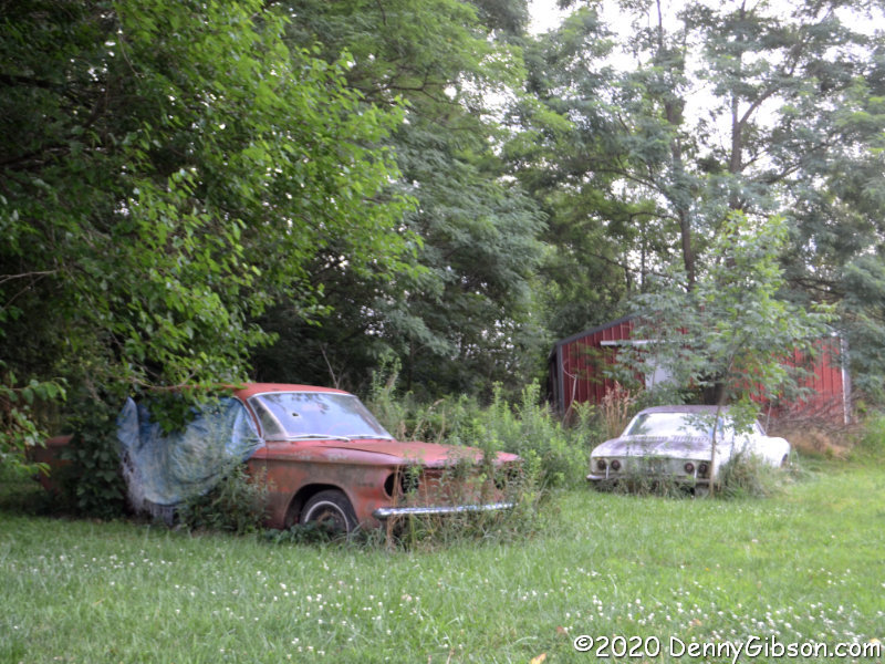
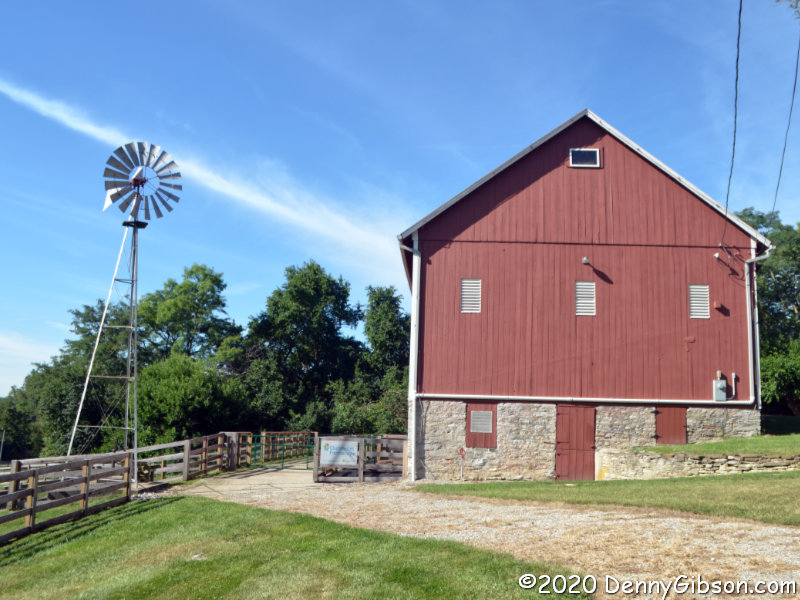
In normal times, tours of the Augspurger House are given on certain days but that has been curtailed by COVID-19. There was no apparent activity at Rosemont Barn, either. In fact, the only non-visitor I saw was a fellow doing some mowing in a field on the far side of the barn.

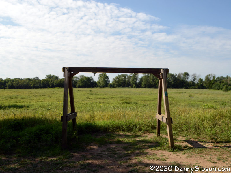
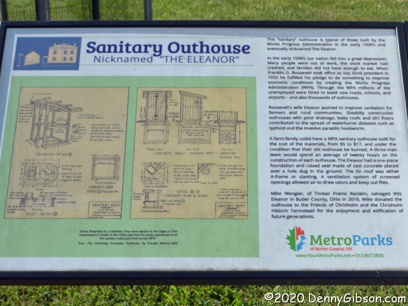
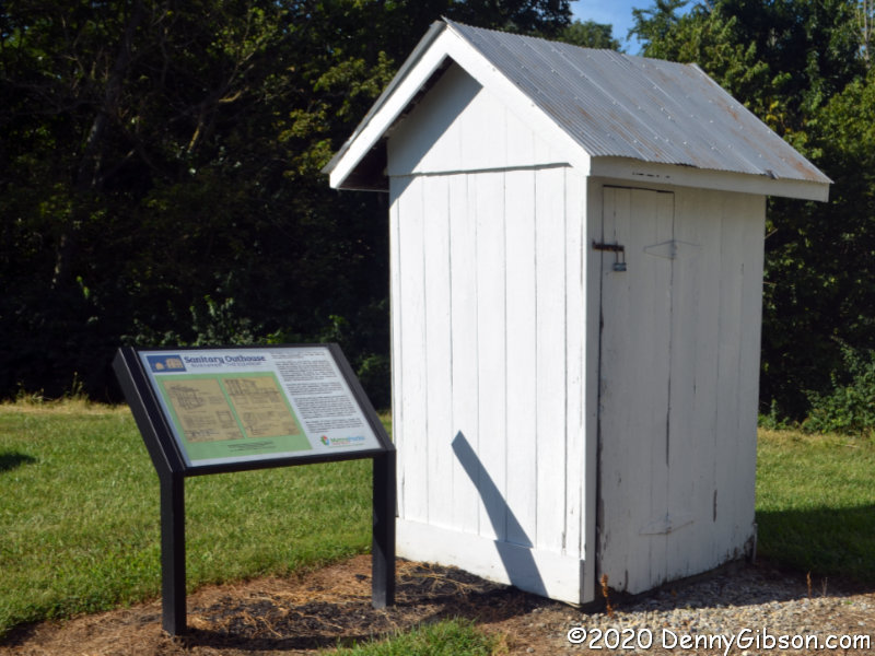
This turned out to be the most interesting building in the park today, and I think it would be quite interesting even with house tours and a critter filled barn as competition. The interesting part is that, as the sign explains, it is one of thousands built by the Works Progress Administration. Existing outhouses were often quite shabby with poor drainage. For the cost of materials, the WPA would construct a properly designed sanitary outhouse. The WPA was the brainchild of Franklin Roosevelt and his wife was the major proponent of this effort to improve sanitation in rural areas. The tidy tiny buildings became known as Eleanors.

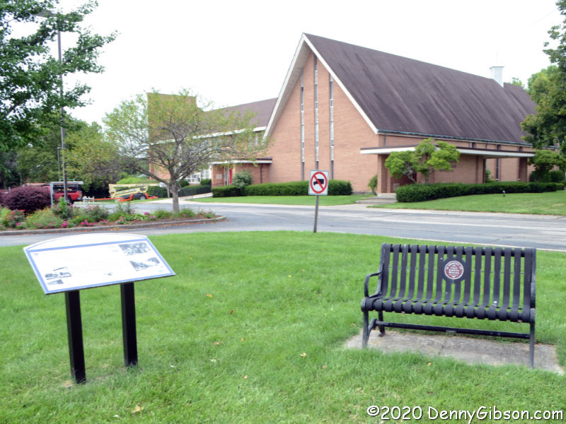
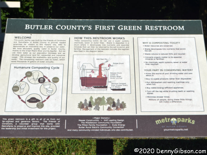
That’s just one of the things I learned today. I also learned a new word. The park’s real restrooms are next to the restored (but unused) Eleanor. They are currently closed and I didn’t even get a picture of the building but I did get a picture of a sign describing them and teaching me a new word. Described as “Butler County’s First Green Restroom[s]”, the composting restrooms deal with “humanure”.

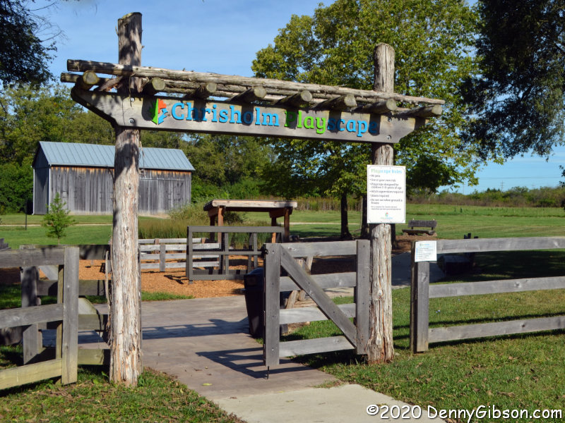
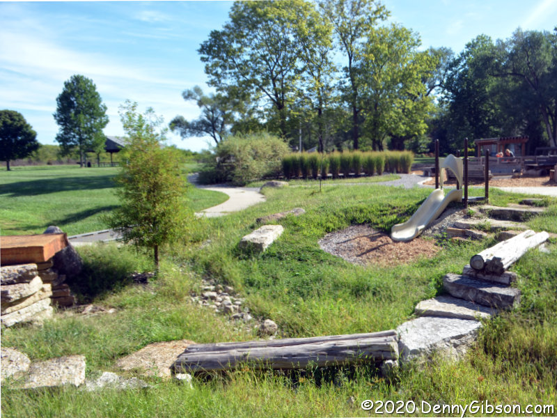
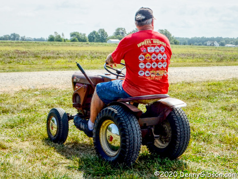
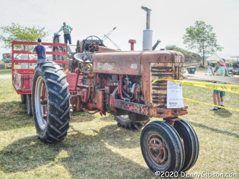
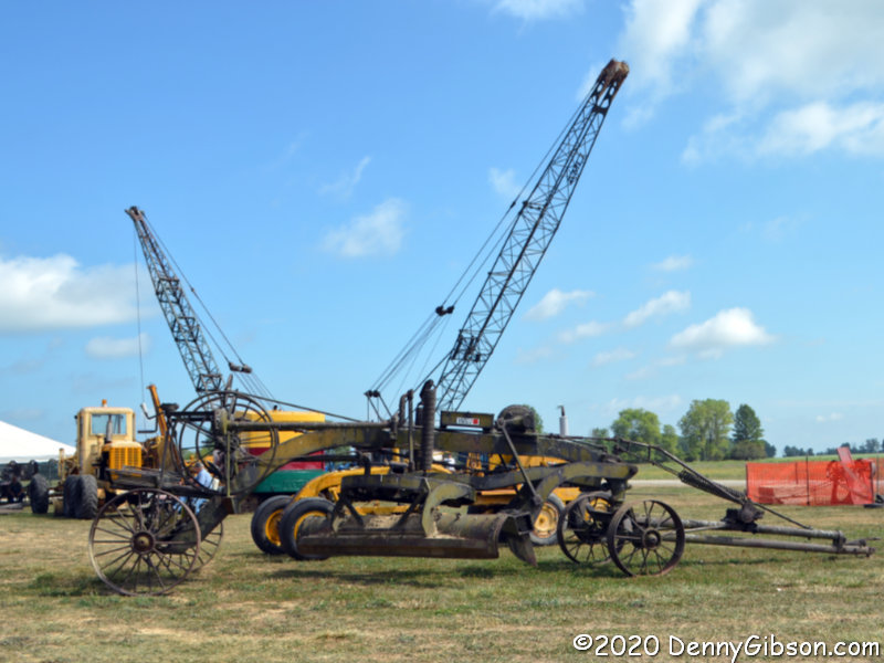
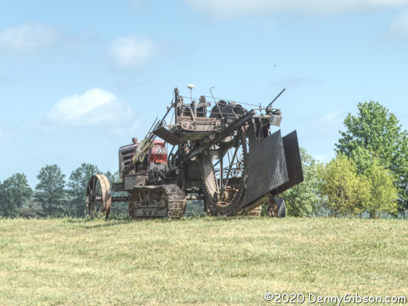
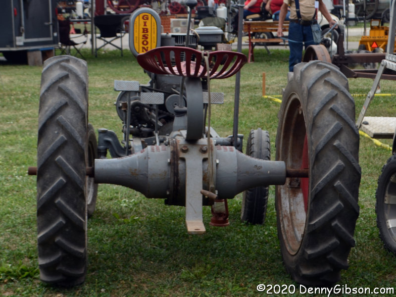
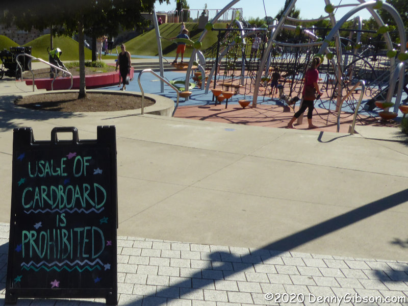
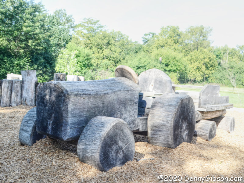
Half of the visitors I saw in the park were at this very cool Playscape. On the way out, I drove by a couple walking their dog, and here I encountered a mom and daughter having a great time on the rustic-styled playground equipment. They do appear as two dots in the background of the second picture, but I really tried avoiding them in my pictures which meant waiting to photograph the tractor while mom was in the wagon being pulled “very fast”.

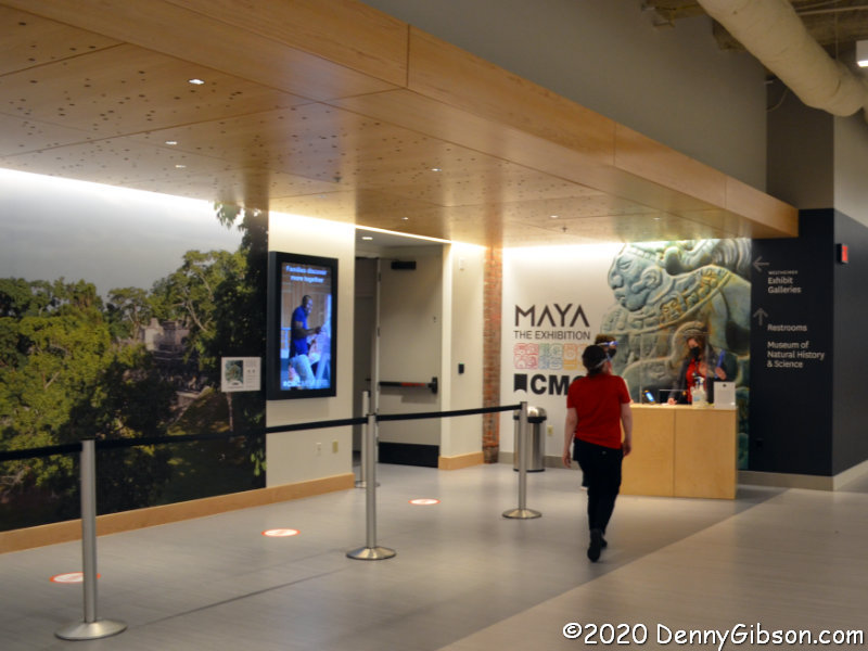
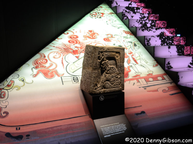
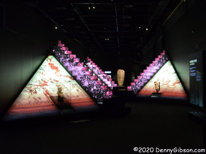
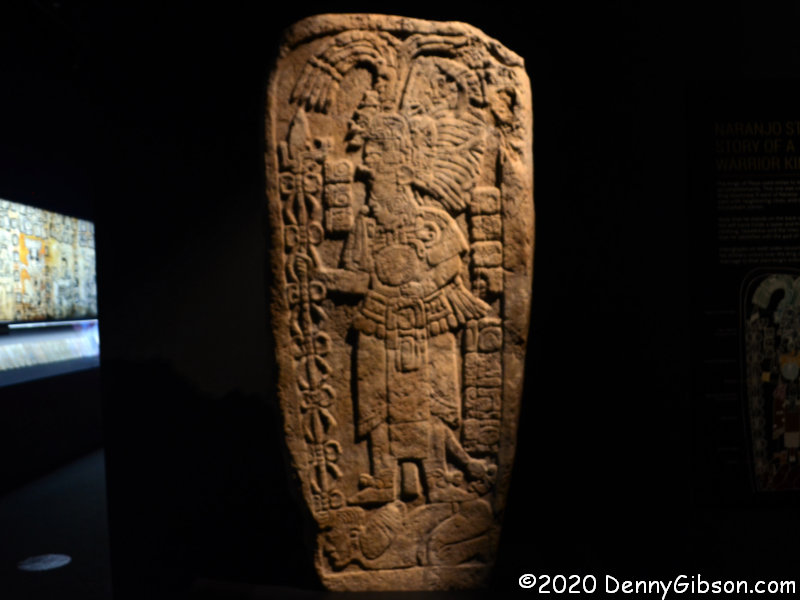
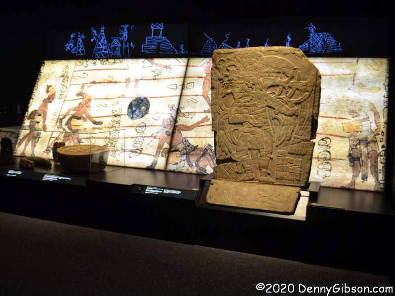
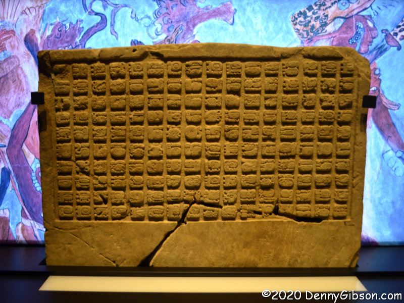
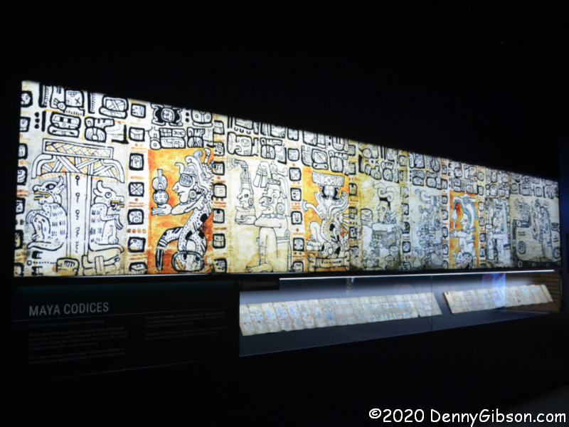
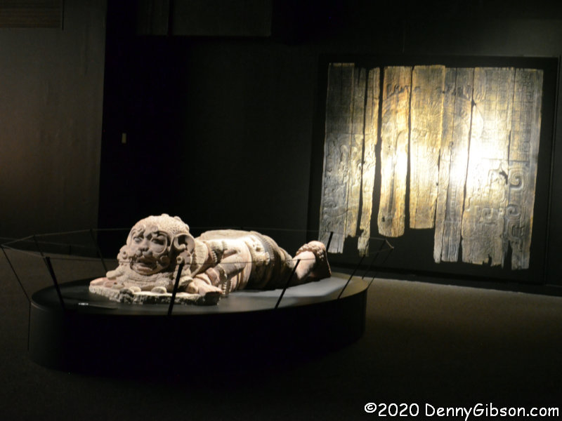
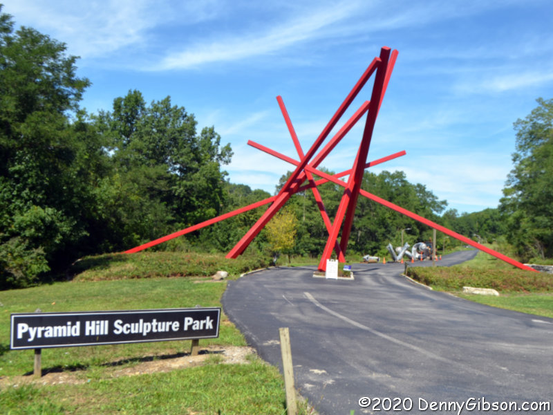
Pyramid Hill Sculpture Park is a little more than eight crow miles from Chrisholm MetroPark. My most recent visit was last December for the Holiday Lights. Today was a reminder that I need to come in the daytime more often and I probably need to pack a lunch. I also need to schedule better so that I am here when the indoor Ancient Sculpture Museum is open.

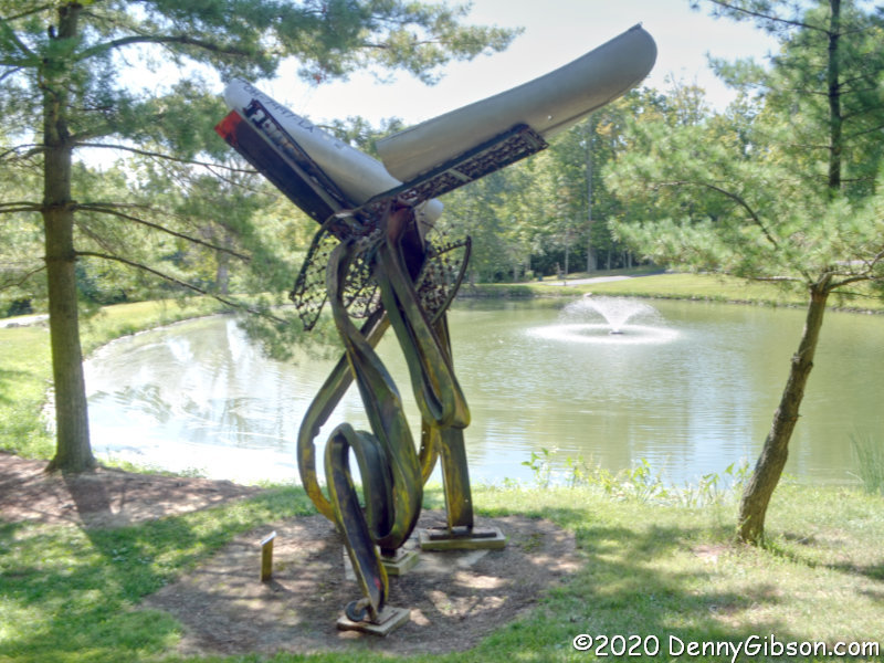
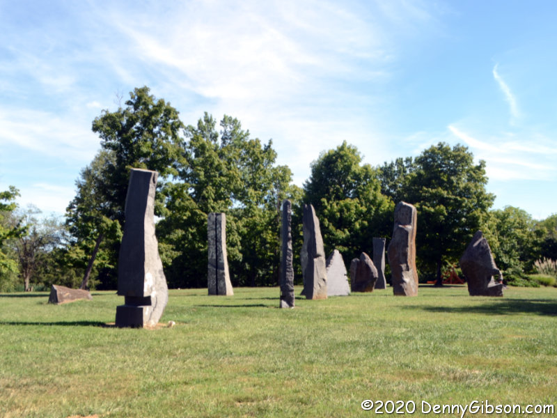
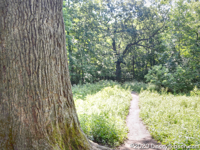
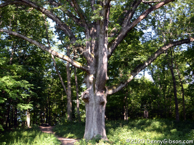
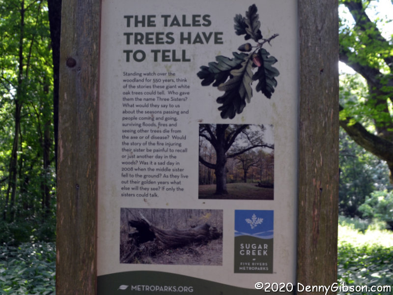
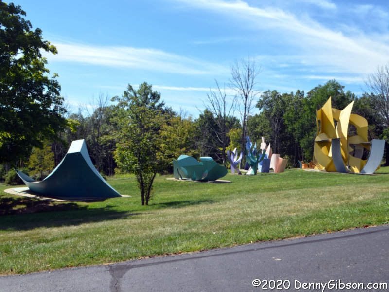
I started off misreading the map so was sort of walking around randomly for a bit. That’s not a problem, of course, as there are sculptures and scenic backdrops everywhere. These photos were chosen about as randomly as my path. The first is of Greg Loring’s Life’s Twists and Turns. The second is Age of Stone by John Isherwood, and the third is George Sugarman’s Garden of Sculpture.

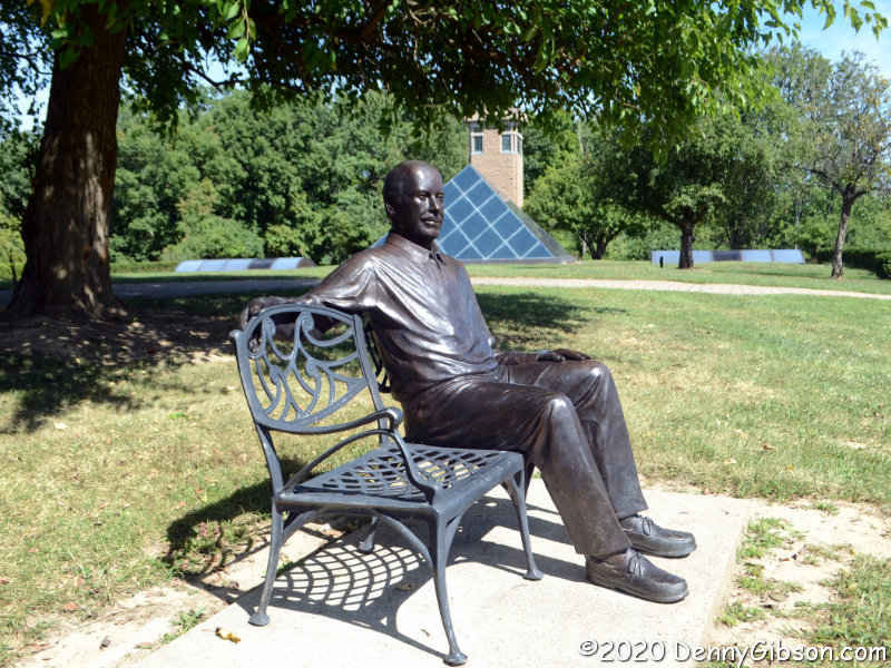
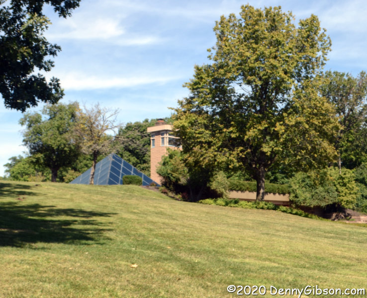
Harry T. Wilkes, the man responsible for creating the park, built and lived in this pyramid topped home that gives the park its name. His 2014 obituary describes him well, and John Leon’s lifesize sculpture gives him something of a continuing presence in the park.

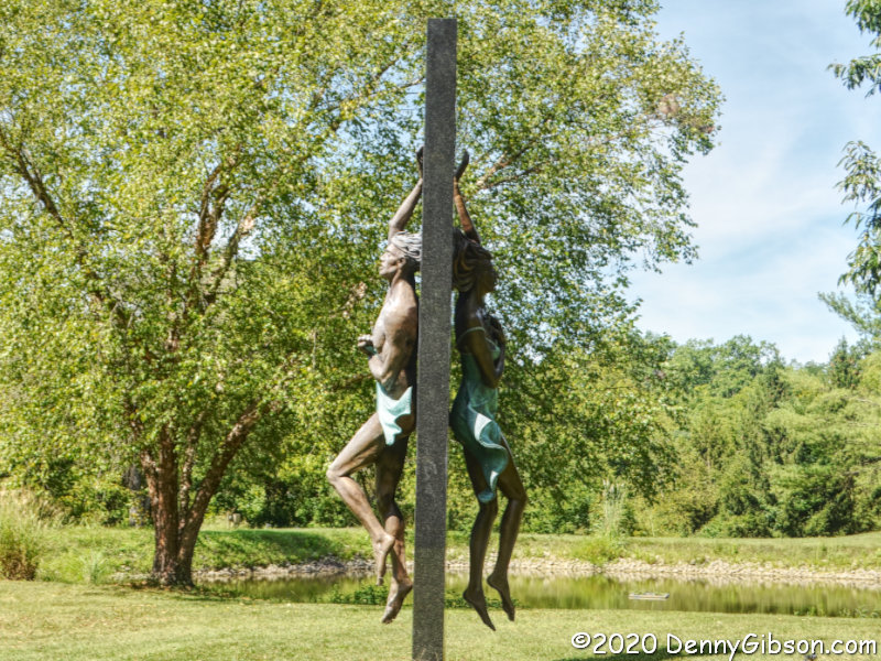
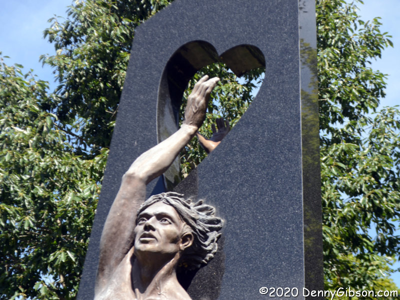
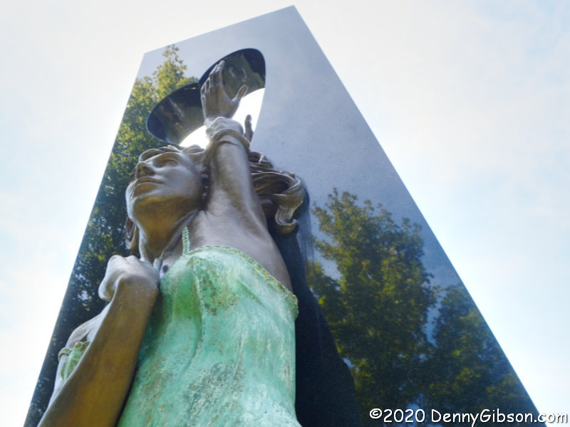
With more than a hundred sculptures displayed on 300+ acres, there is no shortage of things to look at or photograph. I did not photograph everything I saw but I came away with enough photos to overflow this blog post and probably a couple more. In fact, I took enough photos of just this one piece to bore most people. I’m wrapping up my visit with just three views of Sam McKinney’s Wherefore Art Thou with Romeo and Juliet reaching desperately to touch each other through the black granite and family conflicts that separate them.

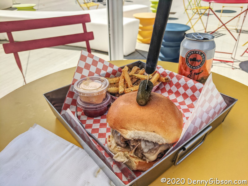
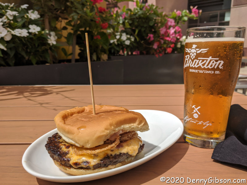
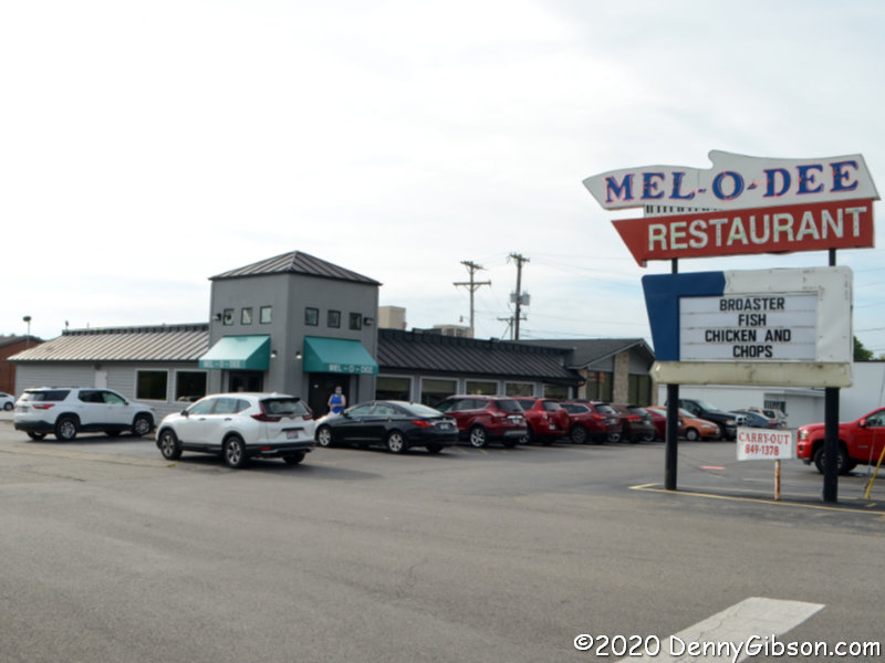
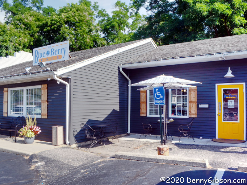
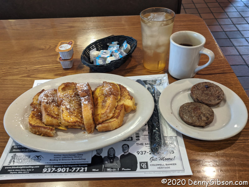
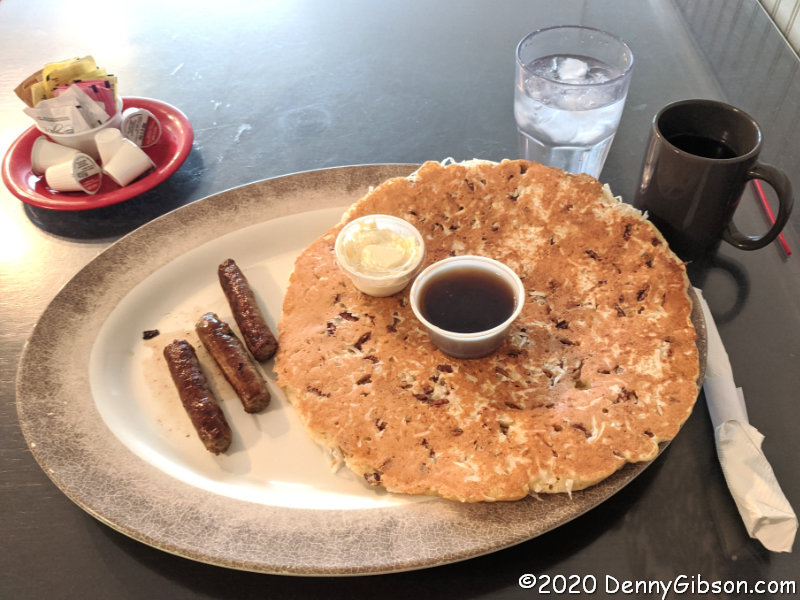
This was my first COVID era visit to 
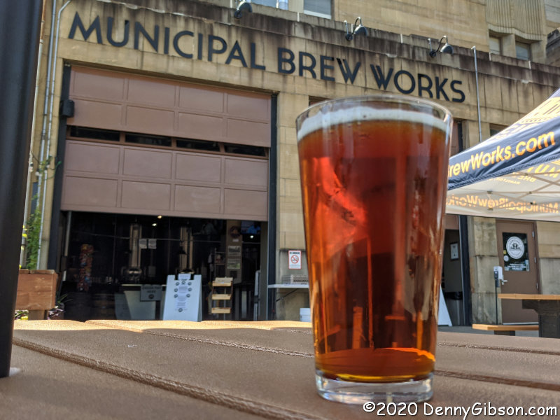
Municipal Brew Works which sits between the two parks in downtown Hamilton. I ordered the 1791 Oktoberfest from mask-wearing servers inside then parked myself at an outside table far from the few other afternoon drinkers. I can’t think of a better way to finish up a temperature perfect day filled with history, art, and sunshine. 

It’s a Gas… Engine Show

Terry’s back. And so is Dale. And so am I. I’ve known Terry since about age twelve. Dale and I go back even further having met in first grade at age six or so. Terry collects and restores Wheel Horse tractors and is a regular exhibitor at an event sponsored by the Tri-State Gas Engine and Tractor Association at the Jay County Fairgrounds in Portland, Indiana. Dale has a passion for bicycles and regularly exhibits at an event the National Vintage Motor Bike Club puts on at the same place. I have attended both events multiple times as a spectator with a lot more curiosity than knowledge. The events have provided the three of us with an informal get-together opportunity and that is something that’s been extra scarce this year.

As a primarily outdoor event, I figured the show would be relatively safe and I believe it was. At odds with that belief was the fact that most attendees walked about without masks most of the time and often chatted without fully six-feet of separation. But people did don masks when standing in food lines and such, and staff at the entrance and elsewhere were masked. And, while faces weren’t always a fathom apart, they were rarely significantly closer than that and people at least seemed somewhat aware of their distance from others. There were frequent announcements about masks being required in the few indoor spaces being used this year, and it sounded like that was being enforced although I did not check it personally. Those announcements also told everyone that masks were required by the free shuttles. We noted that not one person was wearing a mask when the shuttle passed several times within sight of our home base at Terry’s display, but the one time I actually saw someone exiting the shuttle he pulled up his mask as he walked past the other passengers. It was a mixed bag, Safe? Relatively is the right word.

We made two forays into the exhibits. Our first destination was a threshing operation that some of Dale’s neighbors were involved in. Threshing is one of many farming tasks involving multiple generations, and that was the case at this demonstration. Power for the threshing machine was supplied by a kerosene-fueled 1920 Rumely Oil Pull. Mobility came via a somewhat newer 1954 International Harvester Farmall.

I’m told that large scale vintage construction gear has long been part of the show but I either failed to notice or failed to remember. There was even a big pile of dirt available where “kids” could play without being yelled at for messing up the yard.

Here are a few of the things to be seen near home base where we returned to eat lunch purchased from a nearby vendor.

This is the home base I’ve mentioned, with Terry under the canopy and Dale beside it. Those are, of course, just some of Terry’s herd of Horses. The newest addition is that black nose that can barely be seen at the far end of the row. It’s a real one-of-a-kind hotrod that, while I failed to get a good picture of today, I did get pictures of at its place of birth. They’re here and here.

Following lunch, we headed out to cruise the other half of the show. I rode behind Dale in the trailer as I had on the earlier outing. I quite enjoyed being chauffeured around and being able to take (only slightly crooked) pictures at will. Dale once had a summer job as a test driver for Lambert Manufacturing and scored a factory ride for a lawn tractor rally at the annual company picnic. A trailer was included and I was invited so I covered the rally with a view somewhat like the first picture behind a Lambert tractor somewhat like the red one in the second picture.

Not only do the dirt piles you play in grow bigger as you age, so too do the scale models you build. This one is street legal and capable of hauling… stuff.

The guy with the miniature semi-tractor told us about this miniature inline-six a few aisles over. It isn’t a copy of any particular bigger engine, but, with the exception of the carburetor, is built completely from scratch. Even the tiny sparkplugs were machined from some sort of countertop material. It’s mighty impressive from the outside but thinking about the cam and crank shafts inside makes it even more phenomenal.

With a straight line distance of approximately ninety miles, this becomes the farthest I’ve been from home since February. Greenville, which I’ve been to multiple times, is about sixty straight line miles away. The other Gibson I saw there was a lot farther from home than I. This fellow is from a Seattle, WA, company that closed down in 1952. If my original plans for this year had held up, that’s where I would have been sometime earlier this month. Hold on, Seattle, I’m coming.

Here’s the Beef

Cincinnati Burger Week number six is almost over. Today is the final day of an event that is now part of a statewide Ohio Burger Week. Maybe it has been in the past although I always thought it was local. For 2020, special hamburger deals were/are to be found in five cities — Cincinnati, Cleveland, Columbus, Dayton, and Toledo — from August 17 through August 23. I’d seen claims of fiftyish participants but that turns out to be rather low. Nearly seventy restaurants are now listed on the Cincinnati Burger Week website. With this blog in mind, I picked six to try on the six days preceding publication. The number six also fit in with the sixth year for the event and the six dollar (up from $5) burger price. I picked places based on location, the availability of outside seating, and how strongly a specific offering appealed to me. One of the goals of Burger Week is to try something new so half of the places I picked were places I’d never been to before.

The first day went swimmingly and that included perfect weather. Two of my selections were within walking distance but one is closed on Mondays. I headed to the other. At deSha’s American Tavern I enjoyed a Ducking Good Burger at one of the well-spaced tables on the waterside deck. A Ducking Good Burger is described as ground beef, fontina cheese, roasted tomato-garlic aioli, topped with shredded potatoes tossed in duck fat, served on a brioche bun. The only thing keeping this from being the perfect Burger Week experience is that I’m quite familiar with deSha’s (and Belhaven Scottish Ale) so the sandwich itself was the only thing new to me.

The second day was hardly perfect, but it ended well. I decided to head to the farthest away of my selections trying to target a point where the rain that filled most of the day would let up. Not only did I mistime the rain, I really blew it with the ‘burger. I’d made myself aware of the days each restaurant would be closed but not of the time. I arrived at 4:15; They closed at 3:00. But I knew of another nearby Burger Week participant so headed over to Keystone Bar & Grill. The rain had more or less stopped but the outside tables were not yet being used. I sat near the door at a properly distanced table. It turned out that a choice of two hamburgers was offered. When asked, my waitress told me, “I think you should try the donut.” I was well aware that people have been making sandwiches out of donuts but considered them to be totally over the top and had so far managed to avoid them. I tried again today but the waitress and my own curiosity won out. In my defense, this wasn’t just any donut but a Holtman’s donut. I haven’t found a detailed description of the Maple Bacon Donut Burger, but it was delicious even though the touch of sweetness from the donut glaze was a little strange. The new-to-me Three Floyds Gumballhead was pretty good, too. When I went looking for that detailed description at the end of the day, I discovered an apology tacked to the front of the Keystone website. It was an apology for some slow service on the first day of Burger Week that was at least partly due to overwhelming demand for donuts. Henceforth, it said the donut ‘burger would be available for dine-in only.

Great weather returned on Wednesday making it a good day to head to the closest restaurant on my Burger Week list. I placed my order inside Frenchie Fresh Burger Bar then took a seat outside, near the Little Free Library in a phone booth, to await its arrival. Inside seating is available. Burger Week ‘burgers are usually enough to fill me so I tend to skip the extras but I decided to give “Frenchie Fries” with parmesan and truffle dust a try. Good but not necessary. As expected, Le Alpine ‘burger (swiss cheese, caramelized onions, & mushroom demi-glaze) would have been enough. As I ate, I noticed a familiar name in the storefront signage that I had not noticed when checking out things online. Beneath the sketch of a French Bulldog is the phrase “by Jean-Robert”. Jean-Robert de Cavel is a Cincinnati celebrity chef who gained fame at the Maisonette, Pigall’s, and his own fine dining establishments. Apparently, Frenchie Fresh Burger Bar is his move into more casual dining. The beer is Country Boy Brewing’s Cougar Bait which (fortunately, I think) doesn’t seem to work for a guy in his seventies even if he is eating truffle dust.

After starting the week with two places where I’ve eaten many times, I moved on to a pair of new-to-me restaurants. Wednesday was the first I’d been to Frenchie Fresh, and Thursday was my first visit to Brown Dog Cafe. It is one of several restaurants inside Summit Park on the former site of Blue Ash Airport. Both indoor and outdoor seating is available but I didn’t even consider eating inside on such a glorious day. I washed down my fontina cheese, bacon jam, and apple slaw topped ‘burger with Grainworks’ Blue Skies Hero Brew in a Fathead’s Brewery glass. Summit Park really is a park with an observation tower I need to come back and check out. On my way out today, I strolled by a playground I could see in the distance from my table. All distancing and mask protocols were carefully observed by the Brown Dog staff but that was not the case with all the kids playing on the equipment and sliding down hillsides on sheets of cardboard.

On Friday, I made it three new-to-me restaurants in a row by returning to the place where I’d arrived too late on Tuesday. Butler’s Pantry is on the inland side of a building on the south banks of the Ohio River. All COVID precautions are in place and there seemed to be plenty of outside seating. The tasty  ‘burger was topped with pimento cheese, red onion, bacon, onion straws, and root beer bbq mayo although I gotta admit I didn’t pick up much root beer flavor. Maybe the real beer (Braxton Storm, brewed less than half a mile to the south) washed it away. Free parking across the street with validation at the Pantry.

Even though there were still candidates on my list, by Saturday I decided I’d consumed enough hamburgers for the week. I had penciled in the lone non-beef Burger Week participant for a possible dessert someday but used it to fill the last slot in my six-day moving feast. I learned that my impression that only carryout was available was wrong when I arrived and saw the tables out front. I carried my purchase back home as planned, but in hindsight, wish I’d ordered a cup of coffee and nibbled on my beignet sliders at one of those tables along the one time Dixie Highway (now US 42) in Reading. Très Belle‘s Burger Week page describes one of these treats as a berry-filled beignet bun with edible rainbow sugar cookie dough patty and the other as Nutella filled with edible chocolate brownie cookie dough. They only call one decadent but that doesn’t seem entirely honest in my opinion. Maybe advertising double-barreled decadence is against somebody’s rules.

Dam Dents Revisited

I know I can’t do this forever, but I let the Facebook crowd steer me to another blog post this week. This one is somewhat different in that it doesn’t involve something new to me but some things I’d seen multiple times in the past that I was due for a refresher on. Back in 2006, I did Oddment pages on two dams that altered the path of the National Road north of Dayton, Ohio. Those pages are here, for the Taylorsville Dam, and here, for the Englewood Dam. The next year, I wrote an article for American Road Magazine (Vol V Num 3) that talked about both dams. The name of this post comes from the name of that article.

The first photo at left shows the easternmost edge of the easternmost dent. The road runs south for about a mile and a half before turning west to cross the mile-long dam then turning north to rejoin the original route. The dam is shown in the opening photo, which some will recognize as my attempt to reproduce George R. Stewart’s Photo #27 from 1953’s US 40: Cross-Section of the United States of America. Stewart’s photo and my “update” concentrate on the spillway and the bridge that crosses it. More of the massive earthen dam can be seen in the picture at left. The dams were completed in 1922 in response to the horrific 1913 flood. At that time, this was still known as the National Road. It would become US-40 in 1926. The 1953 and 2020 photos show some differences in the bridge itself due to a 1979 rehabilitation. The National Old Trails Road, a continent crossing named auto trail that existed from 1912 to 1926 never crossed these dams since the NOTR followed the “Dayton Cutoff” south through Dayton and Eaton.

There is a small paved area at the east end of the Taylorsville Dam where I parked to photograph it. On the west end, there is an actual park area with considerably more parking space and several informative signs including one from the Ohio National Road Association on Tadmor and Taylorsville. A section of the extensive Miami Vally Trails system passes through here and makes it easy to get to the former location of the town of Tadmor about 1.3 miles away.

The first of these pictures was taken looking back to the south after I’d strolled beyond Tadmor. I have been to the site since the dual purpose plaque (readable here and here) was placed but there are more labeled posts than I remember. Another difference is the rather impenetrable growth between the path and the river. There is a narrow path next to the previously pictured Tadmor sign that leads directly to the abutments of a short bridge that crossed the canal. Because of the growth and my aging sense of adventure, I did not go beyond this today as I did in 2006. The third picture shows a wall of the canal sluice gate with the canal bridge abutments in the foreground.

The rules called for the National Road to follow a straight line to the capital city Columbus with no grade greater than 10%. At Tadmor, following both of these rules in the early 19th century was impossible and it was the straight-line rule that lost. The road turned to the south on the west bank of the Great Miami and curved around a large hill. The grade, though not as bad as climbing the hill, still gave westbound travelers and their animals quite a workout. A spring near the top was certainly a welcome sight. The spring can be reached by heading east a bit where US 40 picks up the original path of the National Road. Although it’s not easy getting a clear view of the spring-fed waterfall, it is pretty easy imagining how refreshing it was to a team of horses dragging a Conestoga wagon up from the riverbank. A less blown-out version of the plaque is here.

An intersection between the dents has a legitimate claim on the Crossroads of America. In the days before US Numbered Highways, the National Road and the Dixie Highway crossed here. With the coming of numbers, the crossing routes became US-40 and US-25. A fair amount of traffic still passes through the intersection today though not nearly as much as through the nearby intersections of the successors to these routes, I-75 and I-70. The memorial bench and explanatory sign are just west of the intersection. A detail lifted from the sign explains a detail lifted from the photo of the intersection.

Continuing west, I came to the beginning of the second dent. Behind those trees on the right is a bypassed earlier curve which I slipped onto for a photograph. The entrance to the eastern portion of Engelwood Metropark is right at the eastern end of the dam. There is parking space for several cars and that is where I paused to photograph the dam and explanatory sign.

The road through the park is one-way which requires the former National Road, now called Patty Road, to be driven from west to east. Since all my other driving in this post has been east to west, that’s the sequence in which I’ve arranged these photos. The little bridge doesn’t look particularly historic when driving over it but the underside is a different story. The second picture shows the bridge from the north side and there’s a view from the south here. A sign that once stood near the bridge has gone missing so I’ve included a photo of it from 2006. The third photo shows where the National Road once continued westward. I walked down it in 2006 but did not today. There really isn’t much to see as a water-filled borrow pit prevents reaching the river.

This is on the west side of the Stillwater River in the smaller portion of Engelwood Metropark. I’ve been in the park before but did not do much exploring. Today I walked an abandoned section of the National Road down to the river. I’ve heard, and have even told others, that there are pieces of bridge abutments along the river. That might be true, but I didn’t see any today. I also didn’t see an explanatory sign mentioned in a Facebook post by William Flood, author of the upcoming Driving the National Road & Route 40 in Ohio: Then and Now. Further online discussion indicated that it might have gone missing from this wooden post. Not finding the sign certainly wasn’t an issue since looking for it is what led me to the riverside and that’s a good thing.


Yes, I had breakfast. The Mell-O-Dee Restaurant isn’t exactly on the National Road, but about two miles to the south where it’s been since 1965. COVID-19 precautions include a closed counter, plexiglass dividers between booths, and masked staff. They bake their own bread and pies and their French toast is made with that bread. It’s what I ordered and devoured with another COVID-19 precaution, disposable utensils.

Tunnel of Trees

A link to a story about a nearby tunnel of trees has appeared in my Facebook feed twice in the last month or so. The first time it came from the home of the article, “Only in Your State”. The second time it came from “Only in Cincinnati” despite the tunnel not being particularly close to the city. It is in Sugarcreek MetroPark, part of the Five Rivers MetroParks organization. The associated “metropolis” is Dayton, Ohio. The article, which is here, connects the tunnel with the town of Bellbrook and that’s one of the reasons it caught my eye. Bellbrook is home to one of my favorite breakfast spots but one that I don’t get to very often because of its thirty-mile distance. Friday’s near-perfect weather was all I needed to go tunnel hunting.

Despite my claim that I don’t get here very often, I have actually eaten at the Blue Berry Cafe twice during these pandemic times, and both times I’ve snagged that little table right by the door. Today I was a little too late and a couple who arrived just ahead of me were seated there. The photo with empty tables was taken after I’d eaten and was leaving. Larger groups were given wait estimates of half an hour but I was seated inside, where tables are well spaced and separated by hanging plexiglass panels, in a few minutes. I opted for my favorite bigger-than-my-head Nutty Professor (coconut & walnuts) pancake and left well fed.

This is the nearly full parking lot at Sugarcreek Metropark at 10:00 AM Friday. I asked someone who was getting ready to leave if some major event was in progress and was told, “No. This is just a really popular park.” Noticing my camera, she added, “But the trails aren’t crowded and there’s plenty of room for pictures.”

The opening picture shows one of many signs encouraging responsible COVID-19 relative behavior. The first photo at left was taken just beyond that sign. Trails are color-coded on maps and trailside markers. There are also maps with you-are-here indicators posted at intersections where going astray would be easy for someone like me. It’s the 1.3 mile long Orange Trail for me.

The first named feature along the trail is the Planted Prairie where deep-rooted prairie grasses have been reintroduced to what was once farmland. The empty wooden frame is another indication of pandemic triggered precautions. There are signs encouraging people not to touch various things and some touchable things, such as this swing overlooking the prairie, have been removed. The third picture is of a narrow trail crossing the prairie to connect the Orange Trail with the Green and Yellow Trails.

The Three Sisters is the name given to a trio of white oak trees that started growing here around 1440 CE. The giant trunk of one sister is in the foreground of the first picture with another sister standing in the background. The cluster of leaves about midway between the two is where the third sister lays after toppling in 2008. That’s her in the second picture. The third picture is of the sister farthest from the trail and there’s a better view of the one nearest the trail here. A descriptive sign is here.

Here’s the tunnel. Most tree tunnels or canopies are formed by branches from trees on both sides meeting overhead. This tunnel comes from a single row of Osage Orange trees planted as a hedge as described on a nearby sign. It certainly does look like something woodland fairies and other magical creatures might stroll through on their way to important gatherings. I’ve seen nothing on the tunnel’s length. My very uneducated guess is an eighth of a mile or so.

This picture was taken as the Orange Trail continues beyond the Osage Orange Tunnel and connects with its beginning near the Planted Prairie. There isn’t a lot of altitude change and the trail is far from strenuous but it is uneven with plenty of exposed roots and a few rocks. That doesn’t prevent those much younger and more energetic than I from jogging or even flat-out running along some of the paths. It sure is easy to see why that parking lot is so full.     

Beside the Dixie Highway

A recent Facebook post reminded me of some roadside markers I’ve been meaning to check out since 2012, and another post made me newly aware of some totally unrelated markers in the same general area. That area also happens to contain a restaurant that’s been on my to-do list for over a year. In these days of dissolved and dissolving travel plans, this trio of minor roadside attractions was sufficient justification for a correspondingly minor road trip. Although not one of the three has any real connection to the Dixie Highway, it once ran by all of them.

The restaurant came first. I first learned of the Fantasy Diner and Ice Cream Parlor from a January 2019 Ronny Salerno blog post. The name comes from its home in what was once the gift shop for the Fantasy Farm Amusement Park. Ronny’s post not only does a much better job than this one in documenting the restaurant but also provides some park history. There are a couple of reasons that I wish I had refreshed my self on Ronny’s post before I left home. One is that I’d have been shocked to find that the great looking wooden counter he photographed has been largely sacrificed for an ice cream cooler and would have at least asked about it. The second is that I might have changed the timing of my arrival in order to try the fried chicken he called “fantastic”. But I was there for breakfast and quite enjoyed my French toast with a view.

Following breakfast, I continued north on the former Dixie Highway to Middletown and made a stop at a marker I’d first noticed eight years ago. The marker is from 1920 when it was erected as part of a Road of Remembrance project. The Road of Remembrance was a proposal to plant a tree for every American soldier who had served in the Great War. A matching marker can be seen almost directly across the road in the second picture and up close in the third. The plaques on both markers look like this. These currently stand near Truth Tabernacle on OH-4, but originally marked the south end of Middletown’s Road of Remembrance a short distance away.

Another pair of markers once stood at the north end of the long rows of trees. Both are shown in the opening photo standing in front of the local American Legion Post. Identical plaques, bearing the names of twenty-four local boys killed in the war, are mounted on the front of both markers. The names of more than a thousand who served in the war are on six plaques mounted on the other sides of the pillars.

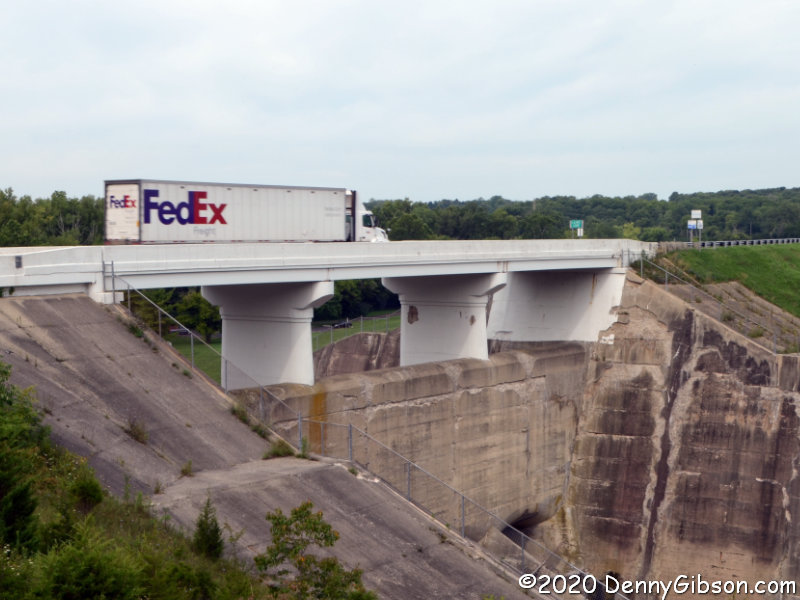
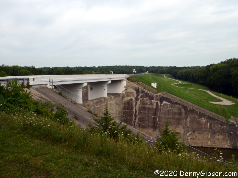
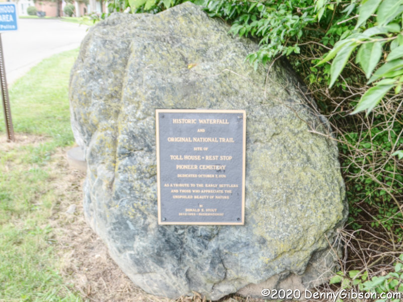
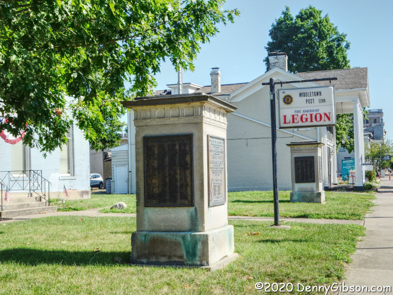
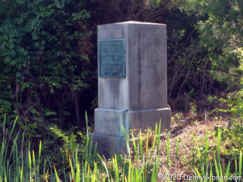
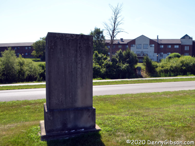
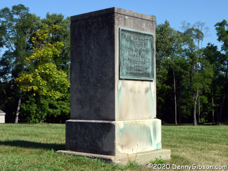
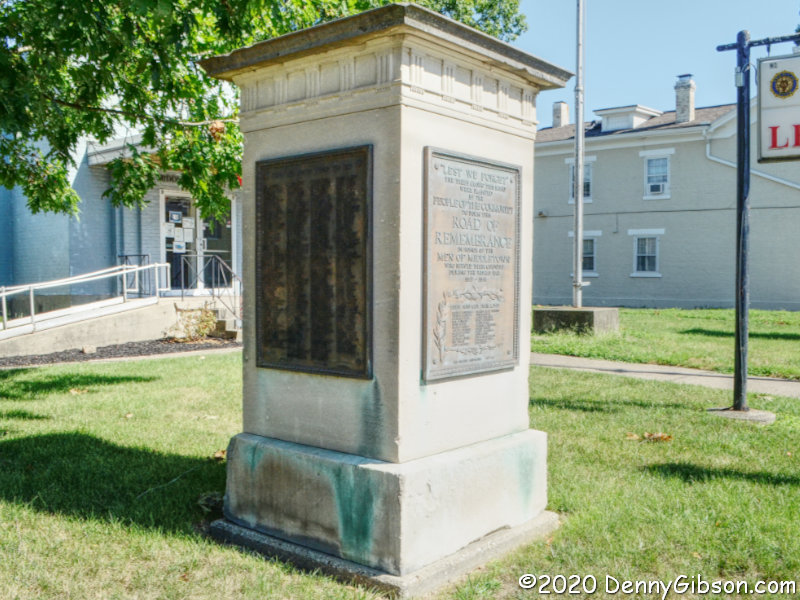
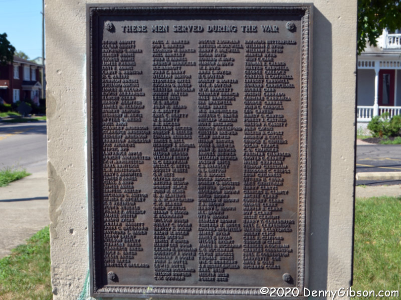
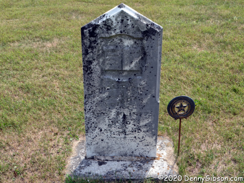
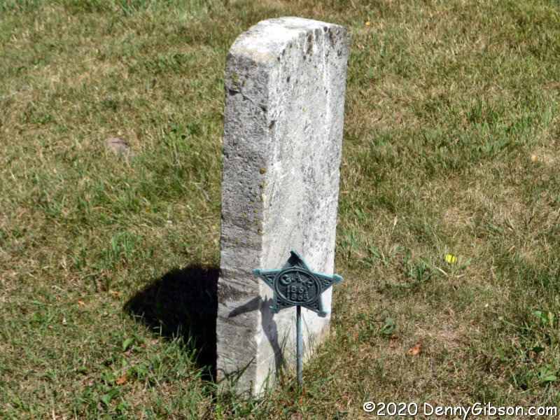
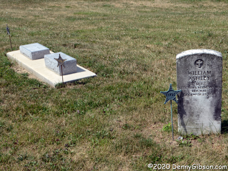
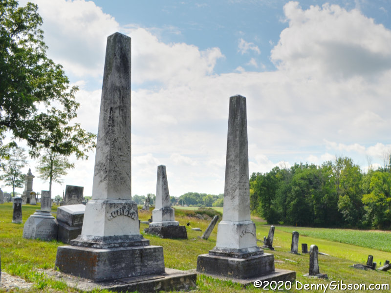
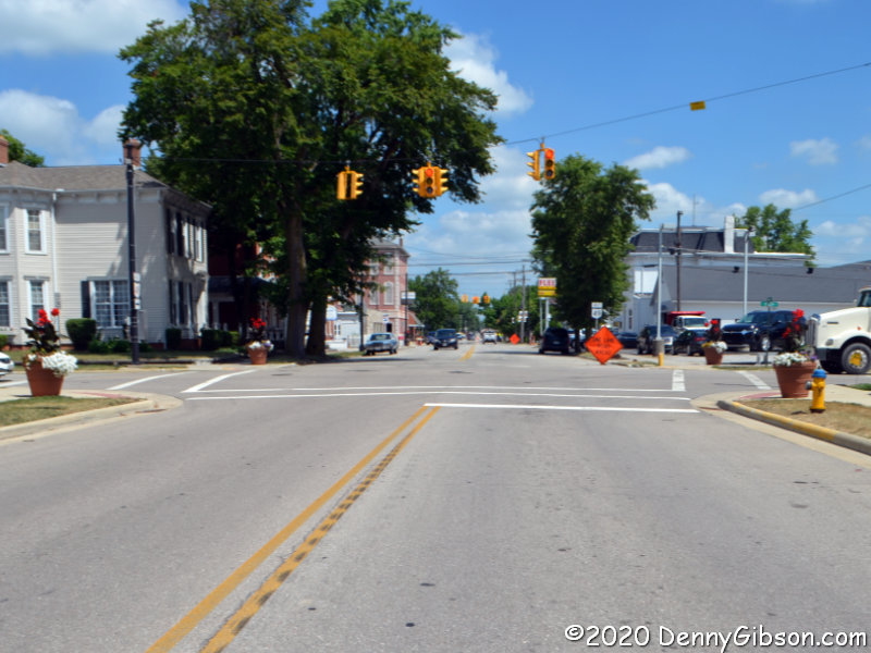
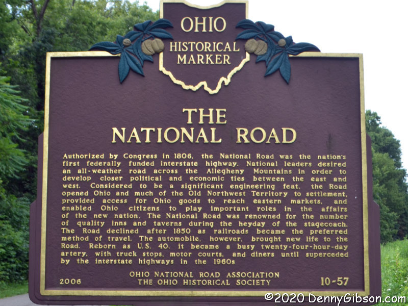
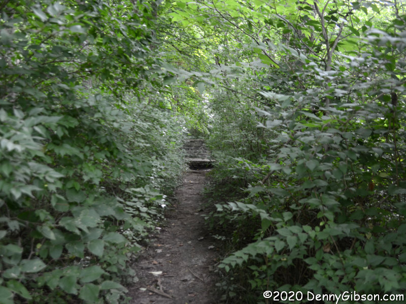
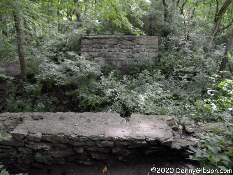
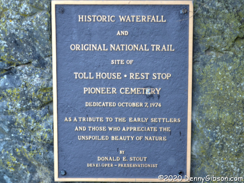
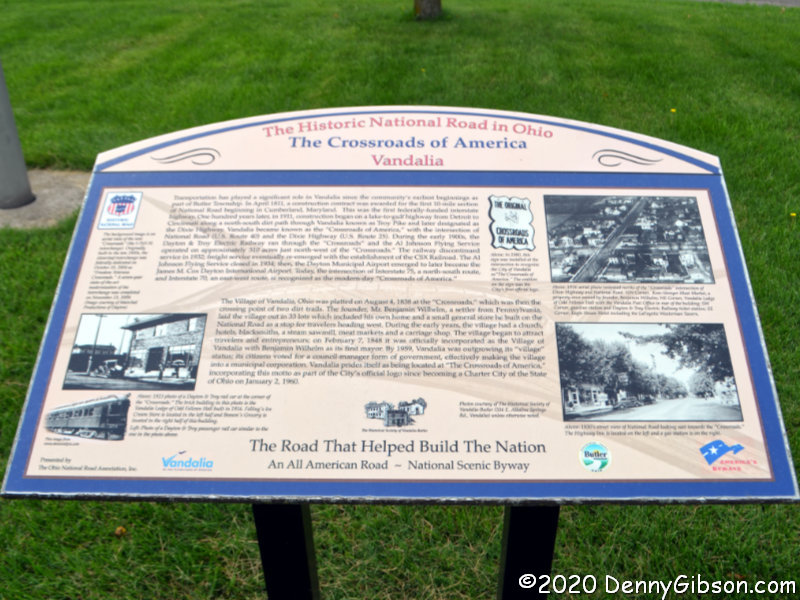
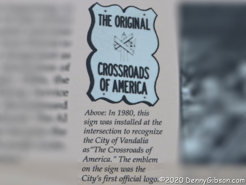
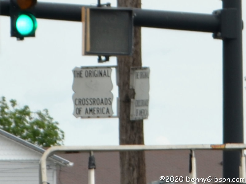
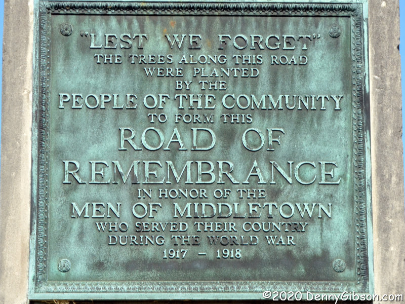
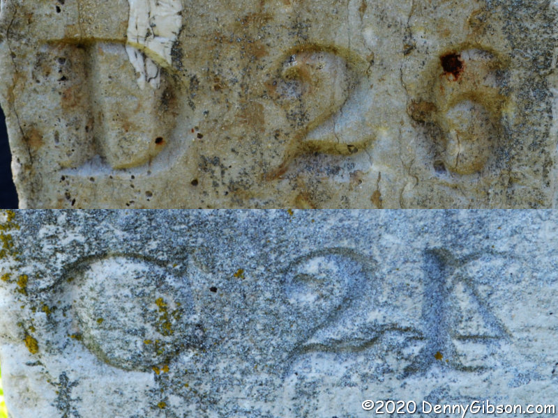
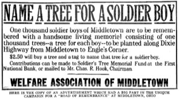
References to the Middletown Road of Remembrance often mention a thousand trees lining a mile of roadway. Both seem to have been considerably exceeded. The markers that now stand at the Legion, originally stood at 14th and Main. The southern markers originally stood about a mile and a half away at Oxford and Main. Plans to construct arches over the road where the markers stood were mentioned, but I’ve seen nothing to indicate that ever happened. Middletown’s Road of Remembrance was dedicated on Labor Day, September 6, 1920, and there are possibly legitimate claims that this was the nation’s first Road of Remembrance to be completed. The ad image is from American Forestry, Volume 26.

The day’s third set of targets was on a later Dixie Highway alignment which I turned south on when I reached the split near Franklin. This photo is not of an active target, but when you are looking for things on the DH and not in the least related to it, this marker certainly qualifies. I’ve previously stopped and photographed this salute to the Poland China hog, and I did it again.

The real goal of my drive on the later DH alignment was a couple of Great Miami Turnpike mile markers. The turnpike was constructed in 1840 so the markers have been waiting quite a while. I learned of them only recently through a Dixie Highway Facebook group post by road fan Karl Howat. I’d already located and taken a drive-by photo of the southernmost of the two and thought I knew enough to find the other one as I drove south. I was wrong. I visually scoured the roadside as I drove but came up empty. I eventually reached the marker I had already located and parked nearby to take some less blurry photos. According to the markings, C(incinnati) is 17 miles away and D(ayton) is 33 miles away. The current name of this path that has had many is Cincinnati-Dayton Road.

I headed back north in search of the other marker and found it with a fortuitous and pretty much accidental glance to the right. Karl had posted photos of both markers and I could see that both were made to be placed on the west side of the road. Northbound travelers would see the distance to Dayton and those headed south would see the distance to Cincinnati. It appears that this marker switched sides at some point in its past. But that’s not the most interesting thing about it. Perhaps understandably, when I first saw the marker, my mind registered D 26 and C 24. But I quickly realized that the 4 my mind saw was reversed and that it must really be the number 1 with some accidental scratches beside it. That, however, would mean this stone claimed that Dayton and Cincinnati were 47 miles apart rather than the 50 indicated on the other marker. I next tried to mentally convert that 6 to an 8 to make the distance a closer match at 49 miles. That didn’t work and I became pretty certain that the numeral was a 6. A one mile difference between the two stones seems possible if not likely. A three mile difference seems very unlikely and I’ve become convinced that the carver goofed and carved the 4 in backward. Form your own opinion from this composite or go check out the original at N39° 25.809′ W84° 21.947′. The other marker is at N39° 20.126′ W84° 24.144′.


For the second consecutive week, here’s a diner tacked on to the tail of the primary subject. K’s Hamburger Shop isn’t exactly on the Dixie Highway but it’s less than two blocks away and that’s close enough for Mike Curtis to include it as a POI on his Dixie Highway Map. Plus there are some unverified rumors that a temporary DH alignment ran right past the location (even though it wasn’t K’s yet). DH or not, they celebrated their 85th anniversary Friday and I was there. They were totally closed for eleven days due to the COVID-19 pandemic, then open for carryout only. Three weeks ago, with the addition of some fancy plexiglass dividers, dining in became an option. Says Marcia, the owner, “My parents kept this place going through the depression and we’ll keep it going through this pandemic.”

Booths are separated by fixed panels and the panel separating counter customers and staff is fixed, but the panels between individual counter positions are hinged so that couples can chat and sneak fries from each other. Panels and everything else are sanitized frequently, of course. The only not-yet-cleaned spot in the counter picture is where I just finished this. Among the many articles written about K’s over 85 years is an American Road Diner Days installment from an unknown (both then and now) writer. Winter 2007 if you’re a curious collector of old magazines.

More Cincy Reopenings

The Cincinnati Reds opened their season on Friday instead of March 26 as planned. Friday is also the day I made the Cincinnati Museum Center visit I’d postponed a couple of weeks earlier. It was supposed to happen on the same day as my Maya exhibit visit, but a service appointment got in the way. The delay moved it from the members-only preview week to a week after the general opening and fountain turn on. Water now shoots high in the air and cascades down through that series of pools in front of Union Terminal. The marker in the foreground stands near where the world’s first professional baseball team had their home plate. Less than two miles away, in an empty stadium, the modern version of the team got the shortened 2020 season rolling with a 7-1 win.

The museum center is using timed entry to keep the number of people in the building below capacity although that hasn’t yet been an issue even though attendance has been slowly increasing. Three museums are part of the CMC. Because just about everything in it is hands-on, the Children’s Museum remains closed as do two of the major components of the Natural History Museum. Keeping the replica limestone cave and the Science Interactives Gallery sanitized just isn’t practical, and some interactive experiences have been temporarily removed as well. I know all of that makes things considerably less entertaining for younger visitors but the most prominent residents of Dinosaur Hall are still there and they’re still awesome.

There are currently two temporary exhibits that are included in CMC admission. I checked out “Inspired by Nature” first. If you’ve spent any time looking over downtown Cincinnati, there’s a good chance you’ve seen some of Charley Harper’s art. It appears in several murals with “Homecoming (Blue Birds)”, on Court Street, being the most well known. The placard at the left of the last picture contains a Harper quote that probably sums up the man as well as any.

This is the centennial year for the passage of the constitutional amendment that allowed women to vote. “An Unfinished Revolution: Women and the Vote” tells of the struggle that preceded that breakthrough as well as the struggle that continues today in pursuit of equality. The 19th Amendment was passed on May 21, 1919, and ratified on August 20, 1920. In between those events, Ohio legislators took steps to assure that women could vote in the 1920 presidential election even if the amendment was not ratified in time. In the center of the first picture, the 1919 and 1920 Hamilton County voter rolls give a visual indication of just how significant a change that was.

Some portions of the Cincinnati History Museum are closed but I think that has at least as much to do with establishing new and reworked exhibits after the big renovation as with anything COVID-19 related. I was excited to find that “Cincinnati in Motion” is now complete. New to me sights included Proctor and Gamble’s Ivorydale complex and Crosley Field where I watched several Reds games and one Beatles concert. Neither “Shaping Our City” nor “You Are Here” were entirely finished when I was here last, but they are now. As we (at least I) struggle to outsmart our phones, it helps being reminded that all new technology requires some learning.

Another thing that happened during the two weeks between my planned and actual visit, was the reopening of the Holocaust and Humanity Center. Entrance to the HHC is not included in CMC admission but it is is the same building and discounted combination tickets are available. This was my second visit and I again found the personal stories and keepsakes extremely interesting. The pictured Torah was saved from a burning synagogue on Kristallnacht. I had taken a picture of the only window in the museum on my first visit but I had not actually looked out of it and that is the whole point of it being there. It provides a view of railroad tracks which is how many holocaust refugees arrived in Cincinnati. The third photo is from the “Humanities Gallery” which deals with today rather than history. I took several pictures of the row of screens and their rotating set of images and picked one to include in this post. Then, as I actually put this post together, I discovered that I had unwittingly selected a picture that was a near duplicate of one I had posted from my first visit. That picture, which can be seen here, obviously made an impression on me undoubtedly because it is evidence of the bigotry present today. I did not want to just repeat that picture and decided I didn’t want to repeat the feeling either. I went with something much more hopeful.

Many things at Union Terminal are now open but absolutely nothing is back to normal. That’s true of the whole world, however, and the folks at CMC and HHC seem to be doing the right thing. Kids have it the worst. I can think of nothing equivalent to the learning that automatically comes along with all the fun in the Children’s Museum and Science Interactives Gallery. I’m sad that they are closed but know that the risk of having them open is too great to even think about. A few interactive displays exist in the Cincinnati History Museum but they are in places that can be constantly monitored and sanitized frequently. In the HHC, pushbuttons are used to activate displays and recordings. Everyone entering is given a rubber-tipped stylus to handle the button-pushing and they are encouraged to “take it with you when you vote”. Hand sanitizer is available throughout all the museums. Every employee and guest I saw was wearing a mask and many staff members also had a face shield. In some sense, this could be considered a good time for adults to visit. It’s not crowded and access to both displays and docents is easy. But empty museums are not, in general, a good thing at all. I really look forward to the return of flocks of noisy kids figuring out where that ball is going to fall and which direction that gear is going to turn.


The picture at right was taken two weeks ago on my way to the Cincinnati Museum Center to see the Maya exhibit. Sugar n’ Spice has operated on Reading Road, about five miles north of downtown Cincinnati, since 1941. They are taking COVID-19 seriously with limited capacity, masked staff, plexiglass dividers, and more. I had heard something about plans to open a second location but I hadn’t really paid any attention to details. As I finished up my original wispy thin pancakes, I struck up a conversation with a manager who showed me some pictures of the new location. I learned that 1) the grand opening was happening the very next day and 2) the new store wasn’t just near the old Sycamore Street diner, it was in the diner.

I stopped here on Friday on my way to see the dinosaurs and suffragettes. It’s a 1955 Mountain View diner that was moved from Massillon, Ohio, to the Over the Rhine section of Cincinnati in 1984. It then operated for many years as The Diner on Sycamore. Its most recent life was as Joe’s Diner which closed in 2016. In between, it had a couple years of life as Vinyl and was dormant for several years. I really like what Sugar n’ Spice has done here and I really like their chances of success. The middle of a pandemic is certainly not the ideal time to open a restaurant but everything was, of course, in motion well before the pandemic hit. Although it’s a family-owned business, Sugar n’ Spice is really an established brand that has brought their bright colors and slightly whimsical decor along with a reputation for quality to a classic factory-built diner. The counter is not currently being used but two outside dining areas are available along with plexiglass separated booths in the Mountain View and in the brick and mortar building it is attached to. I’d totally forgotten how big Sugar n’ Spice omelets are. Five eggs aerated. This is what I had for breakfast — and dinner.

A Darke Drive

A sixteen-mile long driving tour some fifty miles from home is what passes for a road trip when cabin fever and a coronavirus collide. Several years ago, the Arcanum Wayne Trail Historical Society folks put together a self-guided driving tour of the nearby area. That area is the southern part of the county where I was raised so the tour naturally interested me. As I recall, when the tour was first announced, there was some sort of museum event associated with the launch. I couldn’t make it but copied the tour description to my phone and plotted the route on my GPS. My intent was to combine driving the tour with a visit to the museum, but it never became a high priority and, with the museum open just one day a month, it never happened. The COVID-19 pandemic has eliminated even that single day of museum operation while elevating my need for some sort of outing. Road trips planned for April, May, and June have evaporated, those envisioned for July are all but gone, and August doesn’t look any better.

The tour passes one street south of the museum but I stopped by for a picture. The other pictured building is just up the block and some may remember it from this 2017 post. Sadly, the restaurant that was housed in the building and which triggered the post has closed. I’ve since seen a couple more Battle Ax Plus signs, but this was the first.

Arcanum’s Main Street runs north and south. I’m guessing that George Street, where the museum sits, was the original main east-west street since the first street north of it and the first street south of it are called, respectively, North Street and South Street. The tour begins at the intersection of Main and South and heads west, toward the water tower, on South Street. Arcanum isn’t a large town (population 2129 in 2010) so it doesn’t take long to reach open countryside.

South Street quickly becomes Arcanum-Hollansburg Road and intersects State Route 503 in just a few miles. At the corner, a church that was once part of a settlement named Beech Grove has been converted to a home. The tour turns south here, but I headed a short distance north to pause at the cemetery. Someone keeps the cemetery mowed but there is little evidence of any other sort of maintenance. A neighbor’s tractor display helps make the stop worthwhile.

I returned to the tour route and followed it to another cemetery. This is Ithaca Cemetery just north of the town by that name. Going backwards in time, we have veterans of the Civil War, Mexican War, and War od 1812. There are quite a few Civil War veterans buried here including one with a modern military plaque. That sort of plaque is common but I don’t recall ever seeing one for a Civil War vet. Sure is easier to read than weathered stone.

The tour description identifies four burials of significance here but I only managed to locate two. The first is Arcanum’s founder, William Gunder, who is buried next to his wife Nancy. The other is Revolutionary War veteran William Ashley although calling it a burial isn’t really accurate. Ashley was buried on a family farm nearby and when a new owner refused public access to the site, the marker was relocated here. Presumedly, Ashley himself was not moved. The other markers in the picture are for Revolutionary War veterans Ezekiel Farmer and William Walker. These are fairly recent additions and are not mentioned in the tour description. My guess is that these are also markers only.

The tour makes two passes through Ithaca. The directions discuss the impressive three-story I.O.O.F. building on the second pass but I paused for this photo when I entered from the north. The two passes actually overlap only at this intersection. This small crop of Corvairs, which look overly ripe and may have missed their harvest date, is at Ithaca’s western edge.

This is Darke-Preble County Line Road and, since I’m on the south side driving east, I may actually be in Preble County taking these pictures. The trees and bridge mark Miller’s Fork which is, according to the tour directions, “the speculated location of the first settlement of white people in southern Darke County.” The second picture is of the intersection with OH-503 which once contained a toll house, a one-room school, and the aforementioned Ashley farm. The tour directions do not indicate where the farm was in relation to the intersection so the location of William Ashley’s remains may or may not be in the picture.

The tour heads north on OH-503 but turns off of it on the second pass through Ithaca. It then returns to its starting point on Arcanum-Ithaca Road which becomes Main Street at the city limits. It was great to get out and drive some back roads even if it was for less than two hours including graveyard loitering. It helped with road trip withdrawal for the very short term, but overall it may have aggravated it by reminding me of what I’m missing. 

Book Review
Secret Route 66
Jim Ross & Shellee Graham

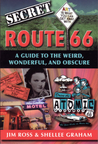
At first glance, this probably looks like a perfect fit for my bookshelf. Like many of the other books there, its subject is a historic highway and its authors are people I know. In this case, the highway is Route 66 and the people are the husband-and-wife team of Jim Ross and Shellee Graham. Both are accomplished historians, photographers, and writers with Jim probably having a bit of an edge in the history department, Shellee having an equally small lead on the photography side, and their writing skills being too close to call. A second glance, however, just might turn up something about this book that is different from most of the others with which it now shares shelf space. It is the word “secret”.

I am not a fan of books with words like “haunted”, “mysterious”, “unsolved”, or “bloody” in their titles. I don’t know whether or not that puts me in a minority of road fans, but apparently it does in the larger world of readers in general. A writer friend’s publisher has pushed for a “haunted” book saying they are four times as popular as the other kind. To me, those words smack of exploitation. They seem to scream out the intent of emphasizing some sort of supernatural or scandalous connection for a topic that must be otherwise boring. I acknowledge that “secret” doesn’t sound quite as exploitative as “haunted” and that even “haunted” and the other words I’ve mentioned can be used as honest labels, but I still find them offputting.

Anyone who read my blog entry about visiting the recently reopened American Sign Museum will know when I bought this book and may even have some idea why. The ASM, like practically every other museum in the country, was hit hard by a COVID-19 related closing. As a member, I’d paid nothing for my visit, and wanted to show a little support with a purchase.

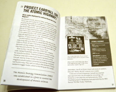
So how is this book I didn’t exactly want? Surprisingly good. I’m not really all that surprised, of course. To my relief, the idea of revealing secrets doesn’t get much further than the title. I doubted that a pair of respected authorities would suddenly become conspiratorial sounding characters sharing dark secrets from the shadows but it was good to have that verified. To some extent, the subtitle also does that. Weird, wonderful, and obscure accurately describe the book’s contents.

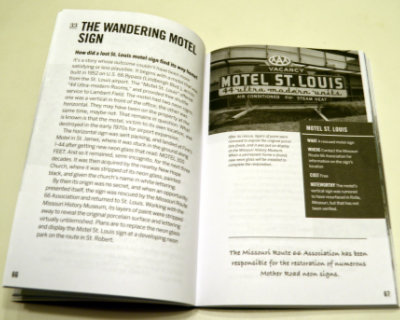
Almost everything in Secret Route 66: A Guide to the Weird, Wonderful, and Obscure is something that, while not actually a secret, is not likely to be found in mainstream guides. Even when the subject is something commonly known, Ross and Graham provide some detail or backstory not commonly known at all. Sometimes the subject isn’t a place or a thing but simply that uncommon detail or story.  Among the things that struck me as weird is the true tale of a proposal to use atomic bombs for roadway excavation. Everyone has their own definition of wonderful but my definition is matched by the story of the Motel St. Louis sign that wandered off to help people find another motel (Finn’s in St. James) and then a church (New Hope) before being rescued and returned home. I thought learning about the annual reunion for the ghost town of Alanreed was kind of wonderful, too. Topping my personal list of obscure things is the chapter on several abandoned bridge abutments on the original route through Santa Fe.

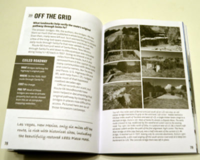
A pair of facing pages make up each of the ninety chapters so that everything about an item can be studied without flipping back and forth. A sidebar contains appropriate information, such as location. These pages are printed in black and white, but they are augmented by sixteen pages of color photographs (plus 2 b&w to make the positioning work) in the middle of the book. Some page flipping here is appropriate but the subject and associated page number are shown for each photo to make it easy. Images in the book are a mixture of historic and modern. Most of the modern photos are the work of the authors but not all. Other researchers and photographers are always credited with images provided.
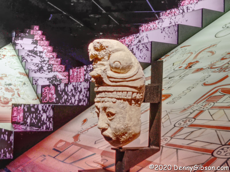
I ended up liking this book that I didn’t exactly want. That really was to be expected with the Ross and Graham names on the cover. It’s a good reference to add to a Route 66 library although not to start one. Seeing obscure things is good. Seeing only obscure things not so much. You don’t want to come home from your first Route 66 trip and have to say “no” to every “Did you see?” your neighbors and relatives ask. You want to respond with, “Yes, and did you see the [put your favorite Route 66 ‘secret’ here]?” 

Secret Route 66: A Guide to the Weird, Wonderful, and Obscure, Jim Ross and Shellee Graham, Reedy Press, LLC,  October 15, 2017, 6 x 9 inches, 208 pages, ISBN 978-1681061078
Available through Amazon.

Maya at the Cincinnati Museum Center

March 14 was to be opening day for a huge exhibit of Maya artifacts at the Cincinnati Museum Center. March 9 was the day a state of emergency triggered by the COVID-19 pandemic was declared in Ohio. The opening did not happen. On Friday, nearly four months later than planned, I was among the first group of visitors to step into the exhibit. We all wore face masks and all staff members wore face masks in addition to clear plastic shields. We were all museum members as only members are allowed in for the first week. Our entry time was preselected which is pretty normal with major exhibits at the museum but the number allowed for each interval was considerably less than what it would have been in March. There were floor markings to encourage six feet of separation and a few interactive “experiences” were removed to eliminate contact. Touching the artifacts would be forbidden in any case and I don’t believe any were removed. All 300+ seemed to be right where they had been waiting for four months.

The Children’s Museum and the cave portion of the Natural History Museum are closed but most of the center is open. Entry, however, is now time-based and I had reserved a slot for checking other things out after the Maya exhibit. That was not to be as I immediately headed home. Missing an appointment with an AC service guy in July is not wise.

That scheduled service call did not actually make me rush through the exhibit but it did cause some shortcuts. As I entered, I learned that an audio tour was available through my phone, but in the probably mistaken belief that it might slow me down, I ignored it. No doubt that’s one reason I have so little information to share on specific items. I read every description but took no notes, not even with my camera, and my memory did not retain details very long.

I did not photograph many of the numerous small pieces in the exhibit and didn’t even do a particularly good job with the larger ones. The three items displayed here against the lighted and decorated pyramids can reasonably be called mid-sized. The picture at the beginning of this article is of the one at the front right of the wider view.

This stela is one of the largest items in the exhibit. It can be seen beyond the pyramids in the previous pictures. Created in 800 CE near the peak of Maya civilization, it documents some of the accomplishments of a Maya king. That’s something I happen to know because of some only slightly blurry photo notes.

Only four Maya codices, all written after the civilization’s peak, are known to exist. The Cincinnati exhibit includes this partial reproduction. It and the two stone carvings are among the items I wish I’d picked up more details on, and it’s likely they will become justifications for a return.

I have no details to share about the stone mask but I do have this for the jaguar man. The exhibit was originally scheduled to close on September 7 but the delayed opening has moved that to January 3, 2021. I hope to return and be better prepared with more time when I do.

As for the rest of the museum, I will definitely be returning, possibly as soon as this coming week, to see that. I sort of want to see what changes COVID-19 has triggered and I most definitely want to check out a special exhibit on women and the vote that is open through September 27. As everyone should know, this is the centennial of the first national election in which women were permitted to vote.