The Fluckes were presenters at last year’s Route 66 Miles of Possibility Conference in Joliet, IL. The primary connection was their 2016 trek along Historic Route 66, which was their third unsupported cross-country trip on a tandem bicycle. This book covers the first of those trips, a 4,300-mile ride from Bellingham, WA, to Bar Harbor, ME, in 2014.
They smoothly alternated lines during the Route 66 presentation like co-anchors on the evening news. Their teamwork in a situation where it was nice but not mandatory hinted at how that team performed on one pair of skinny pedal-powered tires, where it was crucial. That’s also true of their teamwork on the pages of this book. In fact, the form of Coast to Coast on a Tandem seems closely aligned with the realities of tandem bike travel.
There are no passengers on a tandem bicycle. The person in front(captain), in this case Peter, is responsible for steering, which requires constant awareness of what is immediately in front of the bicycle. Bits of debris or small potholes that are no more than inconveniences when traveling on four wheels can be disastrous on two. The front rider is also responsible for gear selection and braking. In the back (stoker), Tracy is responsible for navigation, which means keeping Peter informed of upcoming turns, stops, and such. She also keeps an eye on traffic to the rear and keeps Peter informed of that as well. Both are responsible for powering and balancing their vehicle.
Their views from the saddle are not the same. Peter has a clear view of the landscape ahead, but is mostly focused on the road surface just a few feet away. Tracey has more time to contemplate the scenery, but her view is limited to the left and right. Anything more than short glances to the rear is uncomfortable and potentially unsafe, and the view ahead consists of little more than the back of Peter’s head.
The idea of two different views is carried into the book’s text. Instead of collaborating on a single combined narrative, Tracey and Peter each write their own version of events, and the two versions are interleaved. Sometimes, the pair of synchronized tales differ by no more than the distance between tandem bicycle seats, and sometimes they offer very different takes on a single set of events.
We all know that travel is enhanced at least as much by people as by location. The Fluckes meet and describe people in campgrounds, hostels, restaurants, grocery stores, motels, and through a cyclist-oriented home-sharing organization called Warm Showers. They also meet a few bicycle mechanics as they deal with the wear — especially on tires — and tear of long-distance pedaling. Almost all are friendly and either helpful, curious, or both.
Some of the people they meet are fellow cyclists. The Fluckes are barely twenty miles out of Bellingham when they encounter a cyclist on his way to Boston. Peter and Tracy are following the Adventure Cycling Association’s Northern Tier Route. Peter writes that an estimated 2,000 people travel this route each year. Some do it all, and some do short stretches of a few days or so. Some do it unsupported, like the Fluckes, while some do it as members of packaged tours with a support vehicle tagging along and carrying their gear. Are any of those people on a tandem?. Peter guesses “maybe 1 percent”. The Fluckes encounter none.
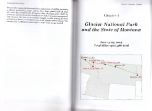
The book begins with descriptions of acquiring gear for the trip, physical training, shipping the bike, etc. Preparing their home world for a near three-month absence takes some effort, too. Once the trip is underway, each chapter begins with a map of the area covered in that chapter, and each day’s journal begins with the date, incremental and cumulative miles traveled, and a brief description of conditions. An example from a day in Montana is:
Day 21
June 21 — Havre to Malta, Montana
93 miles (total miles – 1,147
65-75 degrees, sunny with a nice tailwind to push us along
Not every day is sunny, and not every wind pushes them forward.
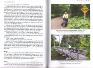
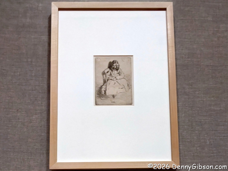
Coast to Coast on a Tandem is not a photo-heavy book, but there are several. All are in color. One is of the couple hoisting the bicycle overhead in Bar Harbour to celebrate completing the trip. Tracy calls it perfect—and lucky. “What were we thinking? Bike all the way across the country and have a complete stranger take only one picture to commemorate the event. Crazy.” Surely she knows better than to think that’s the only crazy thing described in the book.
Anyone even slightly familiar with me will know that the chances of me cycling across the country (or surviving if I did) are essentially zero. I assumed that the chances of my having anything in common with the trim and athletic Fluckes other than a love of traveling were also pretty much zero. I was surprised to learn that we share a fondness for craft breweries. Apparently, Peter and I even share a fondness for porters and Scotch ale. Furthermore, we both like to “collect” breweries. I, traveling in a medium-sized SUV, do it by logging them in an app on my phone. The Fluckes, traveling on a vehicle with the storage capacity of a medium-sized hummingbird, do it by purchasing souvenir glasses, which they then mail home fairly often.
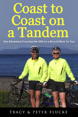
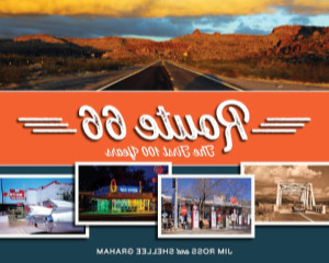
Coast to Coast on a Tandem: Our Adventure Crossing the USA on a Bicycle Built for Two, Tracy & Peter Flucke, M&B Global Solutions (November 2, 2017), 6 x 9 inches, 230 pages, ISBN 978-1942731283
Available through Amazon.


 The last three years have certainly been interesting ones to look back on, statistics-wise. In 2023, I wrote that everything went up except interest, and by that I meant traffic. In 2024, traffic joined the other statistics in posting increases. This year, interest/traffic is just about the only thing that has gone up. Scheduling conflicts and other issues kept me essentially off the road for the entire first half of the year, which naturally resulted in fewer road trips, days on the road, and pictures posted. Blog posts did increase by one, and pictures posted in the blog also went up a bit, but the bulk of pictures always comes from road trips, so the total went down, and neither blog posts nor blog pictures equaled the 2023 numbers. Three of the top five blog posts are frequent members of the list, including last year. The other two are not only new to the top five list, but both were also newly published in 2025. Three of the top five non-blog posts are also frequent list members, but only one appeared last year. Both of the newcomers to the non-blog list were published in 2024. That’s quite a shakeup from last year, when both lists contained four repeats from the year before.