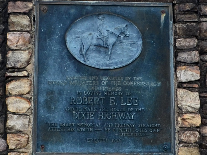
 Like the Madonna of the Trail monuments in an earlier My Caboodles chapter, these, too, are a natural for me. Like the Madonnas, they are markers along the side of a famous historic highway that I have traveled. But there are significant differences. The biggest is that the primary purpose of these markers was not to mark the highway but to promote the memory of Confederate General Robert E. Lee. This aspect is discussed a bit more in an earlier post, Free? Advertising on the Dixie. In this post, I’ll just present the markers in the sequence I discovered them.

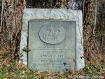
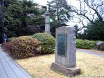
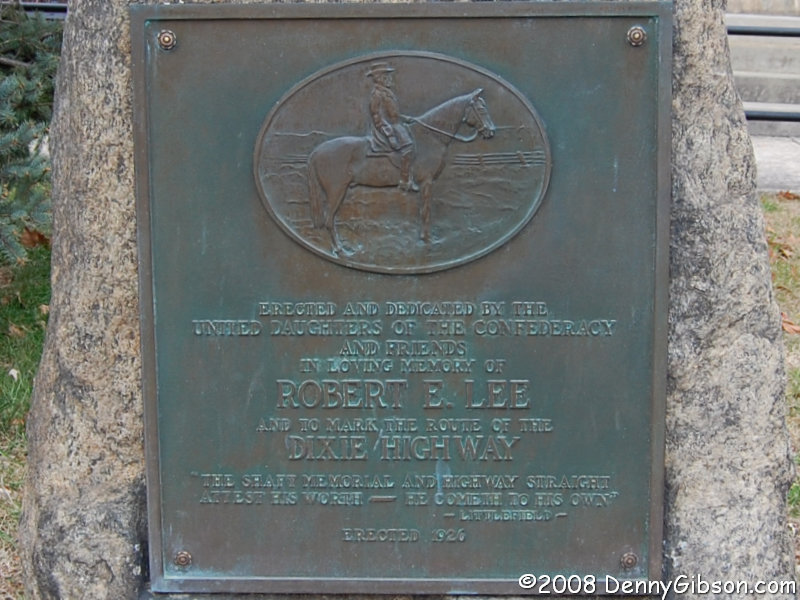
 1. In 2008, when I stumbled upon this marker in front of the Madison County courthouse in Marshall, North Carolina, I had no idea there were others. I was excited to find something with a Dixie Highway reference but even then I must have felt it was off-target just a bit. In my journal, I said, “At least it’s sort of a Dixie Highway marker.” On the morning of November 5, 2020, it was discovered that this plaque had been pried from its stone. Erected 1926.
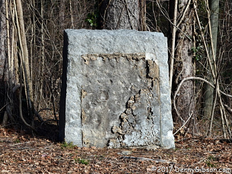
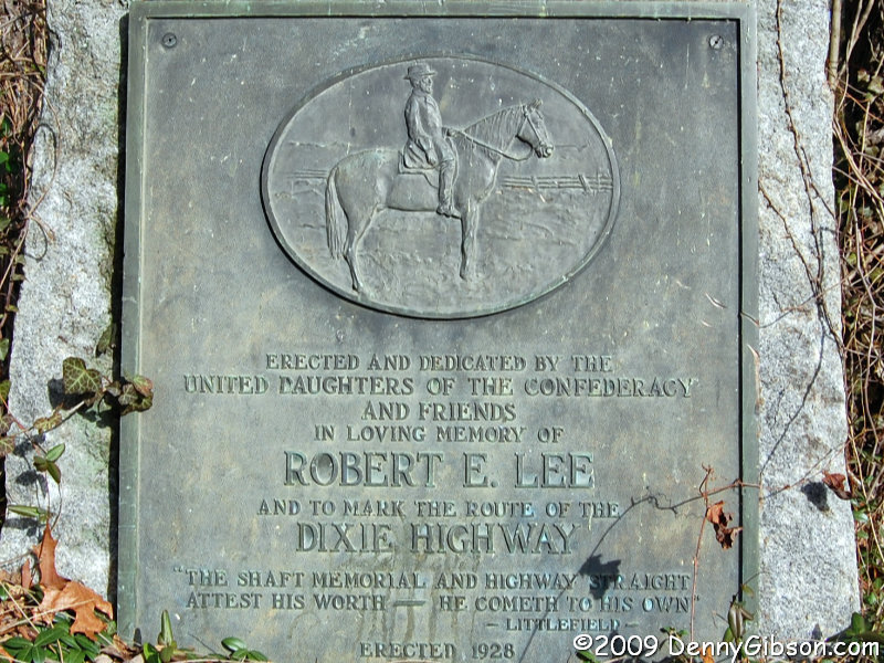
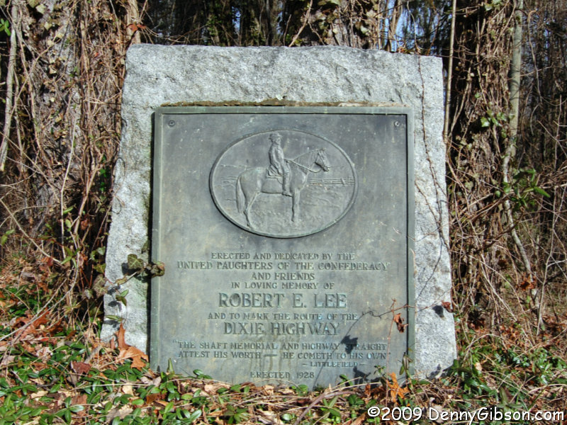
 2. Just a couple of months after discovering the marker in Marshall, I took my first picture of the marker at the NC-SC state line. By then I was aware of the eight markers in the Carolinas, but not of the two outliers. In October 2017, vandals pried the plaque from the marker and its whereabouts are unknown. The third photo was taken in December 2017. Erected 1928.
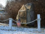
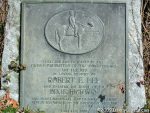
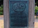
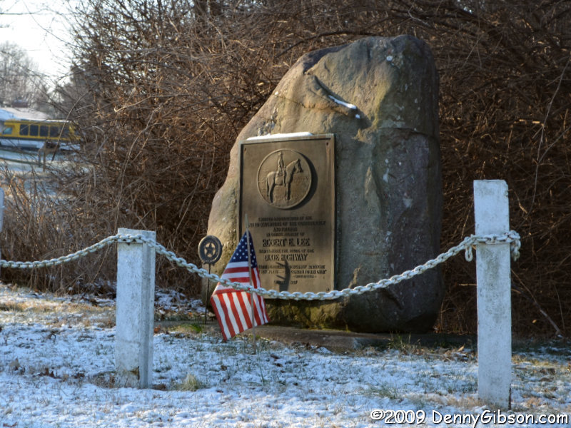
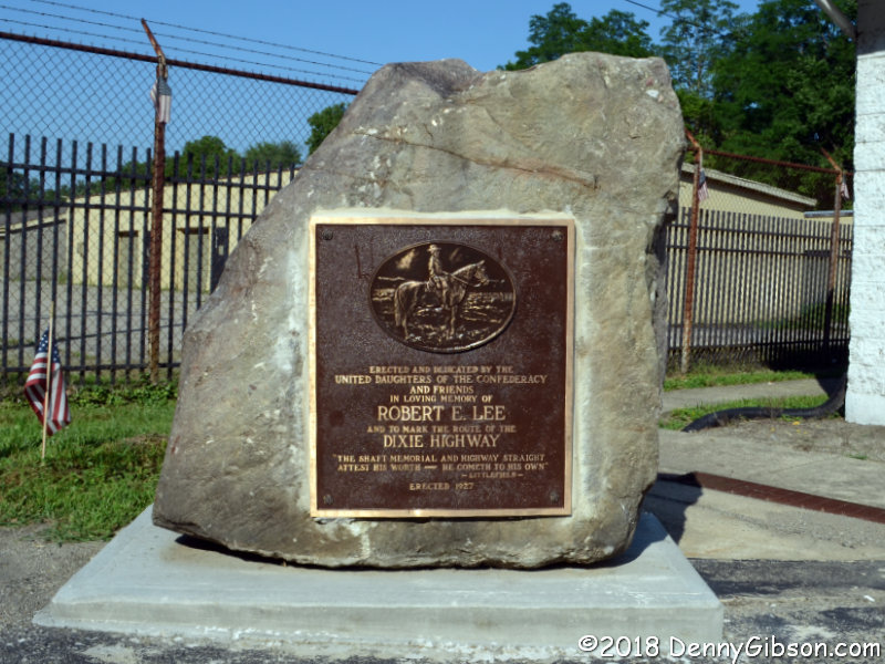
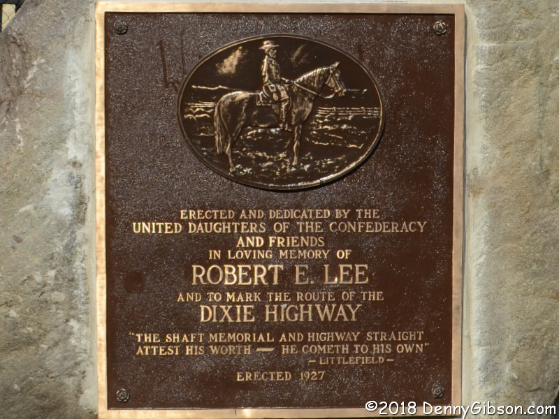
 3. By January 2012, I’d learned of two markers outside the Carolinas. Discovering that one was less than 18 miles north of where I live was actually shocking. In August 2017, just a couple of months before the plaque was ripped from the NC-SC state line marker, this one near Franklin, Ohio, was the target of planned demonstrations and counter-demonstrations. The city shortcircuited things by removing the rock and plaque in the middle of the night. The monument has since been returned to public view on private property about two and a half miles north of its original location. Erected 1927.

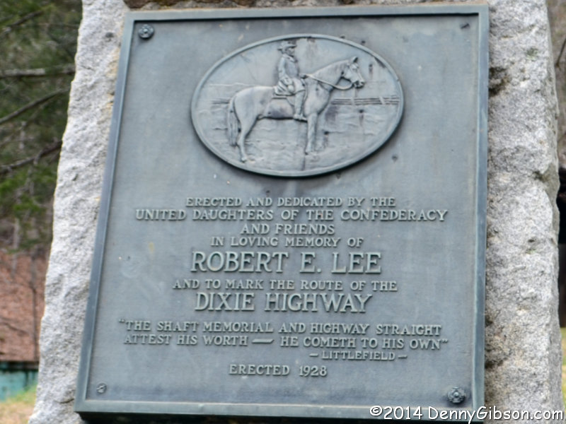
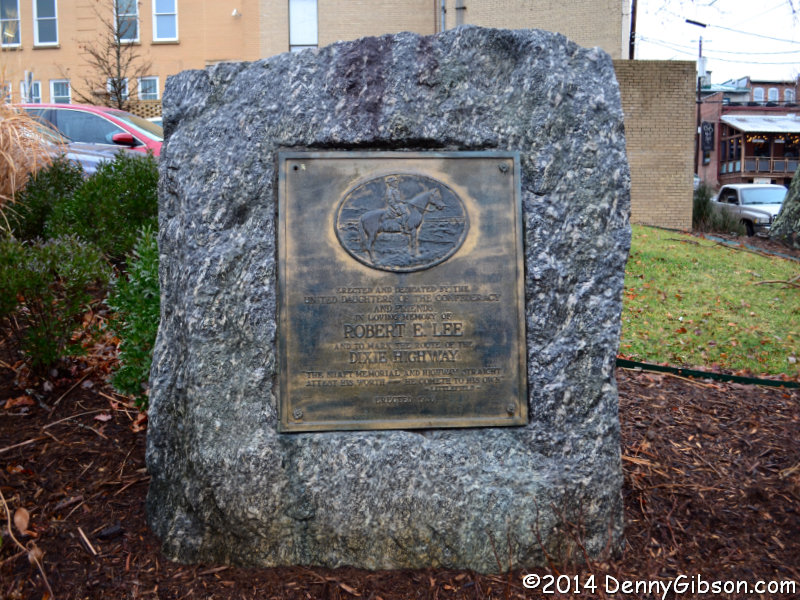
 4. On the second day of my 2014 Christmas trip, I reached all of the Carolina markers which included six I’d not seen before. Just as the second marker I photographed was barely inside the state’s southern border, the first one of this outing was barely inside its northern border with Tennessee. Erected 1928.
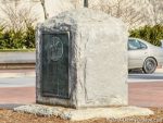
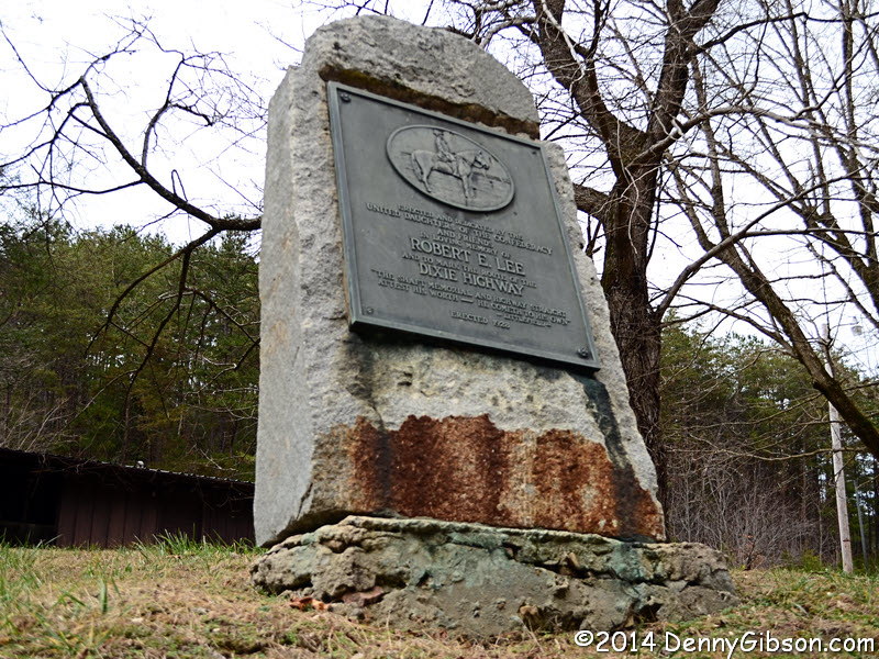
 5. I believe of all the Lee-Dixie markers I must have driven by without noticing, I’m baffled the most by this one mounted in a huge brick base in Hot Springs. Erected 1926.
ADDENDUM 16-May-2024: This plaque was stolen in March 2022. Discussions by city officials over whether to replace the plaque with a replica or something different were continuing as of May 1, 2024. Discussions and plans have been hampered by uncertainty as to who owns the land where the marker stands.
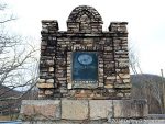
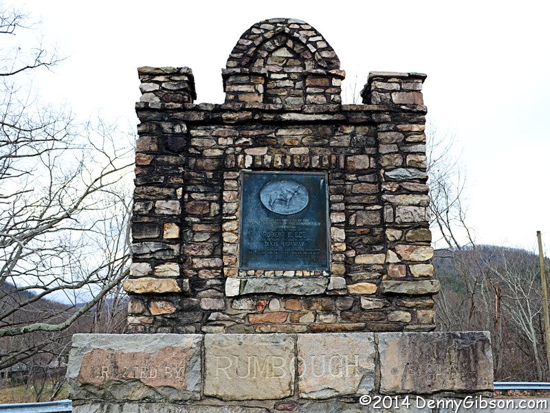
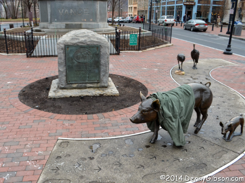
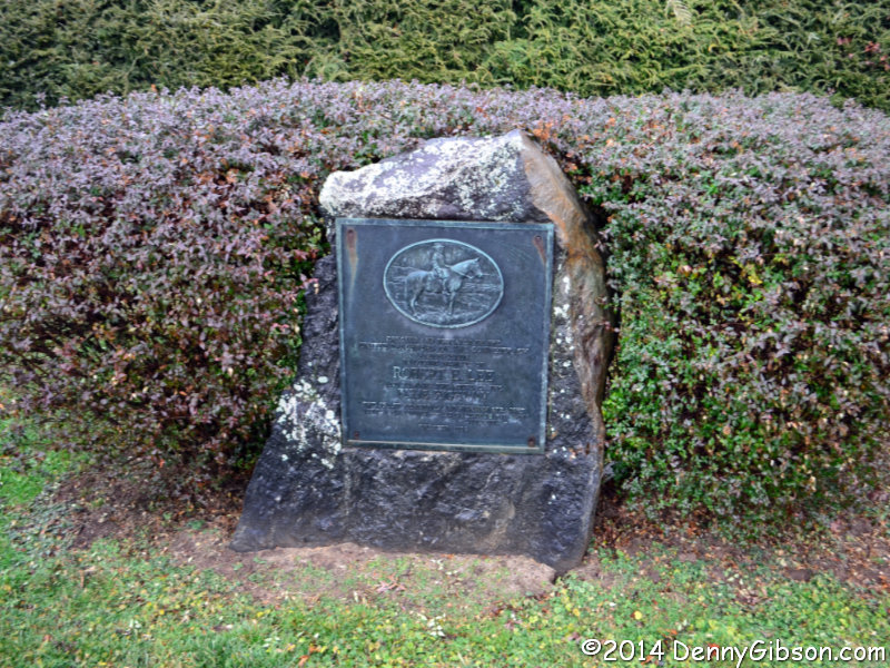
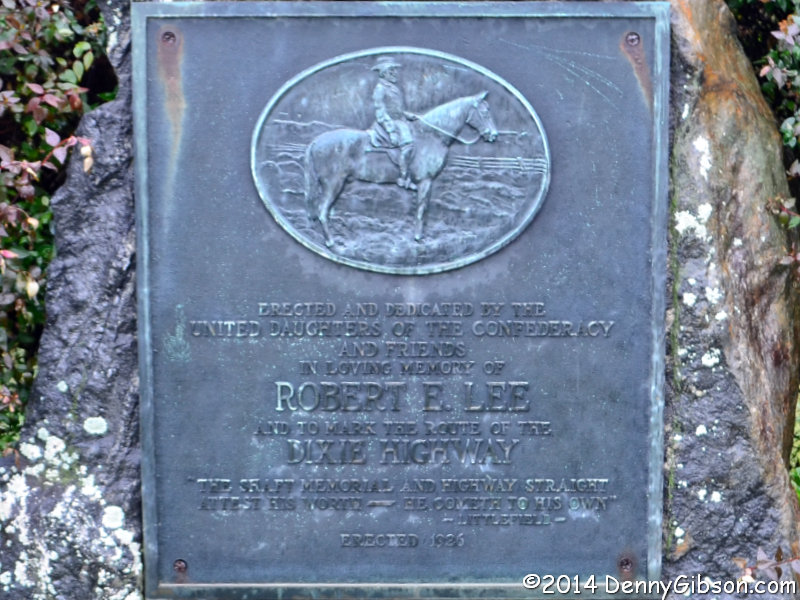
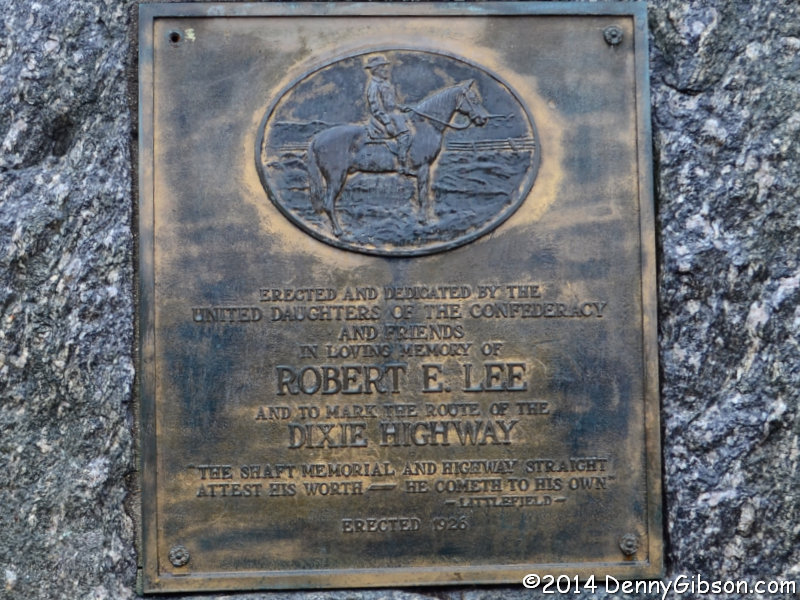
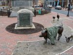 6. The next marker in geographic sequence was the one in Marshall but the next new-to-me marker was in downtown Asheville where it shares space with the 65 foot tall Vance Memorial and a tribute to Drover’s Road. On the day I took my picture, someone had draped a shirt over one of the Drover’s Road pigs. At about the same time that the plaque was pried from the NC-SC marker, an attempt was made to do the same here. The bent corner in the blurry drive-by picture is evidence of that. The face was also badly scratched in a subsequent attack. On July 10, 2020, the marker was removed and put into storage. Erected 1926.

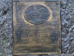
 7. I failed to pick out the marker in Fletcher when I drove by it the first time but I did better on my second pass. On pass number two, I was able to spot it trying to blend into the shrubbery. Erected in 1926.
ADDENDUM 27-May-2023: I have just learned that the plaque was removed from this marker in October 2020. According to information here, the removal was initiated by the church where the boulder stands and the plaque was returned to the United Daughters of the Confederacy.
 8. The marker in Hendersonville wasn’t particularly hard to spot. It’s a tradeoff but I think I prefer a little tougher hunt and the shrub as background rather than the red car. Erected 1926.
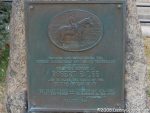
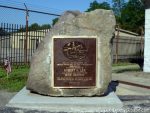
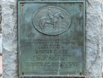
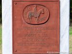
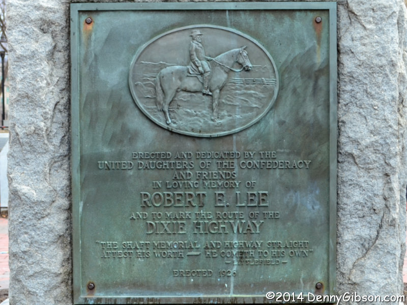
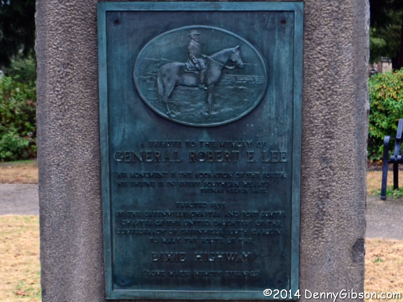
 9. Geographically, the next marker was the already photographed one at the NC-SC state line. That meant the next new-to-me marker was the lone South Carolina marker in Greenville. It’s actually a block off of the Dixie Highway but I don’t know whether it was moved to be with a group of Confederate monuments or was originally erected there. Aside from its placement, the marker is unusual in that it identifies a specific United Daughters of the Confederacy chapter rather than the overall organization which makes the plaque a bit taller than the others. It was also erected several years later than any other Lee-Dixie marker and several years after the Dixie Highway ceased to formally exist. Erected 1935.
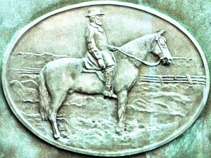
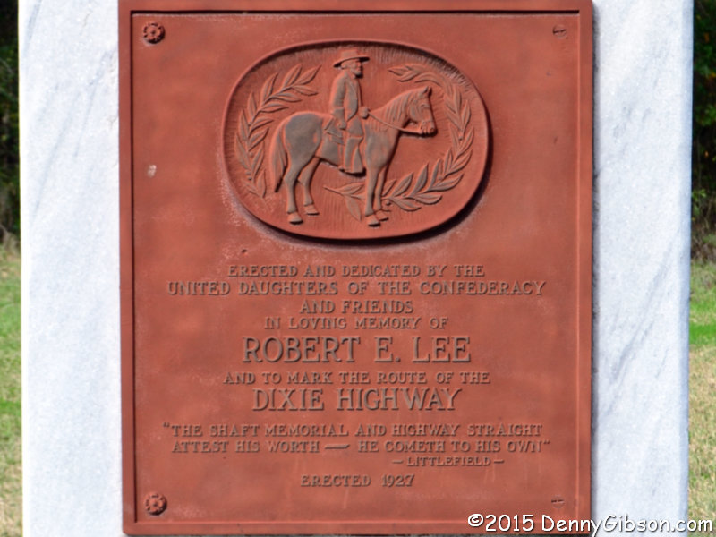
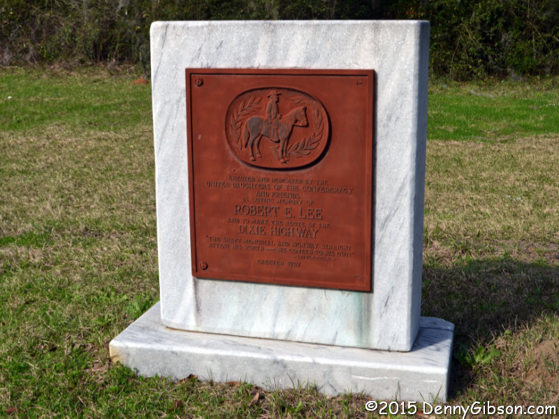
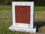 10. I completed the caboodle several days later when I reached the only marker in Florida. It was placed about the same time as most of the others and the text is quite standard, but it is unique in other ways. The most obvious differences are the smooth marble base rather than a rough boulder and a plaque that appears to be made of steel rather than bronze. Lastly, the image of Lee is similar but not identical to the others. Erected 1927.
I had started towards home when I stopped at the Florida marker, but before I actually reached home, I drove by the Ohio marker just so I could say I saw all ten on the same trip.

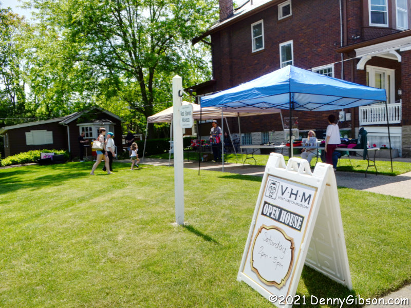 On Saturday, right after I was welcomed at the Vent Haven Museum open house, I was asked if I’d been there before. “Yes”, I answered. “Several years ago.” I later checked to see when that earlier visit was and discovered that apparently — in my mind, today — several equals ten.
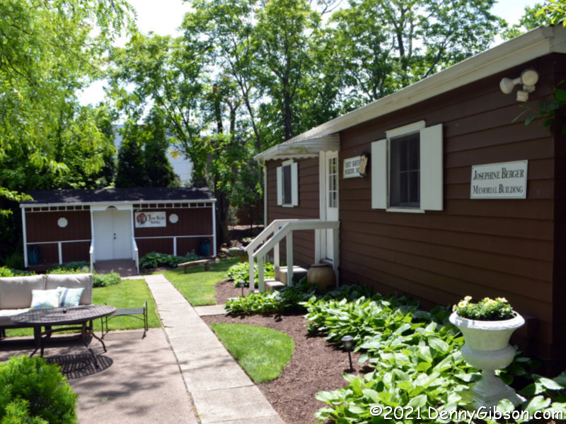
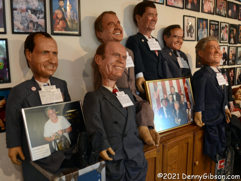
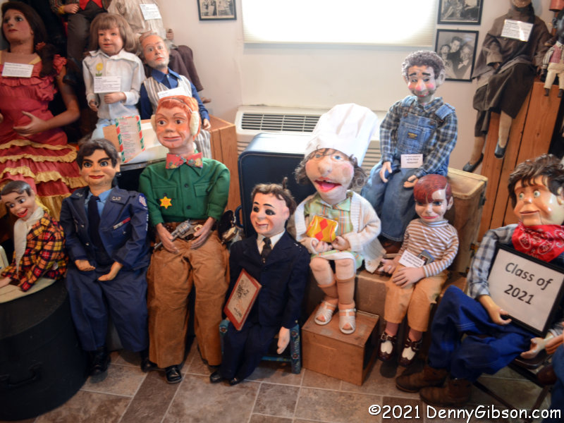
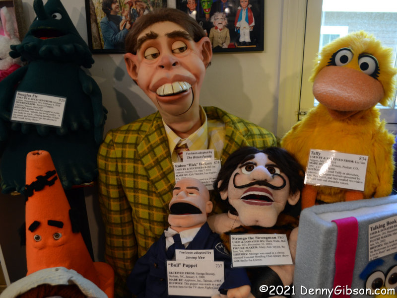 Today I’ll just share a couple of photos from each of the three open buildings. My first stop was in the building directly behind the house. It was built in the 1960s by museum founder W.S. Berger, and is the first building constructed specifically for the museum. There are hundreds of ventriloquist dummies in the building but I’ve chosen pictures of the string of past presidents and another small grouping. It is the smallest member of that grouping that caught my eye. It’s a replica of “Bull” from the TV show Night Court.
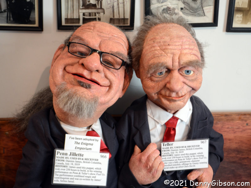
 This is the collection’s first home after it was booted from the residence by Mrs. Berger in 1947. It is the garage left empty when Mr. Berger retired and sold his car. The middle picture is of eight dummies donated in the last twelve months. The museum typically gets 10-15 donated each year. There are also a few hundred dummies in this building but none more realistic looking than Penn and Teller.
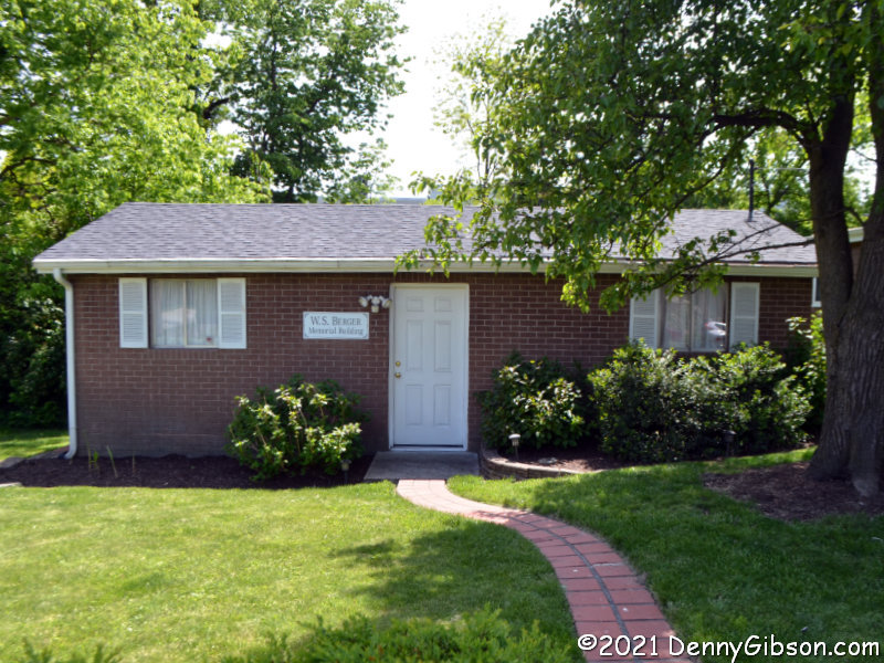
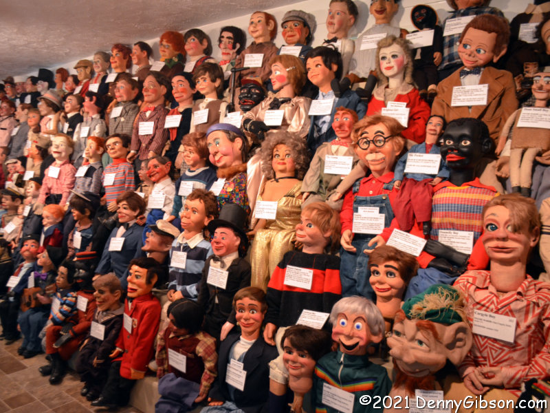
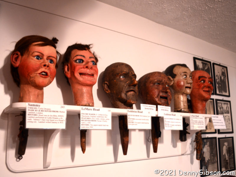 Construction of the third building was started by Berger but he died before it was completed. It and the garage will be taken down later this year to be replaced by a new building that will offer several enhancements (including restrooms!). Be aware that these are not the only wall-of-bodies or shelf-of-heads photo ops in the museum which now has about a thousand residents.
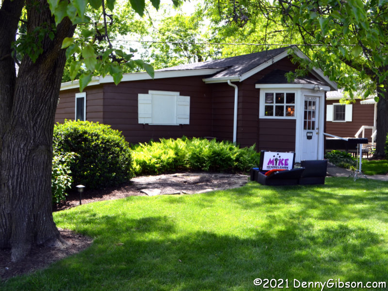
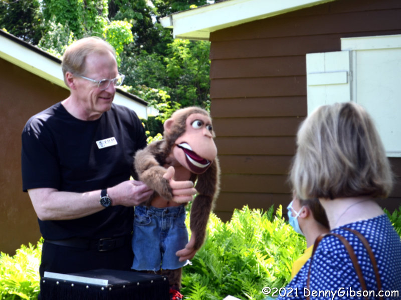 I actually took this picture soon after I arrived but saved it for a closer. It’s Mike Hemmelgarn who made absolutely everyone feel relaxed and welcome.


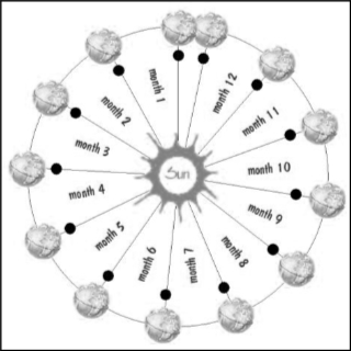 The Jewish calendar is lunisolar, meaning it is based on both the sun and the moon. The more common Gregorian calendar is purely solar with no direct lunar involvement. All months of the Jewish calendar start with a new moon. A new moon occurs approximately every 29.5 days, so that the Jewish calendar can keep the months pretty much in sync with the phases of the moon by alternating 29 and 30-day months. Of course, 12 X 29.5 is a little short of the 365.24 days that it takes the Earth to circle the sun, so every now and then a thirteenth month is added to the year. The timing of these “leap months” is based on a nineteen-year cycle and there are other tweaks as well.
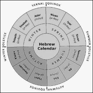 Passover begins on the fifteenth day of the month of Nisan, which is the first month after the vernal equinox. Because every month starts with a new moon, the fifteenth of every month is a full moon. Ergo, Passover always begins on a full moon. Being a week long, it always contains a Sunday. Rather than moving Easter away from Passover in 325, the First Council of Nicaea kept the scheduling just the same as it had always been and simply stopped saying the word Passover out loud. Oh wah, tagoo, Siam.
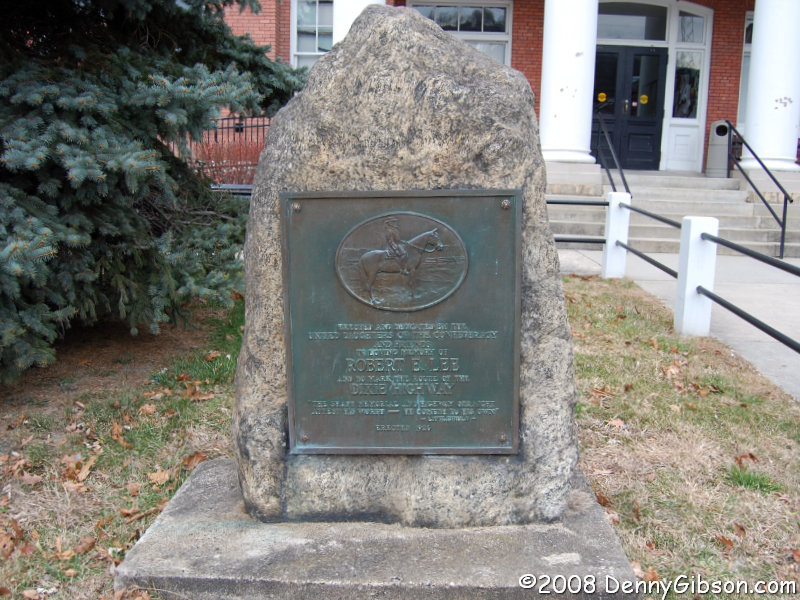


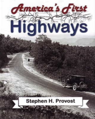 I knew nothing of this book or its author until just before it was reviewed in the Jefferson Highway Association newsletter, The Declaration. The only reason I learned of it that early was because the reviewer, Wayne Shannon, is a friend whom I happened to chat with by phone while he was putting his review together. He was quite positive in talking about the book but, like me, unfamiliar with the name Stephen H. Provost.